Back to Don's Maps
Cycling from Amsterdam to Copenhagen
Day 3, 14th June 2014
60 km (142 km from the start)
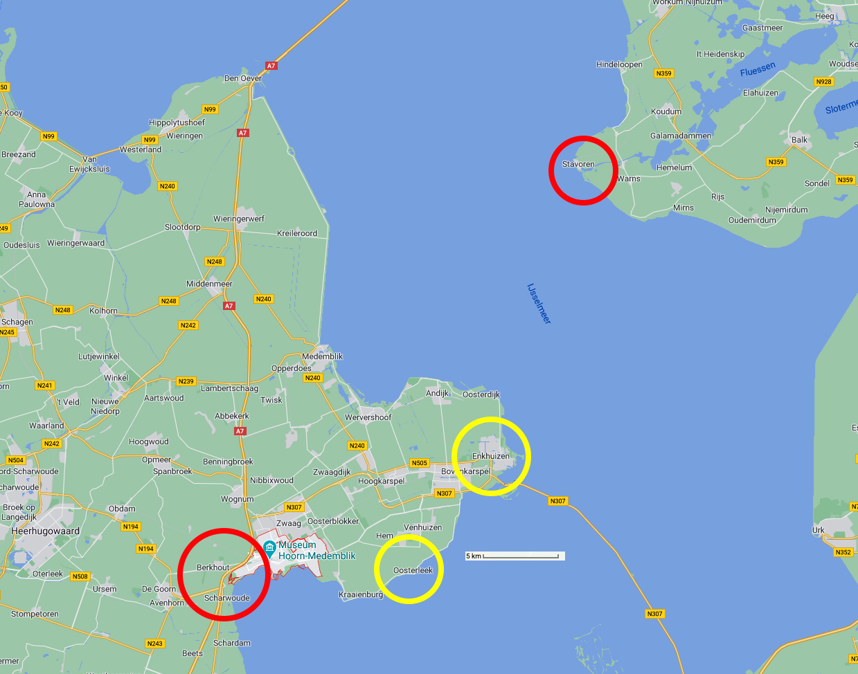
From Hoorn to Stavoren
Photo: Google maps
From Maria's Diary:
Hoorn to Stavoren
Both of us were buggered and slept a long time. We woke about 0530h and decided to leave early. We lost the track and had to backtrack a bit but then found the coastal cycleway and set off for Enkhuizen and the ferry.
It was a brilliant track along the dyke with the sea on one side, the Zuiderzee, and farms on the other. My bottom was still sore but the cream helped. We had to battle against the wind so made slow progress. The bike seemed heavy pushing it against the wind.
Don said we should disconnect our lights, as that was increasing the rolling resistance, and that helped. We passed Hoorn and stopped along the waterfront to have a big breakfast at a hotel restaurant for €10 each for all you can eat and bottomless coffee. Then we continued along the coast for kilometre after kilometre with photo stops and bum stops. We passed Wijdenes and Oosterleek and I thought we'd never get there.
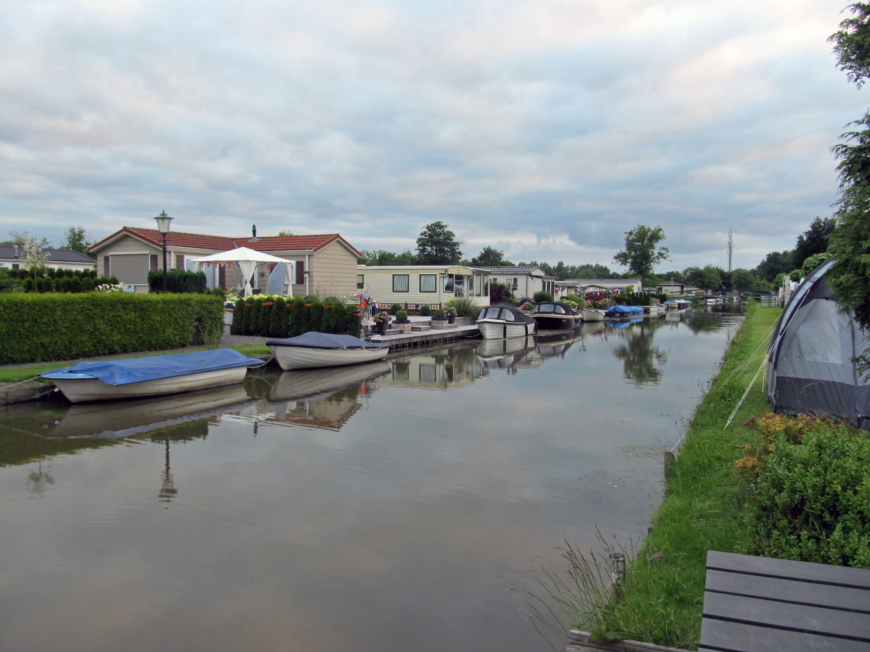
We got up early. "Camping 'T Venhop" was on one of a series of canals, with what appeared to be transportable homes on the other bank, and lots of boats. It seemed to be a holiday area for people from city areas.
Photo: Don & Maria Hitchcock 0546h 14th June 2014
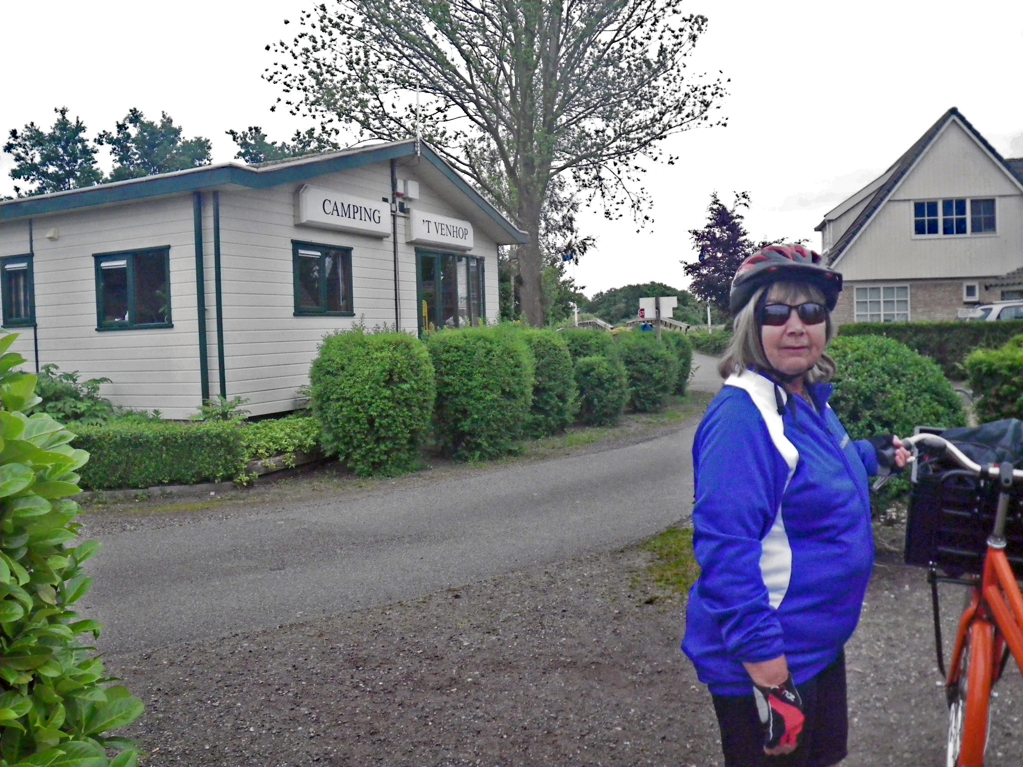
By 6.30 am, an hour after we woke, we were ready to roll. No breakfast, only tea and coffee (of course!), but it was time to get a move on.
Photo: Don & Maria Hitchcock 0631h 14th June 2014
We finally came out on the main coastal cycleway after losing our way a bit. We still had no decent maps, and my watch wrist band compass came in handy again.
Coming from Australia, the light is wrong - the sun is from the south instead of the north, and you don't realise how much you rely on this until the world gets turned on its head. You head south instead of north, and east instead of west, based on the light from the sun, even when it is mostly hidden behind clouds. We are both bushwalkers, and orientation from the position of the sun is a survival skill - except when it isn't!
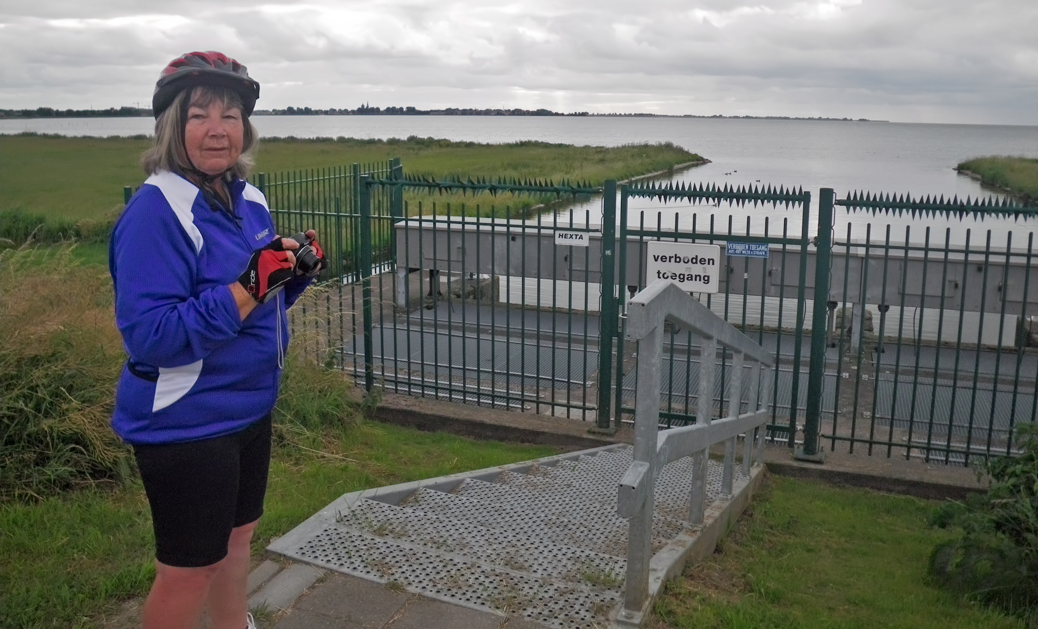
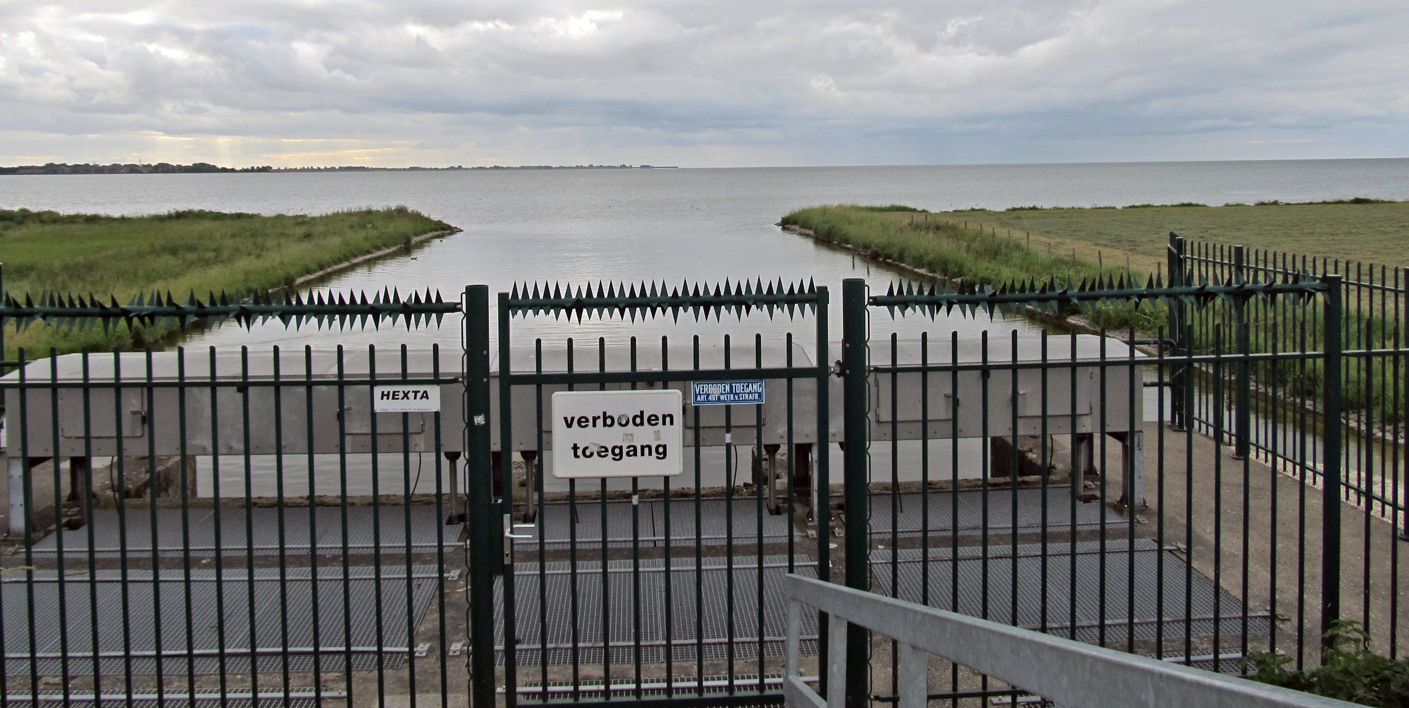
This seemed to be some sort of a water gate allowing water into or from the canals.
The sign reads 'Forbidden - No Access'. It was still cloudy and cool.
Photo: Don & Maria Hitchcock 0716h 14th June 2014


Half an hour later, at Hoorn, we found many hundreds of pleasure boats moored in the harbour, as well as a few small fishing boats.
Photo: Don & Maria Hitchcock 0752h 14th June 2014
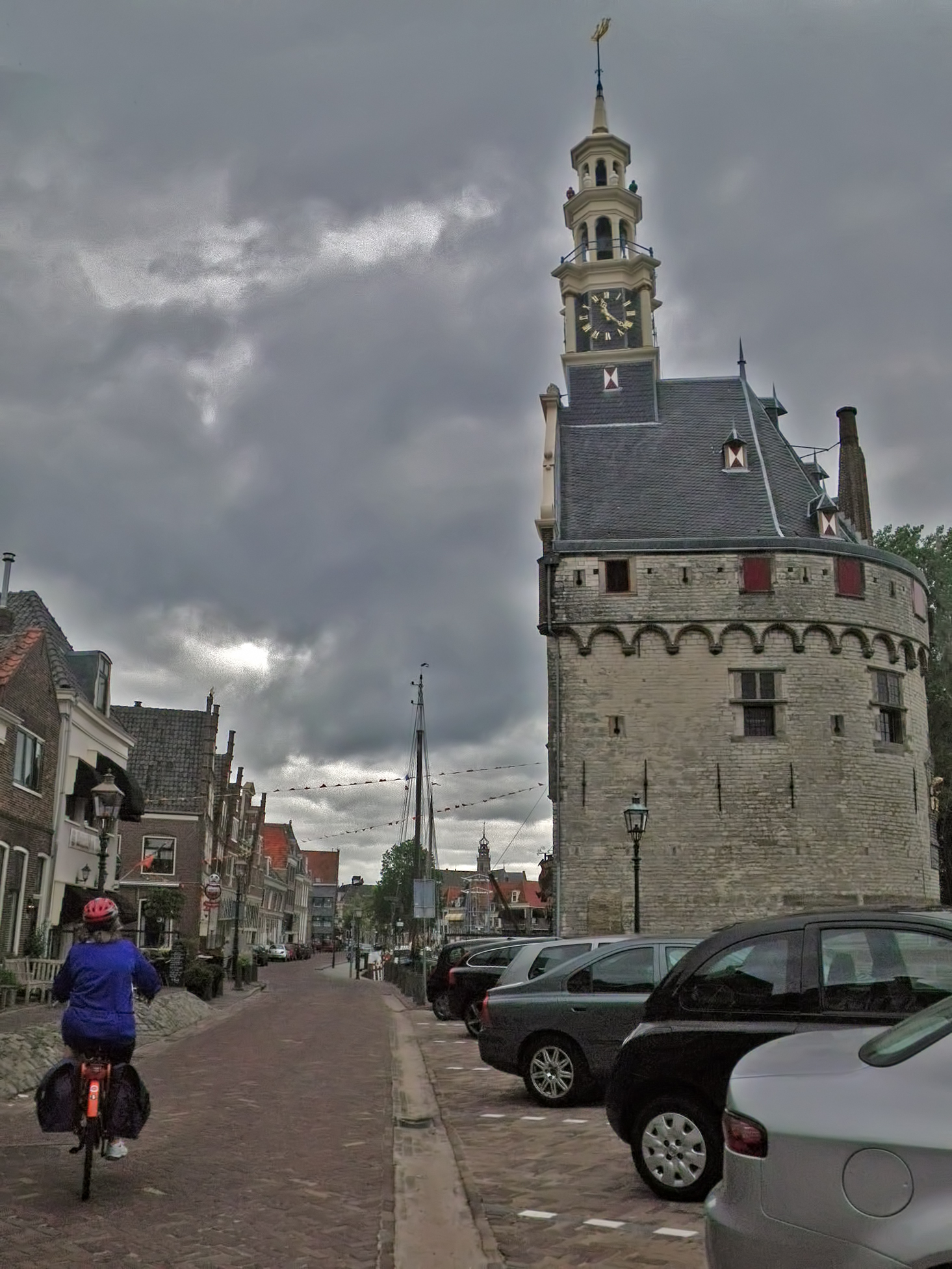
The middle of Hoorn. This is Hoofdtoren, the former harbour control tower.
The Hoofdtoren is a defense tower that dates from 1531. It stands at the harbour entrance of Hoorn in the Netherlands and controlled the shiplane to Hoorn. In 1651 a bell tower was constructed on top of the tower.
The tower became the office for the Noordse Compagnie or Compagnie van Spitsbergen, a company that specialised in whaling.
Nowadays the tower is a Restaurant.
( note that the clock is not telling the correct time! - Don )
Photo: Don & Maria Hitchcock 0755h 14th June 2014
Additional text: https://www.flickr.com/photos/47035764@N03/23834589612
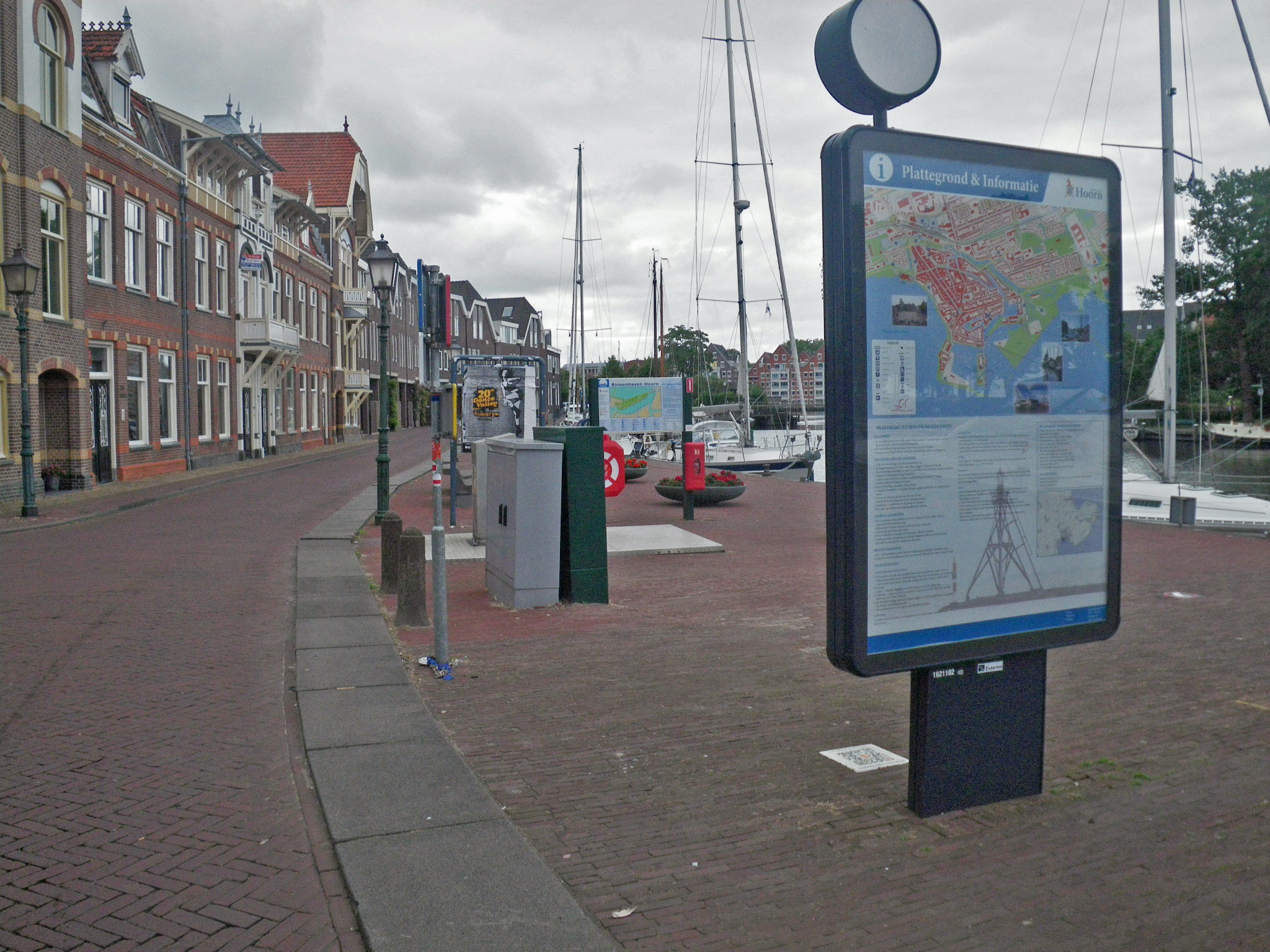
The maps and information are always welcome on a trip like this.
Photo: Don & Maria Hitchcock 0758h 14th June 2014
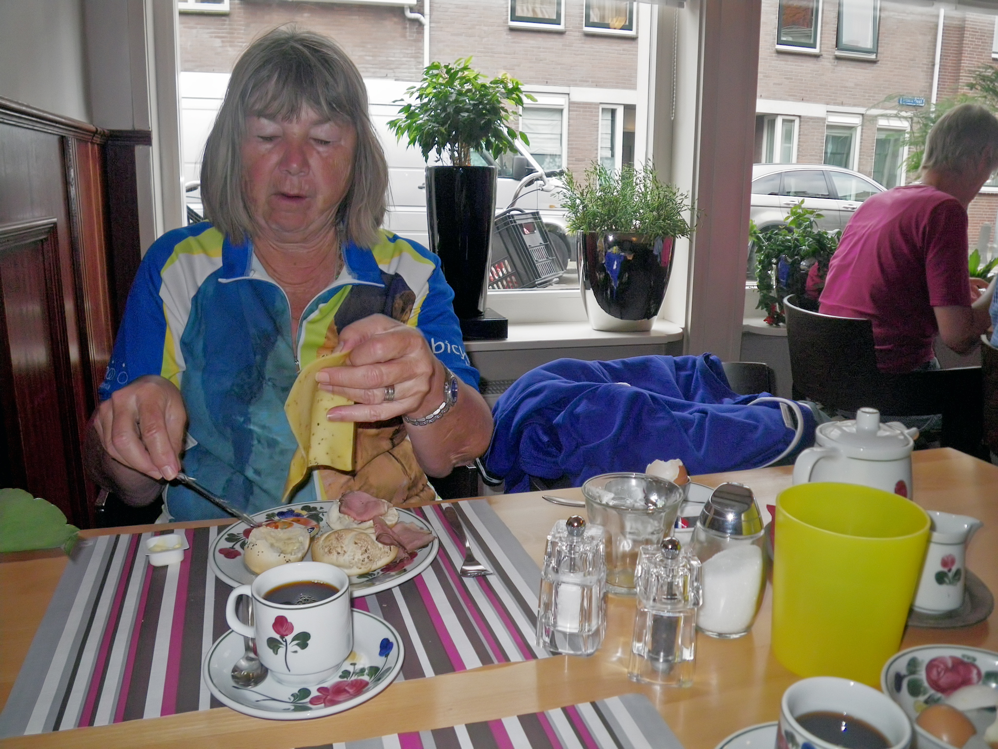
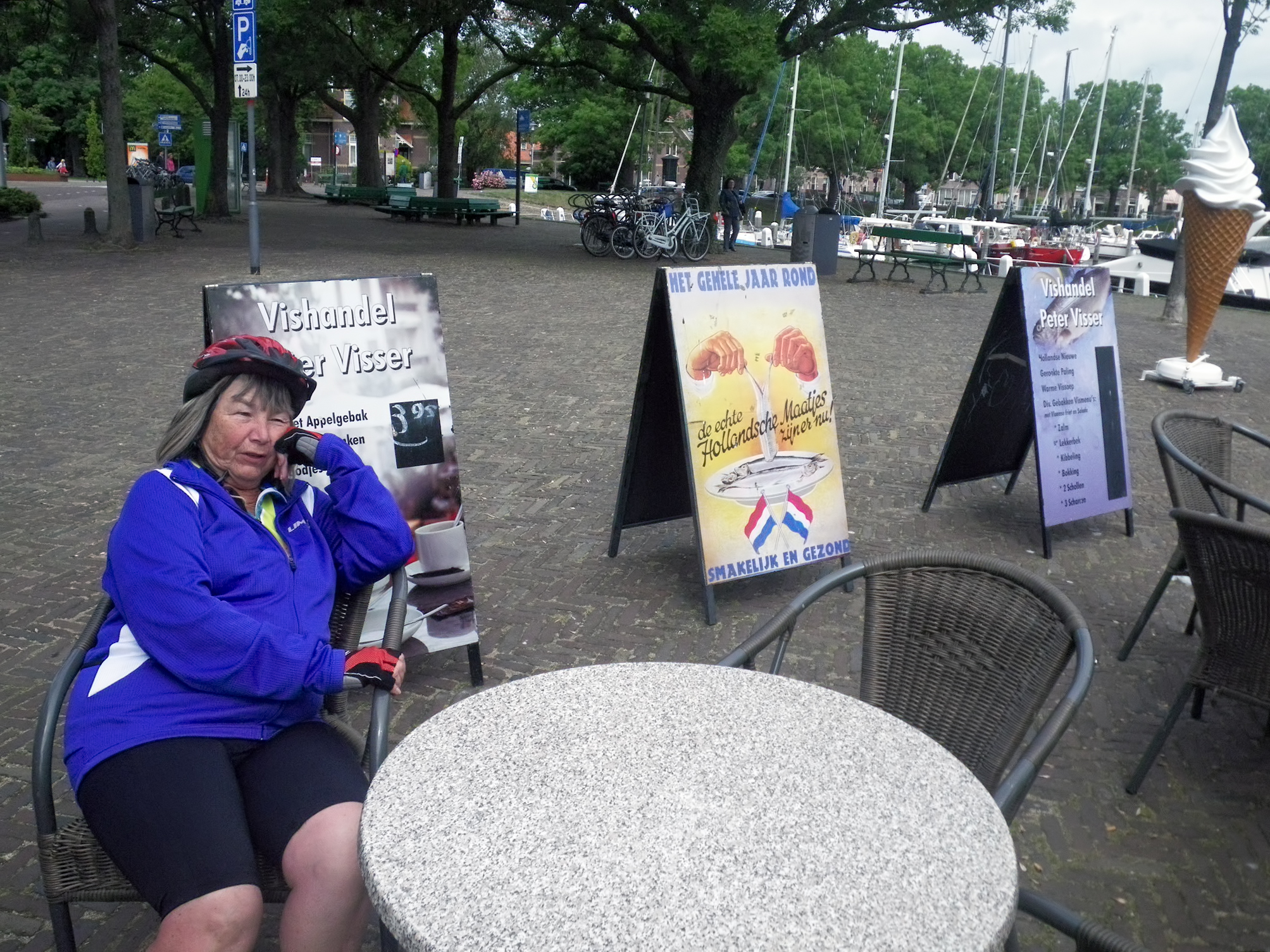
Breakfast was great at a waterfront cafe. All you could eat, and bottomless coffee, at a reasonable price.
The Dutch, Germans, and Austrians understand what a good breakfast is.
One of the bikes is visible through the cafe window - we always tried to keep them under our observation whenever possible, and locked them up when we left them.
We had no problems, but a missing bicycle would have thrown our plans into disarray for a few days.
Photo: Don & Maria Hitchcock 0814h 14th June 2014

Leaving Hoorn. Loosely translated, the sign says something like 'thank you for coming, see you later at Hoorn'.
These signs, similar to those in Germany and Austria, were very useful for working out where you were on the map.
Photo: Don & Maria Hitchcock 0848h 14th June 2014
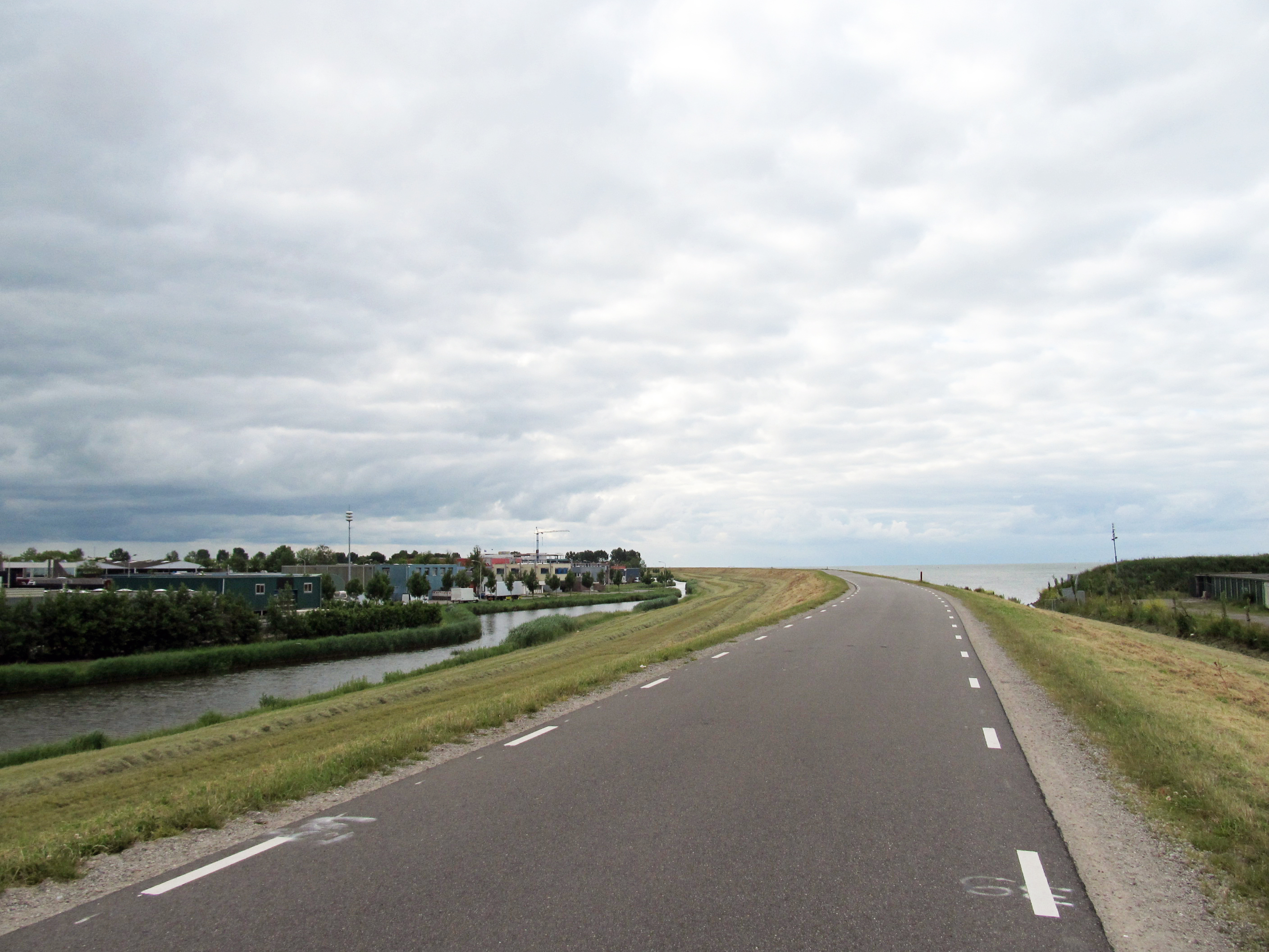
On the radweg. We were on a dyke between the polder on the left and the Zuider Zee on the right.
Photo: Don & Maria Hitchcock 0849h 14th June 2014

Barnacle goose, Branta leucopsis, at a small water filled ditch beside the cycleway.
The barnacle goose and the similar brant goose were at first considered one species, and were formerly believed to spawn from the goose barnacle. This gave rise to the English name of the barnacle goose.
Photo: Don & Maria Hitchcock 0859h 14th June 2014
Additional text: Wikipedia
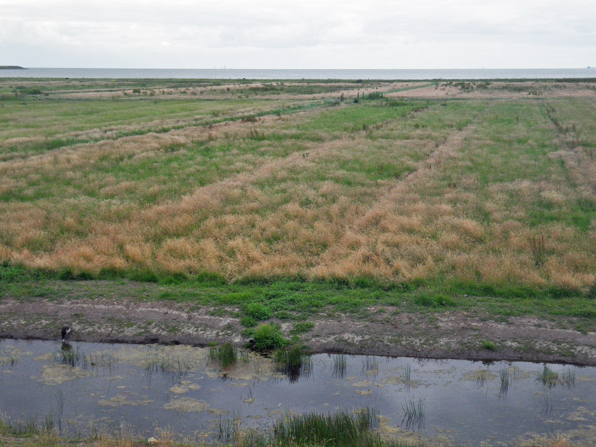
Behind the ditch and the goose was what seemed to be coastal marsh, with the former Zuider Zee behind.
This is now a fresh water lake, the Markermeer. It is only shallow, three to five metres deep, but is an important fresh water resource. In 2003 the Netherlands was hit by drought, and several minor dykes were endangered. Water from the Markermeer was used to keep the area surrounding Amsterdam wet, thereby keeping the dykes safe.
It is closed off from the IJsselmeer (which it was formerly part of) by the Houtribdijk dyke, finished in 1976, which runs from just south of Enkhuizen to Lelystad on the opposite shore.
The huge bay of the Zuider Zee was dammed in the 20th century by the Afsluitdijk (or shut off dyke), completed in 1932, which turned the former salt water bay, which historically gave sea access to Amsterdam, into the fresh water lake now called the IJsselmeer. The dam serves as a sea barrier to protect the land behind it from flooding.
Photo: Don & Maria Hitchcock 0859h 14th June 2014
Additional text: Wikipedia
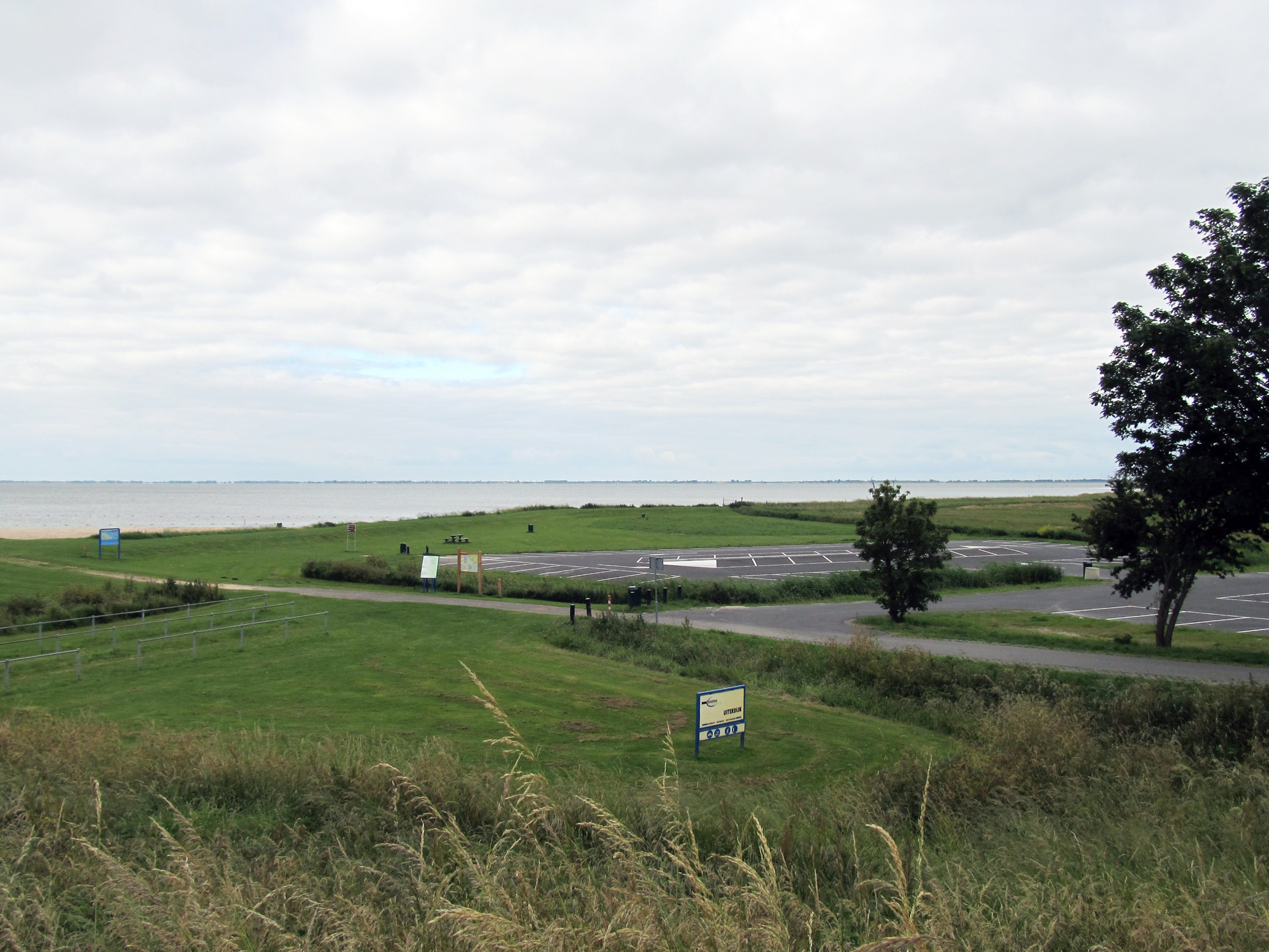
This appeared to be a recreation area, with parking for cars and pedestrian access to the beach.
Originally this fresh water lake formed behind the Houtribdijk dyke was going to be drained and turned into a polder, but by the time that this major project was to take place rolled around, the residents had come to love the lake and beaches, and the public outcry about the proposed development forced the authorities to rescind the proposal, and the area behind the dam wall has remained since as a lake.
Photo: Don & Maria Hitchcock 0902h 14th June 2014
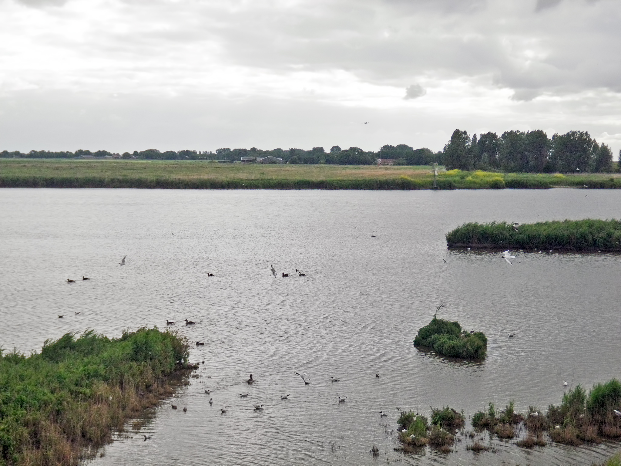
Occasionally the lake beside the polder on our left got very much larger, and offered a good habitat for water birds.
Close in to shore were black headed gulls, kokmeeuw, with geese or ducks further out. We could see several black headed gulls apparently sitting on nests on tufts of grass close inshore.
Photo: Don & Maria Hitchcock 0911h 14th June 2014
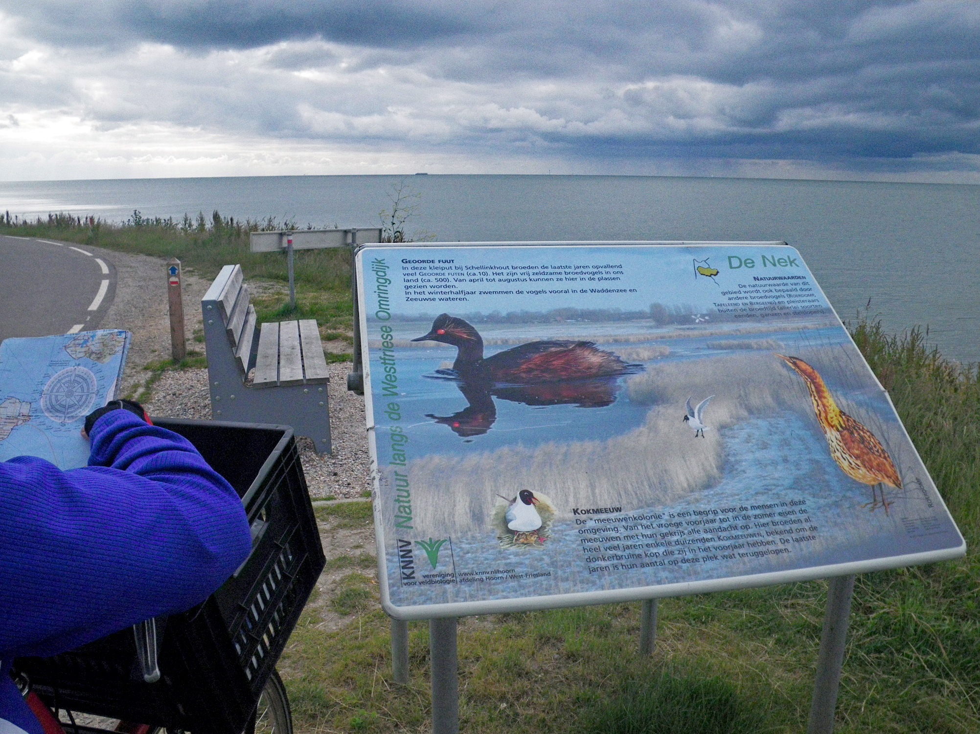
A few minutes later we came to this information board, and the map came out to try to work out how far we were from the ferry terminal at Enkhuizen.
The sign reads, in part:
The Seagull Colony is a household name for the people in this area. From the early spring until the summer, the seagulls (kokmeeuw) demand attention with their screams. For many years several thousands of Black-headed Gulls have been breeding here, known for the dark brown head they have in the spring. In the last few years, their numbers have declined somewhat.
Photo: Don & Maria Hitchcock 0913h 14th June 2014
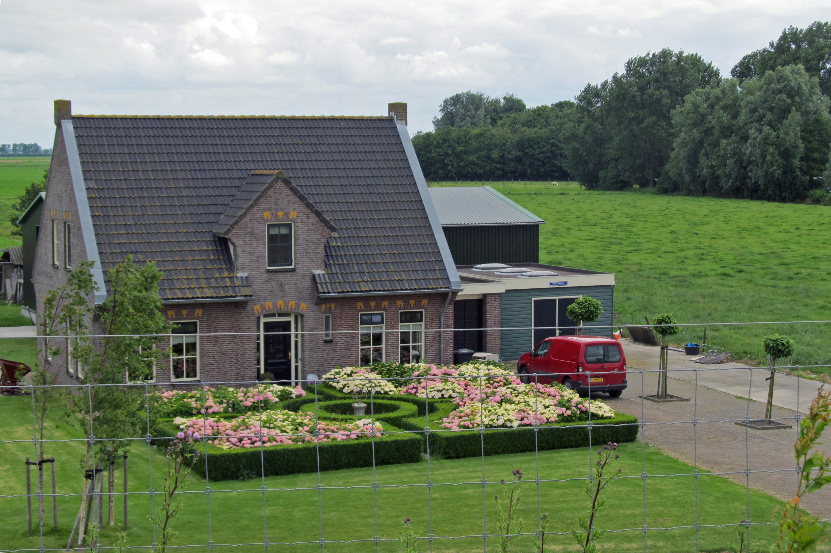
This private formal garden was beautifully designed and maintained.
Photo: Don & Maria Hitchcock 0928h 14th June 2014
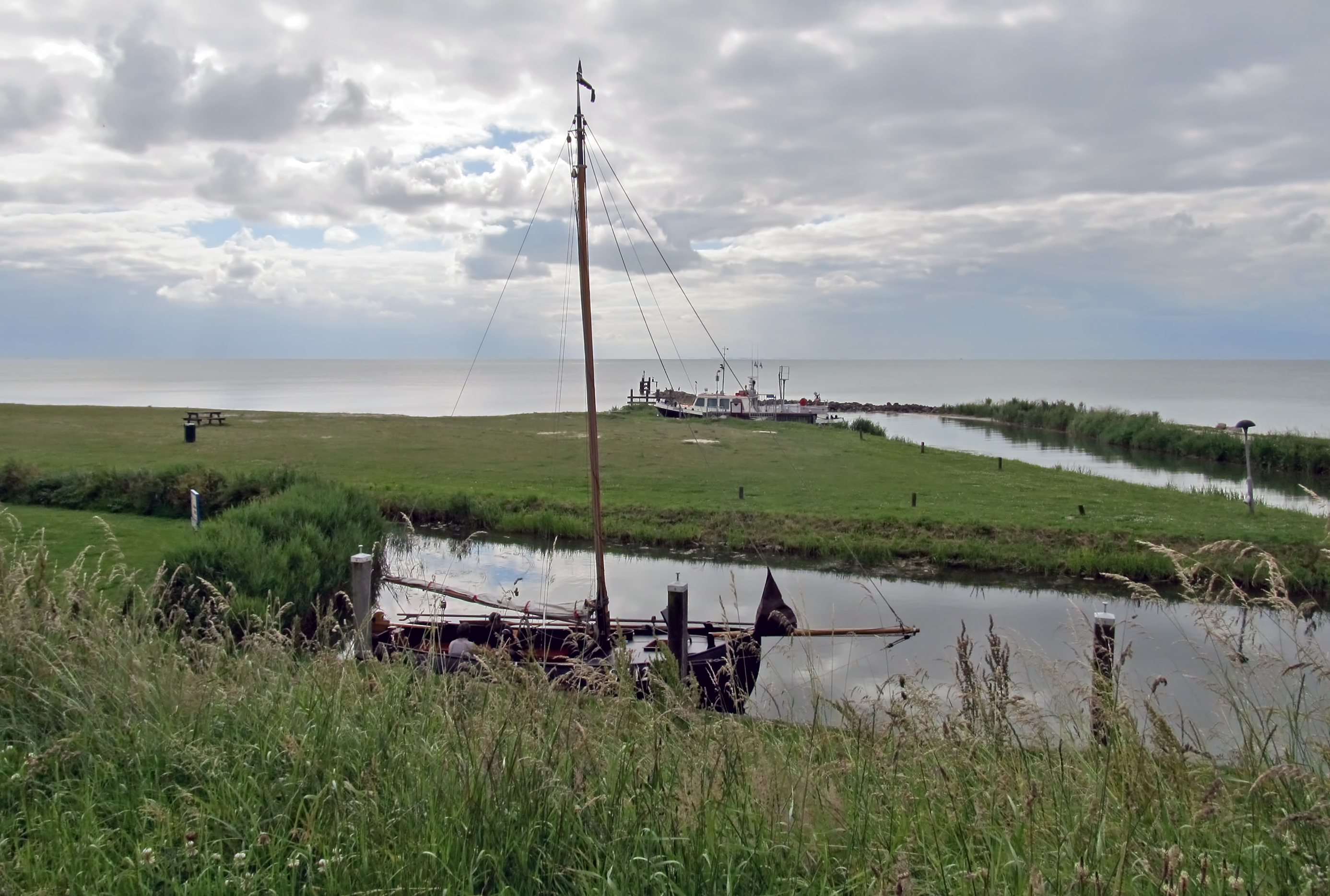
This small harbour provided secure anchorage for a small open cockpit sailboat, possibly used for day fishing, and an enclosed cockpit motor driven trawler.
Photo: Don & Maria Hitchcock 0936h 14th June 2014

The Vuurtje Leek
This lighthouse is located just south of Oosterleek in a right-angled bend of the Zuiderdijk ( that is, the dyke we were travelling on - Don ) along the Markermeer.
The tower was built in 2001 to replace a similar one, which has stood on this site since 1939. Before 1939 there was already a warning light at this place.
I translate this Dutch version of the English language poem by the American poet Emily Dickinson on the side of the lighthouse as:
We would not care about the sun, dear, if it did not set
Photo: Don & Maria Hitchcock 0949h 14th June 2014
Additional text: Wikipedia
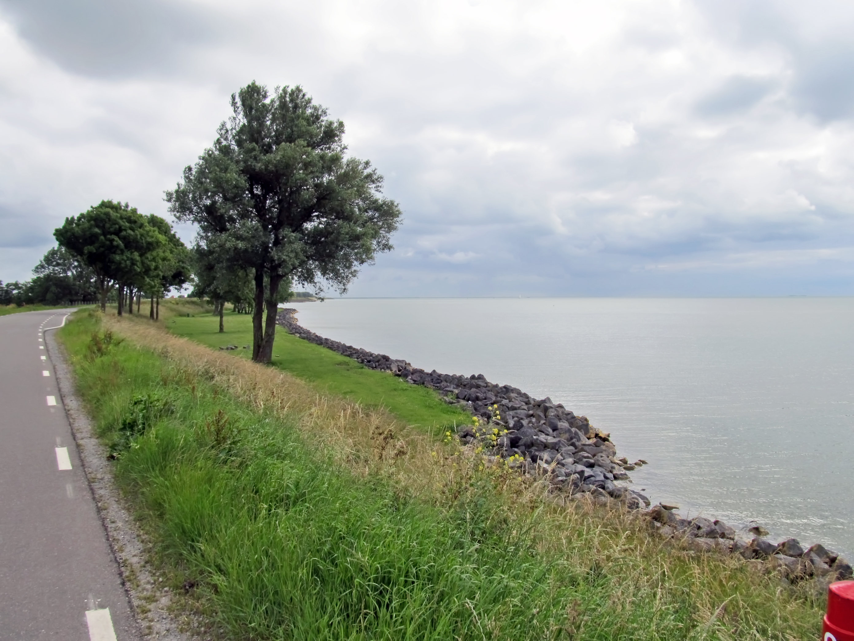
The coast was protected at this point by stone rubble, presumably to guard against wave action, probably from the wake of ships passing close by.
Photo: Don & Maria Hitchcock 0955h 14th June 2014
From Maria's Diary:
After Venhuizen we encountered lots of cyclists riding two or three abreast. Don has real problems with such encounters and at one stage he tipped over across the track. We talked to some ladies who stopped to help. They were a group of over 300 on a tour. We kept meeting large groups all the way to Enkhuizen. It was very unsettling.
I try to give people room to cycle, and Maria and I were travelling in single file, but there were cyclists travelling two or three or even four abreast coming straight at us. They were chatting to each other, and not giving any attention to the possibility that there might well be other cyclists trying to ride in the opposite direction. At one point I fell over trying to avoid them.
I decided enough was enough, no more Mr Nice Guy.
So from then on when a cycle group approached, I drifted over to the centre of the track, and if that didn't work, on to the wrong side of the cycleway. That certainly worked. When they had made the adjustment, and left room by travelling only two abreast on their own side of the track, I drifted back to the centre of my half of the track. After that I had no problems.
The funny thing is, the other cyclists were probably oblivious of their actions in the first place, when they forced me off the cycleway, but were again oblivious later that I had used 'body language' to get them to stay on their own side of the track.
It is rather like the method you can use when walking down a crowded footpath/sidewalk. Fix your gaze steadfastly on where you want to go, ignore the other pedestrians, and you and they will never collide. It is only when you notice each other and make eye contact that you do that silly sideways stepping dance to avoid each other.
From Maria's Diary:
We rode through Enkhuizen and had to ask the way a couple of times. It's not well signposted for foreigners. Finally we arrived at the ferry terminal - a big sigh of relief - it had been a tiring morning. We bought tickets then I walked back into the town to find the ATM. The ferry trip across the Zuiderzee took 1¼ hours - both of us had trouble staying awake.

We bought tickets at the ferry terminal, and found this young gentleman standing around outside.
Photo: Don & Maria Hitchcock 1125h 14th June 2014
Maria was exhausted by this stage, after the long cycle trip and going in to town to get money from an ATM. We used our credit/debit cards when we could, but the cash economy was still extant at that time in Europe, so we always needed spare cash money.
Photo: Don & Maria Hitchcock 1155h 14th June 2014
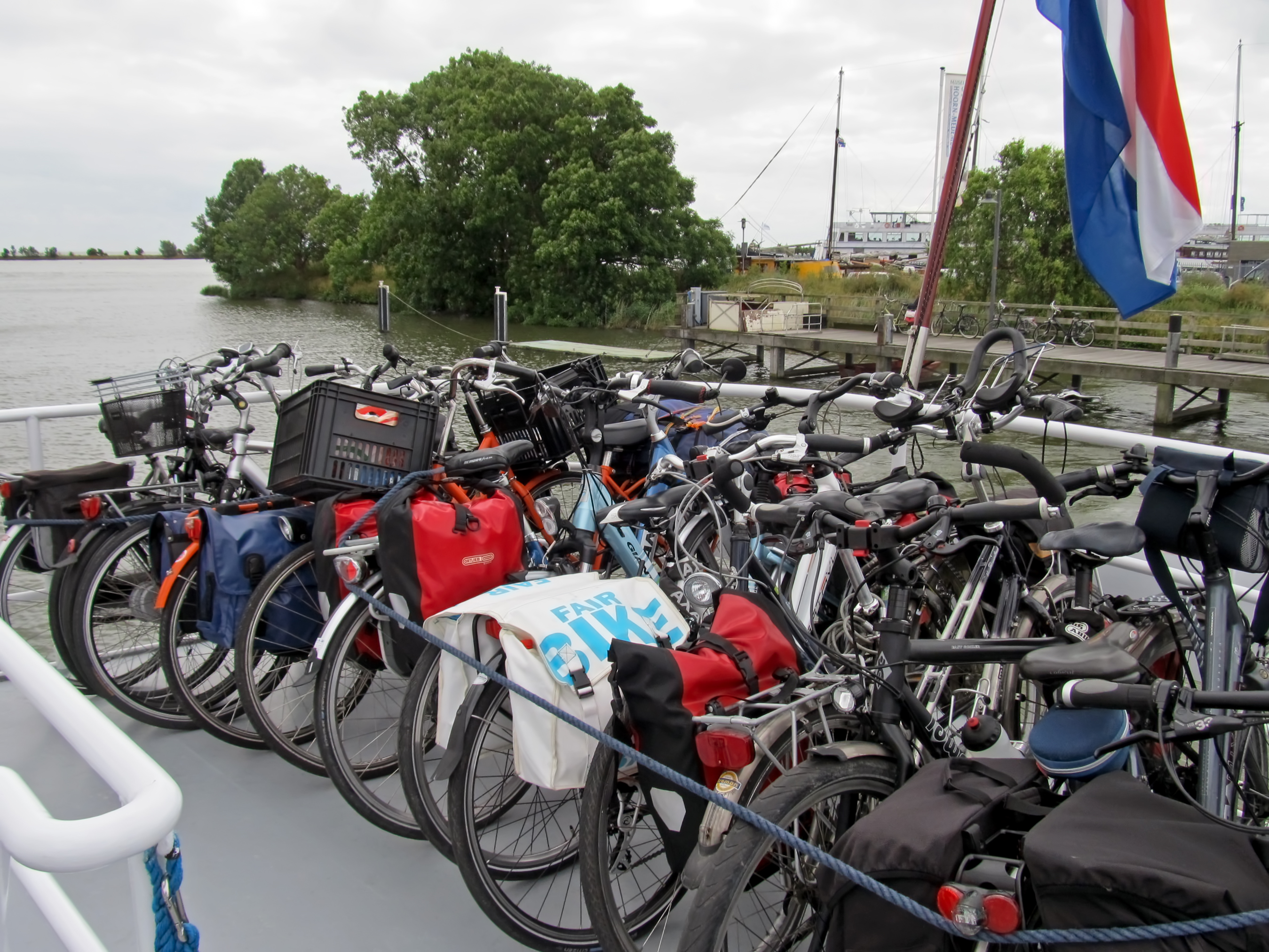
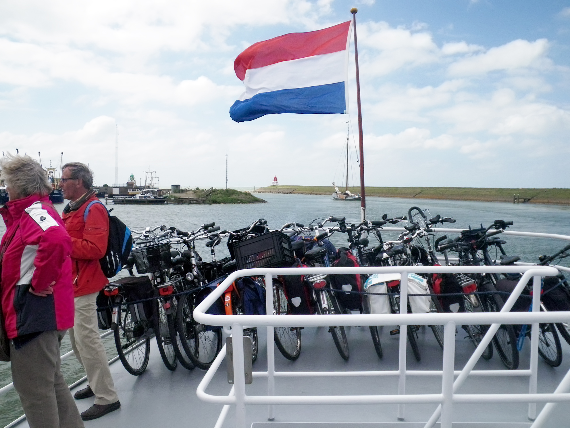
The ferry was due to depart at 1230h, and after we got on board with our bikes, all the cyclists were asked to park their bikes nose to tail at the rear of the top deck, after which they were secured with a rope from one taffrail to the other on the afterdeck.
Photo: Don & Maria Hitchcock 1229h 14th June 2014
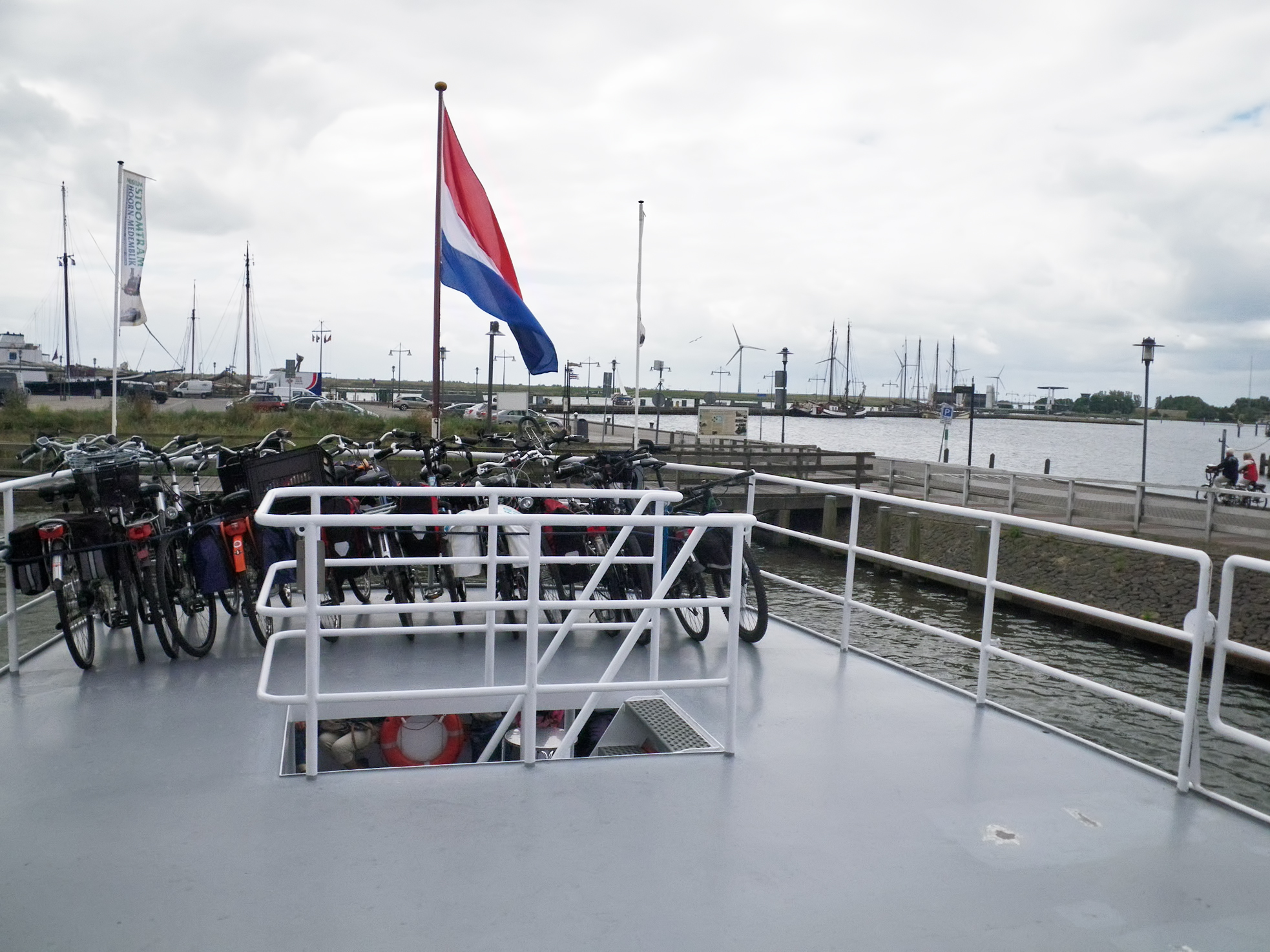
A minute later, we left right on time.
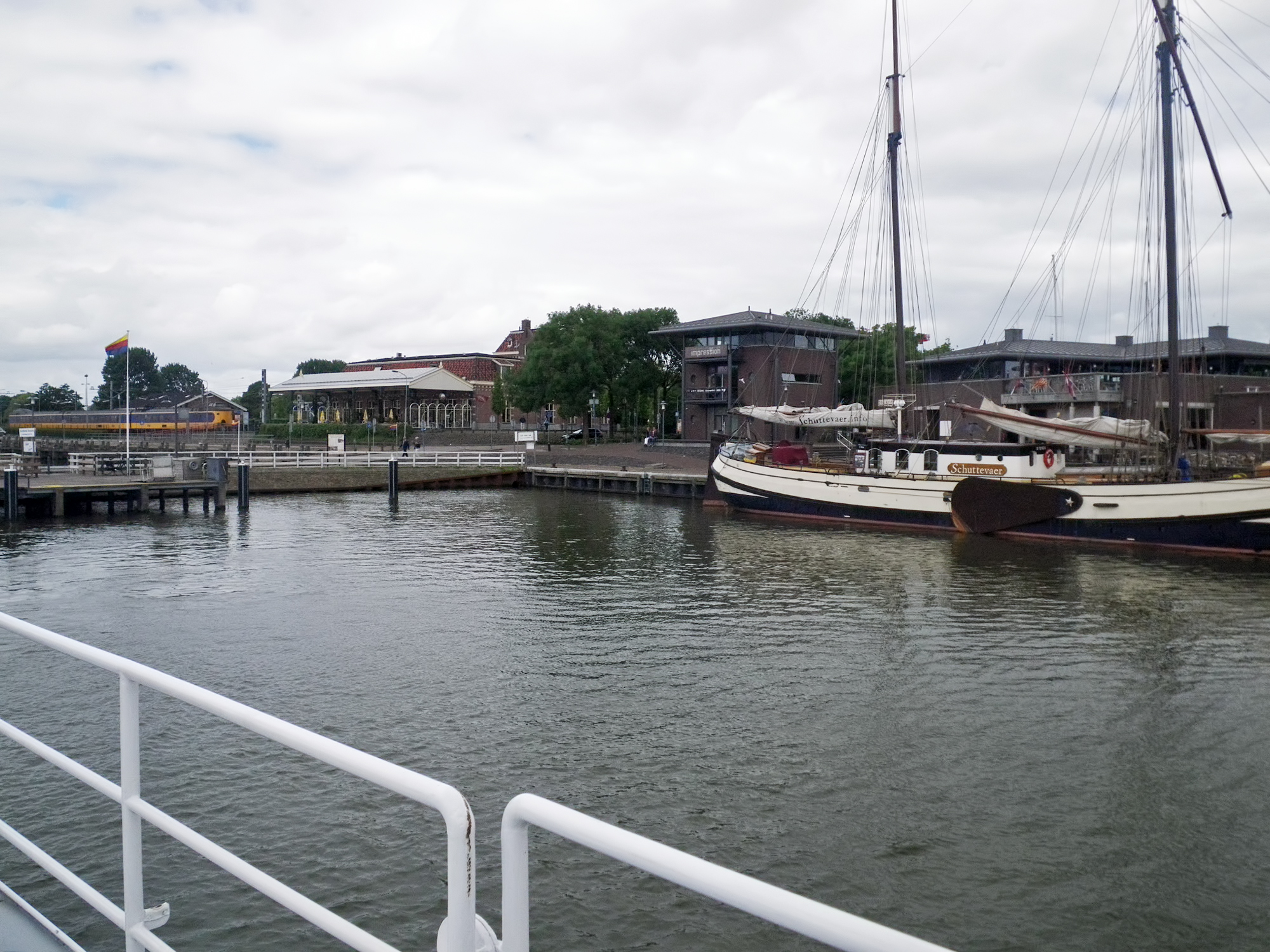
As we pulled away from the quay I was delighted to see that the charter sailing boat Schuttevaer, shown here at its summer berth at Enkhuizen, had a leeboard, the oversized 'guitar pick' fixed to the side of the yacht, and able to be raised or lowered as necessary when under sail, so that the boat can sail against the wind.
Leeboards are an iconic part of shipping on the former Zuiderzee.
Leeboards simplify construction of the hull, as they are attached to the outside and do not require holes in the hull, which can leak. Since centreboards are retractable, they require a large, watertight trunk to hold them in place when retracted, and this occupies what otherwise might be useful space in the cabin or cockpit of the boat. Use of leeboards, while it adds complexity to the process of tacking, leaves the floor of the boat unobstructed. Tacking is easier if there is a leeboard on each side, with the windward one raised to reduce drag. They are called leeboards, after all!
Leeboards were invented in China, and the innovation was transmitted to Portuguese and Dutch ships, where they have been used on relatively large inshore and coastal sailing vessels since around 1570.
For these boats, leeboards provided the advantages of shallow draught for working close inshore and an unobstructed hold for cargo. In particular, they allowed flat bottomed barges to 'take the hard', or intentionally run aground, to load and unload cargo in unimproved tidal areas, as well as to readily conduct maintenance on their hulls.
Photo: Don & Maria Hitchcock 1231h 14th June 2014
Additional text: Wikipedia

On the other side of the quay, two sailing cargo boats also had leeboards.
Photo: Don & Maria Hitchcock 1231h 14th June 2014
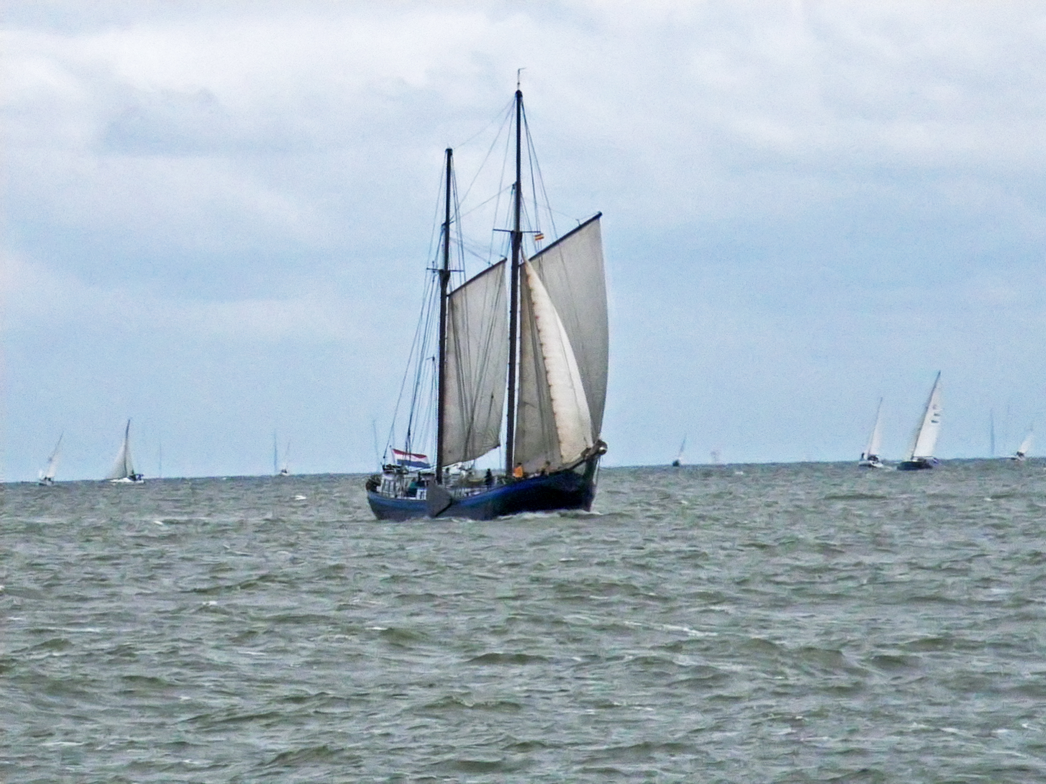
Ten minutes later we were well out on the IJsselmeer, and a fresh breeze was pushing along this gaff rigged two masted barge with a jib set, at a brisk pace.
The windward leeboard was up, as you would expect.
Photo: Don & Maria Hitchcock 1240h 14th June 2014
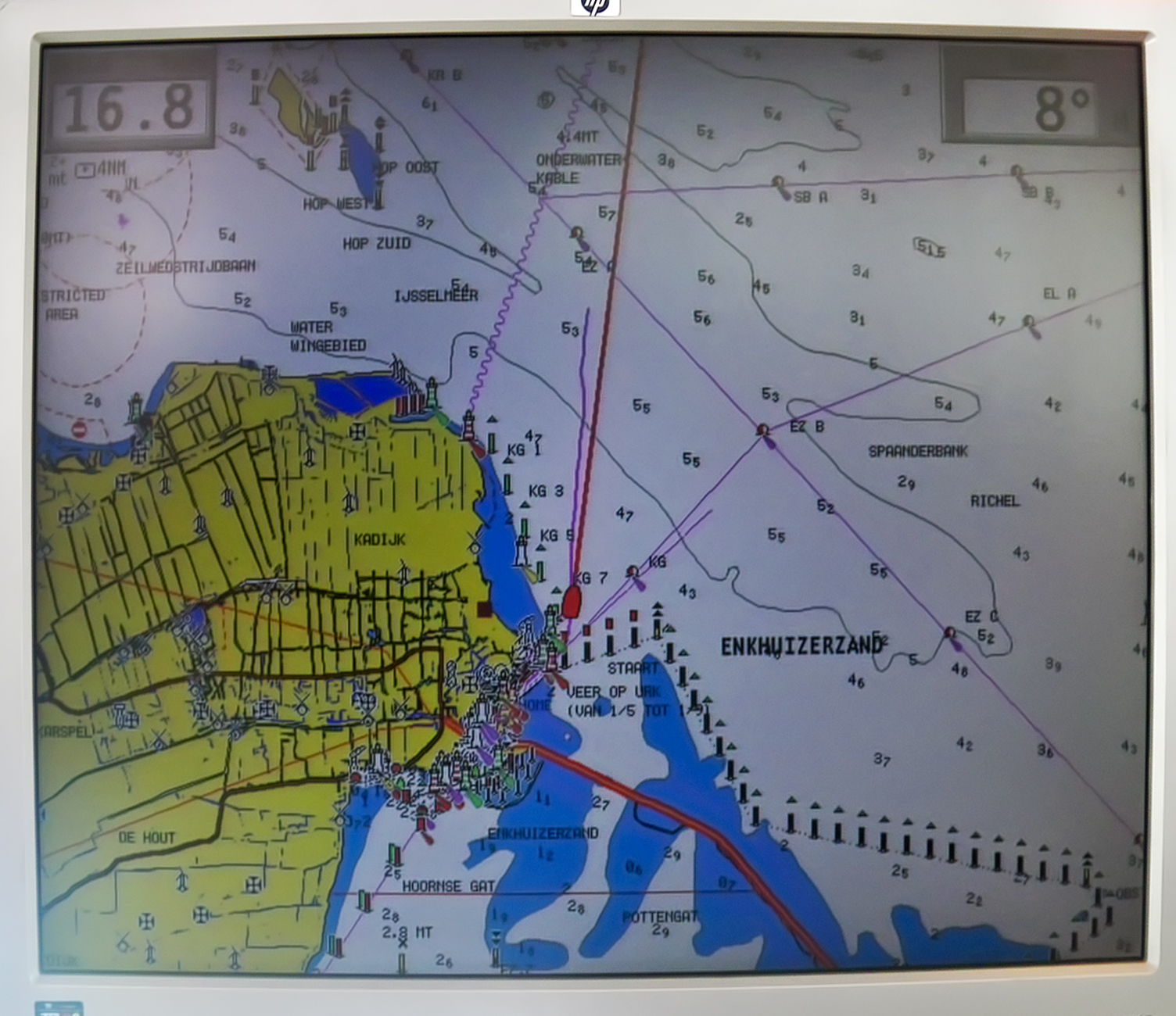
I was interested in the screen of the GPS monitor on board the ship, which allowed the skipper to see the course to be followed and the depth of water.
Photo: Don & Maria Hitchcock 1240h 14th June 2014
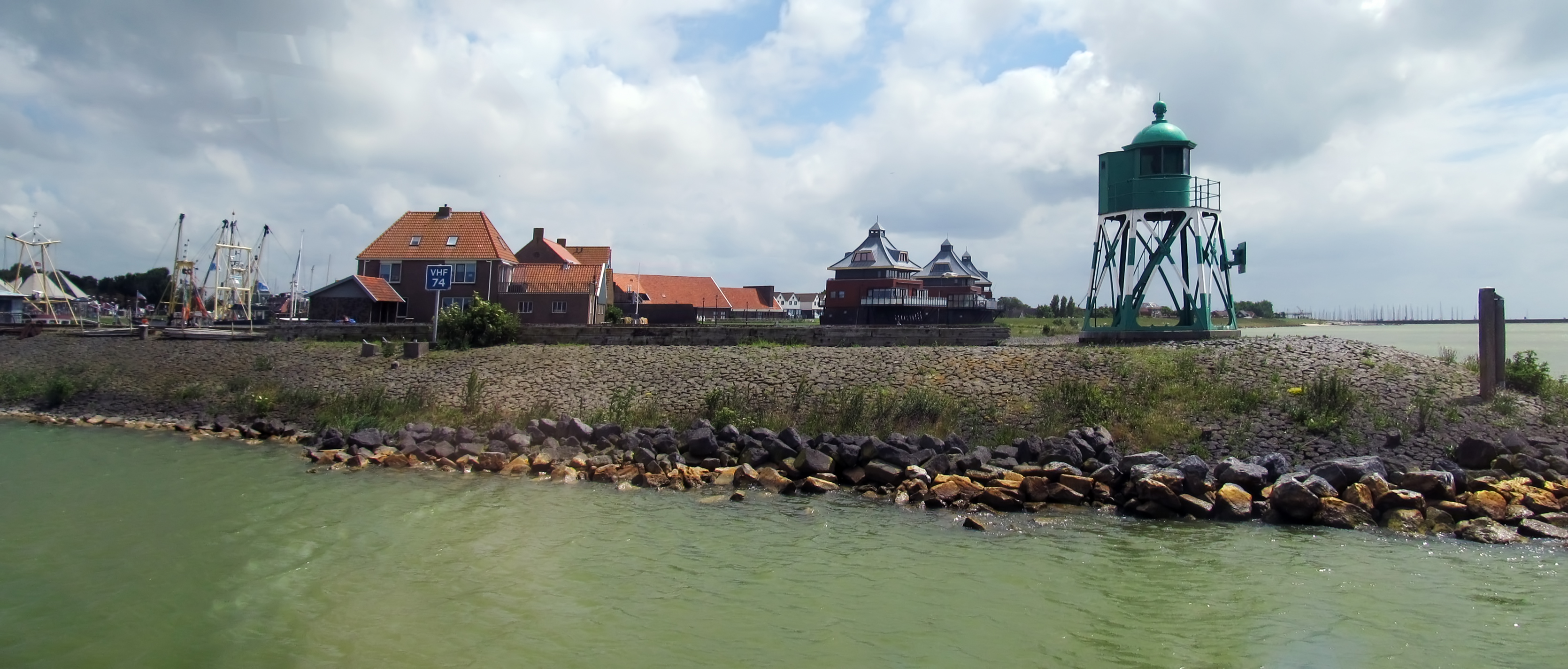
Maria took this panorama of the shoreline as we entered the harbour mouth of Stavoren. The cracked mud on the shore shows that the level of the lake varies, though only within strict limits.
Considerable amounts of water from the Rhine flow through its distributary IJssel into the IJsselmeer, and the closed off bay functions as a large freshwater reservoir, serving as a source for agriculture and drinking water. Outlet sluices in the Afsluitdijk regulate the water level of the IJsselmeer.
Photo: Don & Maria Hitchcock 1350h 14th June 2014
Additional text: Wikipedia
Coming into dock. As we came in, a single masted barge left under power, but with its sails ready to be hoisted once it was out in the open IJsselmeer.
Photo: Don & Maria Hitchcock 1351h 14th June 2014
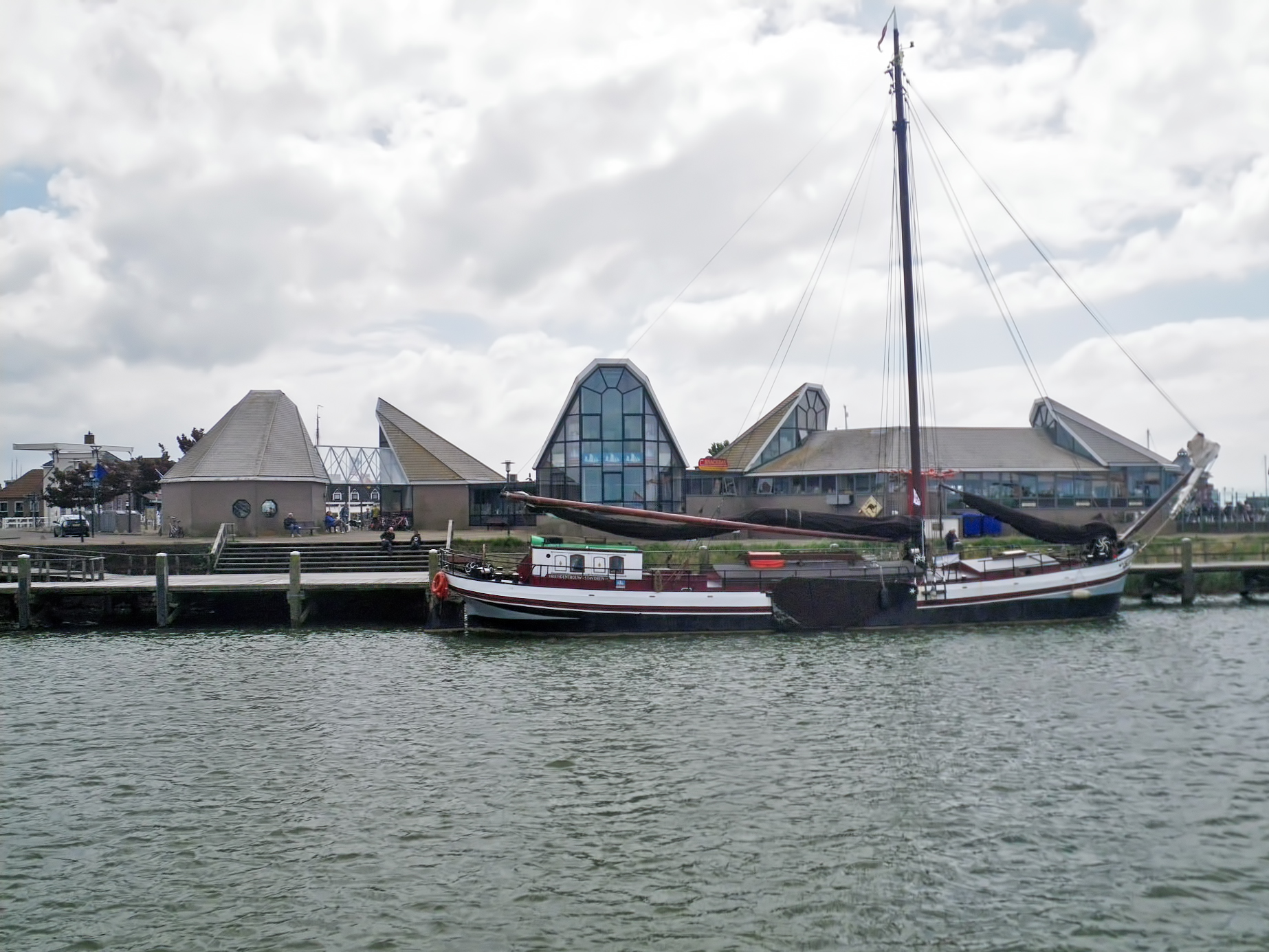
At the dock.
Photo: Don & Maria Hitchcock 1351h 14th June 2014
From Maria's Diary:
At Stavoren (the sort of place where people mess around in boats) we asked about accommodation - Don's missing his internet connection - there were B&Bs for about €90 (too expensive and we always want to get away early) and finally the lady told us about a camping area near the marina.
It was an excellent site close to the showers and toilets (paper provided this time!). It was quite windy most of the afternoon. We had coffee and cake at the restaurant and then played cards for a while. I washed my hair and some more clothes - at least the wind is drying stuff quickly. We'll go back to the restaurant later for an evening meal.

We set up the tent and got organised.
Photo: Don & Maria Hitchcock 1512h 14th June 2014
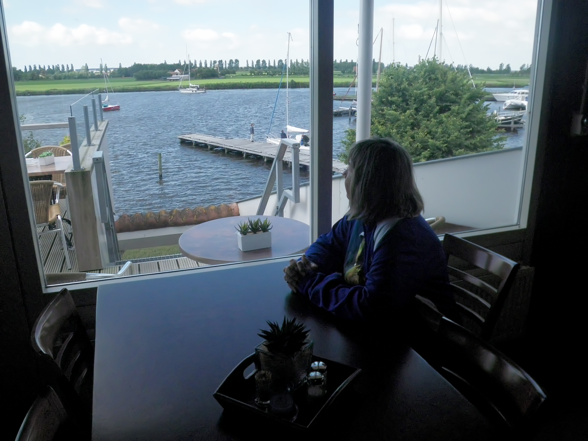
A very pleasant place to be, with a wonderful view and excellent coffee and cake, and later a very fine meal. Life was good.
Photo: Don & Maria Hitchcock 1534h 14th June 2014


The Marina was a beautiful place.
Photo: Don & Maria Hitchcock 1824h 14th June 2014
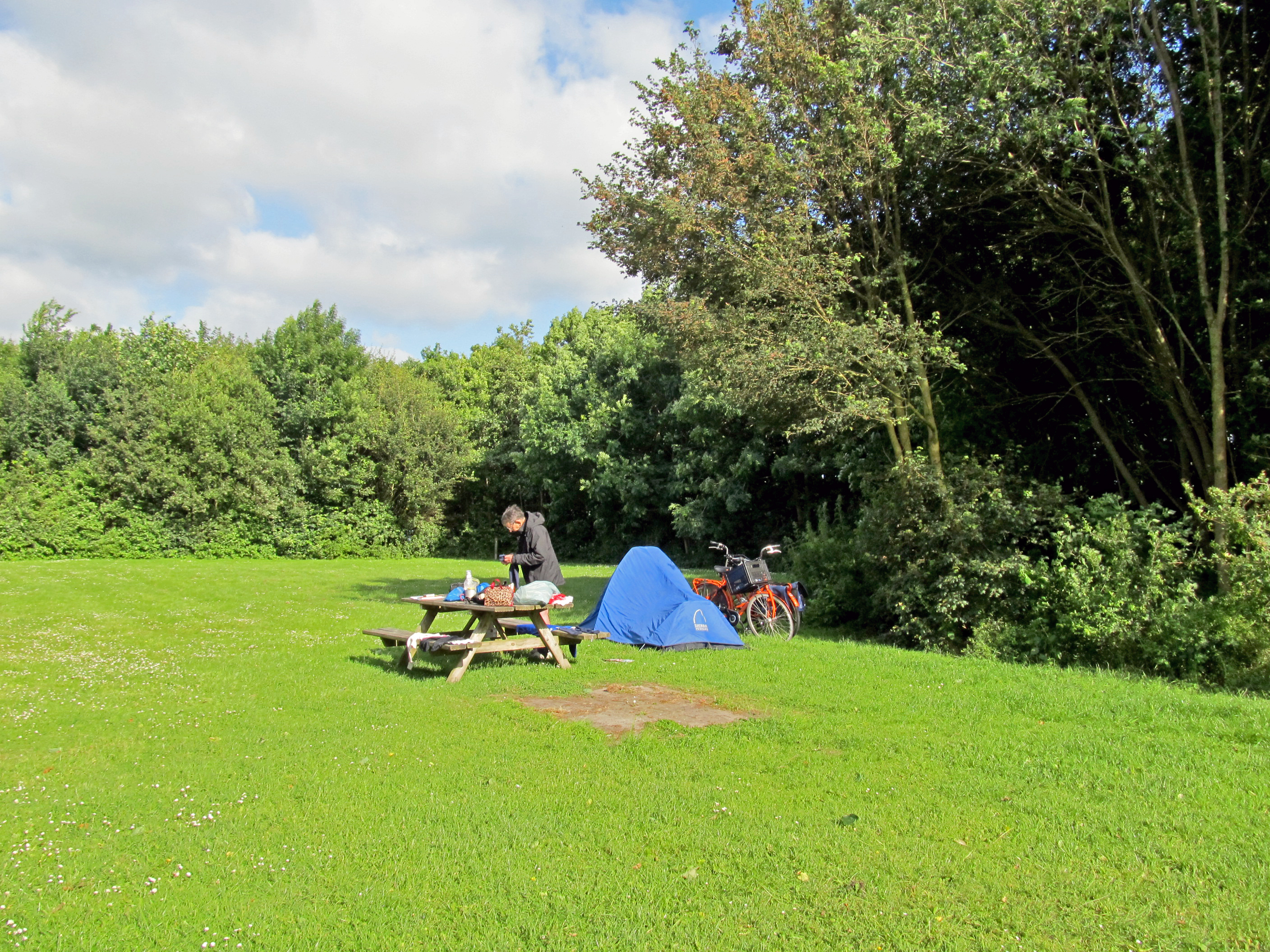
We were in the section of the camping site reserved for cyclists, and we were the only ones there.
Photo: Don & Maria Hitchcock 1824h 14th June 2014
Cycling from Amsterdam to Copenhagen
Day 3, 14th June 2014
60 km (142 km from the start)