Back to Don's Maps
Back to the Iron Gates - Location of the Sharamudoi
Hajducka Vodenica - a Mesolithic Iron Gates site
Hajducka Vodenica is another site in the Iron Gates area. At this site, prehistoric settlements and/or cemeteries covered a strip 12m wide along the river bank, having been significantly destroyed by river erosion and the later interments in the central part of the cove below the Late Roman fortress. It seems that only one third of the space originally containing Mesolithic settlement was preserved.
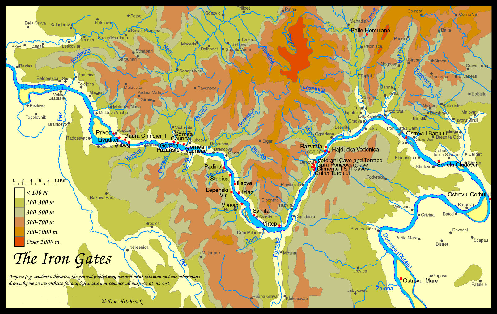
Map of the Iron Gates region, with the position of Hajducka Vodenica marked.
Photo: Don Hitchcock 2014
The following text and photos are from the excellent monograph by I. Radovanović, 'The Iron Gates Mesolithic', 1996. It is essential reading for anyone hoping to get some understanding of the mesolithic in the Iron Gates region.
Those wishing to purchase it may print and snail mail a jpg format Order form for 'The Iron Gates Mesolithic' or a pdf format Order form for 'The Iron Gates Mesolithic'
Ivana Radovanović, who was appointed in 2001 as assistant professor of anthropology at the University of Kansas, Lawrence, taught for 18 years at the University of Novi Sad and at the University of Belgrade. She was also a research associate in the Institute of Archaeology in Belgrade. As a visiting scholar in the United Kingdom, she pursued research and lectured at the University of Durham, the University of Cambridge, and the University of Newcastle. Her areas of specialization include prehistoric technologies, archaeological record and interpretation of burial procedures, and ideology and belief systems of prehistoric hunter-gatherers. She earned doctorate, master's and bachelor's degrees in archaeology from the University of Belgrade.
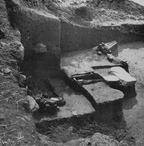
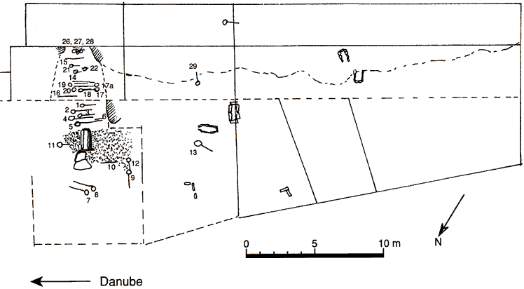
Hajducka Vodenica Ib, later building structure in the central space: rectangular hearth with a side channel, and a threshold.
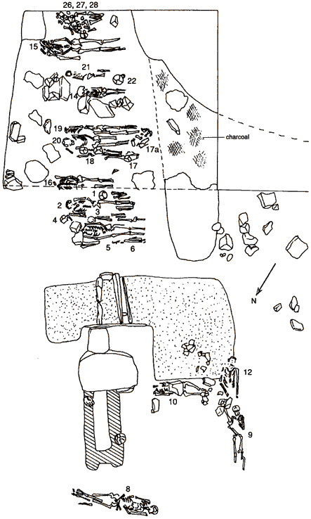
Apart from three burials of adults in extended position in the settlement area, a "chamber tomb" dug into the rock in the rear of a house (associated with two stone sculptures) is recorded. The chamber tomb contained three levels of burials with 27 individuals of both sexes and various ages (except infants). The deceased were interred either in extended position with the same orientation or as secondary burials. Grave goods are exceptionally rare (antlers, mandibula of a large herbivore, and a stone axe in three cases respectively).
Burials are around the hearth and at the rear of the structure, i.e. at the entrance to the chamber tomb. The chamber tomb was not yet excavated when this photograph was taken.