Back to Don's Maps
 Bushwalking Index
 Bushwalking, Hiking and Tramping in New Zealand
Day One and Two of the Travers Sabine Circuit in New Zealand - St Arnaud, Bushline and Angelus Huts
Day One and Two - The Travers - Sabine Circuit in the Nelson Lakes area is a wonderful mix of landscapes and vegetation, from beech forest to alpine moors. It is suitable for experienced, fit walkers who are prepared to spend five to seven days exploring the wonderful areas the tracks give access to. The highlights are the Robert Ridge walk to Lake Angelus, the ascent of the Travers Saddle, and the trip to Blue Lake. After driving from nearby Saint Arnaud, Paddy's track gives access to Bushline Hut, with views of Lake Rotoiti along the way. The well marked Robert Ridge track, narrow and exposed at times, takes you to Lake Angelus Hut, with spectacular views of glacial lakes and cirques along the way, and very interesting alpine vegetation such as vegetable sheep. Snow is possible any month of the year.
You may well be the only person walking the track, and carrying a personal locator beacon is a wise precaution. Weather conditions can be extreme.
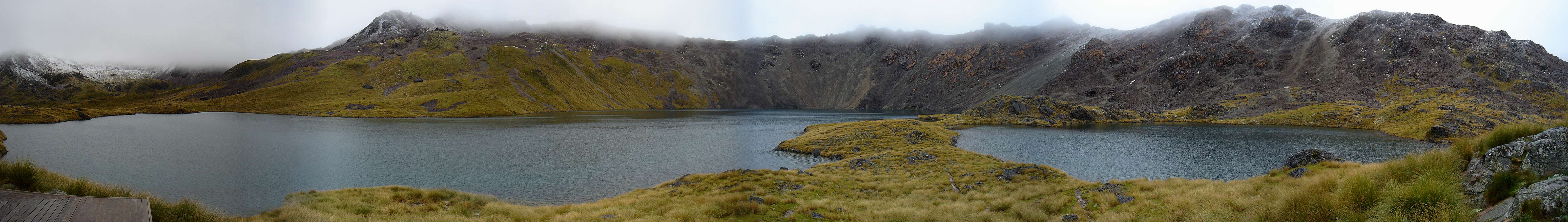
Panorama stitched together by Don Hitchcock from excellent originals by B., 29th January 2007
This is a very useful sketch map of the Travers Sabine Circuit from the New Zealand Government site. The NZ Government has worked really hard to make it easy for tourists to find information, and to book travel and accommodation. I believe they have the best such system in the world.
Photo: http://www.doc.govt.nz
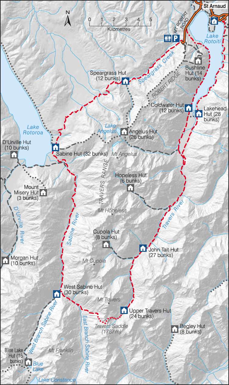
This is a very useful sketch map of the Travers Sabine Circuit in Nelson Lakes National Park from the New Zealand Government site. The NZ Government has worked really hard to make it easy for tourists to find information, and to book travel and accommodation. I believe they have the best such system in the world.
Photo: http://www.doc.govt.nz
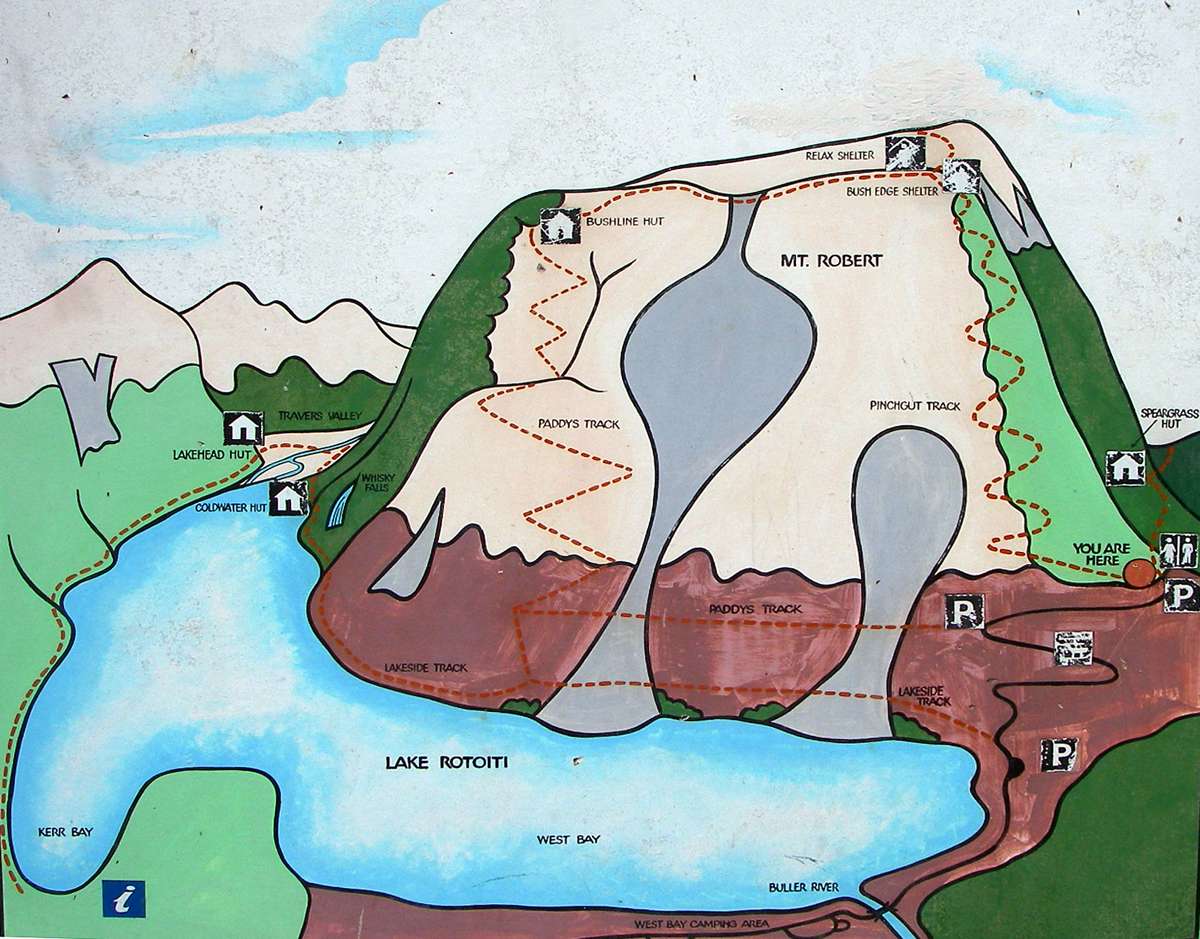
An excellent 3D sketch map at the upper car park of the first part of the walk to Bushline hut using Paddy's Track.
Photo: Don Hitchcock 28th January 2007
Source: Display board by DOC at upper carpark.
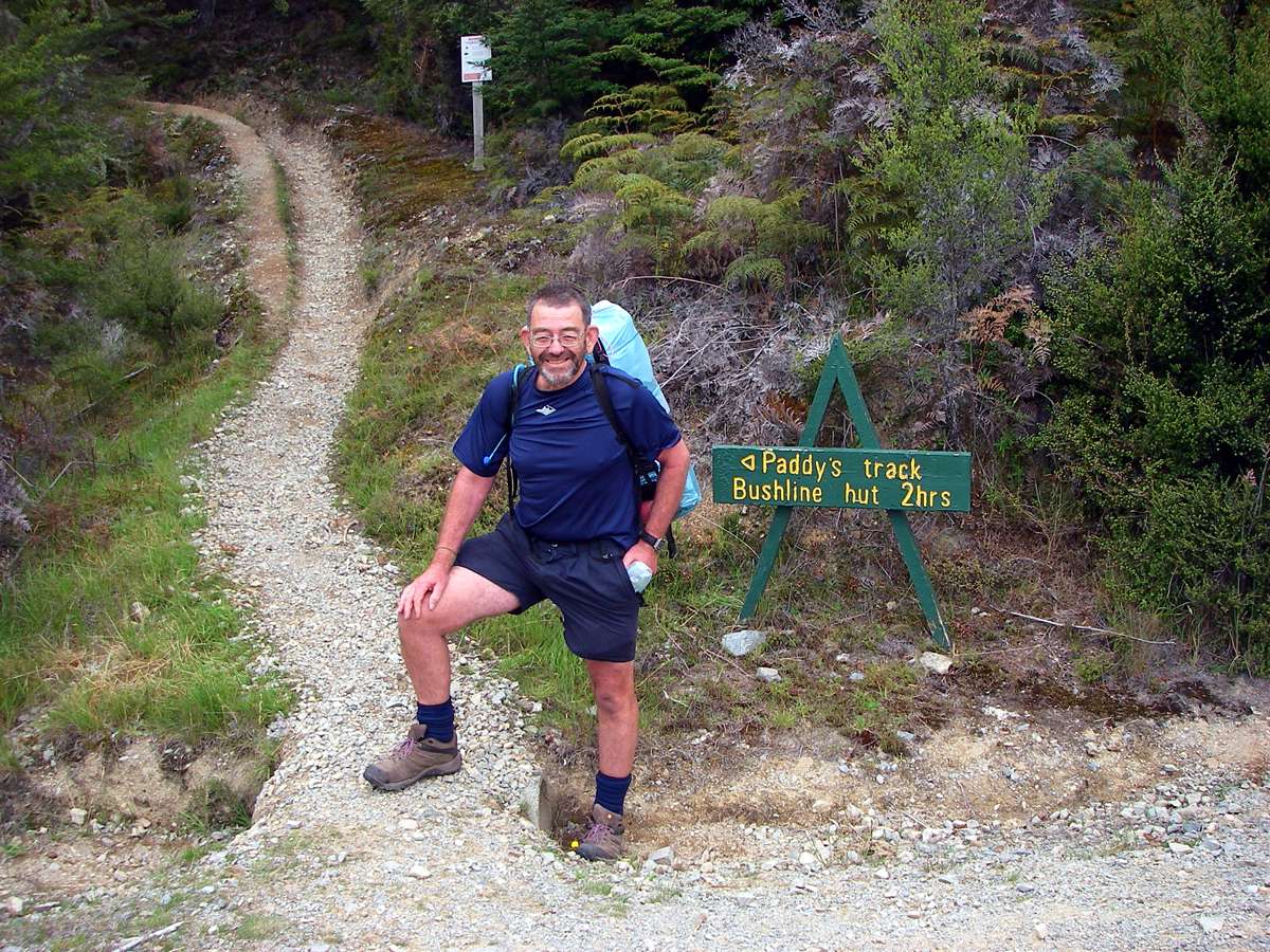 After arriving at St Arnaud, I tried to get a bus or shuttle to the start of the walk and got a recorded message from the bus company saying that the messages might not be listened to for days! I laughed, and started talking to the couple next to me, explaining that I had a seven or eight kilometre road bash ahead of me. They said not a problem, we'll take you up there!
On the way we picked up another tramper, a German boy, and he was going up Robert Ridge to Angelus hut. I told him it was late in the day (nearly 11 am by this time) to be thinking of that track, which is exposed, no tree cover, and high altitude, about 1800 metres, and the weather didn't look good, and the trip takes six hours if all goes well. He went anyway. The couple who took us then took me back 200 metres down the steep gravel road to the start of the track to Bushline Hut, Paddy's track, which goes across the side of the mountain with good views of the lake, and took my photo. New Zealanders are a friendly and helpful lot, and I love their sense of humour.
Photo: Don Hitchcock, 10.51 a.m. 28th January 2007
On arrival by plane in Auckland, I called in to a pharmacist for some cold and flu tablets, and saw a sign on an over the counter medicine:
" This medication has been tested on Australians! "
I laughed out loud, and commented that Kiwis had a great sense of humour. The pharmacist said, " Of course, much better than Aussies! "
By now, the whole shop was waiting for my reply. I remembered that the kiwis had not being doing at all well in rugby and cricket at the time.
I said " Well, I guess it's just as well you've got that at least - after all, you can't play cricket, and you can't play rugby! " at which the shop collapsed in laughter.
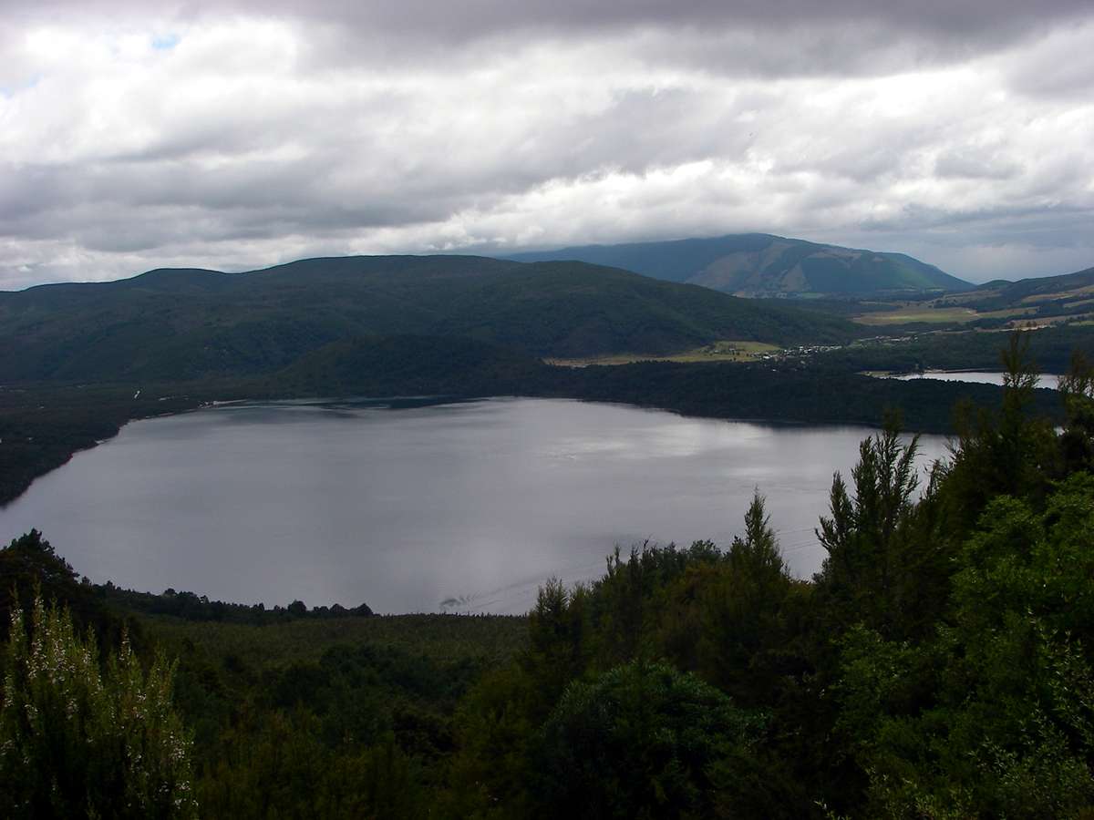
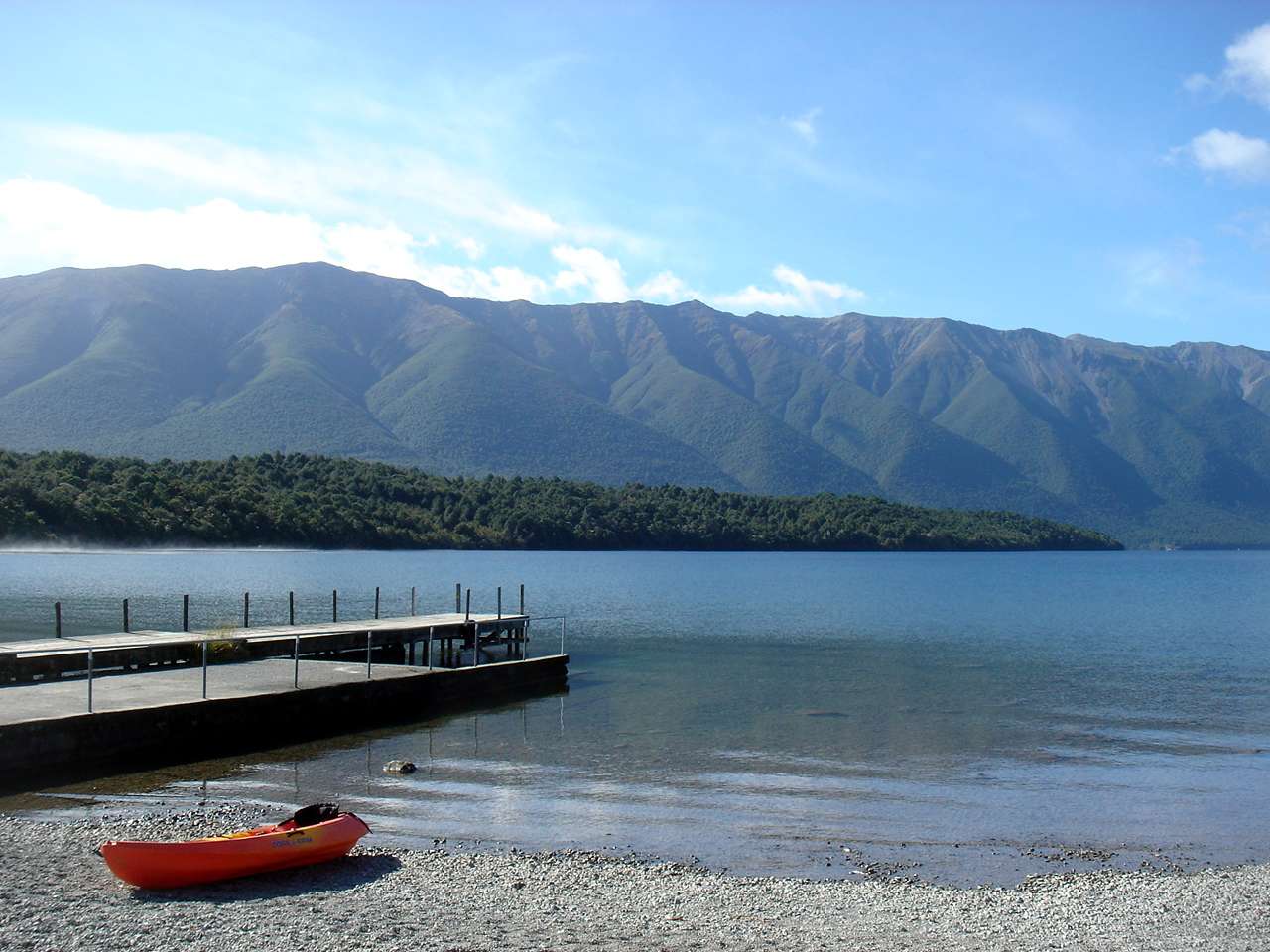
Not long after starting, I got this lovely view of Lake Rotoiti.
Photo: Don Hitchcock, 28th January 2007
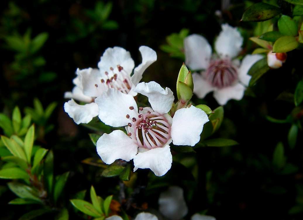
Leptospermum scoparium, an Australian plant naturalised in New Zealand. Perhaps seeds blew across the Tasman at some stage, it has very light and small seed. The oil from the leaves was used for medicinal purposes by the Maori people before white settlement, so it is not a garden escape.
Photo: Don Hitchcock, 28th January 2007
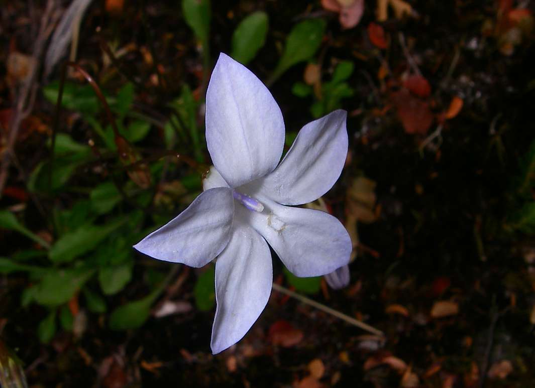
Possibly a Wahlenbergia sp.
Photo: Don Hitchcock, 28th January 2007
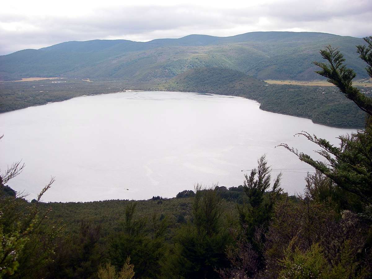
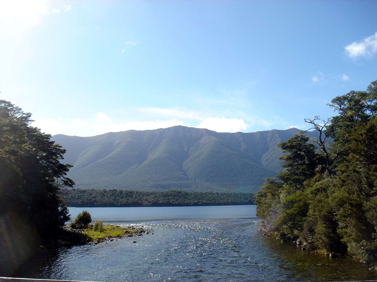
Nearly an hour later, I was able to get a better view of the lake, and the village of St Arnaud.
Photo: Don Hitchcock, 28th January 2007

After lunch, and a long talk to some daywalking fellow bushwalkers from Australia with mutual friends, I got to Bushline hut at 2.30 p.m.
It is a well fitted out hut with a capacity of 14.
I found the German there! The weather had closed in by this time, rain and fog to 20 metres visibility, and he said he couldn't see the track ( I don't think he had even a rudimentary map) so had taken the Paddy's Track circuit back down to the hut.
He had four items of food: a bottle (!) of jam, a bottle of peanut butter, a loaf of bread, and five minute noodles. That was it. In the morning he decided to go back down to civilisation, probably a wise decision, given his lack of preparation.
The huts are basic, they have foam pads for sleeping on, a fuel stove (light with pine you split yourself, then start adding coal) and of course no lighting. Often they have an internal water tap and sink, but not always.
Photo: Don Hitchcock, 28th January 2007

Just before dawn, you could see the lights of the town below, but the lake is hidden by the brow of a ridge.
It looked like it was going to be a beautiful day. I quickly had breakfast, packed up, and left.
Photo: Don Hitchcock, 29th January 2007
Bushline Hut is, as you would expect, at the tree line, and the track up to Robert Ridge leads across low heath, with snow poles marking the way.
Photo: Don Hitchcock, 29th January 2007
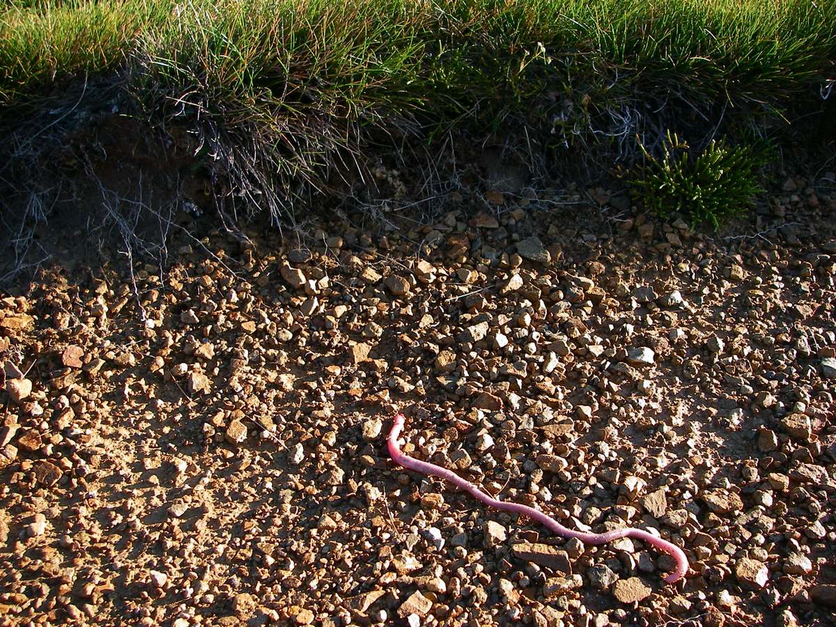
A large earthworm crawling across the gravel. There were many of these on the track.
Photo: Don Hitchcock, 29th January 2007
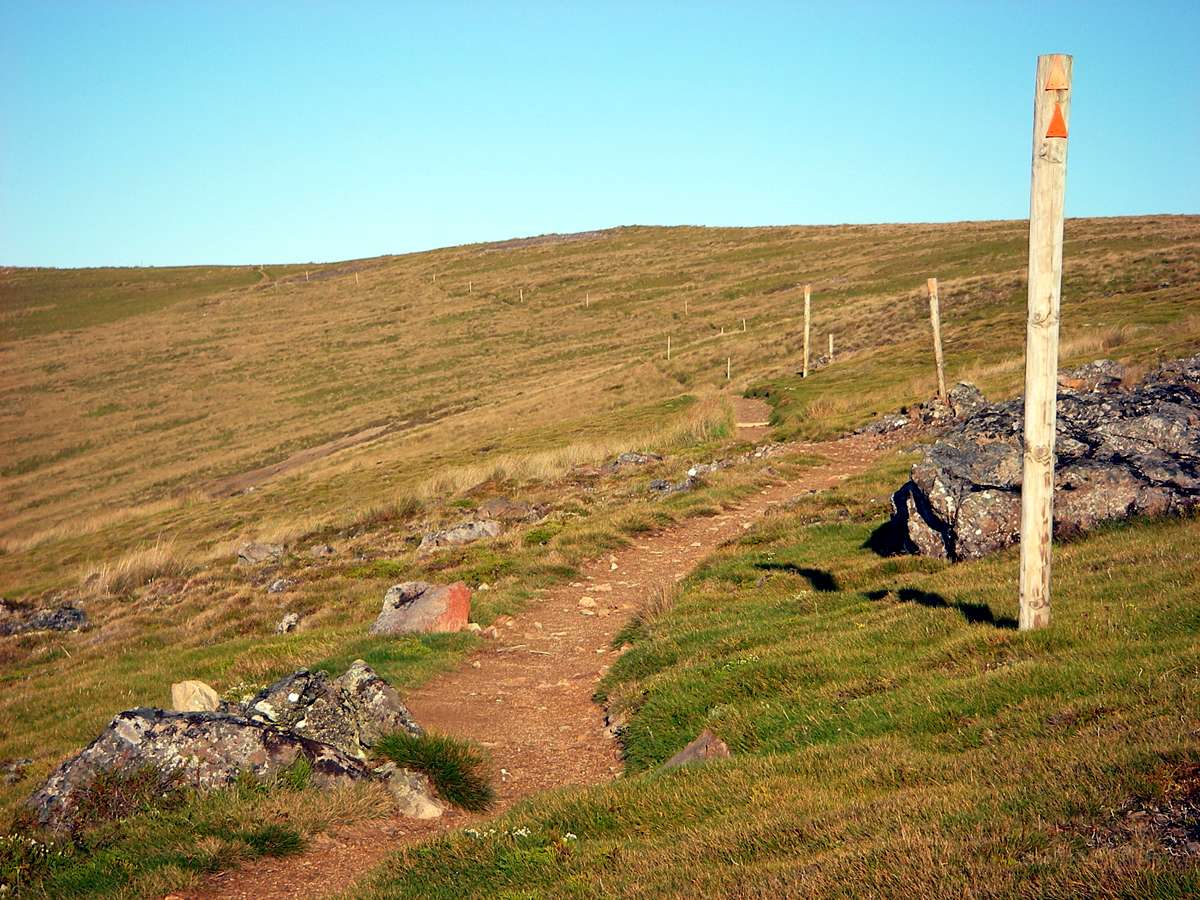
The track to the start of the Robert Ridge Track had flattened out a lot by this time, and was now a well defined track across a broad ridge, marked by snow poles.
Photo: Don Hitchcock, 29th January 2007
Lake Rotoiti was by now a long way down.
Photo: Don Hitchcock, 29th January 2007
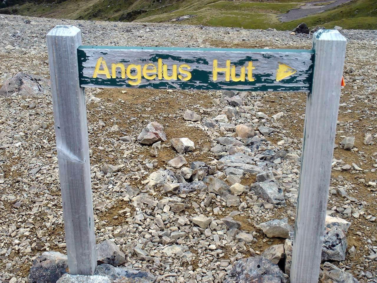
The Pinchgut Track to Robert Ridge
This 3D sketch map at the upper car park shows Paddy's Track, which I took, and Pinchgut Track, which B. took to get to the Robert Ridge Track to Lake Angelus.
Photo: Don Hitchcock 28th January 2007
Source: Display board by DOC at upper carpark.
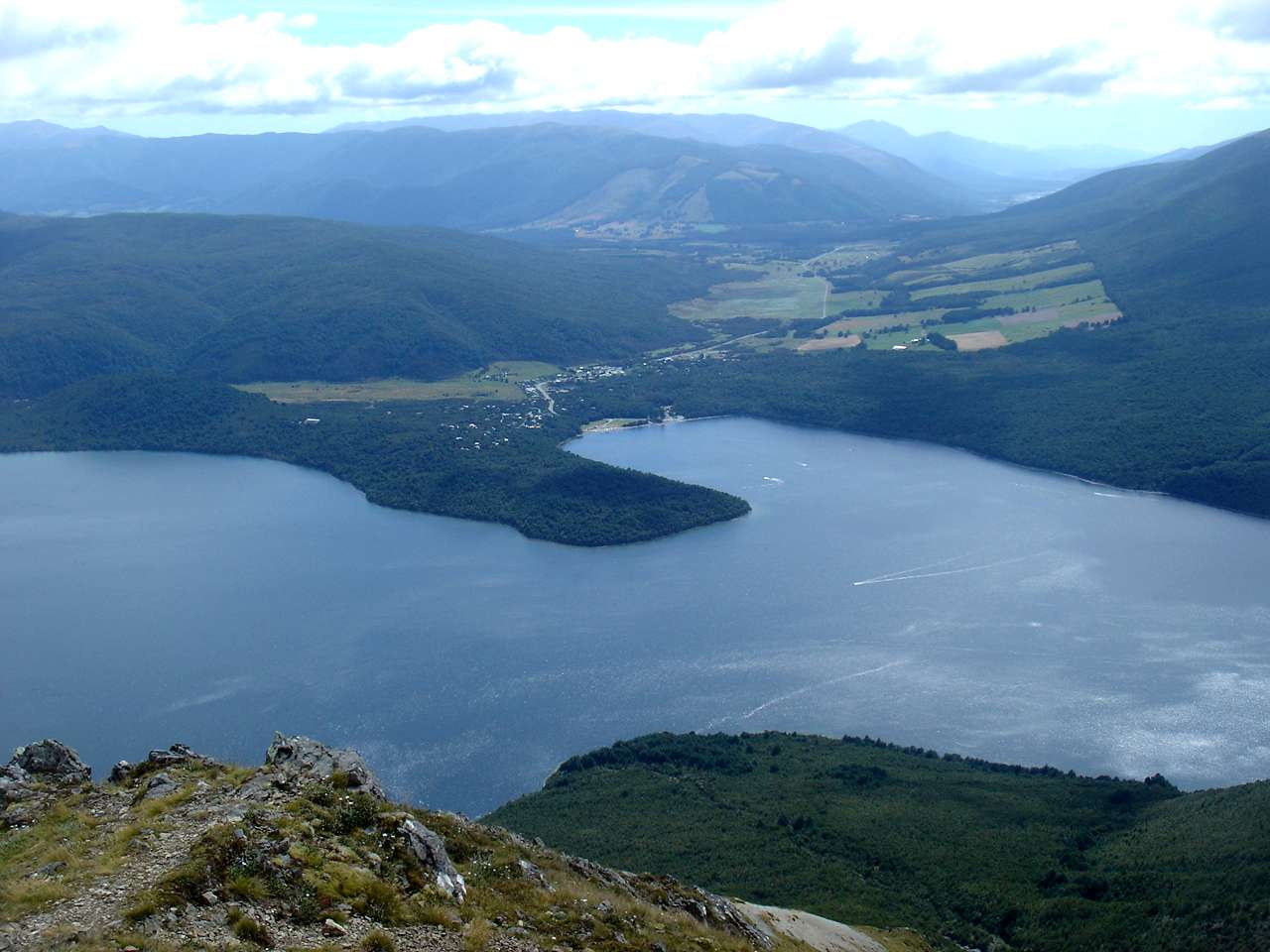
Lake Rotoiti.
From here you can see the ridgeline for Paddy's Track on the left, with the Pinchgut Track start obscured by the flowering tree in the foreground, but the route for the top part of the Pinchgut track may be seen as the last ridge in sunlight on the right side of the highlands, with an eroded gully to its left.
Photo: B., 29th January 2007
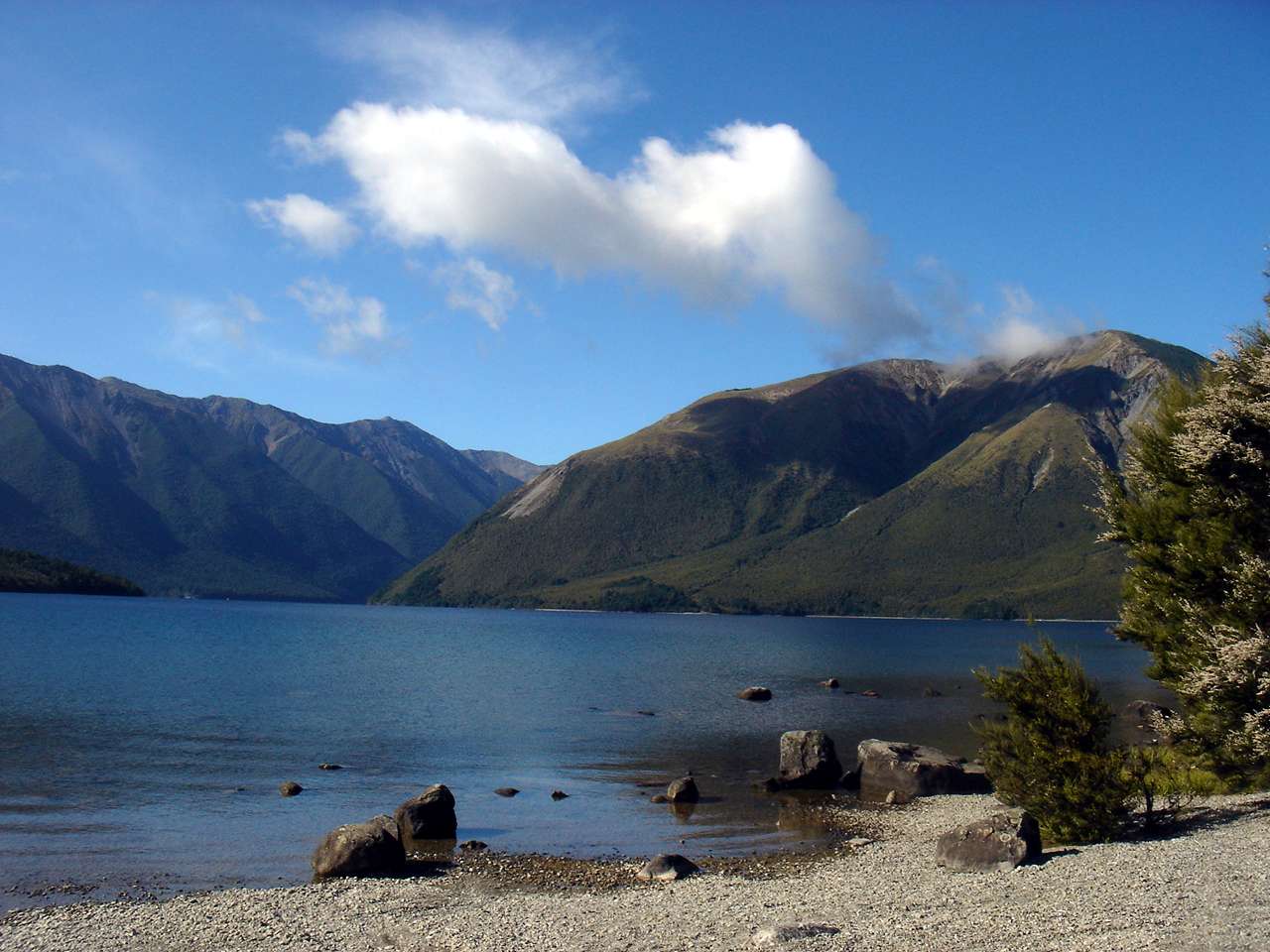
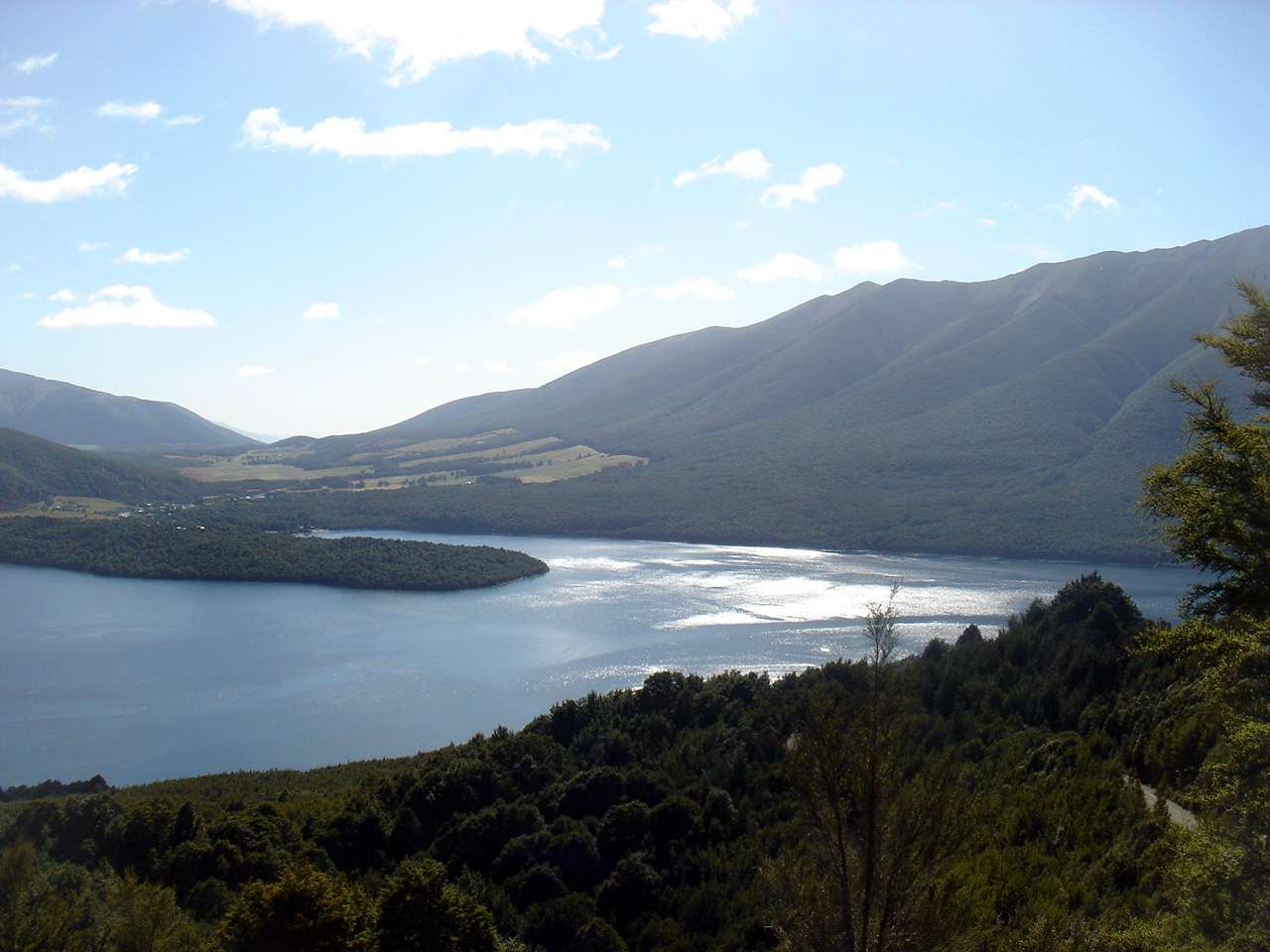
Lake Rotoiti.
There are often power boats on the lake, and there are boat services to take walkers to the other end of the lake if desired.
Photo: B., 29th January 2007
The Buller River is the main stream, apart from the Travers on the other side, flowing into Lake Rotoiti.
Photo: B., 29th January 2007
Lake Rotoiti taken from the start of Pinchgut Track.
The road to the carpark can be seen in the right foreground of the photograph.
Photo: B., 29th January 2007
The view of Lake Rotoiti becomes better as you zigzag up the ridge.
Photo: B., 29th January 2007

At the tree line, this erosion gully appears on the left of the track.
Photo: B., 29th January 2007
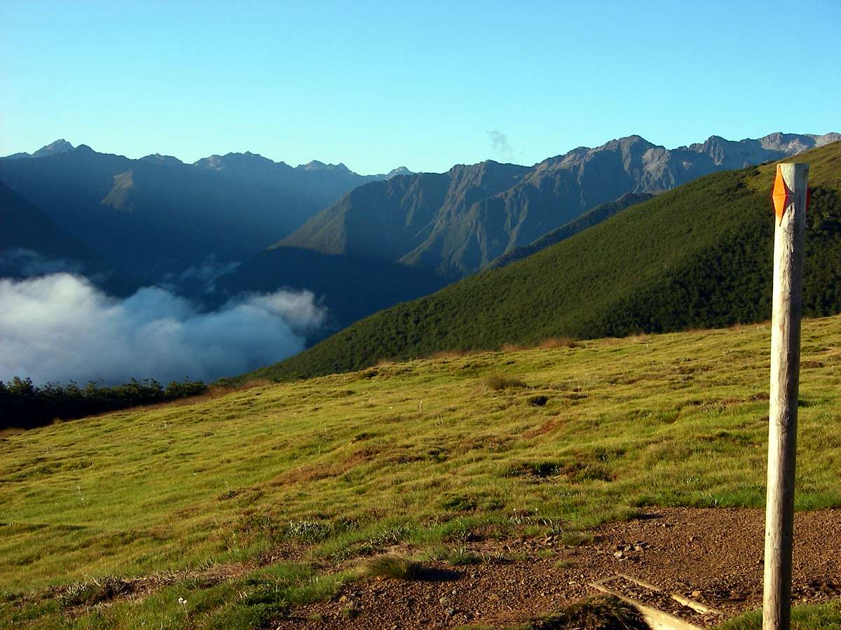
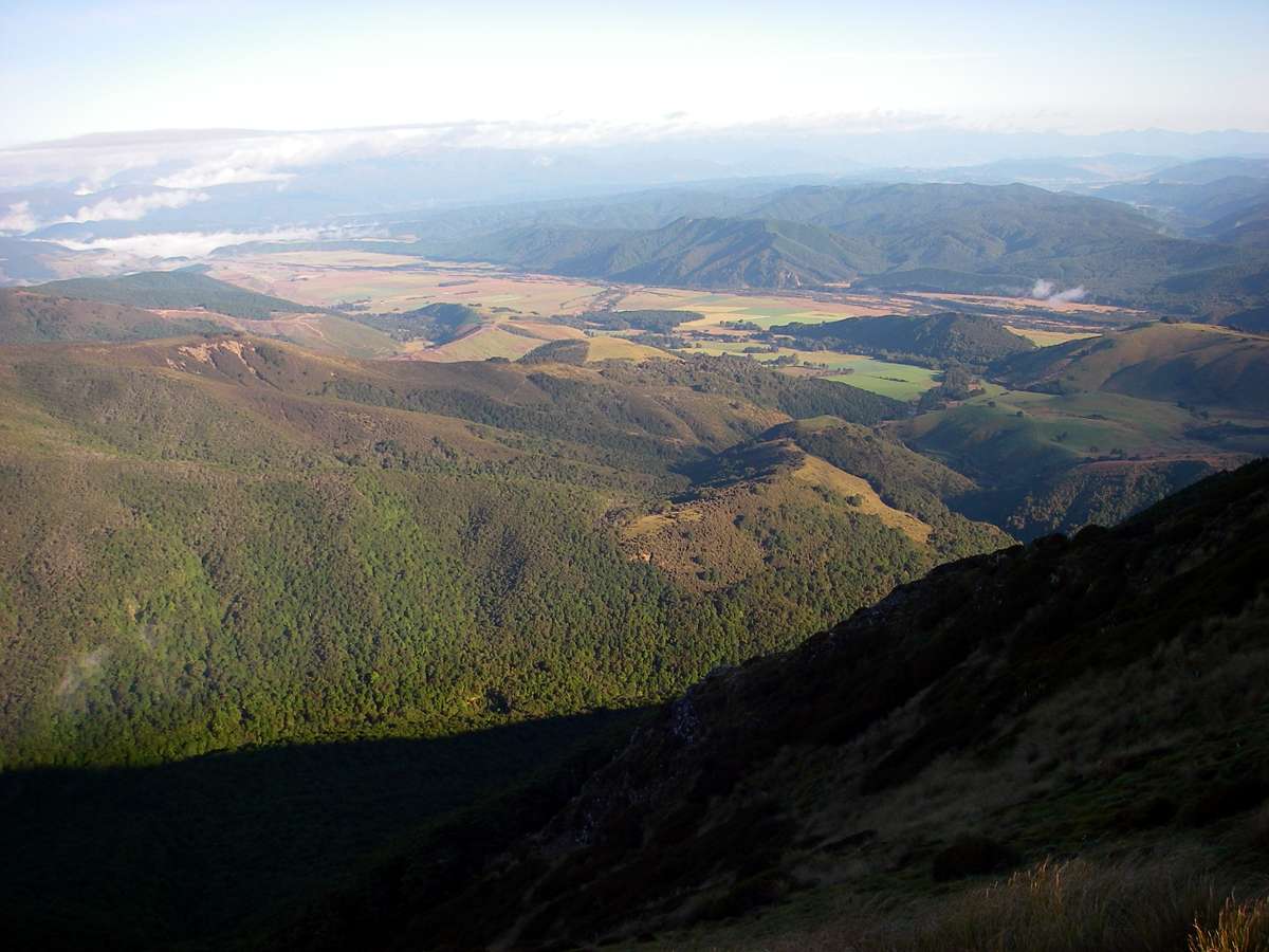
Across the next ridge is the far side of the Travers Valley, with the ridge tops well above the tree line.
Photo: B., 29th January 2007
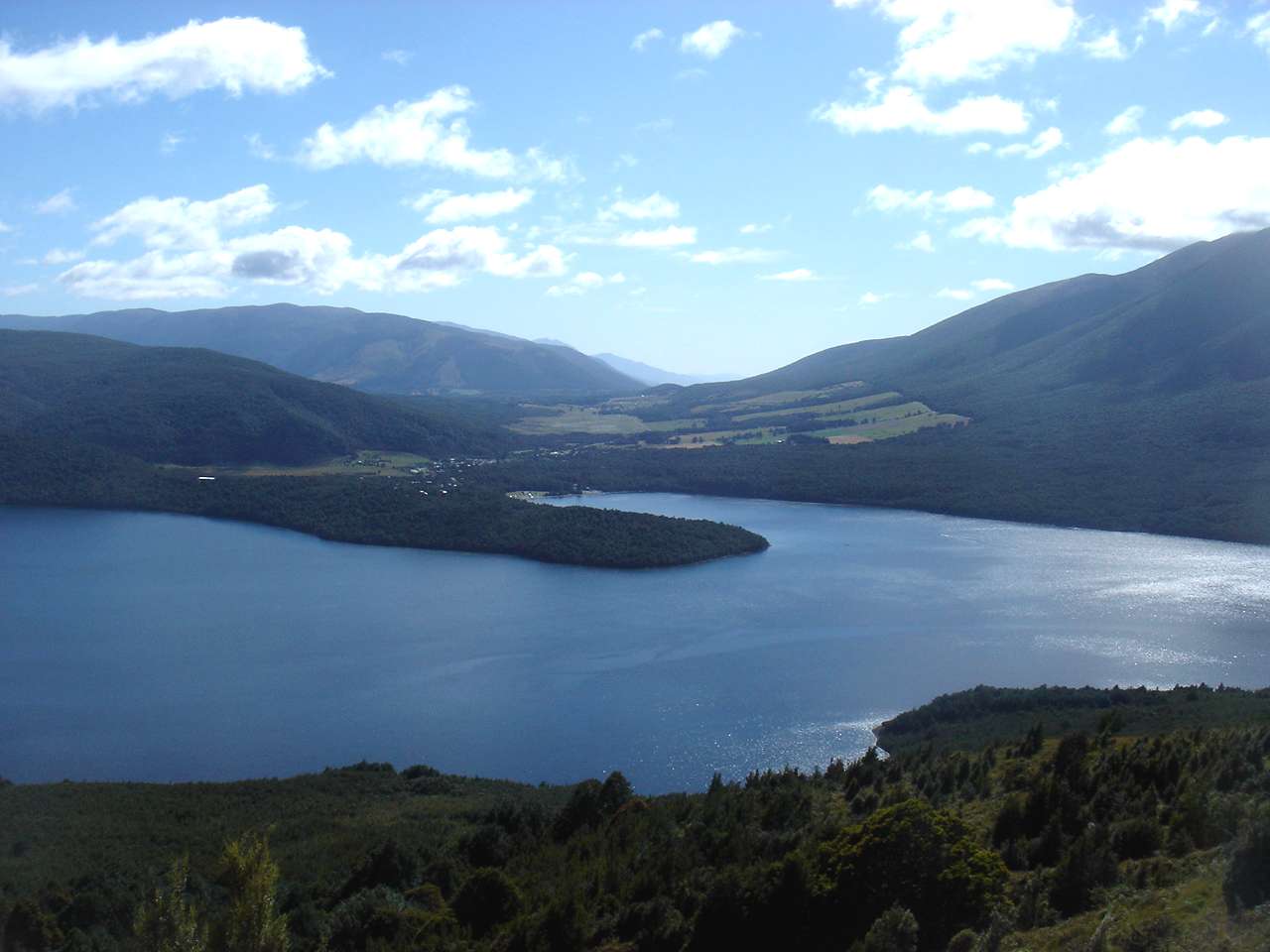
St Arnaud at the head of the lake, and the wash of speedboats zipping about the calm waters make an idyllic scene.
Photo: B., 29th January 2007
The Pinchgut Track starting to level out, with the country to the south west of Lake Rotoiti to the right.
Photo: B., 29th January 2007
Looking back to see Lake Rotoiti almost obscured by the ridge.
Photo: B., 29th January 2007
Well above the treeline on Robert Ridge, with the ridge on the other side of the Travers River on the skyline.
Photo: B., 29th January 2007

The ridge from Bushline Hut is now visible, and soon the two tracks meet.
Photo: B., 29th January 2007
The combined tracks now continue on as Robert Ridge Track to Lake Angelus.
Photo: B., 29th January 2007
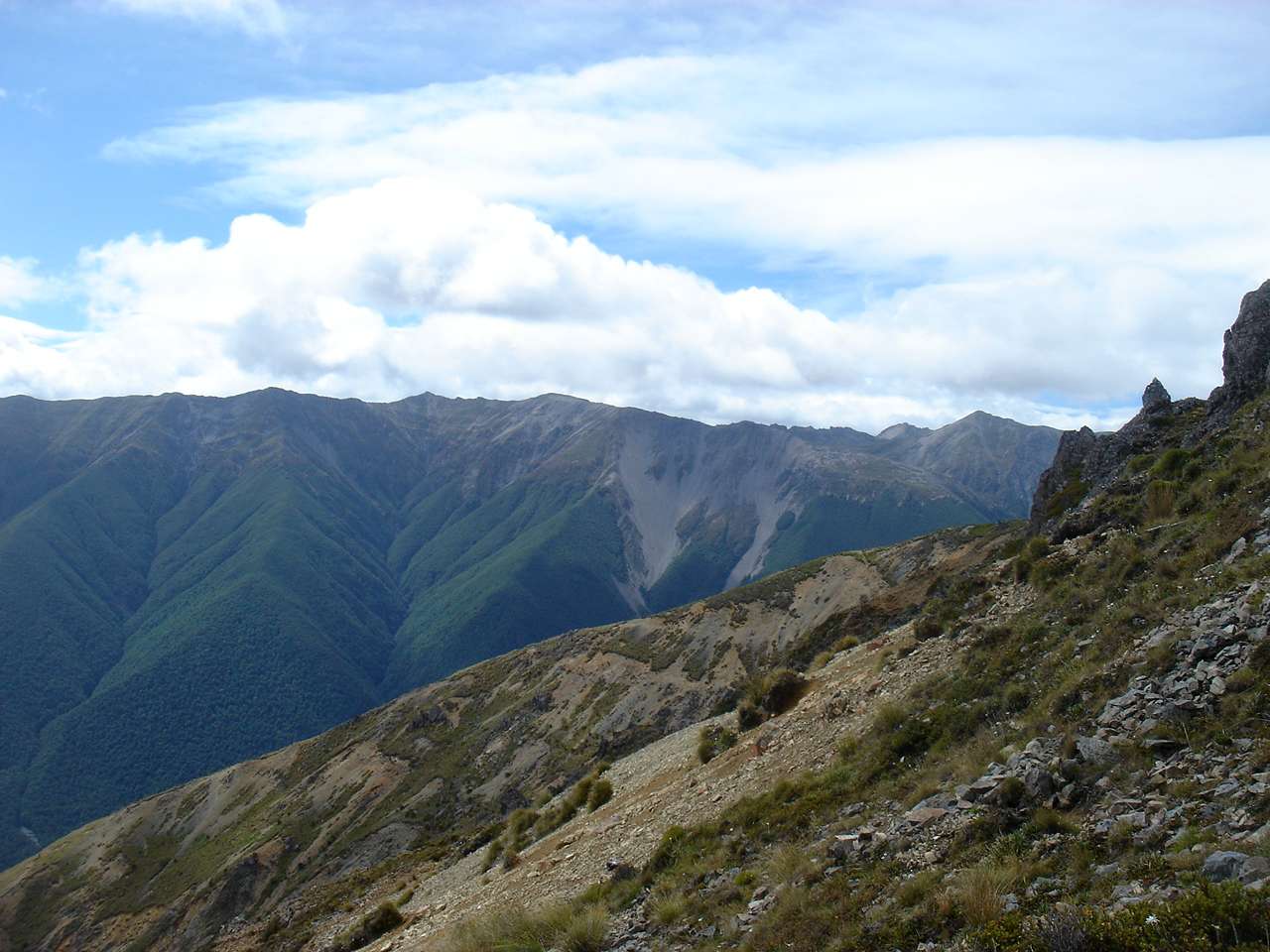
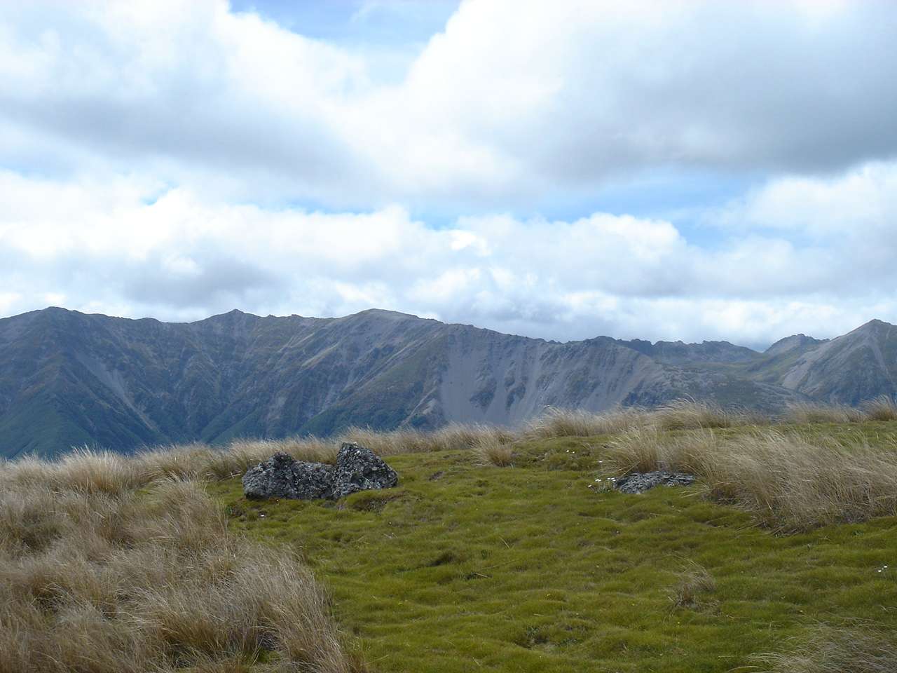
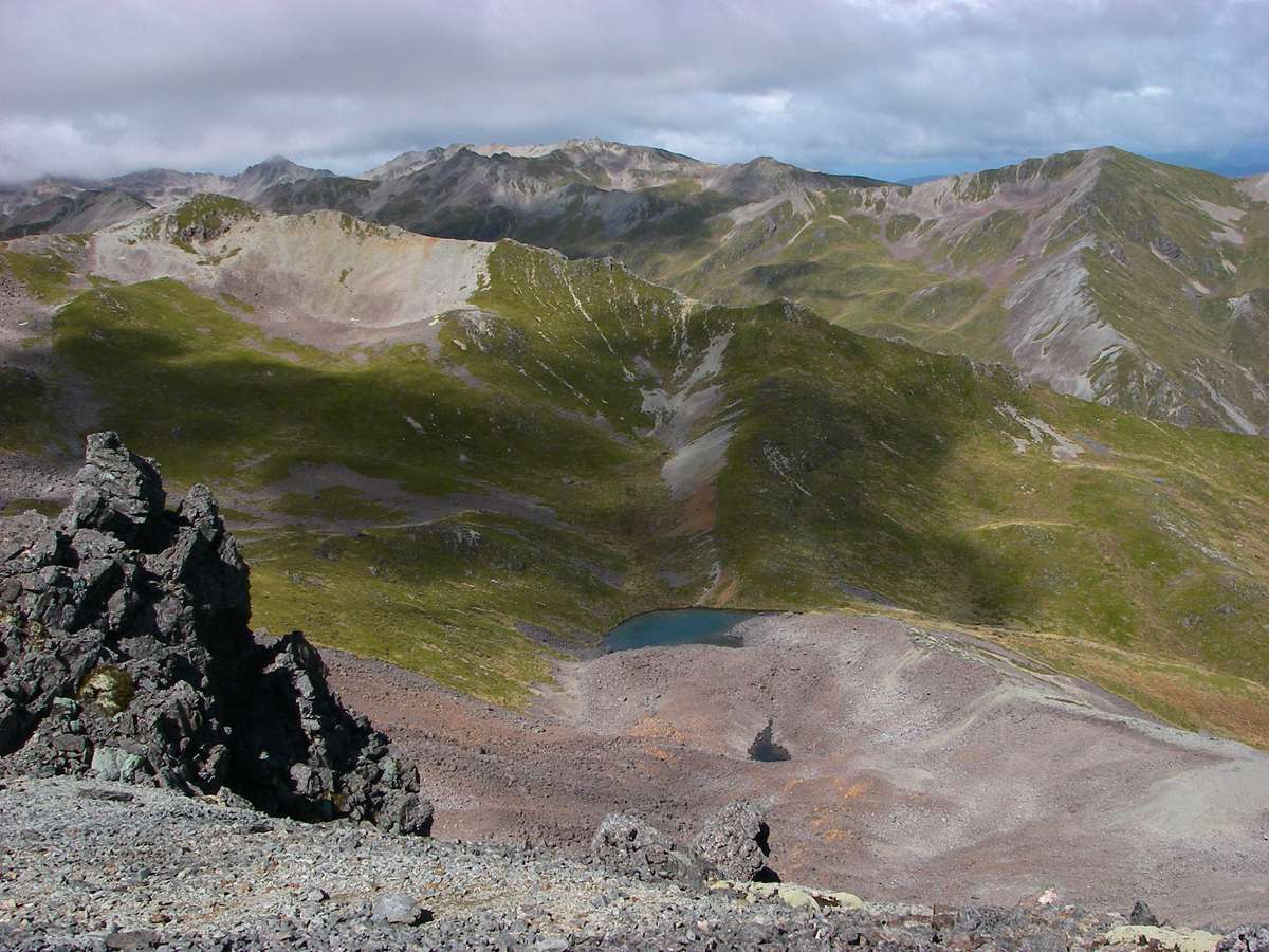
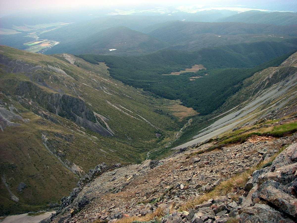
The classic U shaped valleys of glaciated areas, with flat valley bottoms and steep sides was very evident in this view, taken just after the junction of the Pinchgut and Paddy's Tracks to form the Robert Ridge track, which leads to Lake Angelus.
Photo: Don Hitchcock, 29th January 2007
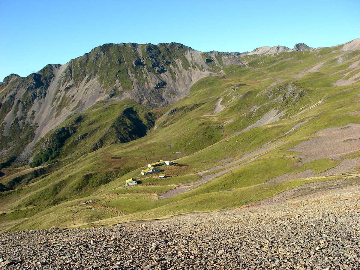
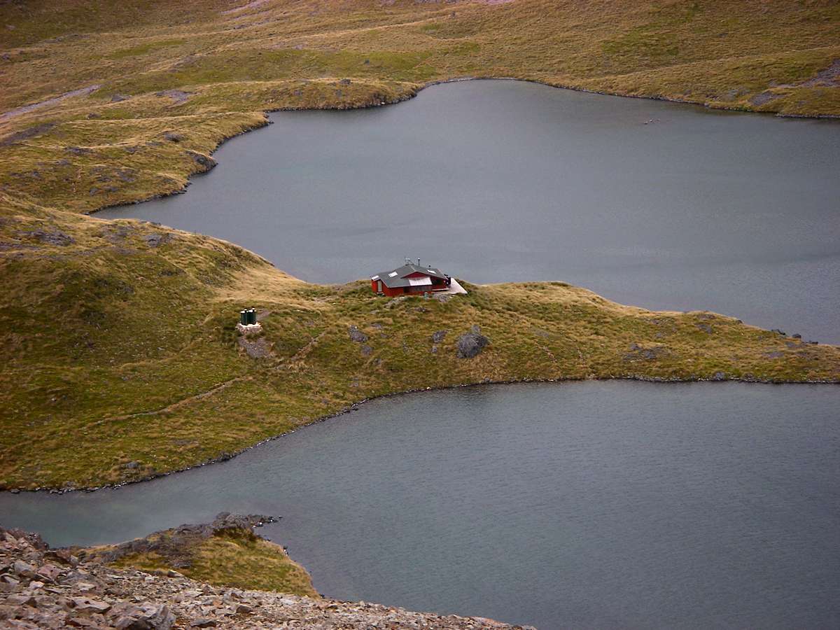
Department of Conservation buildings in a beautiful position in a cirque.
Photo: Don Hitchcock, 29th January 2007
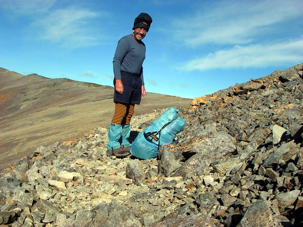
What the well dressed tramper should wear!
The wind had come up, and had turned cold, though the sun was still shining brilliantly. I put on thermal underwear and a lambswool sweater, as well as my very warm hat which I made on the sleeping bag principle, with an inch of insulation, guaranteed to keep my head warm.
My pack was standing up to the rigours of the walks well. I had hand sewn the back pocket on at Karamea to provide more room, and that made a big difference. In it I had a daypack full of the necessities for the day's walk, securely moused to the pack.
The gaiters are essential for New Zealand walking, as they keep the sand out of your boots when crossing creeks and rivers.
Photo: Don Hitchcock, 29th January 2007
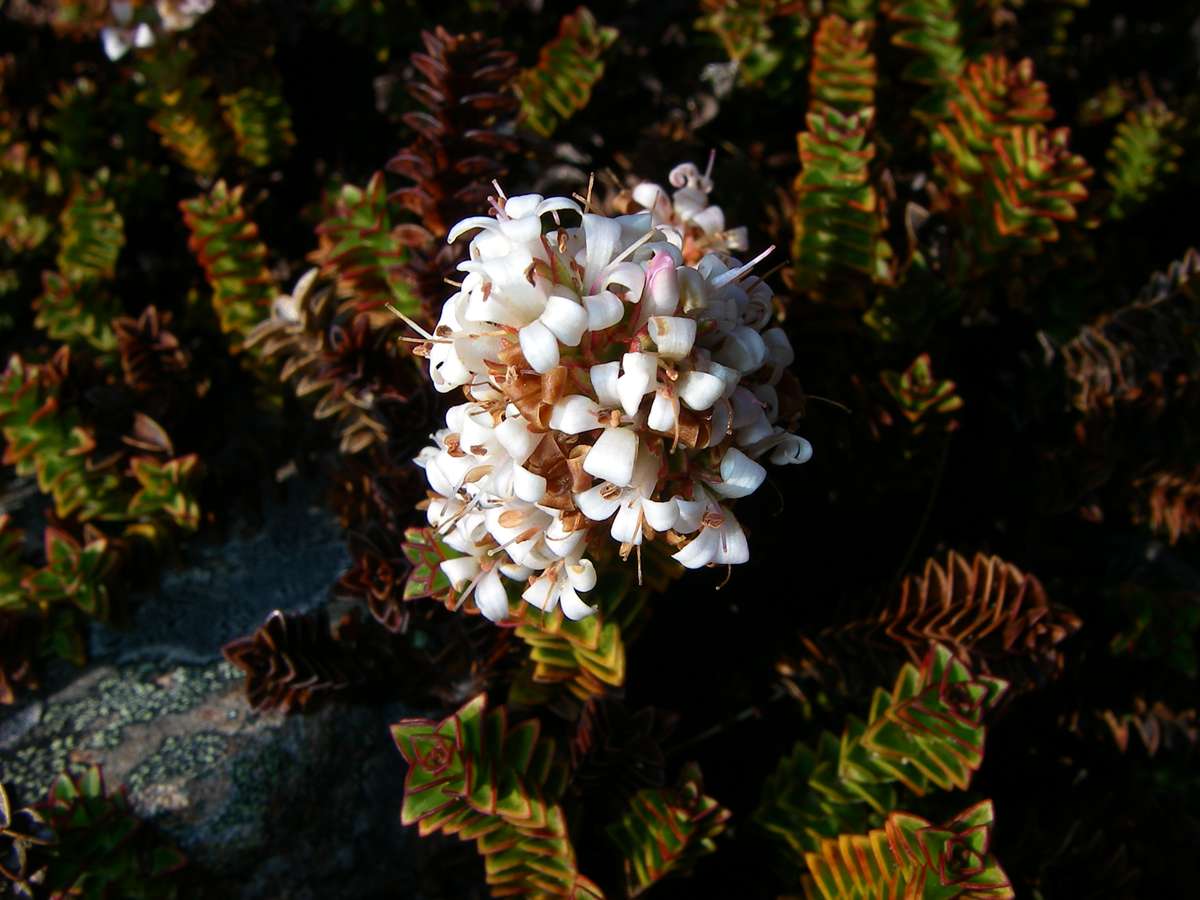
Hebe epacridea, found only on the South Island, at altitudes from 1200 m to 2100 m, on scree and loose rocky debris or crevices in fellfield.
Photo: Don Hitchcock, 29th January 2007
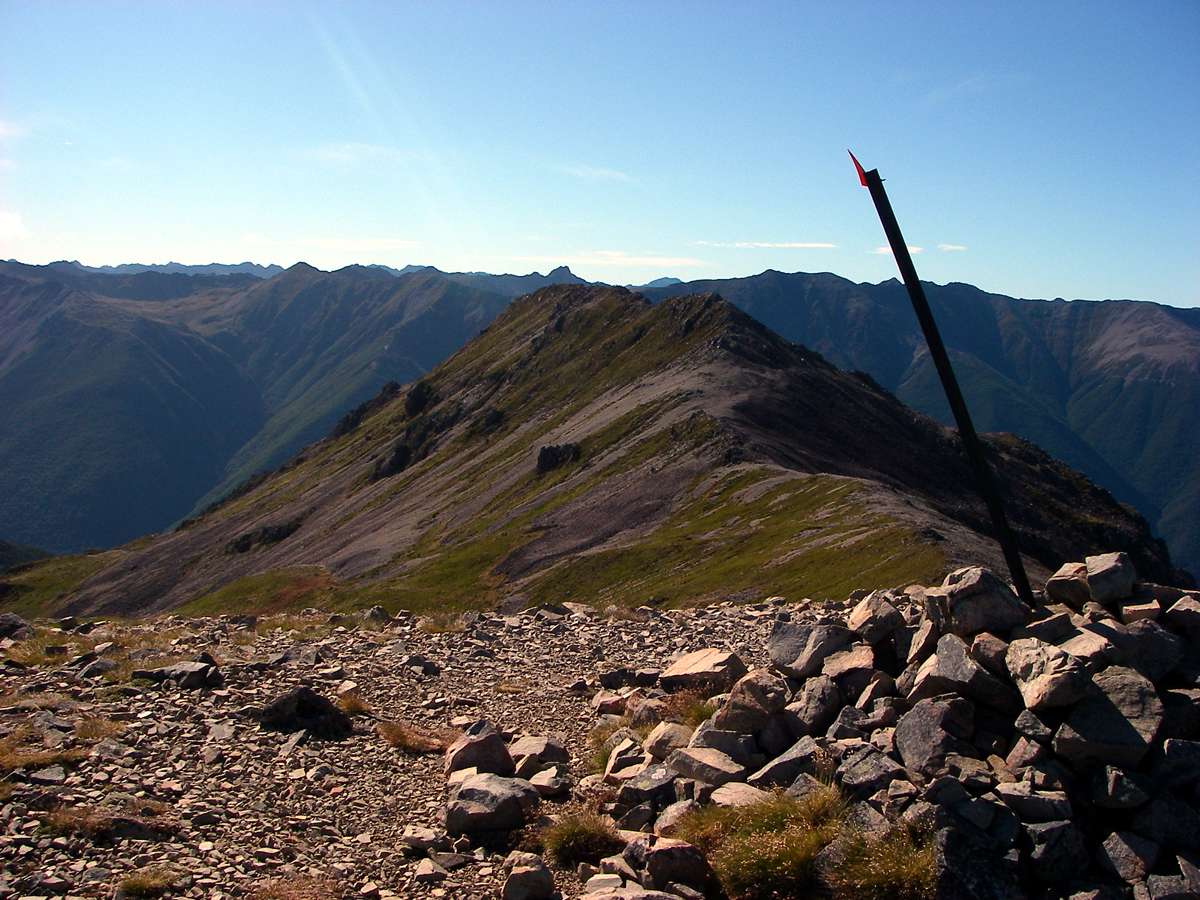
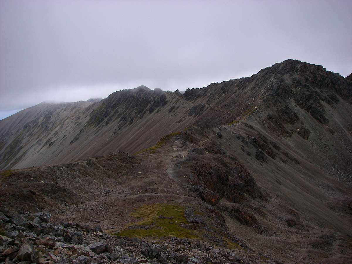
The ridge became much more narrow, and an exciting place to be. The wind continued to increase.
Photo: Don Hitchcock, 29th January 2007
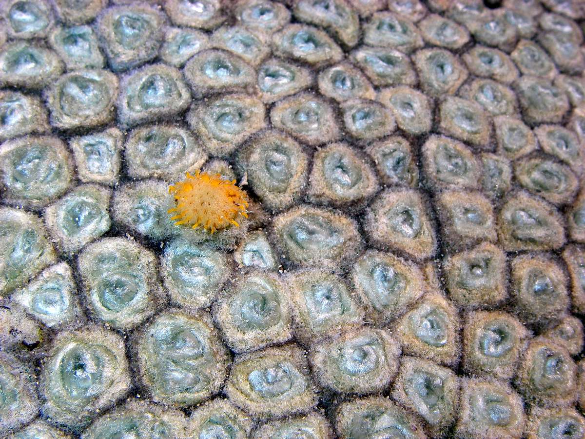
Haastia pulvinaris - Vegetable Sheep.
These are called "vegetable sheep" since from a distance they look like a sheep on the hillside. They occur in alpine areas between 1300 m and 1900 m, on shattered rock outcrops or on stable scree. They are a variety of daisy.
Photo: Don Hitchcock, 29th January 2007

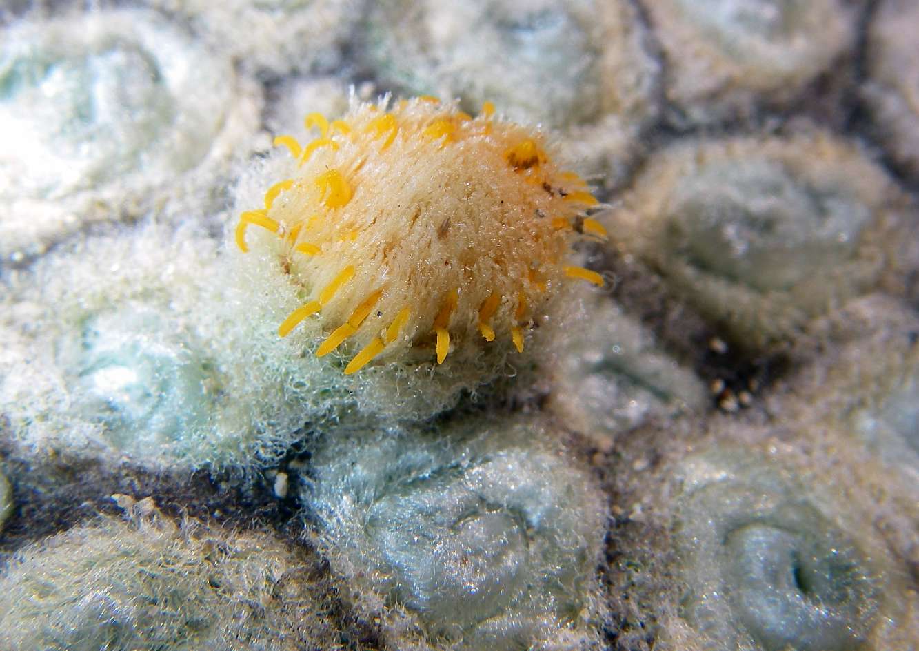
Another good photo of this example of vegetable sheep, taken a couple of hours later.
Photo: B., 29th January 2007
There were a number of these vegetable sheep on the broken rocks near the crest of the ridge at this point. Photo taken looking back down the track.
Photo: Don Hitchcock, 29th January 2007
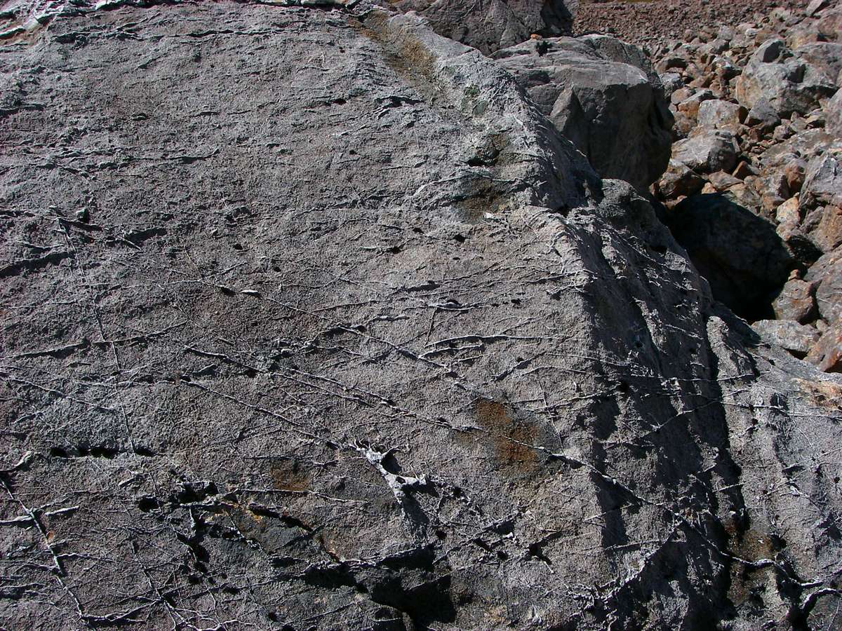
This rock had been cracked and infiltrated by harder sediments, possibly quartz veins, and was now weathering away, exposing the internal structure of the rock.
Photo: Don Hitchcock, 29th January 2007
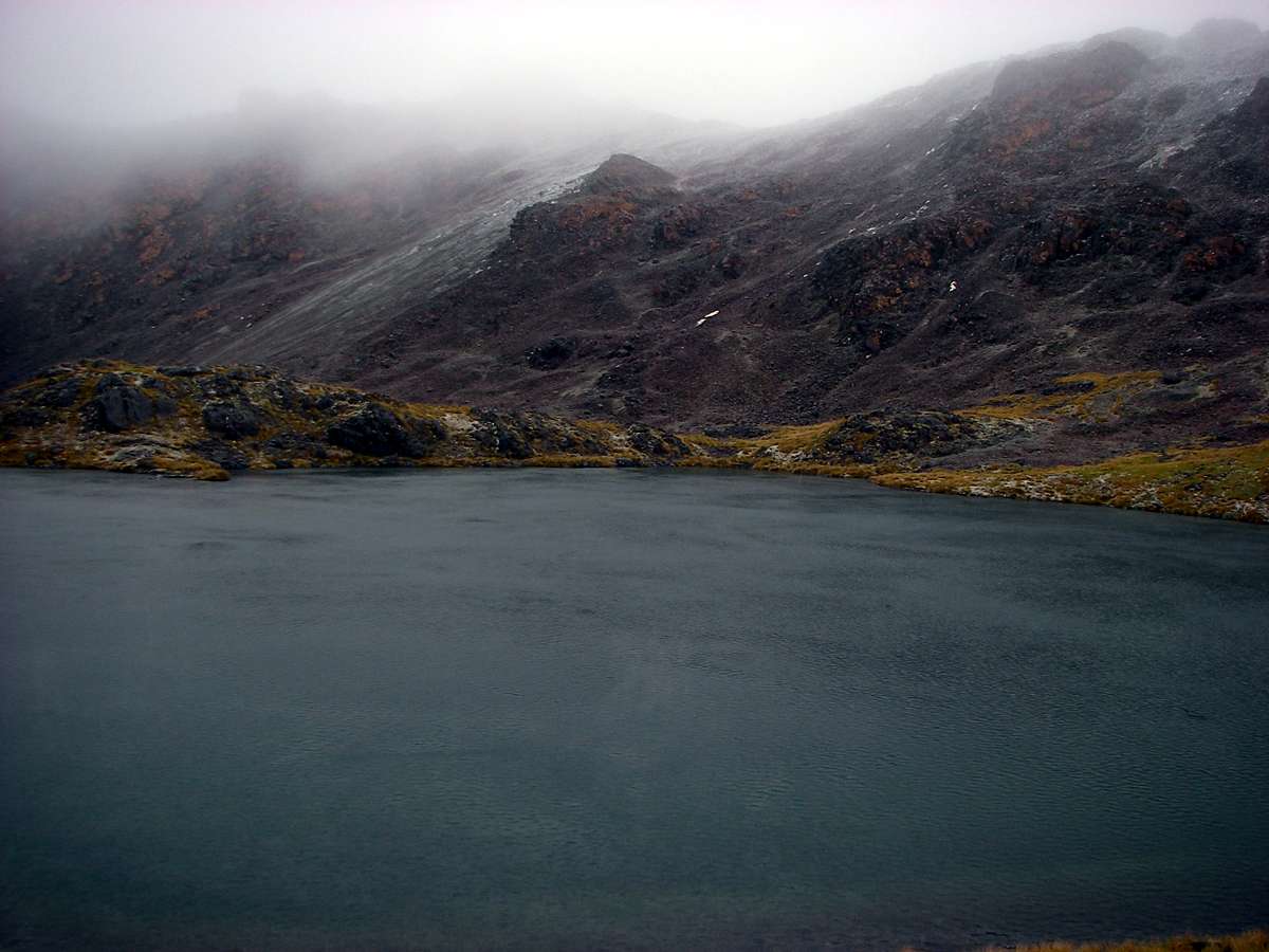
The remains of a small glacial lake, much reduced from its original size in this large cirque, hanging above a large drop to the river below.
Photo: Don Hitchcock, 29th January 2007
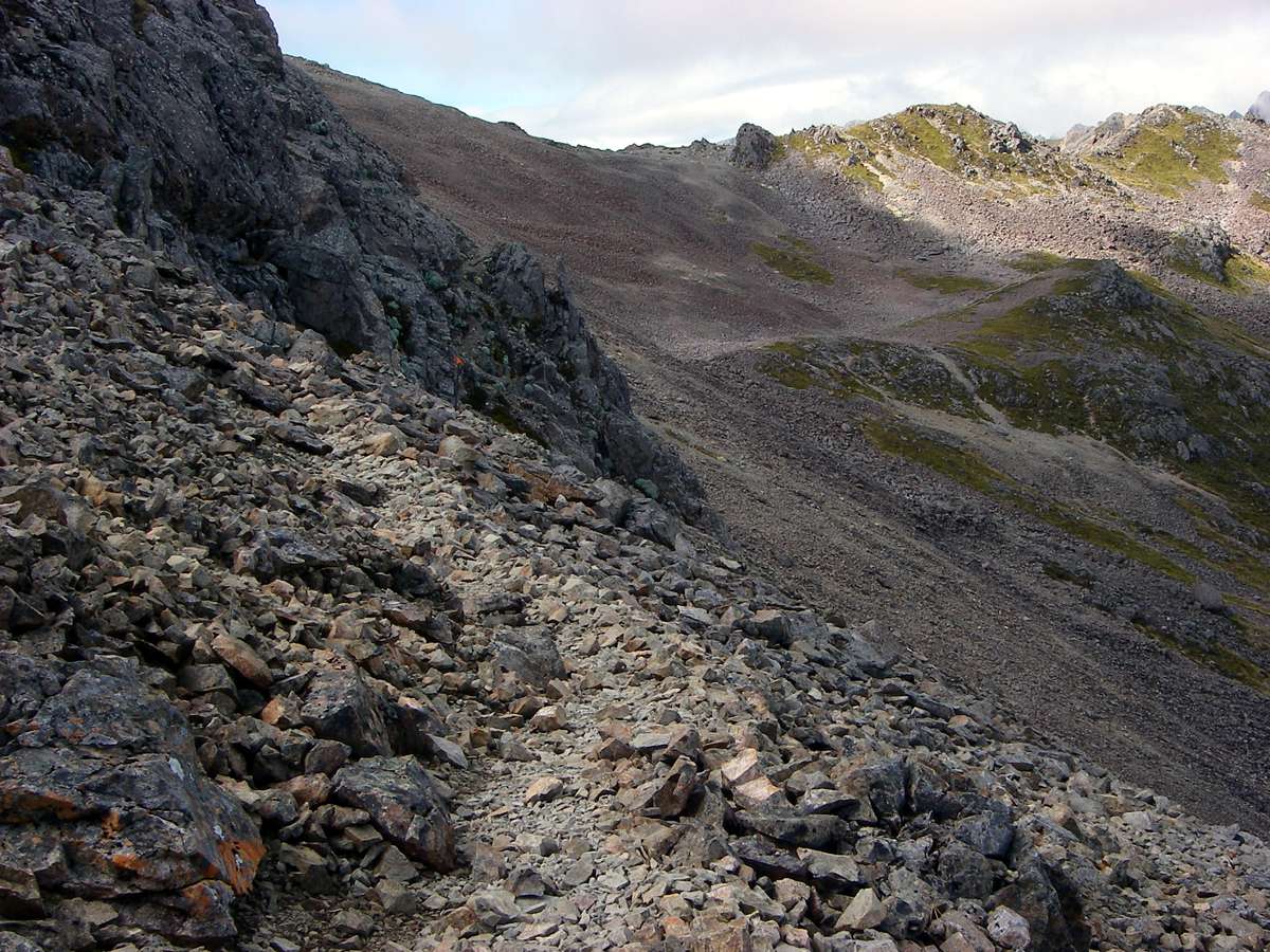
The track dipped below the ridgeline to avoid the broken rock on top.
Photo: Don Hitchcock, 29th January 2007

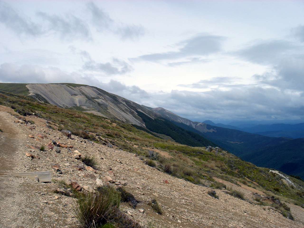
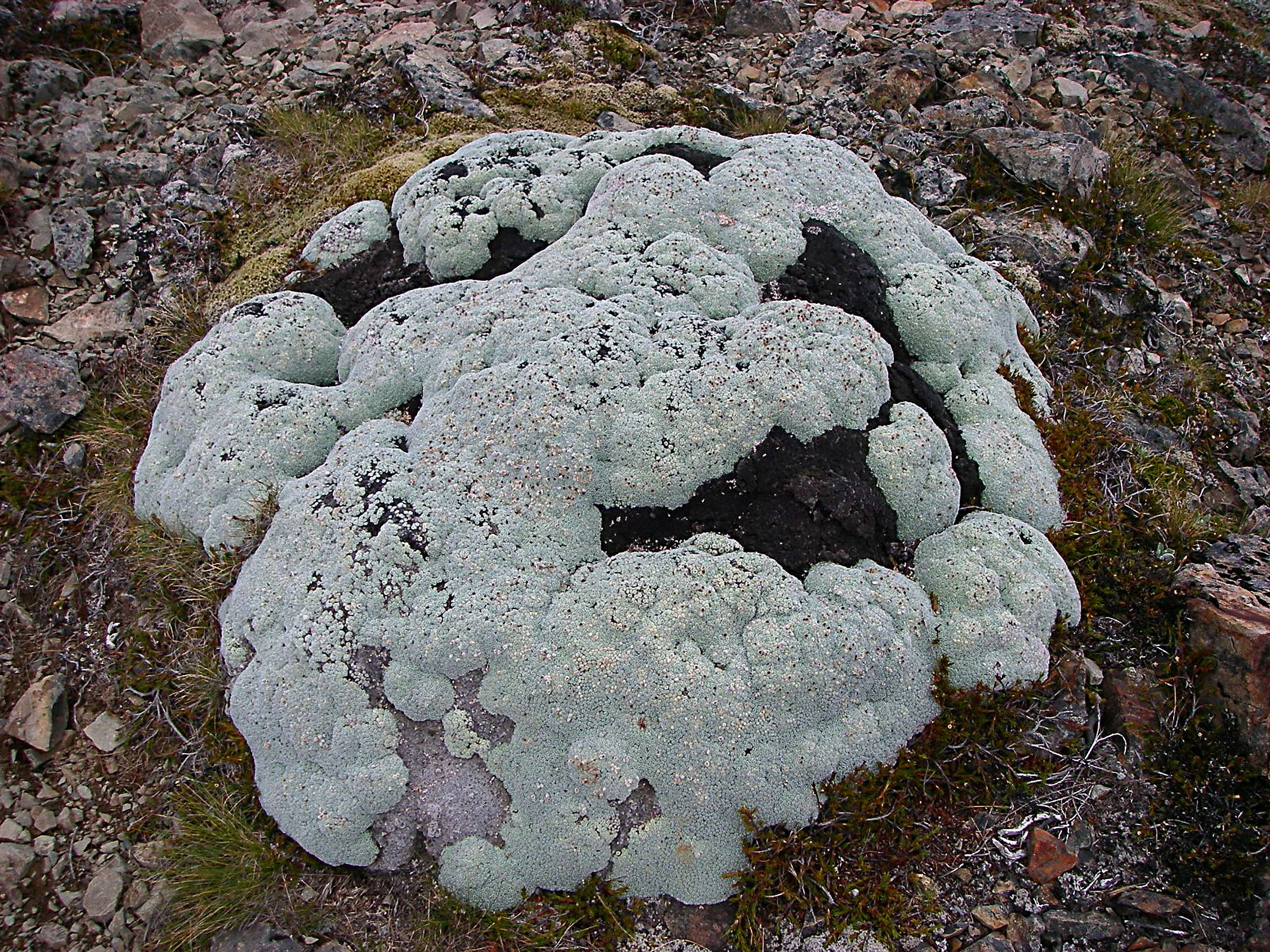
Looking back down the track, I was struck by the huge expanse of loose scree on the side of the ridge. I brewed up some turkish coffee while I admired the view across lichen covered rocks in the foreground, packed up and pushed on. The weather was starting to get dirtier.
Photo: Don Hitchcock, 29th January 2007
The cloud ceiling was starting to come down, and the wind was still increasing, but these tarns perched on the edge of the abyss were beautiful.
Photo: Don Hitchcock, 29th January 2007
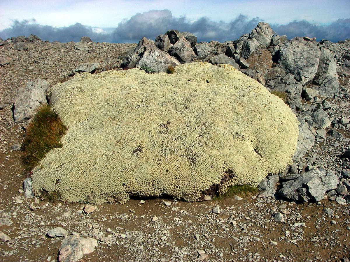
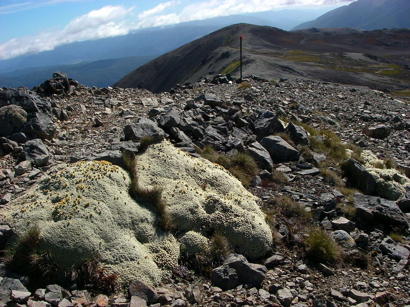
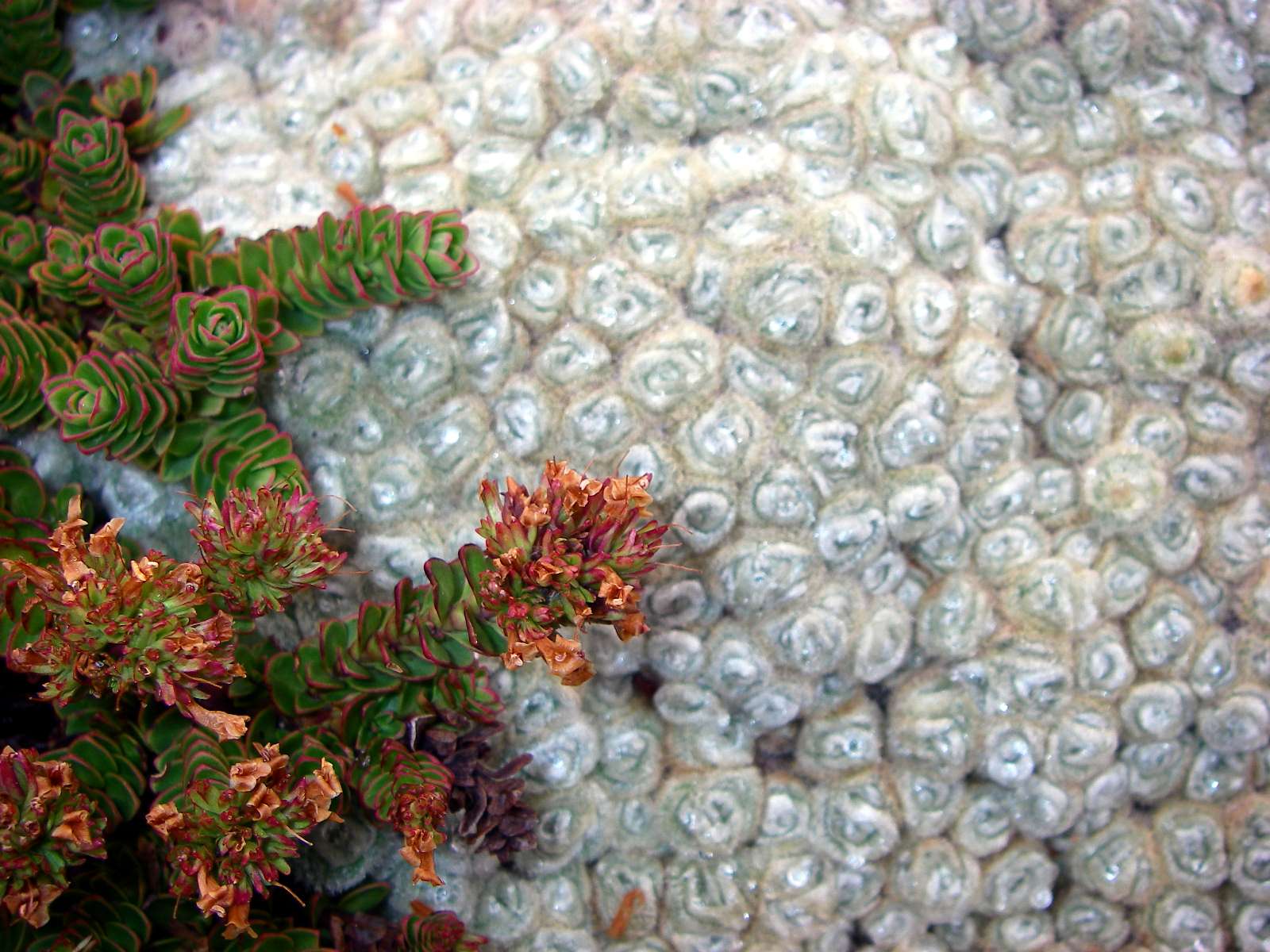
Another species of vegetable sheep, probably Raoulia eximia. It forms very dense light grey cushions up to 2 m across and 30 cm or more thick. The dense covering of soft wooly hairs on the rounded leaf tips gives a velvety texture to the cushions. Found on South Island at 1100 - 1800 m. (New Zealand Alpine Plants, Mark, A. and Adams, N.)
Photo: Don Hitchcock, 29th January 2007
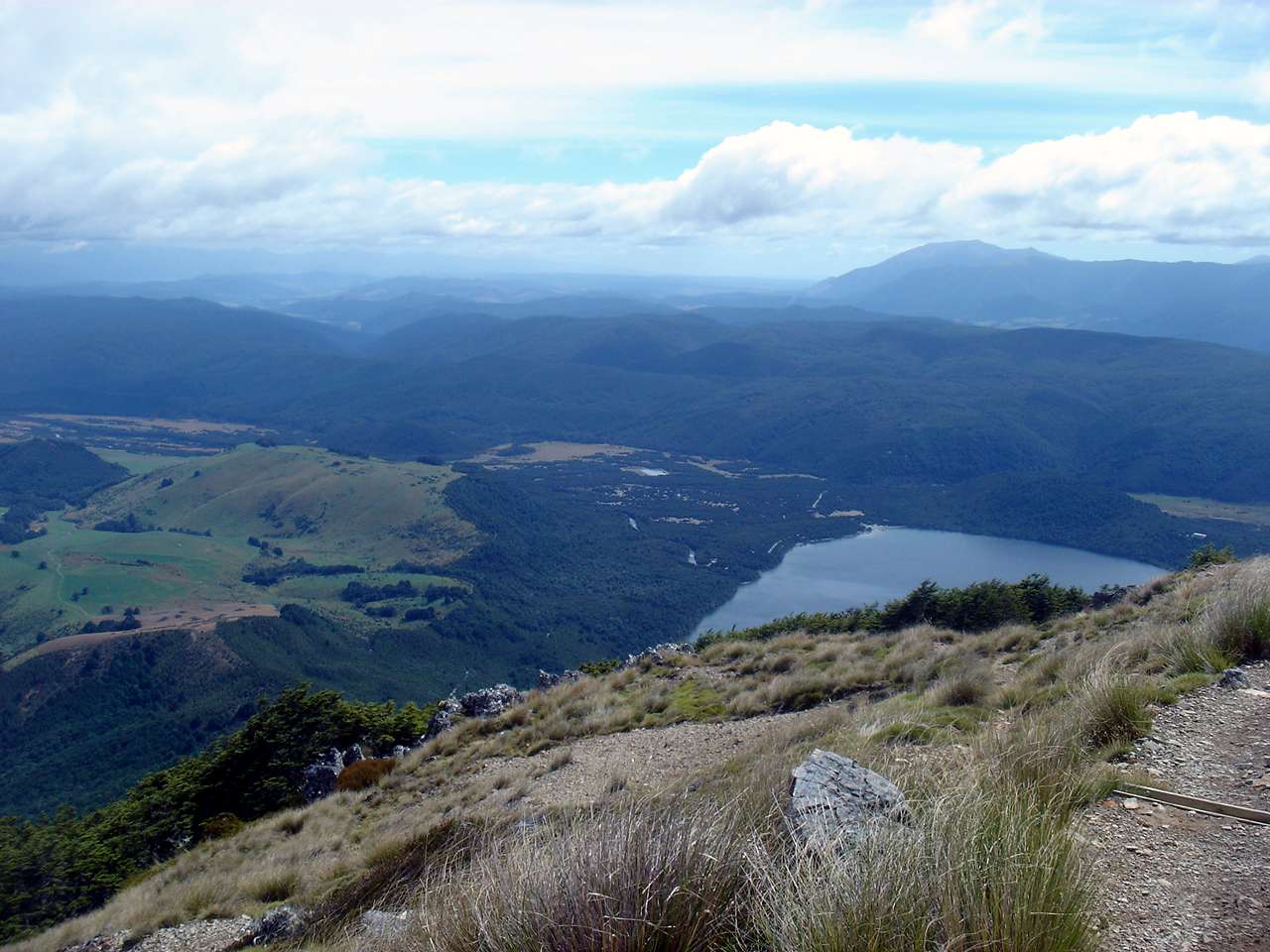
Looking down the slope to the valleys far below.
Photo: Don Hitchcock, 29th January 2007
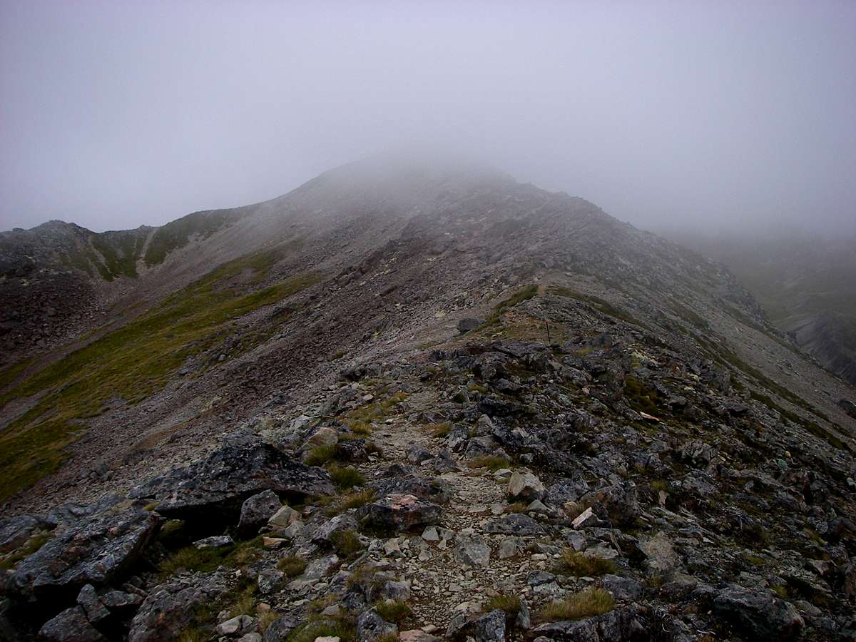
The weather was closing in, and I was hurrying to get to the Lake Angelus hut before it got too much worse. This ridge is very exposed, with no shelter anywhere. The contrasts with the benign conditions when I left Bushline hut were stark.
Photo: Don Hitchcock, 29th January 2007
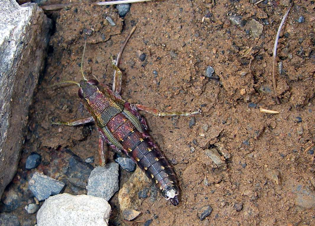
A beautiful grasshopper, untroubled by the weather, but armoured like a medieval knight against whatever the environment could throw at it.
Photo: Don Hitchcock, 29th January 2007
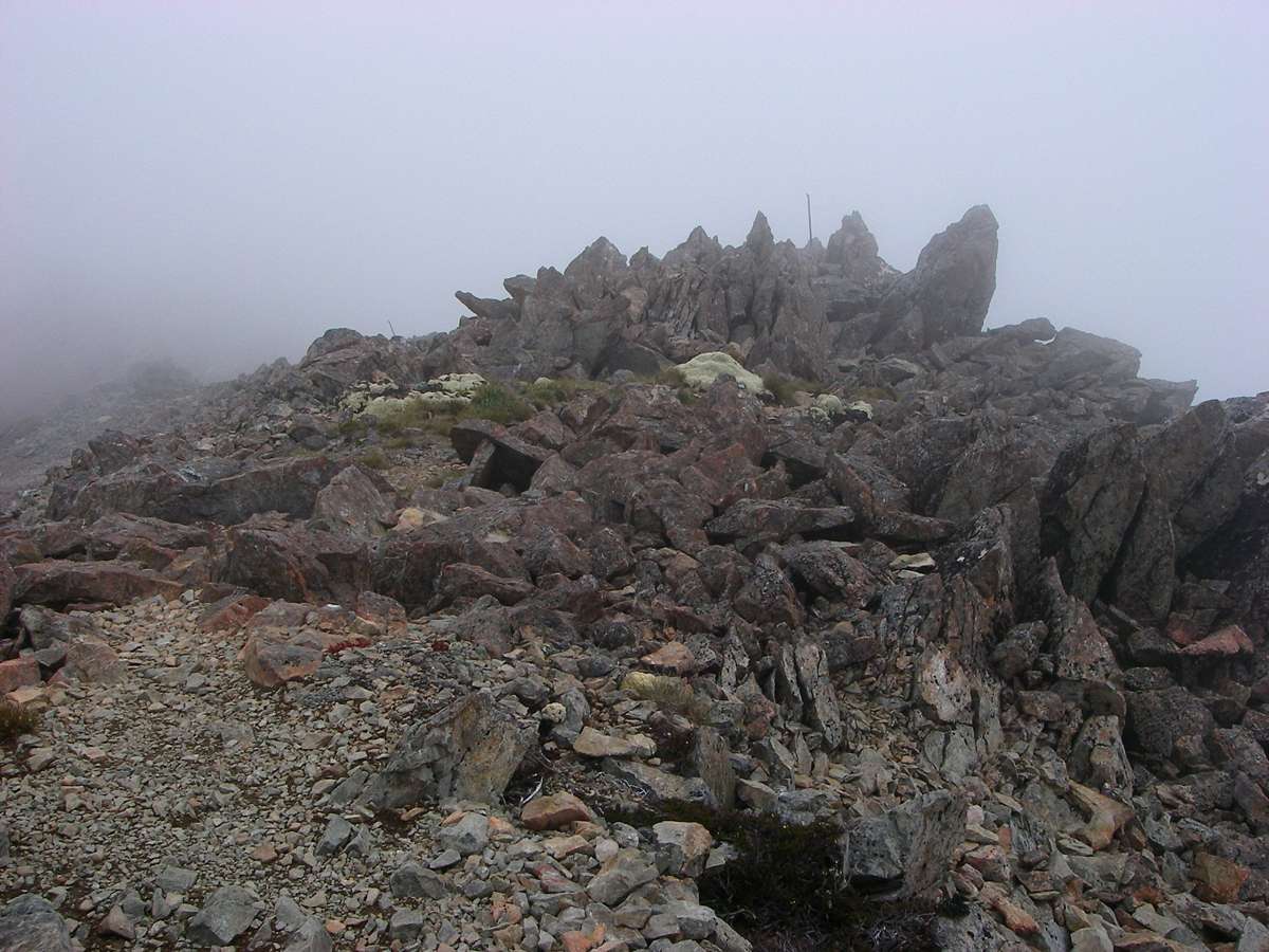
Visibility was now down to less than fifty metres, and the track led over the top of the frost shattered rock on the ridge.
Photo: Don Hitchcock, 29th January 2007

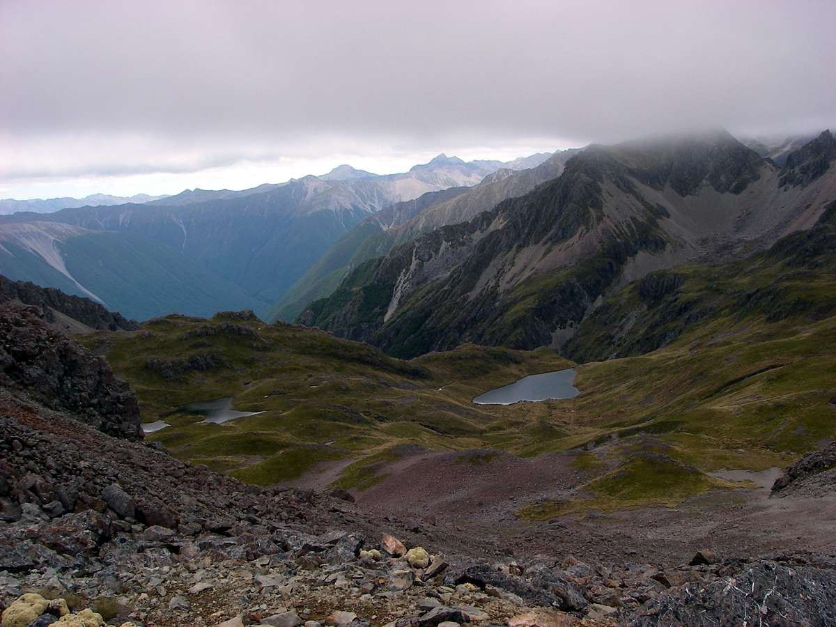
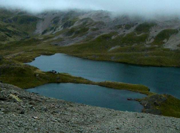
Looking down at a field of tarns in a boggy flat area below the ridge.
Photo: Don Hitchcock, 29th January 2007
Vegetable sheep and Hebe epacridea growing side by side in a beautiful juxtaposition of colour and texture.
Photo: Don Hitchcock, 29th January 2007
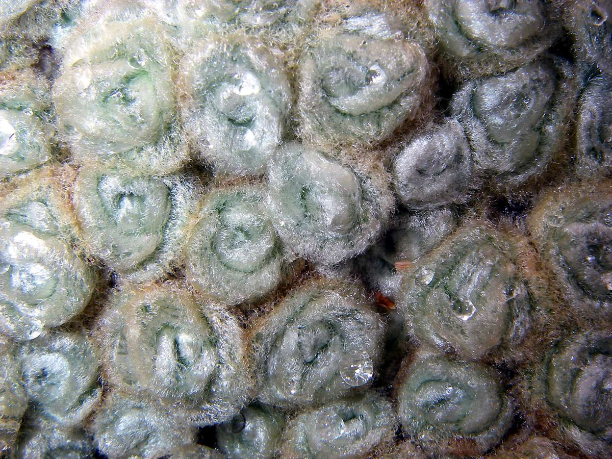
I loved the unusual fine structure of the vegetable sheep, so different to anything else I have ever seen, with their grey whorls punctuated with water droplets in this photo.
Photo: Don Hitchcock, 29th January 2007
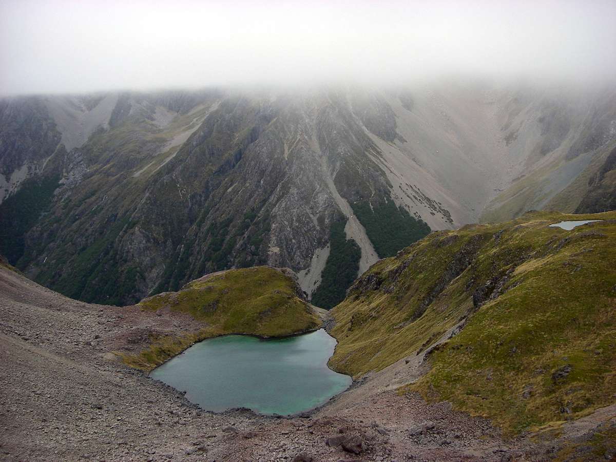
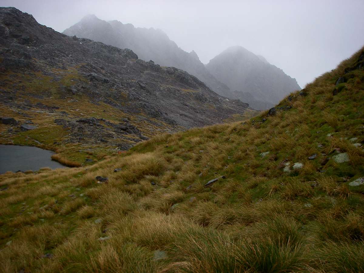
The remnant of a glacial lake, perched above a cliff. Eventually the stream will cut through the final barrier, and the tarn will empty.
Photo: Don Hitchcock, 29th January 2007
A video of my first sight of Lake Angelus, and a welcome one it was too.
Click on the image to see the video. (29.6 MB)
The wind was strong, and the cloud ceiling was not far above my head.
Photo: Don Hitchcock, 29th January 2007
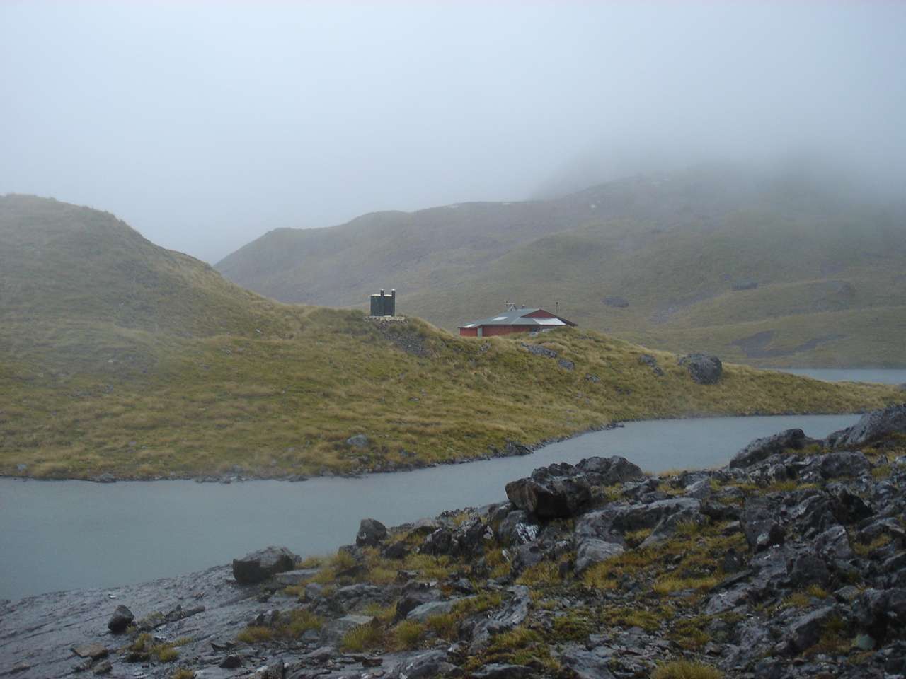
Safe haven ahead. Angelus hut on the Angelus glacial lake.
Photo: Don Hitchcock, 29th January 2007
Looking back up the track I had come down, the exposure and lack of shelter is obvious. It is the sort of track that should only be attempted under good conditions. I had been lucky, and the weather had been very kind to me on this trip, barely hinting at what it would be capable of in another weather pattern.
Photo: Don Hitchcock, 29th January 2007

But I wasn't there yet. This sharp ridge led away in an arc before coming back towards the hut. I got there about 1.30 p.m., just as the weather was becoming much worse, with sharp, cold rain as I got to the hut door.
Photo: Don Hitchcock, 29th January 2007
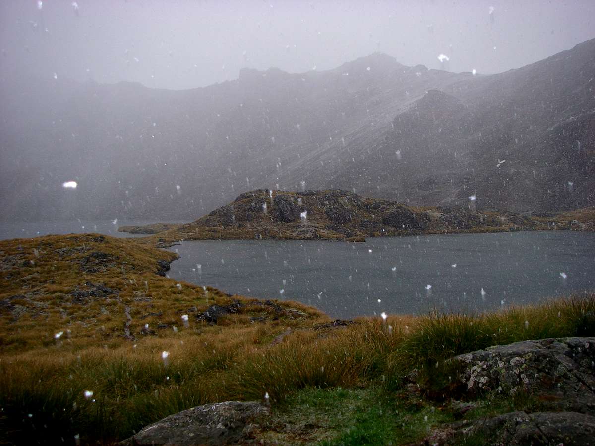
The weather continued to deteriorate, and this photo by B. as she arrived about 2.45 pm shows the miserable conditions - just before the snow started!
Photo: B., 29th January 2007
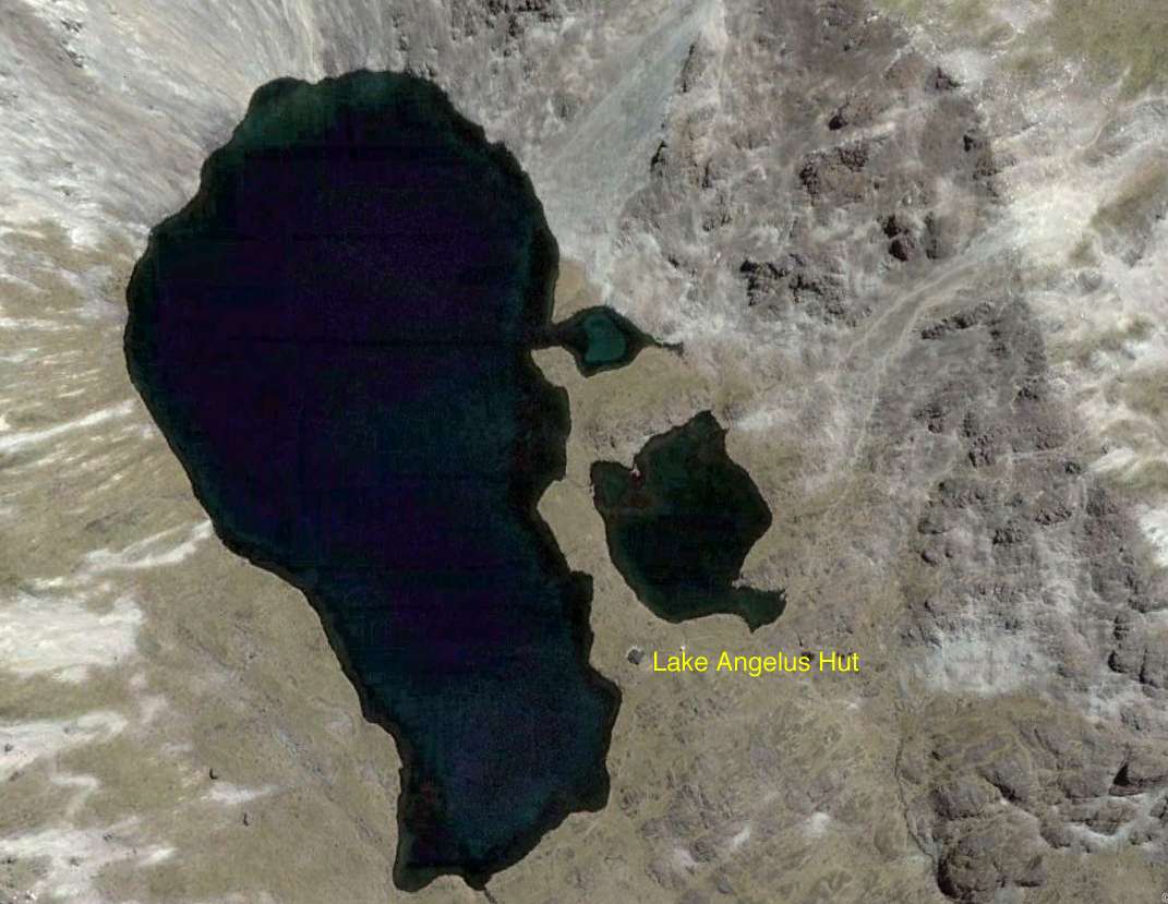
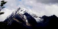
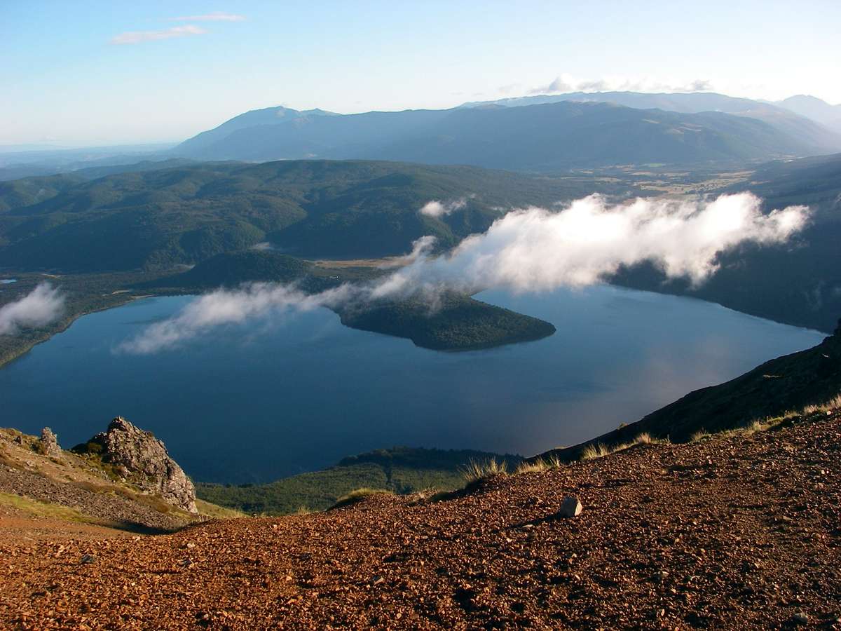
Lake Angelus has been described as more a large tarn than a lake, but it is a beautiful thing no matter what it is called, and no matter what the weather.
Photo: Google Earth
Panorama stitched together by Don Hitchcock from excellent originals by B., 29th January 2007
I sorted myself out, found a place to spread my sleeping bag, had some coffee, and talked to the few people already in the hut. More came during the afternoon, and the hut was full by nightfall. At about three p.m the snow started.
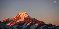
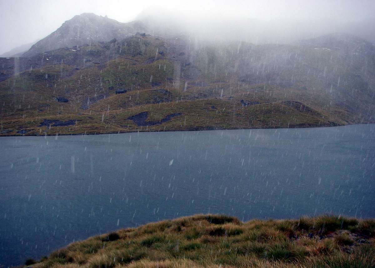
Mount Angelus barely visible through the snow.
Photo: Don Hitchcock, 29th January 2007
During a break in the snow, I went outside for a look at the surrounding countryside. I didn't stay long, as the weather closed in again.
Photo: Don Hitchcock, 29th January 2007
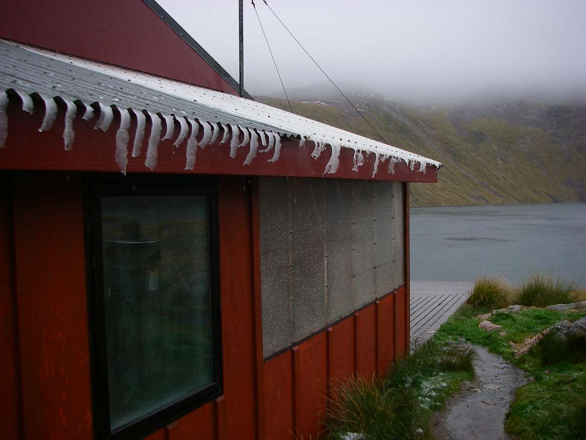
By 4.30 p.m., icicles were forming.
Just after taking this shot, and retreating inside the hut, a party of three Czech daytrippers showed up, a father, mother and adult daughter. They were very wet and very cold, the mother close to hypothermia. The occupants got together to get them dry and warm and fed, and they spent the night bundled up, warm between other sleepers on the benches. They were lucky there were no other repercussions.
They had set off in perfect conditions, but were totally unprepared for the journey, quite unfit, no adequate rain gear, let alone warm clothes, and thought that they could go up to the lake and back in a day from Sabine hut, where they had landed after taking a boat across Lake Rotoroa. A fit, young party could have done it, but they were neither.
Photo: Don Hitchcock, 29th January 2007

Photographs of the hut in winter, on the wall of the Lake Angelus Hut.
A winter trip should only be attempted by very experienced and extremely well prepared trampers. It is not something which should be undertaken lightly, especially by those unfamiliar with the extreme conditions which are encountered in this part of the world at high altitudes.
Photo: Richard Leppard and Peter Kemp
If you have ever wondered about toilets in an environment like this, in which a long drop toilet is not feasible because of lack of drainage, every year or two they send in a helicopter, and pump out tens of thousands of litres of waste from the toilets, which is taken in a series of bucket loads beneath the helicopter back to St Arnaud. It takes most of one day to pump it out and helicopter it away.
Bushwalking, Hiking and Tramping in New Zealand
Bushwalking Index
Anyone (e.g. students, teachers, libraries, government agencies such as tourist bureaus, the general public) may use, print and publish the photographs taken by me and presented on this bushwalking file for any legitimate non-commercial purpose, at no cost, and without asking permission. However a note such as "Photo: Don Hitchcock, donsmaps.com" somewhere in the document would be appreciated if it is to be published.