Back to Don's Maps
 Bushwalking Index
Mount Kosciuszko in the Snowy Mountains of Australia
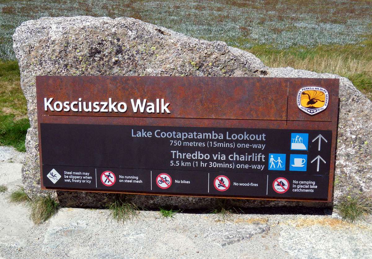
A walk from the top of the Kosciuszko Express chairlift to Mt Koskiuszko, then to Lake Albina and return.
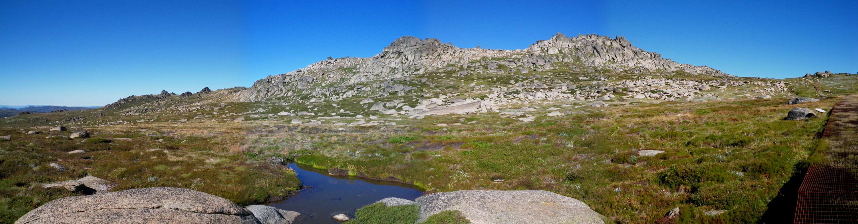
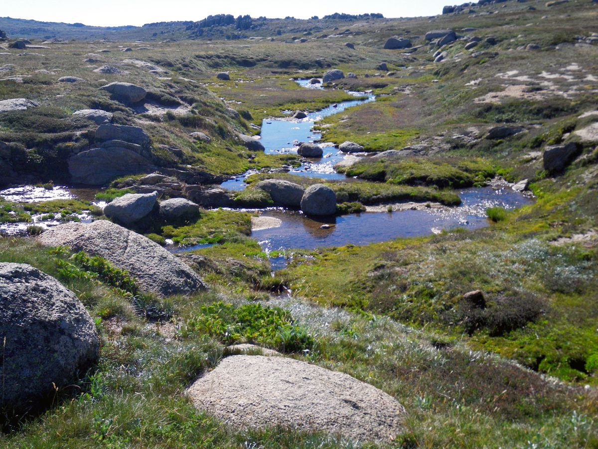
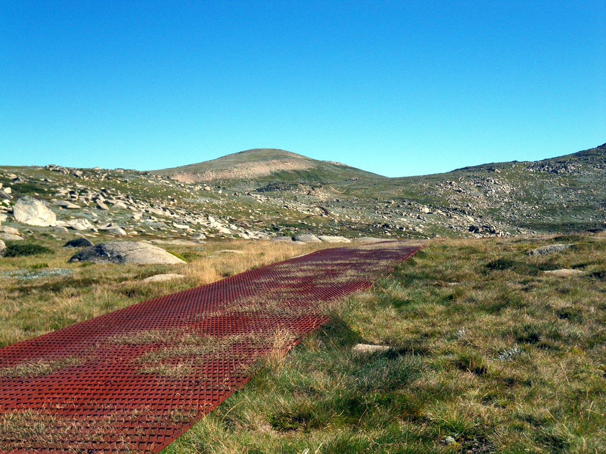
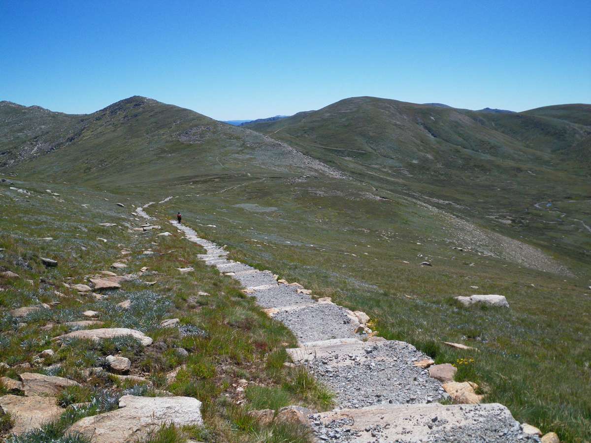
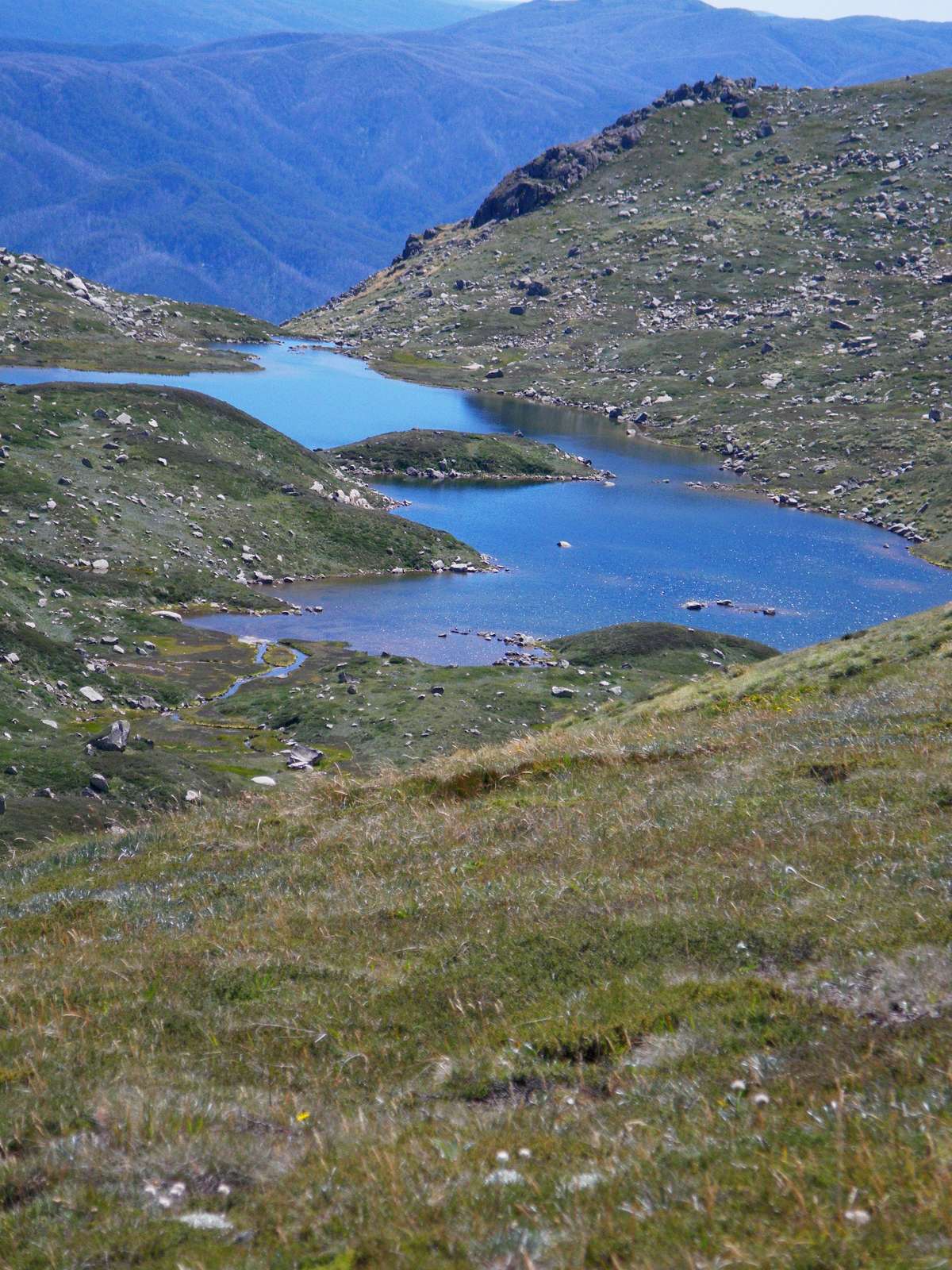
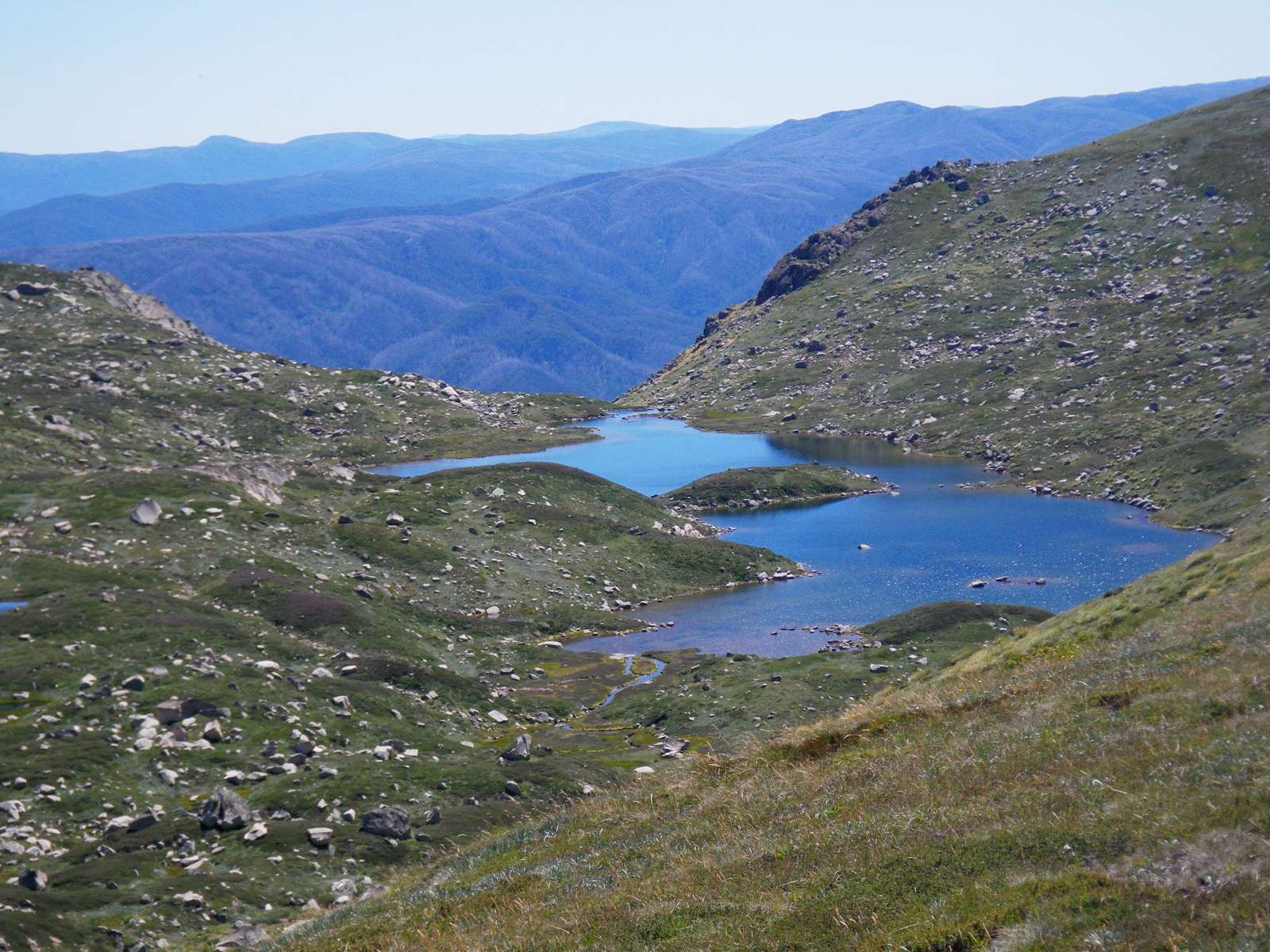
Panoramic photo of the view from the track of the Rams Head range, thirty minutes after leaving the chairlift. The vegetation is a low heath, with rocky outcrops and small tarns, and the area is above the tree line.
Photo: Don Hitchcock March 2010
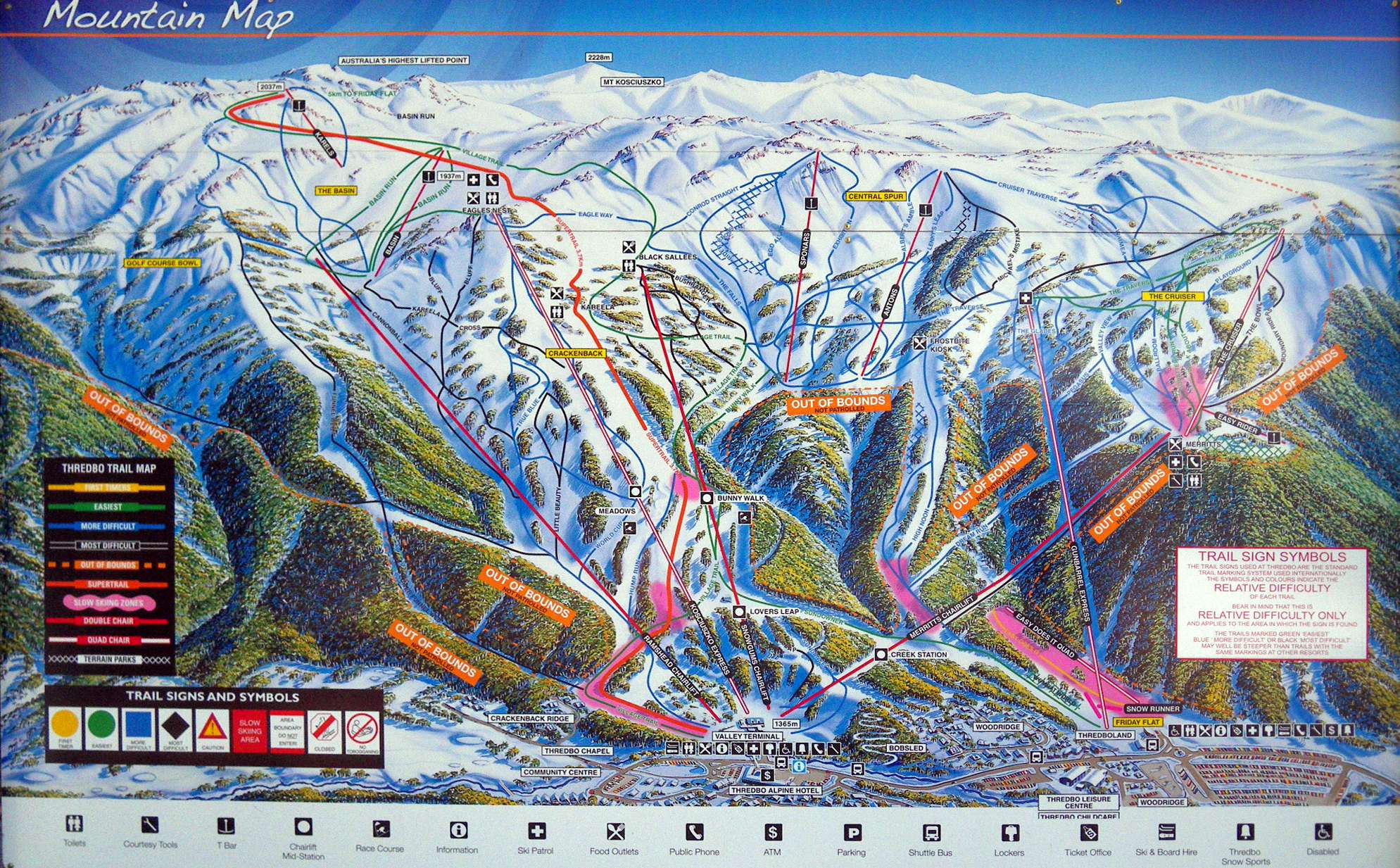
Map of the chairlifts and the ski runs in use during winter.
Source: display at the foot of the chair lift.
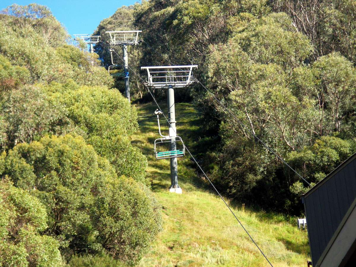
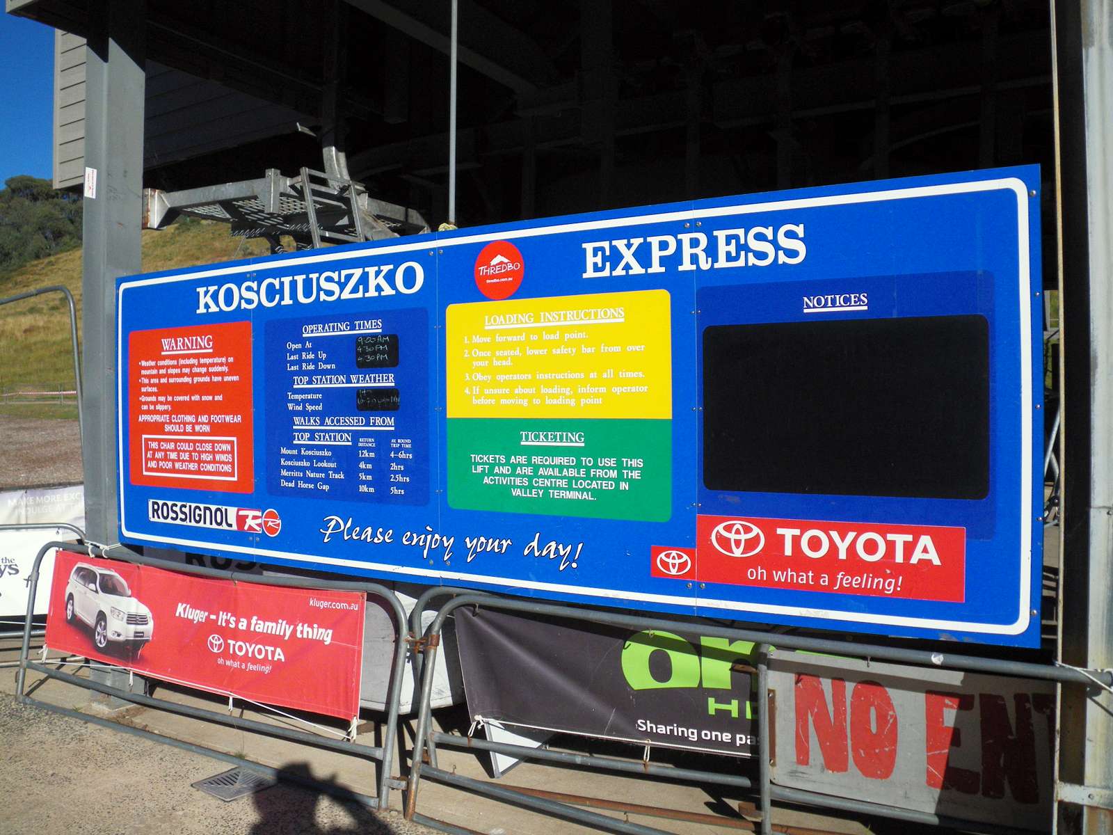
It is worthwhile to take the chairlift from Thredbo Village to the top of the hill, saving a 600 metre climb. The chairs are removed from the wire each night, and replaced every morning. When we were there the chairlift started at 9 a.m. and the last ride down was at 4.30 p.m., so we decided to make sure that we were back in plenty of time.
Photo: Don Hitchcock March 2010
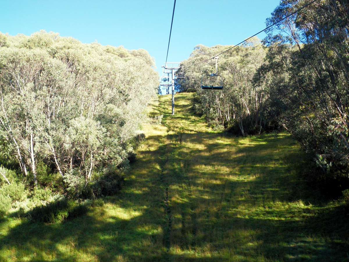
I was a little nervous, it was a long time since I had been on a chairlift, but there is always someone there to make sure you get on and off safely. It turns out that you have enough time to sit down and pull the foot bar and handlebar down in front of you. The operator can increase the time available a little by swinging back the chair, and the chair makes a 180° turn at the loading point, which means that you are able to get into position easily.
The ride itself is remarkably smooth, though you are a long way above the ground. There are cameras between each support pole so that operators can monitor the safe operation of the lift, and stop the lift if there is a problem of any kind.
Photo: Don Hitchcock March 2010
We were the second occupied chair lift, there was a mountain biker ahead of us. Mountain bikers ride to the top, then take a dedicated track to the foot of the mountain, a hairy ride I would imagine, but very enjoyable for those with sufficient skill.
Photo: Don Hitchcock March 2010
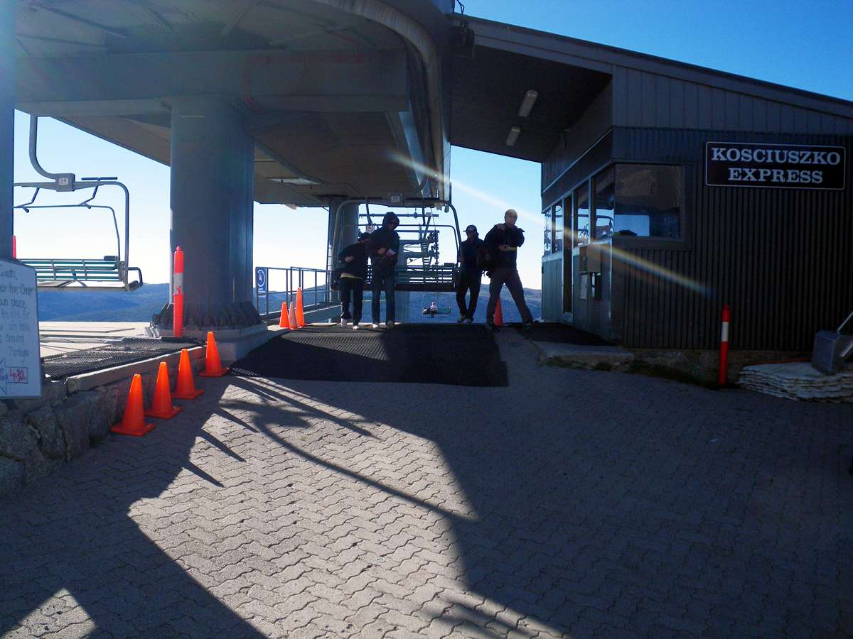
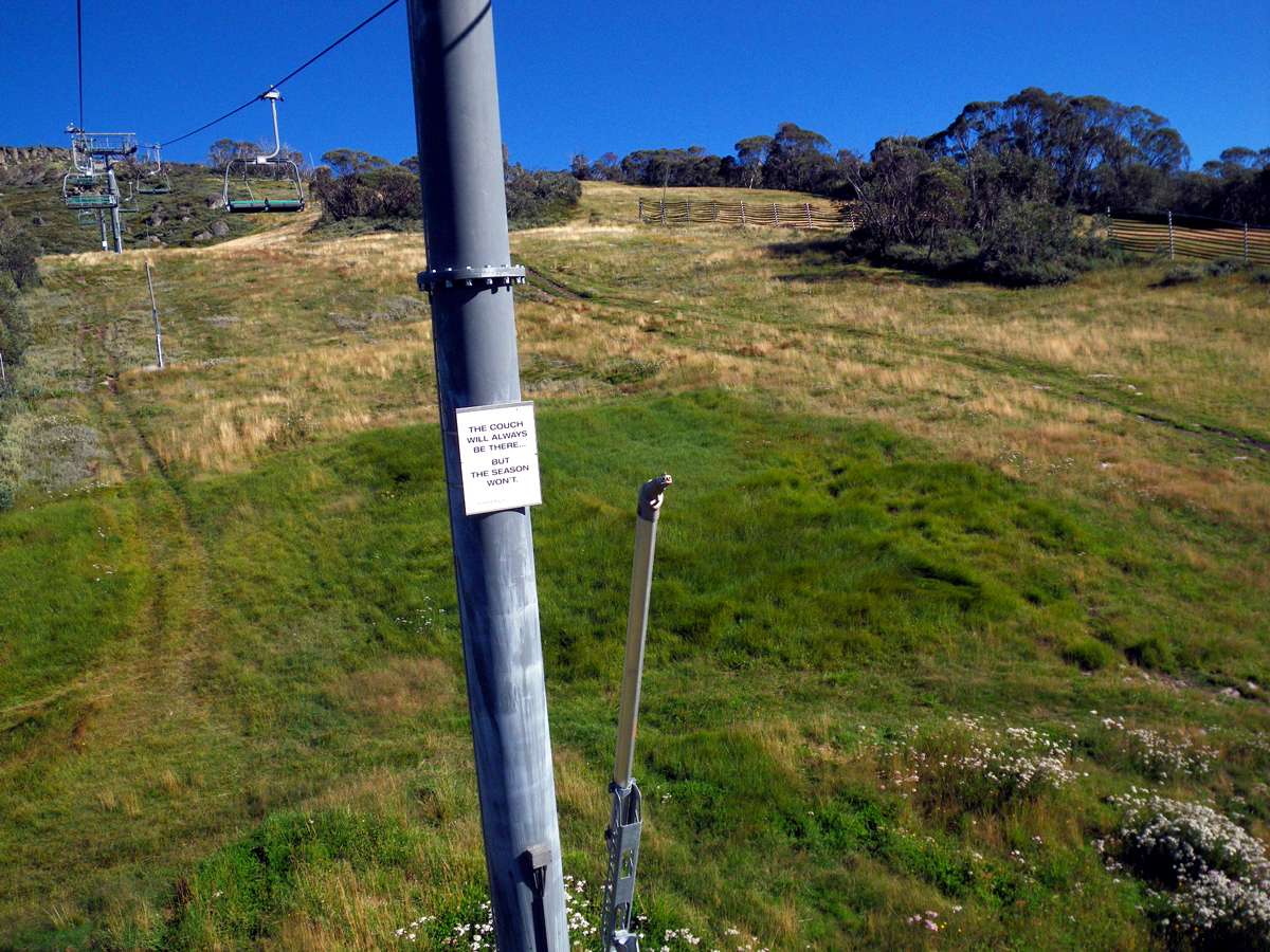
Getting off was also easier than I expected, as you get off facing uphill, but down a ramp, and the chair turns away from you to make the journey back down the slope.
Photo: Don Hitchcock March 2010
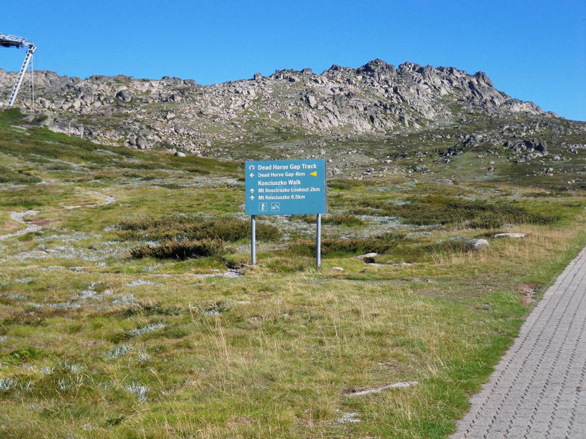
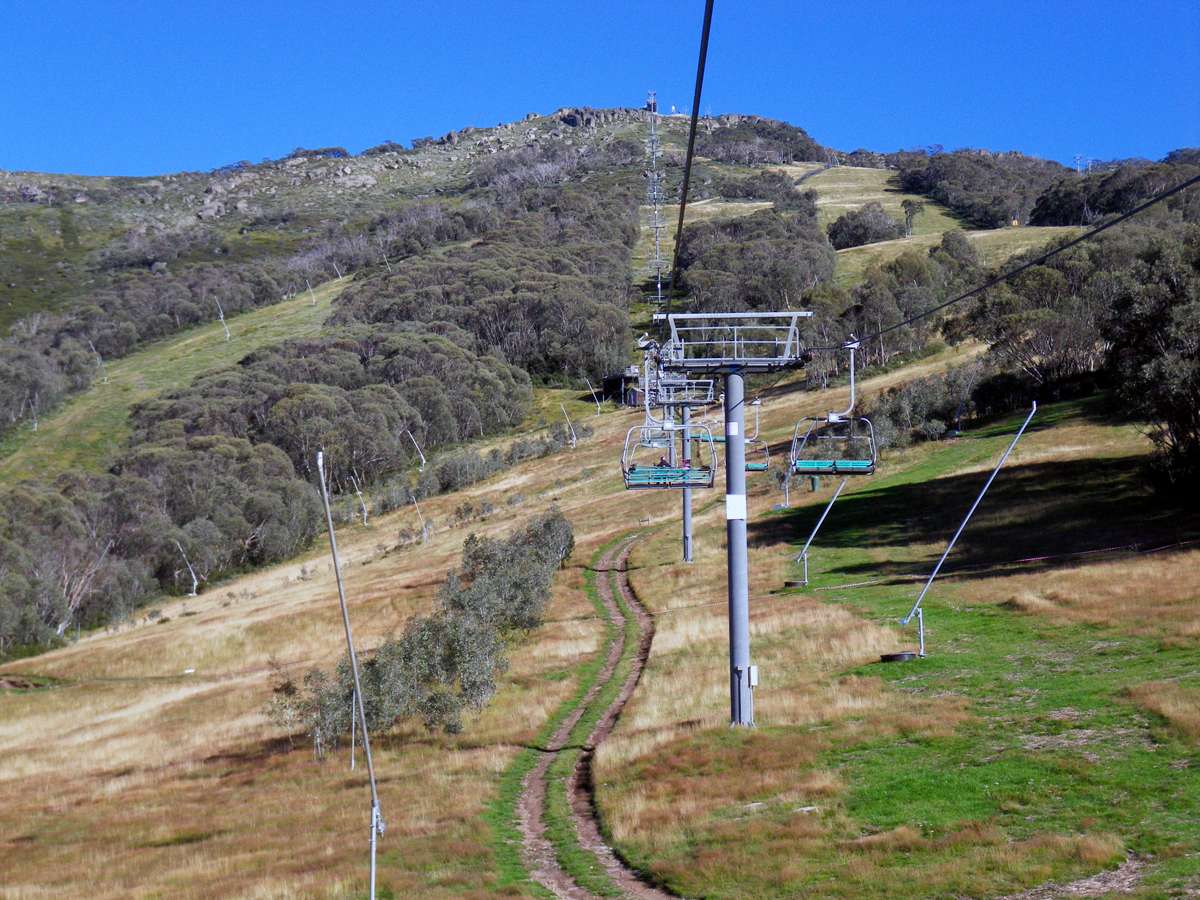
We started along the track towards Koscuiszko and passed the Dead Horse Gap sign. It would be a good day trip to walk up from Dead Horse Gap to the Eagles Nest Cafe at the top of the chairlift for coffee and cake, and return to your car at Dead Horse Gap by the same track.
Photo: Don Hitchcock March 2010
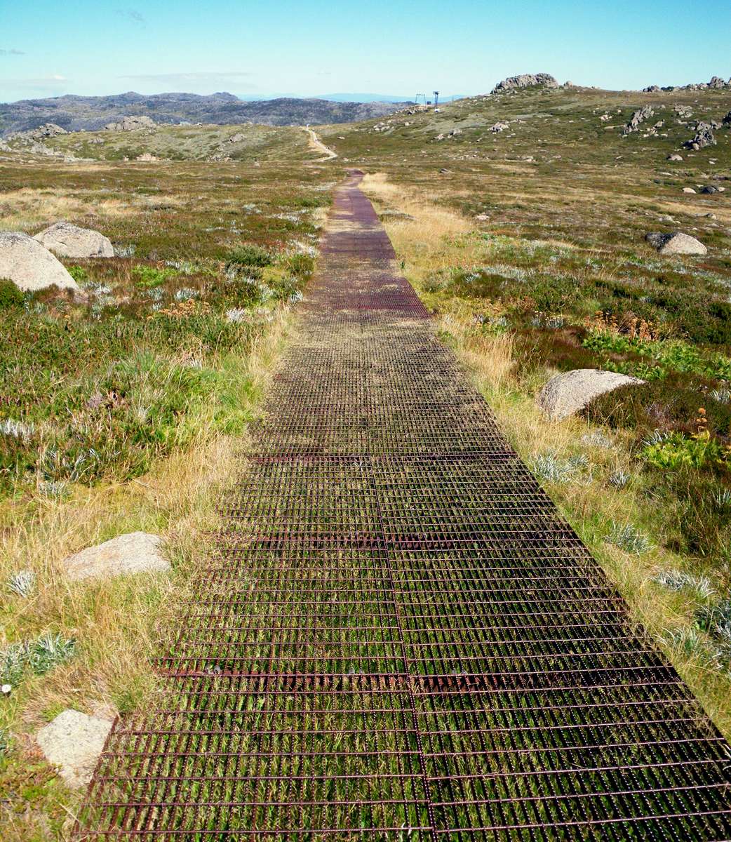
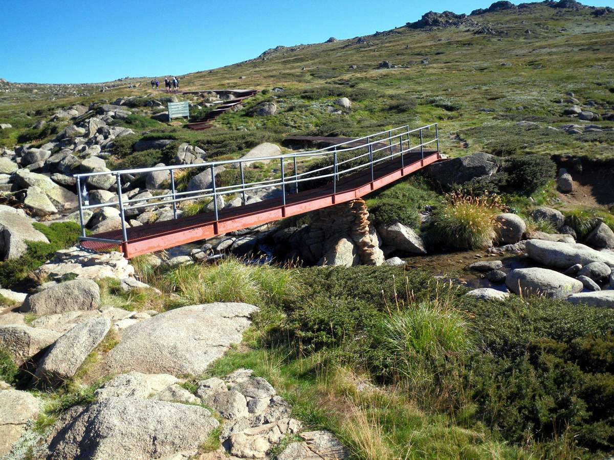
The steel mesh used for the track is ungalvanised, since the Zinc would eventually be eroded away and enter the food chain. Plants and animals are in general well adapted to iron in the environment, but not Zinc.
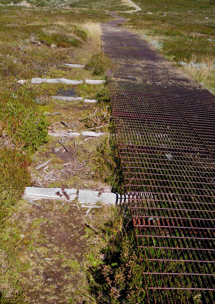
The mesh walkways replaced tracks which were being overused, as can be seen in the second photo. It takes a long time, but eventually these tracks will heal over, and evidence of them will disappear.
Looking back to the chairlift in each case.
Photo: Don Hitchcock March 2010
This bridge is not up to the general standard of the rest of the track.
The stone work pier two thirds of the way across is not of a high standard, and the "broken back" look of the bridge made me cringe. It should have been made strong enough to bridge the gap with one flat and horizontal beam, or better still in an arch. Perhaps the builders were constrained by time or materials or both. The stonework approaches to the bridge need to be rebuilt.
The whole thing needs to be removed and replaced with something more befitting the world heritage status of this otherwise beautiful walk.
Photo: Don Hitchcock March 2010
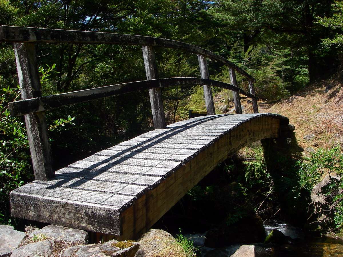
New Zealanders on the other hand do bridges for walkers very well indeed. This bridge over Wright Creek, not far from the eastern end of the Wangapeka track in the South Island of NZ is a superb piece of work.
As well as being a delight to the eye, it is simple, elegant, durable and strong. The engineers and workmen are to be congratulated.
Like all such works of art, it is hard to think how it could have been done otherwise. It is art concealing art.
Photo: Don Hitchcock January 2007
Panoramic photo of the view from the track of the Rams Head range, thirty minutes after leaving the chairlift. The vegetation is a low heath, with rocky granite outcrops and small tarns, and the area is above the tree line. Most of the walk is on a metal mesh which has not been galvanised in order not to pollute the environment with zinc as the metal corrodes. The iron oxide or rust from the rusting of the track is not a pollutant in these quantities, since it is a common element in the environment when rocks containing iron weather.
Photo: Don Hitchcock March 2010
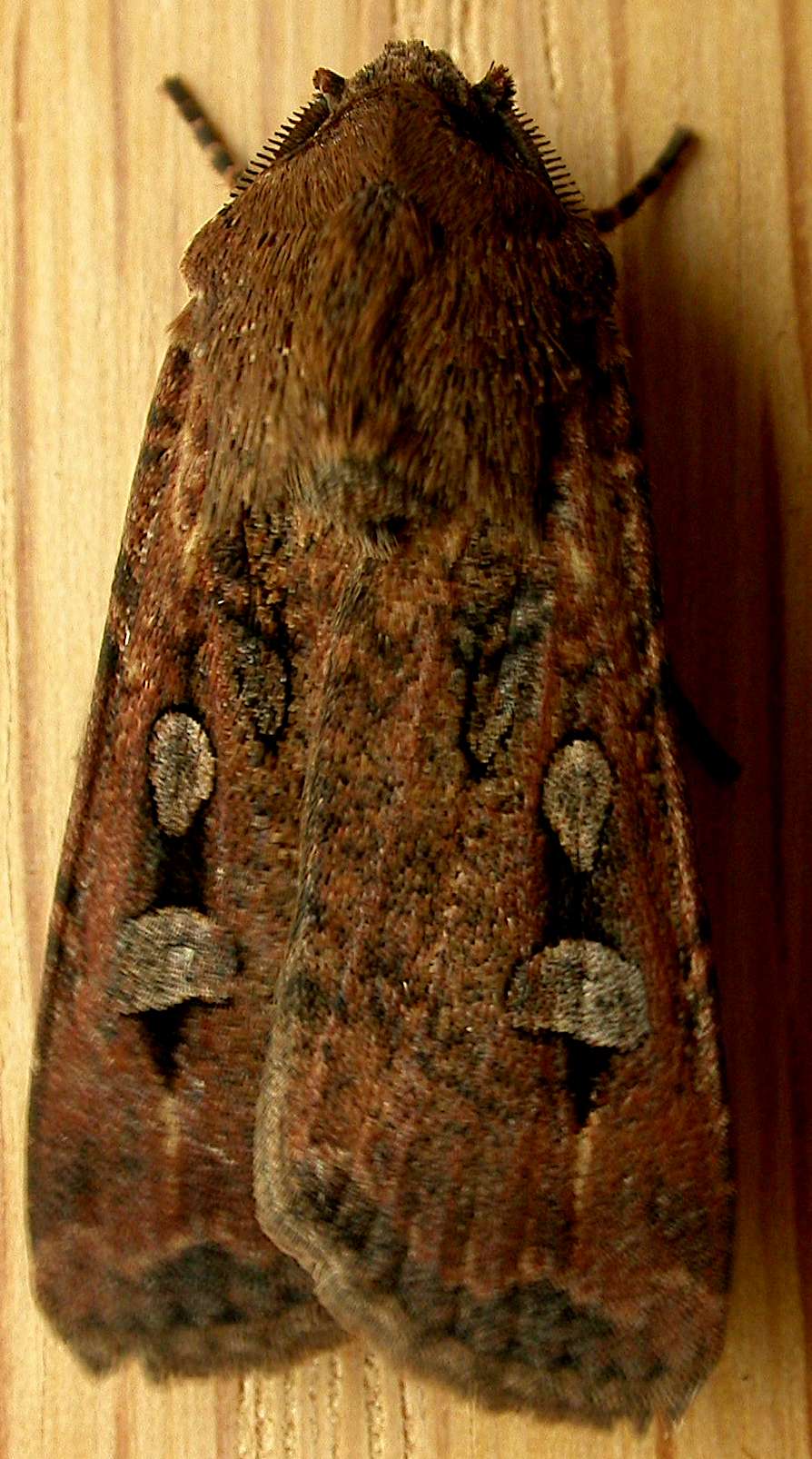
Photo: Bogong Moth, Agrotis infusa. Photographer/Author: Donald Hobern from Canberra, Australia.
Text below from a sign beside the track, by the NSW NPWS:
Granite is the only rock I saw... large blocks of which cover the tops of every eminence. (Grazier Stewart Ryrie, describing the rocky outcrops of the Rams Head Range in 1840.)
The scattered rocks and sharp crags of the Rams Head Range formed when cracks in granite were invaded and weathered by water and ice. Some boulders remain where they formed. Others were transported by glaciers, or slipped downhill on saturated soil.
The lichen encrusted boulders now provide shelter for heath communities, small mammals such as the endangered mountain pygmy possum and bogong moths.
Every spring millions of bogong moths escape the heat of the New South Wales and southern Queensland plains by migrating to cool mountain crevices such as these. Many moths end up as dinner for birds and pygmy possums.
However, migrating from farmland areas in which pesticides were used, the moths are bringing arsenic with them. This arsenic killed vegetation outside the crevices when moth bodies were washed out in heavy rain. Tests also found that moth-eating small mammals had arsenic in their systems.
Aboriginal people also ate cori (bogong moths) during summer when they came to the mountains for ceremonies.
Source of the Bogong Moth photograph above: Wikimedia Commons.
Photographer/Author: Donald Hobern from Canberra, Australia
Description: Agrotis infusa
Agrotis infusa (Boisduval, 1832), to MV light, Aranda, ACT, 3/4 October 2008
Date: October 04, 2008 at 12:00
This file is licensed under the Creative Commons Attribution 2.0 Generic license.

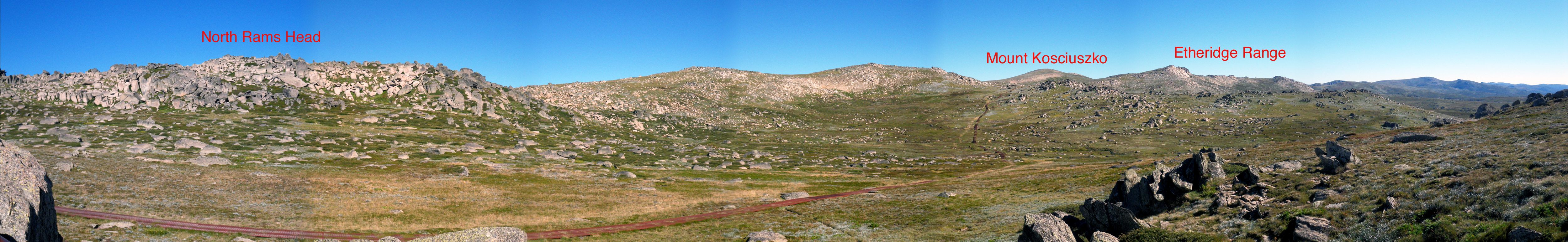
Panoramic photo from Mount Kosciuszko Lookout. North Ramshead to the left, Mt Kosciuszko visible past a saddle in the distance, the Etheridge Range to the right of Mount Kosciuszko, and the headwaters of the Snowy River. An information board at the lookout said that when explorer Paul Strezlecki visited Australia's highest mountain in 1840, the shape of the mountain reminded him of the tomb of the Polish freedom fighter, General Kosciuszko.
Photo: Don Hitchcock March 2010
From a sign at the Lookout:
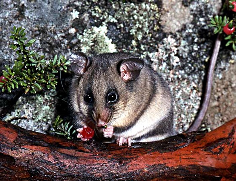
You are near the boulder habitat of the endangered mountain pygmy-possum, Burramys parvus.
Burra = an Aboriginal word for rocks, Mys = Greek for mouse, Parvus = Latin for small.
Despite the international flavour of their scientific name, these tiny mammals live only in the Australian Alps. Thought extinct until 1966, fewer than 2000 adults remain in the wild.
Photo: http://www.environment.gov.au/biodiversity/threatened/publications/tsd05mountain-pygmy-possum.html
Binge eating prepares tiny possums for winter
Every spring mountain pygmy-possums and other animals feast on the bogong moths that come to the mountains to escape the heat of the plains. The possums also eat seeds and berries of alpine shrubs such as the mountain plum-pine, caterpillars, beetles and spiders.
Surviving winter
The bogong feasting assists the possums to put on large amounts of fat. They often double their body weight. Their ability to store fat and hibernate under the snow helps them survive winter.
Under the insulating snow, they lower their body temperature by 35 °C. This slows their metabolism so they can live off their fat and not eat for up to seven months. They curl up and hibernate in spaces between the rocks and below the snow, in places where the temperature only goes down to 2°C.
Other animals in the area include the broad toothed rat, dusky antechinus and southern bush rat.
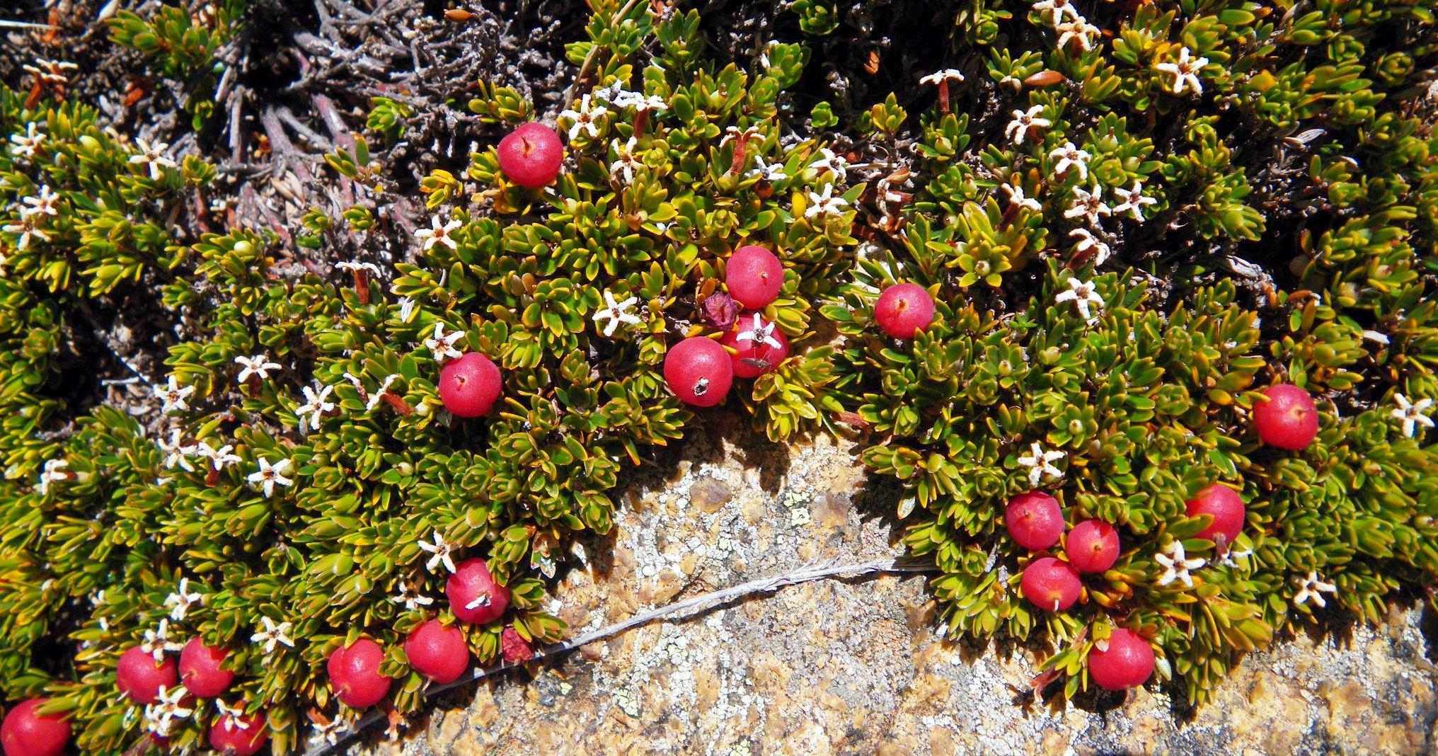
Carpet Heath, Pentachondra pumila. The leaves are no more than 5 mm by 2 mm, the flowers are white and scented. The fruits take two years to ripen. Growing over a rock. These berries are eaten by pygmy-possums, as shown in the preceding photograph.
Photo: Don Hitchcock March 2010
The source of the Snowy River, flowing away from the viewer down a broad glaciated valley, starting on its long journey to the sea.
Photo: Don Hitchcock March 2010
A little tarn, with a crayfish hole below water level.
Photo: Don Hitchcock March 2010
Mount Kosciuszko, showing its head above a saddle.
The mesh on the path, laid down twenty years ago, has made a huge difference to the ecology of the region. The park and the tracks were being loved to death.
Photo: Don Hitchcock March 2010
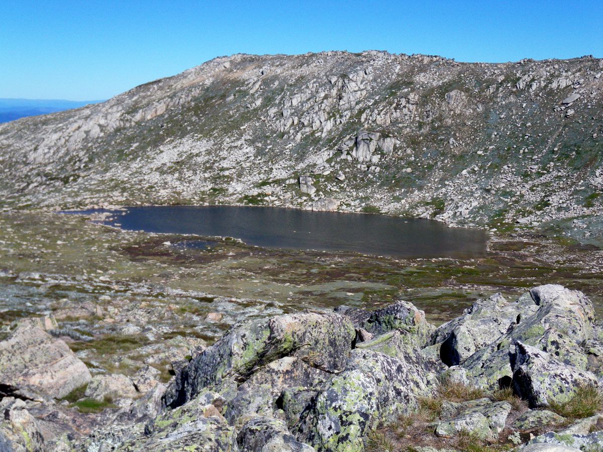
Lake Cootapatamba.
This is the highest glacial lake in Australia.
Photo: Don Hitchcock March 2010
(from a display board by the NSW NPWS at the lookout over the lake)
This glacial lake was named Kau-oola-patamba, the place where the eagle drank, from an Aboriginal storyline. Today you are more likely to see ravens and pipits here on the highest of the park's five glacial lakes.
These lakes are:
• the only lakes formed by glacial action on mainland Australia.
• the highest lakes in the country
• the freshest water on mainland Australia due to the low salt content
• low in nutrients
• covered with winter ice.
Lake Cootapatamba was naturally dammed behind moraines, piles of rocks, pebbles and rock flour left by glaciers. No fish live in the lake, however some crustaceans make the shallow, chilly lake their home.
Sometimes you can see bands of light and dark water. This is sediment gradually filling in the lake. Since the arrival of Europeans there has been a high rate of erosion. Despite this, the Kosciuszko alpine bogs, fens and lakes that make up the only alpine wetlands in New South Wales are generally in healthy condition.
The biggest problem facing the natural lakes is people 'having to go' - human waste.
Camping is therefore not permitted in the catchment area of glacial lakes.
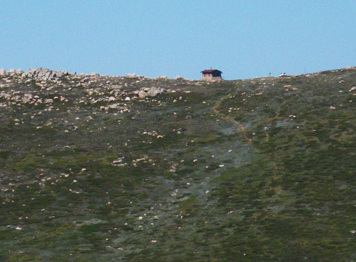
From here you can see Cootapatamba Hut, built by the Snowy Mountains Authority. It is for emergency shelter only.
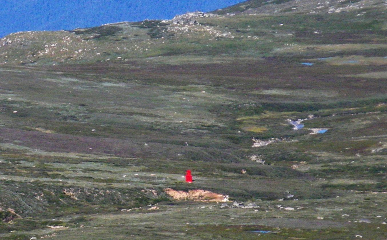
The emergency hut is a small red dot from the lookout.
It is red so that it may be more easily seen in poor visibility conditions, and has an entrance tower so that it can be entered even if there is a lot of snow on the ground.
Photo: (left) Don Hitchcock March 2010, (right) from the display board at the lookout.
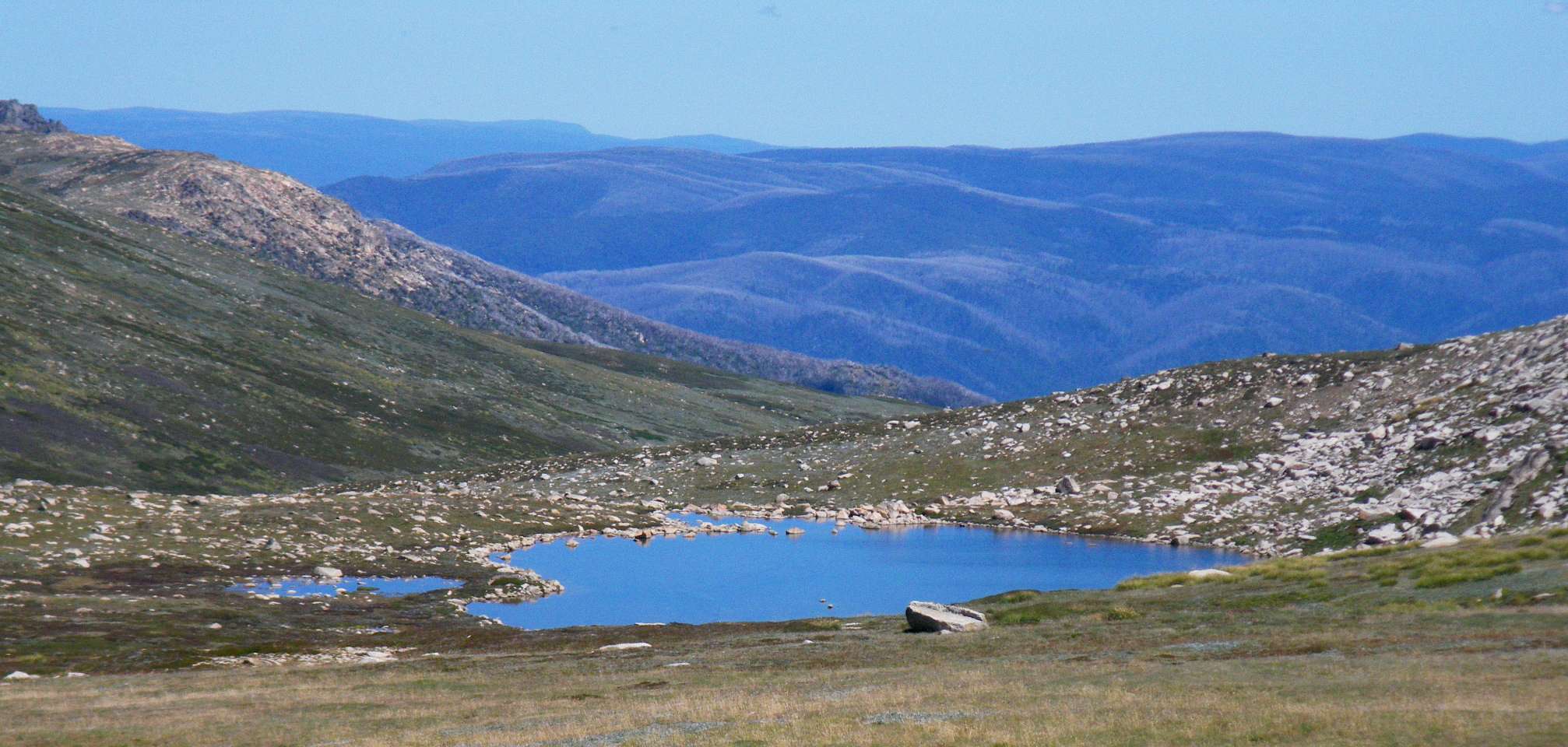
Lake Cootapatamba, again, from a viewpoint further down the track. This time the light was such that the lake was a brilliant blue, a delight to the eye, with the rolling hills of the alpine country forming a wonderful backdrop.
Photo: Don Hitchcock March 2010
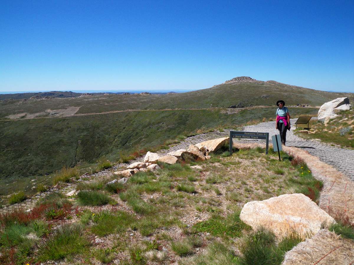
At Rawson Pass, I was struck by the good design and professionalism of this sign.
Certainly all the information is there - but look at how the graphic designer has organised and presented it, in three dimensions for what is essentially a two dimensional object - an information sign.
I loved the fact that it was done on steel, with no galvanising, and this was used to advantage with the raised lettering for "Kosciuszko Walk", the logo of the NSW NPWS, and especially the way the steel was cut to delineate the various parts of the sign - the heading, the logo, and the information, without compromising the structural integrity of the steel sheet.
In addition, the sign was presented on a carefully selected large flat slab of local rock - this is not accidental.
This object is a work of art, done by a highly skilled professional. Most people would walk past without a second glance, but it adds class, nevertheless. There is no substitute for quality. This has it in spades.
I was impressed.
Photo: Don Hitchcock March 2010
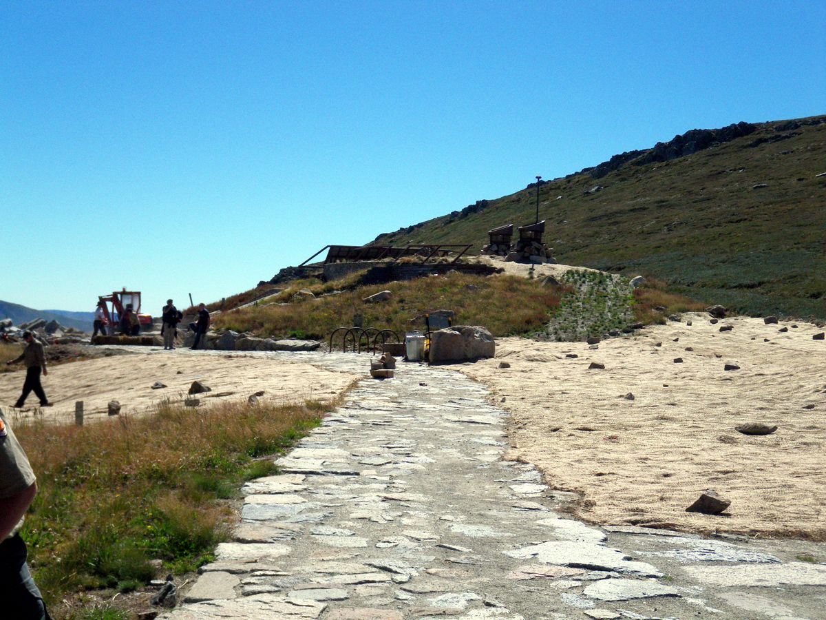
The new toilet block at the base of Mount Koskiuszko is nearly finished. A lot of money has been spent making it as unobtrusive yet as functional as possible, with the least visual and environmental impact. It is a fantastic engineering feat, and all concerned, designers, should be congratulated.
It seems odd to lavish praise on a toilet block, but this is a very important and very worthwhile addition to the park.
Photo: Don Hitchcock March 2010
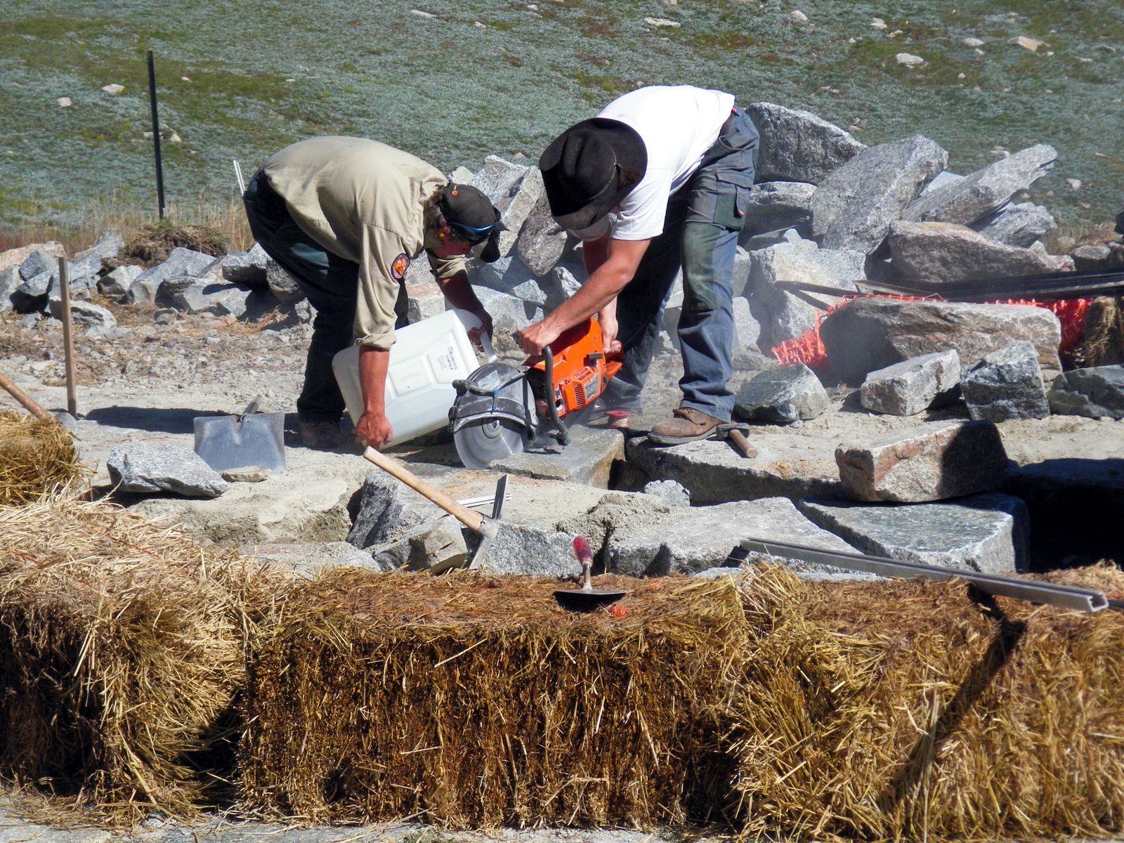
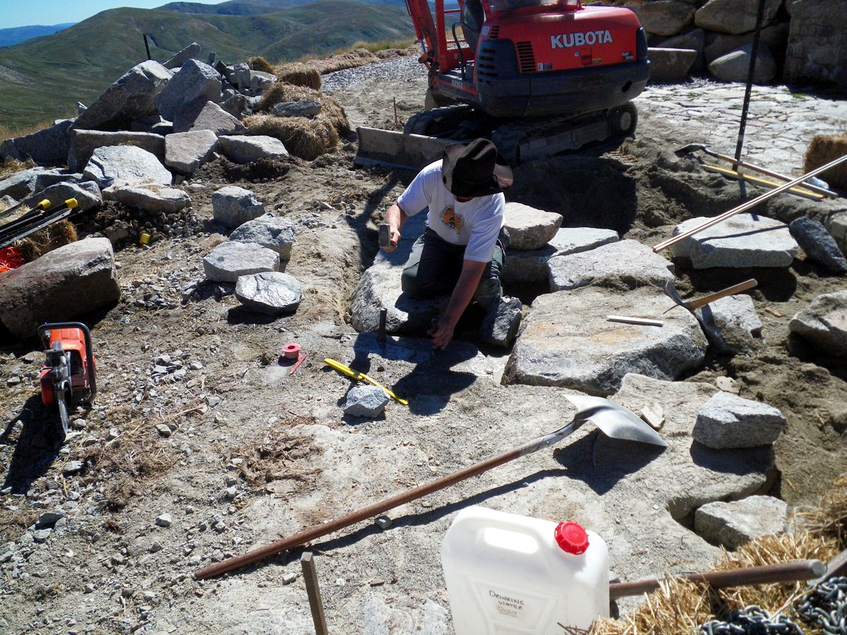
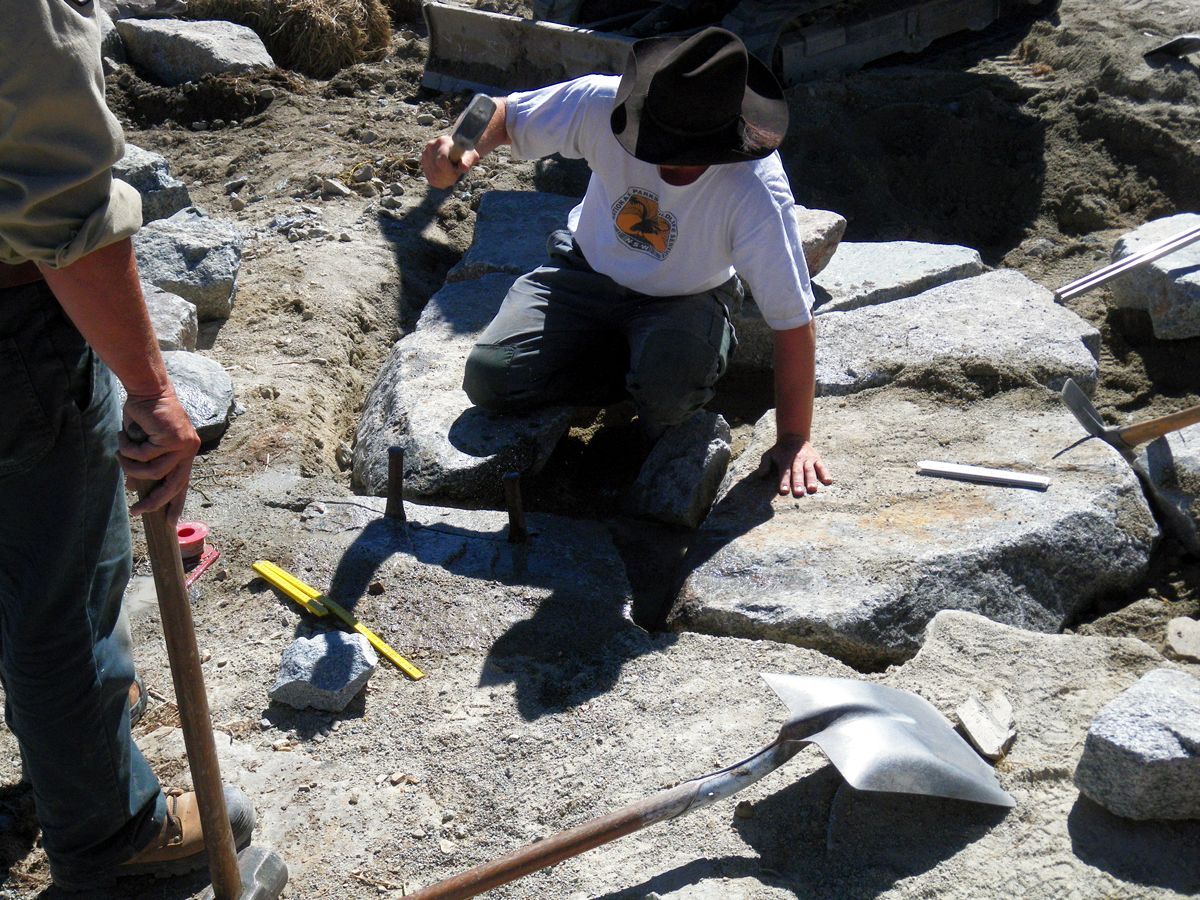

The workmen were working on the path and 'patio' outside the toilets when we were there. They used a petrol powered diamond saw, cooled and lubricated by water poured on the stone, to cut a groove in the rock, then a hammer and wedges to split the rock to the required shapes.
It was a fascinating process to watch.
As Kathy remarked in her diary: "The toilets were of sturdy construction – they looked like a nuclear bunker and inside everything was stainless steel – massive steel doors you had to yank firmly open and waterless soap inside."
Photo: Don Hitchcock March 2010
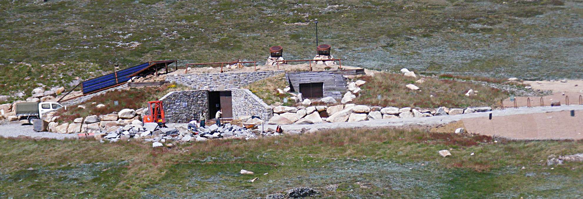
A distant shot of the construction of the toilet block. It would also function as an excellent defacto winter emergency shelter. At least there would be plenty of toilets!
Photo: Don Hitchcock March 2010

The start of the final track to the summit of Mount Koskiuszko at Rawson Pass.
Photo: Don Hitchcock March 2010
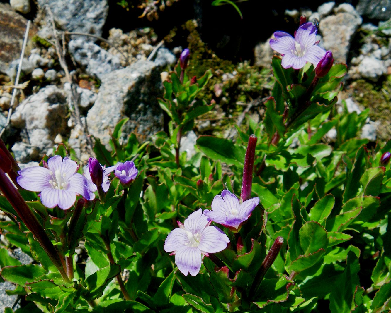

Epilobium gunnianum growing well beside the path to Mount Kosciuszko.
Photo: Don Hitchcock March 2010

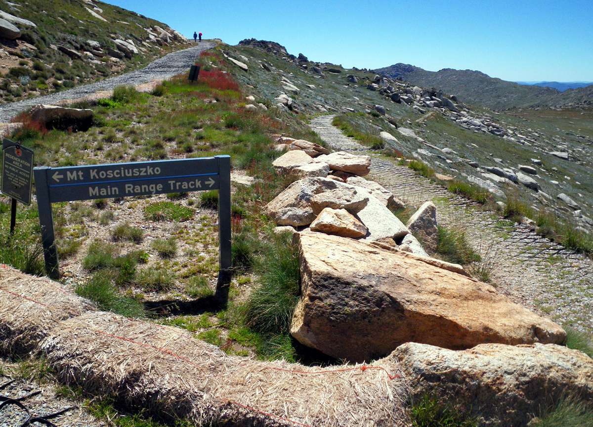
Map showing the paths in the area, at the junction with the main range track before the final ascent to Mount Koskiuszko.
Source: Sign beside the track, NSW NPWS
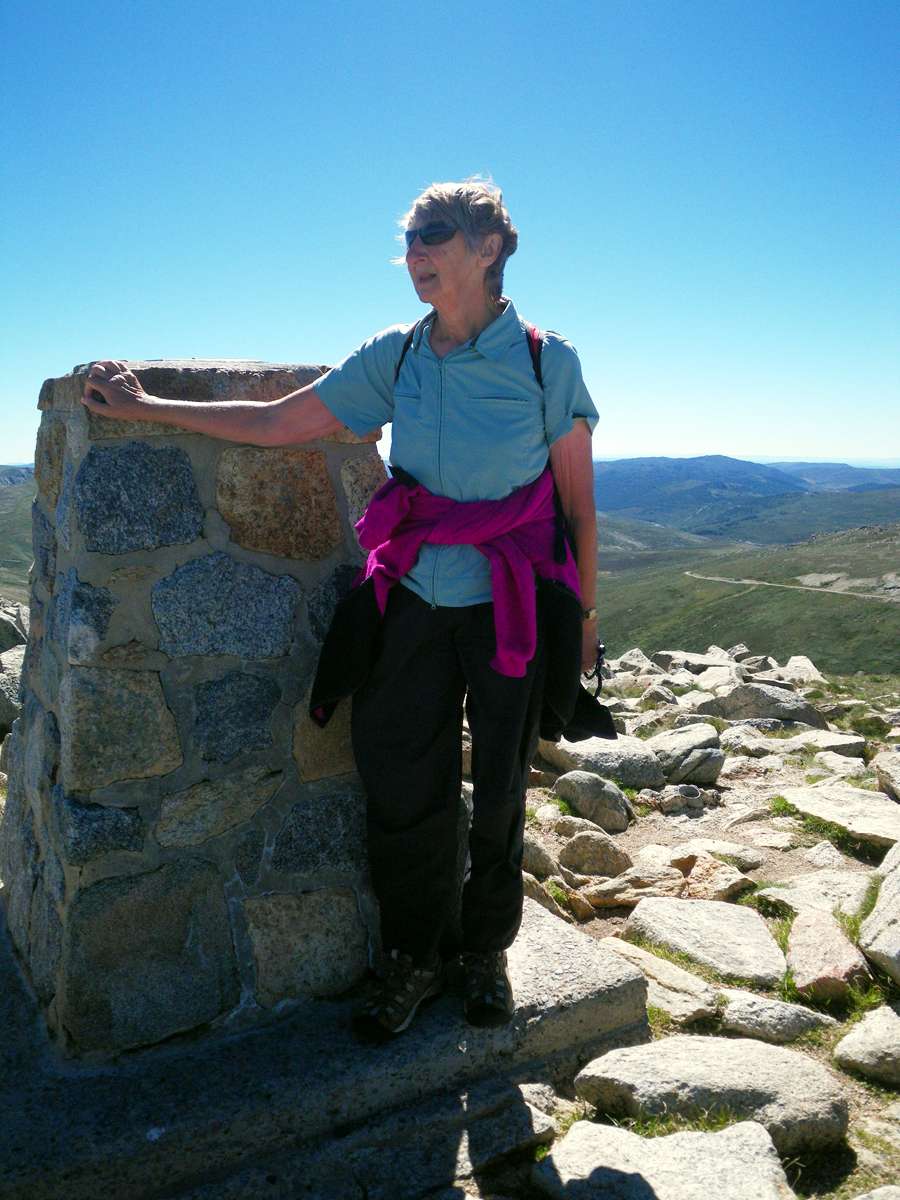
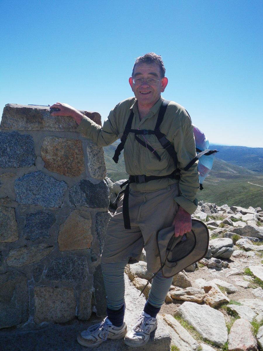
Kathy and myself at the summit. The path to the top was superbly surveyed. I have never before been on such a well graded path. It curves around the back of Mount Koskiuszko on its way to the summit at exactly the right incline for continuous easy walking.
Kathy's diary reads for this section:
On the last 1.6 km we were on a circular road of such gentle grade that Don blessed the engineer who’d made it – “I give him a 10 for this grade – no, an 11”! There were so many people on top (2229 m) that we didn’t stay long – just enough to be photographed as the highest person in Australia and a glimpse of where we had come in one direction and down into the blue Geehi Valley in the other and into the Snowy Valley downstream. It had taken us 2 hr 20 mins. Some cheeky ravens taunted us on our way down – such an effortless glide down the hill.
Photo: Don Hitchcock March 2010
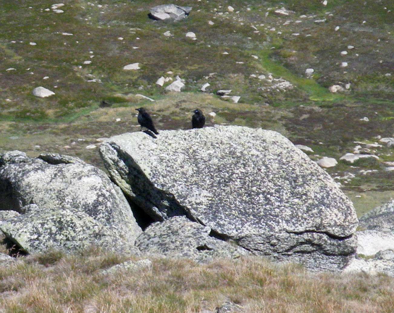
Ravens were the only birds we saw above the treeline.
Photo: Don Hitchcock March 2010
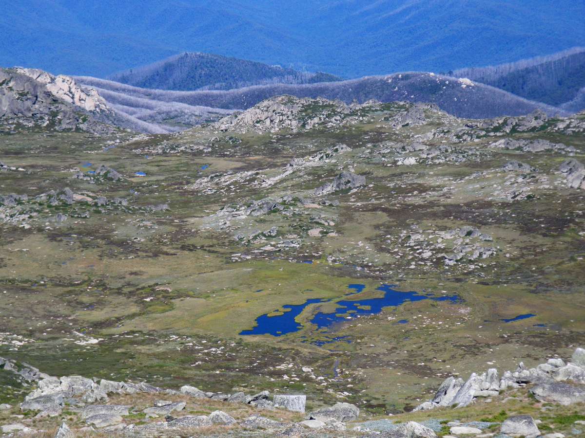
Tarns are able to support microscopic pond life and crayfish. The white fringe on the ridges is formed by the dead white trunks of trees killed in the 2003 bushfires.
Photo: Don Hitchcock March 2010
Back at the track junction, we headed off down the Main Range Track towards Lake Albina, Blue Lake, and Charlotte Pass.
Noticeable in these photos is the method used to stabilise the track in many places - a honeycomb of UV resistant plastic strips. It seems to work fairly well. Stone paving is more aesthetic and longer lasting, but initially more expensive.
Photo: Don Hitchcock March 2010

The ridge on the other side, connecting Seamans Hut to Rawsons Pass, with the old road beneath the skyline had a series of rock outcrops which looked for all the world like a set of giant stallion droppings!
Photo: Don Hitchcock March 2010
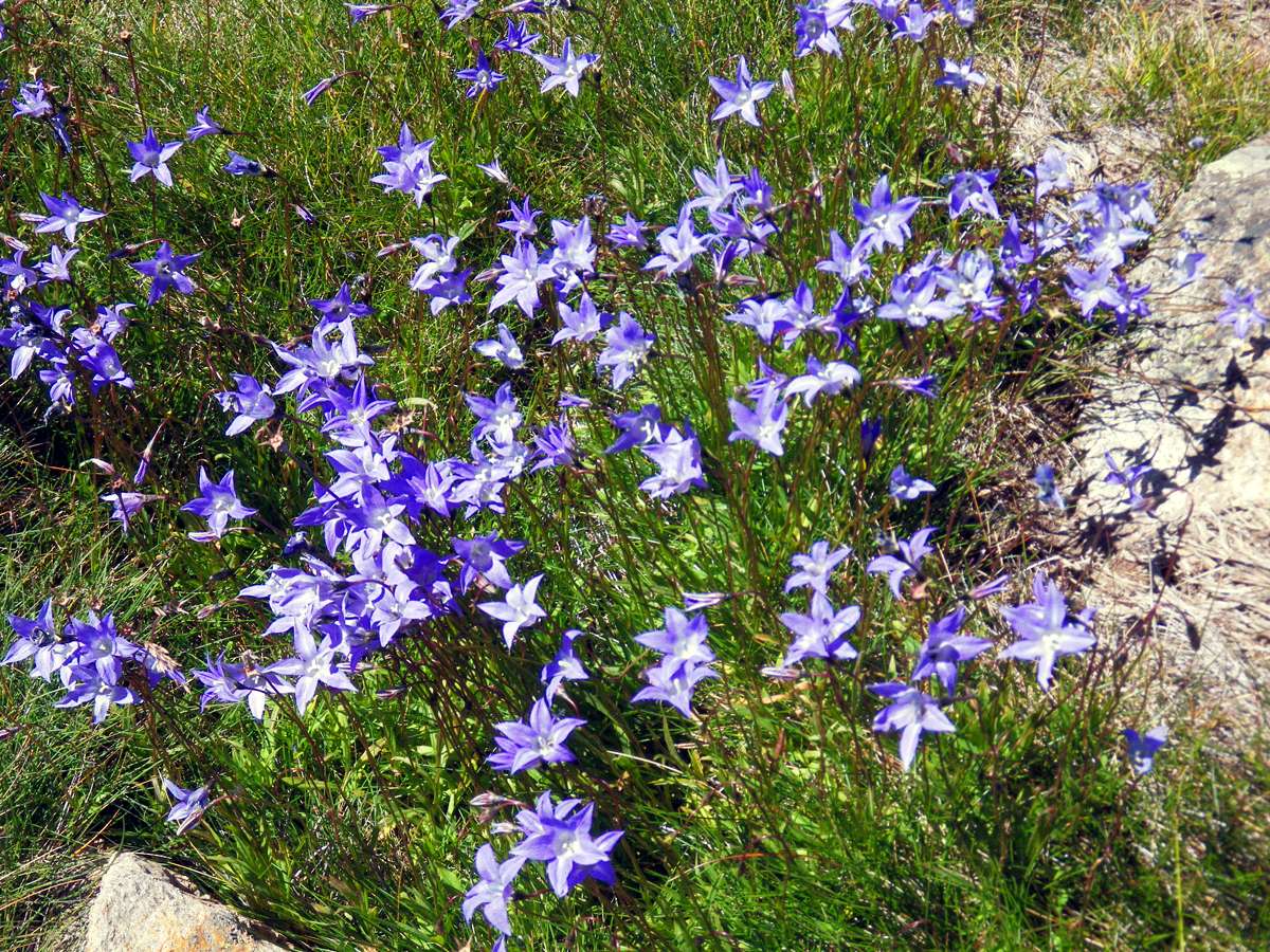
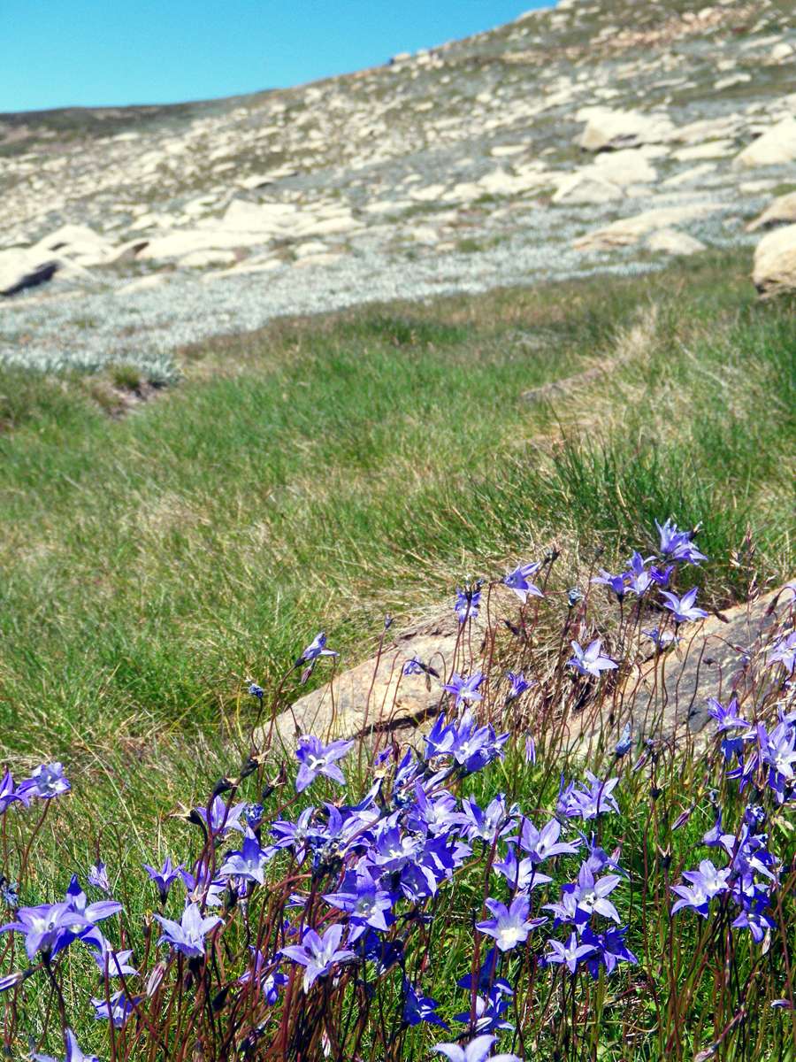
Wahlenbergia gloriosa
This is common in boulder strewn alpine country. It is a perennial herb with spreading rhizomes, which is why it appears in clumps, as in this photograph.
Photo: Don Hitchcock March 2010
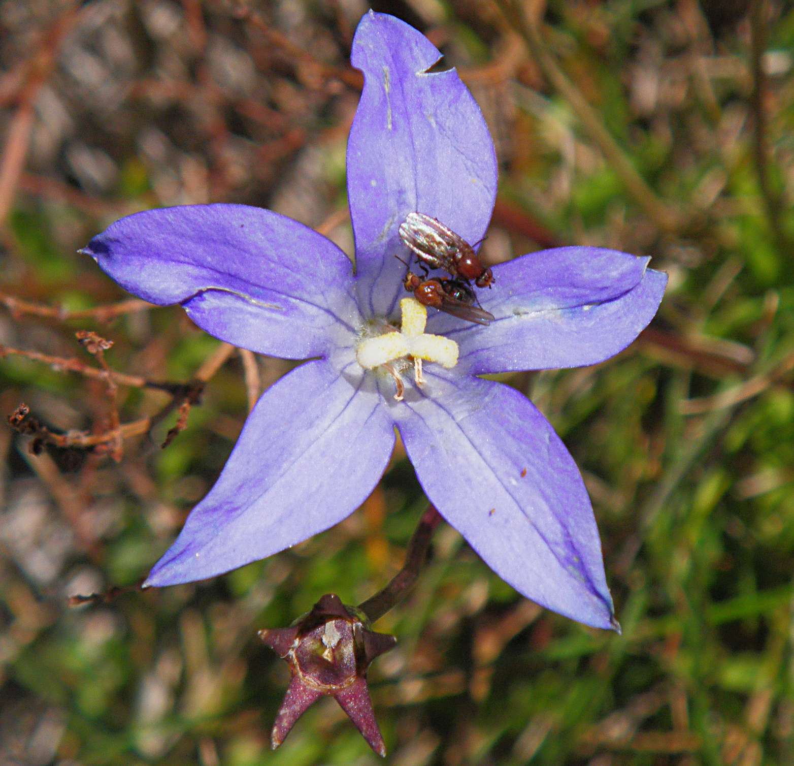

Wahlenbergia gloriosa
These insects, apparently a species of fly, were interacting in a strange way, as though they were fighting for possession of the flower. It may also have been a mating ritual.
Photo: Don Hitchcock March 2010
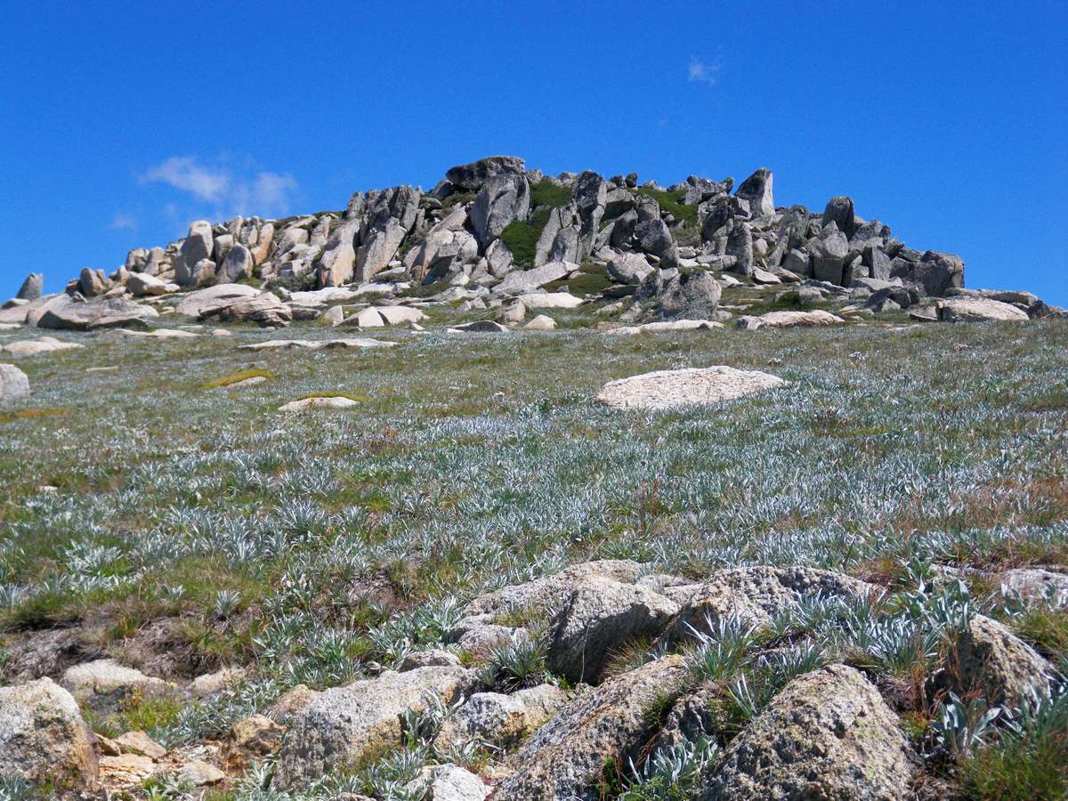
This outcrop would provide shelter for a myriad of small animals and plants.
Photo: Don Hitchcock March 2010
Bidgee- widgee, Aceana novae-zealandiae
The fruit of this plant is a large burr which attaches readily to socks and clothing. The name is a corruption of the Maori word for burr, 'piripiri'. The whole flower head easily comes off the plant, leaving you with lots of them on your socks. To be avoided at all costs.
Photo: Don Hitchcock March 2010
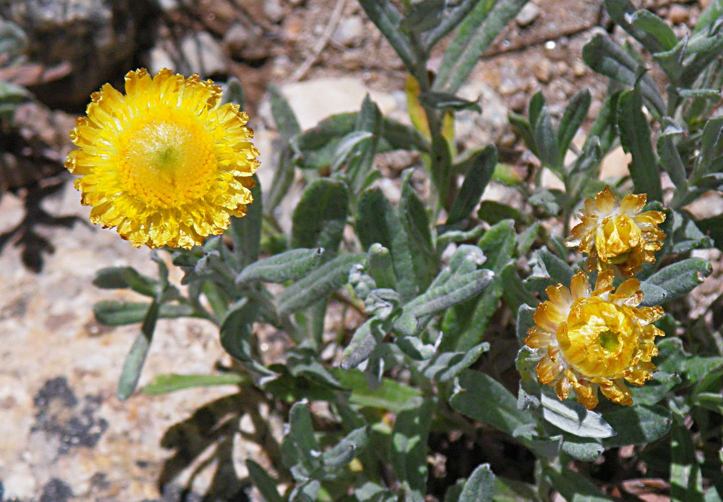
Leucochrysum albicans, formerly Helipterum albicans
This is a perennial herb with wooly/hairy leaves, and solitary terminal flower heads. There are various subspecies and varieties with differently coloured inflorescences and bracts, this one is golden throughout.
Photo: Don Hitchcock March 2010
It was possible to make good time down this section of the track, you can almost skip down the slope. The stone work has made the track much more stable.
Lake Albina is in the fold of the hills just past the next ridge, to the left.
Photo: Don Hitchcock March 2010
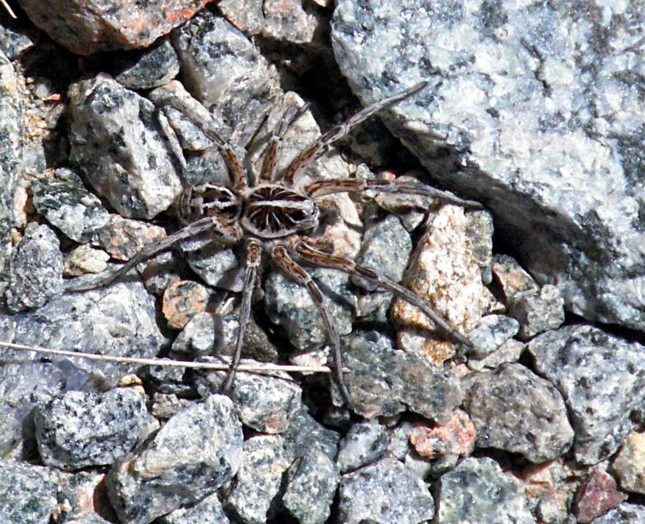
This wolf spider was almost invisible on the track. They live mostly solitary lives and hunt alone. Two of their eight eyes are very prominent, as can be seen in this photo. They depend on their good stereoscopic vision to hunt prey.
Photo: Don Hitchcock March 2010
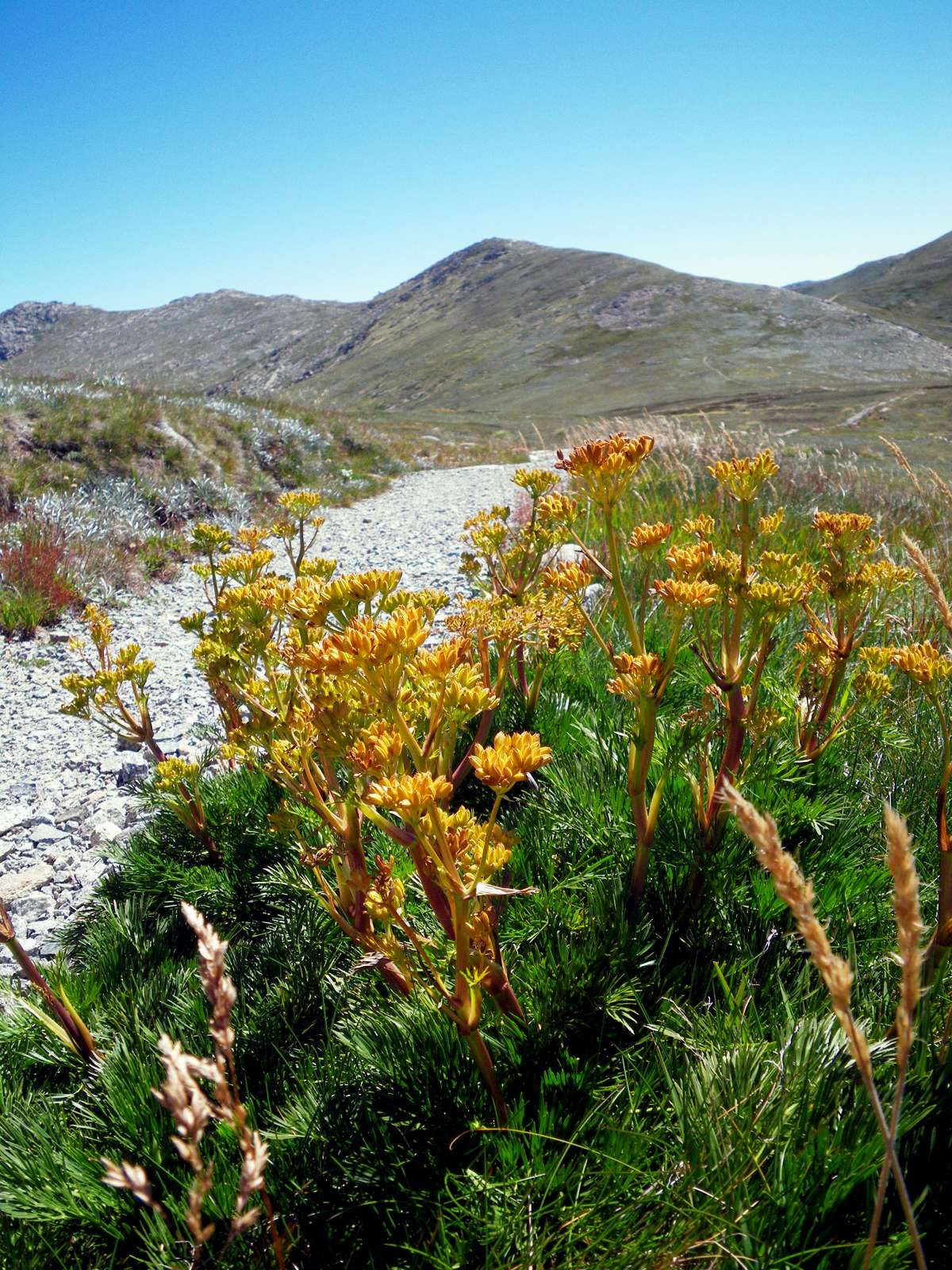
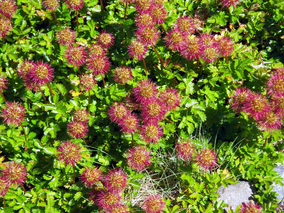
Mountain Celery, Aciphylla glacialis.
This is a particularly good specimen. It had a resurgence in the Snowy Mountains when grazing was phased out in the area, since it is palatable to stock.
Photo: Don Hitchcock March 2010
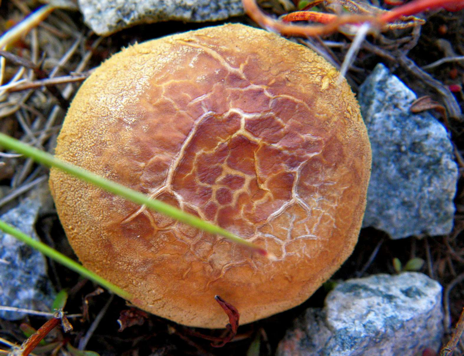
A fungus growing amongst the rocks, possibly a puffball.
Photo: Don Hitchcock March 2010
Seamans Hut was visible on the ridge across the broad valley of the Snowy River. It is in a very exposed position, and is a valuable emergency shelter. My new camera has an excellent 5x zoom, and antishake technology, which makes this sort of shot possible without a tripod.
Photo: Don Hitchcock March 2010
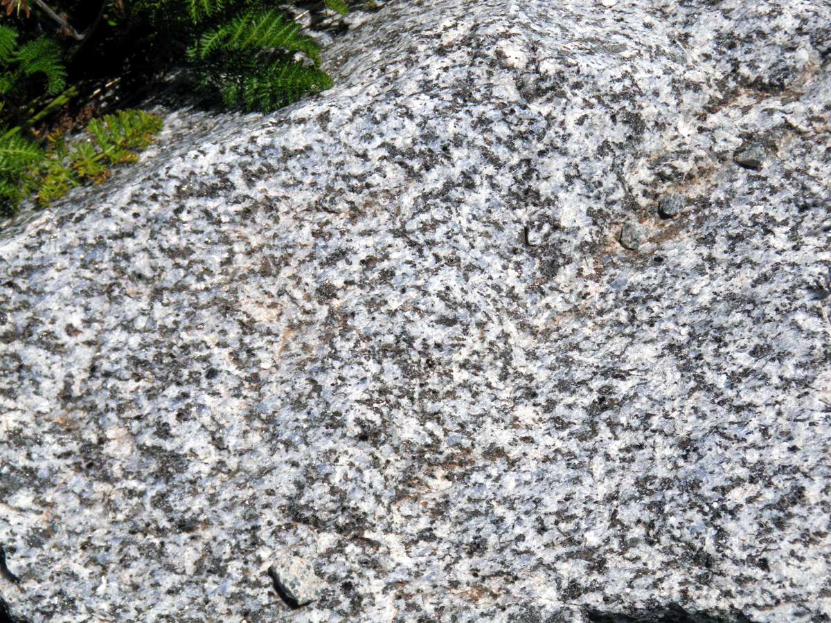
Gneiss. This is a metamorphic rock, very similar to granite but with (in this case barely perceptible) banding of the crystals, reflecting its geological history.
The name is originally from the German language, and means "spark" from the way that it often glistens in the sun.
Photo: Don Hitchcock March 2010
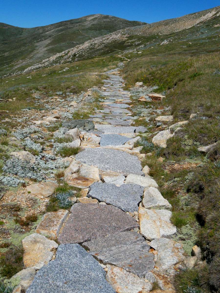
This newly laid path has been beautifully done. I heard that Nepalese stone workers were brought in especially for this task.
The stones will gradually accumulate lichens, the spaces between the stones will gradually fill in with clay and gravel as walkers use the path, and plants will colonise the spaces. It looks a little raw at the moment, but in fifty years time it will be even more beautiful, and more functional.
Looking back to Mount Kosciuszko.
Photo: Don Hitchcock March 2010

Lake Albina and surrounds, seen in a panorama of several photos stitched together.
The Main Range Track, the gravel path on the right, continues to Blue Lake and Charlotte Pass.
Photo: Don Hitchcock March 2010

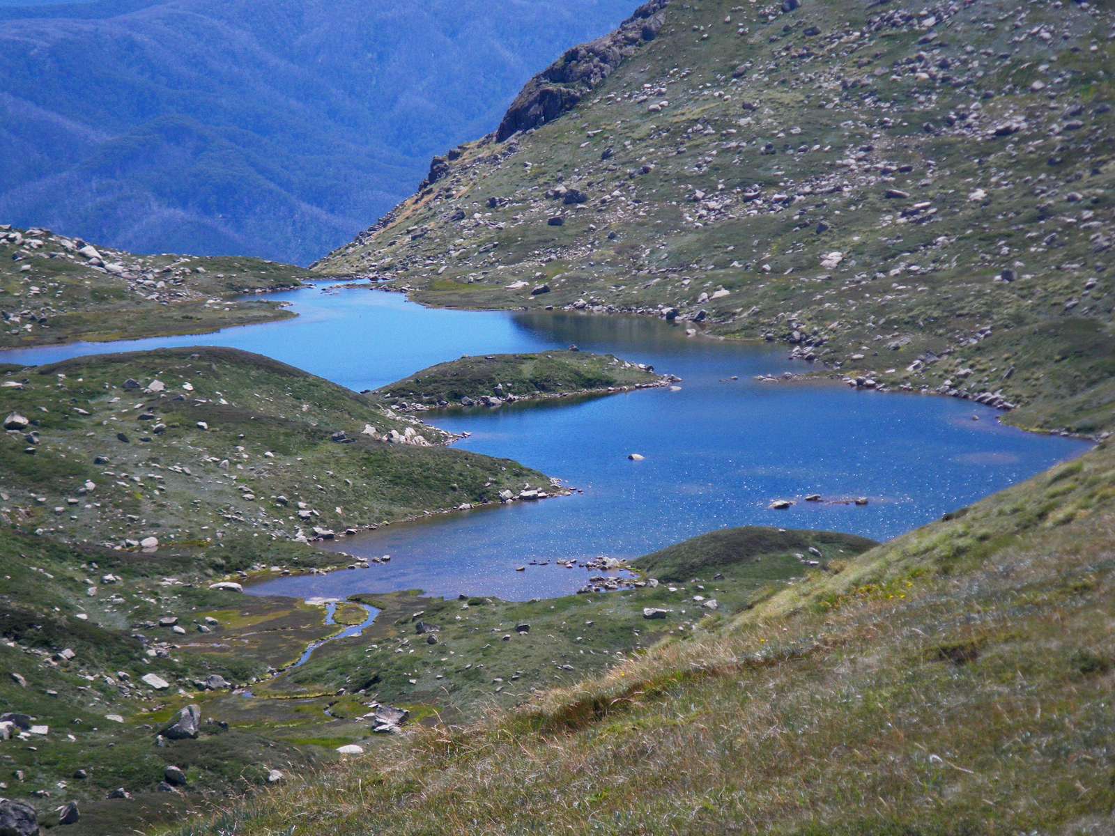
Lake Albina
This is a 'hanging' glacial lake. During the last ice age, this area would have been filled with snow and ice, which hollowed out the cirque, which now has water in the bottom, though in winter it is covered with ice and snow. Moraine dams the exit of the lake. Eventually this dam will be breached, and Lake Albina will drain away.
We had lunch at this idyllic spot on the slopes of Mt Northcote, before returning to Charlotte Pass. The lake hangs on the edge of a precipice and Lady Northcote Creek drains out of it.
Kathy's diary reads:
We were back at the chairlift by 3.45 pm after checking out the Eagles Nest café. The trip down the lift was even more exciting as we faced downhill! Little boys on bikes were zooming down their track below us and we had great views down the Snowy Valley and Thredbo trying to make out the site of the fatal landslip many years ago.
Photo: Don Hitchcock March 2010
Bushwalking Index
Anyone (e.g. students, libraries, government agencies such as tourist bureaus, the general public) may use, print and publish the photographs taken by me and presented on this bushwalking file for any legitimate non-commercial purpose, at no cost, and without asking permission. However a note such as "Photo: Don Hitchcock, donsmaps.com" somewhere in the document would be appreciated if it is to be published.