Back to Don's Maps
 Bushwalking Index
 Bushwalking, Hiking and Tramping in New Zealand
 Day One and Two - The Travers - Sabine Circuit in the Nelson Lakes area is a wonderful mix of landscapes and vegetation, from beech forest to alpine moors. It is suitable for experienced, fit walkers who are prepared to spend five to seven days exploring the wonderful areas the tracks give access to. The highlights are the Robert Ridge walk to Lake Angelus, the ascent of the Travers Saddle, and the trip to Blue Lake. After driving from nearby Saint Arnaud, Paddy's track gives access to Bushline Hut, with views of Lake Rotoiti along the way. The well marked Robert Ridge track, narrow and exposed at times, takes you to Lake Angelus Hut, with spectacular views of glacial lakes and cirques along the way, and very interesting alpine vegetation such as vegetable sheep. Snow is possible any month of the year.
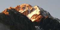 Day Four of the Travers Sabine Circuit in New Zealand - John Tait Hut to West Sabine Hut over the Travers Saddle. It is a steady climb to Upper Travers Hut, but the view of Mount Travers from the valley bottom is spectacular. Travers Falls is a beautiful little 20 metre high waterfall. From Upper Travers Hut the way leads up the Saddle, with some steep sections. There are many beautiful alpine plants such as Hebe, Celmisia, Gentiana, Helichrysum, Coprosma, vegetable sheep and New Zealand flax on the eastern side of the saddle. On the saddle itself there are some beautiful large tarns, but the area is exposed and often windy and cold. The track drops down into the East Branch of the Sabine, via a steep scree slope. The area is subject to avalanches after heavy snow.
Day Three of the Travers Sabine Circuit in New Zealand - Angelus Hut to John Tait Hut
Day Three - The Travers - Sabine Circuit in the Nelson Lakes area is a wonderful mix of landscapes and vegetation, from beech forest to alpine moors. The Cascade Track from Lake Angelus has alpine vegetation such as Tikumu (Celmisia) and Hebe, and some beautiful waterfalls, before reaching the Travers River, with beech forests and lichens. There are superb views of Mount Travers before reaching the John Tait Hut. John Tait built the first hut in this area, and the Hut is named after him.
The Travers Sabine Circuit is a track for experienced, fit, self sufficient walkers. The huts rely on coal fires for warmth and cooking, and it is advisable to carry your own stove and fuel. You may well be the only person walking the track, and carrying a personal locator beacon is a wise precaution. Weather conditions can be extreme.
Day Three
Angelus Hut to John Tait Hut
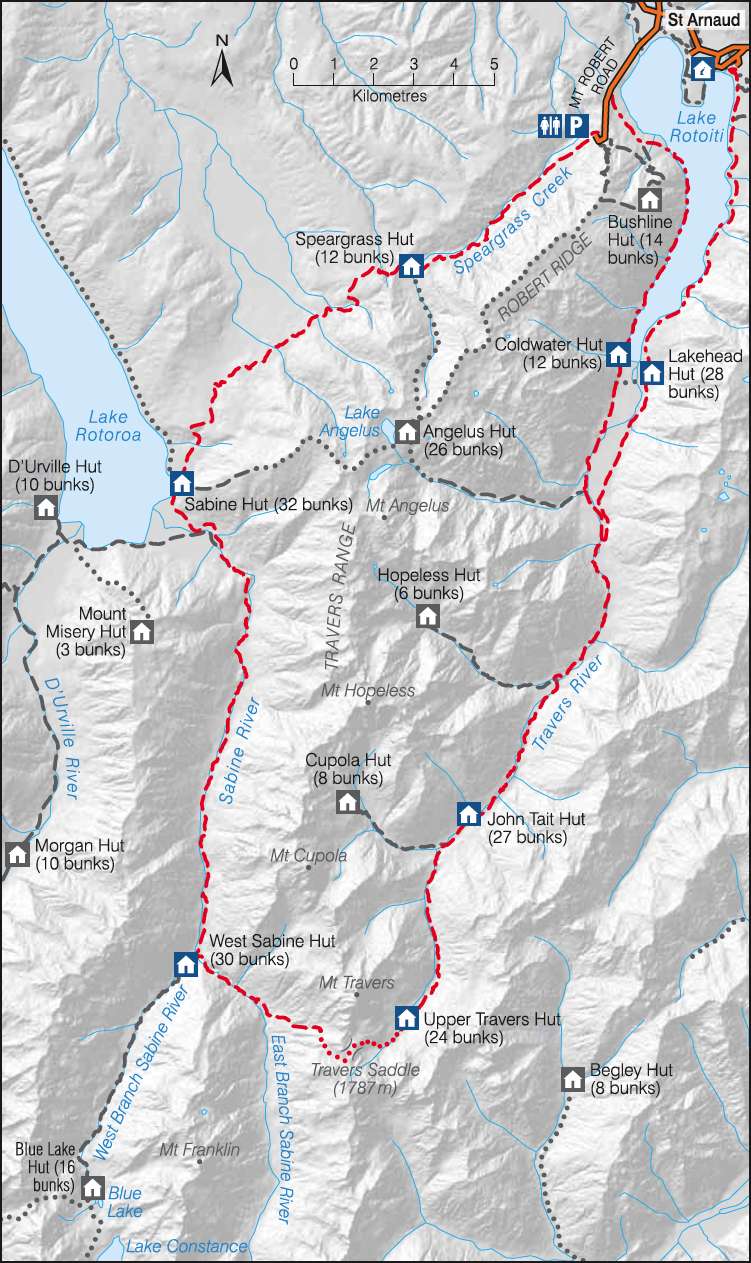
This is a very useful sketch map of the Travers Sabine Circuit in Nelson Lakes National Park from the New Zealand Government site. The NZ Government has worked really hard to make it easy for tourists to find information, and to book travel and accommodation. I believe they have the best such system in the world.
Photo: http://www.doc.govt.nz

I was awake early, ready to head for John Tait hut.
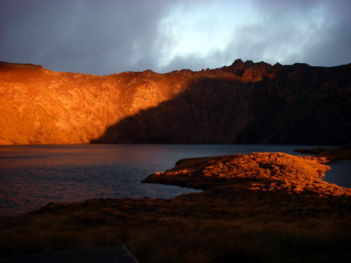
At first light, it was obvious that conditions were much better than the previous afternoon, and once the sun hit the lake and the hills around, I got underway.
Photo: Don Hitchcock, 30th January 2007
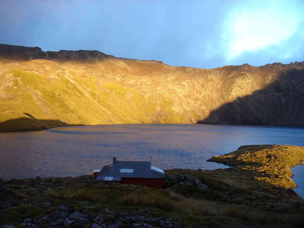
Lake Angelus Hut is in a superb setting.
Photo: B., 30th January 2007
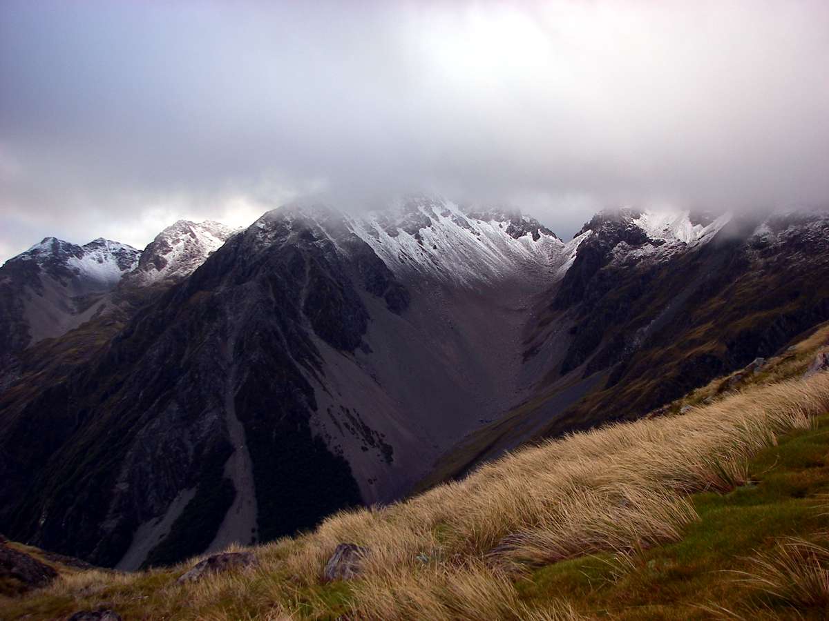
Although Mount Angelus had a light dusting of snow, and the peak itself was obscured by cloud, conditions on the Cascade track, which leads downhill to the Travers River were excellent, although quite wet with runoff.
Photo: Don Hitchcock, 30th January 2007
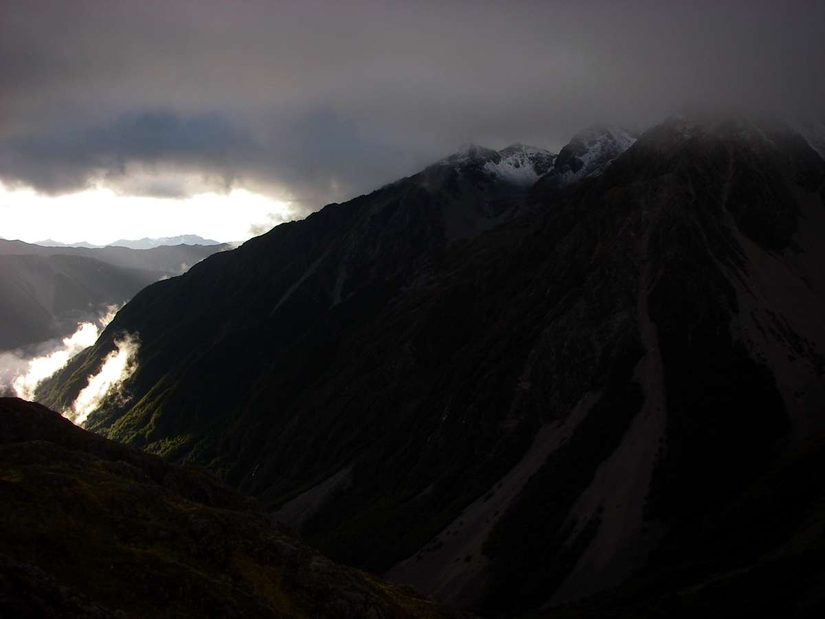
The Travers Valley on the left of the photo was bathed in sunlight, and it looked like it was going to be an excellent day once the morning cloud burnt off the highlands.
Photo: Don Hitchcock, 30th January 2007
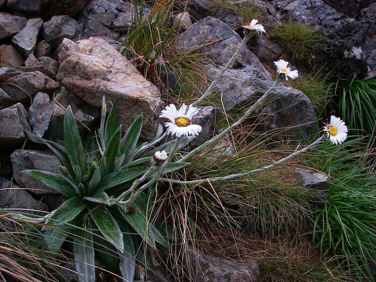
Celmisia semicordata
Tikumu are large-leaved mountain daisies. They belong to a large and complex group in the genus Celmisia that are widespread and often abundant in New Zealand mountain grasslands and herbfields. In the South Island, tikumu usually refers to Celmisia semicordata, but is used for Celmisia spectabilis also.
Photo: Don Hitchcock, 30th January 2007
Text: http://www.landcareresearch.co.nz/research/biosystematics/plants/weaving/tikumu.asp
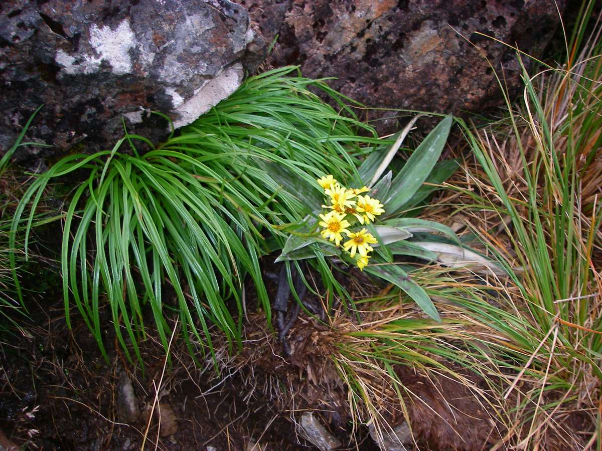
This is possibly a very rare yellow flowered Celmisia, although it looks more like a Senecio growing through a Celmisia group of leaves!
I would be grateful for an enthusiast's identification.
Photo: Don Hitchcock, 30th January 2007
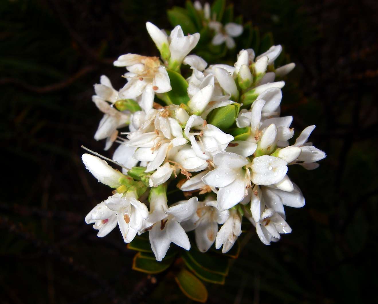
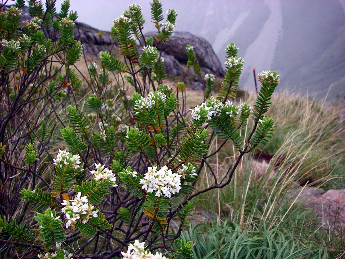
Hebe pauciramosa var masonae
Photo: Don Hitchcock, 30th January 2007
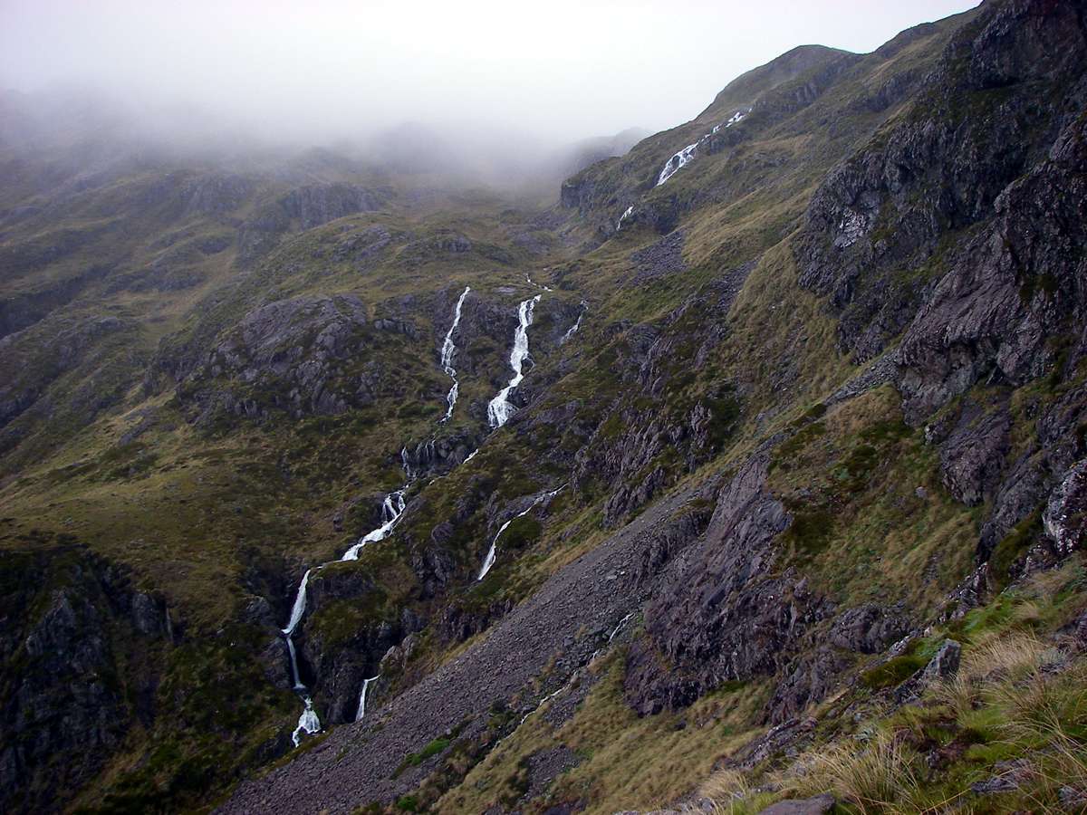
The Cascade Track lived up to its name. These waterfalls were at their best after overnight snow and rain.
Photo: Don Hitchcock, 30th January 2007
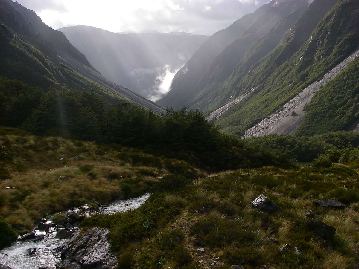
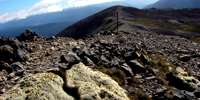
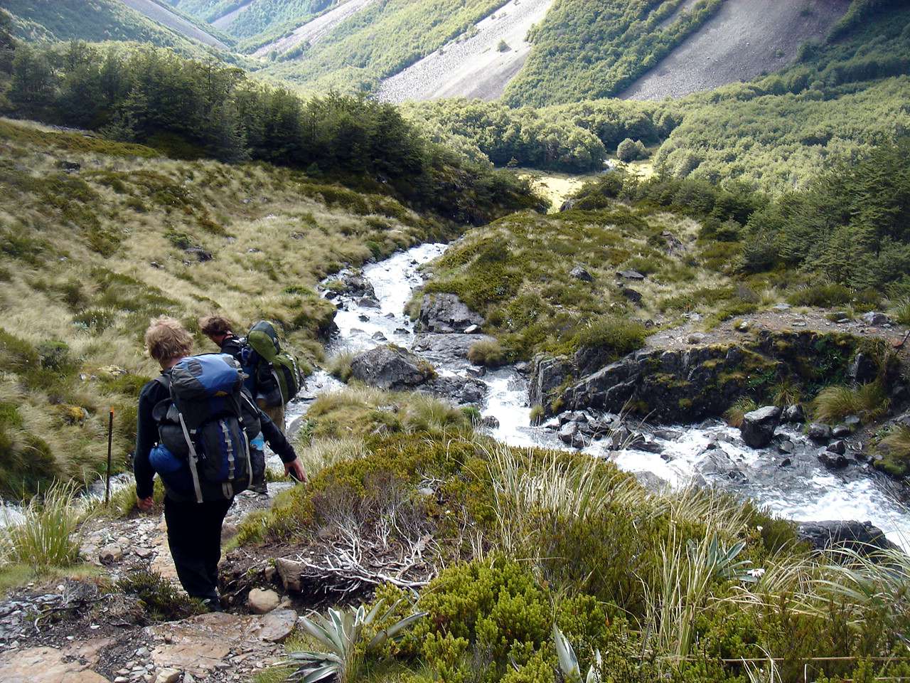
Looking down the Cascade Track to the Travers River valley. This would be a steep pull coming up the other way, I was glad to be going downhill.
Photo: Don Hitchcock, 30th January 2007

The steep track was about to became less so, but more boggy.
Photo: B., 30th January 2007
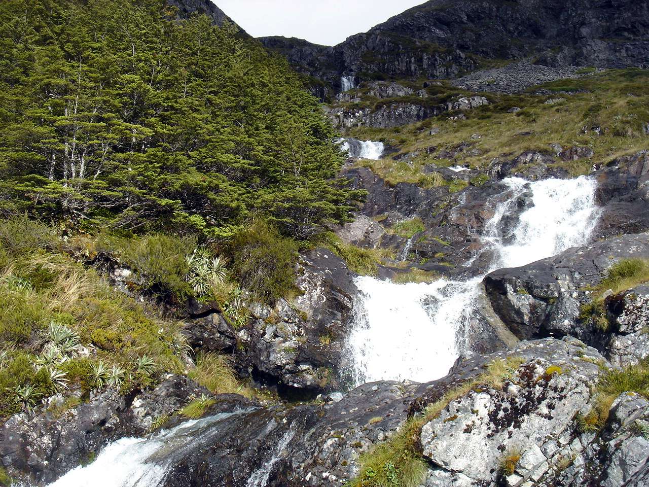
After yesterday's rain and snow, this waterfall was superb. It formed the boundary between alpine vegetation and the treeline.
Photo: B., 30th January 2007
Descending to the tree line, with the waterfall and crossing on the right.
Photo: B., 30th January 2007
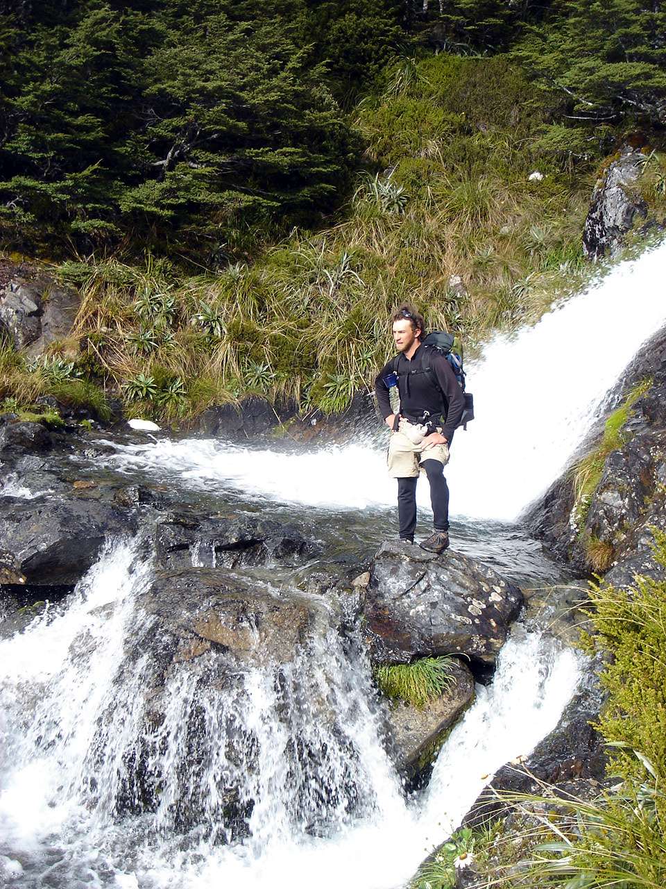
The track at this point was a rock hop across the lip of the plunge pool of the waterfall.
Photo: B., 30th January 2007

It was a picture book waterfall and plunge pool. New Zealand is a beautiful place.
Photo: Don Hitchcock, 30th January 2007

Looking back up to the right to Mount Angelus, and the snow and ice on the southern flank which appeared to be permanent.
Photo: Don Hitchcock, 30th January 2007
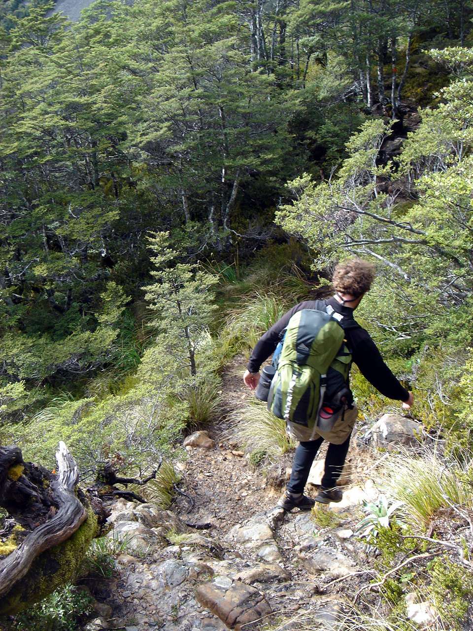
The trees were small and scrubby at first, but soon became taller and filled out.
Photo: B., 30th January 2007
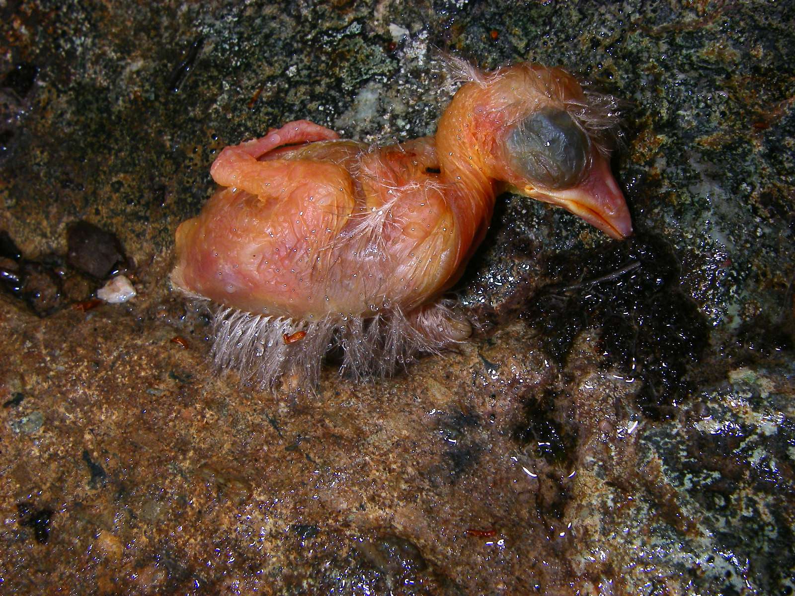
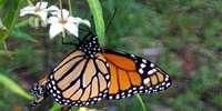
A chick dropped from a tree above the track which did not make it to fledging. It would be good to know why - was the nest parasitised by a cuckoo, was there something wrong with the bird, did another earlier born chick push it out of the nest?
Note how large the eye is in comparison to the head.
Photo: Don Hitchcock, 30th January 2007
The track, always wet, became more like a shallow creek at this point. I found it easier just to plough through the water, ignoring the resulting wet feet, as I have to do in the gorges at home in Australia.
Photo: B., 30th January 2007
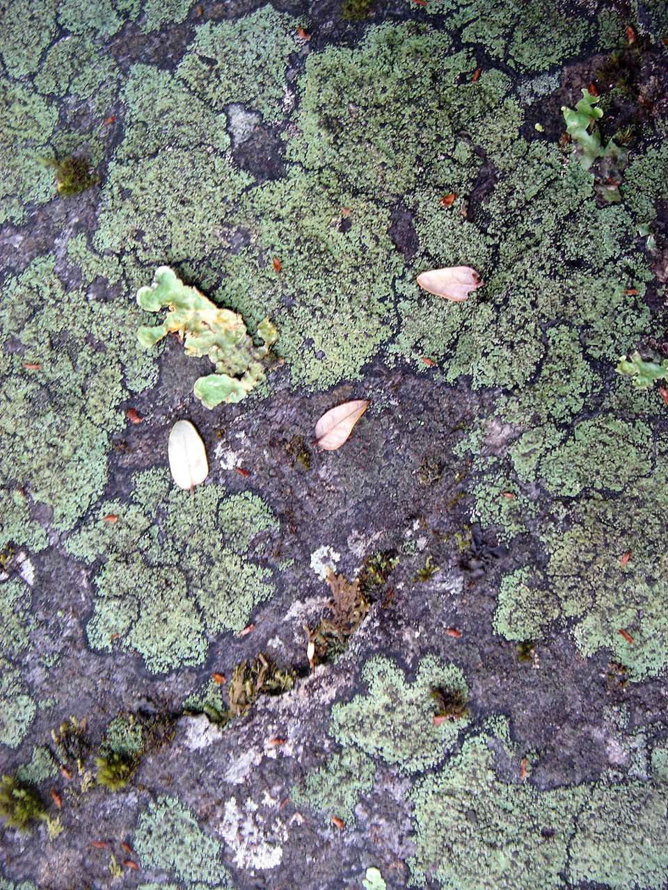
This is a striking and beautiful life form which I called the mosaic lichen. It occurs in several places in New Zealand. It appeared to me that rival colonies of lichen kept a narrow dark margin between them as they competed to cover the surface of a suitable rock.
Photo: B., 30th January 2007
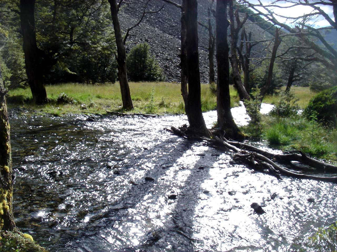
At the bottom of the descent, this forest appeared on the flat ground beside the Travers River.
New Zealand has Gondwanaland vegetation, which means that there are few flowering trees such as we have in Australia.
Photo: Don Hitchcock, 30th January 2007
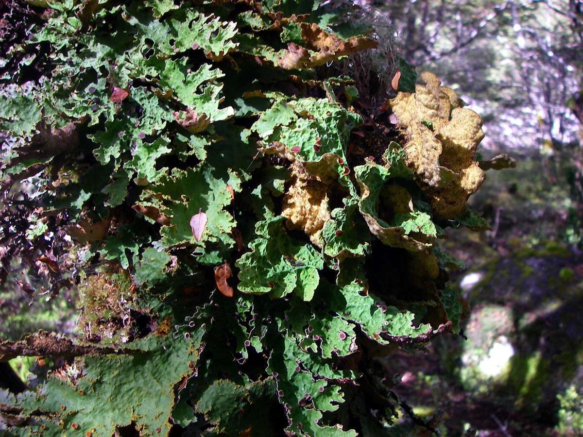
One thing it does have in superabundance is lichens. This was a very interesting form, with leaf like growths.
Photo: Don Hitchcock, 30th January 2007
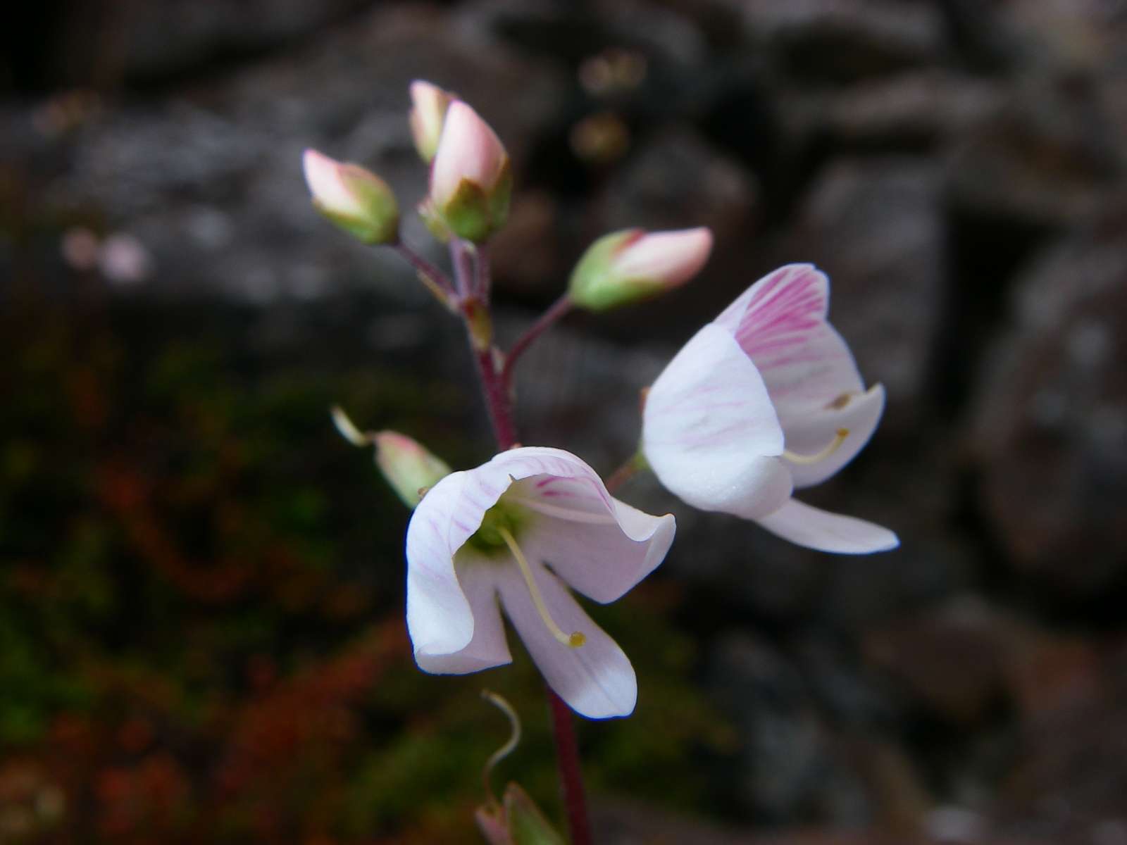
This looks something like a Gentiana, but the pistil is much too long.
Photo: Don Hitchcock, 30th January 2007
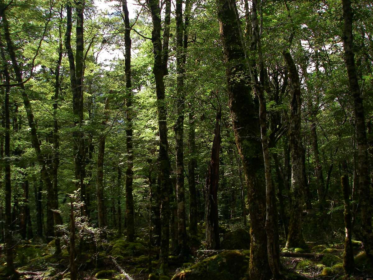
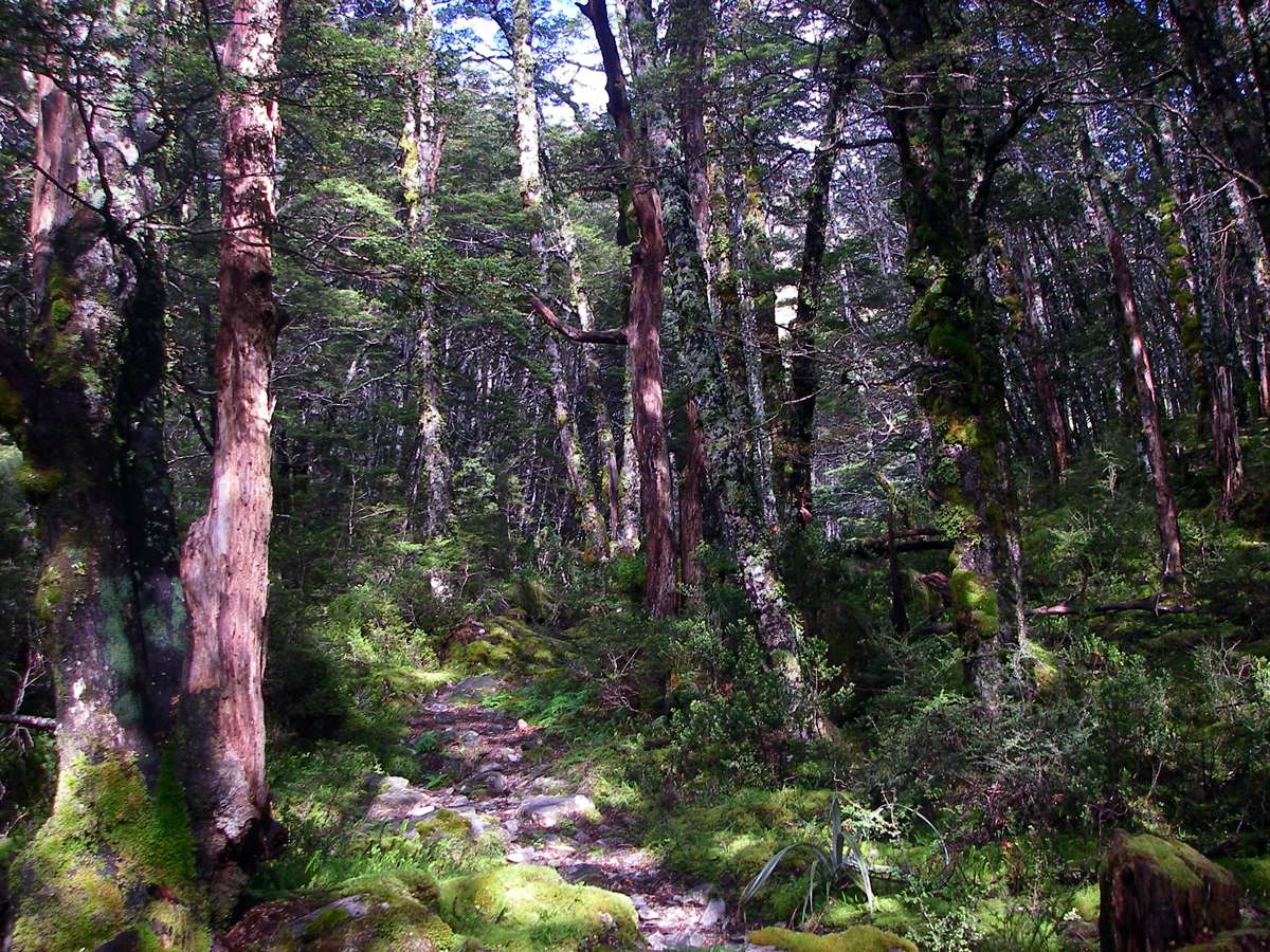
New Zealand has a lot of beech forests!
Photo: Don Hitchcock, 30th January 2007
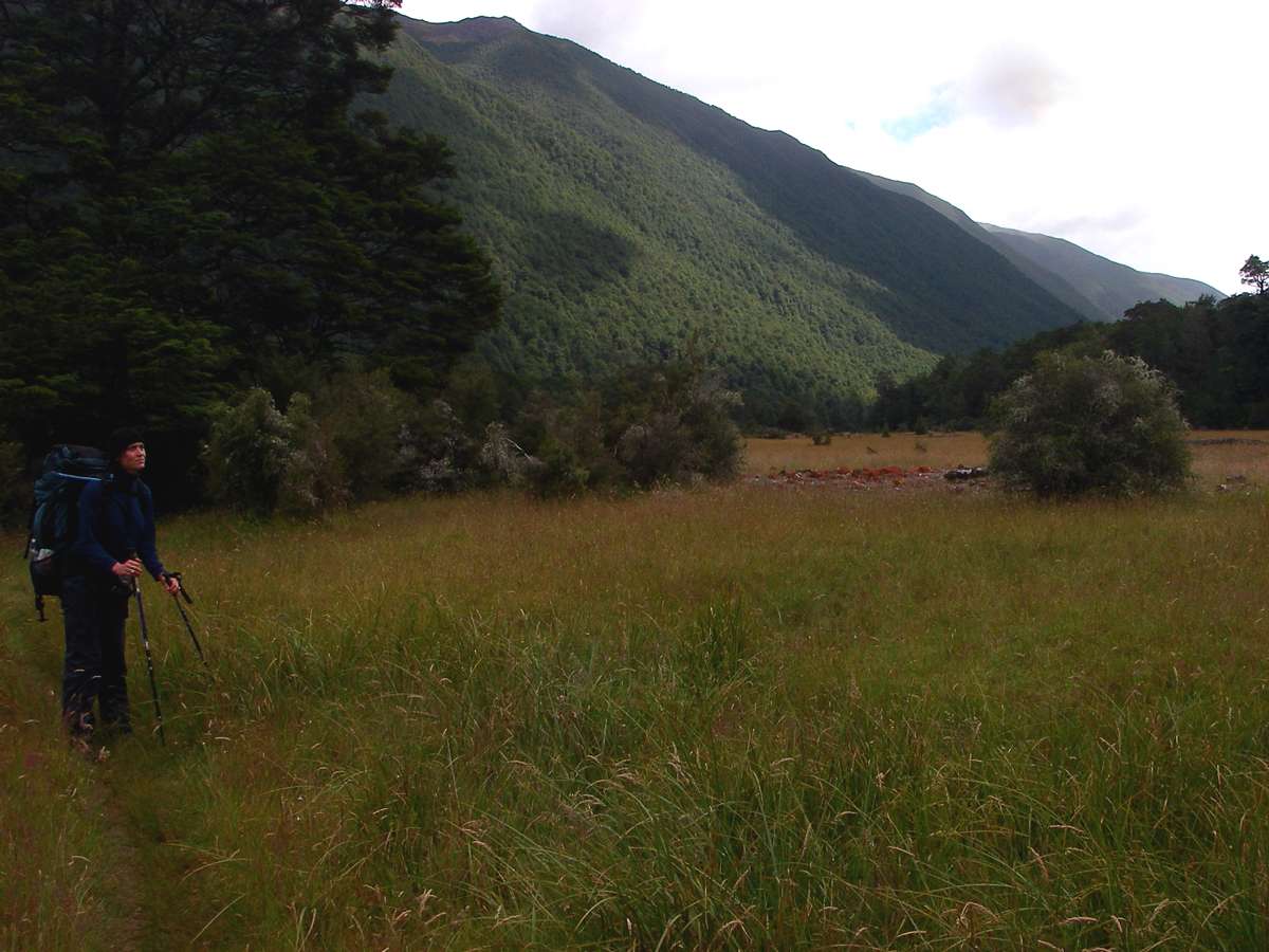
Finally the open valley of the Travers appeared. By this time I had met up with B., a walker going in the same direction, and we continued up the river valley. She was much faster than me, and soon left me behind. We met again at John Tait, where there was already a girl from the former East Germany.
Photo: Don Hitchcock, 30th January 2007
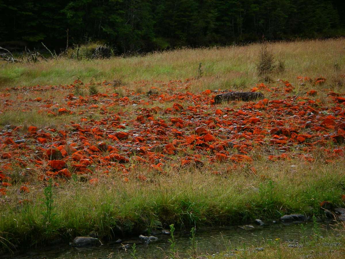
This brilliant red lichen was growing on rocks. This was the only place I saw it during nine weeks in the South Island.
Photo: Don Hitchcock, 30th January 2007
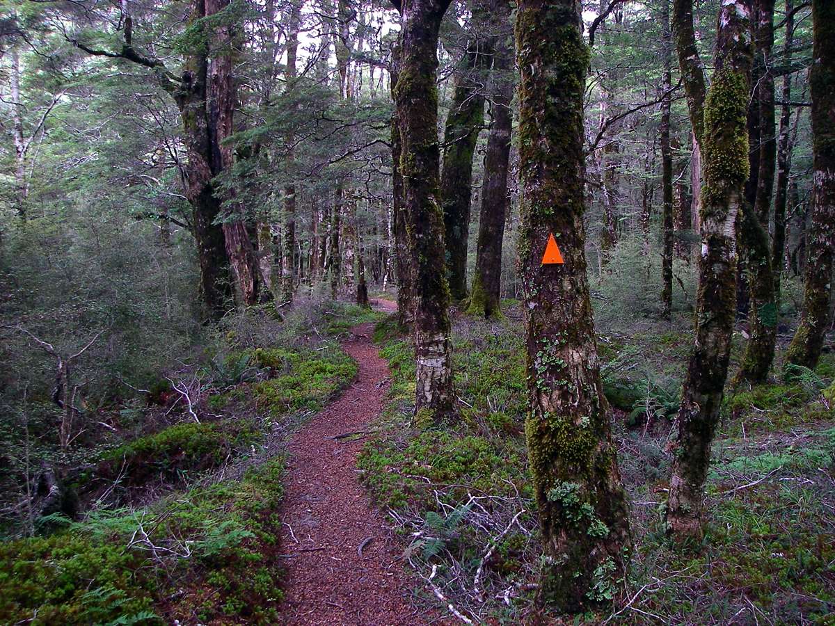
The track wound in and out of beech forest and open grassland. The track was a dream to walk on, it was well marked and softened by beech tree leaves.
All the NZ tracks are (usually!) well marked with orange triangles.
Photo: Don Hitchcock, 30th January 2007
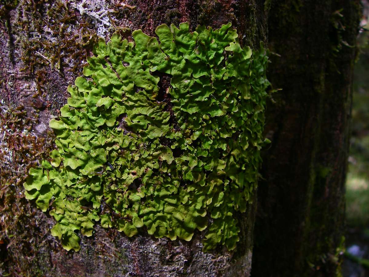
A green, shiny lichen on a tree.
Photo: Don Hitchcock, 30th January 2007
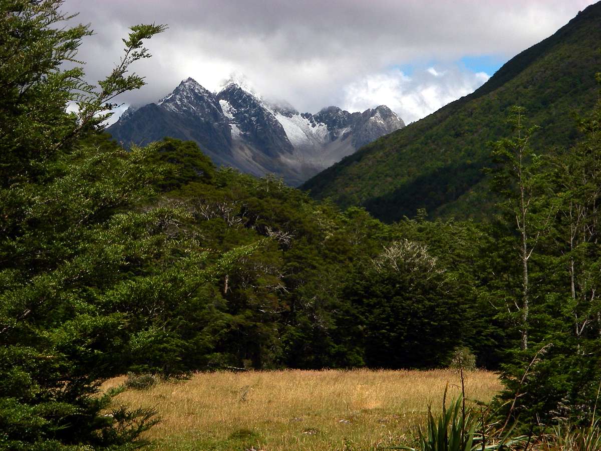

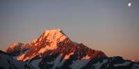
Mount Travers, 2338 metres tall on the skyline, forming one side of the Travers saddle.
The saddle over which the track goes is on the other side of the mountain!
Photo: Don Hitchcock, 30th January 2007

Another superb waterfall, no less beautiful because of its small size, where two waterfalls join and pass under a swing bridge hanging from wire ropes on the track.
The tracks on walks in New Zealand are superbly designed, made and maintained, on the whole, and the bridges are excellently constructed, making a minimal impact on the environment but always providing a safe (if sometimes wobbly!) crossing of streams which can be trickles or raging torrents.
Photo: Don Hitchcock, 30th January 2007
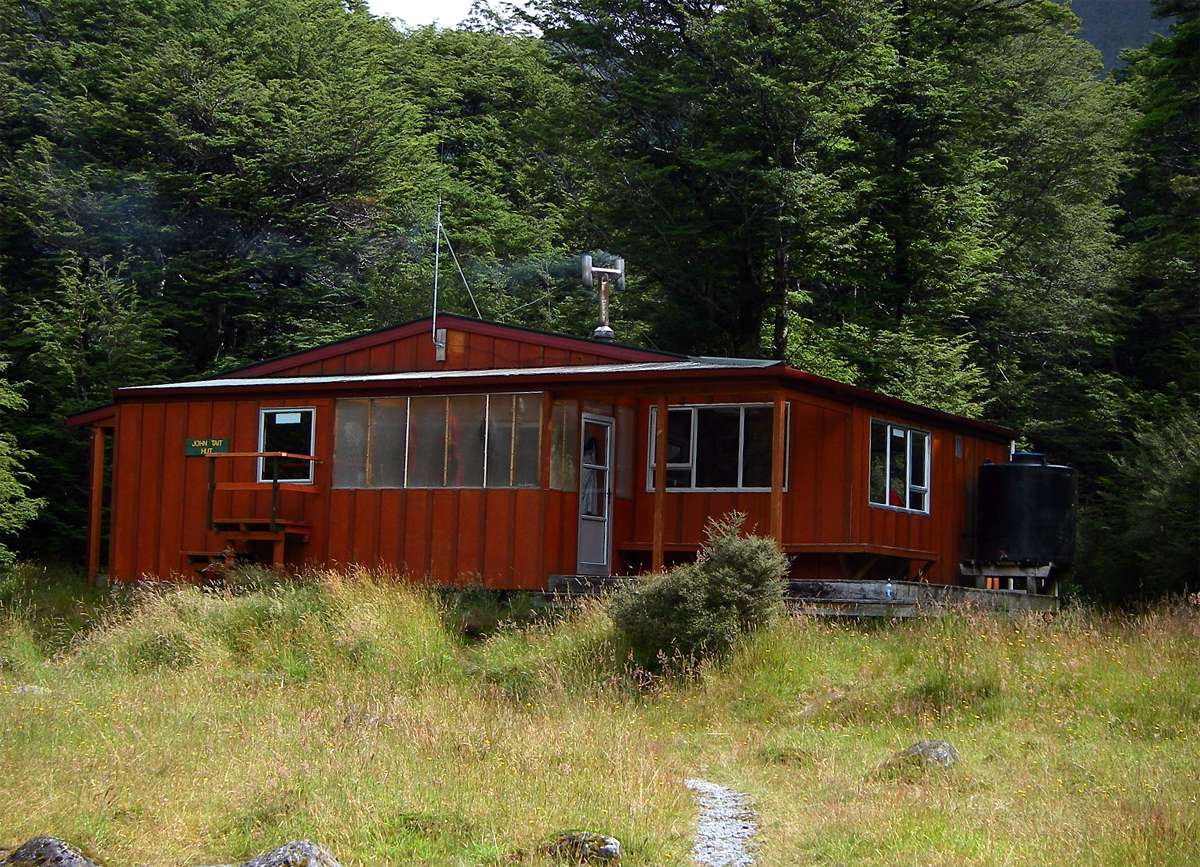
A few minutes later at around 3 pm, the welcome sight of John Tait Hut came into view. This photo was taken after I got a fire going.
The H formation of the chimney is to avoid rain getting in, and to stop downdraughts interfering with the drawing of the stove. It is an old method to regulate draught in situations where prevailing winds or turbulences cause downdraught and backpuffing, and works very well.
John Tait is a good hut, but needed some tender loving care at the time I was there. It had sleeping mats that needed replacing, there was something wrong with the water tank, either not all the water from the roof was getting to the tank, or there was a leak, or perhaps there had just been too many trampers, but the inside tap didn't work because the inlet to the tap was above the water level. There was enough in the tank so you could get rain water from the outside tap.
Photo: Don Hitchcock, 30th January 2007
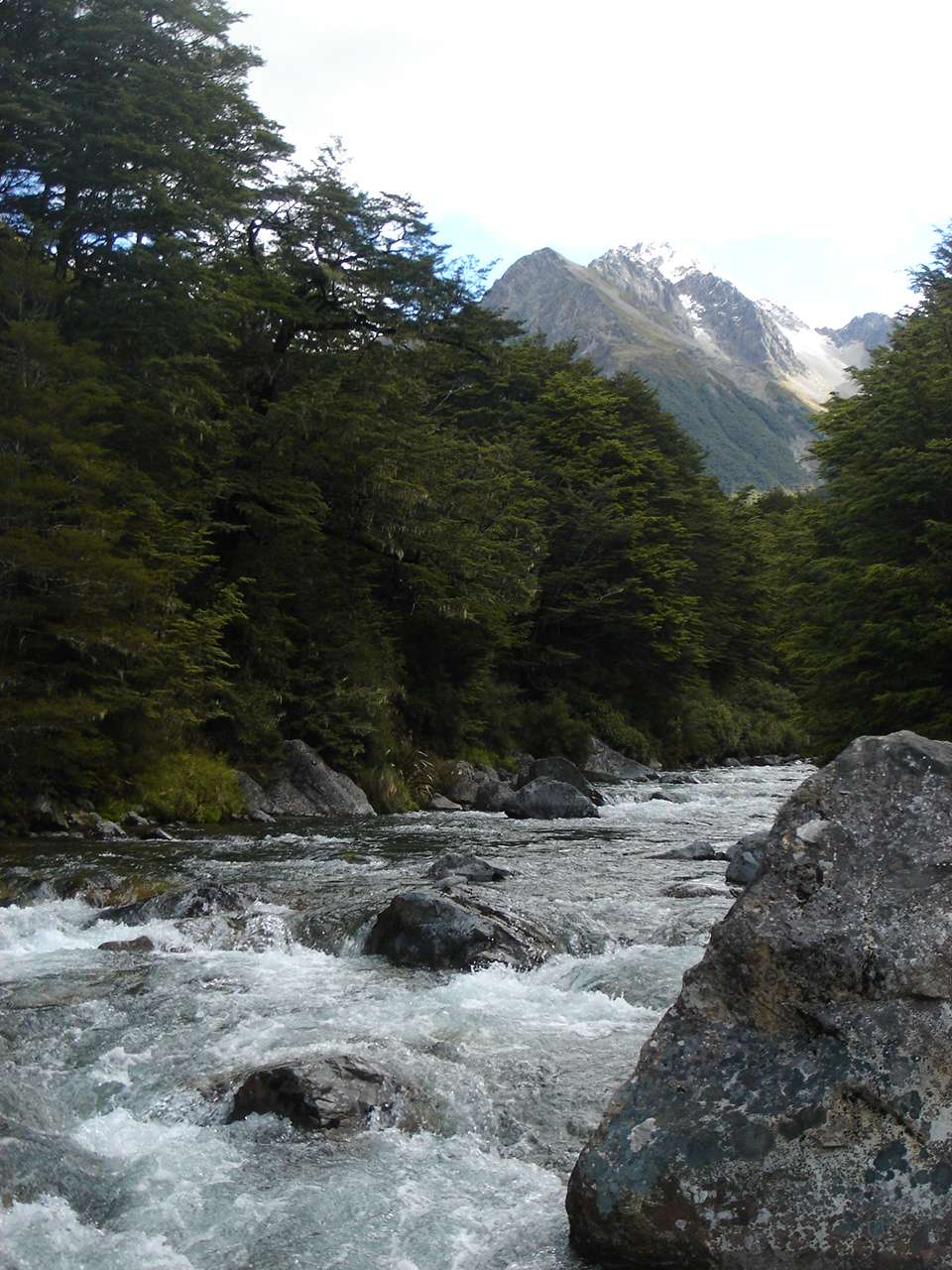
B. takes superb photographs, she has an artist's eye.
This is the Travers River near John Tait Hut, with a view of Mount Travers above the mountain stream, a real picture postcard shot.
Photo: B., 30th January 2007
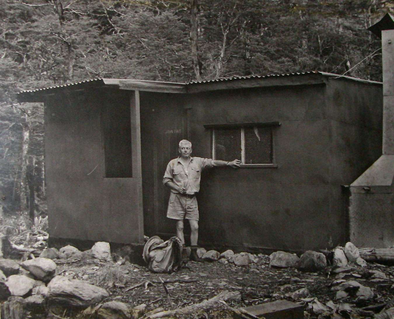
John Tait in front of the original hut, ten minutes above the present hut, at the Cupola Track junction. The photograph is part of a display set up in the present hut about this dedicated tramper.
Photo: Display, John Tait Hut. Photograph by Reg Webber, 1952.
Recollections on the building of the John Tait Hut
The John Tait Hut that you see in the Travers Valley is not the original! It dates from 1978. The first hut was built with love and enthusiasm in 1951. Her is its story.
John Tait was president of the Nelson Tramping Club from 1948. He climbed Mt Travers during a summer holiday with his family and saw the need for a shelter well up the Travers Valley.
The Man
Many people using the hut have wondered how John Tait was, so I will tell you a little of the man - my father - as I saw him. Born in Scotland in 1901 (died in Nelson in 1982), he came in his early teens with his family to Nelson where his father, also John Tait, was to take up a position of organist and choirmaster at All Saints Church. After attending Nelson College he gained an MA at Canterbury University and many years later with his wife and three daughters returned to teach at his old school. He was an unselfish man, modest almost to a fault, as shown by his considerable reluctance to have this hut named after him. He was public spirited and a classical scholar, though not obviously so - but we all knew the meaning of "excelsior" when climbing with him! Gifted musically, he was at one stage acting conductor of the Nelson Male Voice Choir. His dry Scots humour was widely appreciated and helped defuse many a tricky situation. And he was a great organiser! The nickname given to him by Club members throughout the building programme was "The Moving Spirit". The back country of New Zealand which reminded him of his native land attracted him and his enthusiasm was passed on to his family; when the hut project arose all were keen to help. Preliminaries: As early as 1948 the Rotoiti Scenic Board gave the Club its fullest support but were unable to assist financially as funds at that time amounted to a meagre £2/12/7! But a "one to one" subsidy was obtained from the Government.
The Club Captain at that time was Dave MacMorland, a draughtsman with the Lands and Survey. He drew up a plan based on a prefabricated Publics Works hut, ordered the materials and organised a trial assembly of it in a Nelson backyard. It was then dismantled, the wooden parts pre-painted and tied in bundles suitable for an adult to carry; each was colour-coded with rags from the family scrap bag. Club members took the materials by hired truck to the Lake where they were stored in a boatshed on the foreshore. The next step was to ship the gear to the lakehead. And so began a series of trips uin the Tait family's fourteen foot dinghy, clinker built with two sets of oars and a high bow where one could snooze on a sack and enjoy the lapping of the water when not "on duty".
Now this was where "Woman Power" came in, in the form of John's none-too-heftily built daughters - Jennifer (17) Alison (14) and Catherine (10) who had been taught boating skills by their yachtsman father who rowed with them. The return trip took about four hours. Sometimes leaving at 8 pm on a moonlit night, thus avoiding the "chop" on the water and sun's heat, and sometimes leaving at dawn when the calm lake mirrored the surrounding peaks, they transported all the wooden frame. The aluminium walls and roof went on the Stratford's launch.
Up the Valley
So during the six weeks of the 1950/1951 summer holidays, many family "picnics" were held in the lower Travers. With the help of family (including our elderly grandmother) and unsuspecting friends whom we'd managed to lure up there, the wooden bundles were slowly but surely moved up the valley through grassland, matagouri and bush. Even the principal of Nelson College for Girls, Miss Clarice Johnstone, was co-opted in return for her lunch. Tramping time from Lakehead to Hut site is five and a half hours - about 16 km of valley tracks. Clearly this was too far to carry heavy loads in one trip, so several short stages were used to give the porters more frequent breaks. The streams were unbridged in those days but in midday heat the chilly waters were welcome.
The first cache was under a large beech known as the Mistletoe Tree where curious cattle investigated these strange bundles, slobbered over the paint and chewed off some of the colour coding rags! But how to carry that bulky chimney cowling? John solved that one by getting inside it with his head, covered by his elderly "stetson", poking out of the top - gales of mirth from the family! Walking behind him as he puffed on his beloved pipe was an experience to remember. After this initial family effort members of the Nelson and Blenheim Tramping Clubs took over - all voluntary labour of course.
The Site
The hut site was right beside the Travers River, ten minutes walk past today's hut. The Travers there is just a burbling mountain stream. The site had to be cleared, and during this time some rare green geckoes were discovered. Mountain cedar with its durable timber grew nearby and this was used for foundations.
Building the Hut
During Easter of 1951, fortunately in perfect weather, the hut was erected on site by a keen working party. A Tilley lamp hung from a tree to extend the working hours. The hut contained six double wooden slat bunks (to sleep 12) and a table and had a porch for firewood, packs, wet clothes and boots. An open fire provided heat but downdraughts in the narrow valley made it smoke badly.
Ten years later, under the guidance of George Lyon, Parks Board Ranger, the open fire was replaced by a stove, a wooden floor was put in and the slat bunks were replaced by cyclone netting which squeaked horribly when bodies stirred in the night! This time the unbreakable materials were air-dropped from a fixed wing plane, but the stove was carried up in pieces along with three bags of cement.
The Opening Ceremony
This was made memorable by the actions of one bright spark who placed a sack over the chimney and bolted the door on the outside. My sister Alison, the youngest there, lit the first match and recalls the terrible coughing and spluttering which followed! This was prophetic as the chimney continued to smoke... well documented by acid comments in the log books! But as John would have said, "Better than a night in the wet bush"!
The following summer, family and friends made a day trip to the hut, rowing up the lake and back for good measure. With them were ski-club members Clem and Reg Webber, who had been most supportive in the venture. Reg was responsible for the pictorial record.
As well as hard work, the whole exercise was fun and most worthwhile as it proved over the years. It showed what can be achieved when someone has a vision and the ability to carry it through.
It was quite a poignant moment in 1978 to see the flattened remains of that small hut lying near the helicopter pad at St Arnaud township. No small credit in the writing of this article must go to my sister Alison whose memory dovetailed mine in a most satisfactory manner.
Jennifer H. Norris, May 1991
Bushwalking, Hiking and Tramping in New Zealand
Bushwalking Index
Anyone (e.g. students, teachers, libraries, government agencies such as tourist bureaus, the general public) may use, print and publish the photographs taken by me and presented on this bushwalking file for any legitimate non-commercial purpose, at no cost, and without asking permission. However a note such as "Photo: Don Hitchcock, donsmaps.com" somewhere in the document would be appreciated if it is to be published.