Back to Don's Maps
 Bushwalking Index
 Chandler River - Bushwalking and Hiking
These photos and accompanying text are for the interest of armchair travellers only, and do not constitute comprehensive instructions for bushwalkers.
The Chandler River Gorge is for very fit, very experienced and well prepared bushwalkers only. There is no track, it is very strenuous, and bush craft, topographical maps and compass are required. Sufficient water and food and survival equipment should be carried. One or more overnight camps are usually necessary, for which sufficient appropriate equipment should be carried. Always carry a Personal Locator Beacon, and tell reliable people where you are going and how long your party will be away. Mobile phones do not work anywhere in the gorges for sure, and almost never even on top of the cliff line.
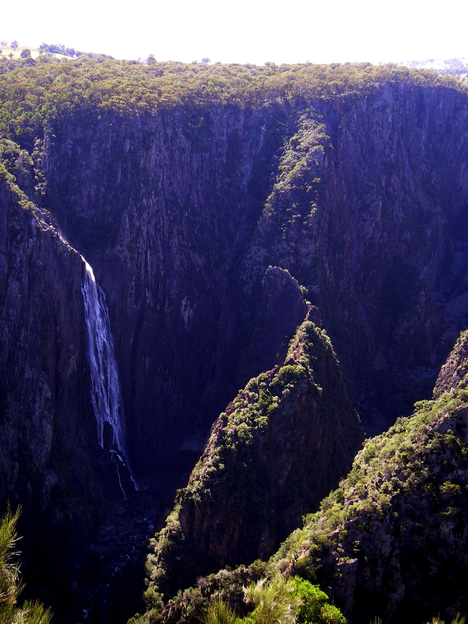
Wollomombi Falls. There is a narrow ridge in sunlight in this photo which divides the Wollomombi River from the Chandler. It is composed of rotten rock, and rockclimbers have had a few scares on it. You cannot walk to the bottom of the falls, it is accessible only by rope.
Photo: Don Hitchcock April 2006
Wollomombi Falls with not as much water coming over the falls, despite reasonable spring and early summer rainfall.
Photo: Don Hitchcock November 2008
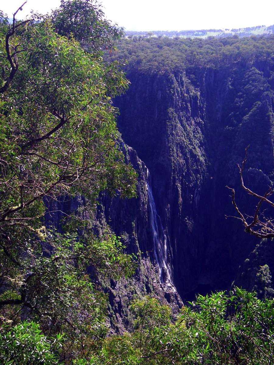
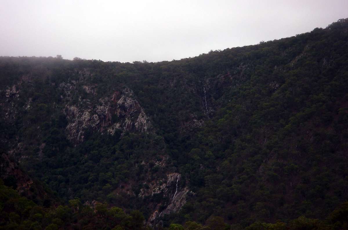
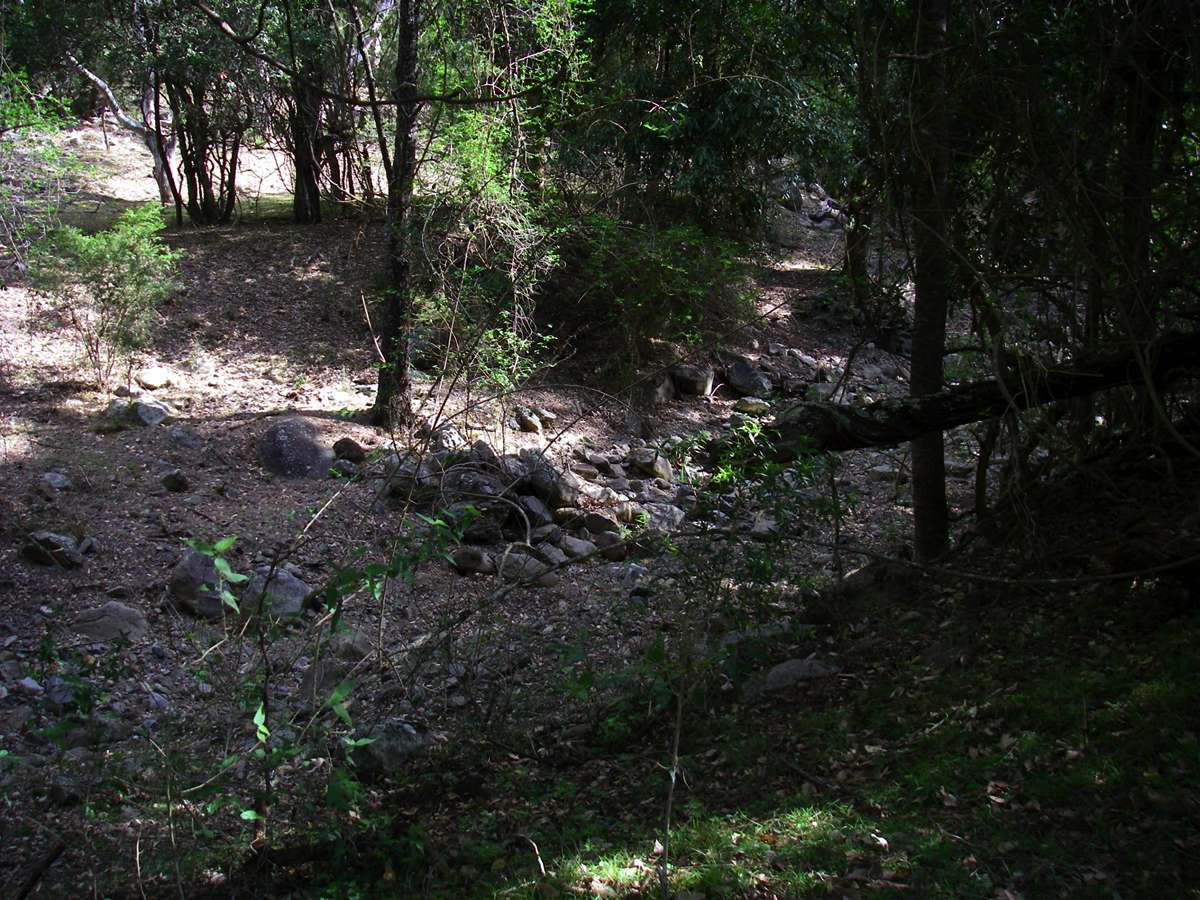
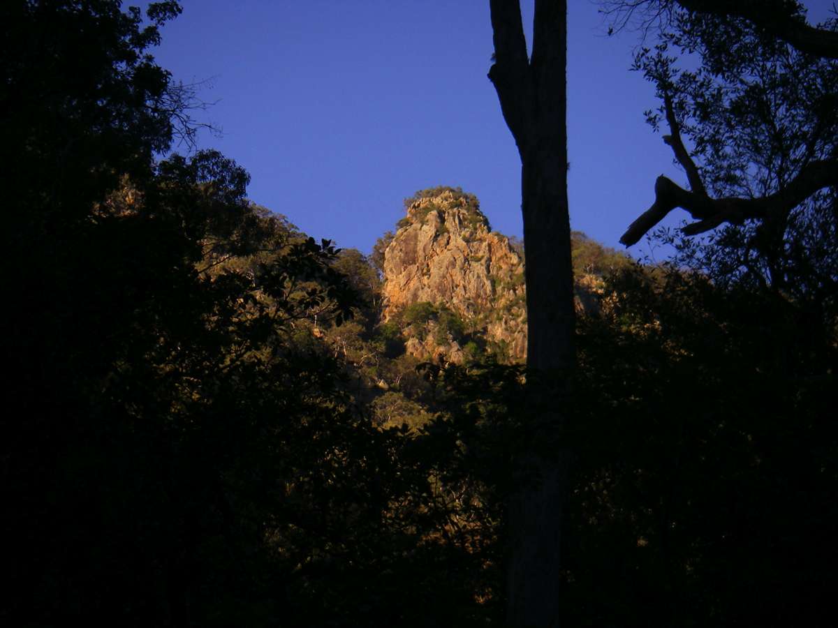
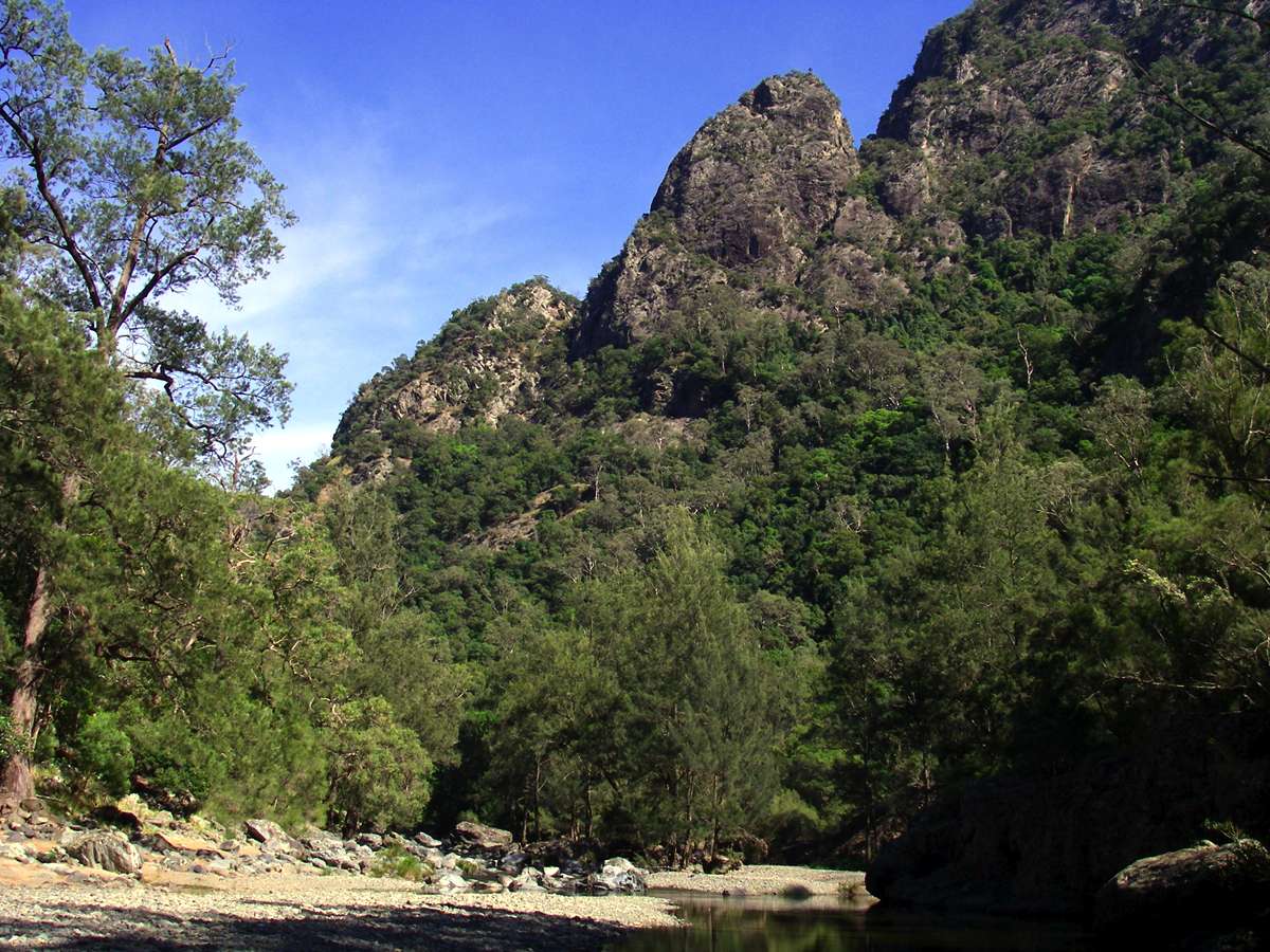
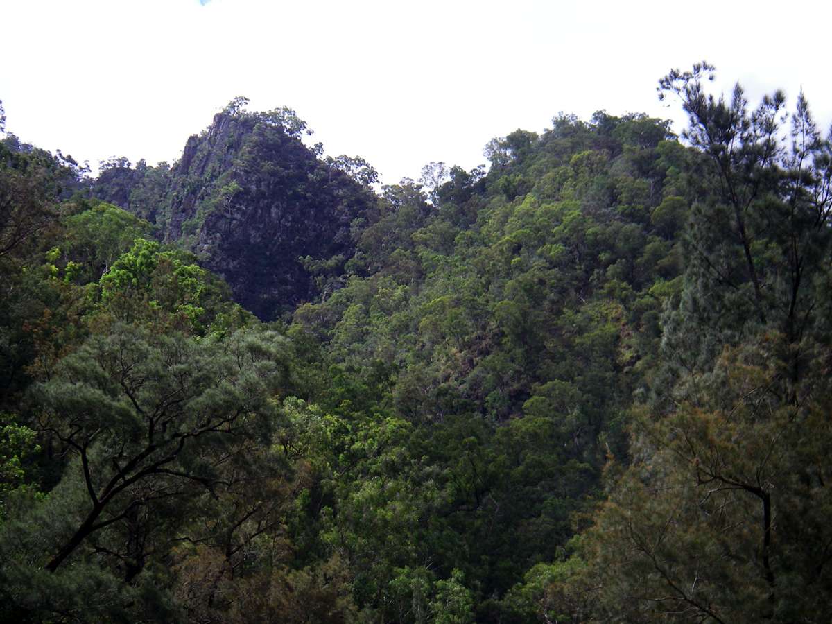
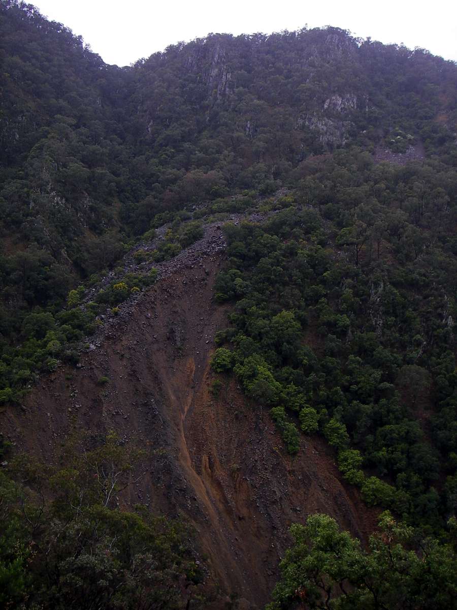
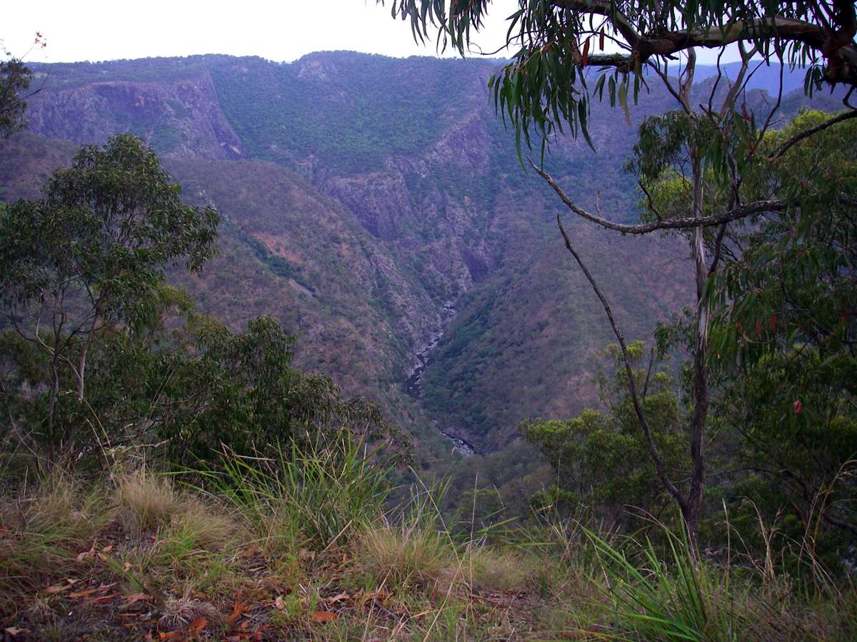
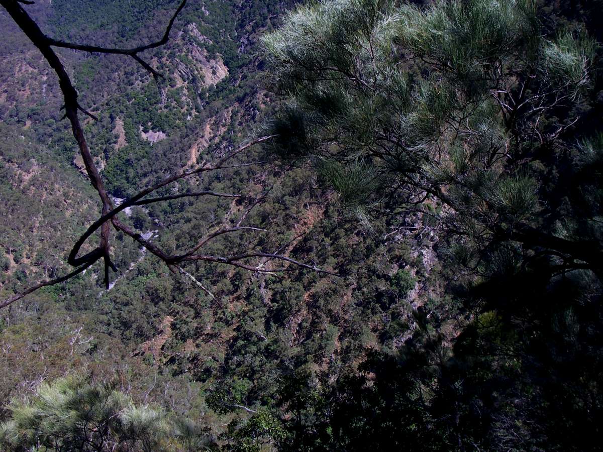
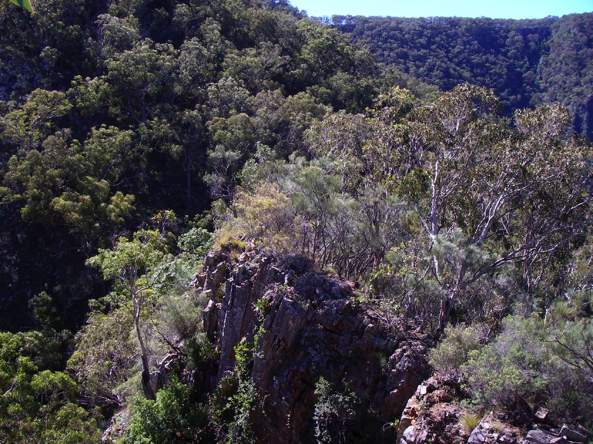
Chandler Gorge.
Wollomombi Falls just visible at the head of the gorge, Chandler Falls to its right behind a ridge.
This section of the gorge is not accessible to bushwalkers, and provides a challenge for fit, agile and experienced rock climbers.
Photo: Don Hitchcock Chandler Lookout, March 2008
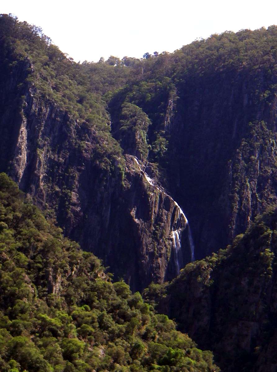
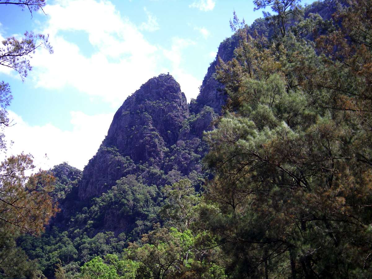
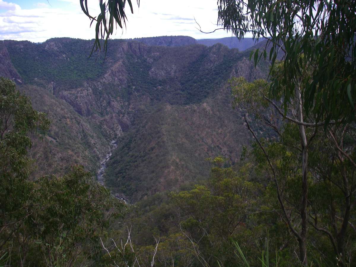
Wollomombi Falls zoomed in from the same vantage point.
Photo: Don Hitchcock November 2008
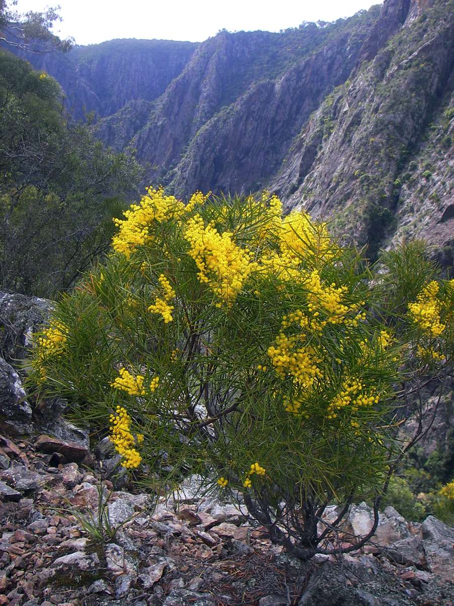
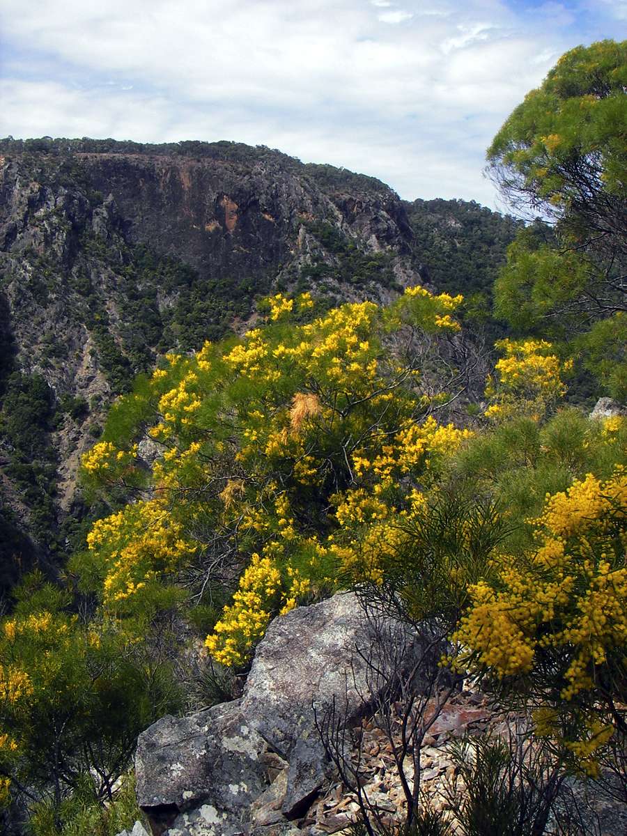
Taken from the same vantage point as the photo above, these wattles were in flower in September. Acacias as a group have a long flowering season, and can be in flower at any month of the year, depending on the species.
Photo: Don Hitchcock September 2005
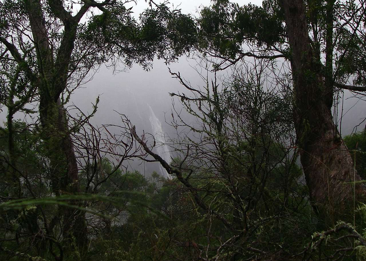
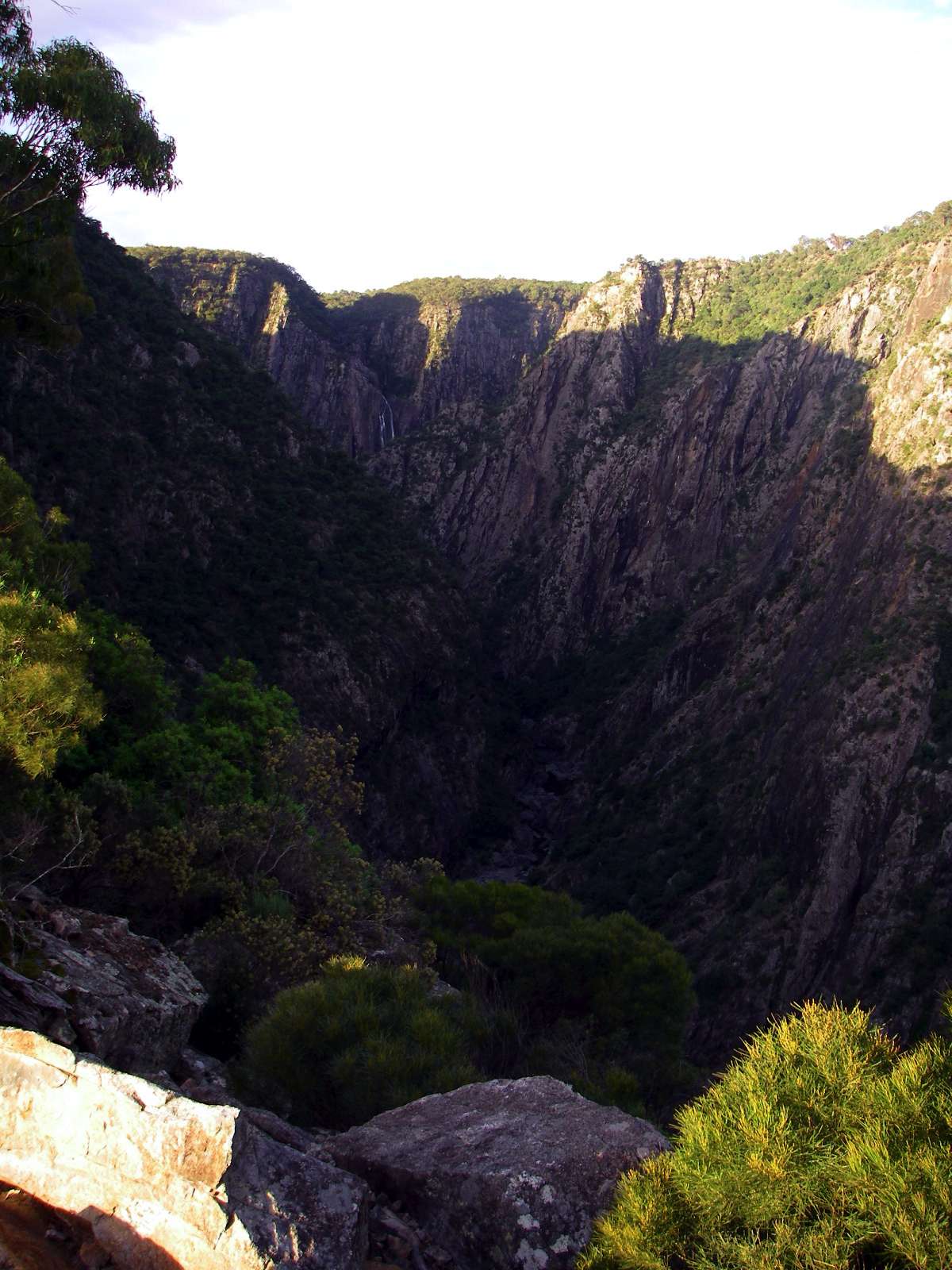
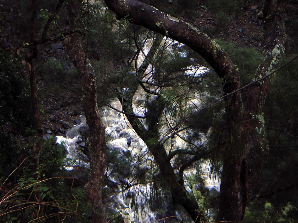
Wollomombi Falls in full flood, seen through mist and rain.
Photo: Don Hitchcock January 2008
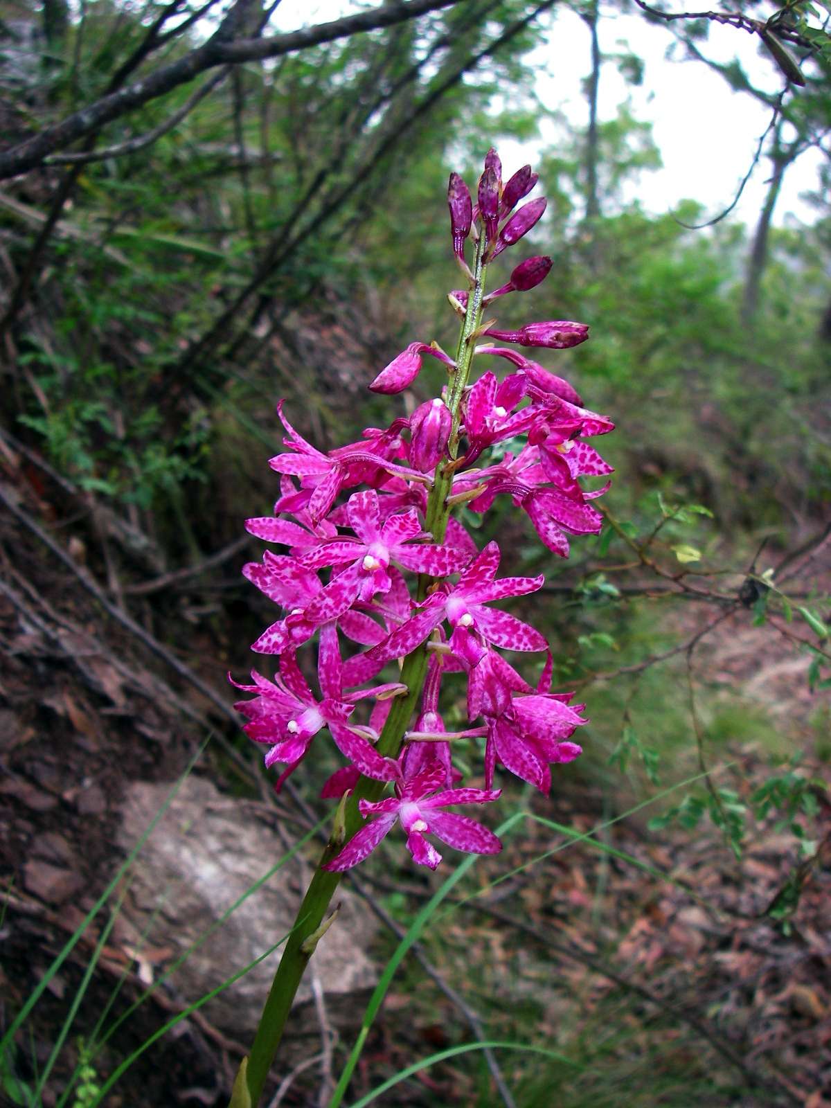
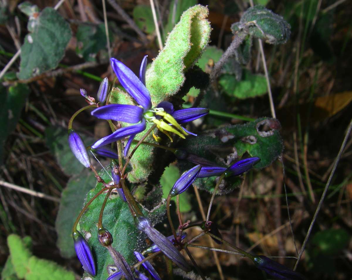
Spotted ground orchid. Australia has a wealth of orchids.
Photo: Don Hitchcock January 2008
Zoomed shot of an unusual sight - Saint Helena creek in flood, during the very wet weather of December - January 2008. This was a once in twenty year event, I've never seen so much water in the gorges since I started walking there in earnest in 2000, when the children were grown. Saint Helena has two major waterfalls along its length, as shown here.
Photo: Don Hitchcock January 2008
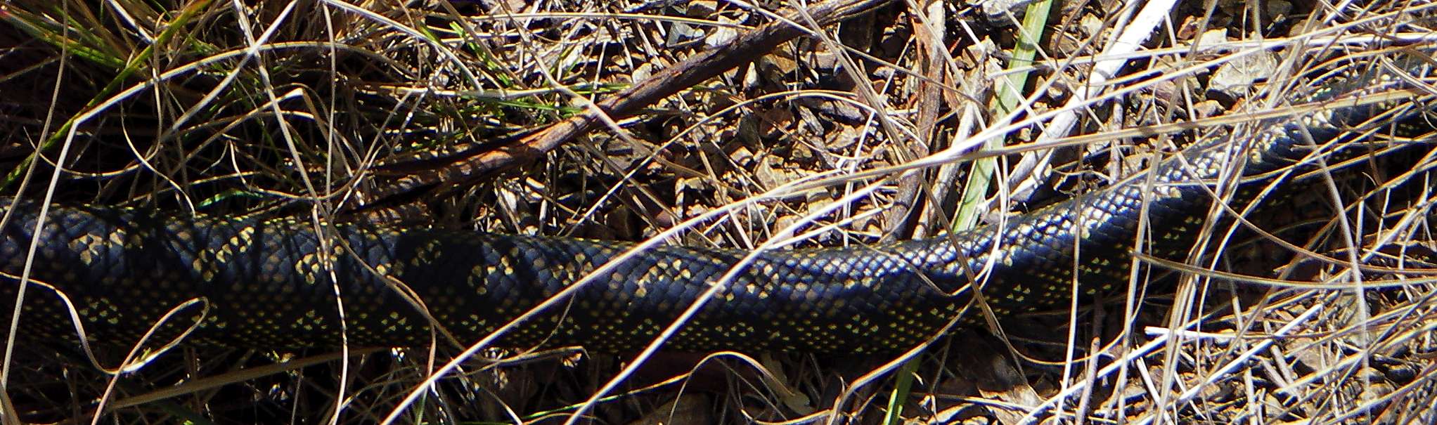
Carpet Snake (Morelia spilota) in the Chandler Gorge. The snake fell on me from a low tree branch upslope, giving me quite a start(!) until I realised what species it was.
Photo: Don Hitchcock September 2005
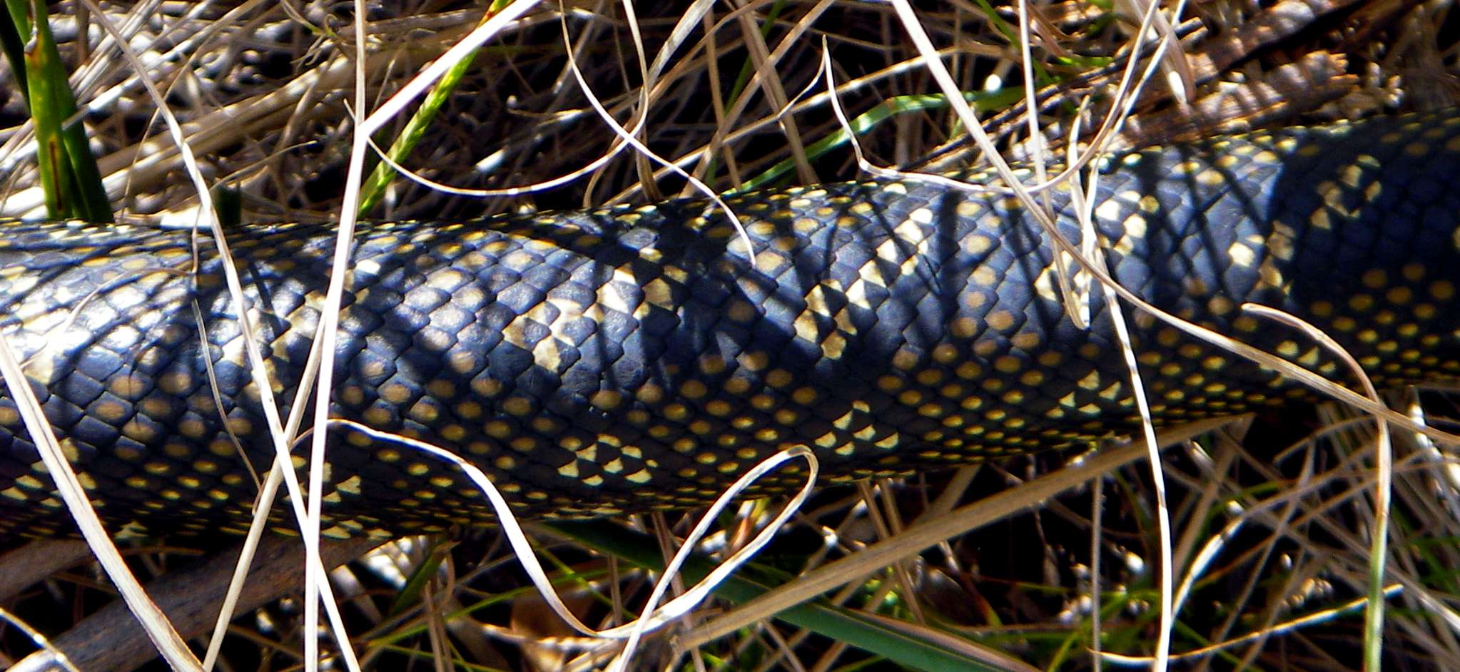
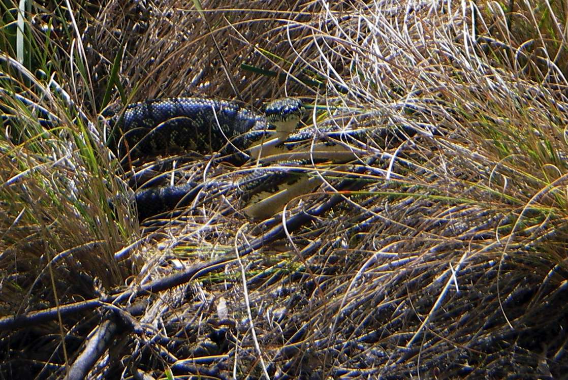
I took the opportunity (left) to get a close up of the scales since it was showing no interest.
When the snake decided to take a closer look at me (right), I backed away - I'd hate to be a victim of mistaken identity, though I was pretty sure of its species. Carpet snakes are also known as Diamond Pythons, and are not poisonous. Adults can grow to 4 m in length and weigh over 5 kg.
Photo: Don Hitchcock September 2005
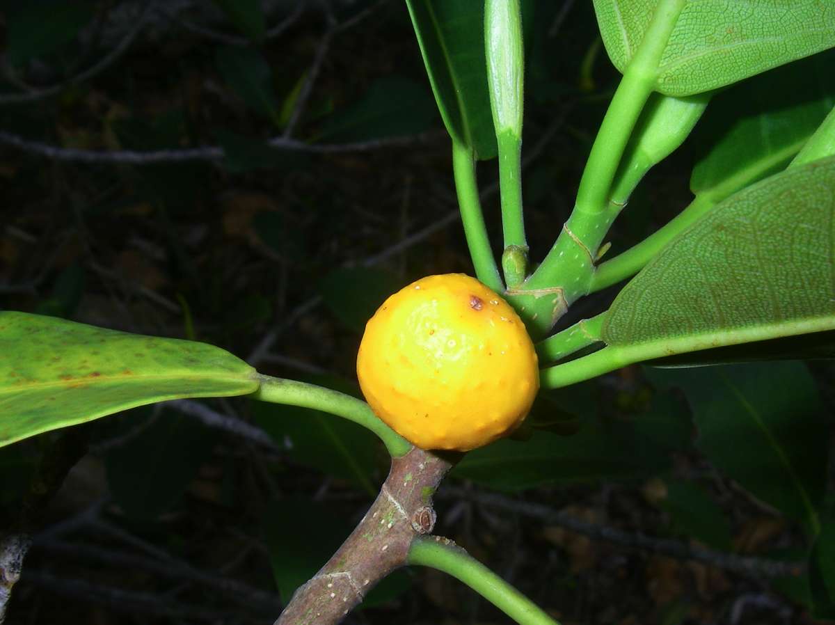
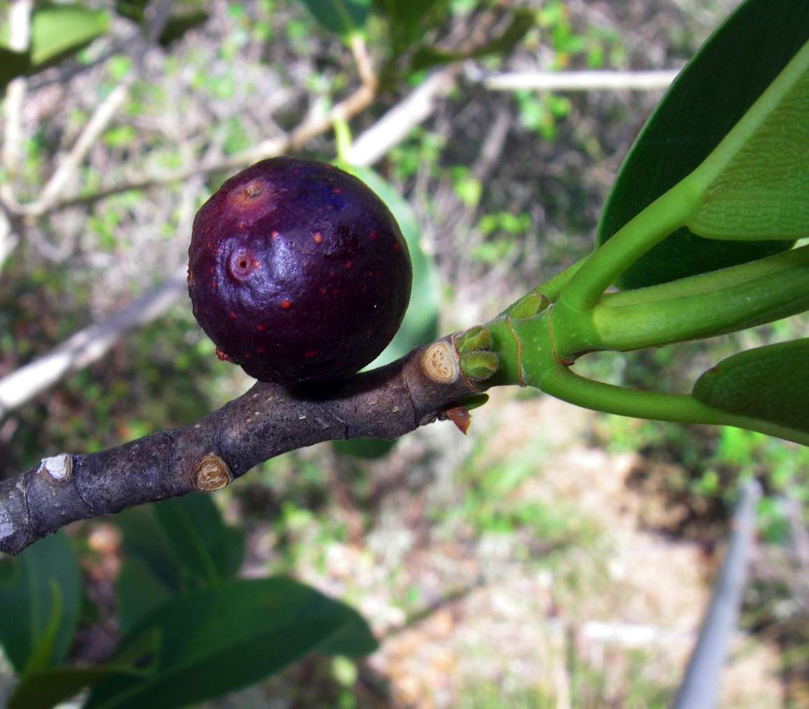
Native Fig with very few but larger than normal fruit. The fruit is edible, and much favoured by many of the birds which frequent the gorge.
Photo: Don Hitchcock November 2008
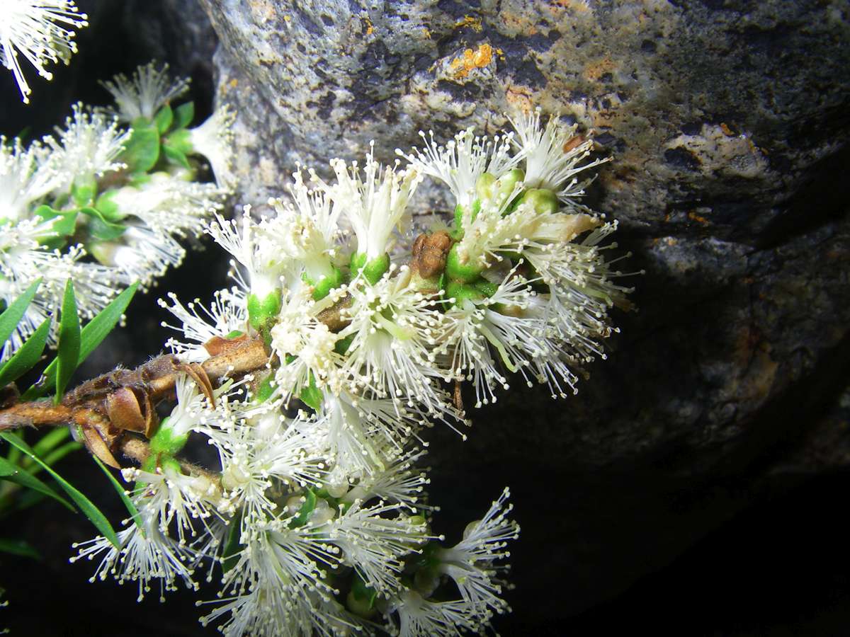
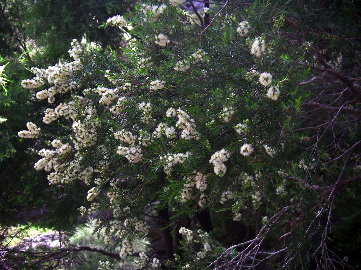
Melaleuca sp.
Photo: Don Hitchcock November 2008
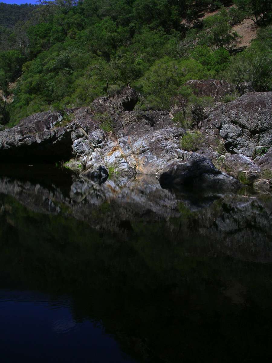
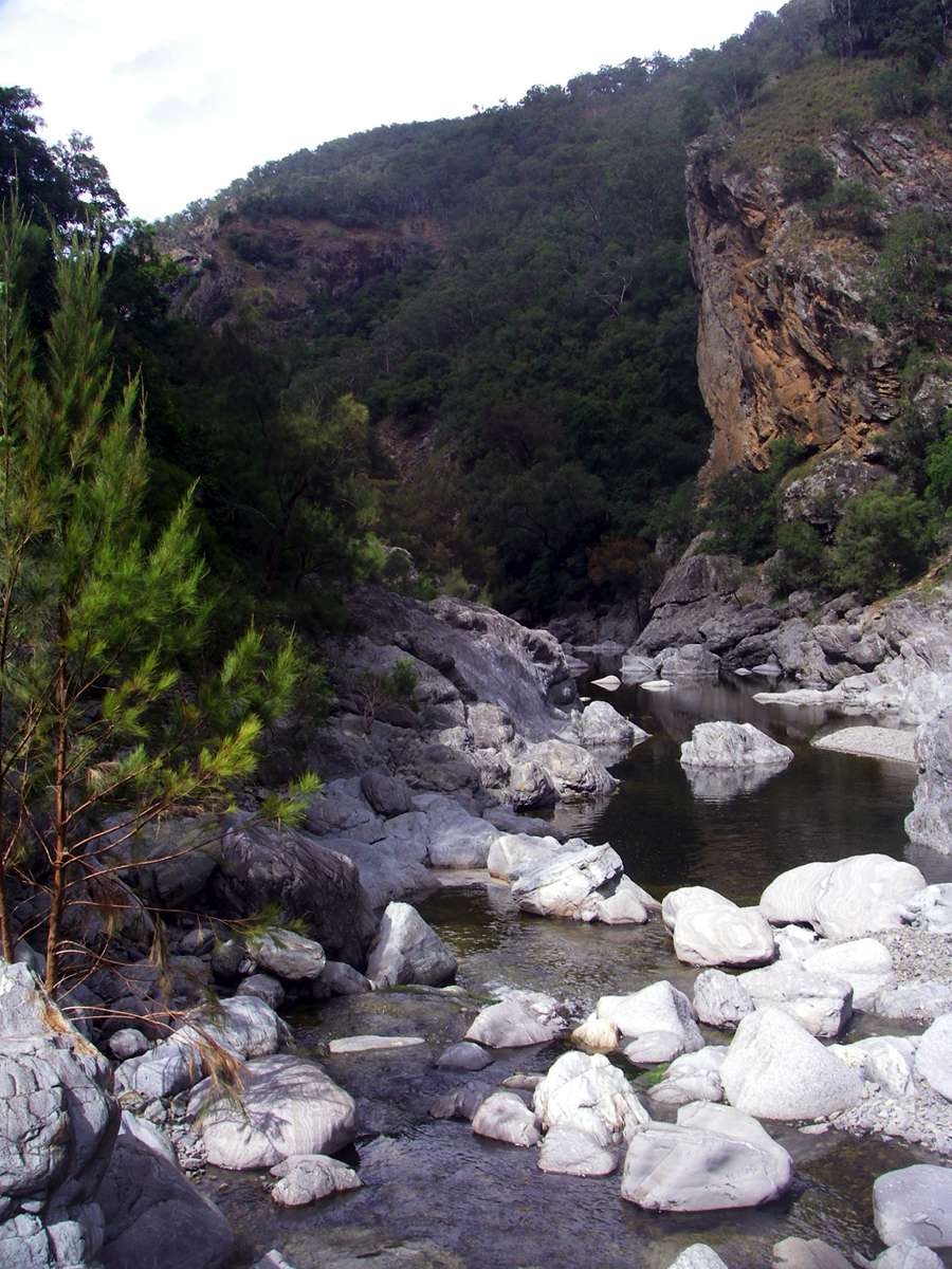
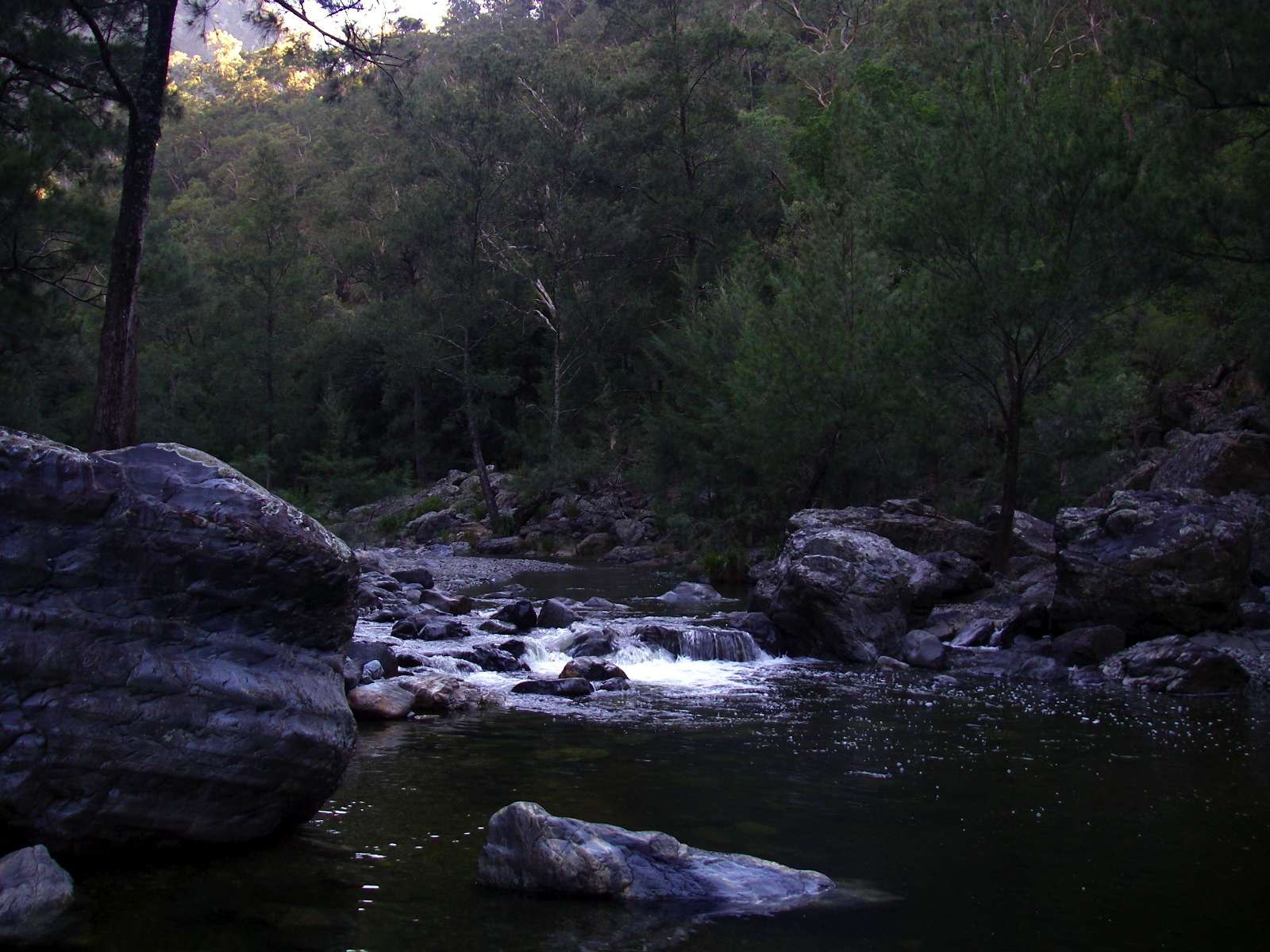
Reflections in the Chandler, on one of the many deep pools in the upper reaches.
Photo: Don Hitchcock October 2007
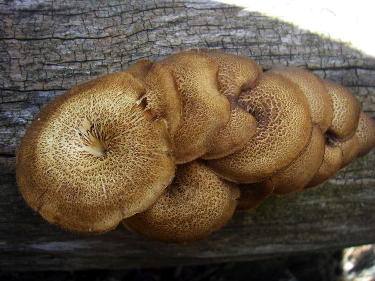
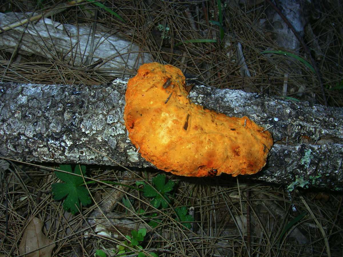
Fungus. The gorges are a treasure trove of these interesting life forms.
Photo: Don Hitchcock November 2008
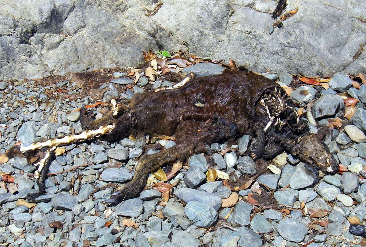
Brush Tailed wallaby carcass. The gorge system is home to around 90% of this species. This one may have fallen from the very steep rock wall above, which is their typical habitat, or perhaps it died of old age.
Photo: Don Hitchcock November 2008
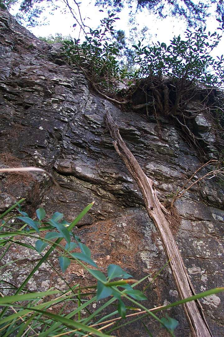
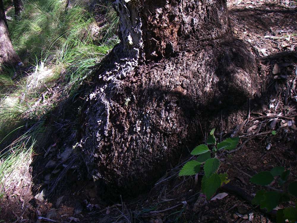
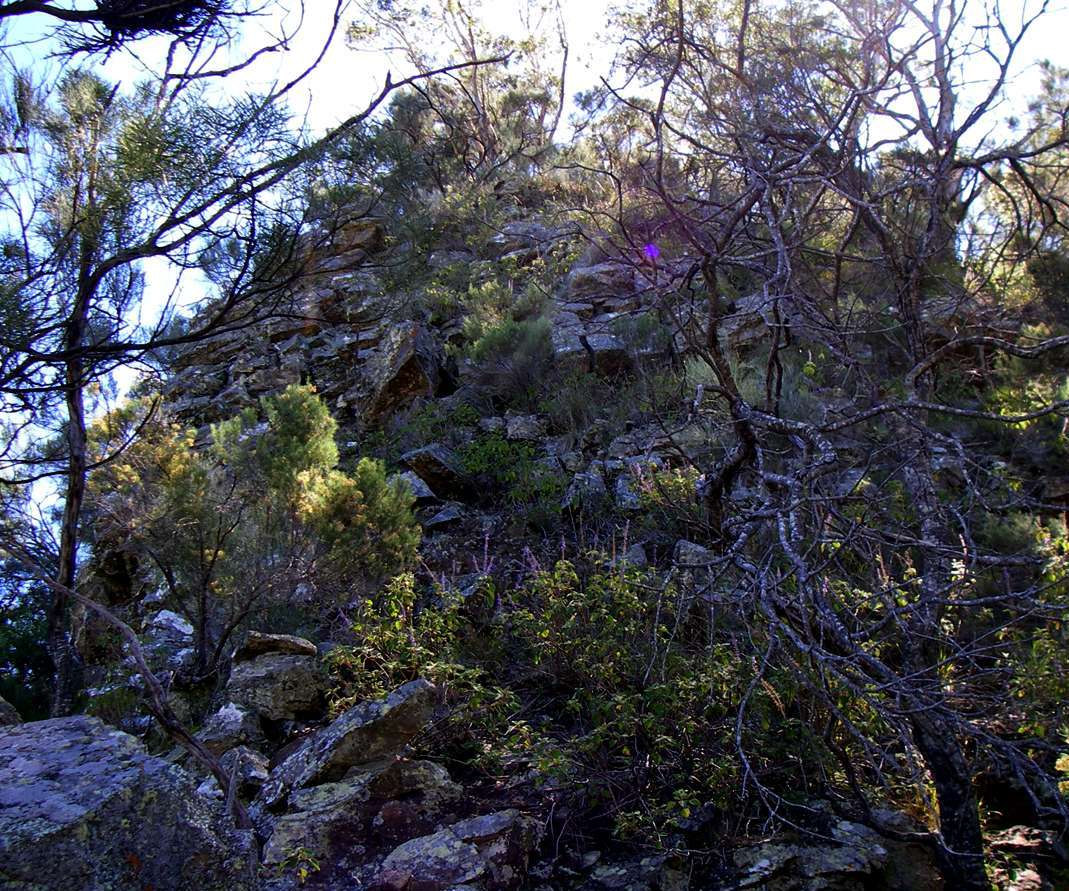
This rock offers a little climbing practice. The branch has been there for many years, as an aid to getting up and down safely.
Photo: Don Hitchcock May 2004
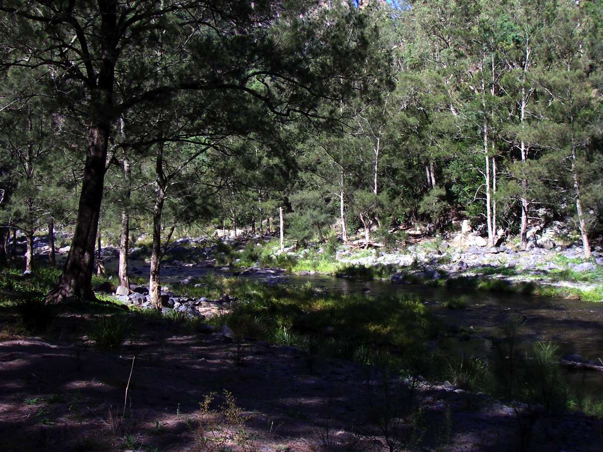
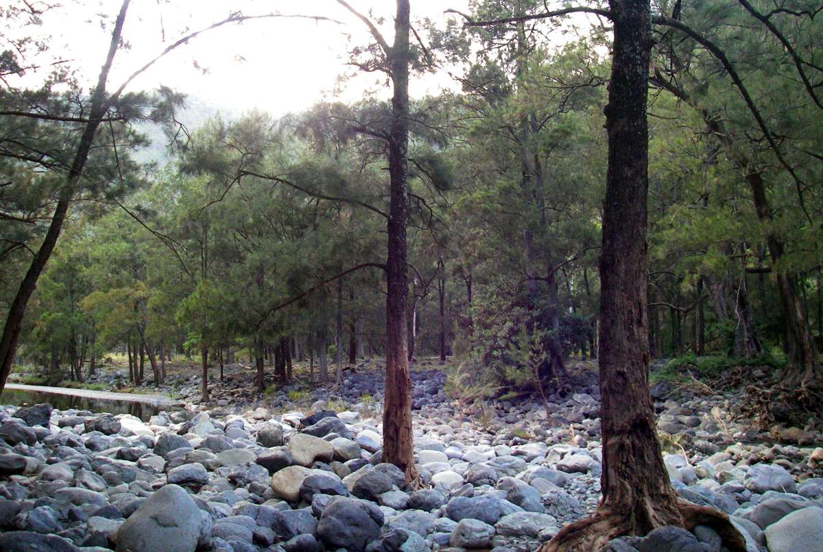
One of my favourite camp sites in the whole gorge system, just downstream of Green Gully Creek.
Photo: Don Hitchcock April 2006
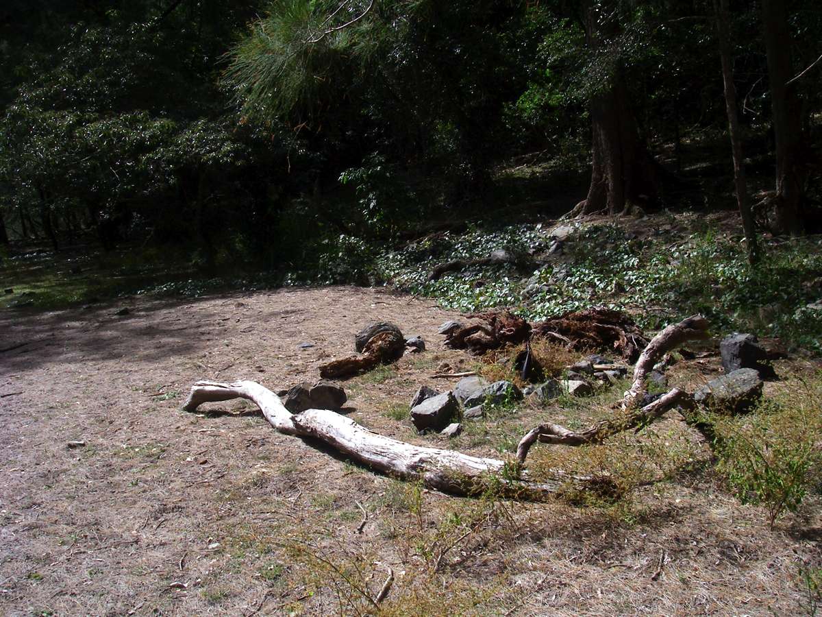
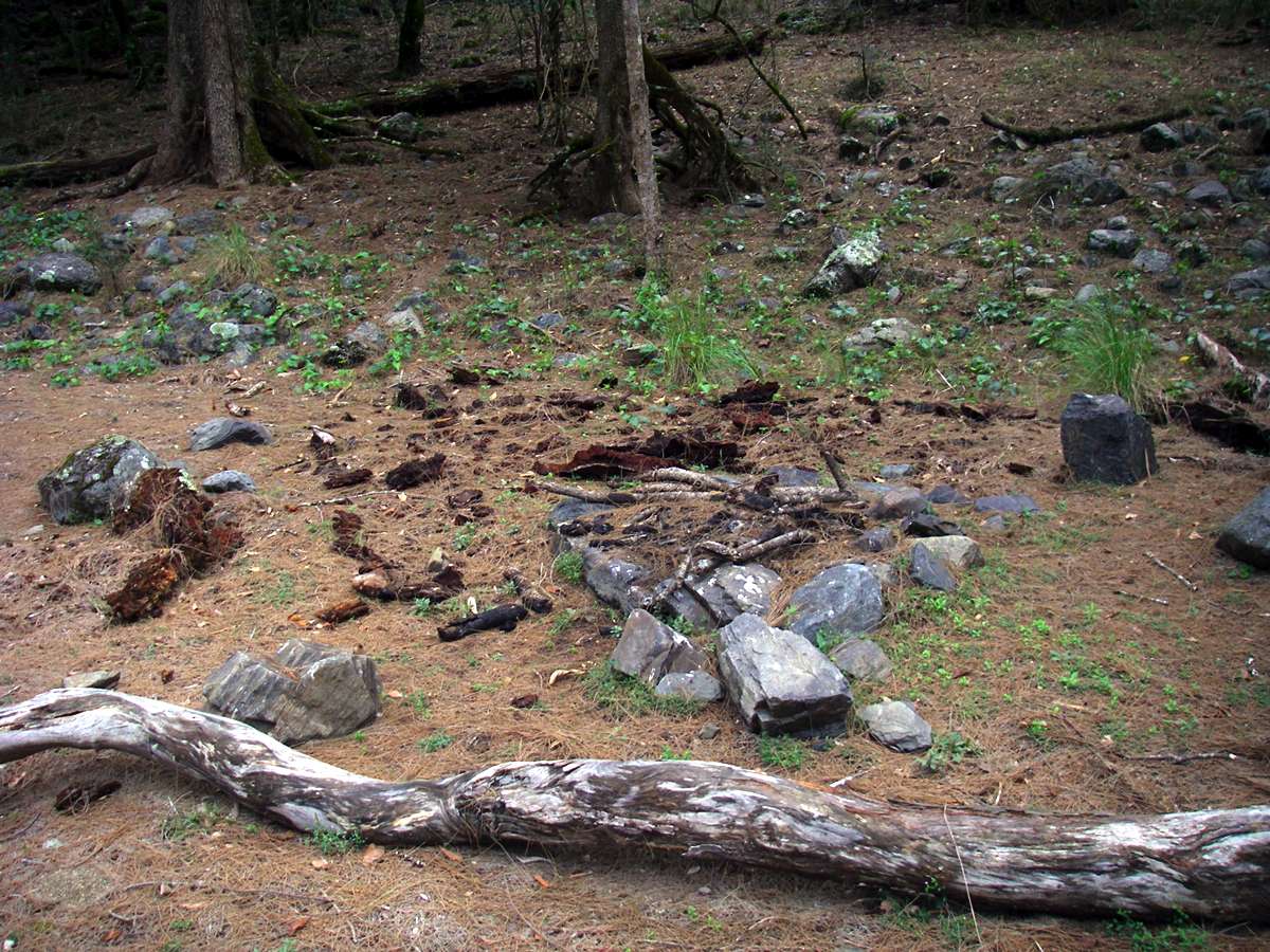
The fireplace at the camp site in March and in November 2008. In the intervening period the remains of what used to be a great log seat for seven or eight years crumbled to dust.
Photo: Don Hitchcock March, November 2008
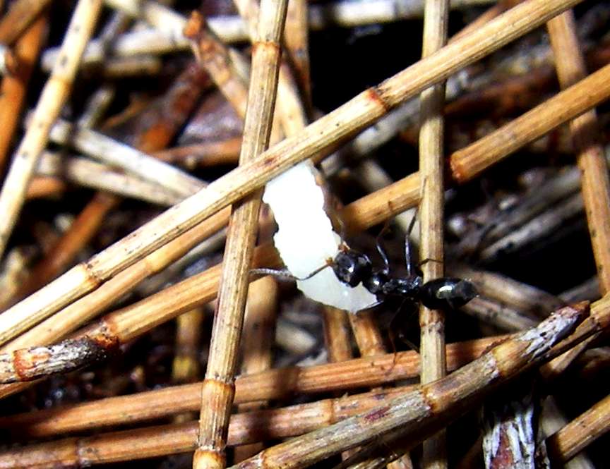
An ant with a huge prize - a crumb from my lunch bun. Australia has a staggering number of ants and ant species.
Photo: Don Hitchcock November 2008

What I call Pulpit Rock on Church Rock, in the Chandler Gorge, seen in miserable weather from the campsite above, left, and in idyllic weather, right.
Photo: Don Hitchcock September 2005, October 2007
Church Rock and Pulpit Rock seen from Green Gully Ridge.
Photo: Don Hitchcock May 2008

Still raining heavily, packed up in the morning after heavy overnight rain. Packing away a tent in rain is not something that happens often in this area, but it is not something I look forward to.
Photo: Don Hitchcock September 2005
"Cobblers' Pegs" or "Farmers' Friends", Bidens Pilosa, an exotic weed. It is particularly prevalent in the Salisbury Waters Gorge, though it occurs throughout the gorge system, as here in the Chandler.
The seed sticks to clothing and even hairy legs. It is used as a vegetable in Africa, and the leaves can be dried and stored for future use. The leaves can be boiled as a vegetable or used fresh in salads.
Photo: Don Hitchcock April 2006
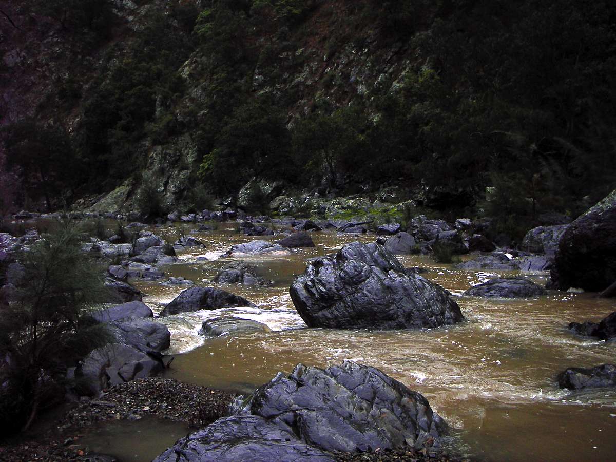
Chandler River after heavy overnight rain.
Photo: Don Hitchcock September 2005

Green Gully Creek flowing into the Chandler, a most unusual sight. After heavy rain, the flow can be very high, but it drops quickly, and most times the only water flow is beneath the rocky surface.
Note the Casuarina saplings (on the rocky scree which forms the "bed" of Green Gully Creek) which were not there in 2000.
Photo: Don Hitchcock September 2005
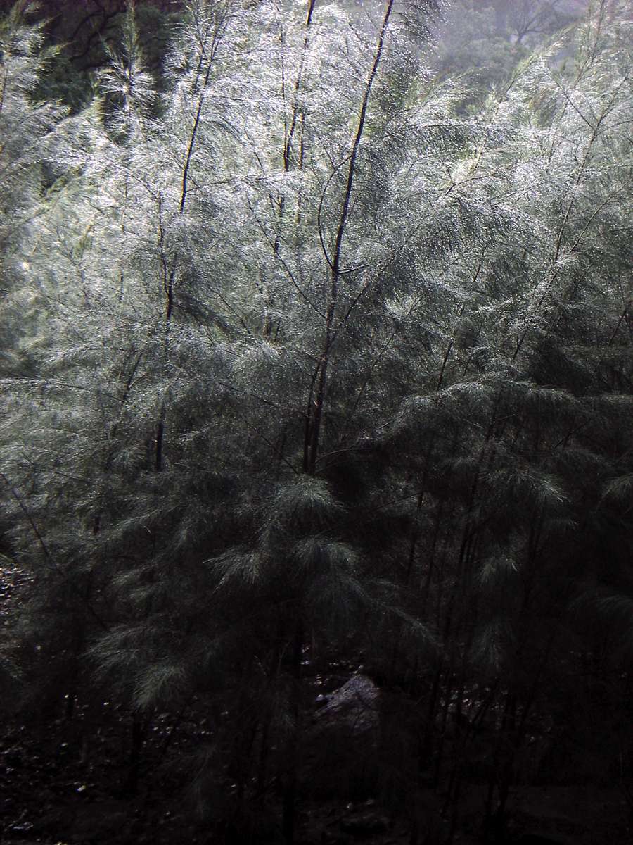
Casuarinas are one of my favourite trees. The wind in the needles is a wonderful sound, and the dry needles make excellent tinder for starting a fire.
These are the saplings on Green Gully Creek, haloed in raindrops.
Photo: Don Hitchcock September 2005
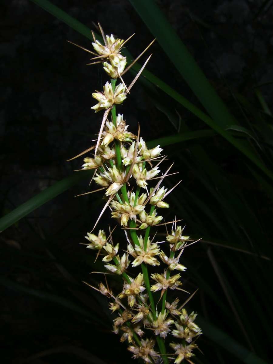
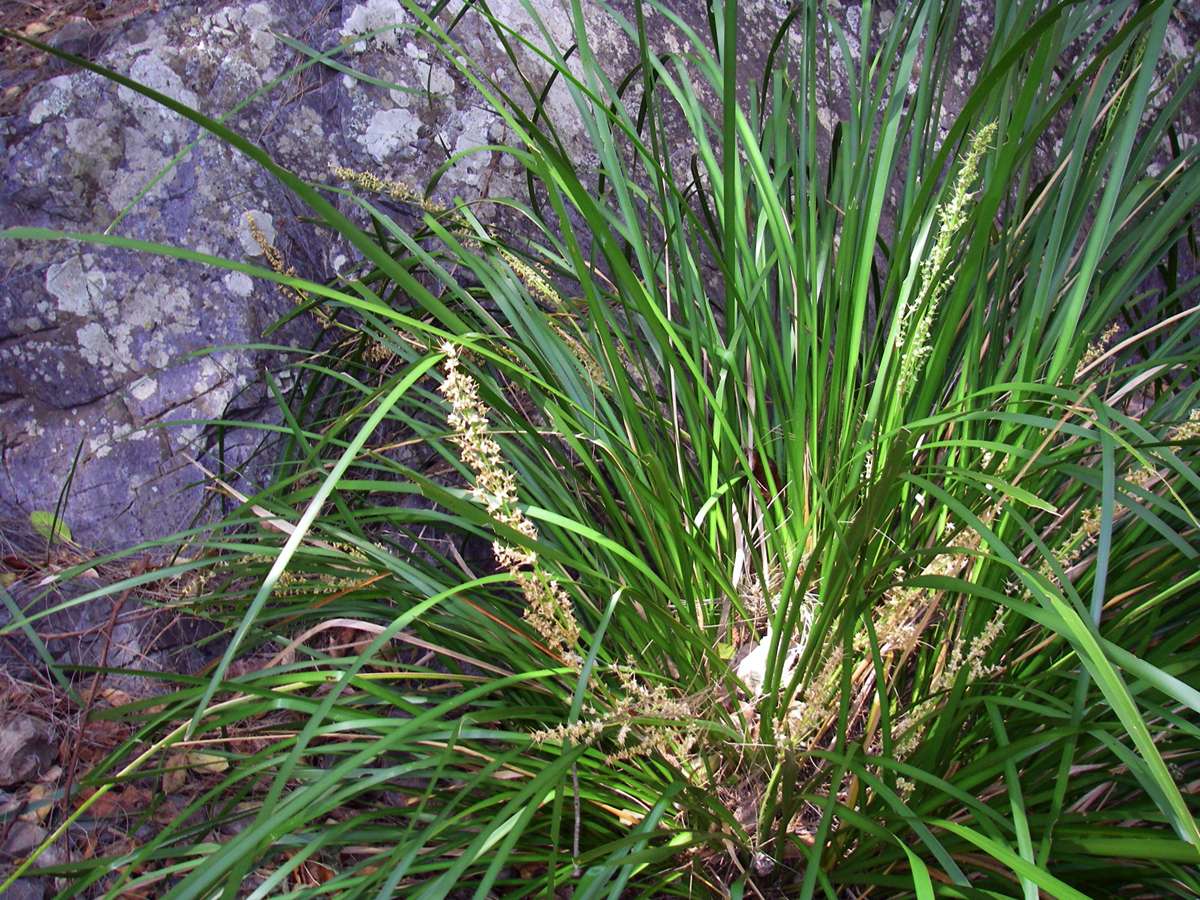
Lomandra longifolia in flower.
Photo: Don Hitchcock October 2007
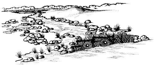
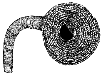
Information below from the Australian National Botanic Gardens - Education Service at: http://www.anbg.gov.au/aborig.s.e.aust/lomandra-longifolia.html
Women gathered the smooth strap-shaped leaves of Lomandra longifolia from the water's edge to make baskets. They split each rush, tied them in bundles to be soaked, allowing the fibres to become pliable for weaving baskets and fish traps.
The illustration below shows how Aboriginal people used a combination of weirs and basketry traps for fishing.

A "squeeze" is any constriction or obstacle in the path along a gorge which restricts progress, usually when the gorge narrows to sheer cliffs. They can be tricky to get past.
This is what I call an "optical squeeze", in that it looks as though it is going to be tricky to get past, but offers no real problems once you get closer.
In this case it soon becomes obvious that the path is over the rocks to the left of the second image.
Photo: Don Hitchcock October 2007, March 2008

This particular squeeze a little further downstream is interesting in that it offers few problems going upstream, but feels distinctly unsafe coming downstream. The remedy is to take off your pack, and retrieve it after straddling the small rock ridge. Looking upstream in each image.
Photo: Don Hitchcock March 2008, May 2004
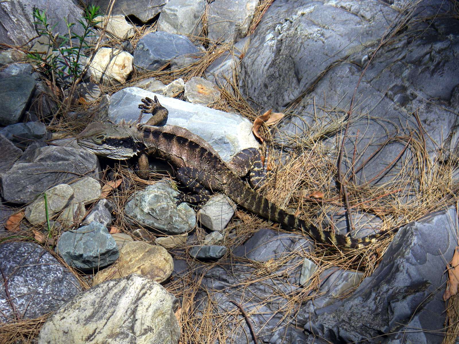
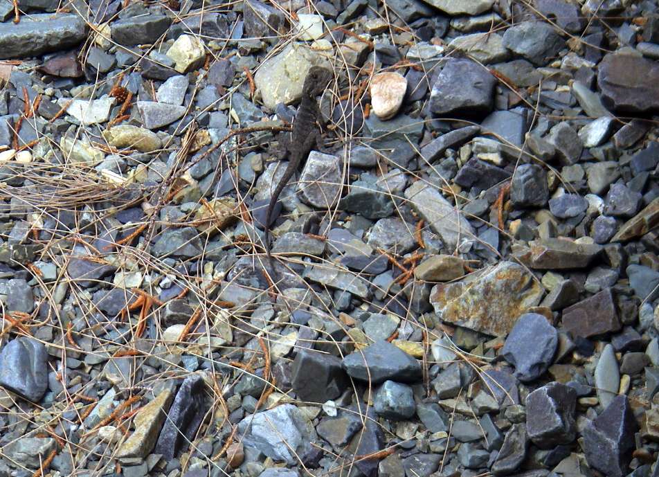
A lizard, a "water dragon" which sat still long enough to have its photo taken. Usually the first you know of a water dragon is when you hear the "plop" as they launch themselves into a pool as you walk along the bottom of the gorge. They have superb camouflage which disrupts their outline, making them very difficult to see under most circumstances. They can stay underwater for a very long time.
Photo: Don Hitchcock October 2007
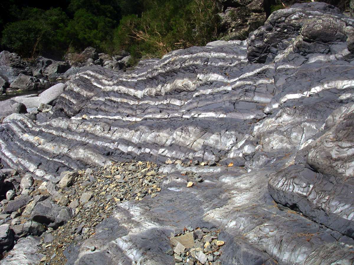
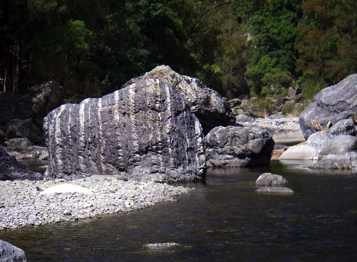
These bands in the rock appear to be examples of very wide layers of banded chert, occurring both in the bedrock of the river and in the cliff walls above, as evidenced by the fallen rock.
Photo: Don Hitchcock March 2008
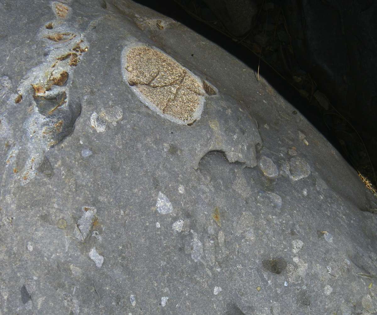
An interesting example of "country rock" in a siliceous metamorphosed matrix, with a band of altered rock at the periphery of the country rock pebble. It may simply be a metamorphosed conglomerate.
Photo: Don Hitchcock March 2008
A beautiful little dragon lizard in the river bed, with a strangely blunt face. It was very wary, I was lucky to get this shot.
Photo: Don Hitchcock March 2008
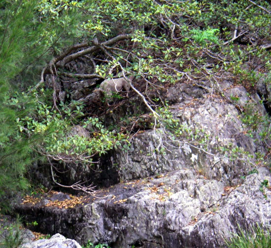
A goat disappearing up the ridge. Goats are a feral pest in Australia, and local land owners on the edges of the gorge and the NPWS get together every few years and hire a chopper to go down the gorges to cull as many as possible. They are dangerous to bushwalkers when they dislodge rocks from high up on the gorge sides.
Photo: Don Hitchcock October 2007
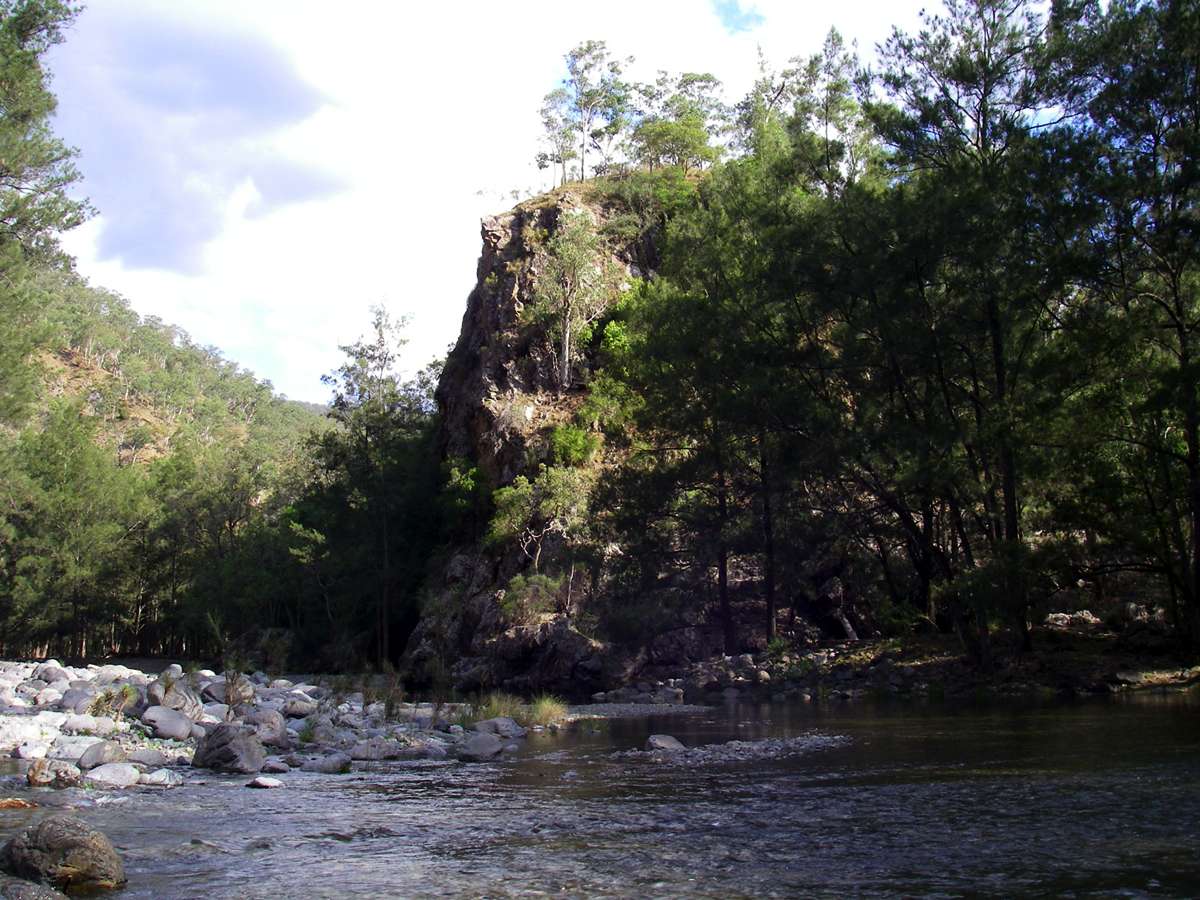
The distinctive bluff where Slaughter House Gully meets the Chandler just in front of this bluff, and upstream from it.
Photo: Don Hitchcock October 2007
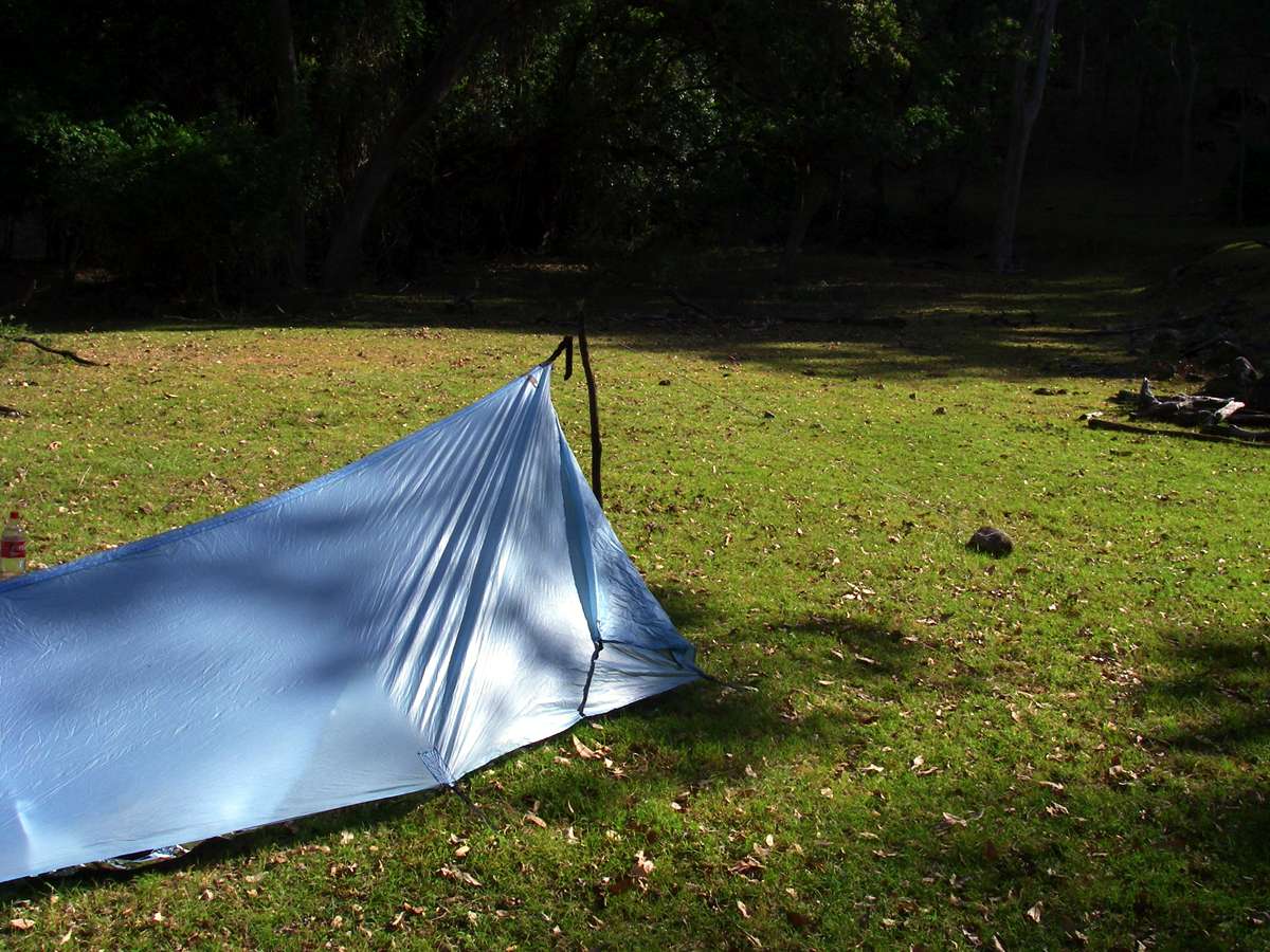
Slaughter House Gully has a good campsite on the edge of the Chandler, and there are other good campsites not far downstream on the true left of the Chandler. The site is ringed by trees, however, and care should be taken when siting your tent.
Photo: Don Hitchcock October 2007
The start of Slaughter House Gully where it meets the Chandler. This trip was specifically to see if I could get up the gully to the cliff tops, which seemed possible on the topographical map. It is often possible to get up a ridge if it is named, though this is not usually the case with creeks and rivers in this area. Still, it was worth a try.
Photo: Don Hitchcock October 2007
I was on my way up the creek before full daylight, about 0430 hours true time, though 0530 hours daylight saving. I've never been sorry that I started a trip early, and this was no exception. The creek bed was very rocky and had many "bars" or rocky outcrops going across it.
Photo: Don Hitchcock October 2007
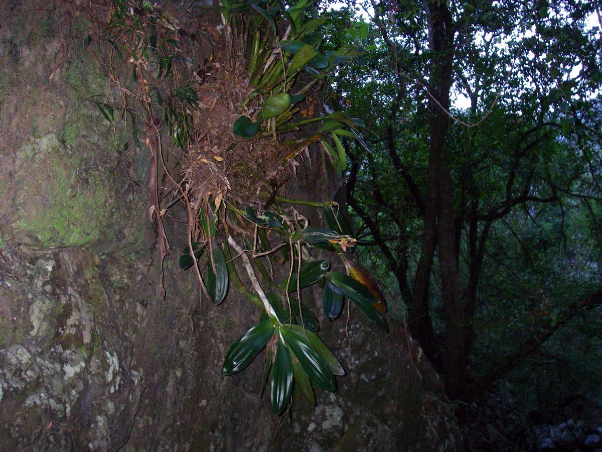
This rock orchid was clinging to the side of the rock face bordering the gully.
Photo: Don Hitchcock October 2007
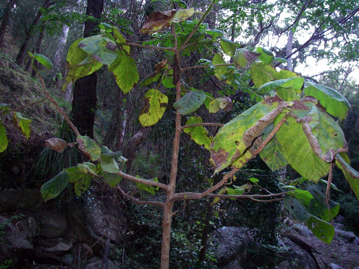
The stinging tree, or Gympie bush, is usually found in much lower and wetter environments than this, but with global warming the plants are gradually making an appearance in the Chandler. There is a full grown, healthy tree with saplings nearby in a side gully further down the Chandler, though this one in Slaughter House Gully seems to be making heavy weather of the marginal conditions.
Photo: Don Hitchcock October 2007
Half an hour later, with the creek bed not getting any less rocky, and the slope getting steeper, I pulled the plug, but not before I got this shot of the cliff line a long way ahead, now bathed in the rays of the rising sun. I decided there are easier ways to get to the cliff line, though this way might work if you were desperate.
Photo: Don Hitchcock October 2007
Back at the Chandler, I had a belated breakfast and found this strange fungus, which I have since thought could be a slime mould.
Photo: Don Hitchcock October 2007
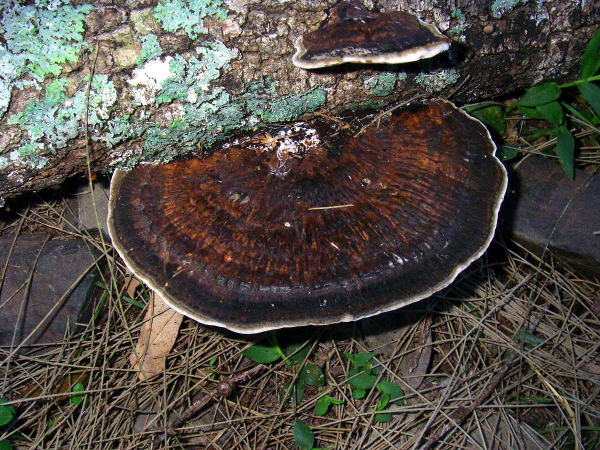
Another bracket fungus, a type that seems to have a staggering number of members in Australia.
Photo: Don Hitchcock October 2007
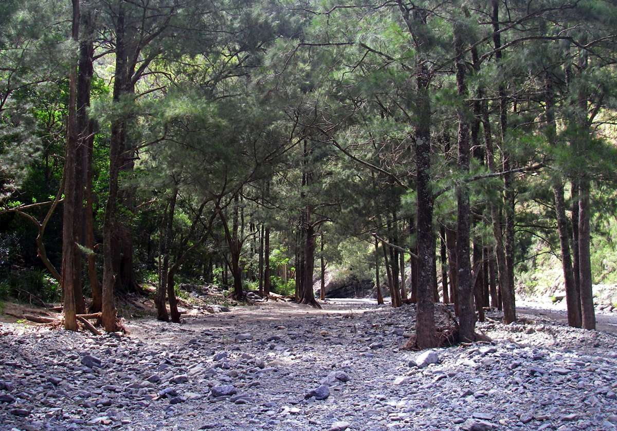
The distinctive wall of rocks across the Chandler that marks the start of the trip up the river from Slaughter House Gully.
Photo: Don Hitchcock October 2007
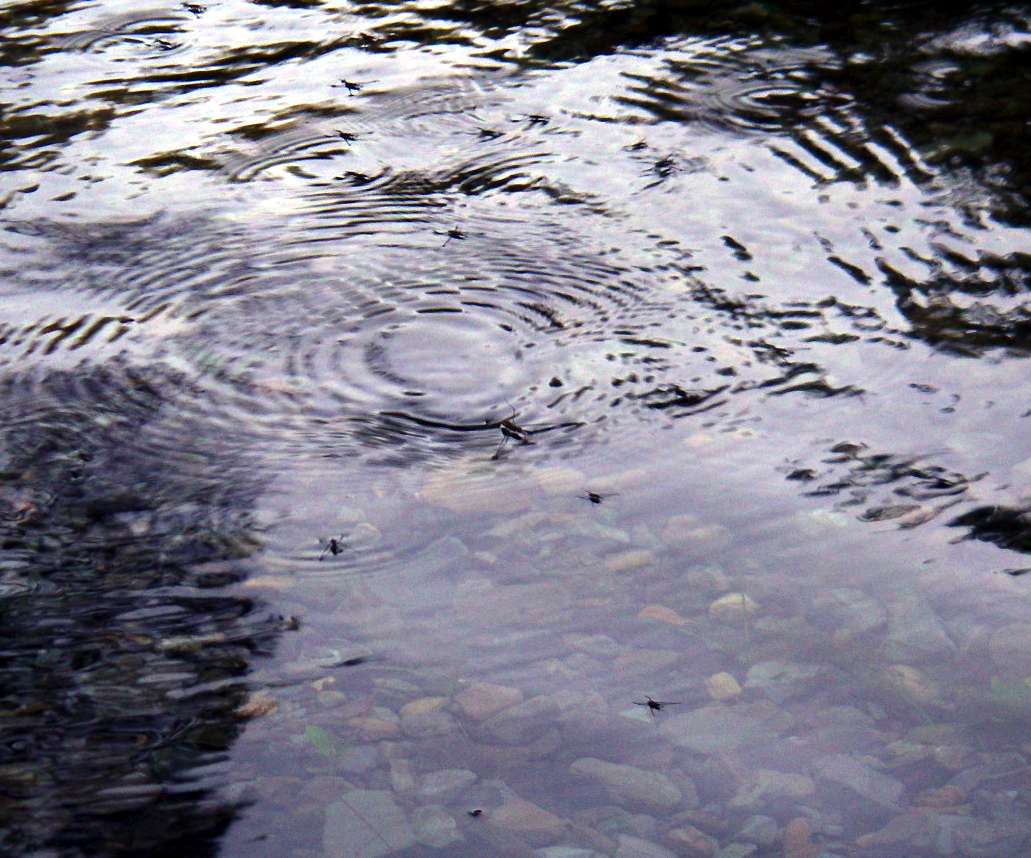
"Water Boatmen" skimming across the water surface.
Photo: Don Hitchcock October 2007
Continuing down the Chandler from Slaughter House Gully, these trees showed the effects of abrasion from rocks on their lower trunks during the floods of December 2007 / January 2008.
Photo: Don Hitchcock March 2008
Two rocky bluffs. I was on my way to the next possible ridge out after Slaughter House Gully.
Photo: Don Hitchcock March 2008
The stream bed was very rocky at this point, and once again damage to the casuarina trunks from the flood was extensive.
Photo: Don Hitchcock March 2008
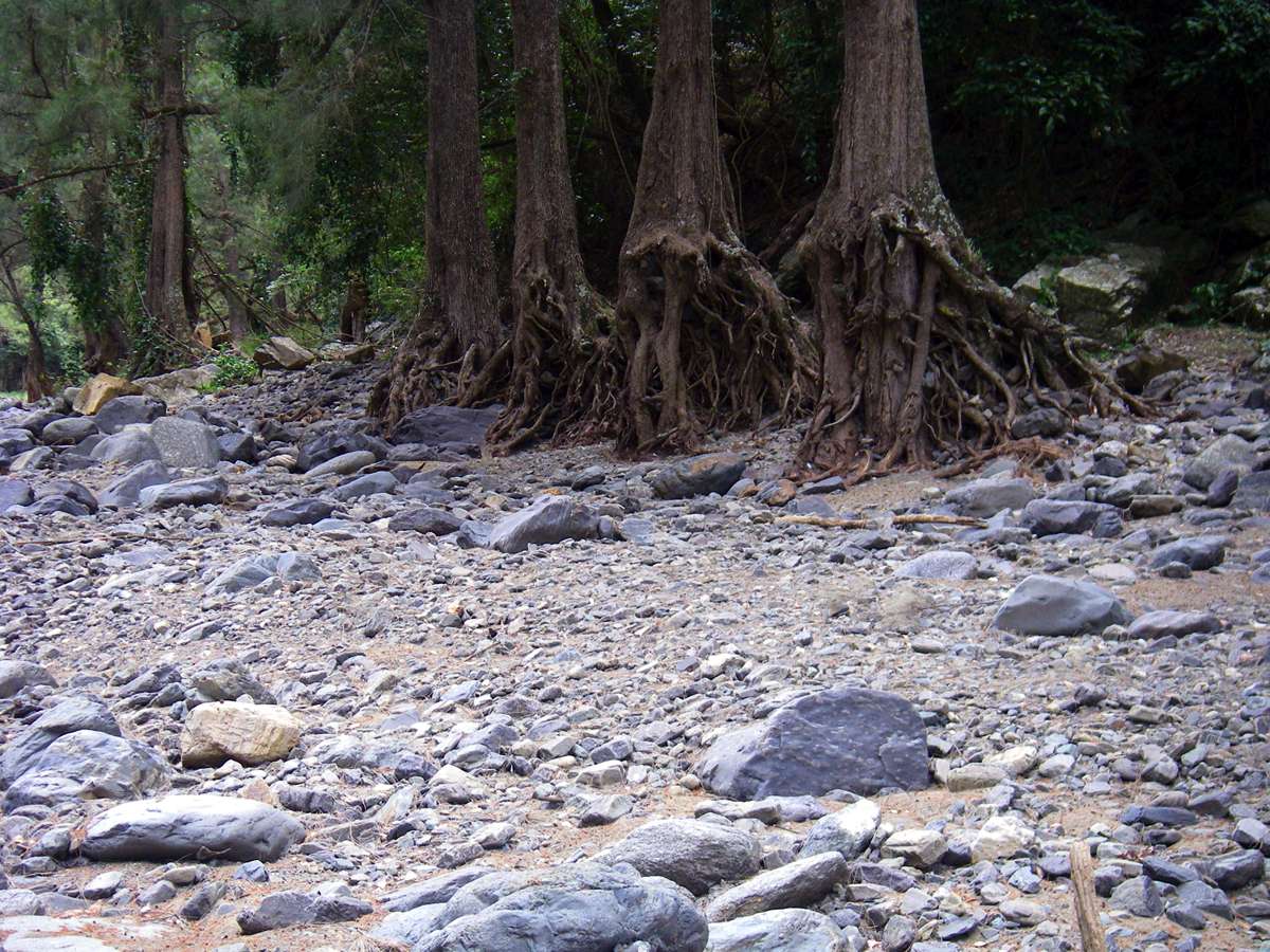
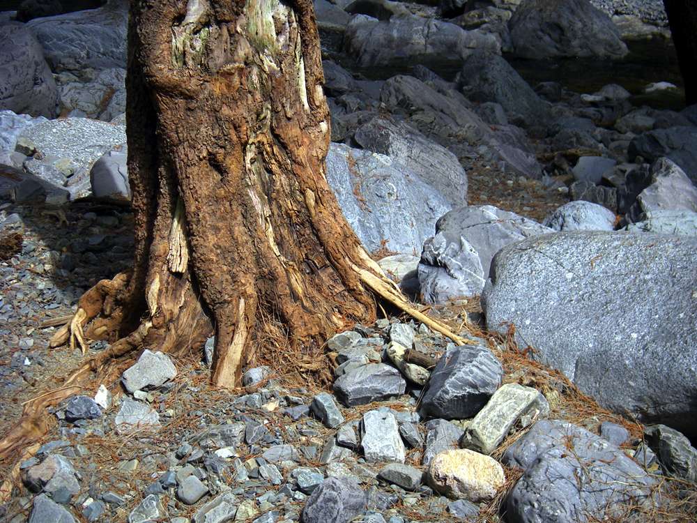
These casuarinas had been undermined by the flood waters, exposing their roots.
Photo: Don Hitchcock March 2008
Wild cattle tracks are always welcome, it enables the walker to make much better time. This point is just near the bottom of the ridge I was hoping to climb to the ridge line, the last one to the cliff line so you can walk back to Wollomombi Falls, before the next long shallow ridge which leads instead to the Long Point road.
Photo: Don Hitchcock March 2008
On the way up the ridge I came across this hole dug by an echidna looking for ants.
Photo: Don Hitchcock March 2008

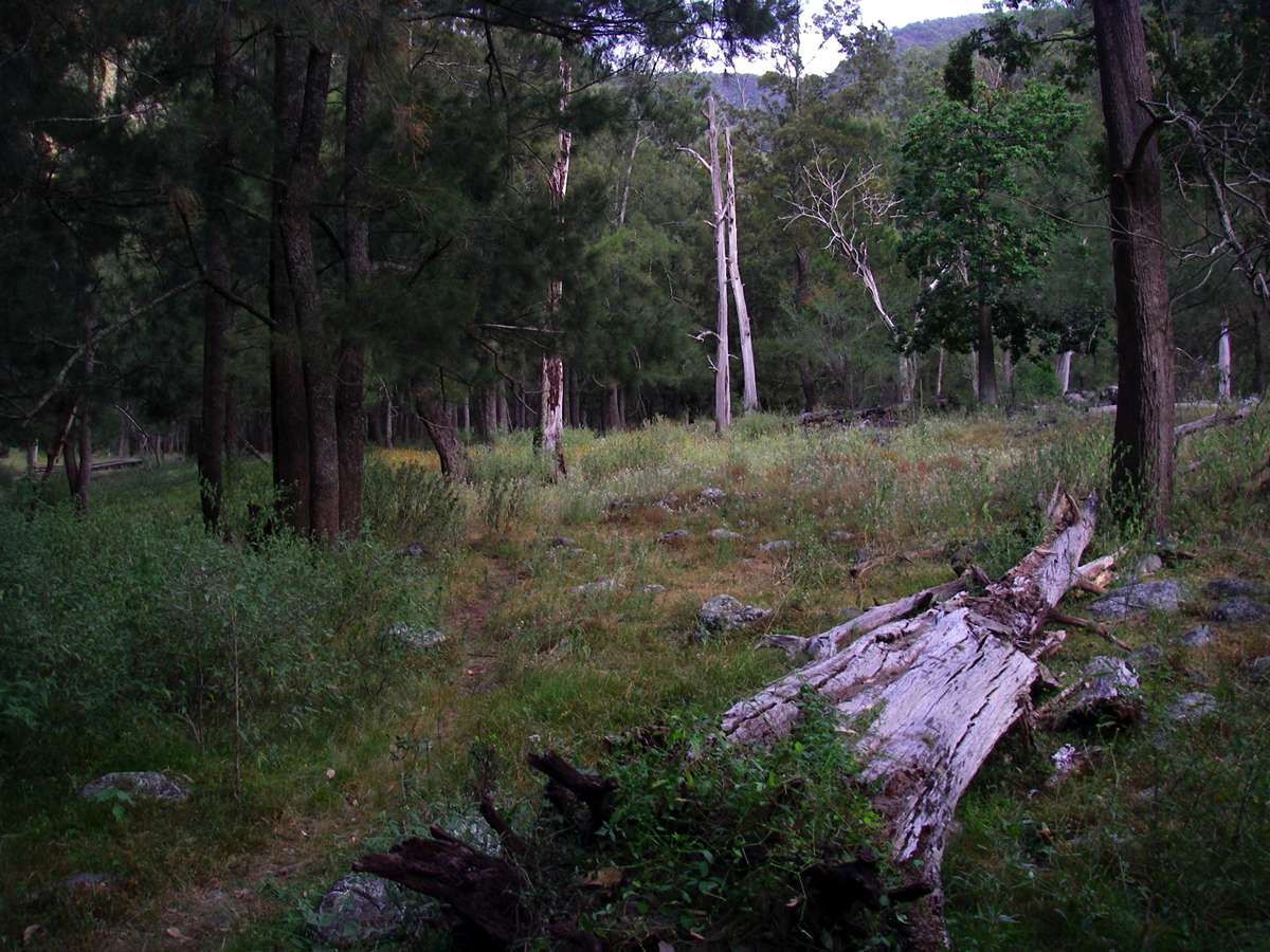
Looking back down the ridge to the grassy wide inside of the curve of the Chandler.
Photo: Don Hitchcock March 2008

For some time the ridge had a relatively small gradient and was easy to climb. Not what I was after, it is better for the ridge to be steep, it means that there is less likelihood of cliffs ahead, because you are always going to be needing to ascend five or six hundred metres to get to the cliff line.
Photo: Don Hitchcock March 2008
Wallaby dirt wallow at a flat part of the ridge.
Photo: Don Hitchcock March 2008
Shortly thereafter, the sight I had half expected, a very steep ridge and cliffs ahead. I would have had a difficult traverse to the left of the ridge, much of which was hidden by vegetation, then climb a steep section with no guarantee of success. I reluctantly turned back. Maybe I'll try again later, now I know what to expect, and allow lots of time. It might turn out to be not too bad.
Some ridges look possible on the topographical map, but turn out to be difficult, others such as Green Gully Ridge and St Helena Spur look very dodgy on the map, but turn out to be quite doable.
Photo: Don Hitchcock March 2008
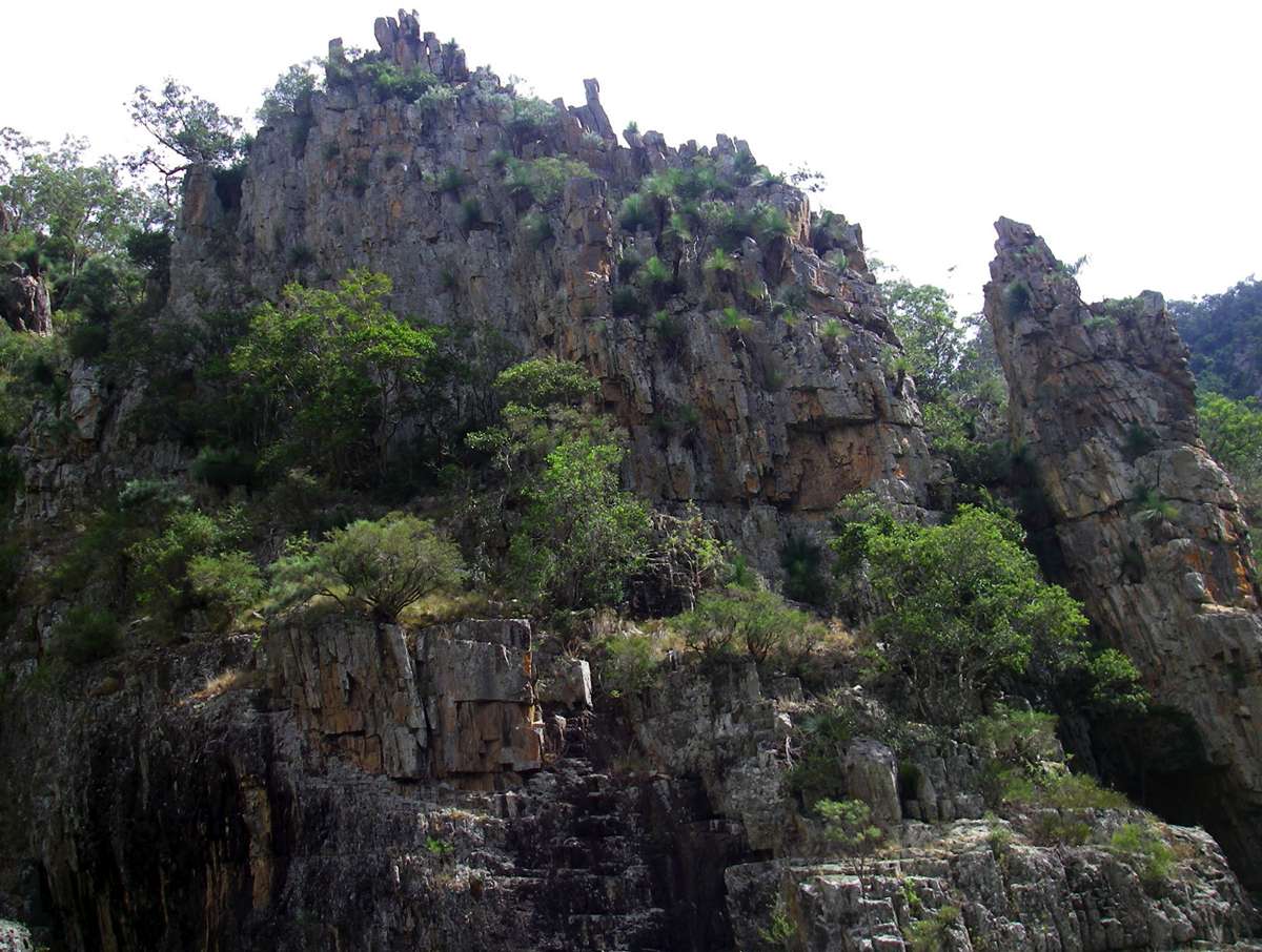
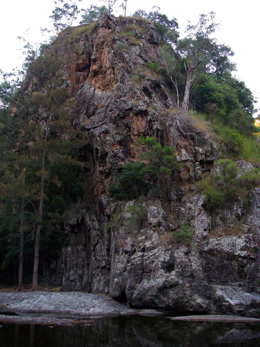
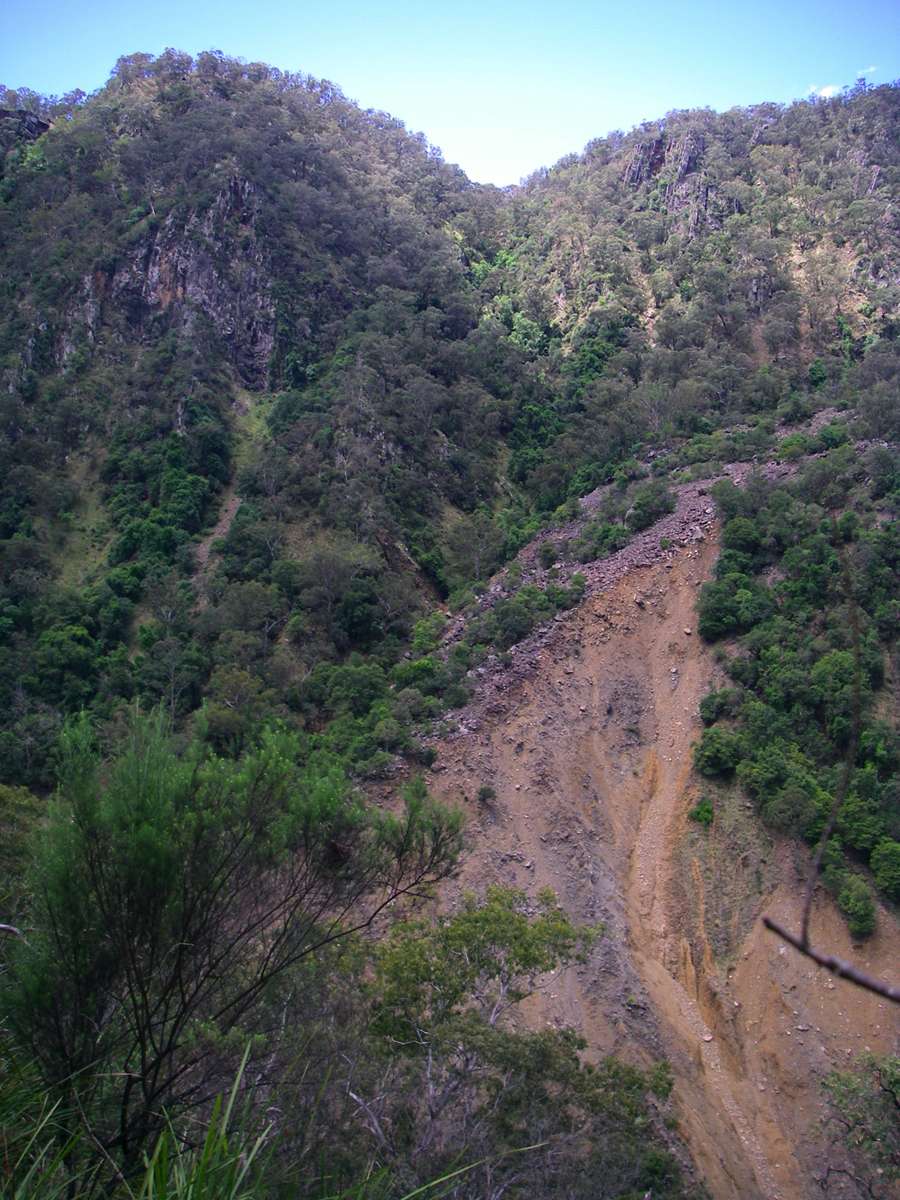
The distinctive rock formations seen when heading upriver from Slaughter House Gully.
The one in the middle and the right is not far downstream of Pulpit Rock, part way up Church Rock.
Photo: Don Hitchcock October 2007, October 2007, March 2008
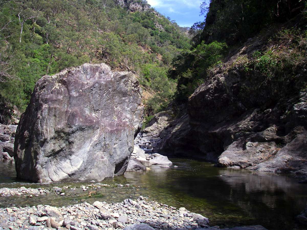
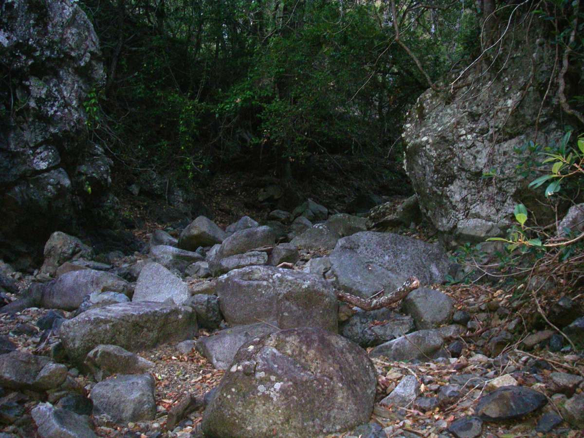
Sometimes the size of the rocks sitting in the bed of the river, obviously having got there by tumbling down from the gorge walls above, gives you pause for thought.
Photo: Don Hitchcock October 2007
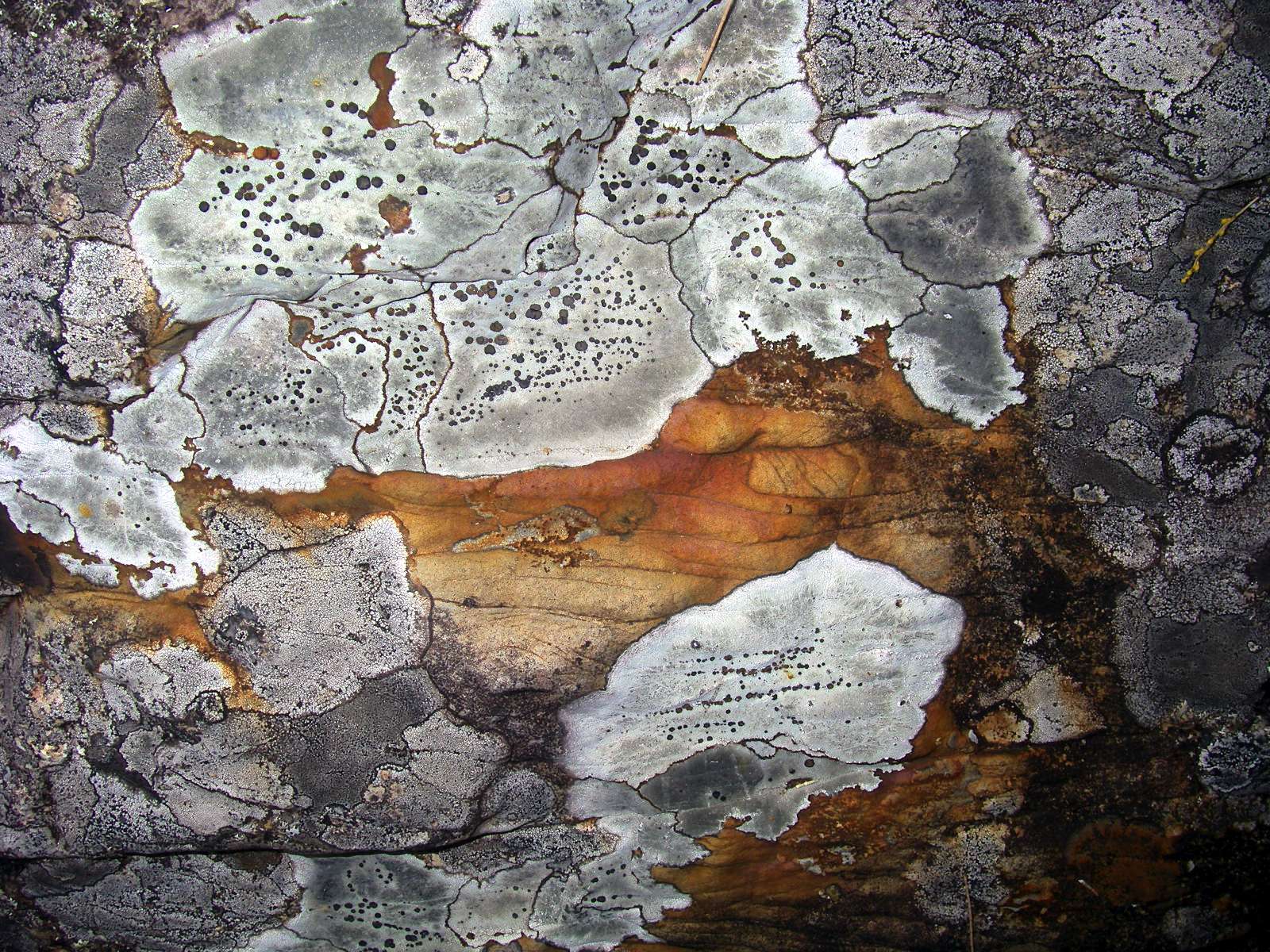
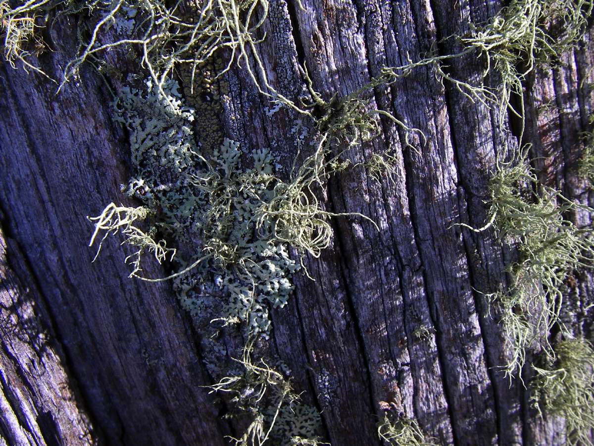
There are some beautiful lichens on the rocks away from the highest flood levels.
Photo: Don Hitchcock March 2008
On the way upstream, the distinctive shape of the ridge up St Helena Spur appears. It is a very steep but interesting way out of the gorge, with three distinct phases, the first to the lookout I call "Oh Expletive!" lookout, so called because of the view up the rest of the ridge when you get to the lookout and see what is ahead after pushing through the vegetation on the top, and the second the very steep rocky climb up the second phase ridge. Little Old Ladies have done the climb a friend tells me, some only once in her company ...
The third phase is the final climb up a broad ridge to the cliffline, which offers no surprises.
The left hand image shows phases one and two, the right hand image shows phases two and three.
Photo: Don Hitchcock March 2008, October 2007
Continuing up the Chandler, not far from the start of St Helena Spur, Green Gully Ridge appears. The best way up is to follow the narrow ridge of rock in the foreground of this shot, beside the creek to the start of the climb. It is steep but not excessively so.
Photo: Don Hitchcock October 2007
Chandler Gorge from the ridge leading down to it from the Long Point Shelter Shed.
Photo: Don Hitchcock April 2008
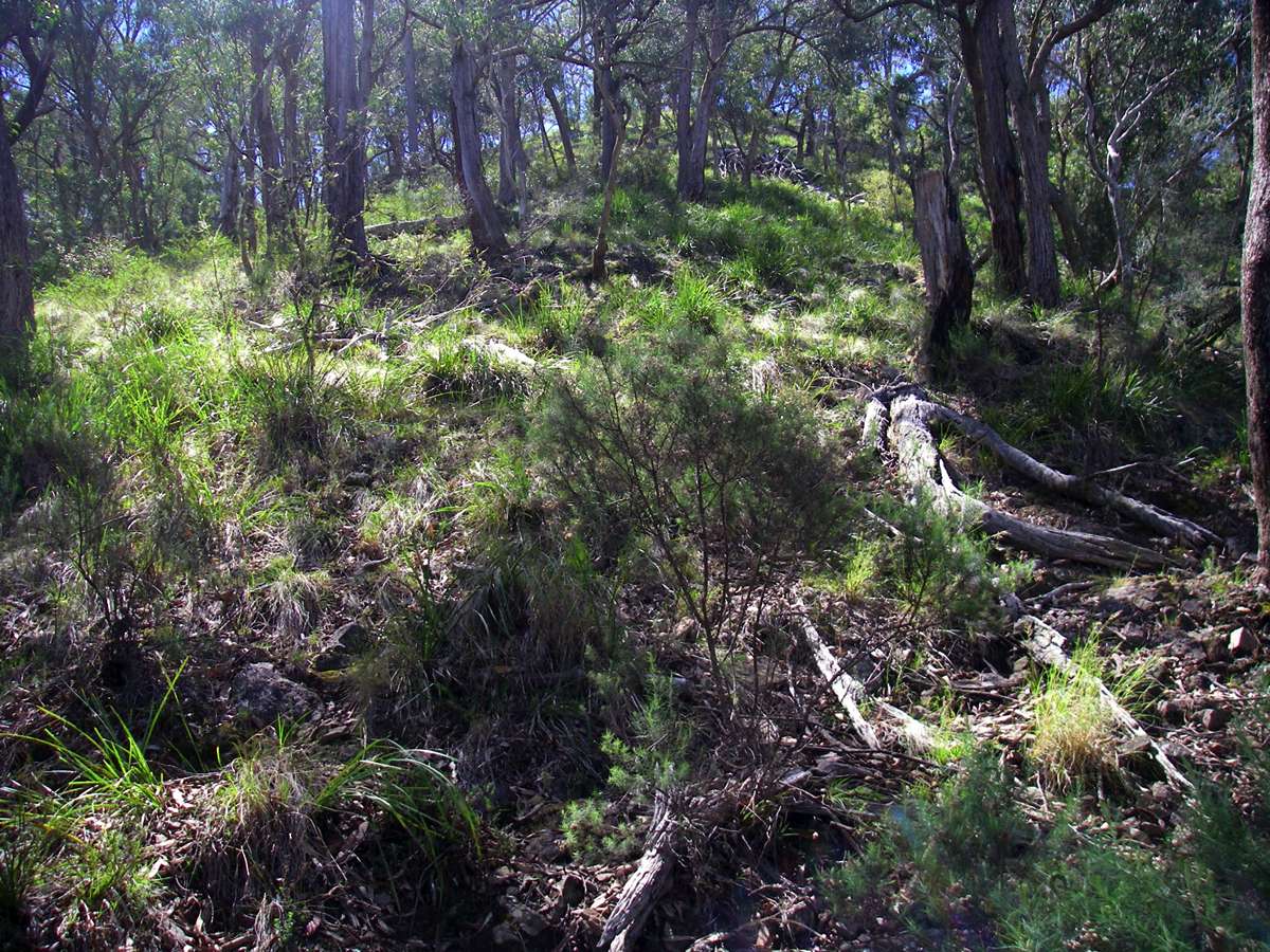
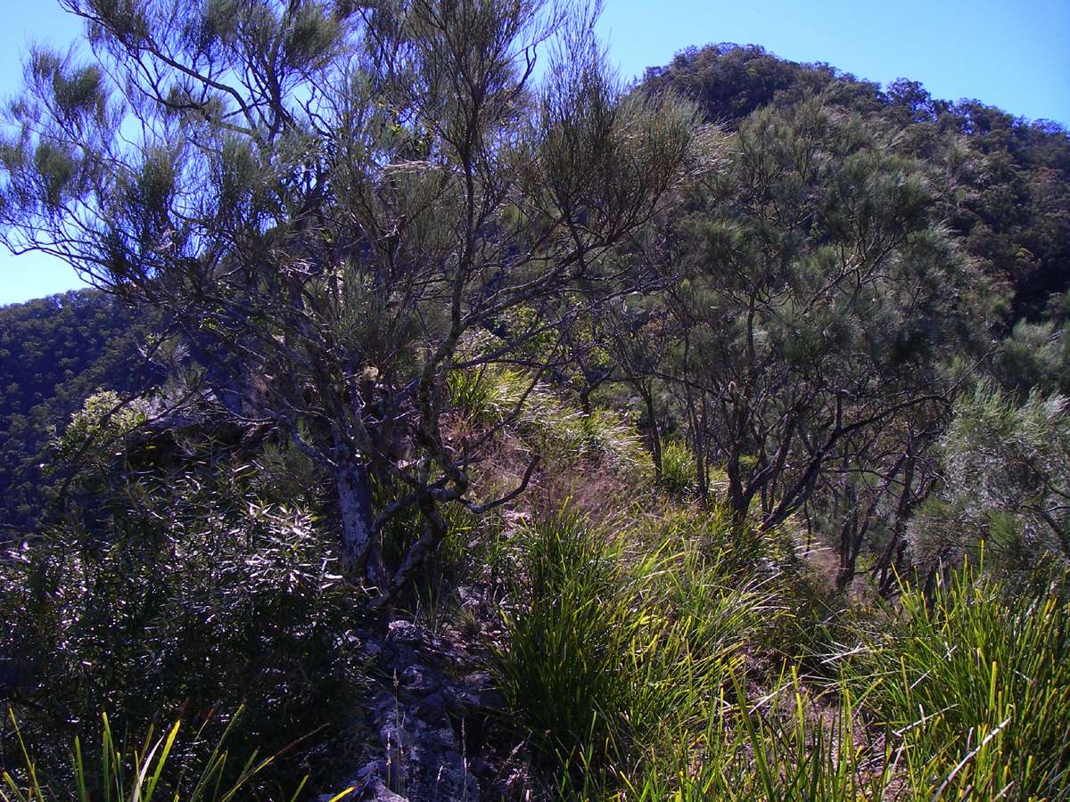
Green Gully Ridge

Before going up the ridge, it is worthwhile making a side trip up Green Gully Creek to this beautiful little waterfall, which I call "the smallest waterfall in the world". It's only about ten metres high, but perfect in its own way. It disappears into gravel at the base.
I once watched, with heart in mouth, a Canadian bloke I had taken down the gorges climb up and down this with no rope and with joggers on his feet. It is much steeper than it looks in this photo. Down is much harder than up, as most walkers know. He went straight up the middle, and nearly straight down the middle. There was no water coming over at the time, but still.....
Photo: Don Hitchcock May 2008
The best way up Green Gully Ridge is to follow the narrow ridge of rock in the foreground of this shot, beside the creek to the start of the climb. It is steep but not excessively so. It takes a fit party about two hours (or one hour for tiger walkers!) to get to the cliff line about 500 metres above, and less than half an hour from there to the carpark at Wollomombi Falls. If you take your time, and have a cup of coffee or lunch along the way, the ridge can easily take four hours.....
Photo: Don Hitchcock October 2007

This is the debouchement of Green Gully Creek into the Chandler from a low level of Green Gully Ridge. The gravel used to be covered with sapling Casuarinas, but they have been washed away by flood waters.
Photo: Don Hitchcock November 2008
Looking through Casuarinas and other native species to Green Gully Creek, from the vantage point of Green Gully Ridge, an excellent ridge out of the Chandler Gorge. It is a steady steep climb, but there are no surprises.
Photo: Don Hitchcock September 2005
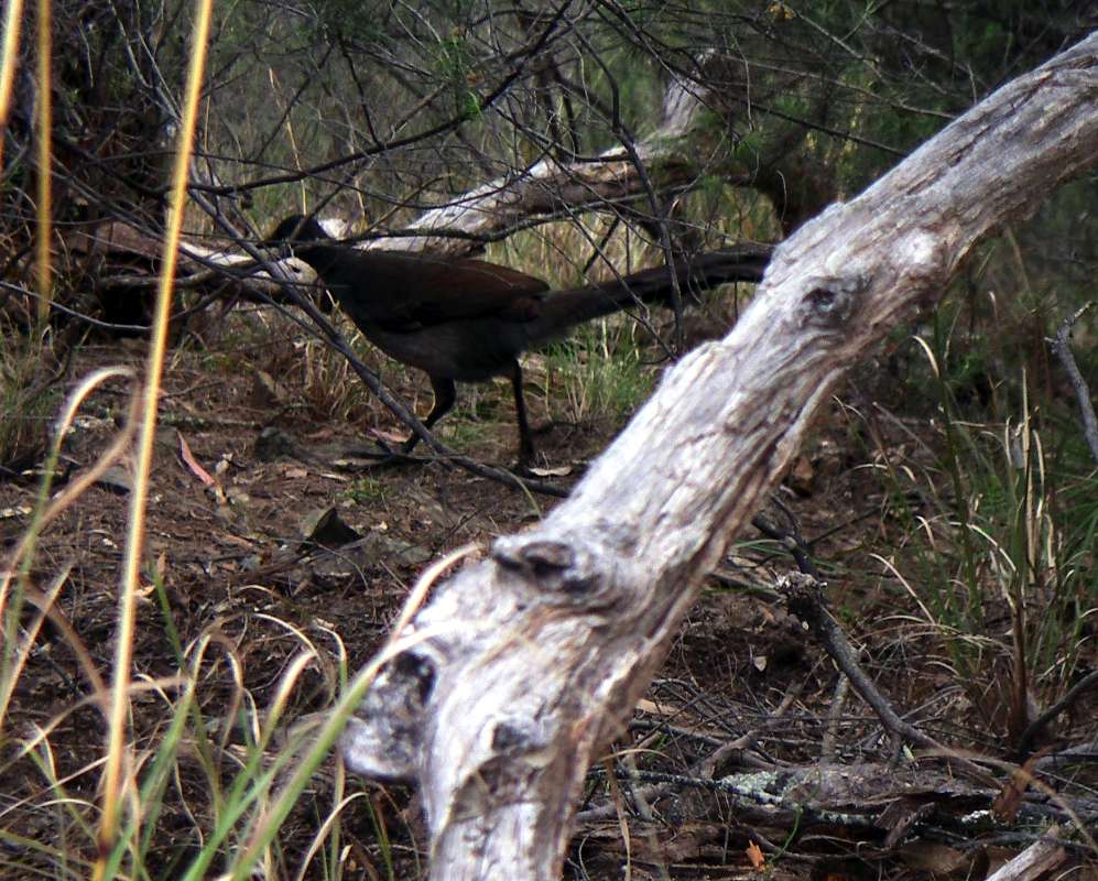
On this climb a year later, I was surprised how difficult it was to go up the ridge, the whole thing seemed to be turned to a fine tilth like a well ploughed paddock. Taking a rest stop, I suddenly realised why, when this Lyre Bird suddenly appeared, and took absolutely no notice of me as it went about the business of turning over the soil and leaf litter looking for insects and grubs.
Photo: Don Hitchcock September 2006

Looking downstream along the swollen Chandler, from Green Gully Ridge.
September 2005
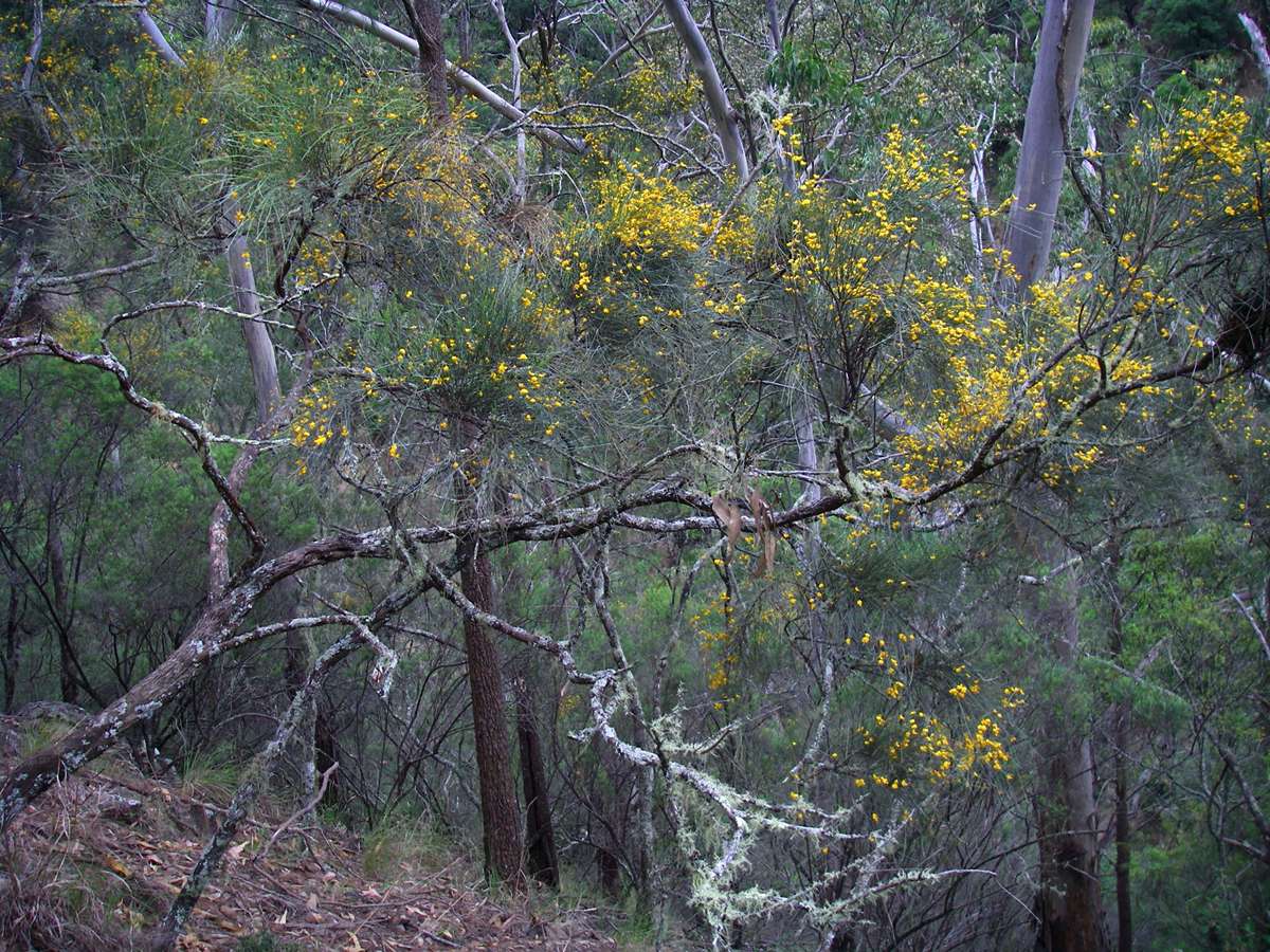
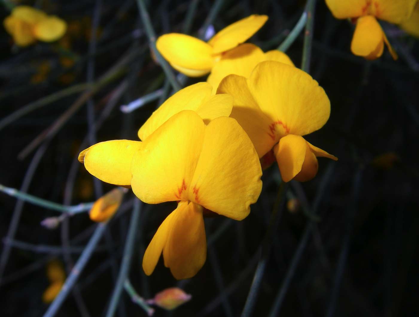
Jacksonia scoparia on Green Gully Ridge.
This is a wide spread plant often seen on roadsides in the Armidale area, flowering in October/November.
October 2007
From http://www.anbg.gov.au/gnp/gnp2/jacksonia-scoparia.html
Jacksonia are pea-flowered shrubs or small trees found wild only in Australia, mainly in the west. Their distinctive feature is flat, angular or winged branchlets which are entirely leafless except in young growth. They are rarely grown in gardens, though they were sent by early discoverers for growing under glass in England from 1803.
Jacksonia scoparia (Dogwood) is a beautiful small lightweight tree of milder areas and mountains of New South Wales and Queensland. It has been known to supply some drought fodder and also to have some minor value as timber. The common name of dogwood is one given to various quite unconnected plants and in this case is said to refer to the smell from the wood when burnt - it is no indication of its ornamental value.
Jacksonia scoparia reaches about 4 m high.
Most of the year the general effect is of a dense and softly drooping crown, with many thin branchlets somewhat tufted, and of a dull or greyish green. The slender trunk becomes dark and furrowed with age.
Name meaning:
Jacksonia - after George Jackson, (?1780 - 1811), a botanical librarian;
scoparia - brush- or broom-like, referring to the manner of growth
This scree slope on the opposite wall of Green Gully is a very distinctive landmark. Once past this, you are half way up the ridge. There is an almost level grassy section, the only one in the climb, not far up the ridge from here which makes a good rest stop.
Photo: Don Hitchcock September 2005, November 2008
This is the almost level grassy section which I call Half Way Flat. It takes me about an hour from the bottom to here, and an hour to the top from here.
Photo: Don Hitchcock November 2008

Edgars Lookout from Green Gully Ridge.
Photo: Don Hitchcock September 2005
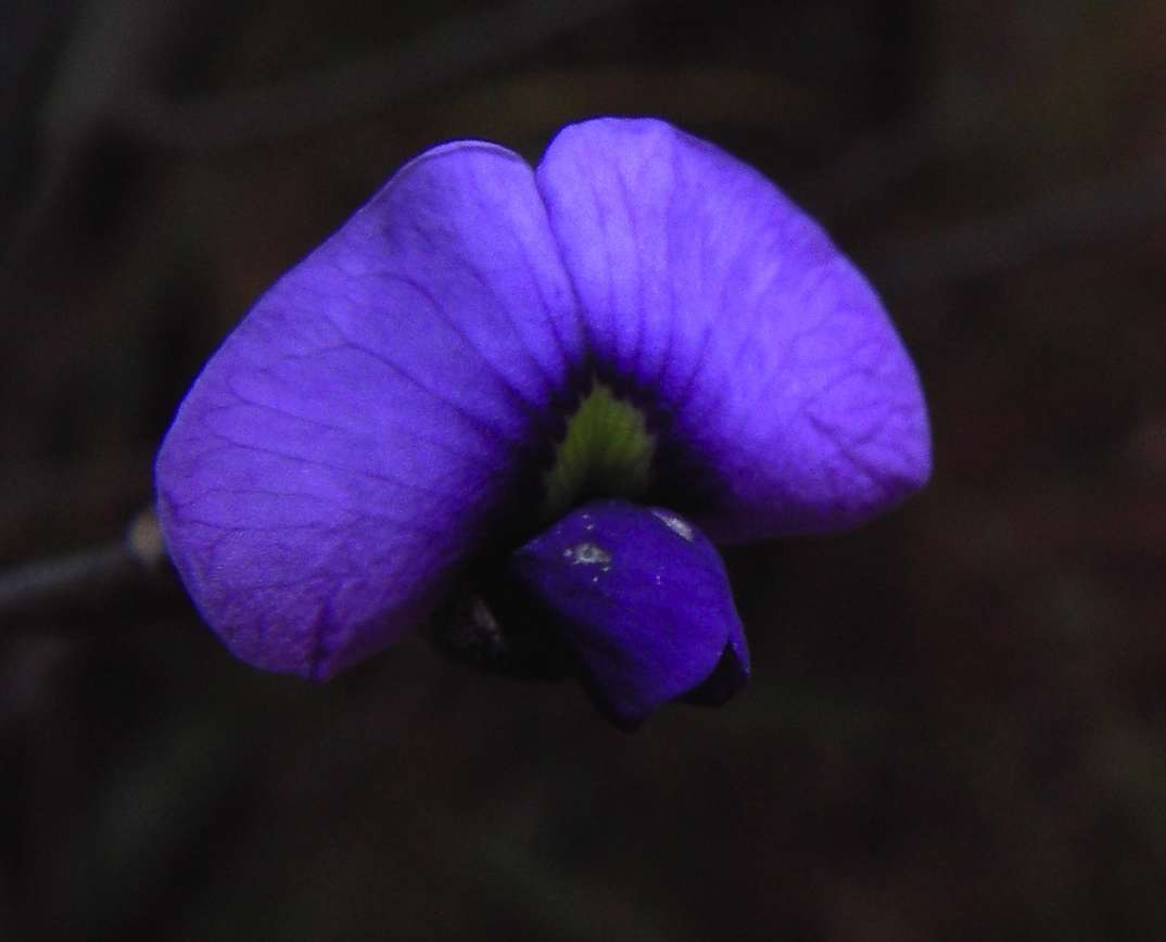
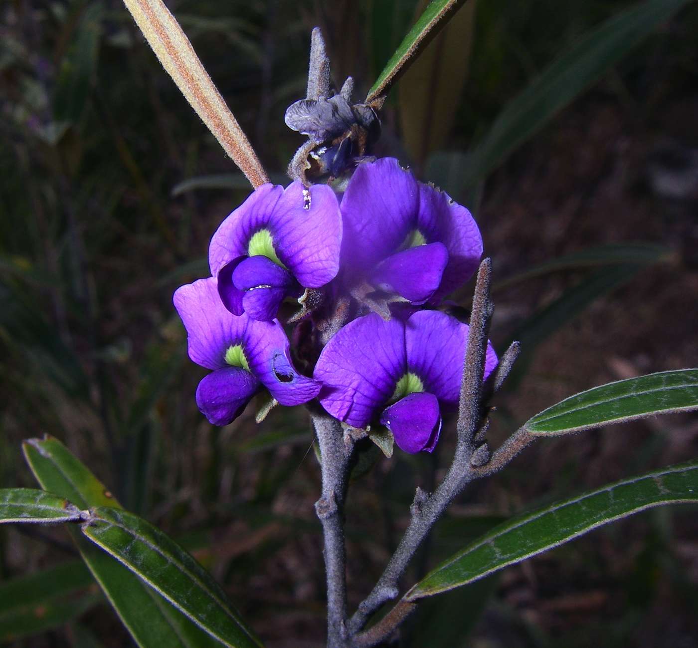
A Hovea sp. on the climb up Green Gully Ridge.
September 2005, September 2006
It is good to see the end in sight, but the top seems to take forever to show up. The last part of the ridge is very even in slope, so you can see the top a while before you get there, and it is steep.
Photo: Don Hitchcock November 2008
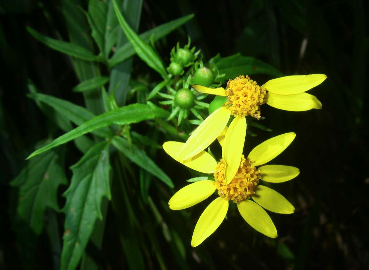
In November there were a lot of these Senecio sp. flowering on the ridge just before the top.
Photo: Don Hitchcock November 2008

Just before the top of the ridge there is a line of moss covered rocks which rarely see the sun, and with the wet conditions on this trip, the mosses were lapping it up.
Photo: Don Hitchcock September 2005

Melaleuca sp. in the Green Gully Creek stream bed on top of the cliff line.
Photo: Don Hitchcock November 2008

An unusual sight, Green Gully Creek in flood, and tumbling over the vertical drop to the valley below.
Photo: Don Hitchcock September 2005
A little further on these Dianella sp. were in flower in amongst the Correa sp.
Photo: Don Hitchcock November 2008
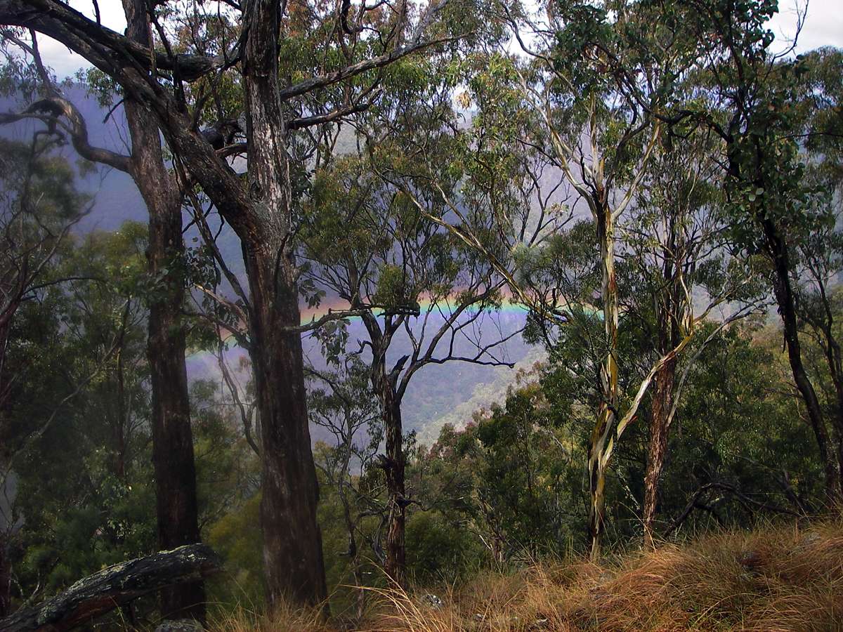
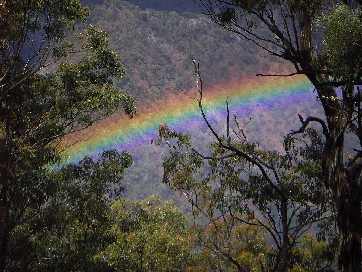
At last the sun came out, giving a view of a rainbow down in the gorge.
Photo: Don Hitchcock September 2005
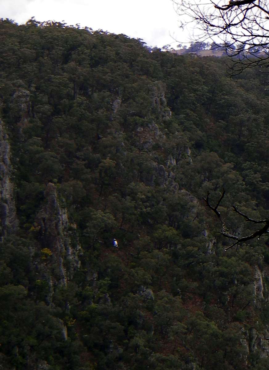
This car below Edgars Lookout was pushed off the edge of the cliff some time ago, and is only visible when the light is right.
Photo: Don Hitchcock September 2005
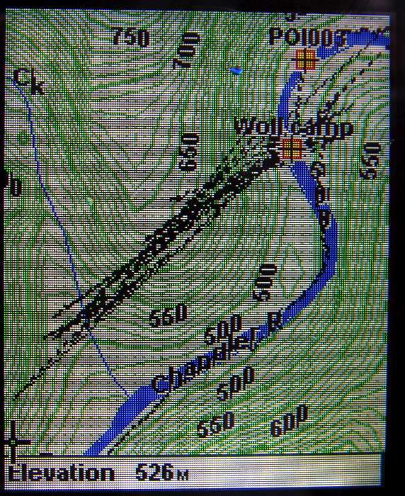
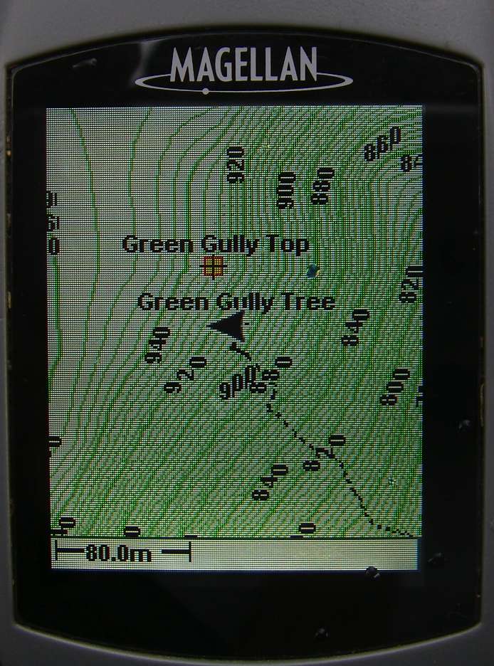
A GPS unit can be a mixed blessing. It is the surest way to slow progress I have yet found, as it is consulted and waited for and fiddled with and what with turning it on and waiting for the satellites to lock in, and putting in way points, any time you pull out the GPS you can guarantee a loss of five to ten minutes. Yet in the gorges, it can be invaluable, since the tendency is to think that you are always at least one wriggle on the map further on the journey than you really are.
However it can become obvious at times that their accuracy should be taken with a grain of salt. Note the way that the track oscillates back and forth on the first image, admittedly at the bottom of the gorge where reception is not ideal, and on the other, taken at the very top of the cliff line (Green Gully Tree, a distinctive Kurrajong) on flat land, it would appear to be well down a steep slope.
Photo: Don Hitchcock October 2007
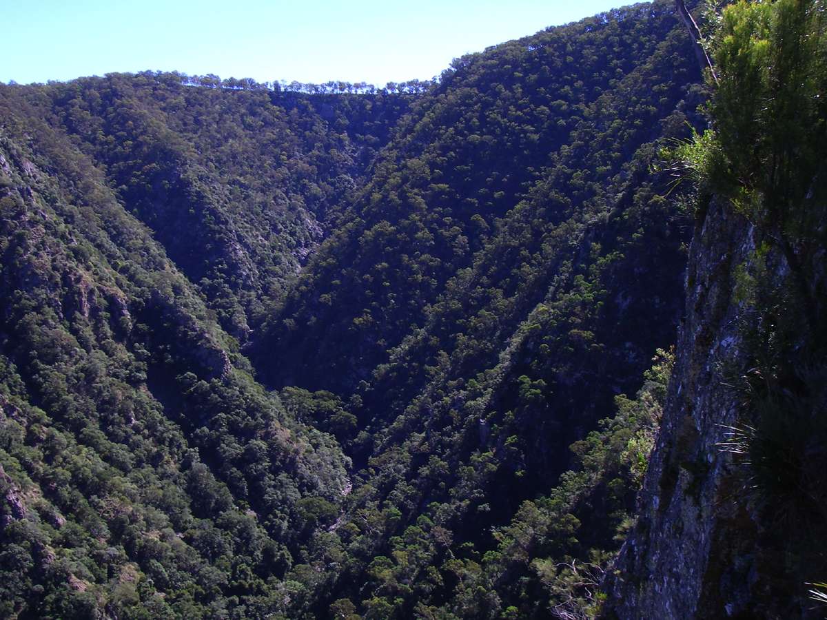
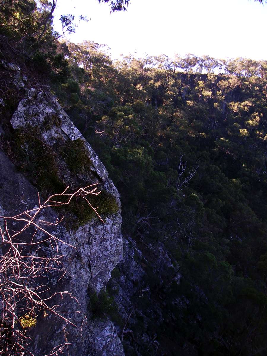
Looking over the cliff line to the Chandler, heading downstream five hundred metres below.
Photo: Don Hitchcock October 2007, November 2008

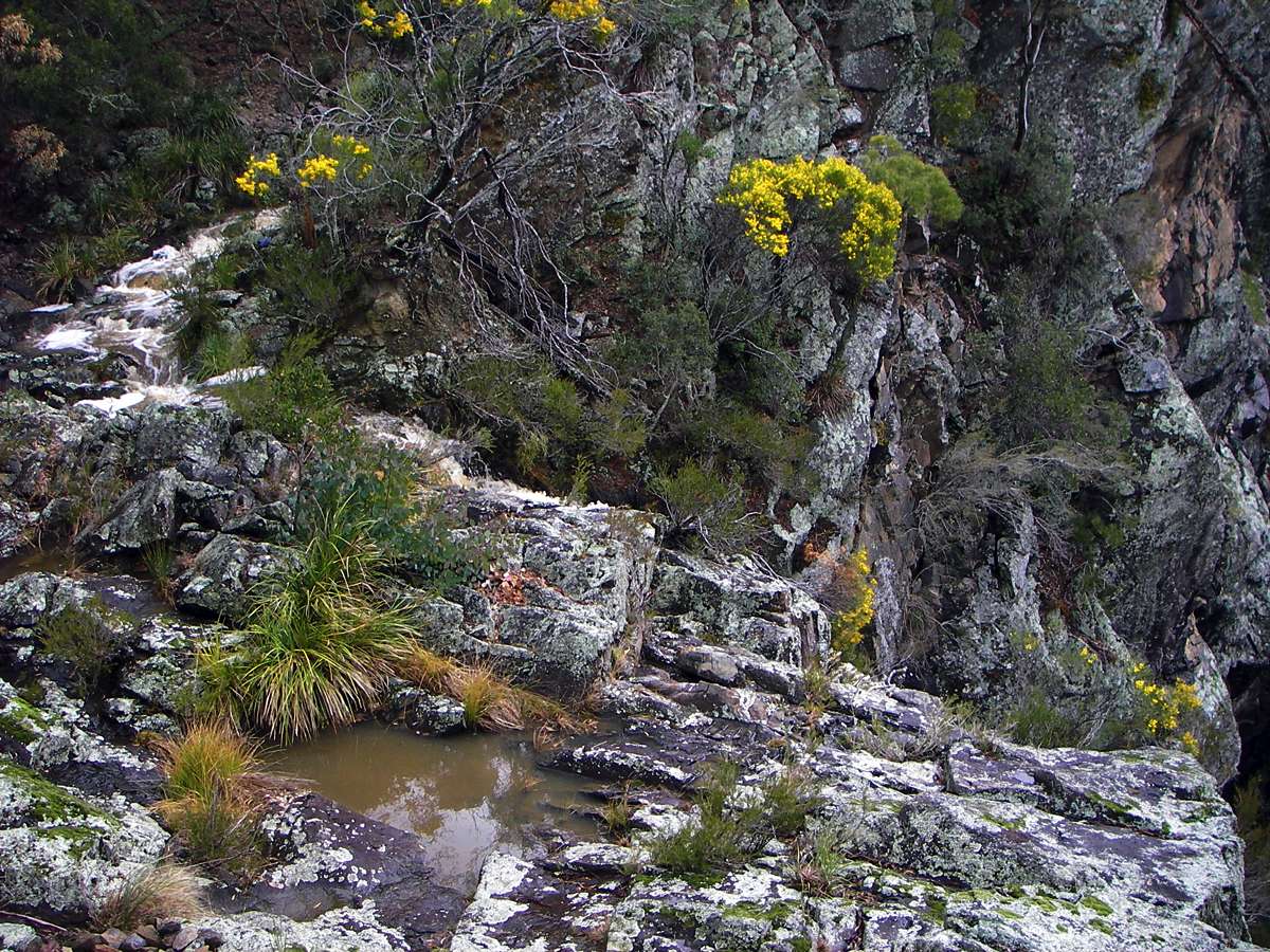
Looking back at a waterfall in Green Gully.
Photo: Don Hitchcock September 2005

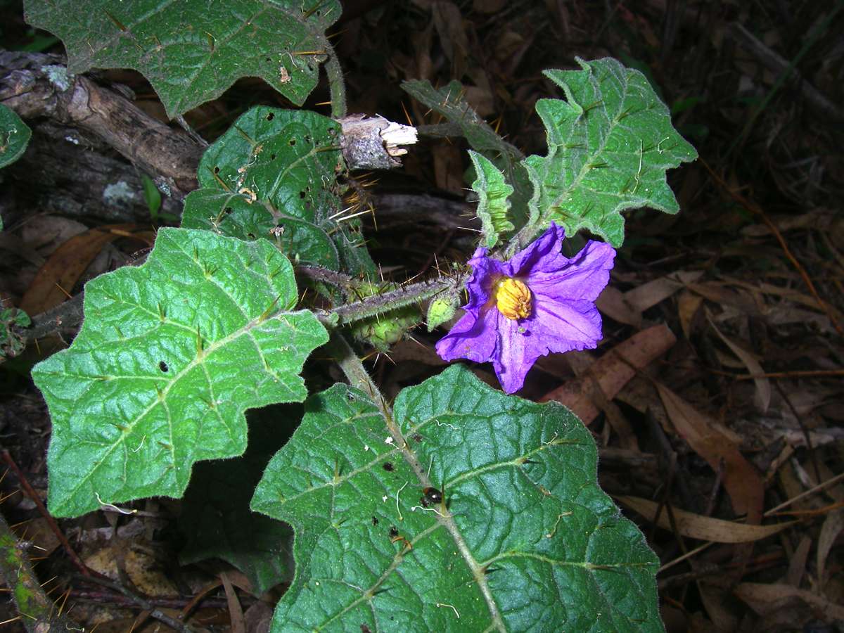
Solanum sp.
Photo: Don Hitchcock November 2008
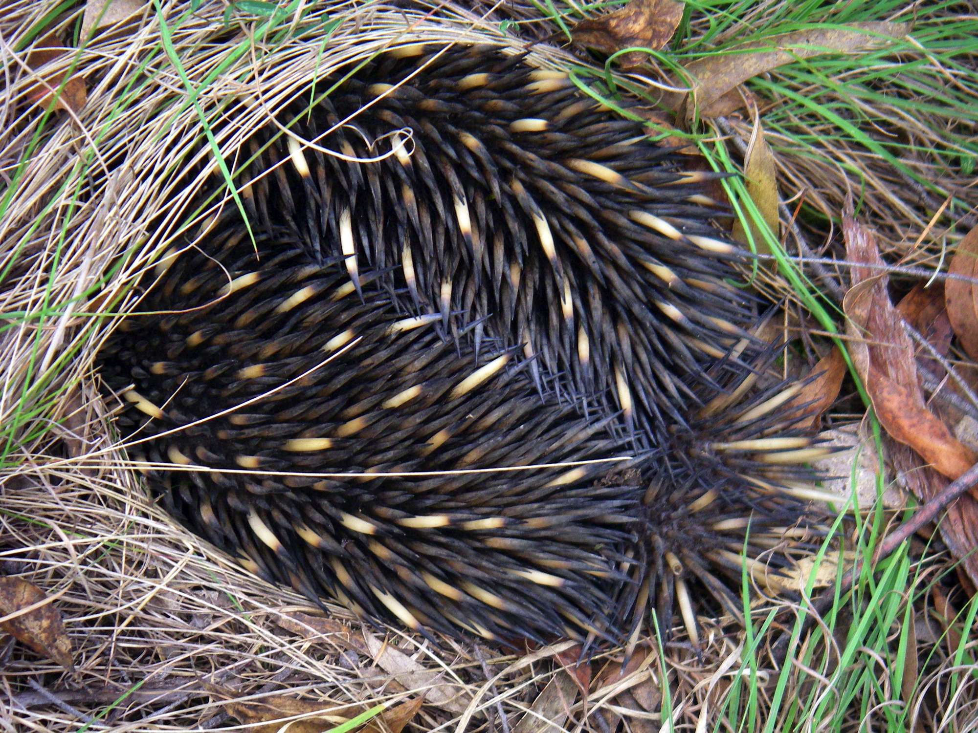
An echidna trying to make itself invisible near the fence on top of the cliff line.
Photo: Don Hitchcock November 2008
A Eucalyptus or gum tree sometimes known as a candle bark, or ribbon bark. Gum trees are adapted to fire, and can withstand wildfires that would kill any other tree. They have adapted to use this to their advantage, by killing off other plants and trees which offer competition. By dropping bark, they create perfect conditions for fire to start and propagate. These strips of bark can be lifted high in the air by a fire, and carry the fire front kilometres in front of the main fire. In addition, they drop very flammable leaves and twigs as well as whole branches, which adds to the fuel load on the forest floor.
This habit makes them sought after by bushwalkers, because below a Eucalyptus you can always find kindling and twigs and small and large branches for a fire to cook the evening meal. The leaves in particular carry oil glands which you can see if you hold a green leaf up to the light. This oil is distilled from the leaves of coppiced trees to make Eucalyptus Oil, which is a penetrating, antiseptic oil that evaporates rapidly and can be used to remove substances such as grease and tar.
The smell of burning eucalyptus leaves and twigs has a very distinctive odour, is almost guaranteed to bring (emotional!) tears to the eyes of an expatriate Australian when suddenly confronted with it, and a green twig with leaves is often placed on top of a billy when boiling water for tea, to give the tea the gum tree flavour.
Eucalyptus trees have dormant buds under the bark, epicormic buds, which sprout a month or two after a fire, making the blackened trunks look like they are covered in a green fuzz. Eventually a dominant shoot becomes apparent, and the other shoots die off. A few years later it is hard to see that a fire has been through the forest. In addition, the ash bed formed from the fire offers ideal conditions for the germination of Eucalypt seedlings.
Photo: Don Hitchcock September 2005
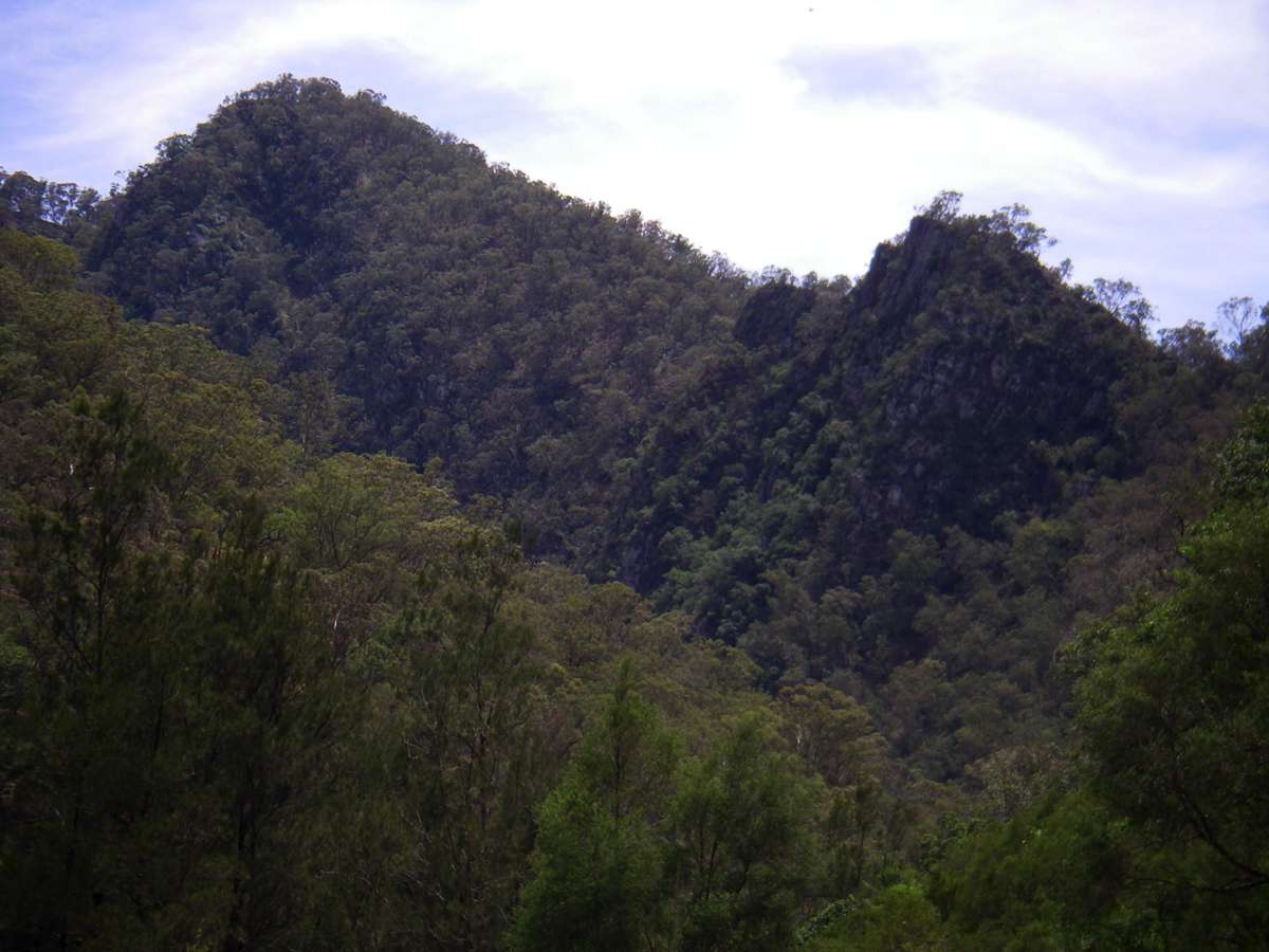
St Helena Ridge
The distinctive shape of the ridge up St Helena Spur, shown here from downstream. It is a very steep but interesting way out of the gorge, with three distinct phases, the first to the lookout I call "Oh Expletive!" lookout, so called because of the view up the rest of the ridge when you get to the lookout and see what is ahead after pushing through the vegetation on the top, and the second the very steep rocky climb up the second phase ridge.
The third phase is the final climb up a broad ridge to the cliffline, which offers no surprises.
The left hand image shows phases one and two, the right hand image shows phases two and three.
Photo: Don Hitchcock March 2008, October 2007
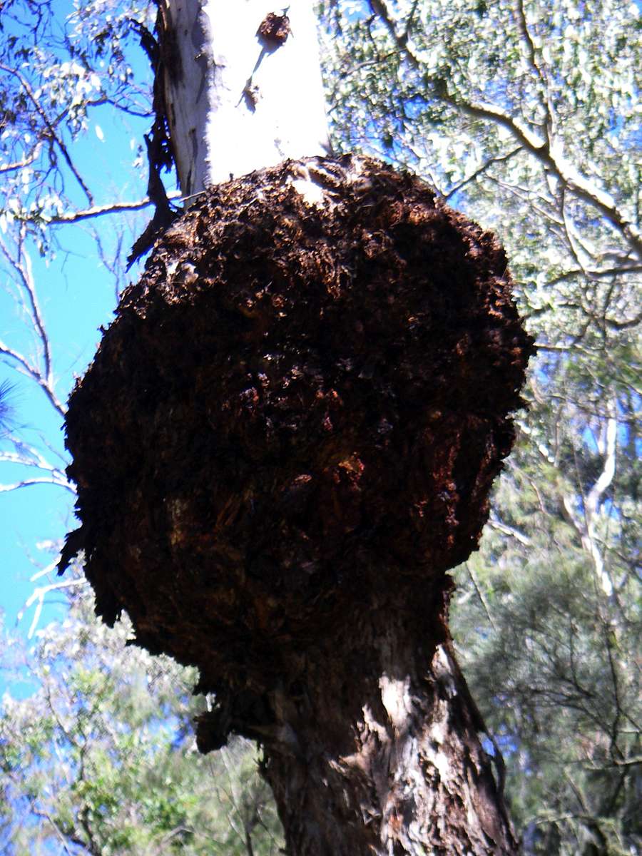
Burl on a gum tree on the way up St Helena Ridge. A burl is caused by an injury to the tree where the growth of the tree changes causing a random swirling grain pattern, much prized by wood turners.
Photo: Don Hitchcock April 2006
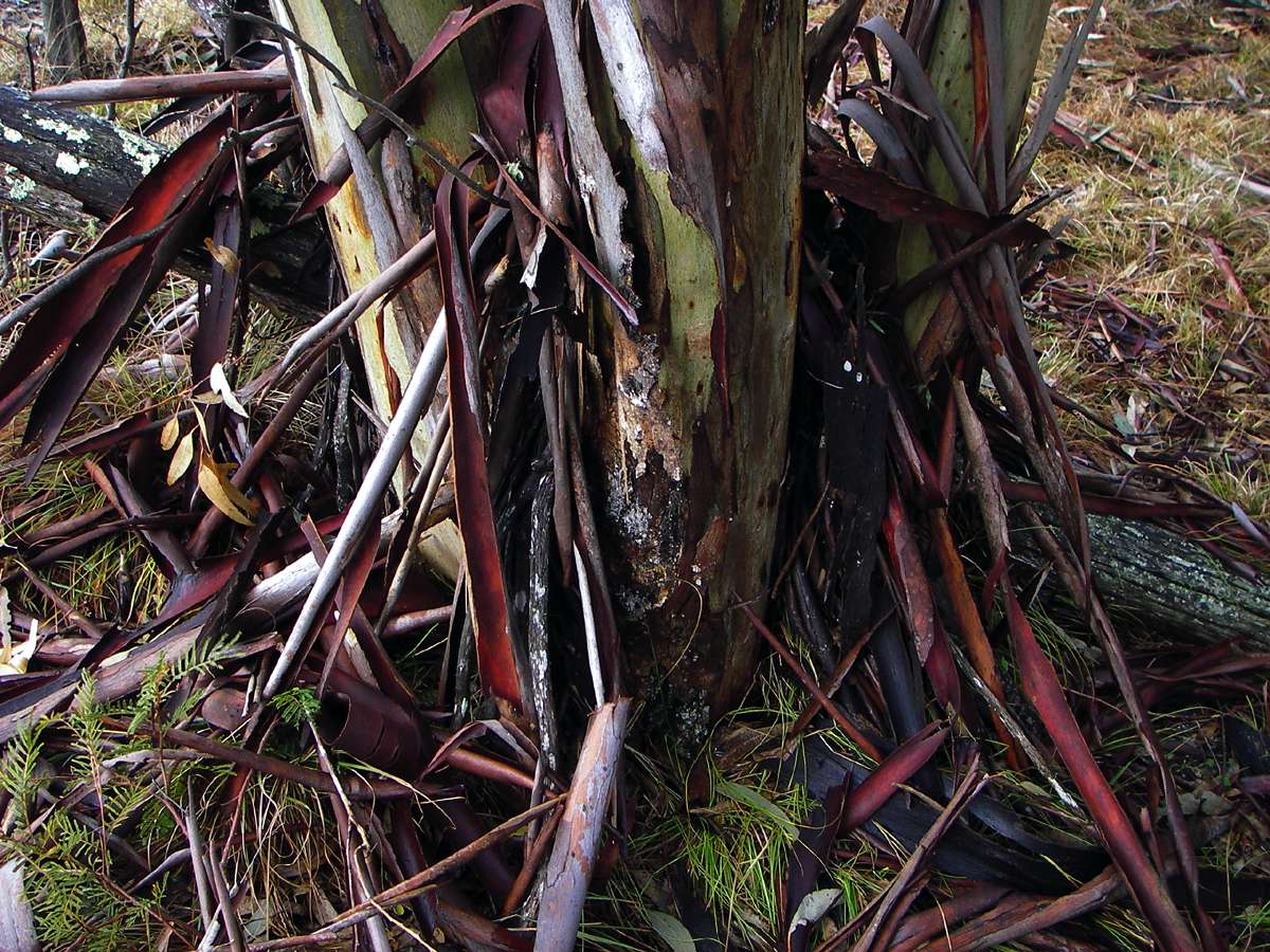
Lignotuber at the base of a Eucalyptus.
Lignotubers are a woody swelling at the base of many Eucalyptus trees, which contain buds and energy reserves. If there is a fire, and the leaves of the plant are burnt off, the lignotuber provides energy for the emergence of epicormic buds protected from the heat of the fire by the thick bark of Eucalypts.
The lignotuber itself has a mass of buds which may become active under really bad conditions, and this allows coppicing of some Eucalyptus species for the efficient production of Eucalyptus Oil from the oil glands in the leaves.
Photo: Don Hitchcock April 2006

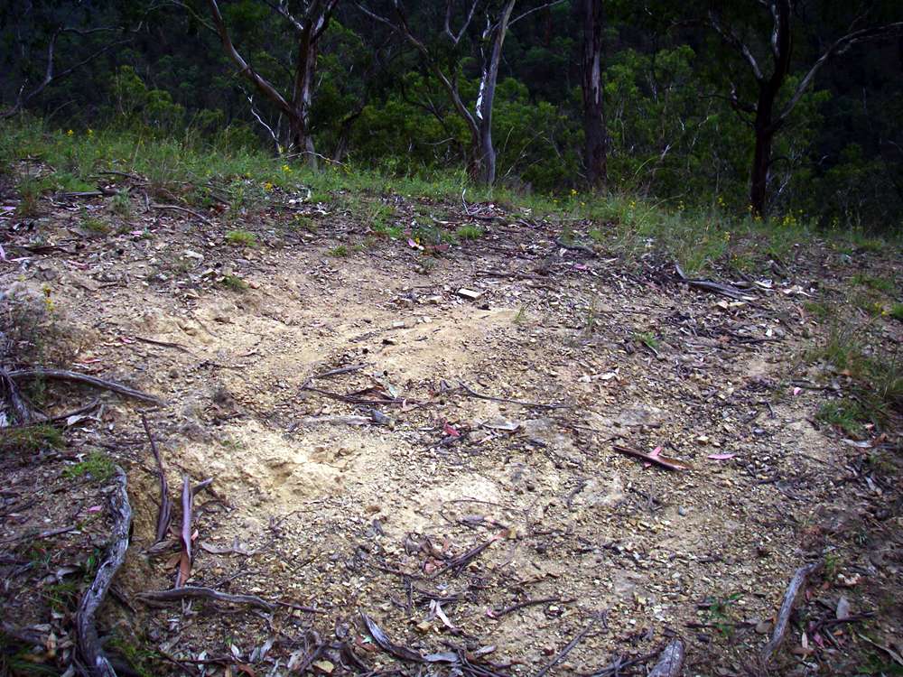
The daunting sight that greets you when you reach the top of "Oh Expletive!" lookout on the way up St Helena Ridge. The walker must go down into the saddle and then climb the rocky narrow ridge in the near background here, though it is not quite so bad as it appears. No actual rock climbing techniques are involved, but it helps to have a head for heights.
Photo: Don Hitchcock April 2006
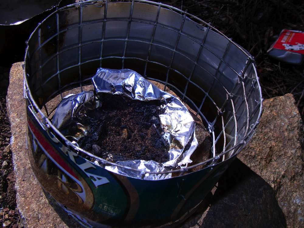
I am always looking for the ultimate bushwalking stove, and this is a method I thought might work, and I decided to try, when having lunch on the lookout.
I carefully cut three sides of a rectangular hole with my sharp knife in one side of a soup packet, folded the "lid" so formed back out of the way, and put the soup mix into my cup, then filled the empty soup packet (aluminium foil and paper and plastic) with fine gravel and clay. Then I poured two coca cola caps of methylated spirit (denatured alcohol, spiritus) into the mix, and lit it.
It boiled a cup of water for my soup with no problems! It could have been re-used many times, and must come close to being the lightest possible stove.
Photo: Don Hitchcock April 2006
Another view of the ridge still to be climbed.
Photo: Don Hitchcock April 2006
The path is not always obvious. At one point two handholds and one toehold became simultaneously portable, and I gashed my knee badly on a sharp rock. I bandaged myself up, and continued on. Luckily no major damage was done, but my knee looked impressive, and I still bear the scar.
Photo: Don Hitchcock April 2006
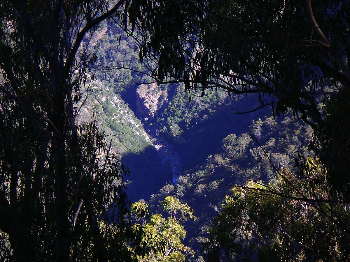
The exposure is sometimes spectacular if you've not climbed ridges like this before.
The Chandler, a long way below.
Photo: Don Hitchcock April 2006
As you climb higher, the slope becomes easier.
Photo: Don Hitchcock April 2006
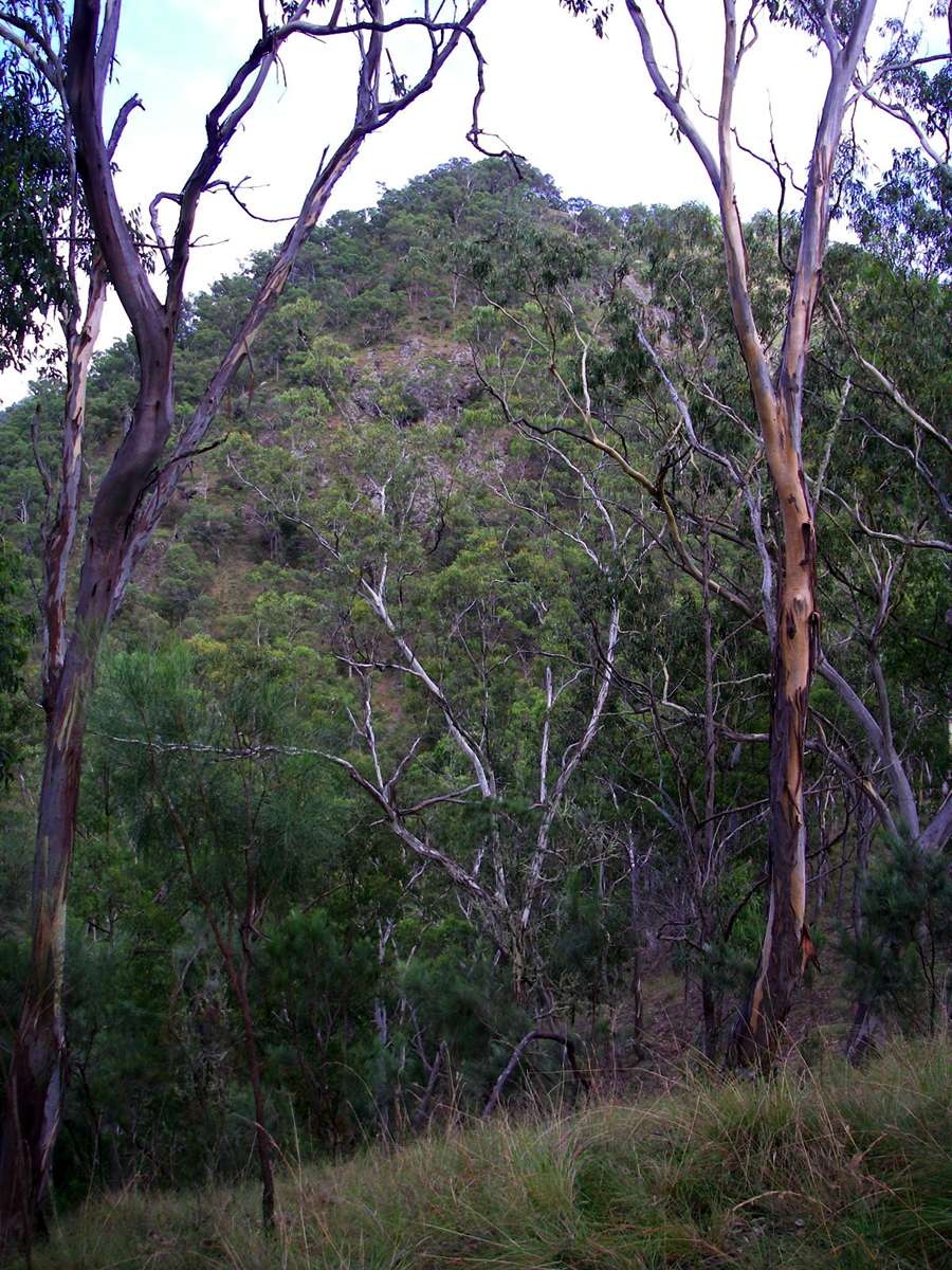
Looking up St Helena Gorge, with the cliff line behind. In wet times, there is a waterfall at the head of the gorge.
Photo: Don Hitchcock April 2006
Nearly at the top of the steepest incline, though not yet at the cliff line.
Photo: Don Hitchcock April 2006
At this point you can sidle down to the right with the sharp ridge above you, and avoid the exposure of the cliff below. There is then the broad ridge in the background of this shot to ascend to get to the cliff line.
Photo: Don Hitchcock April 2006
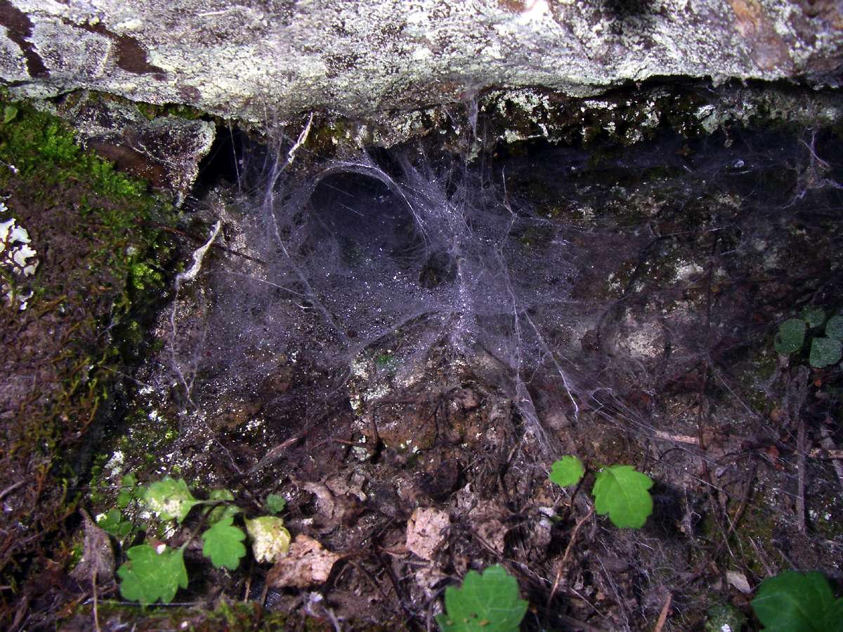
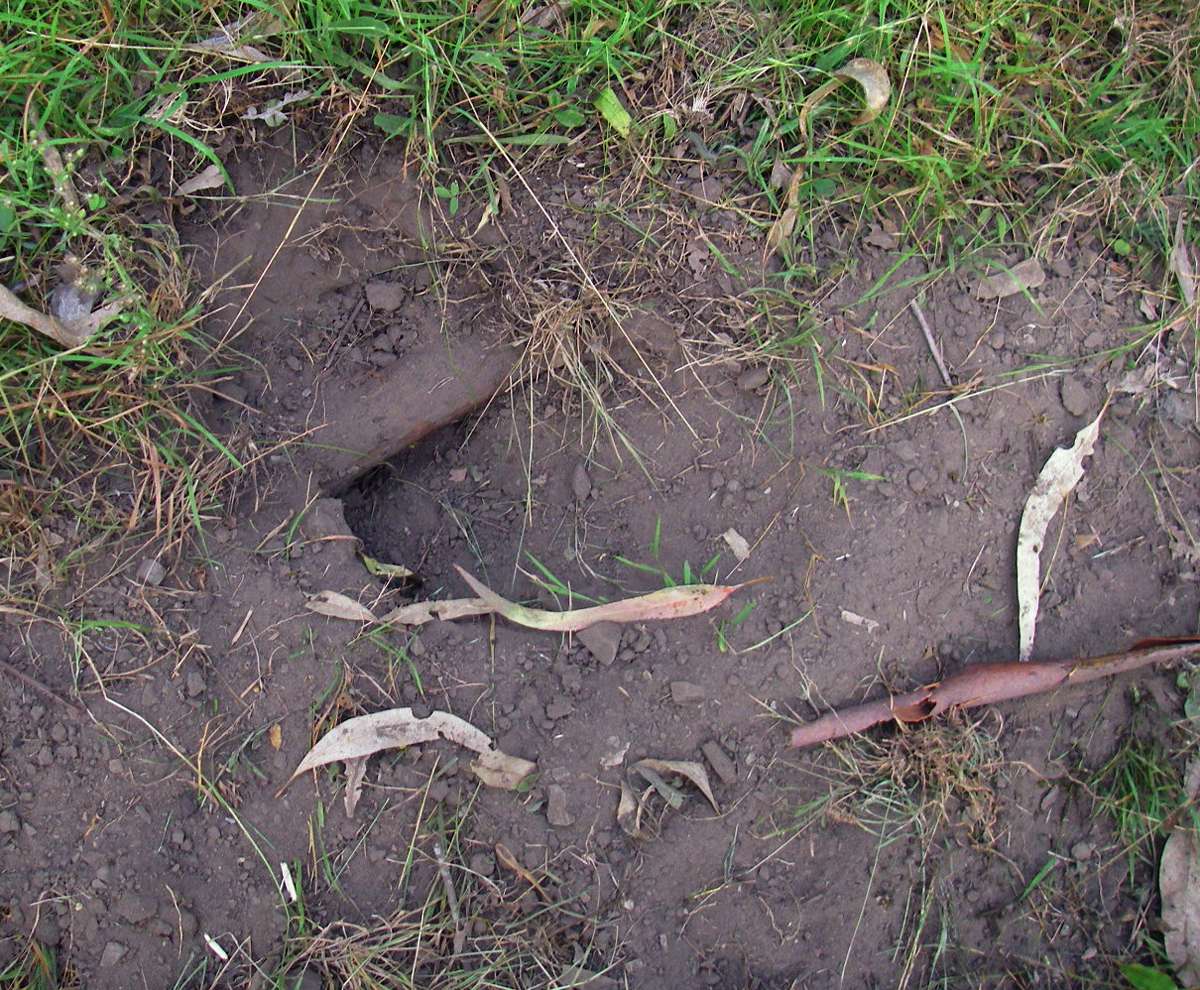
Possibly a funnel web spider hole. I did not investigate further, the local funnel webs have a deservedly dangerous reputation.
Photo: Don Hitchcock April 2006
Zooming in on the Chandler a long way below from the third, broad ridge.
Photo: Don Hitchcock April 2006
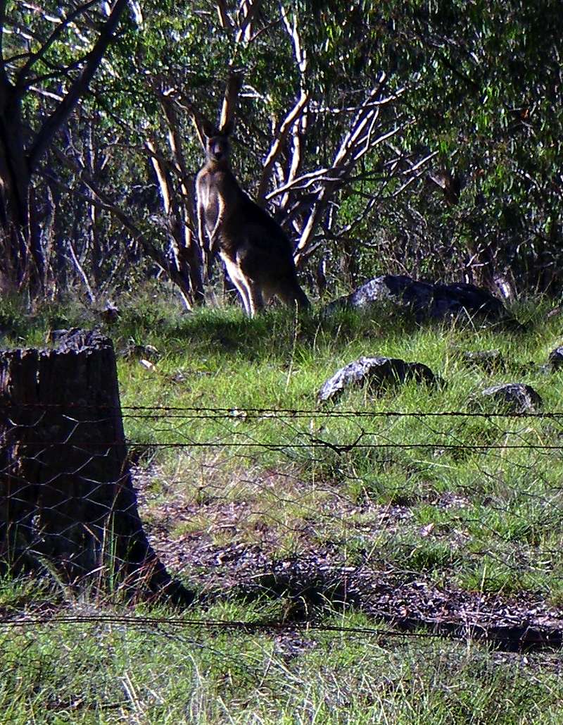
At the very welcome top, a big old man kangaroo was there to greet me. It is a little over half an hour from this point to the Wollomombi Falls car park.
Photo: Don Hitchcock April 2006
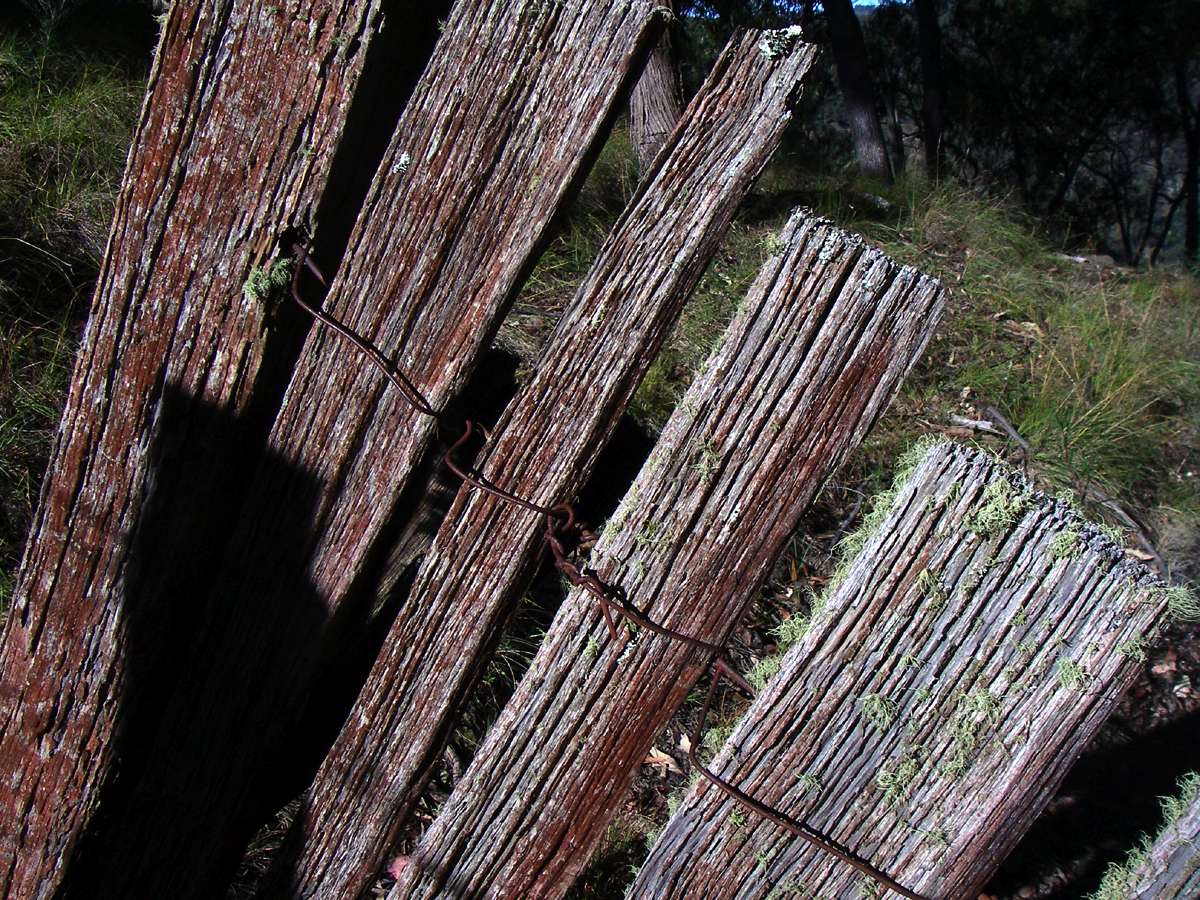
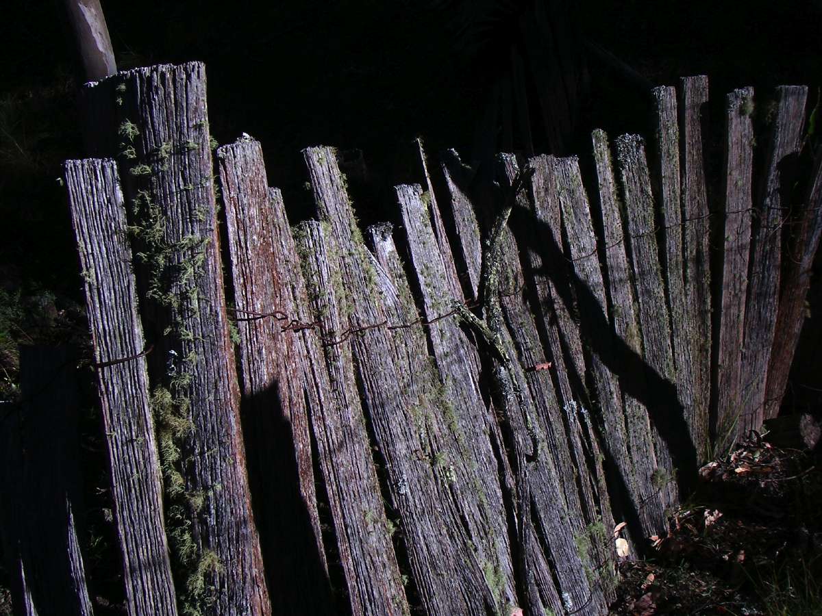
The remains of this fence, painstakingly made more than a hundred years ago, continue for a long way along the cliff line.
Photo: Don Hitchcock April 2006
The Wollomombi paling dog fence
This fence is on the northernmost boundary of Oxley Wild Rivers National Park. Its remains stretch from Wollomombi Falls to St Helena Creek and just beyond. At one stage the fence formed the southern boundary of three properties, 'Rosewood', 'Green Hills', and 'St Helena'. These properties were once part of the larger 'Hillgrove' pastoral run established by Captain Maurice O'Connell in the 1830s.
In 1905 'St Helena' and 'Green Hills' were created, while 'Rosewood' had been in existence since 1880.
At one time, shepherds herded sheep into yards at night, as this offered some protection against the dingo. Portable timber 'hurdles' were used, and to prevent the spread of disease, mobs of sheep were moved from one area to another. As mobs became larger, it became more difficult to herd them at evening. By the 1880s and with the onset of gold mining, labour became scarce and the number of shepherds was reduced. As the sheep industry spread into more inhospitable areas, settlers had to resort to some form of barrier fencing.
By July 1880 a Native Dog Destruction Association offered to pay ten shillings for the scalp of a dingo with a strip of skin attached on some of the properties in the area.
Tons of wire and wire netting were carried by train to Armidale after 1882 and then by road transport to the property. Wire and its transport was a costly item for the grazier and particularly so for small farmers. In some cases settlers brought wire up from Grafton by bullock or horse teams.
The Wollomombi paling fence is, however, unique. Its construction techniques derive from an earlier period before the availability of wire netting. Wire was not readily available in New England until the arrival of the railway in Armidale in 1882. Timber was abundant in the area, skilled bushmen ran sawmills in the region and rural workers had the skills to construct fences. The timber for this fence has been cut by hand rather than by saw. The evidence from its materials and the construction technique suggests that it predates the 1880s.
The first wire available to graziers and farmers was black and nearly 6 mm thick. The black material was a protective covering used to add strength by inhibiting rusting. It was replaced by galvanised wire. The first reference to galvanised wire fencing in Australia appeared in an 1888 advertisement. The boom in wire fencing took place after 1889.
The choice of palings as opposed to wire for the Wollomombi dingo fence seems to have been dictated by the availability of abundant timber, where the expense would be in labour and time rather than materials. There were many skilled timber-getters and workers in the Ebor and Wollomombi districts because of the early demand from the 1880s for wood by the Hillgrove mines. Labour and time, like the materials, were easy to supply whereas wire was costly and difficult to transport. Nevertheless some wire was used. The choice of threaded wire rather than wood to support the palings gave the fence the flexibility to traverse the uneven ground so that each paling sat firmly on the ground without leaving gaps, even as it crossed protruding rocks. The rocky terrain discouraged setting the palings into the ground in the traditional palisade form.
The continuity of the unusual paling fence construction through an area that later had multiple owners is best explained if it was built under one owner in a relatively contained period of time.
The limited evidence from the technique and land tenure suggests that the Wollomombi paling fence was more likely to have been constructed in the late 1870s. As such, it may be the earliest sector of the wild dog fence surviving in New England.
The Wollomombi Wild Dog fence is an item of local heritage significance. It is an early and rare type of barrier fence within a larger system of barrier fencing that continues to function today in northern New South Wales. It represents a distinct variation on a traditional type of fencing that has now been superseded. It is associated with the development of the pastoral industry on the New England Tableland, the changing pattern of land tenure and the ongoing struggles of landowners to reconcile their industry with the competing forces of the native environment.
Text above: Adapted from the very valuable text of an address given by Graham Wilson, OAM, to a meeting of the Armidale and District Historical Society at Kent House on Tuesday, 16 June 2009.
Looking over the edge of the cliff line.
Photo: Don Hitchcock April 2006
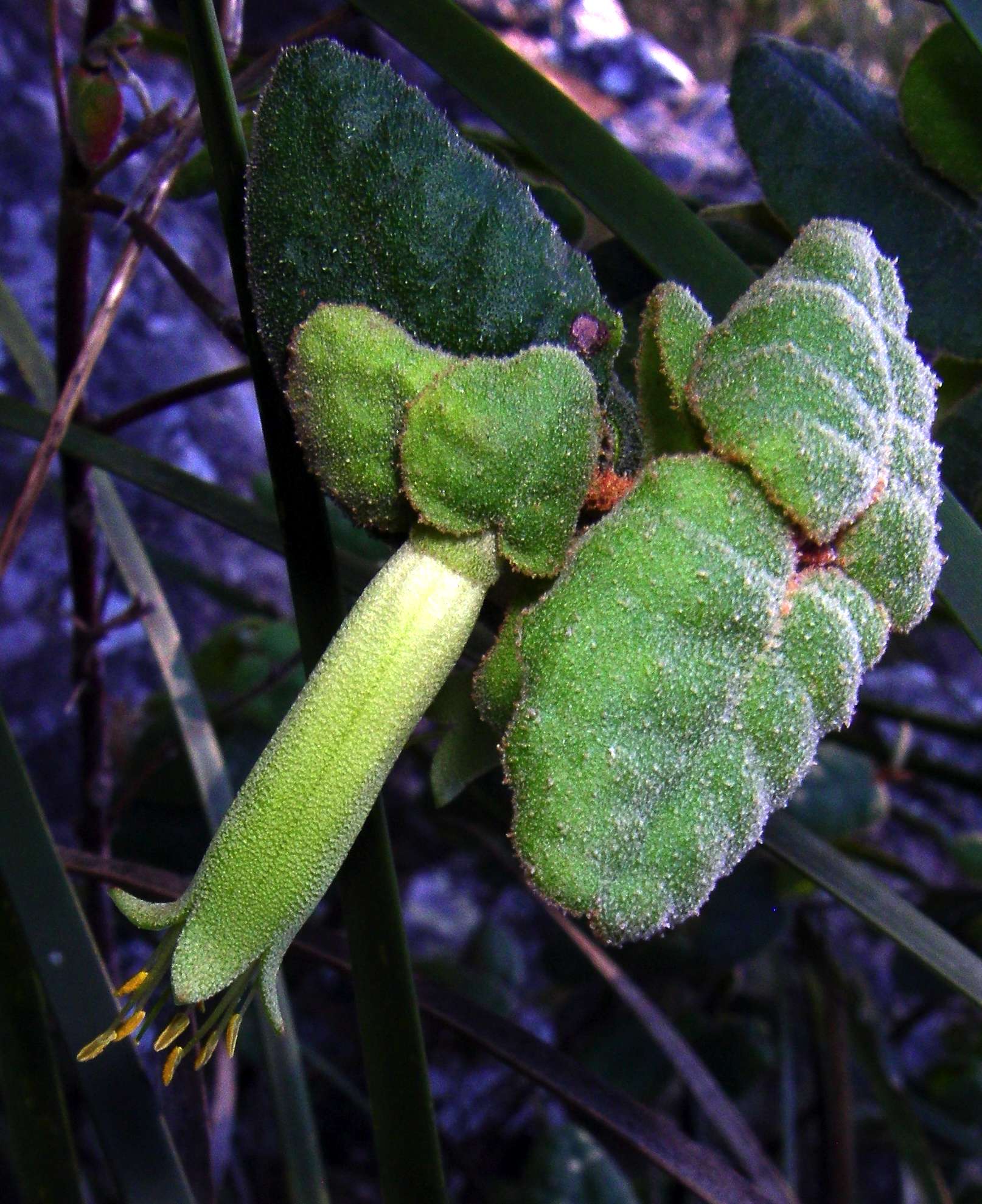
The local green variant of Correa reflexa at the cliff line.
Photo: Don Hitchcock April 2006
Bushwalking Index Anyone (e.g. students, libraries, government agencies such as tourist bureaus, the general public) may use, print and publish the photographs taken by me and presented on this bushwalking file for any legitimate non-commercial purpose, at no cost, and without asking permission. However a note such as "Photo: Don Hitchcock" somewhere in the document would be appreciated if it is to be published.