Back to Don's Maps
Mizyn, Мізин
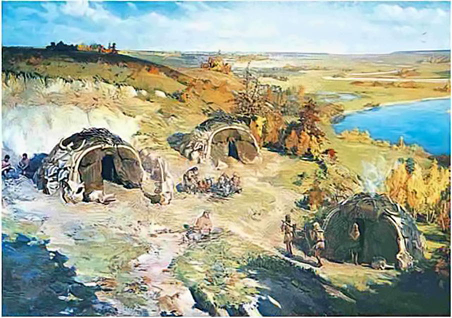
Mizyn scene. Two skulls with tusks form the arched entrances, the tusks being joined by a hollow leg bone. Antlers were woven together to help form the roof.
Note that the entrance was apparently screened with a mammoth hide door.
Artwork: I. Izhakevich.
Source: http://subject.com.ua/textbook/history/6klas_v_1/8.html
Ivan Sydorovych Yizhakevych was a Ukrainian painter, writer, and People's Artist of the Ukrainian SSR. Born: January 18, 1864, Vyshnopil' Died: 1962, Kyiv, Київ, Ukraine (Wikipedia)
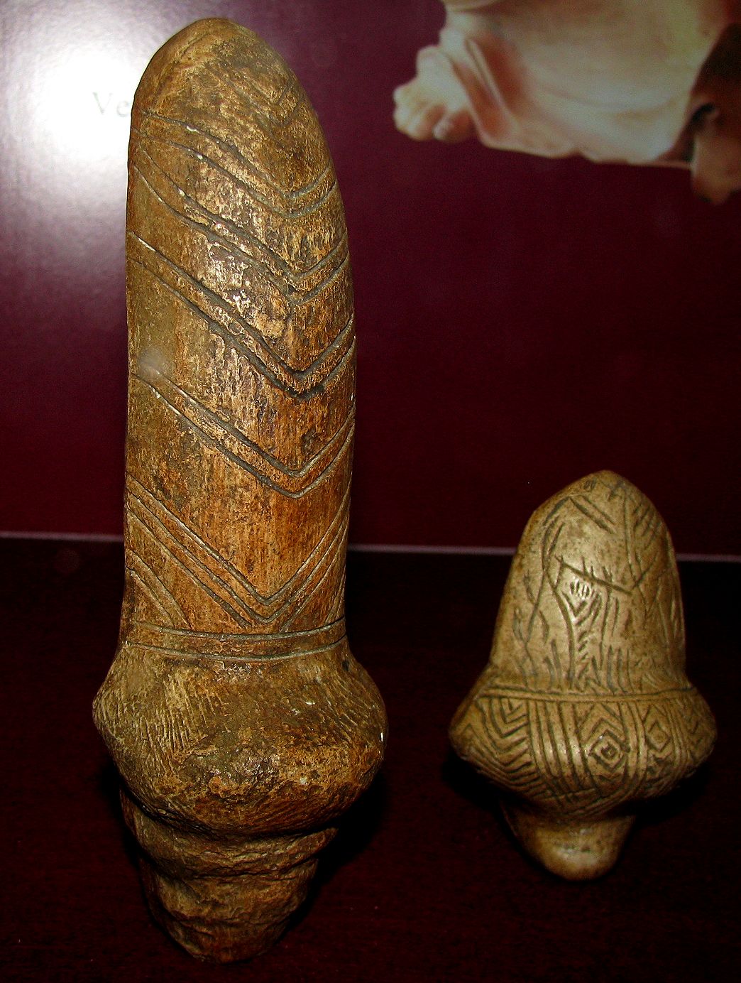
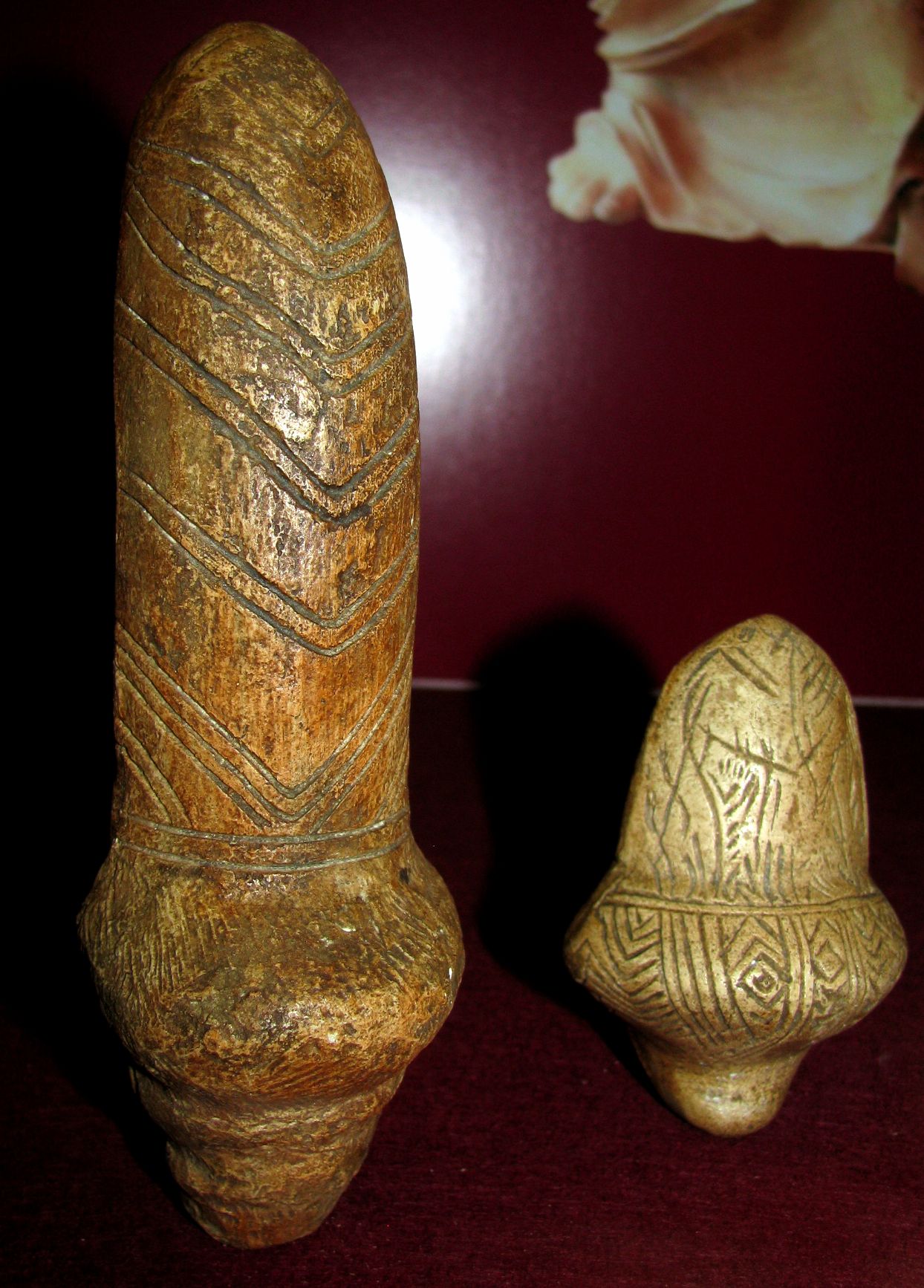
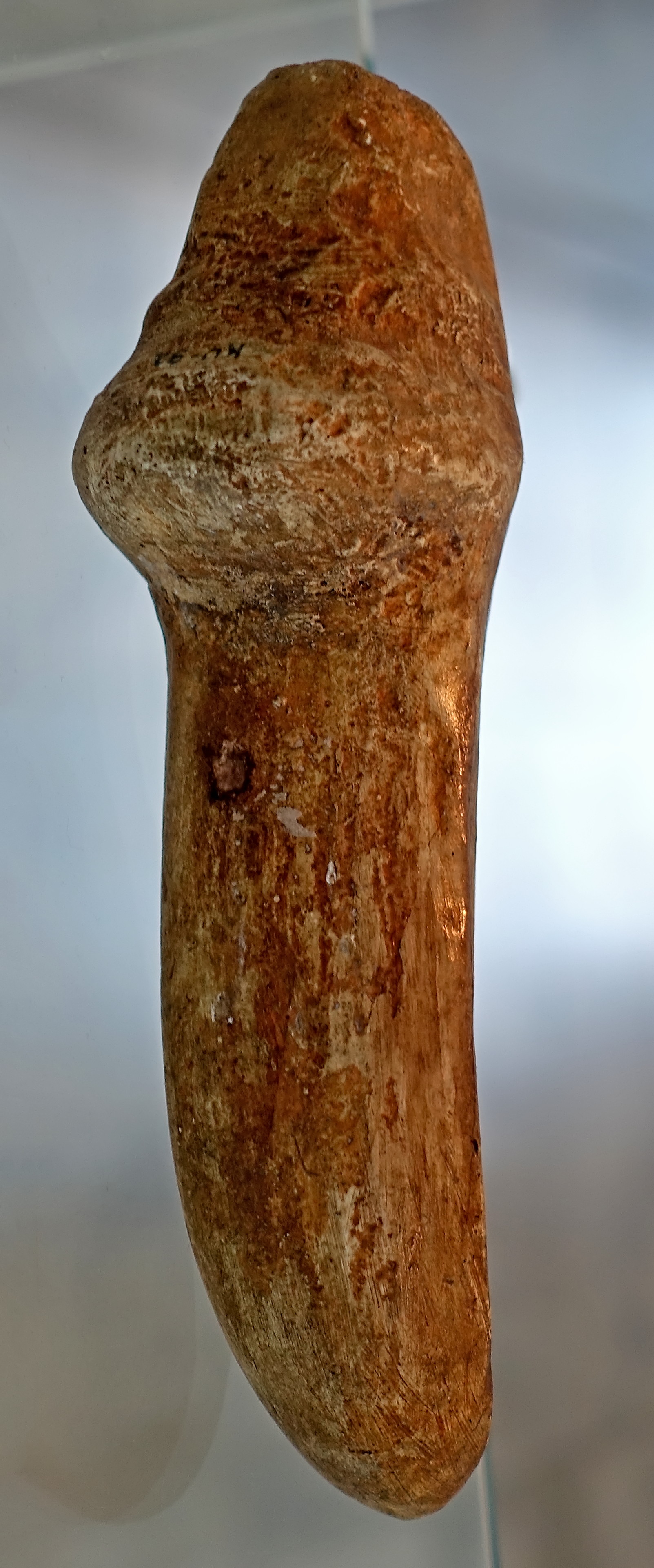
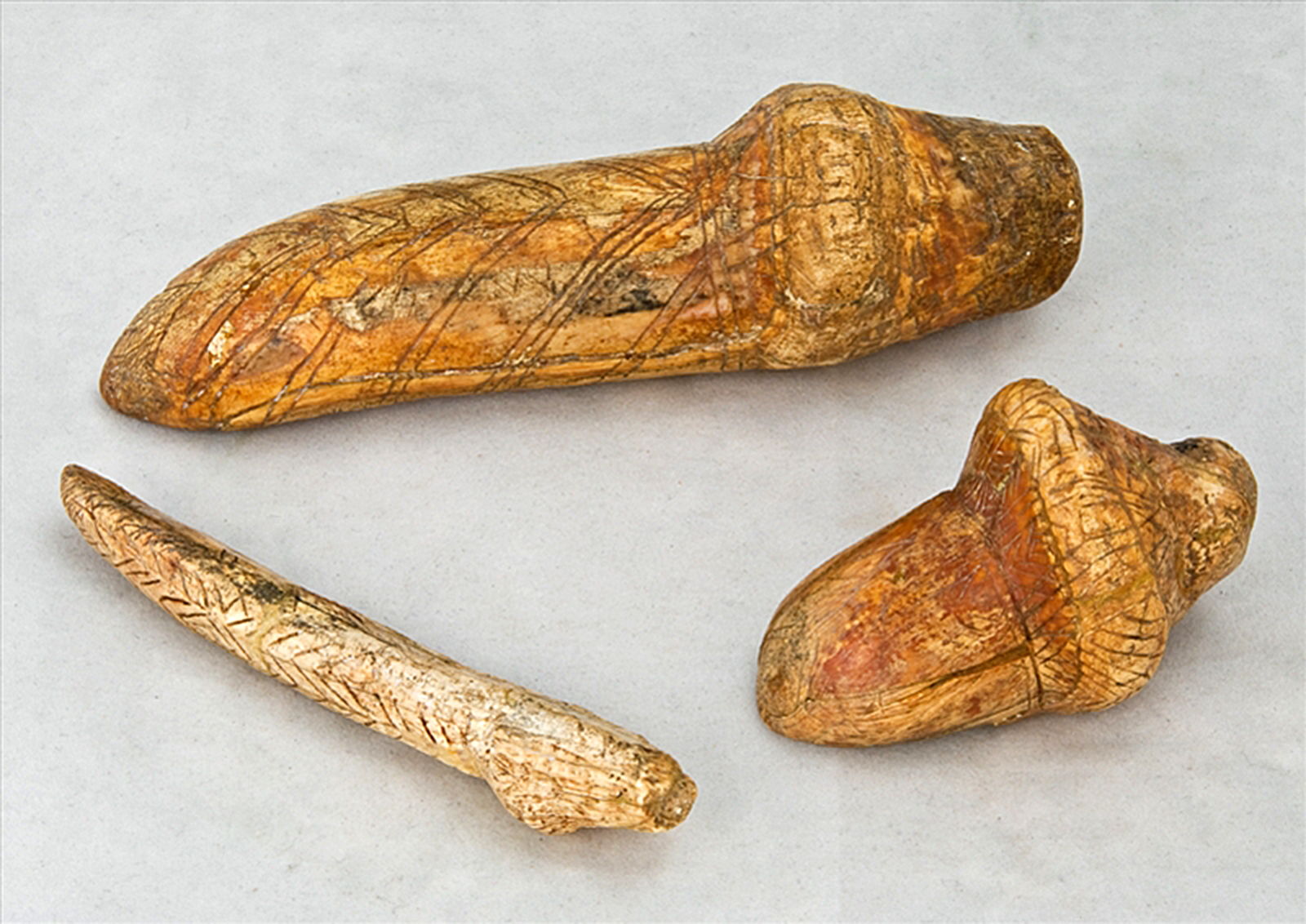
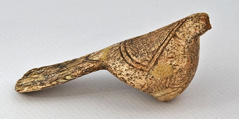
These sculptures and others like them from Mizyn have been variously described as phallic figurines, birds, and bird/woman hybrids. They were made originally in Mammoth ivory.
Photo: Don Hitchcock 2008
Source: Facsimiles in the Vienna Natural History Museum
Highly stylised female figurine from Mizyn, showing a decorated and an undecorated side.
Photo: Don Hitchcock 2018
Source and text: Facsimile, Anthropos Pavilion/Moravian Museum, Brno, Czech Republic
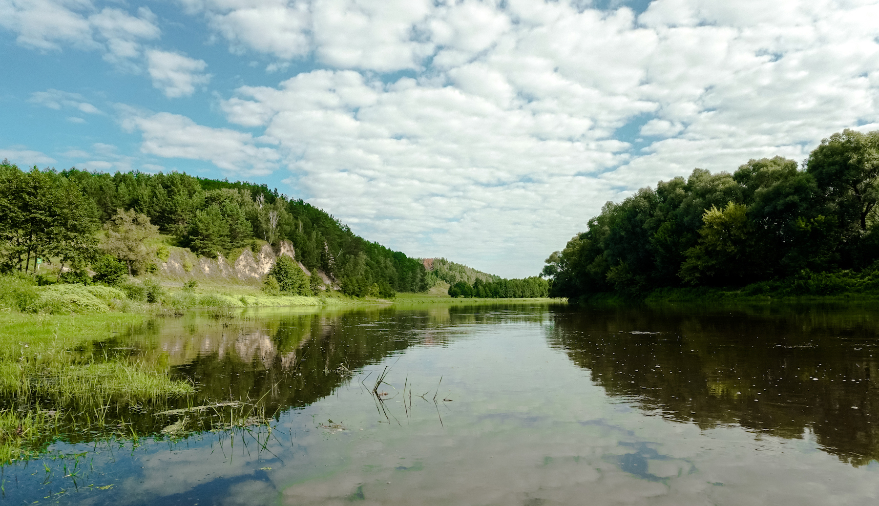
Scene at Mizyn National Park
Photo: VolodymyrKharchenko
Permission: Creative Commons Attribution-Share Alike 4.0 International license
Source and text: Wikipedia
Stylized female figurines of mammoth tusk from Mizyn. 15 000 BP, Late Palaeolithic.
Photo and text: http://www.nmiu.com.ua/en/expositions/prehistoric-period-in-ukraine.html
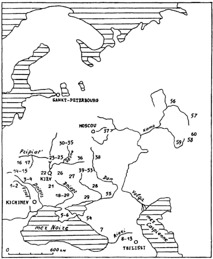
Distribution of mobile art in Eastern Europe.
1 Staryé Duruitory, 2 Brynzeny, 3 Kosseoutzy, 4 Klimaoutzy, 5 Suren' 1, 6 Chan-Koba, 7 Apiantcha, 8 grotte d'Uvarov, 9 Sakagia, 10 Sagvardgilé, 11 Gvardgilas-Kldé, 12 Devis-Khvreli, 13 Taro-Kldé, 14 Molodova V, 15 Lissitchniki, 16 Lipa VI, 17 Klinetz, 18 Ossokorovka, 19 Dubovaya Balka, 20 Kaïstrovaya Balka, 21 Mejiritch (Mezhyrich), 22 Kyivo-Kirillovskaya, 23 Mézine (Mizyn), 24 Novgorod Severskyi, 25 Puchkari I, 26 Dobranitchevka, 27 Gontzy, 28, Rogalik, 29 Amvrossievka, 30 Eliseevitchi I, 31 Eliseevitchi II, 32 Yudinovo, 33 Khoylevo II, 34 Timonovka, 35 Suponevo, 36 Avdeevo, 37 Sungir', 38 Gagarino, 39 Kostienki 19, 40 Kostienki 21, 41 Kostienki 13, 42 Kostienki 1, 43 Kostienki 14, 44 Kostienki 12, 45 Kostienki 17, 46 Kostienki 2, 47 Kostienki 11, 48 Kostienki 4, 49 Kostienki 15, 50 Kostienki 9, 51 Kostienki 8, 52 Borchtchevo 1, 53 Borchtchevo 2, 54 Ilskaya, 55 Murakovka, 56 Ostrovskaya, 57 Bez'imyannyi, 58 Smelobskaya, 59 Kapova, 60 Ignatievskaya.
Photo: Abramova (1995)
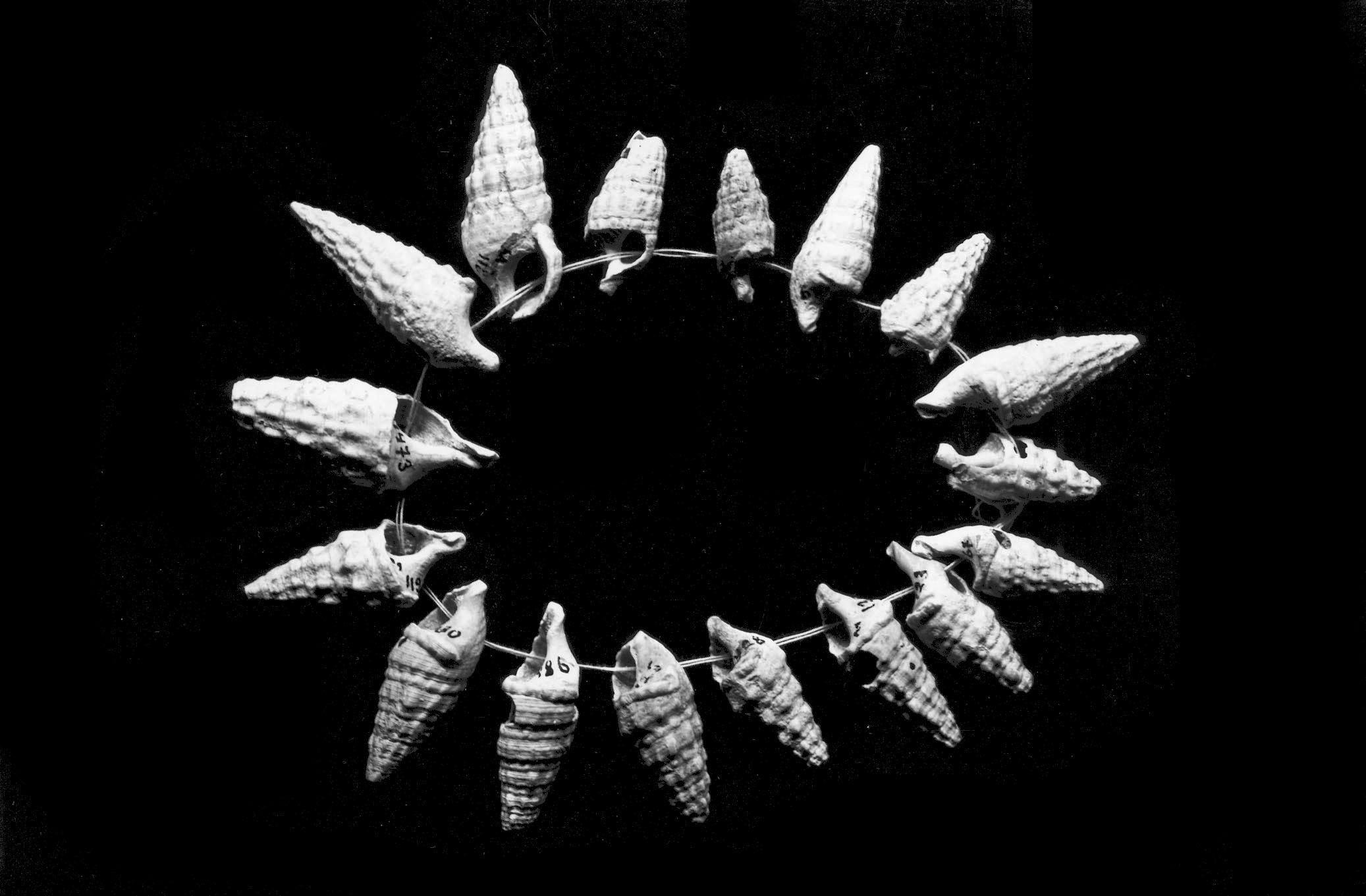
Necklace of contemporary marine shells and fossils from Mizyn.
Photo: © L. Iakovleva and F. Djindjian
Source: Iakovleva and Djindjian (2012)
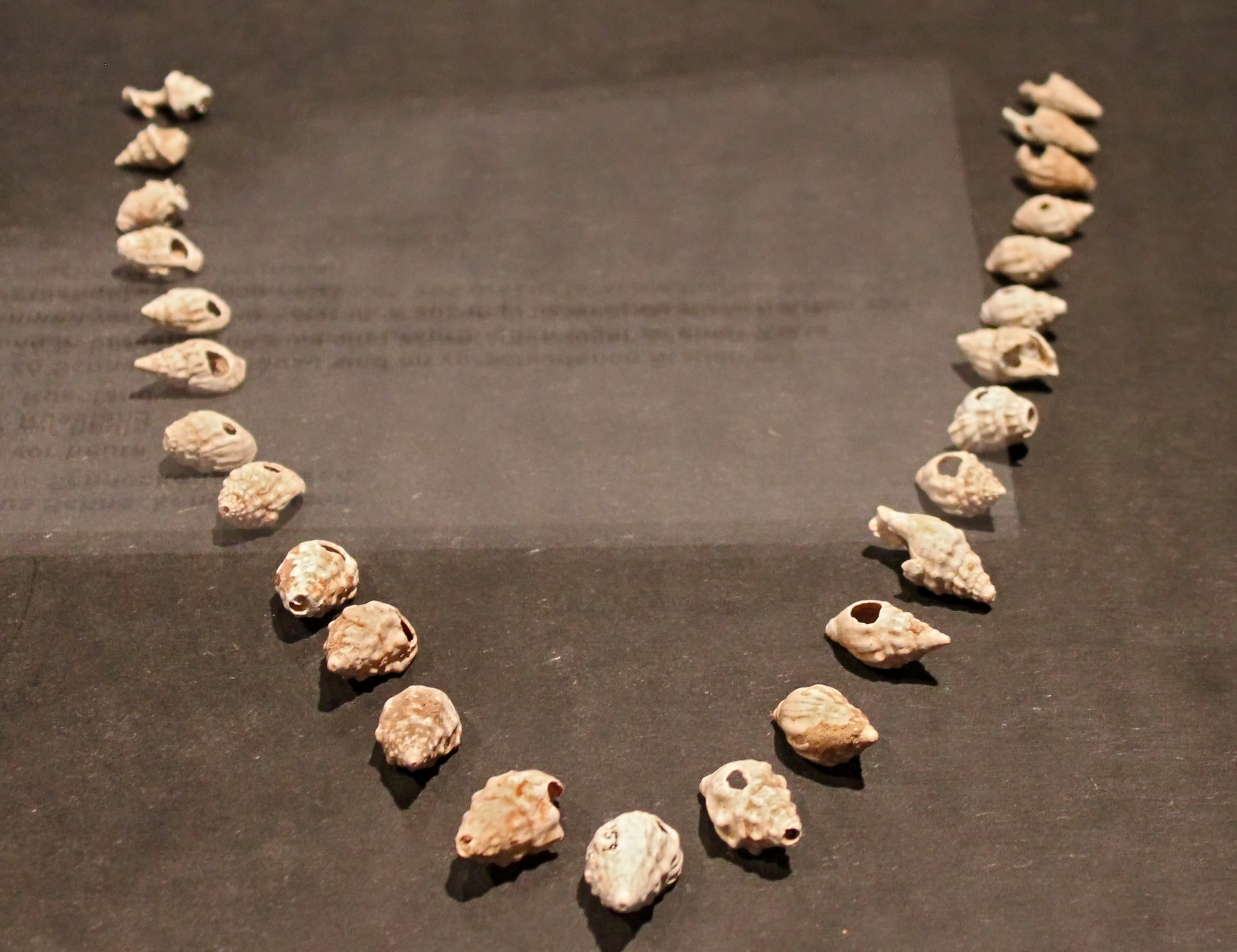
These 26 sea shells have been perforated at various points and were originally combined into a chain. It is composed of three different types of sea shells.
Mizyn, 15 000 BP
Photo: Ralph Frenken
Source: Original, exhibited at the Archeological Museum Hamburg (Ice Age - The Art of the Mammoth Hunters from 18 October 2016 to 14 May 2017)
On loan from the Hermitage Museum, Saint Petersburg, Russia.

Stylized female figurine from Mizyn.
Photo: ©A. Marshack
Source: Soffer et al. (2000)
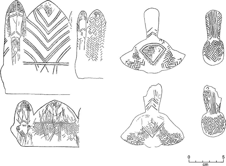
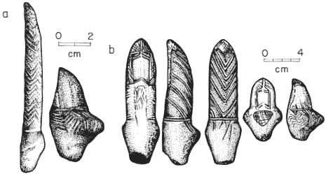
Design motifs on some Mizyn figurines.
Photo: Soffer et al. (2000)
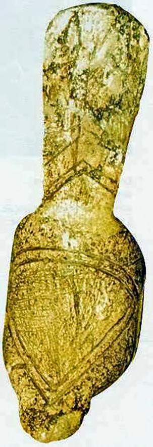
Statuette féminine sculptée avec double triangle pubien et chevrons gravés de Mezine - Collection MNIU - Photo L. Iakovleva.
Female statuette carved with double pubic triangle and engraved chevrons, from Mizyn - Collection MNIU - Photograph L Iakovleva.
(This is the original of the design motif in the top row, second from the right in the photo above from Soffer et al. (2000) - Don )
Photo and French text: "les mammouths - Dossiers Archéologie - n° 291 - Mars 2004"
Photograph L Iakovleva.
My thanks to Anya for access to this resource.
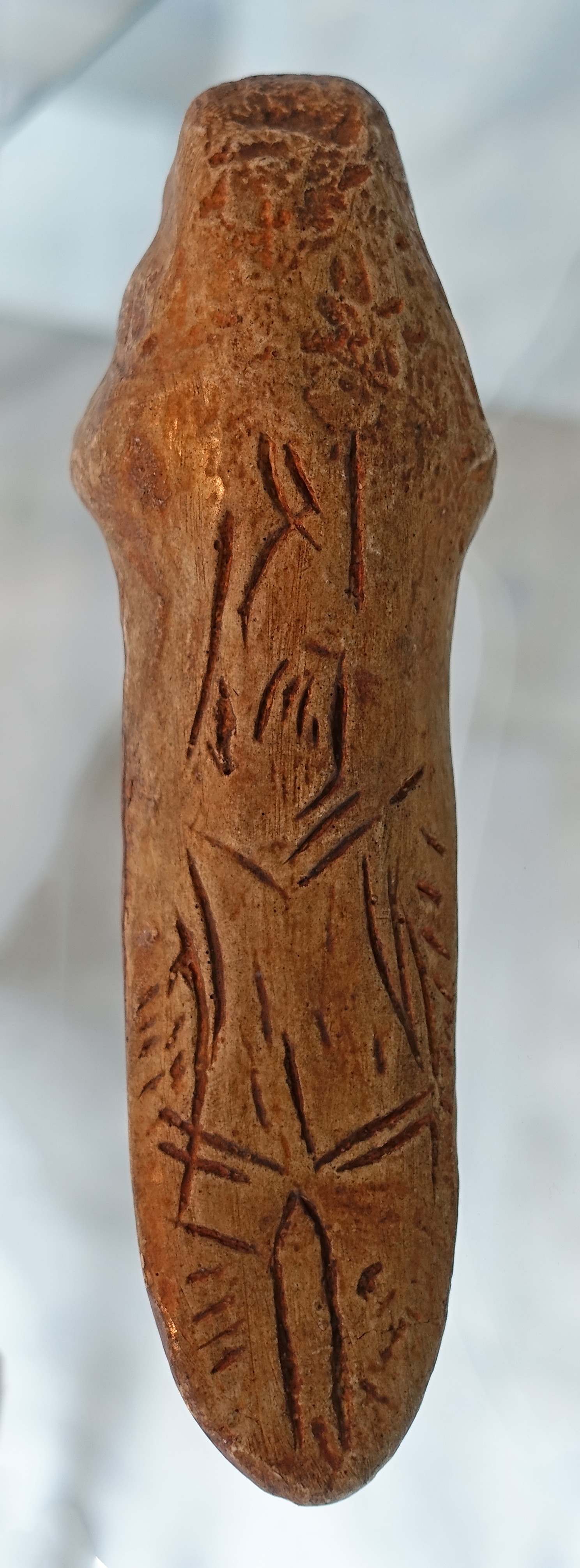
Stylized female figurine of mammoth tusk from Mizyn. 15 000 BP, Late Palaeolithic.
(This photo gives a much better idea of the general form of the statuette above, and highlights the dual nature of the bird/venus motif.
My thanks to Ed Yu for bringing it to my attention - Don )
Photo and text: http://www.nmiu.com.ua/en/expositions/prehistoric-period-in-ukraine.html
These art pieces, variously designated bird/phallic/female figurines from Mizyn, in Ukraine, are also a part of the Lalinde / Gönnersdorf style.
Mizyn is more than 3000 km from Lalinde, but the artworks are clearly part of the same tradition, though translated into a more 'chunky' style, and in mammoth ivory, like the venus figurines of Gönnersdorf (done as figurines in bone and antler, and ivory at the nearby Andernach), rather than in the form of just engravings, as at Lalinde.
Photo: Soffer (1985)
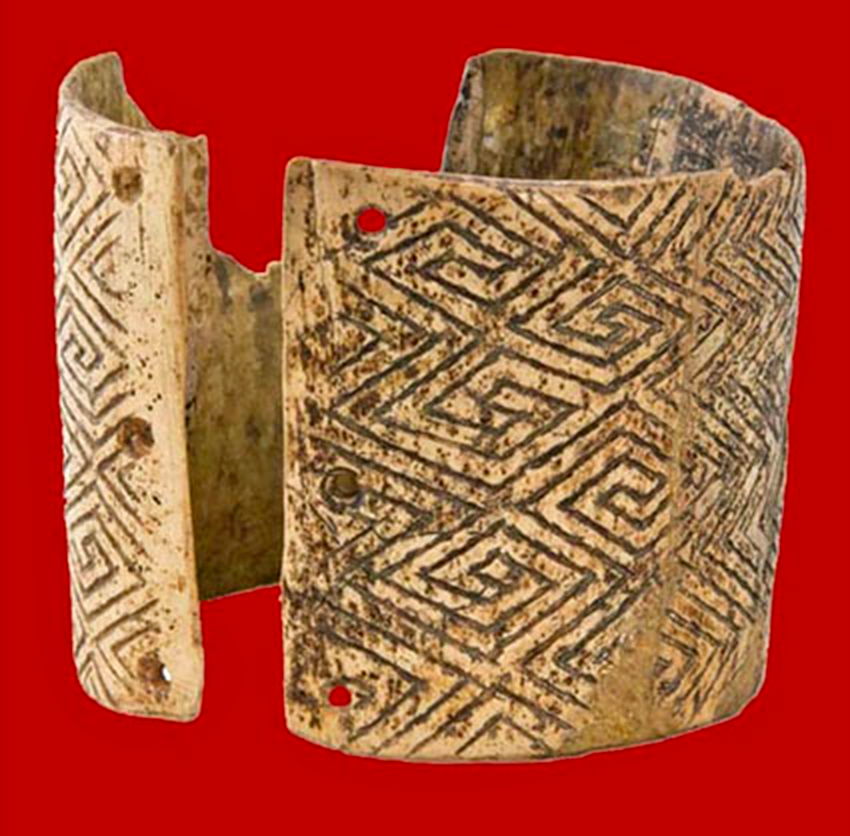
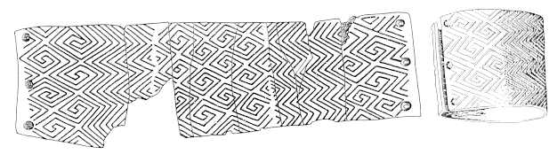
Bracelet of mammoth tusk from Mizyn ornamented with a geometric design.
15 000 BP, Late Palaeolithic.
Photo and text: http://www.nmiu.com.ua/en/expositions/prehistoric-period-in-ukraine.html
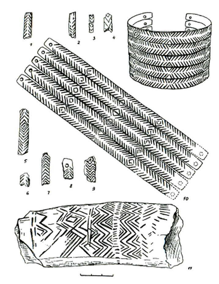
1- 9 fragments of necklaces or bracelets
10 recreations of the fragments as bracelets and a diagram showing the complete recreated design.
11 fragment of a decorated mammoth tusk.
Photo: Abramova (1995)
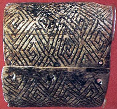
Bracelet gravé en ivoire de mammouth de Mézine. Collection IA NASU.
Bracelet engraved out of mammoth ivory from Mizyn. Collection IA NASU.
Photo and French text: "les mammouths - Dossiers
Archéologie - n° 291 - Mars 2004"
Photograph L Iakovleva.
My thanks to Anya for access to this resource.
Anthropomorphic statuettes.
Photo: Abramova (1995)


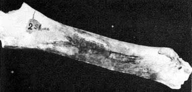
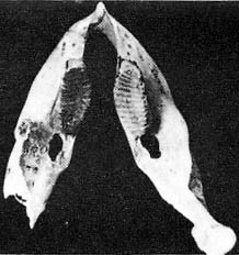
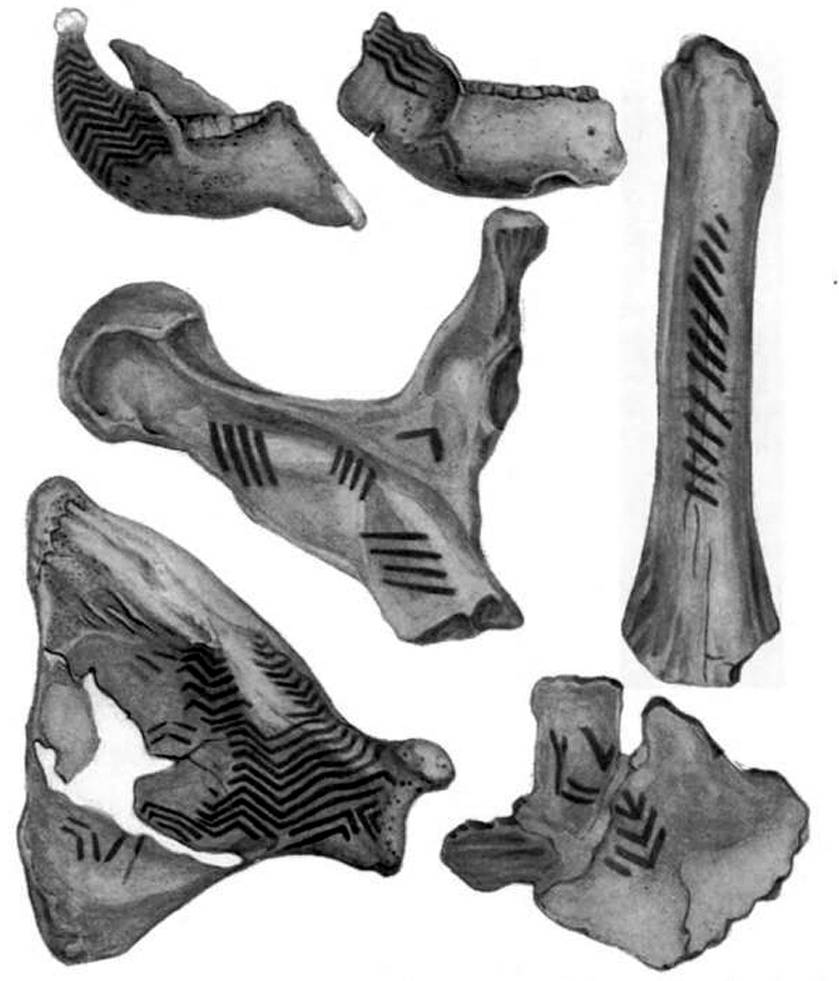
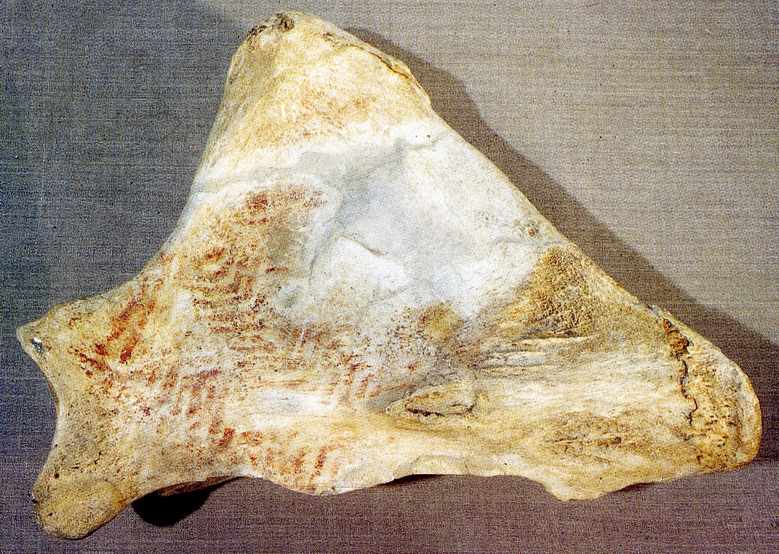
This shoulder blade and the jaws of a mammoth have been decorated and may be musical instruments, played by striking.
The jaws had slightly different decorations on the left and the right. The lines appear to have been drawn with a finger.
Photo: Don Hitchcock 2015
Source: Facsimiles, Vienna Natural History Museum
Text below from Lister, Bahn (2007)
Northern peoples today, such as the Eskimo and Samoyed, always have a dance hut in their villages. This is the same size as a dwelling, but is set aside for song and dance, entertainment and ritual, and is used especially in the festivals of autumn and winter, at the start of the winter hunt.
The site of Mizyn in Ukraine, dating to about 24 000 years ago, contains a mammoth bone hut which may have been devoted to a similar use.
Although the interior space was probably too constricted by roof supports to allow for dancing, the floor appears to have been kept clear of domestic refuse - a sign that it was perhaps used for ritual purposes.
A set of mammoth bones painted with red ochre and a reindeer antler hammer were found in a group on the floor of the hut. Originally they were thought to be art or cult objects.
However, subsequent analysis revealed areas of surface damage on all of them, as well as signs of smoothing, thinning, polishing or rubbing. The conclusion must be that they formed a set with some common function that involved concentrated blows, as well as rubbing and polishing through prolonged contact with hands and perhaps fur clothing. The reindeer antler has the polish of long use on its handle, while its working surfaces are very worn and its spongy pores have reddish ochre in them, picked up from the decorated surfaces on the mammoth bones.
A controversial interpretation of this evidence is that these bones were used as musical instruments, in a kind of ice age orchestra. The bones were presumably percussion instruments, struck with hammers. A mammoth shoulder blade, decorated with linear and zigzag stripes in red ochre, bears traces of polish on the neck, corresponding to the positions of the palm and thumb, suggesting that this was where it was held with the left hand, while the right hand struck the body of the instrument with a hammer. Other areas of wear possibly indicate that the bone was hit in different places to vary the tone of the note produced.
A femur had had the soft, spongy material extracted from inside, perhaps to increase its resonance. It may have been played horizontally, like a xylophone, perhaps on a support rather than on the ground, judging from other polished areas. A half-pelvis and two jaw bones, likewise painted with red parallel stripes, appear to have been used in a similar way.
The two jawbones were placed on their undecorated left sides, and the right sides - both painted with red stripes - were struck. The teeth were removed from one of them, perhaps to alter its resonance. A piece of bone from a skull, decorated with spots of red colour, was probably used as a drum: the cranium's cellular structure creates an unusual resonance, as experiments with modern elephant skulls have shown.
Finally, among this set of bones was a 'bracelet' made of five very springy rings of ivory, perforated so that they could be tied together, and all incised with a herringbone design. This too may have been a kind of musical instrument, producing a sound similar to castanets.
The hut also contained two or three kilograms of red and yellow ochre, in four concentrations, as well as bone pendants, needles and awls: some scholars have suggested that these may have been used to prepare theatrical performances.
After restoration and conservation at the Hermitage museum, all the original Mizyn instruments were played with bone hammers by a collection of percussionists under the direction of VI Kolokolnikov of the Kyiv State Philharmonic. The musicians were able to produce a variety of resonant sounds using their knowledge of the music of northern peoples today, and were able to give a rendering of what Ice Age music might have sounded like.

The original jam session. Assistants at the Ukrainian Museum of Archaeology, Kyiv, are here seen in 1976 recreating the sounds of an Upper Paleolithic "orchestra" using painted mammoth bones found at the site of Mizyn. The bones date from about 20 000 BC
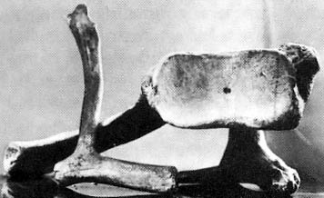
The instruments consist of a mammoth shoulder blade as a drum with an antler hammer,
a mammoth hip bone said to resonate with different tones like a xylophone,
parts of a "castanet"
and a "rattler" made from mammoth jaws.
Photos: Secrets of the Ice Age by Evan Hadingham, 1980
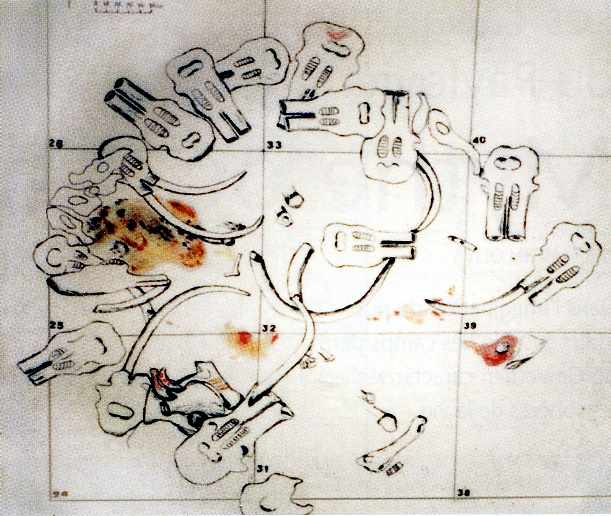
Mammoth bones decorated with geometric designs from Mizyn on the Desna River (after Pidoplichko 1969, 97, fig 31)
The site of Mizyn is located on the Desna River approximately 25 kilometres downstream from the city of Novgorod-Severskii in Ukraine. The occupation area lies on the lower slope of a large tributary ravine near its confluence with the main valley, approximately 10 metres above the modern river bed. The artifacts and features are buried in loess-derived colluvium, and their stratigraphic and chronologic position is not well defined.
Three radiocarbon dates obtained on mammoth teeth yielded ages of 29 000, 21 600, and 15 100 years BP. Mizyn was discovered in 1908 by F. K. Volkov, and was excavated over the course of many decades by Ukranian and Russian archeologists such as Efimenko, Voevodskii, and Shovkoplyas.
Over 1200 square metres of the occupation area was eventually exposed. The features appear to include at least two former structures of mammoth bone, several bone filled pits, hearths, and debris concentrations. More than 113 000 stone artifacts were recovered, with burins predominating heavily among the tools, and the nonstone inventory uncluded a large and diverse inventory of tools and art. THe associated faunal remains are primarily mammoth and arctic fox, but large numbers of wolf, horse, reindeer, and musk-ox are also present
Photo and text: Hoffecker (2002)
Omoplate de mammouth peinte utilisée dans la construction d'une des
cabanes de Mézine. Photo L. Iakovleva.
Painted mammoth scapula used in the construction of one of the huts of Mizyn. This appears to be very similar to the scapula depicted above, rotated through 180°. Photo L Iakovleva.
Photo and French text: "les mammouths - Dossiers
Archéologie - n° 291 - Mars 2004"
My thanks to Anya for access to this resource.
![]()
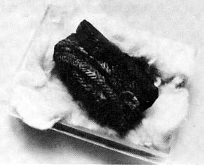
Aiguille à chas gravée de chevrons en ivoire de mammouth de Mézine -
Collection MNIU.
Mammoth ivory needle with eye, engraved with chevrons, from Mizyn. Collection MNIU.
Photo and French text: "les mammouths - Dossiers
Archéologie - n° 291 - Mars 2004"
Photograph L Iakovleva.
My thanks to Anya for access to this resource.
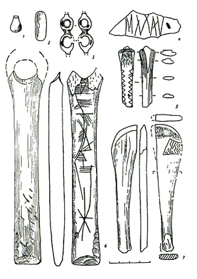
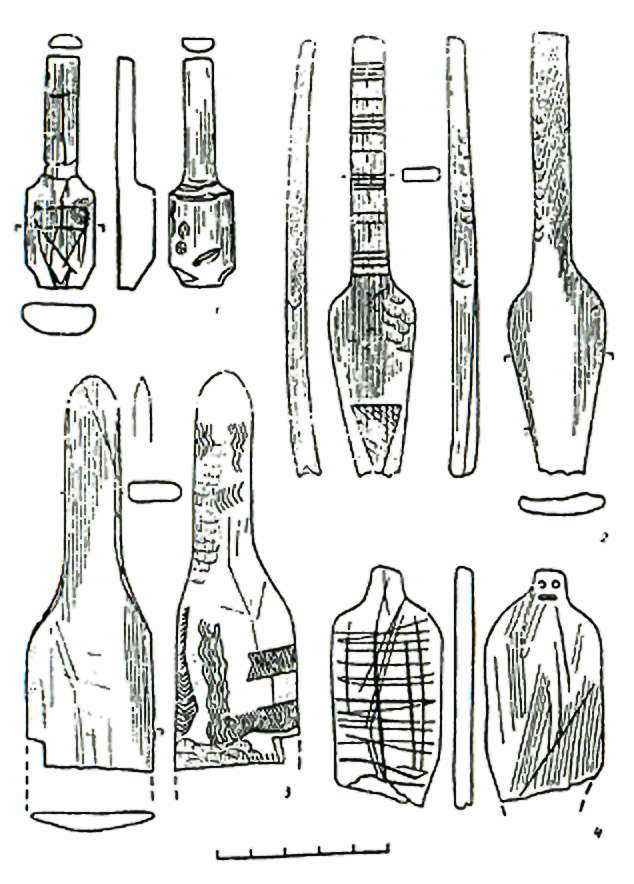
1-2 Beads in the process of being made, in yellow amber.
3 Labelled a broche en ivoire, this looks like ivory beads in the process of being made.
4 Fragment of engraved bone.
5 Fragment of a decorated rod.
6 Baton percé, a spear straightener.
7 Fragment of a decorated scoop.
Photo: Abramova (1995)

Cabane No 1 de Mézine avec les zones d'activité de plein air. Photo IA NASU
Photo and text: Archeometriai Müely 2005/4
Les parures en coquillages au Paleolithique superieur recent dans les territoires de peuplement du bassin du dniepr
by Lioudmila Iakovleva
From:
http://www3.calle.com/info.cgi?lat=51.8167&long=33.0833&name=Mezin&cty=Ukraine&alt=403
Latitude 51.8167 Longitude 33.0833 Altitude (feet) 403
Lat (DMS) 51° 49' 0' N Long (DMS) 33° 4' 60' E Altitude (metres) 122
From:
http://history.cn.ua:8101/english/
The Chernihiv (Чернігів) Regional Historical Museum by V. Tarnovsky is the oldest and best known in Ukraine. It was founded in 1896.
The settlement of Mizyn is one of the oldest in Ukraine and belongs to the Paleolithic. Excavation showed that it consisted of five household complexes.
The time of the settlement existence may account for 22-23 years. At least seven families totalling 50 people lived there.
They hunted for large animals and in most cases for mammoths. Collective hunting gave them food, skins for covering dwelling houses and clothes.
Bones of large animals were the best building materials at that time.
On display in the museum are bones of mammoth's shoulder, lower jaw, and tusk.
Flint tools are widely represented by various cutters, scapers, and prickers.
The Mizyn settlement have become famous of their works of art. The inhabitants made ornaments from mammoth's bone, and liked decorative items made from cockleshell.
The settlement of Mizyn is celebrated for its oldest musical instruments complex, which consists of an ornamented mammoth shoulder, antler hammer, noisy bracelet.
The inhabitants performed their dances under this music more than 20 000 years ago.
This reconstruction is of the remains of a similar hut to those of Mizyn, but found in Germany:
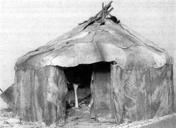 Gönnersdorf (Rhénanie-Palatinat), Magdalénien supérieur, vers 12 600. Cette reconstitution réaliste de l'habitation no 1 (Ø = 7 m) s'inspire librement d'une yaranga tchouktche; la carcasse en bois dont le toit s'appuie sur un mât central est recouverte de peaux de chevaux, l'entrée cloisonnée largement ouverte au sud-est laisse voir le dallage de schiste et le support d'une broche à un fémur de mammouth.
Gönnersdorf (the Rhineland-Palatinat), higher Magdalenien, around 12 600 BP. This realistic reconstruction of the dwelling No 1 (diameter = 7 m) is similar to a yaranga (the traditional circular dwelling tent) of the Tchouktche people of Siberia. The structure's roof is supported on a central pole and is covered with horse hides, the partitioned entry opened to the south-east lets us see the schist (flag stones) pavement and the femur of a mammoth.
From:
http://fulbright.kiev.ua/cohen/index.htm
The palynological spectra of Mezhirich site (Middle Dnipro / Дніпро area), that is about the same latitude as a Rogalik-Peredelsk group, marks undoubtedly prevailed steppe periglacial landscape. The pollens of a birch, alder and pine are rather individual (Dolukhanov, Pashkevich, 1977; Kornietz and all., 1987, p. 109).
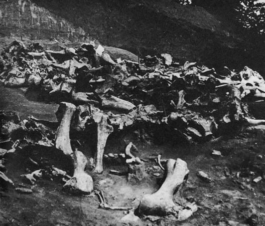
View of mammoth bone ruins excavated at Mizyn in Ukraine
Click on the photo for a larger view.
Photo: Secrets of the Ice Age by Evan Hadingham, 1980
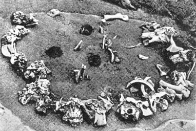
Circular hut at Mizyn. As an experiment tusks were placed in the upright skulls which formed the outer wall. This demonstrates how the combination could have formed a viable structural unit.
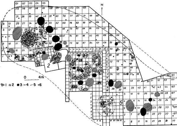
5, limits of the site; 6, border of the core and periphery areas of the site
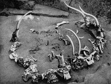
 Plan du pourtour de la cabane n°1 de Mézine d'après le document I. G.
Chovkoplass. Relevé des ossements de mammouths ornés d'après L. Iakovleva.
Plan du pourtour de la cabane n°1 de Mézine d'après le document I. G.
Chovkoplass. Relevé des ossements de mammouths ornés d'après L. Iakovleva.
Plan of the circumference of the hut n°1 of Mizyn according to the document by I G Chovkoplass. Plan of the bones of decorated mammoths according to L Iakovleva.
Photo and French text: "les mammouths - Dossiers
Archéologie - n° 291 - Mars 2004"
Photograph L Iakovleva.
My thanks to Anya for access to this resource.
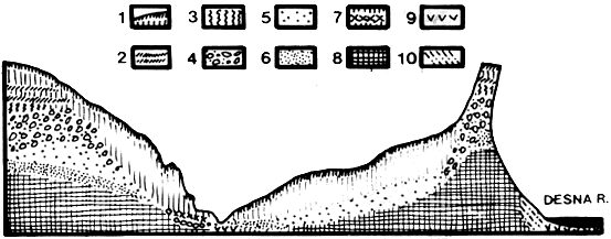
6, sand; 7, cultural remains; 8, chalk; 9, alluvium; 10, colluvium
Mizyn, like many other sites on the East European Plain, was discovered during excavation for a cellar. It was excavated at various times from 1908 to 1961.
Its position is at 51 deg 45 min N, 33 deg 05 min E.
(From Soffer, Olga, 'The Upper Paleolithic of the Central Russian Plain',1985 ISBN 0-12-654270-8 (alk. paper) ISBN 0-12-654271-6 (pb) )
Soffer says:
Cultural remains were located on the left-bank promontory of an old ravine that cut through the interfluve deposits. The ravine is located on the north (right) bank of the river in an area where the interfluve plateau first gently descends to the river and then abuts the river in steep 40-70 m cliffs.
The site was open to the south and protected by the plateau to the north. (The site is considered to occupy 1200 square metres) Shovkoplyas also reports finding five storage pits with large bones up to 0.6 m below the level of the hearths outside Dwelling 1. The hearths were a part of the cultural layer, they overlie the storage pits, and are separated from them by a sterile layer of colluvial loess.
The promontory on which the cultural layers were deposited is today 10-12 metres above the river, approximately 300 m up the ravine from its entrance into the Desna.
Maximal slope of 15 deg to 20 deg for some parts of the living floor is reported...
Shovkoplyas explains the absence of a second cultural layer on the level of the storage pits by a rapid downslope erosion that purportedly occurred when man first occupied the promontory - possibly during a spring thaw.
The map in Soffer's book shows five mammoth bone houses in a row.
Soffer states that bone tools including eyed needles were found at the site, and that portable ivory art included figures variously described as phallic figurines, birds, and abstract representations of the female form.
A useful book may be:
Pidoplichko, I., Upper Palaeolithic dwellings of mammoth bones in the Ukraine: Kiev-Kirillovskii, Gontsy, Dobranichevka, Mizyn and Mezhyrich. Oxford: J. and E. Hedges, 1998. 276 p. University Museum Library GN414.3.B64 P53 1998
References
- Abramova Z., 1995: L'Art paléolithique d'Europe orientale et de Sibérie., Grenoble: Jérôme Millon.
- Hoffecker J., 2002: Desolate landscapes: Ice-Age settlement in Eastern Europe, Rutgers University Press
- Lister A., Bahn P., 2007: Mammoths: Giants of the ice age, University of California Press
- Soffer O., 1985: The Upper Paleolithic of the Central Russian Plain eBook ISBN: 9781483289182
- Soffer O., Adovasio J., Hyland D., 2000: The 'Venus' Figurines - Textiles, Basketry, Gender, and Status in the Upper Paleolithic, Current Anthropology Volume 41, Number 4, August–October 2000