Back to Don's Maps
 Back to Tools of the Stone Age
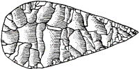
Les Peyrugues Tools
The 2.5 m thick stratigraphy of the Les Peyrugues site, a rockshelter located in the Célé valley (Lot, France), covers the last 25 millennia. A catastrophic cliff fall occurred during the interval 16-13 kyr BP, resulting in talus erosion and in the deposition of a thick boulder layer, as also happened at Laugerie Haute and Laugerie Basse.

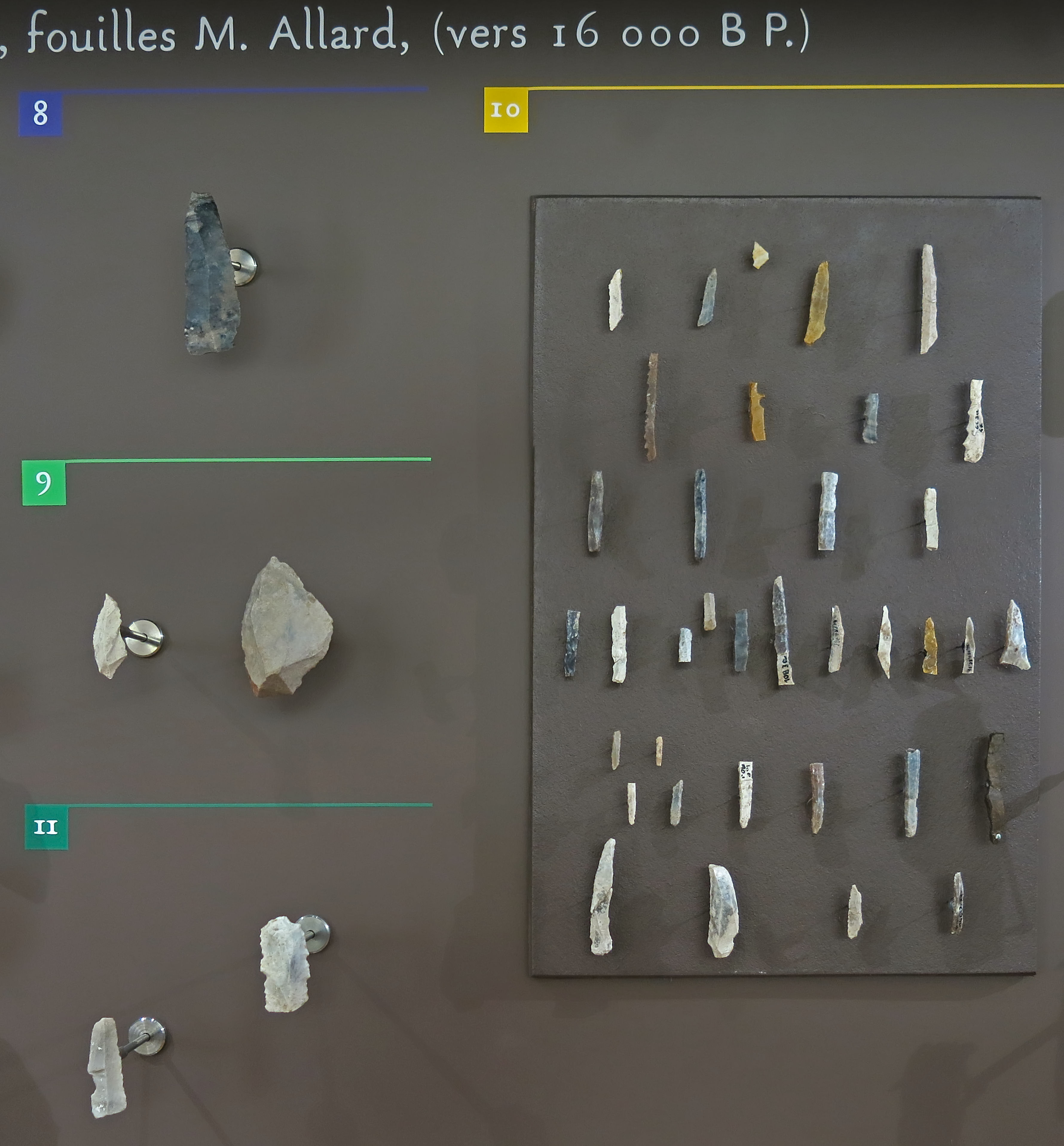
Les Peyrugues tools, layer 3, excavations of M. Allard.
Age: circa 16 000 BP
■ 6: Grattoirs, scrapers on the end of a blade
■ 7: Burins
■ 8: Retouched tools
■ 9: Perçoirs becs, drills/borers
■ 11: Notched/denticulated tools
Photo: Don Hitchcock 2014
Source: Originals, Le Musée National de Préhistoire, Les Eyzies-de-Tayac
Les Peyrugues tools, layer 3, excavations of M. Allard.
Age: circa 16 000 BP
■ 8: Retouched tools
■ 9: Perçoirs becs, drills/borers
■ 10: Microliths
■ 11: Notched/denticulated tools
Photo: Don Hitchcock 2014
Source: Originals, Le Musée National de Préhistoire, Les Eyzies-de-Tayac
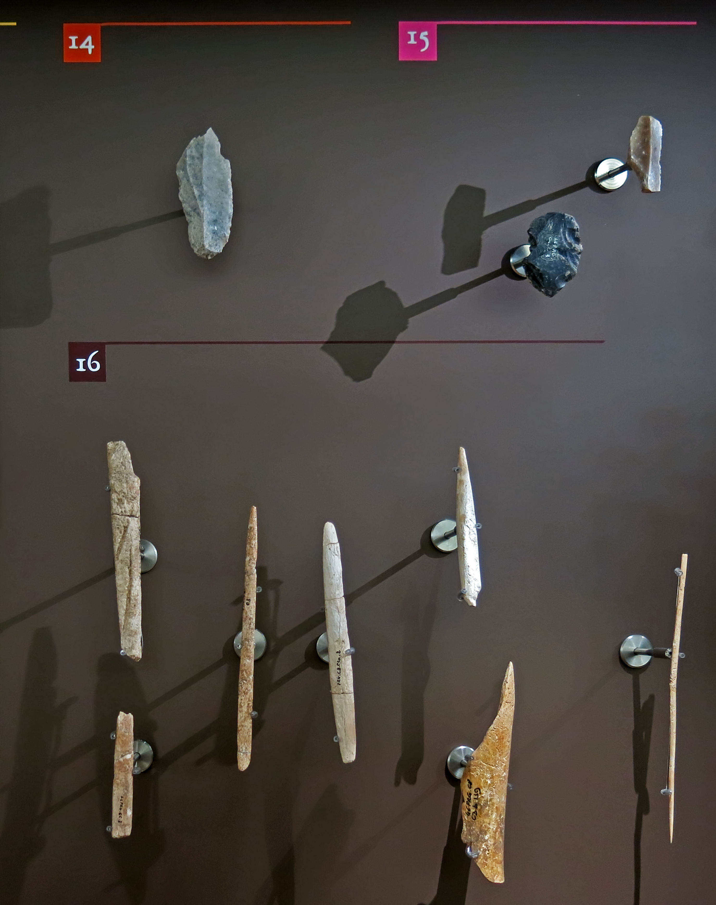
Les Peyrugues tools, layer 3, excavations of M. Allard.
Age: circa 16 000 BP
■ 14: Composite tools
■ 15: Special tools
■ 16: Bone industry
Photo: Don Hitchcock 2014
Source: Originals, Le Musée National de Préhistoire, Les Eyzies-de-Tayac
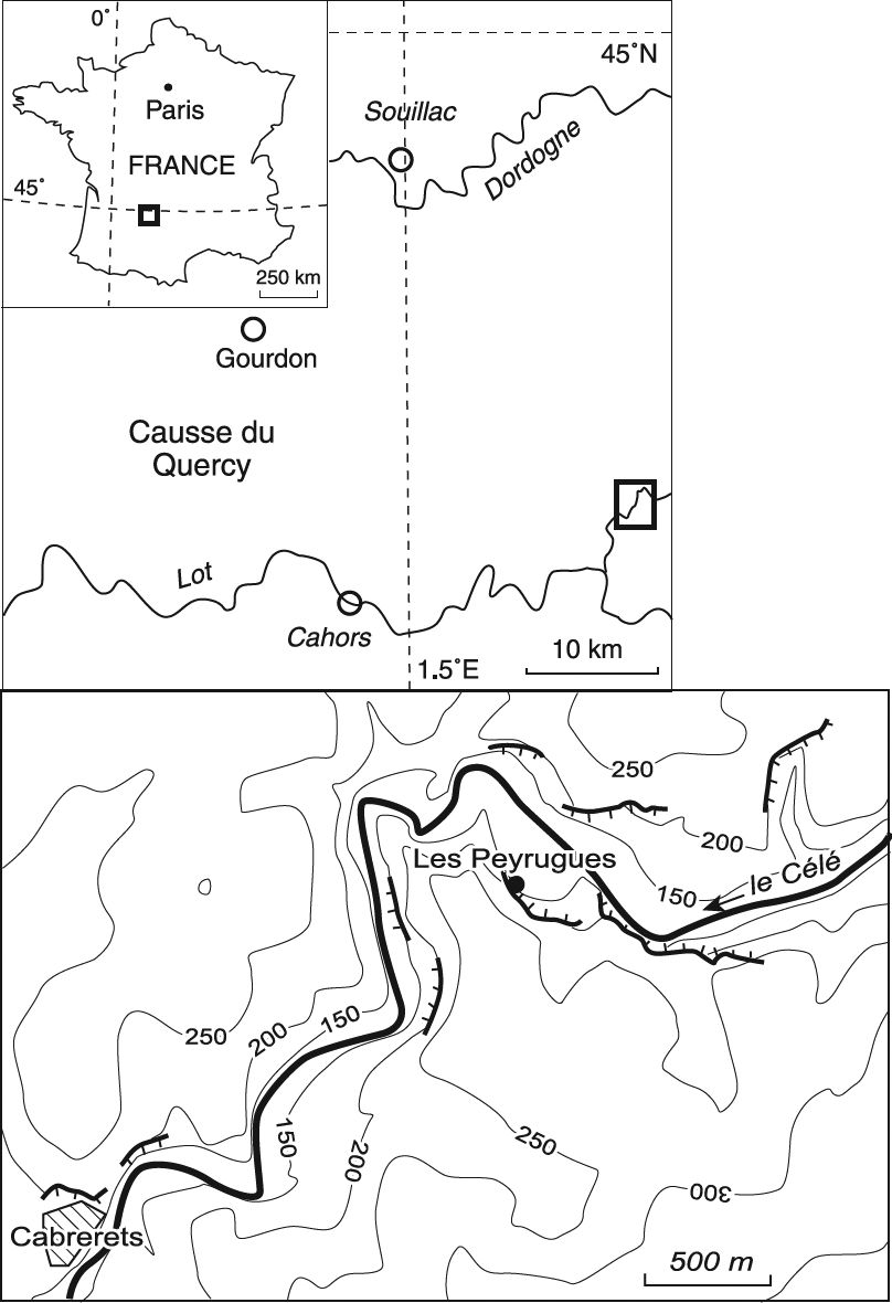
Map showing the location of Les Peyrugues.
Photo: Aubry et al. (1995)

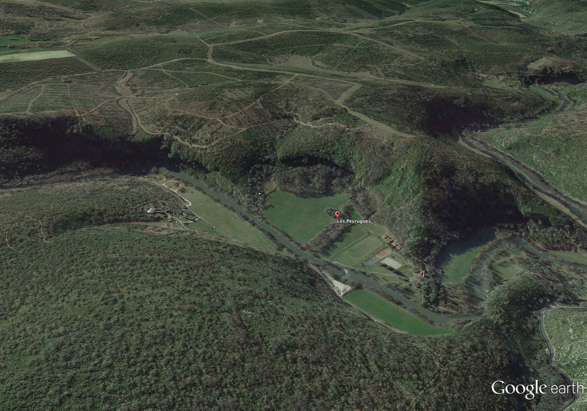
Aerial view of Les Peyrugues, north at the top.
Photo: Google Earth
Aerial view of Les Peyrugues, south at the top, in relief mode.
Photo: Google Earth
References
- Aubry T., Detrain L., Kervazo B., 1995 - Les niveaux intermédiaires entre le Gravettien et le Solutréen de l'Abri Casserole (Les Eyzies de Tayac) : Mise en évidence d'un mode de production original de microlithes et implications, Bulletin de la Société préhistorique française, tome 92, n°3, 1995. pp. 296-301; doi : 10.3406/bspf.1995.10030
Back to Don's Maps
 Back to Archaeological Sites