Back to Don's Maps
 Back to Lake Mungo index
Mungo - The Walls of China

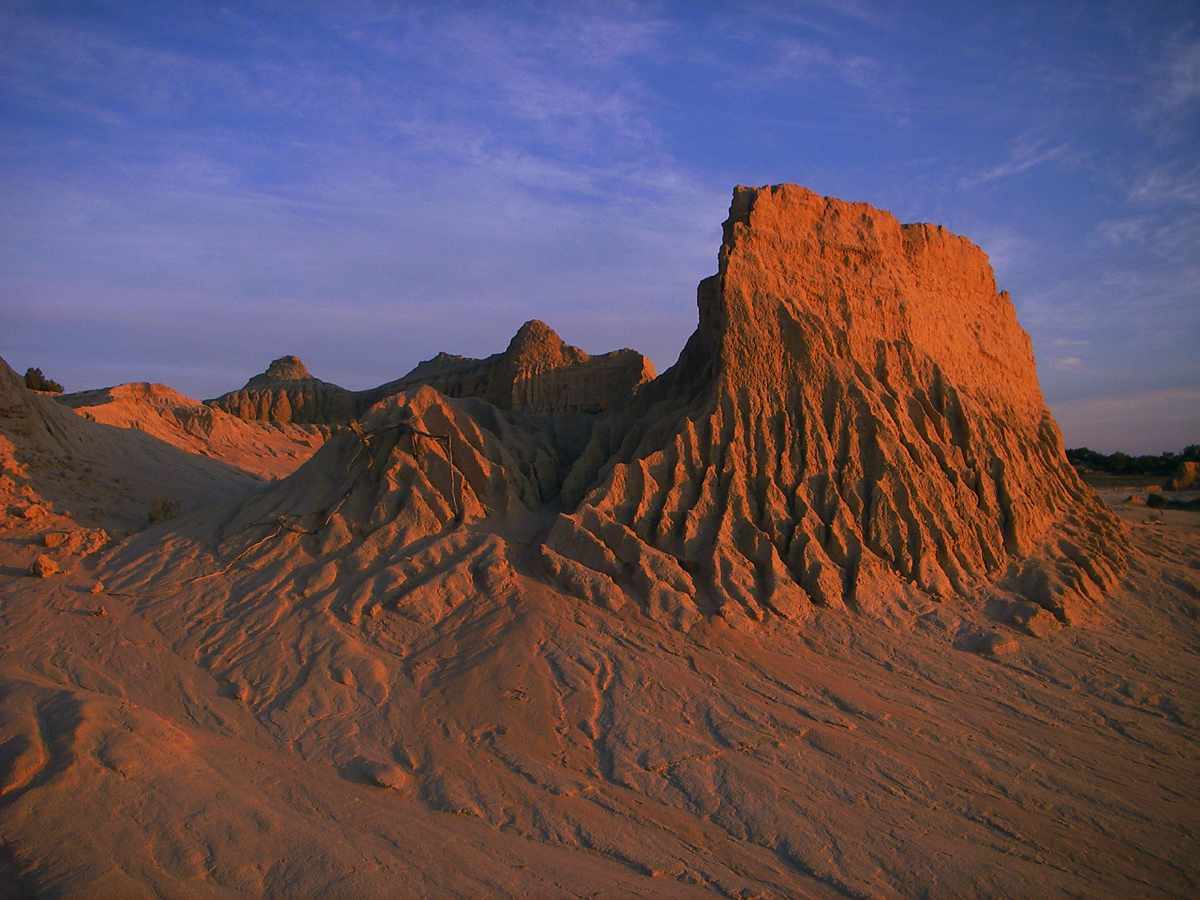
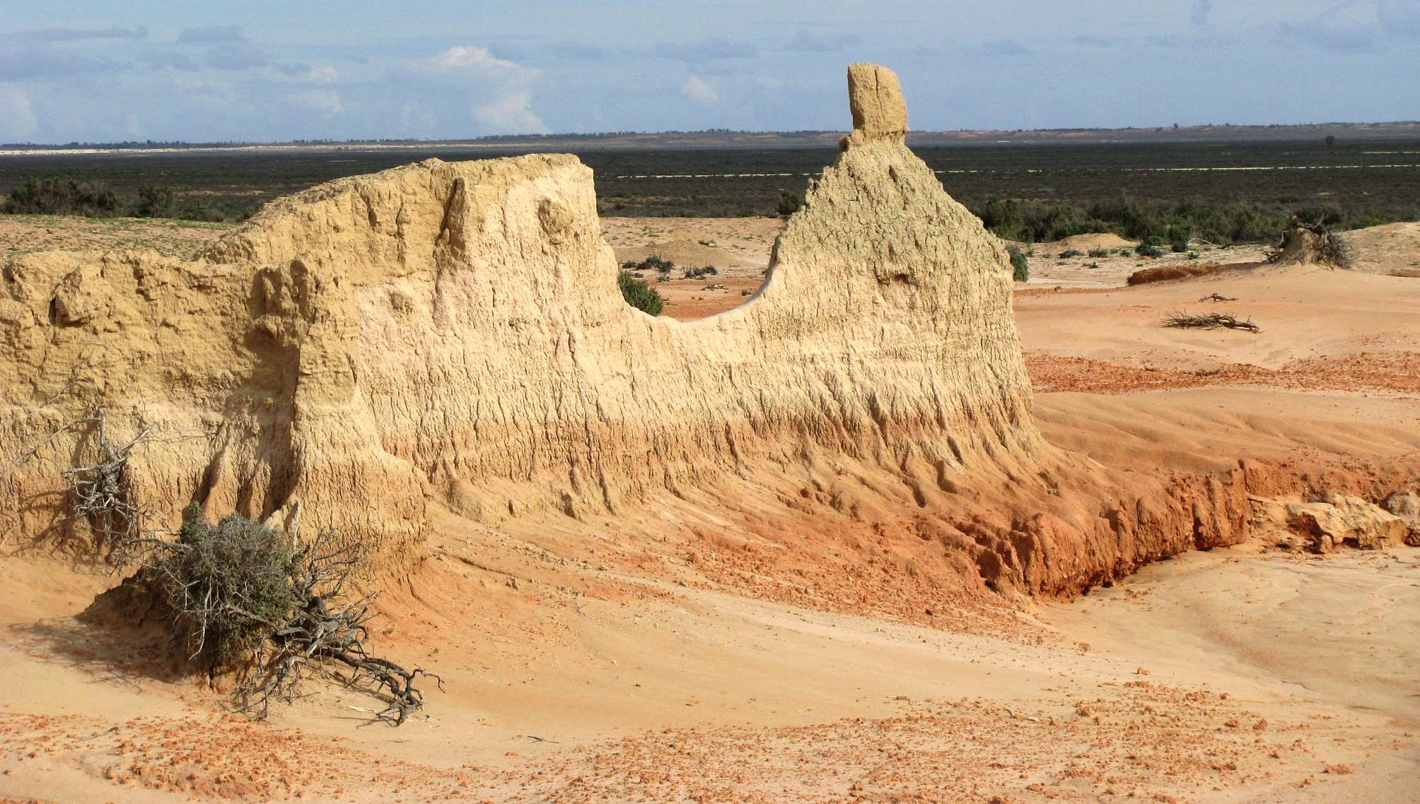
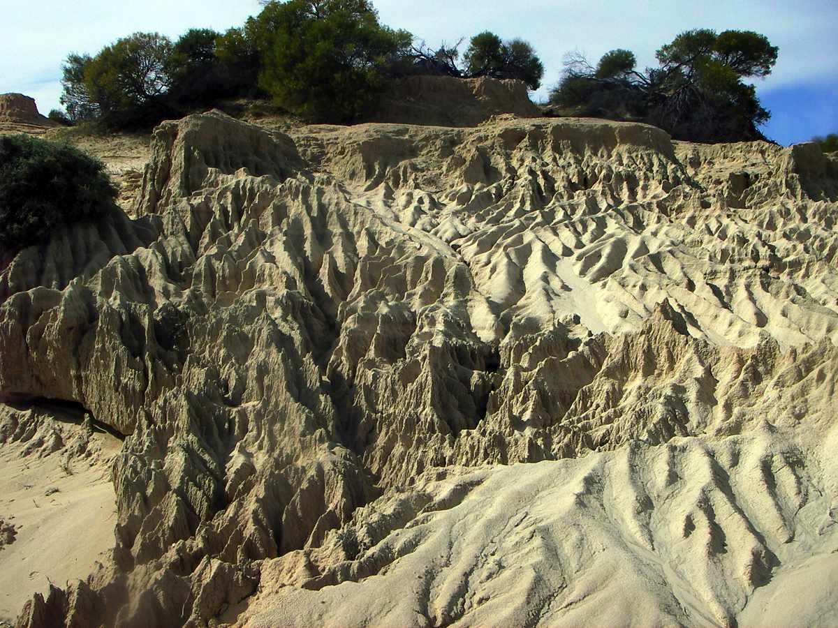
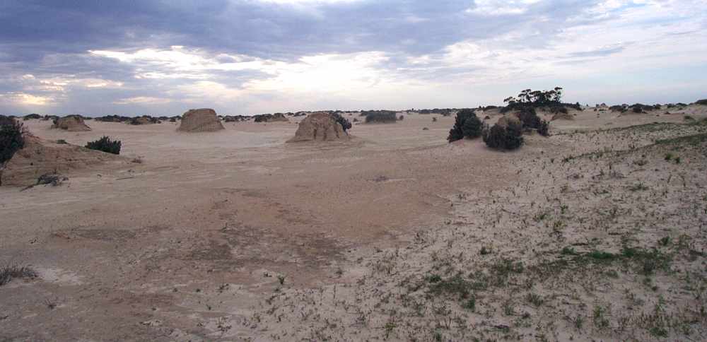
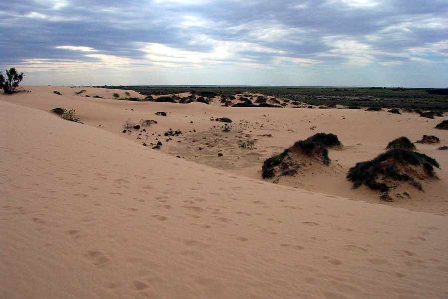
Panorama of "The Walls of China", the eroded lunette on the eastern side of Lake Mungo, carved into fantastic shapes by the occasional rain which falls. The average rainfall for the area is around 250 mm per year.
Photo: Don Hitchcock 2005

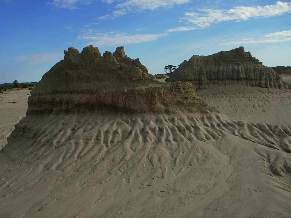
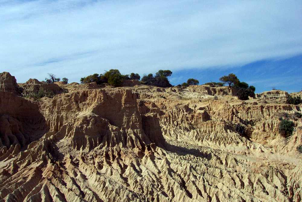
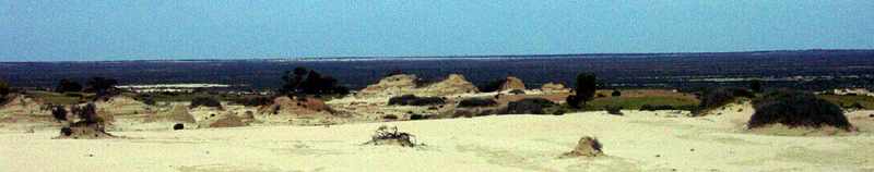
Panorama of "The Walls of China" four years later, taken from the same vantage point. Some erosion is evident in the interim, but not as much as I would have expected.
Photo: Don Hitchcock 2009
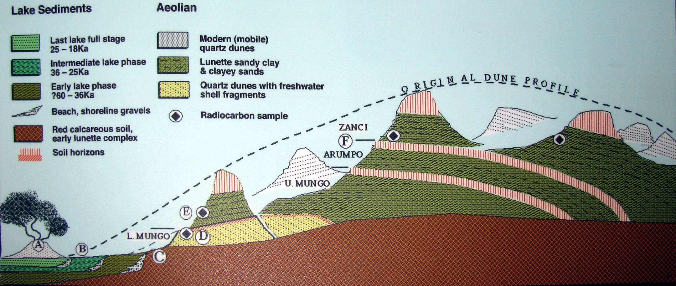
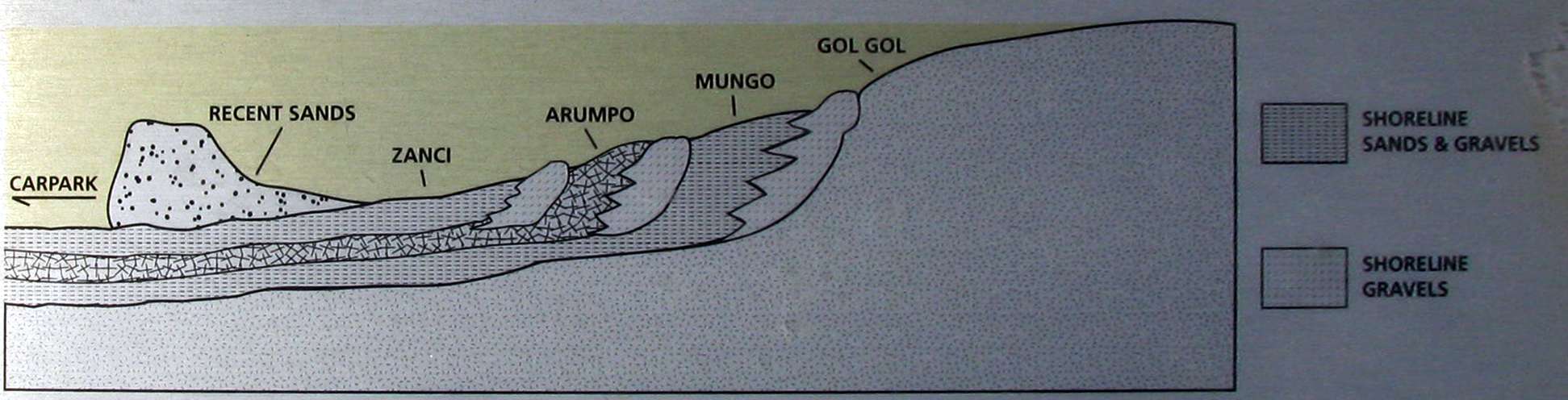
Depositional sequence at Lake Mungo
Source: Display at Lake Mungo Interpretation Centre
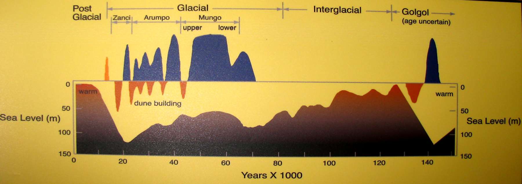
History of climatic conditions at Lake Mungo
Source: Display at Lake Mungo Interpretation Centre
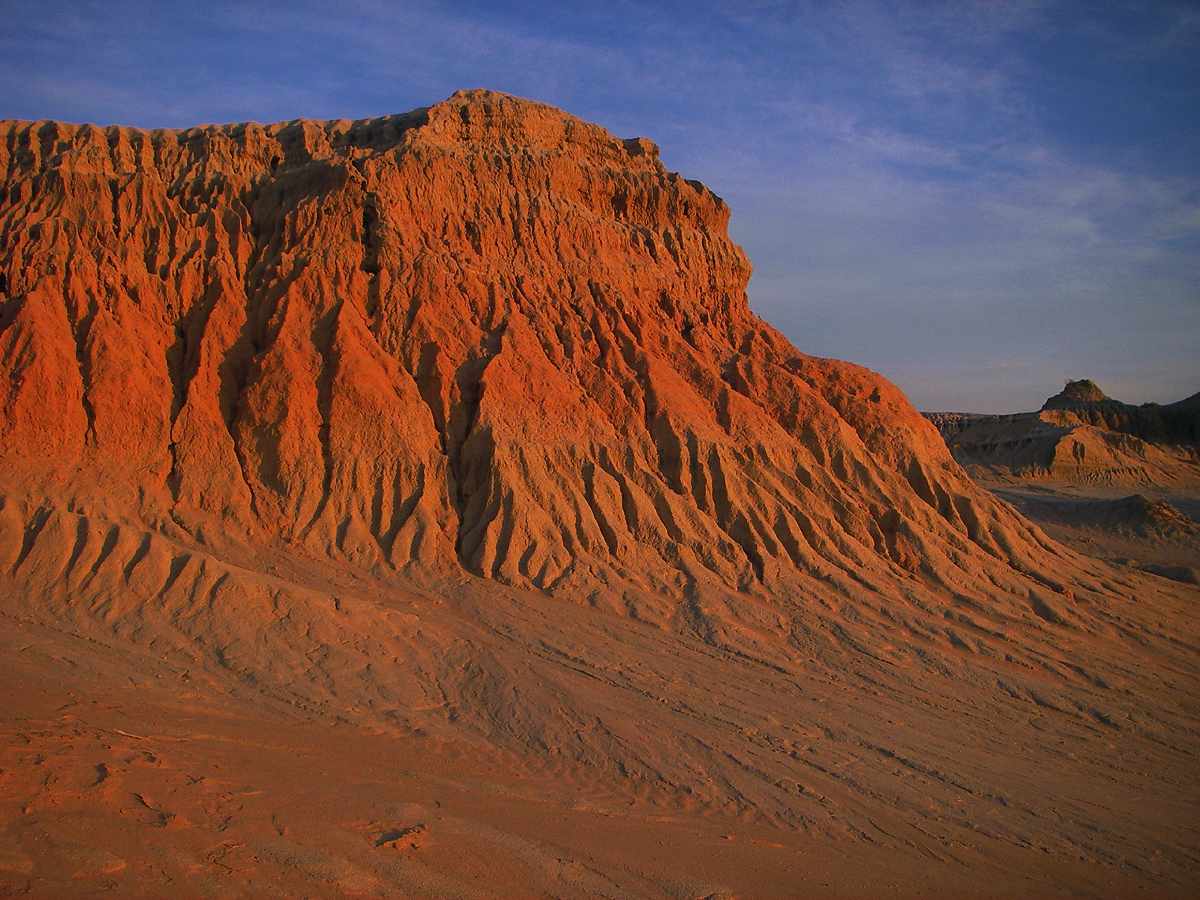
Sunset is the magic time for the erosional artefacts of the walls of china
Photo: Don Hitchcock 2005
Much of the erosion is from the occasional rain which falls. Wind then moves the resulting sand and clay over the top of the lunette to the mobile dunes on the lee (eastern) side.
Photo: Don Hitchcock 2005
Walls of china in the early morning light.
Photo: Don Hitchcock 2005
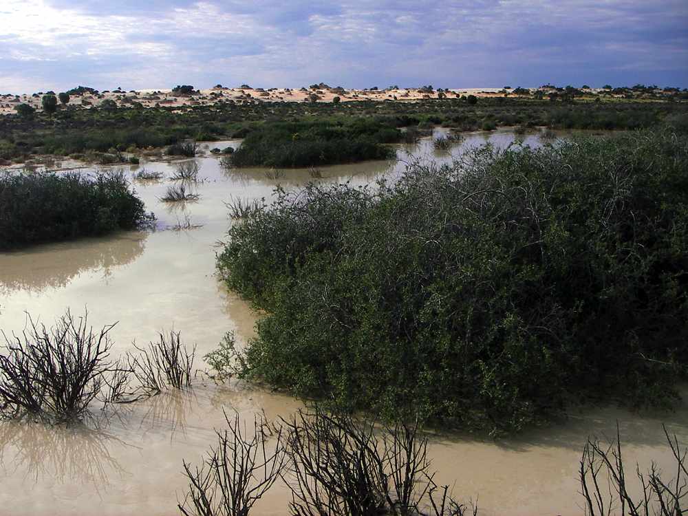
Ephemeral pool in Lake Mungo. Looking towards the lunette to the east.
Photo: Don Hitchcock 2005
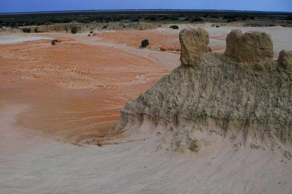
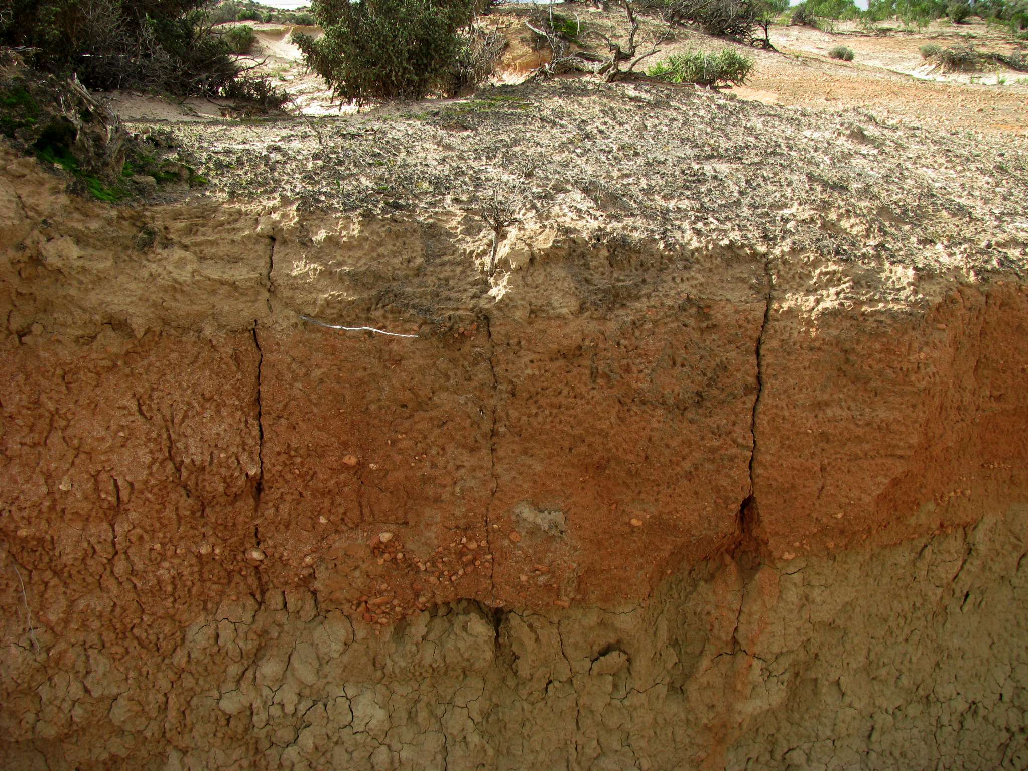
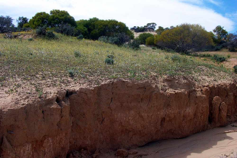
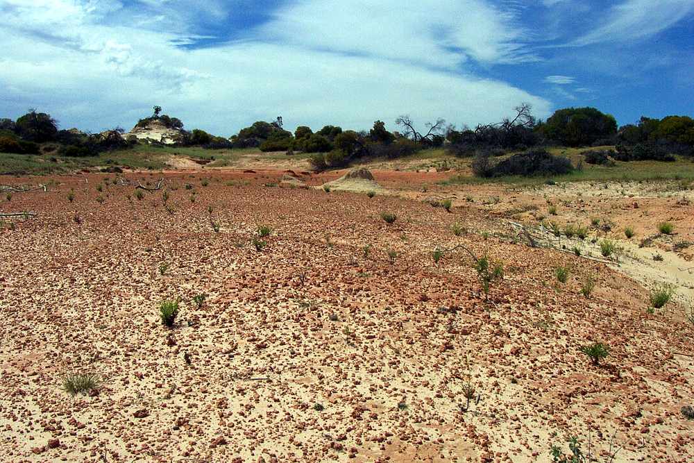
This photo illustrates well the different coloured layers of the Mungo sediments, with the flat Lake Mungo lakebed in the distance.
Photo: Don Hitchcock 2005
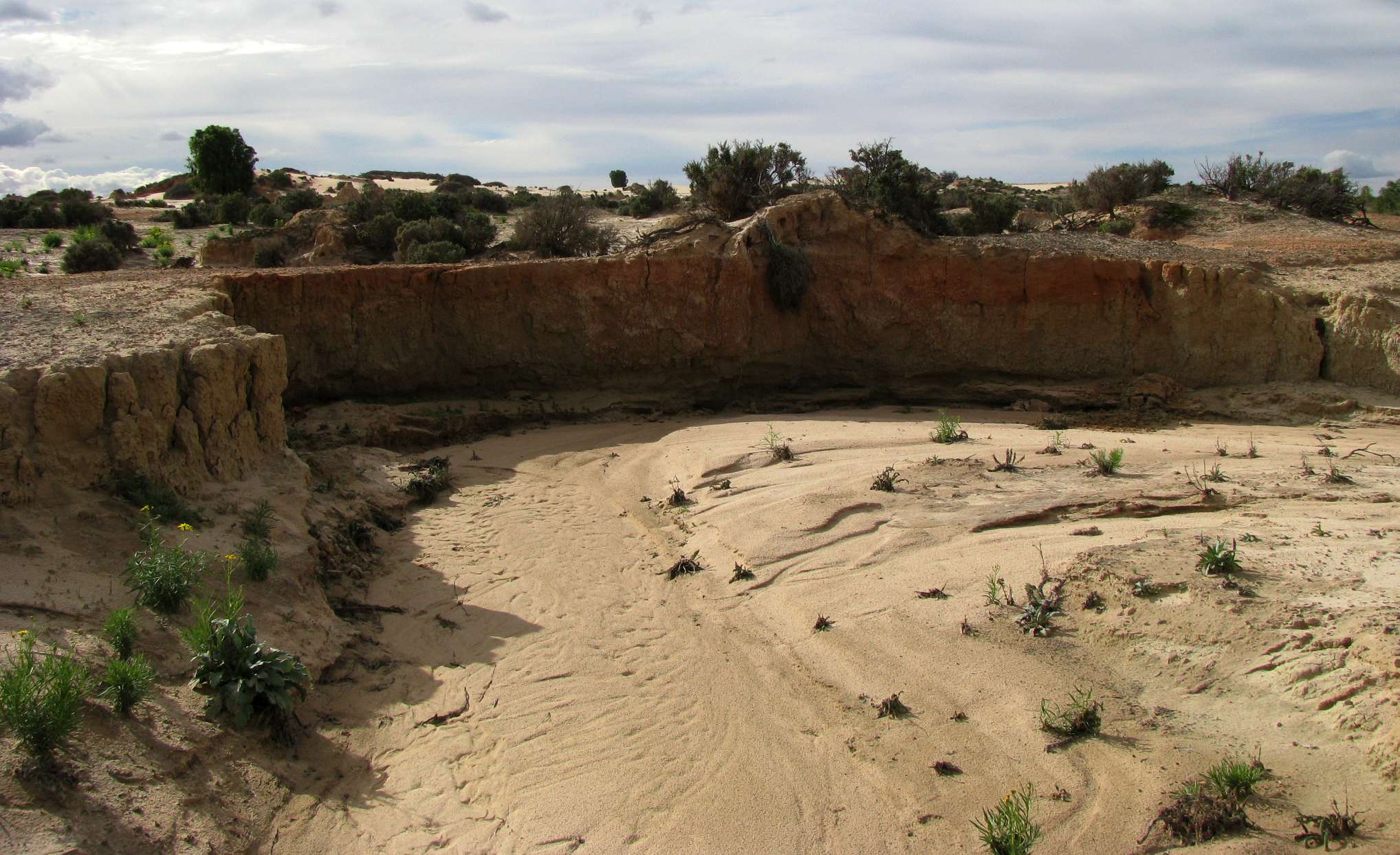
Parts of the lunette are being very actively eroded, especially by water. Note the small bush which has been undermined, and is hanging down the sand face.
Photo: Don Hitchcock 2009
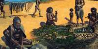
At least the erosion exposes things such as these hearths in the sand face of the photo above, with their clay balls used to help cook game in earth ovens.
Photo: Don Hitchcock 2009
Sometimes, setting aside the earthly plants, the Walls of China reminds me of the planet Mars. It is eerily beautiful, yet at the same time a very alien landscape.
Photo: Don Hitchcock 2009
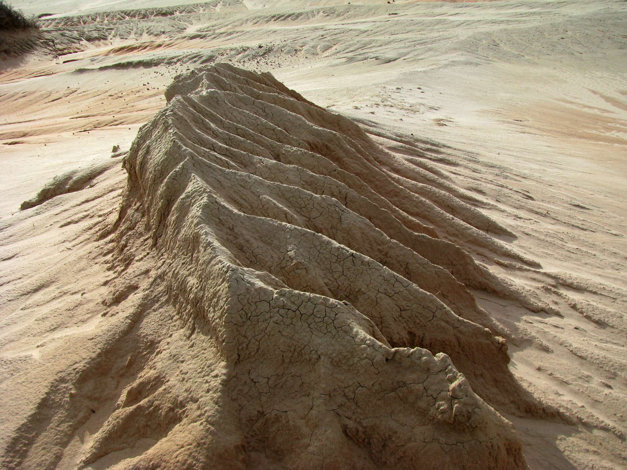
Some shapes are ephemeral, and this small spire looks certain to disappear in the next heavy fall of rain.
Photo: Don Hitchcock 2009
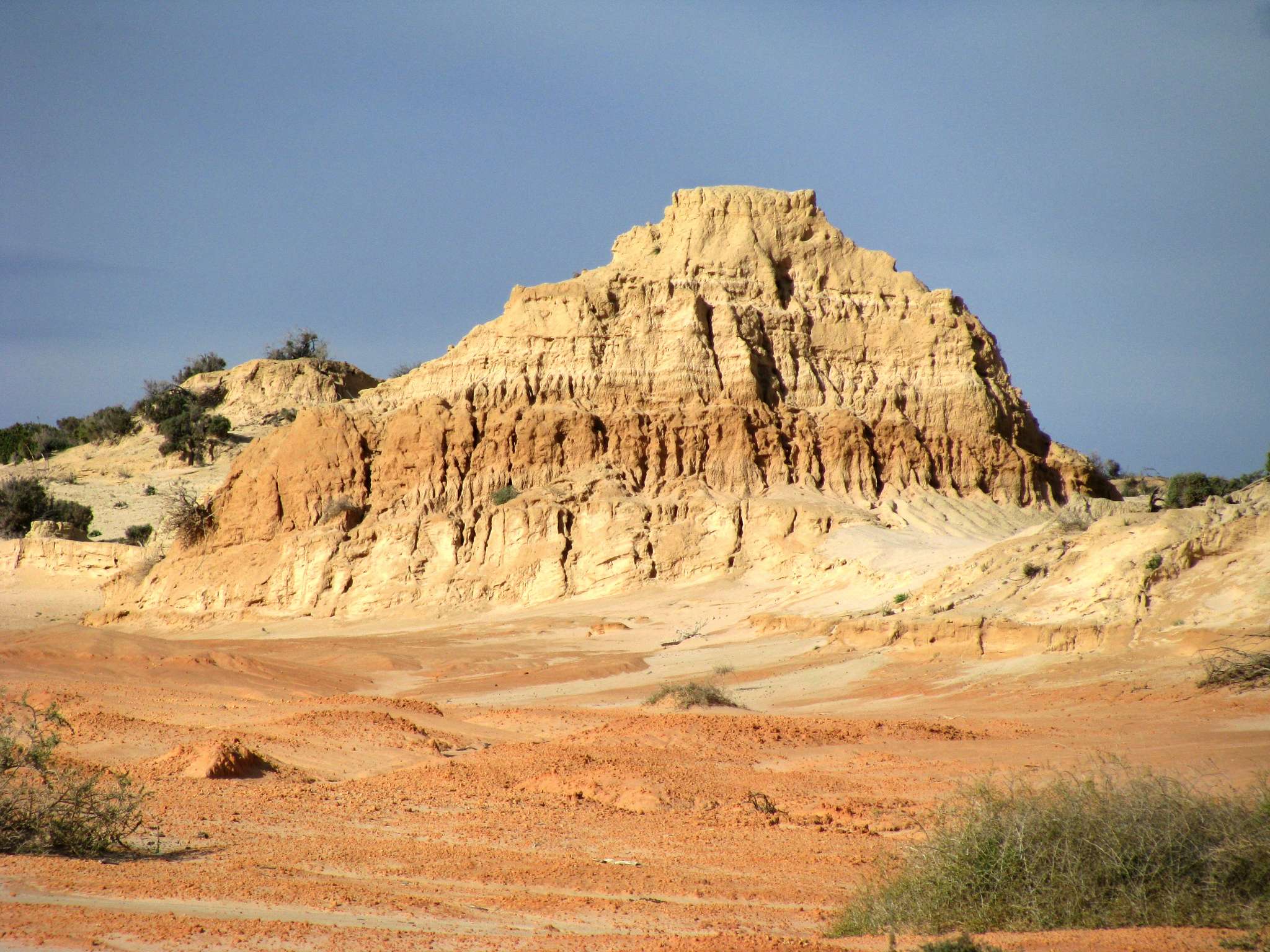
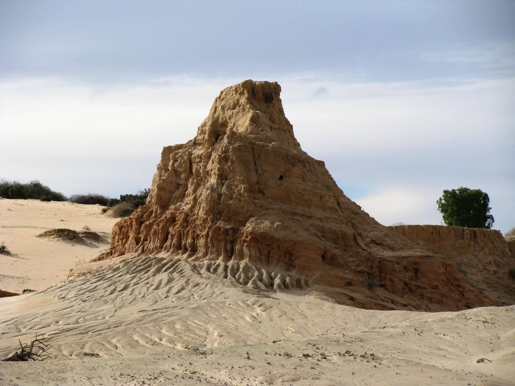
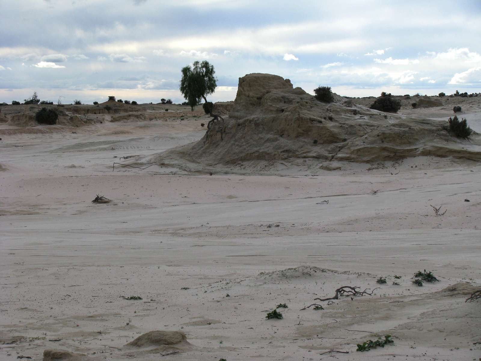
More substantial shapes may stay essentially unchanged for many years.
Photo: Don Hitchcock 2009
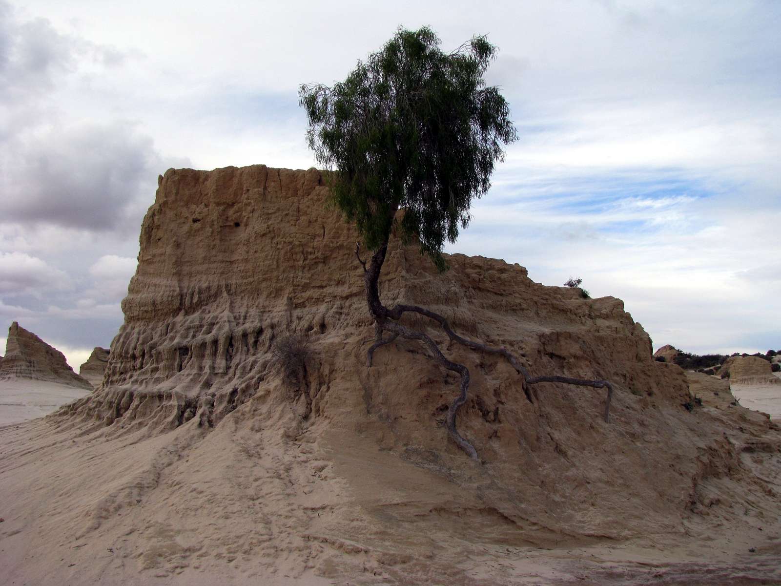
Another indication that sometimes erosion is slow is the fact that this tree obviously germinated on the side of the pillar, and has grown into a reasonably sized specimen, albeit with its roots exposed now.
Photo: Don Hitchcock 2009
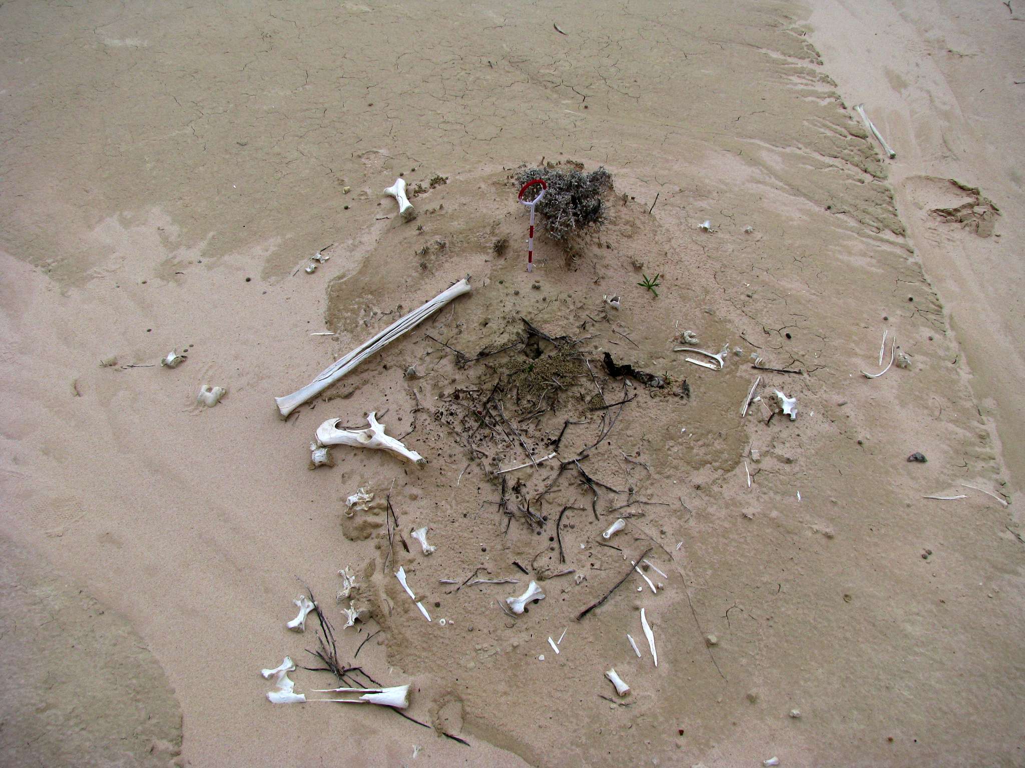
Pegs have been used to identify particular areas. The one on the right seems to have been used to identify the pile of bones, to determine how long it takes to disintegrate on the surface.
Photo: Don Hitchcock 2009
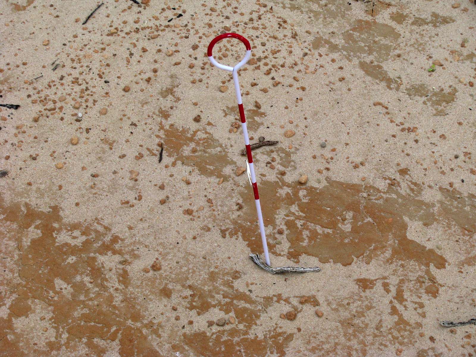
These pegs appear to have been used to record the amount of erosion in the area. They appear to have originally been pushed in flush with the surface.
Photo: Don Hitchcock 2009
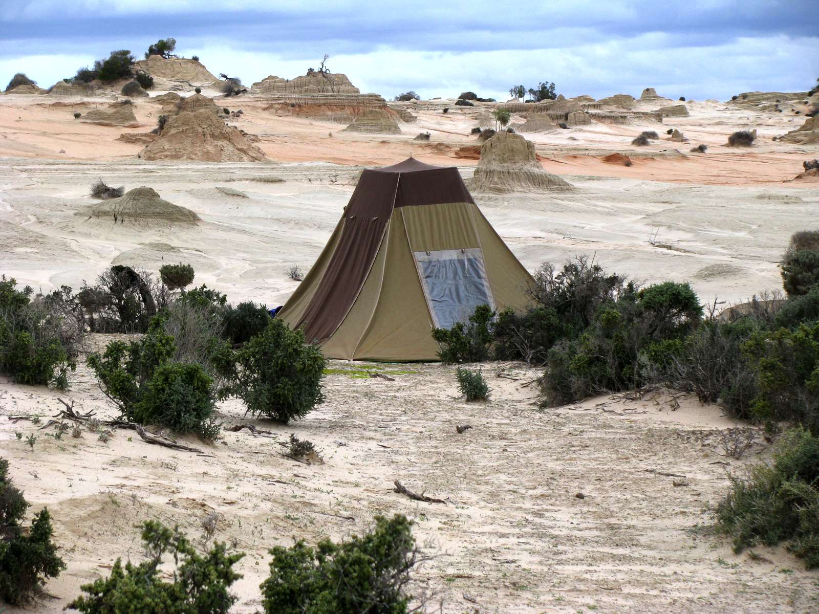
This tent appears to have been put in by park staff, possibly to provide shelter for those doing research on night time animals on the walls of china.
Photo: Don Hitchcock 2009
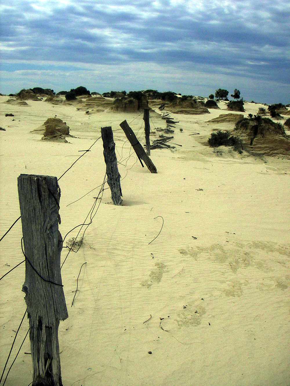
Abandoned fence not far from Vigars Well, but on the western side of the lunette. The fence posts are of cypress pine, a wood which is resistant to weathering and termites. The wood is not impervious to all agencies of decay, however, and the part which was above ground is wider and thicker than the part which was below ground - incidentally indicating how much erosion has taken place since the fence was erected.
Photo: Don Hitchcock 2005
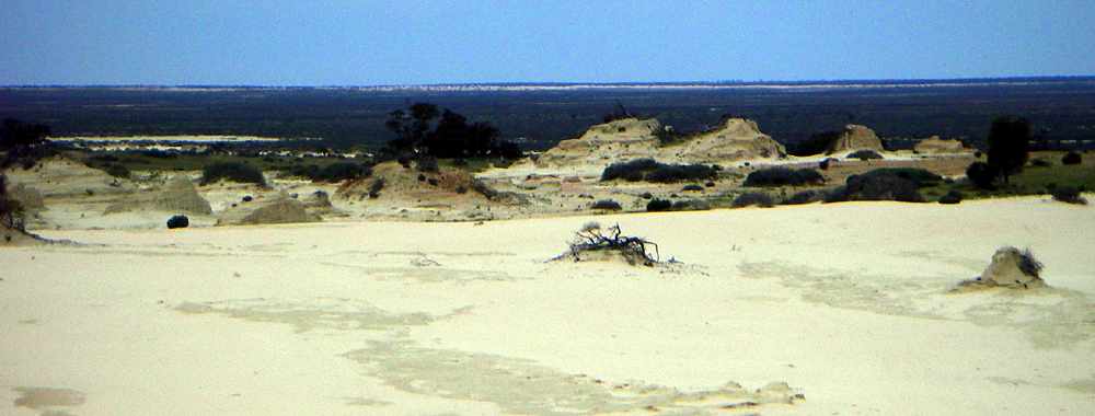
Looking towards the south east across Lake Mungo from the top of the lunette near Vigars Well.
Photo: Don Hitchcock 2005
badlands
Photo: Don Hitchcock 2005
badlands
Photo: Don Hitchcock 2005
badlands
Photo: Don Hitchcock 2005
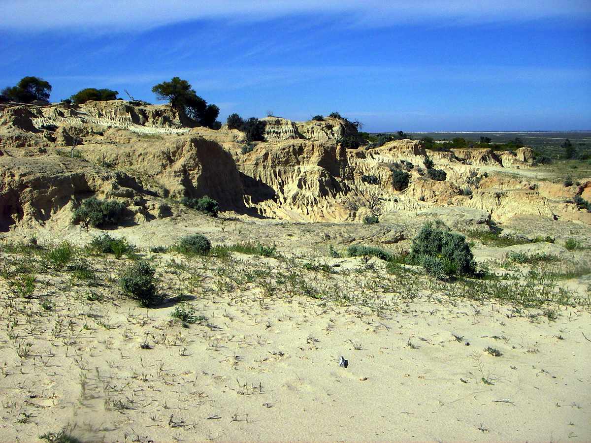
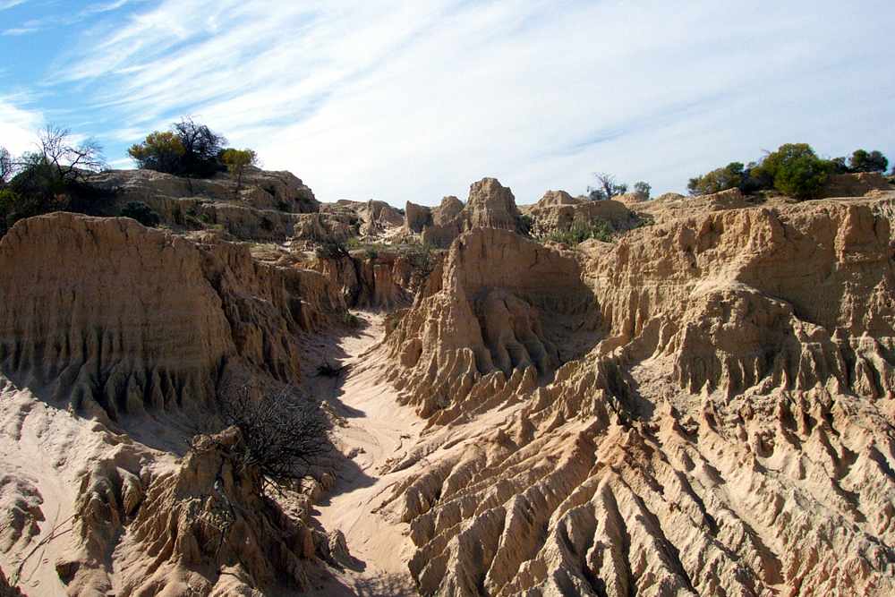
Badlands topography on the walls of china.
Photo: Don Hitchcock 2005
This white layer may be a former lake shore.
Photo: Don Hitchcock 2005
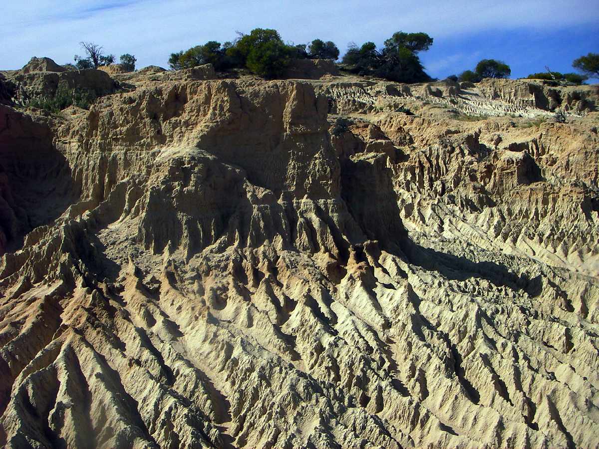
Badlands topography on the walls of china.
Photo: Don Hitchcock 2005
Far northern end of the Lake Mungo lunette, near Lake Leaghur.
Photo: Don Hitchcock 2005
Plain of gibbers, or small stones.
Photo: Don Hitchcock 2005
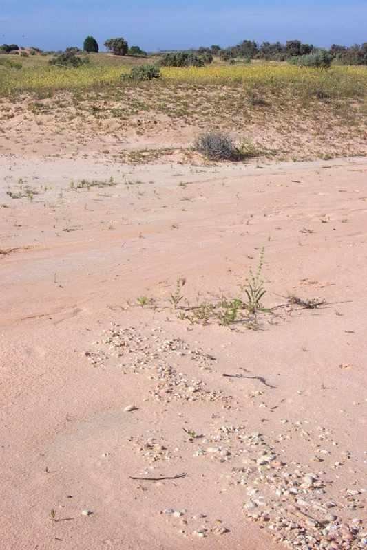
Ancient shoreline, marked by pebbles.
The lines of gravel and pebbles in this area can be traced for many kilometres along the shore of Lake Mungo. They are water rolled pebbles that washed up along the shoreline and show that strong wave action, generated from frequent westerly winds, smoothed and moved pebbles and small rocks.
Text: Sign at Lake Mungo NP.
Photo: Don Hitchcock 2005
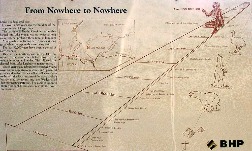
Mungo is a dead end lake.
Just over 4600 years ago, the building of the pyramids of Egypt began.
The last time Willandra Creek water ran this channel into Lake Mungo was not twice as long ago as that, but three times as long ago!
First Nations people were fishing here eight times as long ago as when the pyramids were being built.
The last 50 000 years have been a period of many changes.
Here at the northern end ofthe lake the impact of the west wind is less direct... the lunette is lower and wider. This allowed the channel fromLake Leaghur to remain open. Sheep grazing and rabbits have reduced ground cover on the slopes to some shrubs and ephemeral grasses and herbs. The few taller mallee eucalypts to the left, all which remains of the woodland are heavily used by ravens (which many people call crows) and the Wedge-tailed Eagle for nesting purposes. The eagle lives almost entirely on rabbits and carrion while the ravens live on carrion.
Text: Sign at Lake Mungo NP.
Photo: Don Hitchcock 2005
Dunes behind Vigars Wells. This is a high active dune, which is moving west towards the wells.
Photo: Don Hitchcock 2005
Looking south east from the top of the dunes at Vigars Wells towards the western side of Lake Mungo, across the walls of china.
Photo: Don Hitchcock 2005
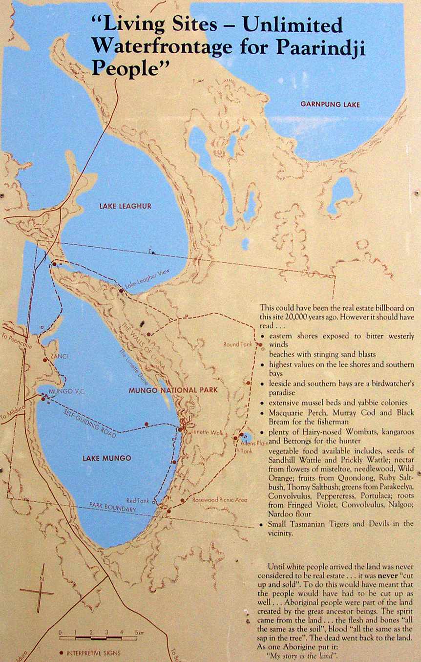
Sign at Lake Leaghur.
The text reads:
"Living Sites - Unlimited Waterfrontages for Paarindji People"
This could have been the real estate billboard on this site 20 000 years ago. However it should have read...
- Eastern shores exposed to bitter westerly winds.
- Beaches with stinging sand blasts.
- Highest values on the lee shores and southern bays.
- Leeside and southern bays are a birdwatcher's paradise.
- Extensive mussel beds and yabbie colonies.
- Macquarie Perch, Murray Cod and Black Bream for the fishermen.
- Plenty of Hairy-nosed Wombats,kangaroos and Bettongs for the hunter.
- Vegetable food available includes seeds of Sandhill Wattle and Prickly Wattle; nectar from flowers of mistletoe, needlewood, Wild Orange; fruits from Quandong, Ruby Saltbush, Thorny Saltbush; greens from Parakeelya, Convulvulus, Nalgoo; Nardoo flour.
- Small Tasmanian Tigers and Devils in the vicinity.
As one First Nations person put it:
'My story is the land'.
Text: NPWS Lake Mungo
Photo: Don Hitchcock 2005
Water levels in Lake Mungo varied a lot. There are three gravel layers in this area (only Zanci is visible) representing three major lake filling events between 55 000 and 22 000 years ago.
The line of gravel before you is the most recent shoreline at Lake Mungo. It is called the Zanci shoreline gravels and represents a brief high water phase from 22 to 24 000 years ago. After this Lake Mungo dried and rarely refilled. Other lakes in the north of this region have held water more recently.
A horizontal line drawn from this gravel shoreline to similar gravels near the Mungo Visitors Centre shows the depth of water in Lake Mungo was about eight metres.
Text: Sign at Lake Mungo NP.
Photo: Don Hitchcock 2009