Back to Don's Maps
 Bushwalking Index
  The walk from Grassy Creek to Mulligans Hut via O'Hara's Gap and the Tree Fern Fire Trail
  The walk from Mulligans Hut to Boundary Creek via Surveyors Creek and Dandahra Crags
 Boundary Creek to Grassy Creek - World Heritage Walk, Gibraltar Range - Washpool National Park
A one hundred kilometre network of walking tracks forms the Gibraltar - Washpool World Heritage Walk. The route links the Gibraltar Range and Washpool National Parks in rugged mountainous country, high above the Clarence Valley on the edge of the Northern Tablelands. Dramatic and diverse changes in the landscape are typical along the walk. Dry eucalypt sclerophyll forests, set amidst a broken collection of ridges and granite tors, surround a mosaic of sub-alpine swamps. In more dense country, lush rainforests safeguard the largest area of coachwood in the world. Within these ancient pockets of wilderness, waterfalls plummet from a lacework of streams and wild rivers. They offer refuge to a rich variety of wildlife including many rare and endangered species. In spring and summer the heathlands, swamps and open woodlands erupt in a colourful display of wildflowers.
Text above: 'A Walk on the Edge of Wilderness, The Gibraltar - Washpool World Heritage Walk', free booklet from NPWS.
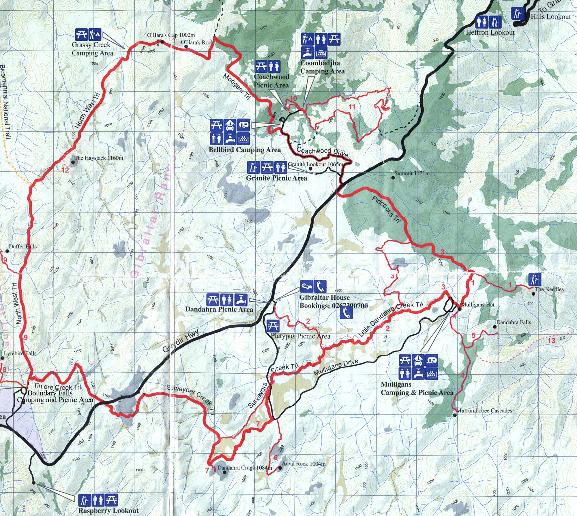
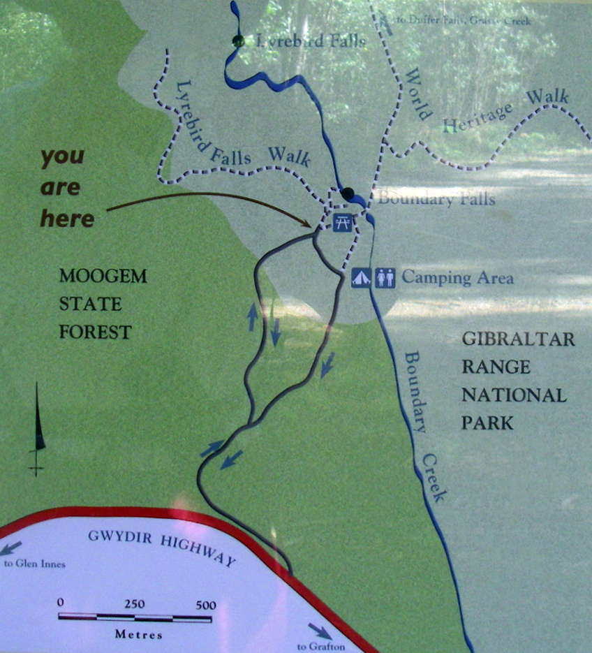
This is a great map from the National Parks and Wildlife Service (NPWS), showing the entire circuit. You can pick one up free from the Glen Innes NPWS office, as well as an excellent free booklet on the walks of the circuit, 'A Walk on the Edge of Wilderness, The Gibraltar - Washpool World Heritage Walk'. This booklet contains detailed track notes as well as flora and fauna lists.
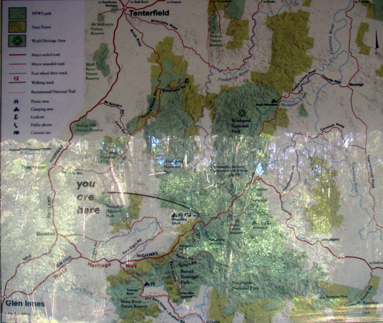
I got the 1:25 000 topographic maps, but they are almost too detailed. I found this map to be all I needed to complete the entire circuit, and left the topo maps in the car. The track is very well signposted, with occasional 'You are here' maps on display boards.
This whole World Heritage Walk has been superbly set up, it is a credit to all concerned. The complete circuit without side trips is about 50 km, and can be done in three days if you are fit and well prepared, though the track notes recommend five days to allow for extended side trips. The tracks are excellent.
Here is the map as a pdf, which should print on one page from the free program Adobe Reader:
Map as a pdf for printing
Photo: Free handout from NPWS.
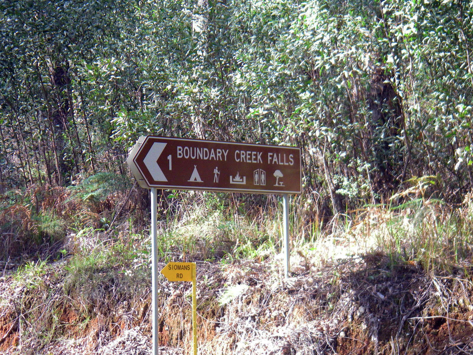
Boundary Creek is a kilometre or so off the main Gwydir Highway.
Photo: Don Hitchcock, November 2009

There are a number of short tracks in the area for those with limited time.
Facilities include modern fire and cooking stands, pit toilets and picnic tables. Bring your own drinking water and firewood. No pets are allowed in the park. Water is suitable for drinking only after proper treatment.
Photo: Don Hitchcock, November 2009
Text: Adapted from http://www.environment.nsw.gov.au/NationalParks/parkCamping.aspx?id=N0012
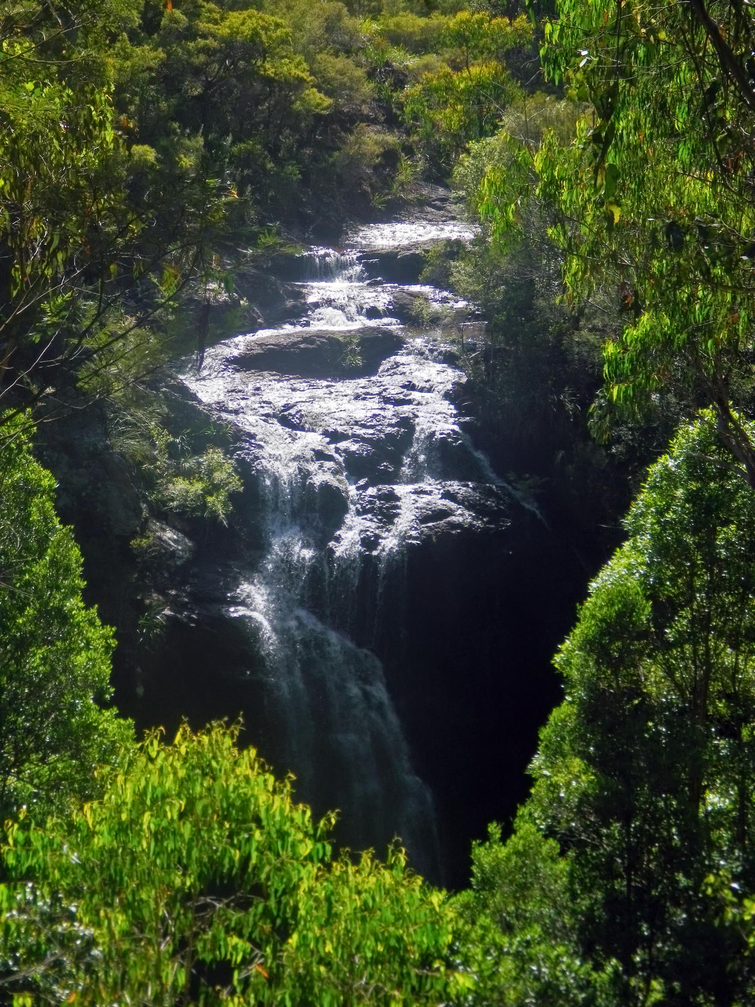
Boundary Falls as seen from the track above. There is another track which allows a view from the bottom.
Photo: Don Hitchcock, January 2012
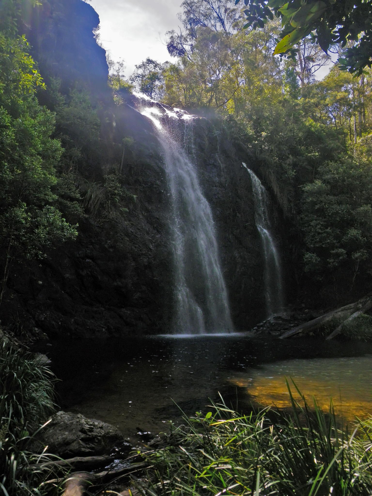
Boundary Falls from below.
Photo: Don Hitchcock, January 2012
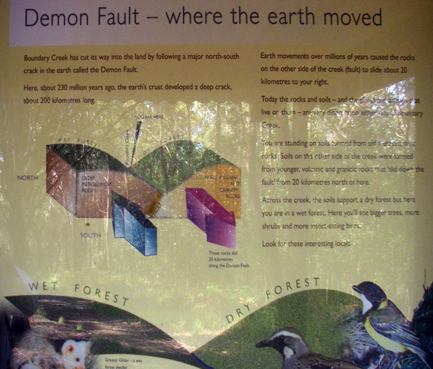
Boundary Creek has cut its way into the land by following a major north-south crack in the earth called the Demon Fault. Here, about 230 million years ago, the earth's crust developed a deep crack, about 200 kilometres long. Earth movements over millions of years caused the rocks on the other side of the creek (fault) to slide about 20 kilometres to your right.
Today the rocks and soils - and the plants and animals that live on them - are very different on either side of Boundary Creek. You are standing on soils formed from old metamorphic soils. Soils on the other side of the creek were formed from younger, volcanic and granitic rocks that 'slid down the fault' from 20 kilometres north of here. Across the creek, the soils support a dry forest, but here you are in a wet forest. Here you will see bigger trees, more shrubs, and more insect-eating birds.
Photo: Don Hitchcock, November 2009
Text: Adapted from the NPWS display pictured.
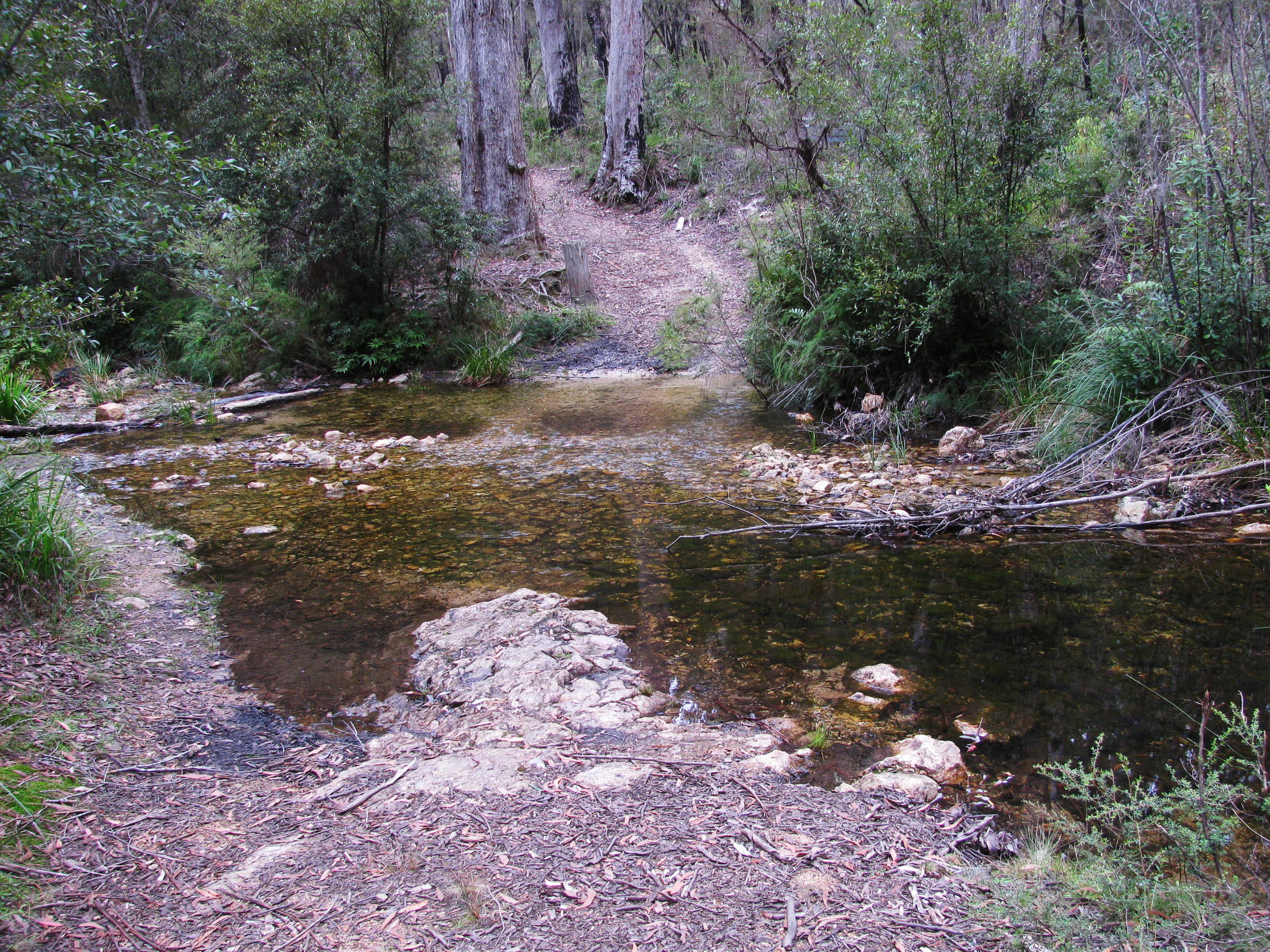
Boundary Creek crossing, upstream of the Falls.
Photo: Don Hitchcock, April 2015
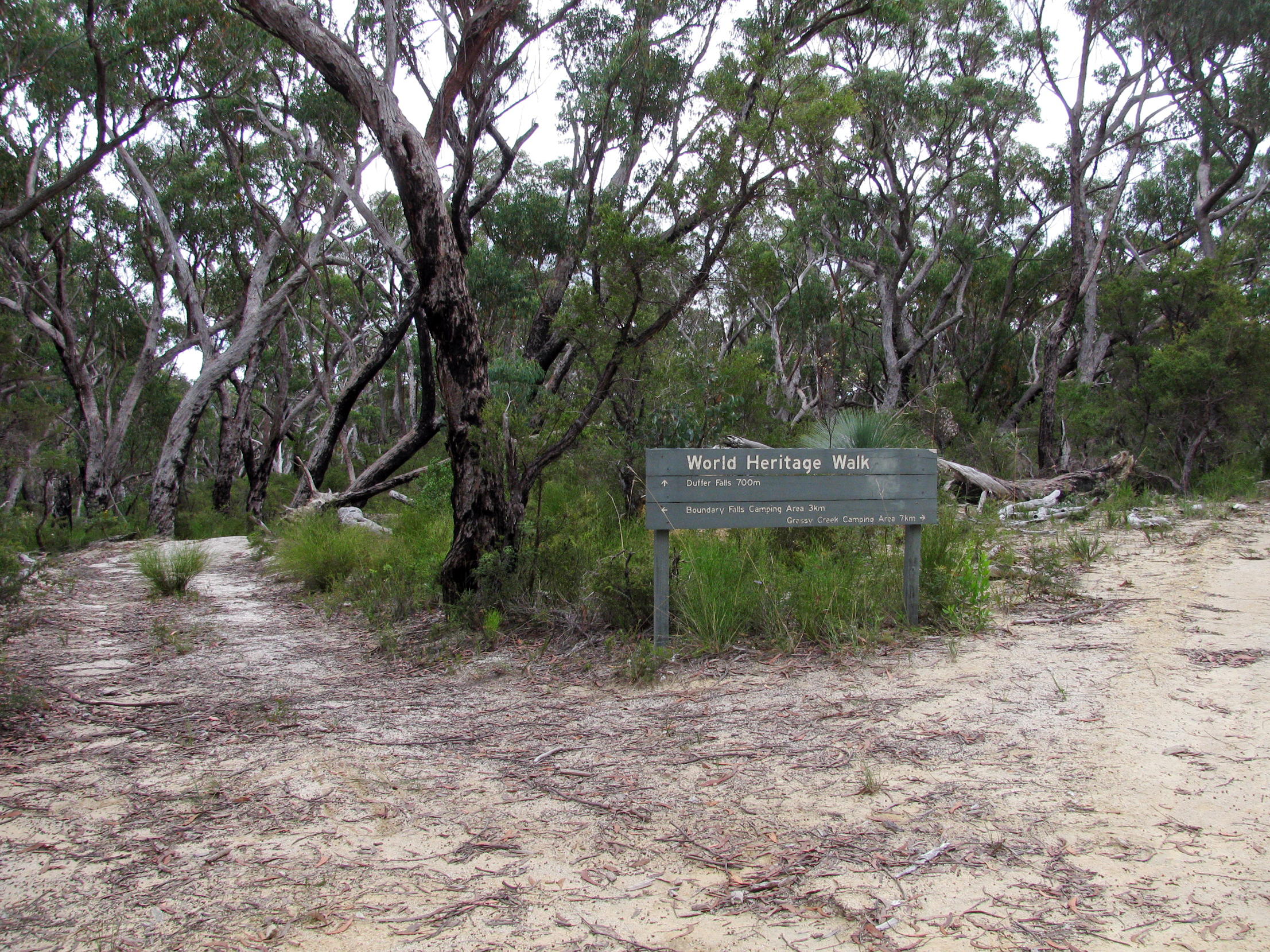
I parked the car and started towards Grassy Creek, where I planned to camp for the night, after a 10:30 am start. The distance was only ten kilometres, plus another two to visit Duffer Falls, though I spent a lot of time photographing the wonderful spring flower display, so I didn't get there till 4:00 pm.
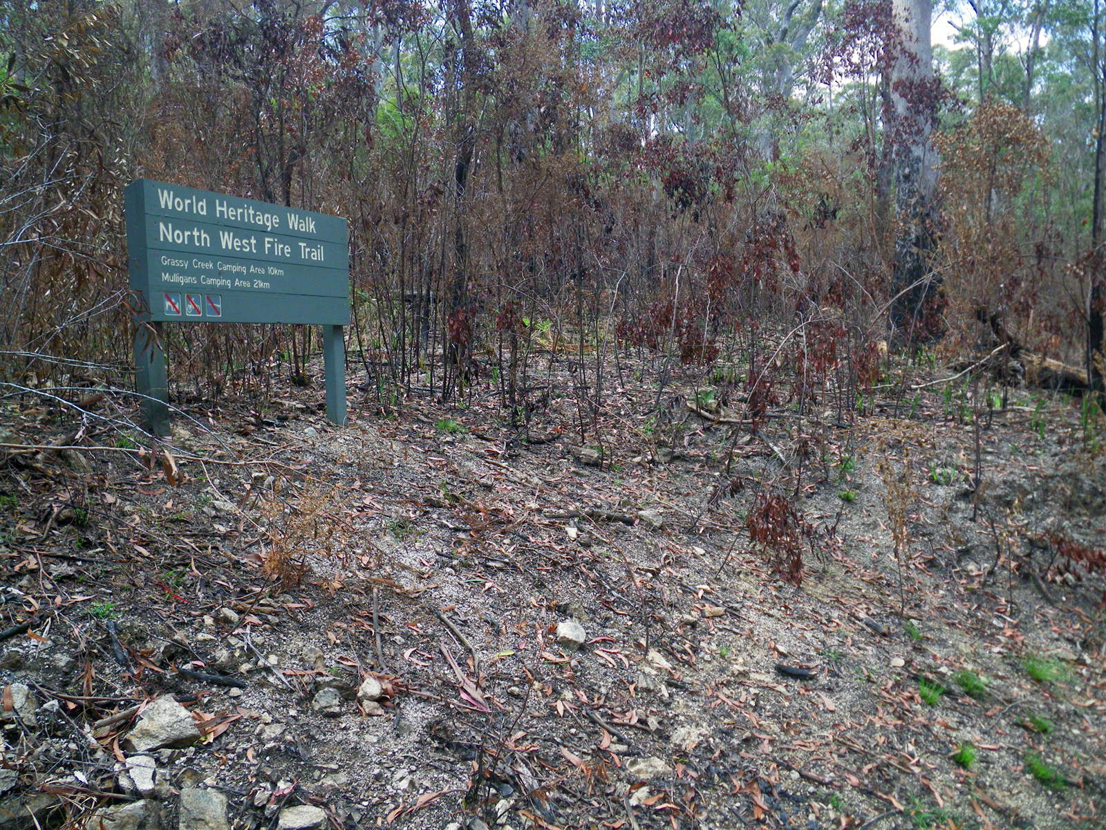
There had been a bushfire through the area, but it was only in the Boundary Creek area, and then limited in extent.
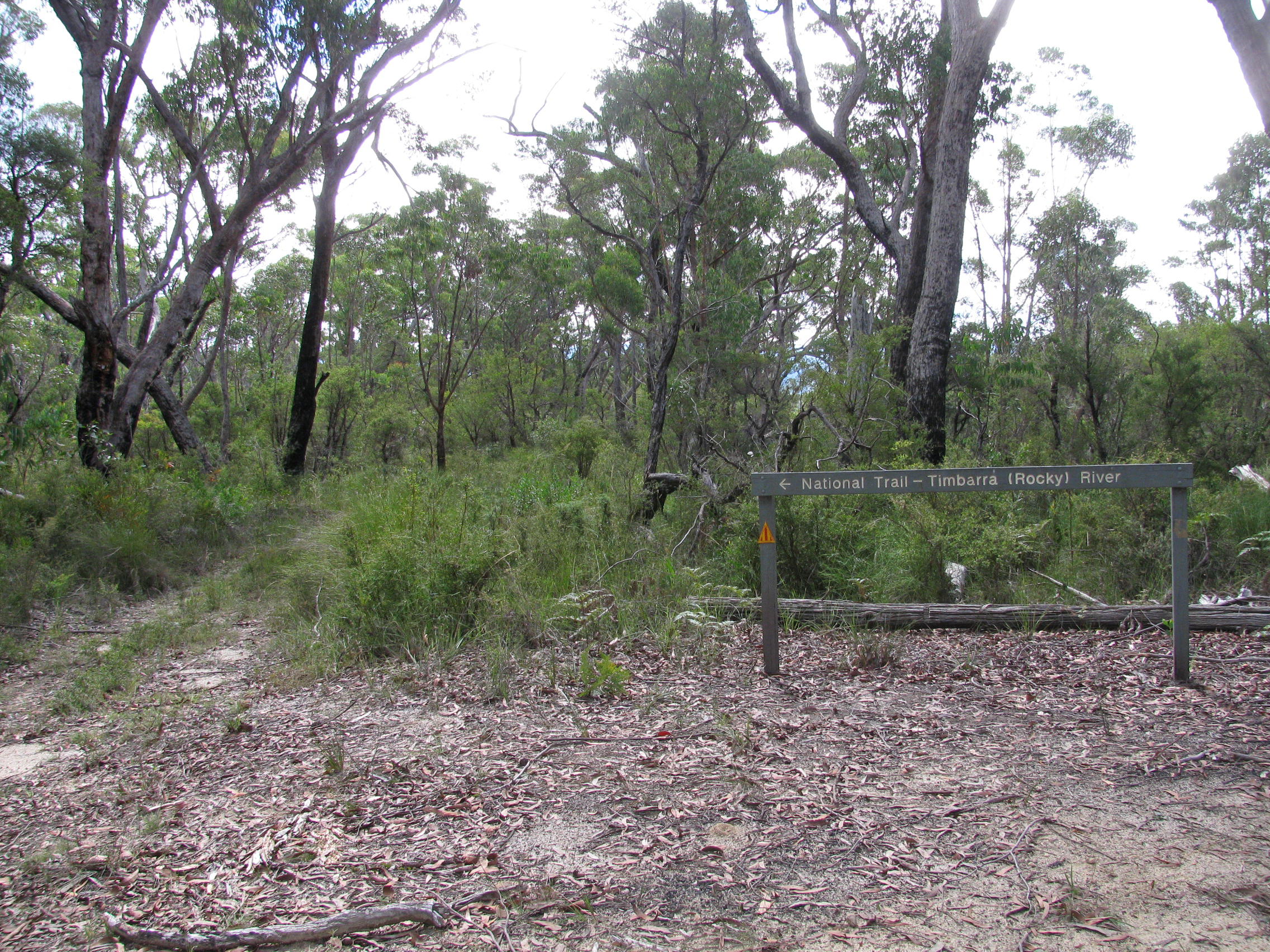
Note that the distance to Mulligans Hut on the sign of 21 km is via the shortest route, Surveyors Creek Trail. Via the circuit past Grassy Creek, which I took, it is more like 30 kilometres.
Photo: Don Hitchcock, November 2011
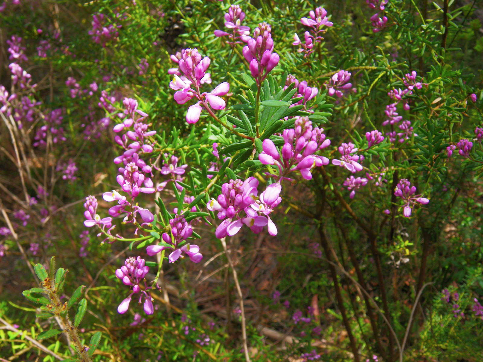
On the left, unburnt side of the road I came across these 'match heads' or Comesperma ericinum.
Comesperma ericinum, commonly known as Heath Milkwort, pink matchheads or Pyramid Flower, is a slender shrub of the family Polygalaceae. It grows to between 1 and 1.5 metres high and branches out vertically. The leaves are 5 to 25 mm long and 1 to 4 mm wide. Purple, lilac-pink or white 'winged' flowers are produced in clusters at the end of the stems from October to January.
It occurs in the states of South Australia, Tasmania, Victoria, New South Wales and Queensland in Australia.
Photo: Don Hitchcock, November 2011
Text: Adapted from Wikipedia

The low intensity fire had been stopped by the track to Mulligans Hut. Signage on this whole network of walking tracks is excellent.
Photo: Don Hitchcock, November 2011
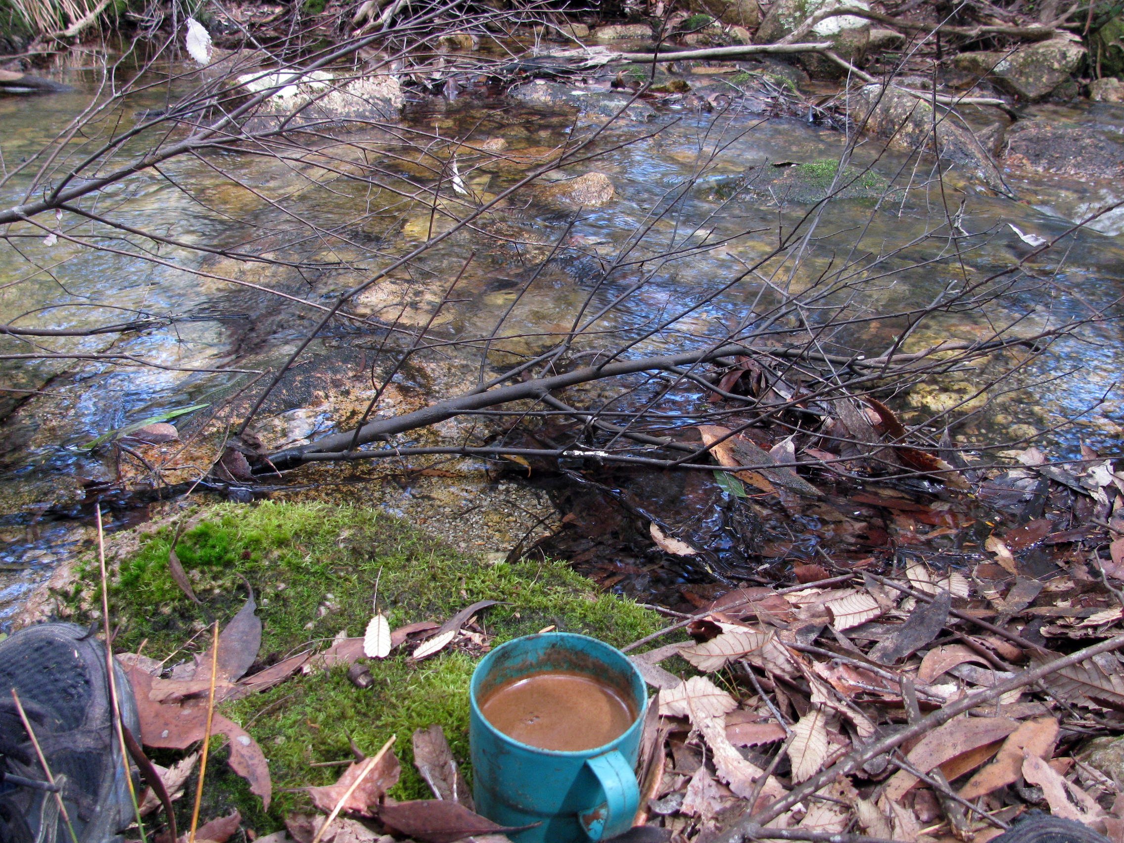
Forty minutes later, a creek crossed the track, and I brewed up some Turkish coffee at a lovely little spot just off the track.
Photo: Don Hitchcock, April 2015
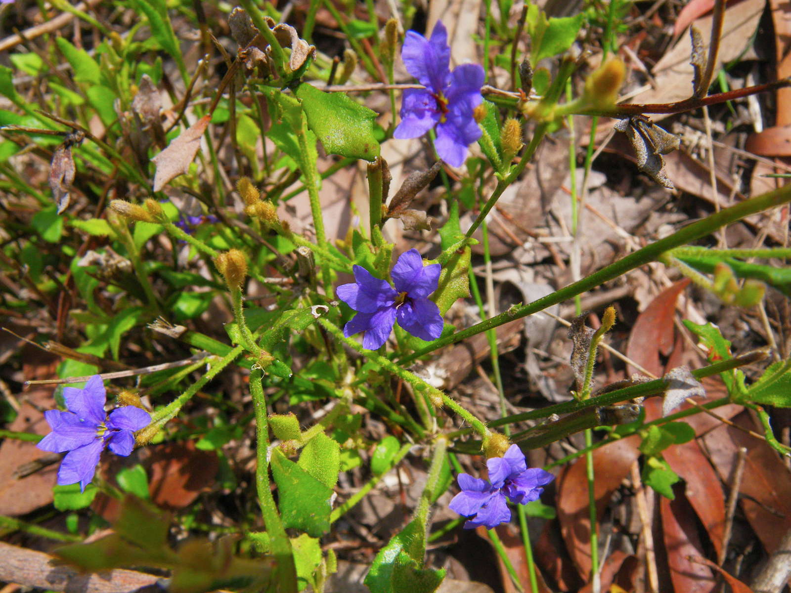
Dampiera purpurea, commonly known as the mountain or purple or furry Dampiera, is a subshrub in the family Goodeniaceae native to Victoria, New South Wales and Queensland in eastern Australia. Its blue-purple flowers appear in spring and early summer (September to December), and it is pollinated by insects such as butterflies and bees. Adapting readily to cultivation, Dampiera purpurea is grown as a garden plant in Australia.
It is an erect multi-stemmed plant to 1 m (4 ft) high with obovate to elliptic leaves which are 9 to 60 mm (0.4-2.4 in) long and 5 to 42 mm (0.2-1.7 in) wide. The stems and undersides of leaves are covered in fine hair and rough in texture, while the leaves are bare of hair when mature. The flowers are mainly produced between August and January in the species' native range. Three to five flowers arise each on groups of two to nine flower-bearing branches. Reaching 25 mm (1 in) in diameter, they are generally blue-purple in colour with yellow centres, though pink and white flowers have been recorded.
Photo: Don Hitchcock, November 2011
Text: Adapted from Wikipedia
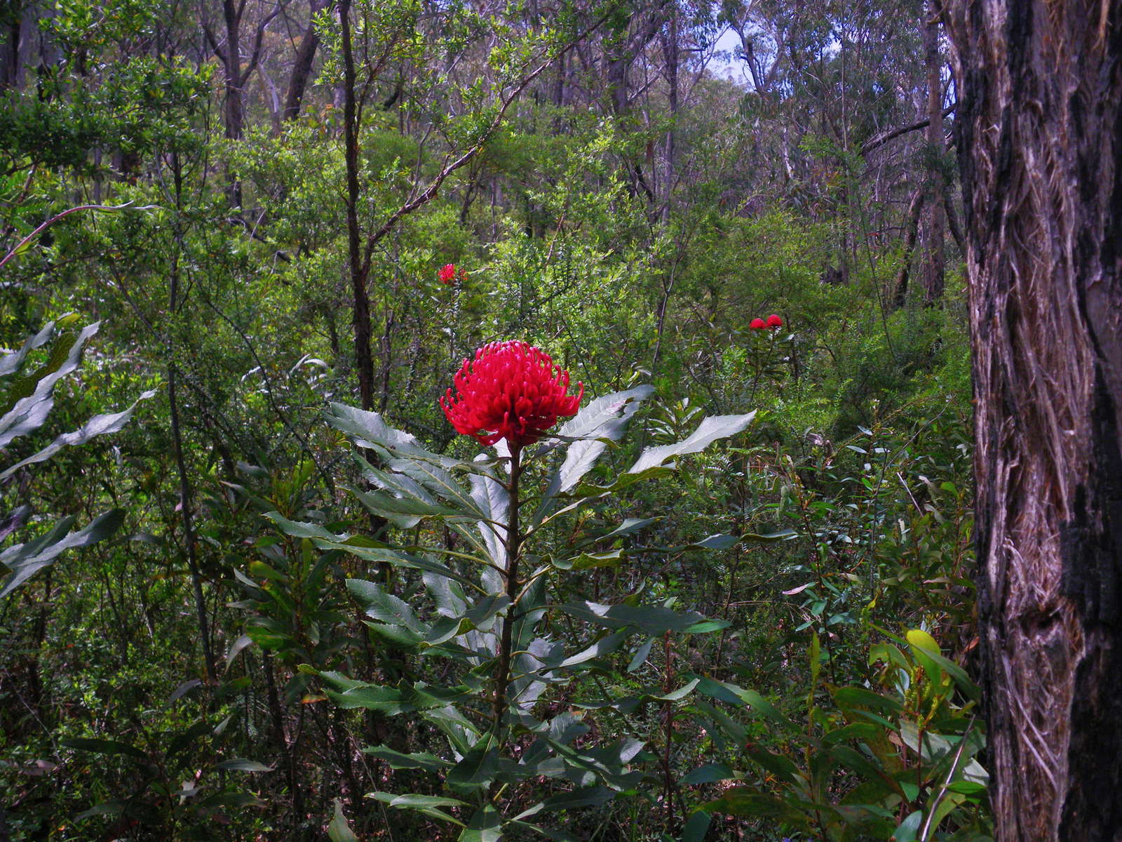
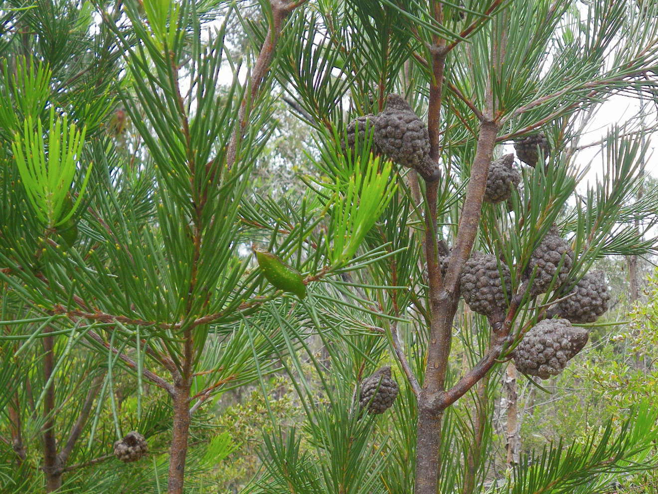
These Gibraltar Range Waratahs (Telopea aspera) were spectacular. They occurred sporadically along the first five kilometres of the track towards Grassy Creek.
Telopea aspera is a large shrub in the Proteaceae family. It is endemic to the New England region in New South Wales in Australia. It was first described by botanists Peter Weston and Mike Crisp in 1995, separated from its close relative Telopea speciosissimaby its rough foliage and dryer habitat.
The Gibraltar Range Waratah is a large erect shrub up to 3 or 4 metres (10-13 ft) in height with one or more stems. It has dull green leaves which are alternate, and are more coarsely-toothed than its southern relative. The inflorescences, which appear in spring, are large and crimson coloured. They consist of a large domed flowerhead ringed by bracts. These are followed by large seed pods which eventually turn brown and split open revealing winged seeds inside.
Photo: Don Hitchcock, November 2011
Text: Adapted from Wikipedia
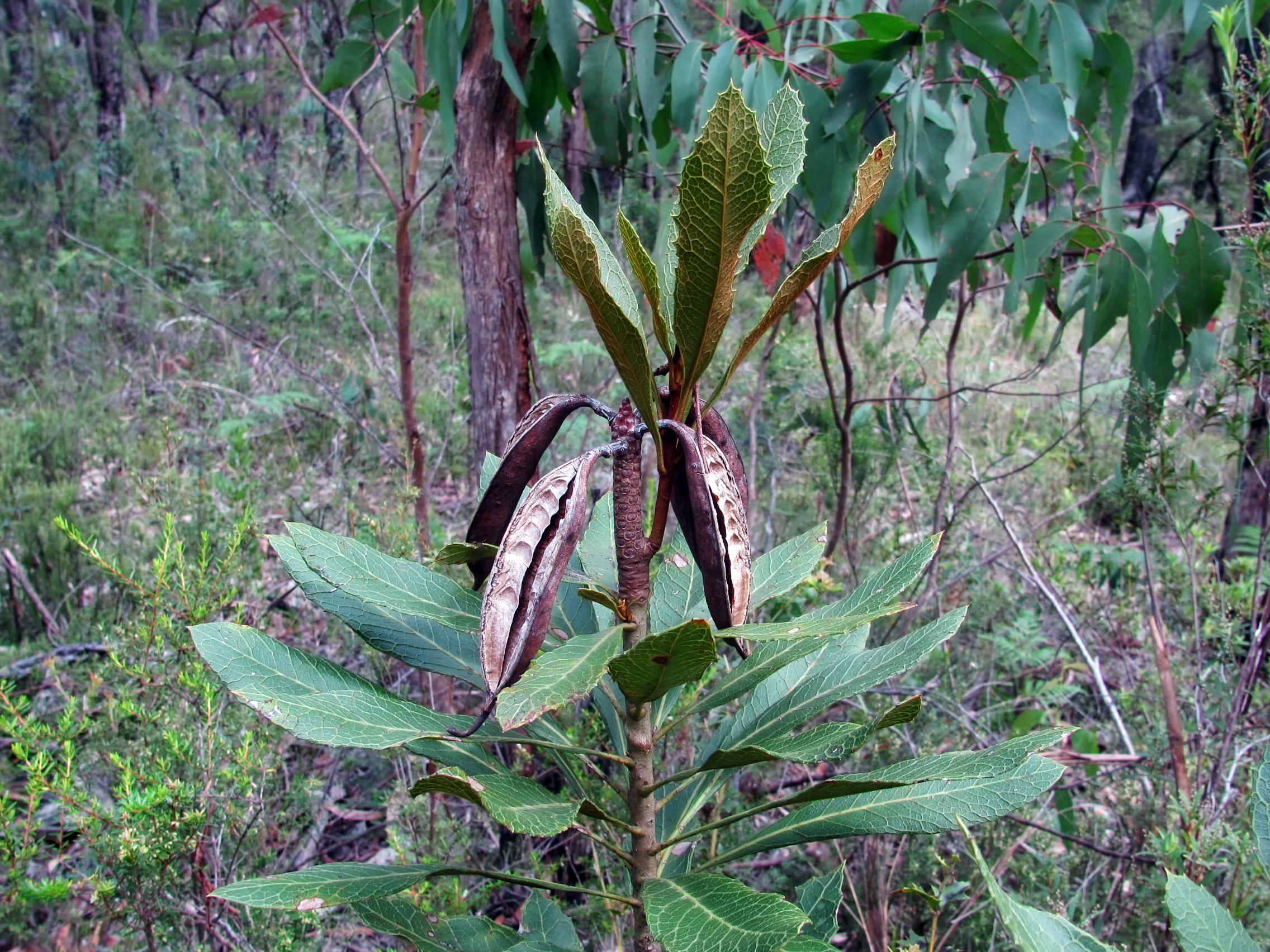
In this shot in early autumn, there had been no fertilisation of this Waratah, by this time there should have been fat green seed cases if that had occurred.
The dry opened seed cases here are from the previous year's flowering.
Photo: Don Hitchcock, April 2015
Boronia algida, commonly known as Alpine Boronia, has pale pink or white four-petalled flowers which appear between September and January.
Photo: Don Hitchcock, November 2011
Text: Adapted from Wikipedia
Pea flower, possibly Dillwynia sp.
Photo: Don Hitchcock, November 2011
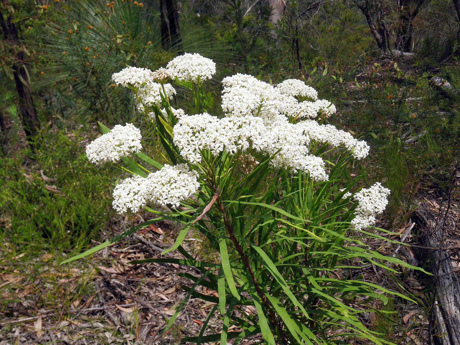
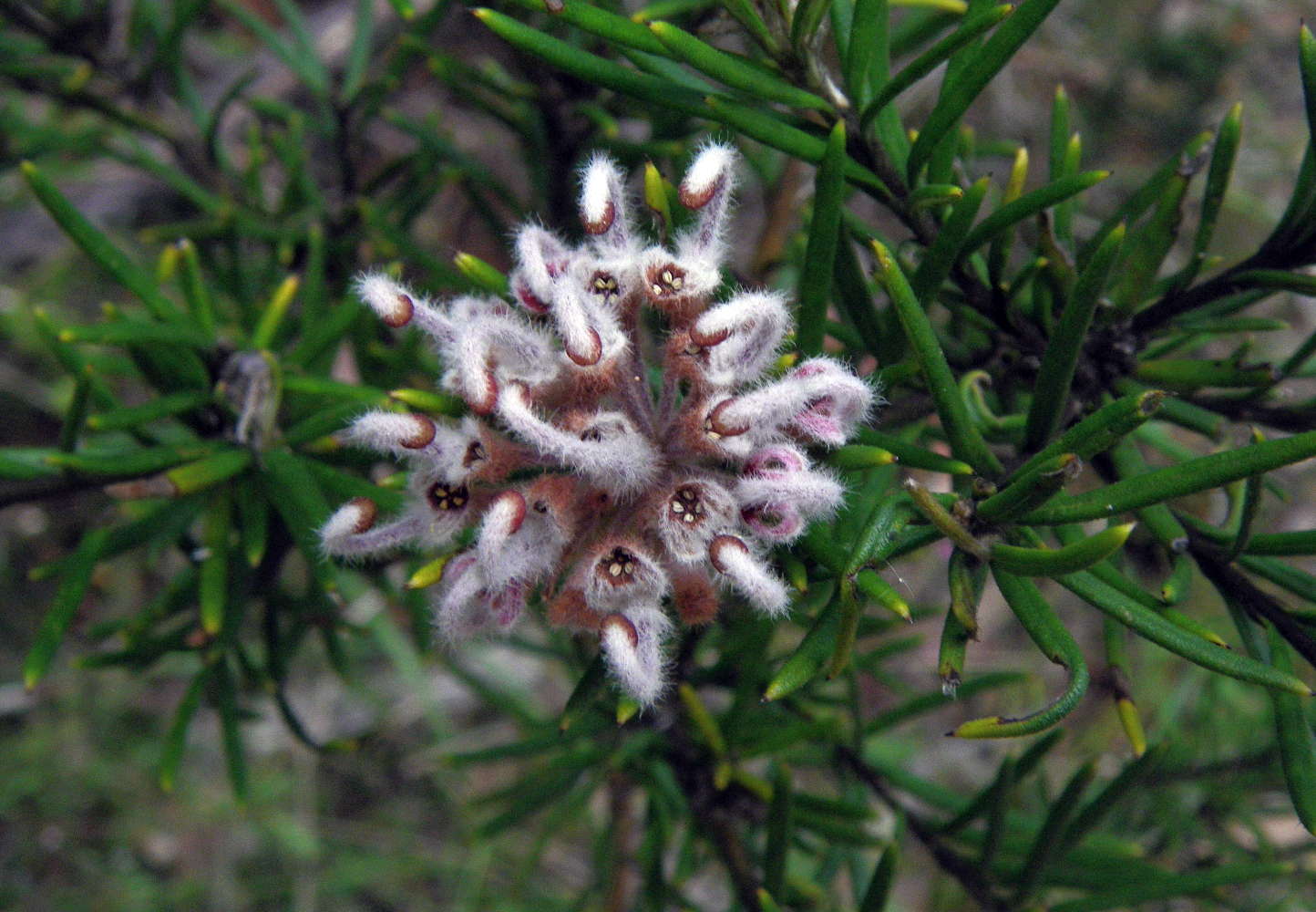
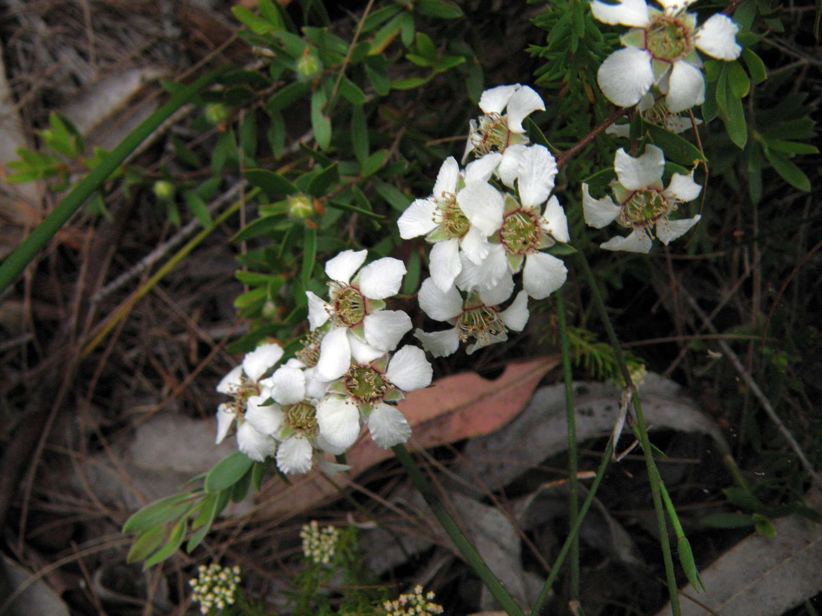
The massed white flower heads on this plant were superb.
Photo: Don Hitchcock, November 2011
Side track junction to Duffer Falls, 3 km from the start.
Photo: Don Hitchcock, April 2015
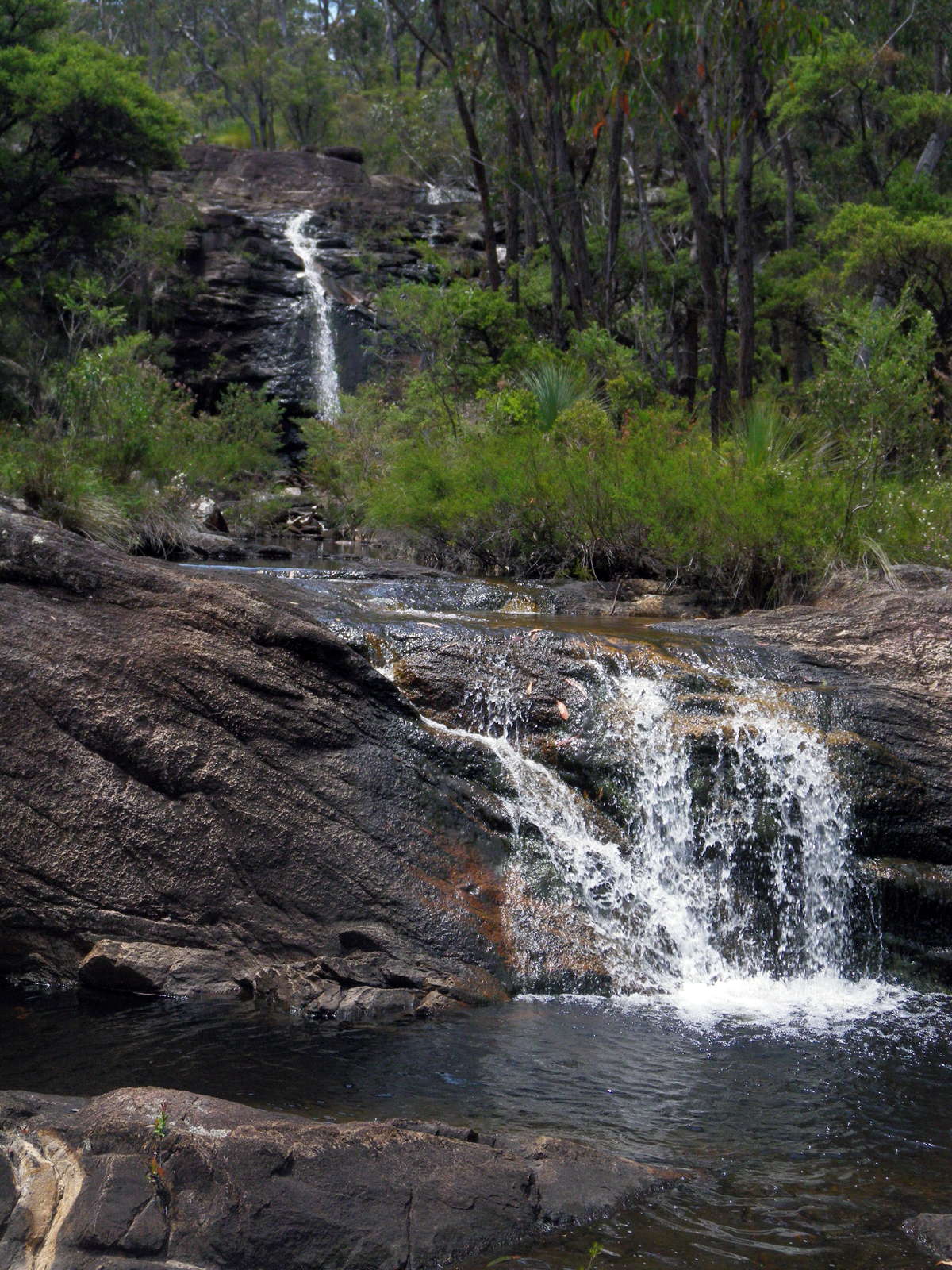
I took the side track to Duffer Falls. This is a little cascade at the point where the track meets Duffers Creek, on its way to the falls. From this point on, great care should be taken, especially in wet weather.
Photo: Don Hitchcock, November 2011
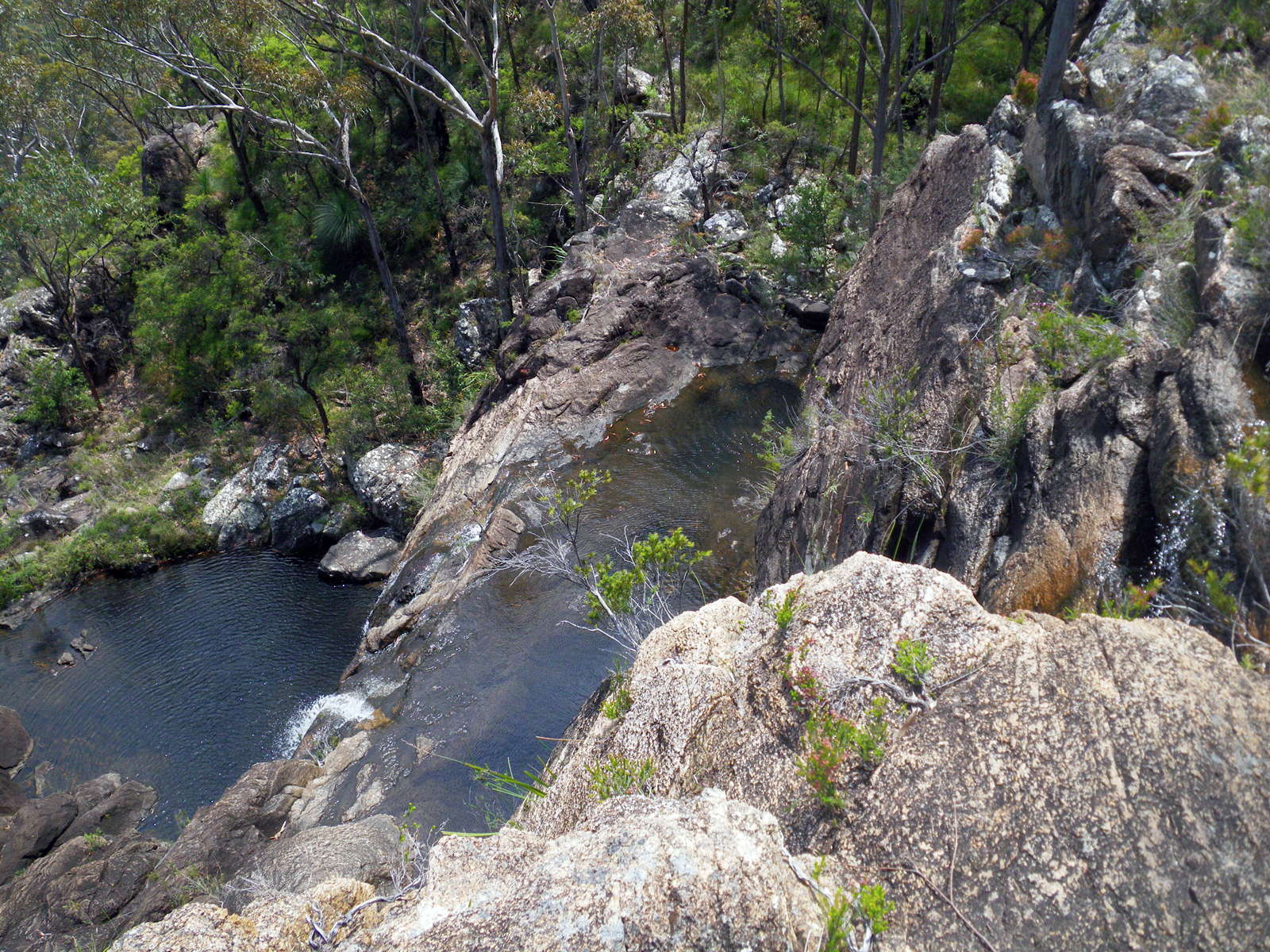
It is hard to get a direct look at the falls. This is taken from the top. The water is crystal clear.
Photo: Don Hitchcock, November 2011

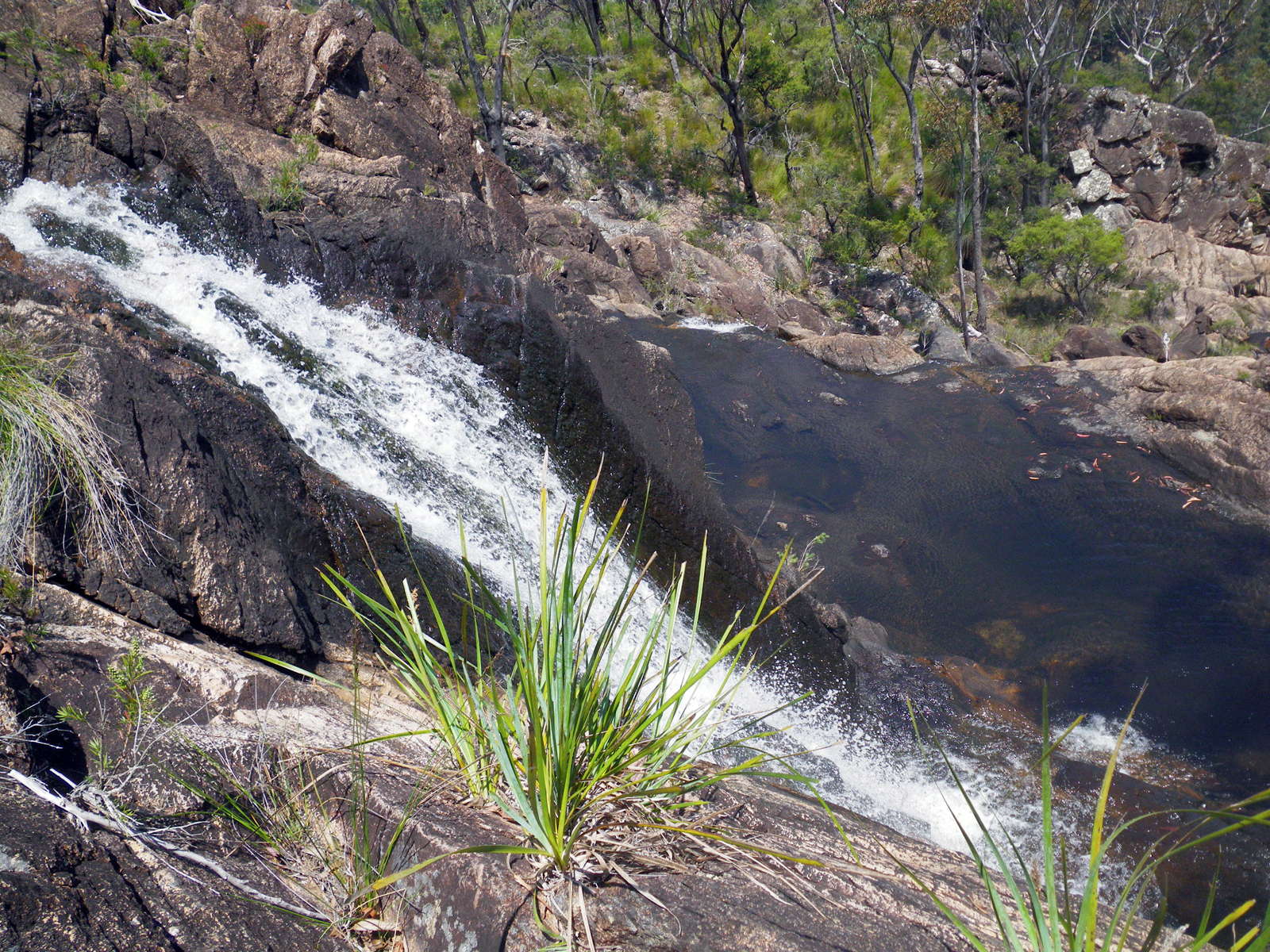
The water falls in a series of cascades into the valley below.
Photo: Don Hitchcock, November 2011
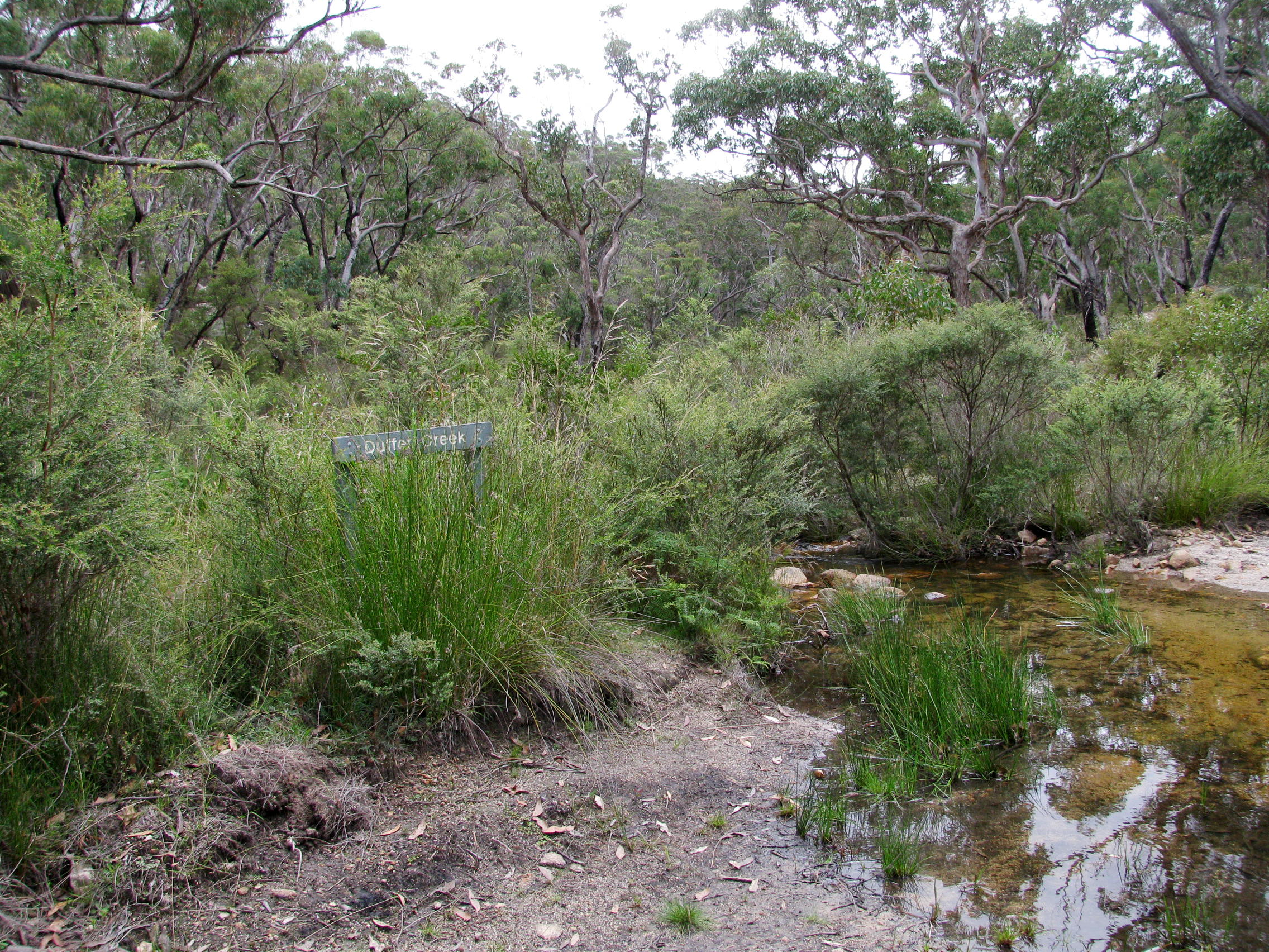
Duffer Creek, which feeds the falls, is crossed five minutes after returning to the main track to Grassy Creek.
Photo: Don Hitchcock, April 2015
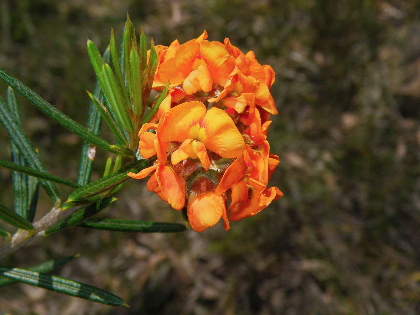
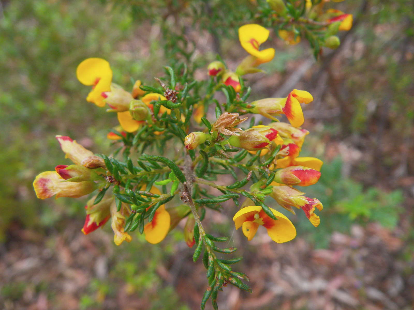
A beautiful orange Pea flower.
Photo: Don Hitchcock, November 2011
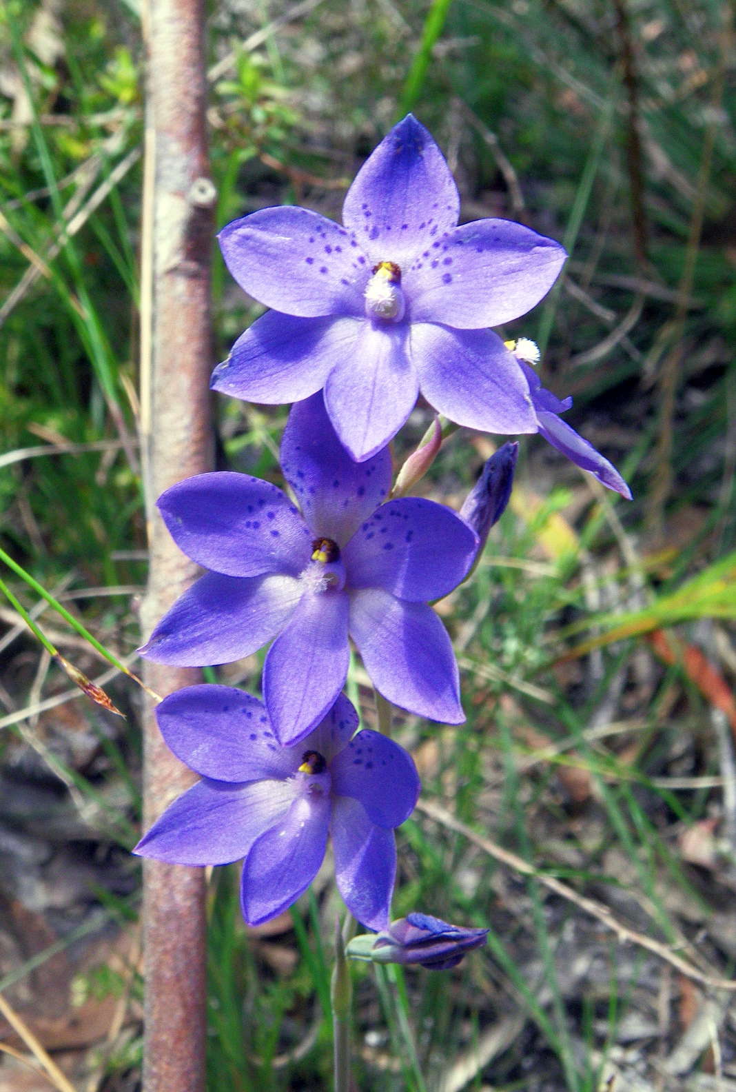
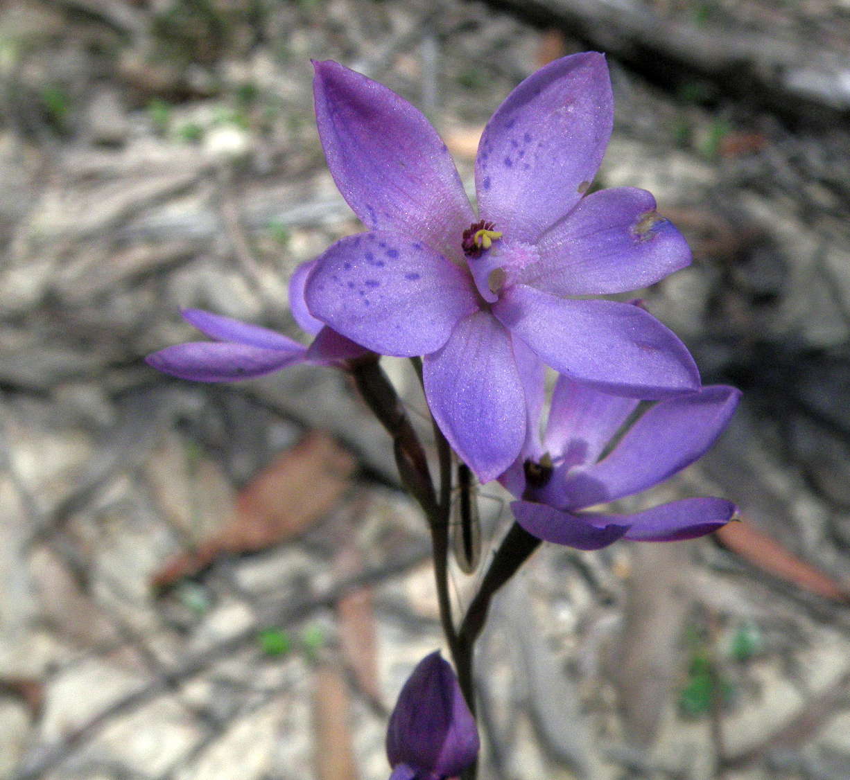
The Spotted Sun Orchid, Thelymitra merranae
Thelymitra are known as 'sun orchids' because the flowers of most species only open fully on warm, sunny days.
Photo: Don Hitchcock, November 2011
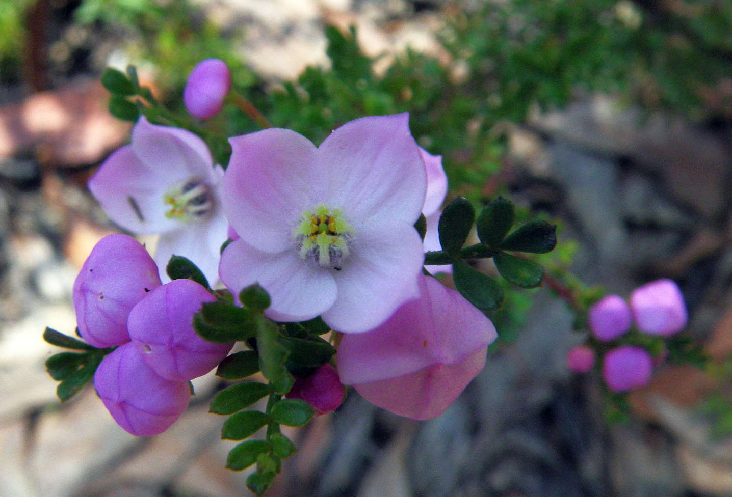
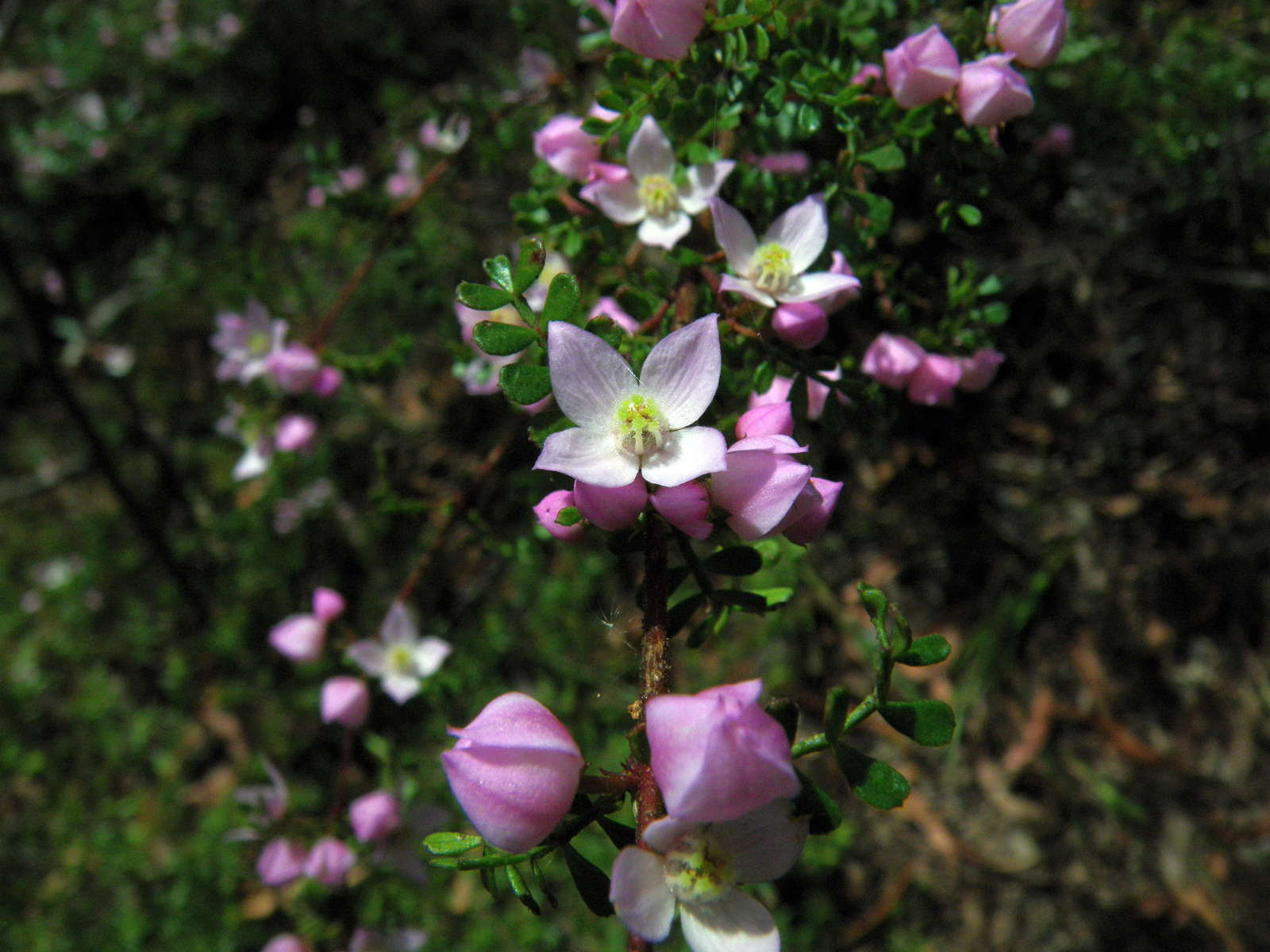
The small leaved Boronia, Boronia microphylla is a beautiful small shrub in the Rutaceae family, up to one metre in height, found in moist, protected areas. The flowers are 10 mm across, have four petals, and are pink in colour.
Photo: Don Hitchcock, November 2011

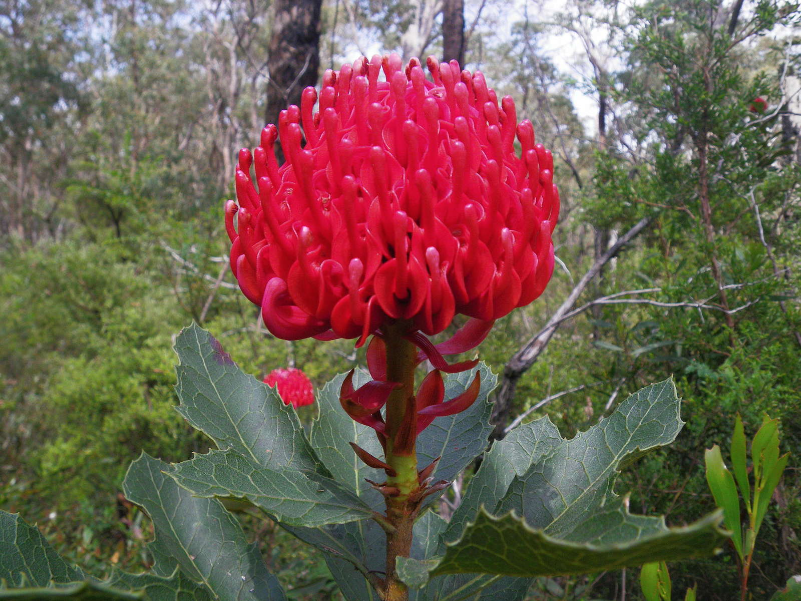
Another Gibraltar Range Waratah, Telopea aspera. Telopea means 'seen from afar', a very appropriate scientific name.
My small, waterproof bushwalking camera sometimes has difficulty registering the colours of Telopea, the colours of this genus are so intense that the result sometimes comes out posterised, but this time it got it right, and in focus.
Photo: Don Hitchcock, November 2011
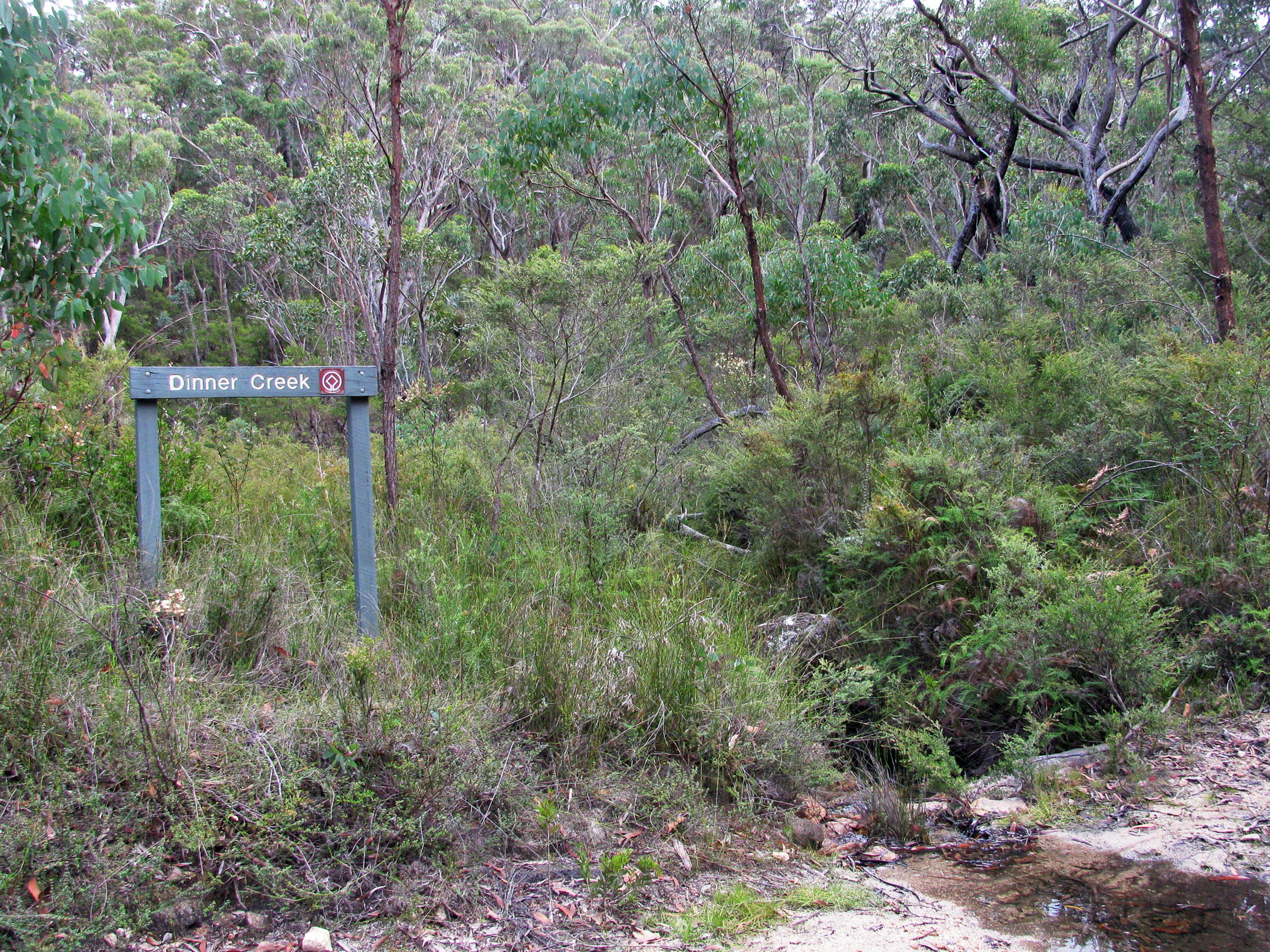
Dinner Creek crosses the track a bit later on, and is a fine spot for an early lunch.
Photo: Don Hitchcock, April 2015
Bauera rubioides growing where it likes to grow: beside a running stream, Dinner Creek in this case, in a moist, protected environment.
Photo: Don Hitchcock, November 2011
The Grey Spider Flower, Grevillea acerata, is closely related to Grevillea sphacelata and Grevillea buxifolia.
It is a rare species confined to Gibraltar Range National Park.
Photo: Don Hitchcock, November 2011
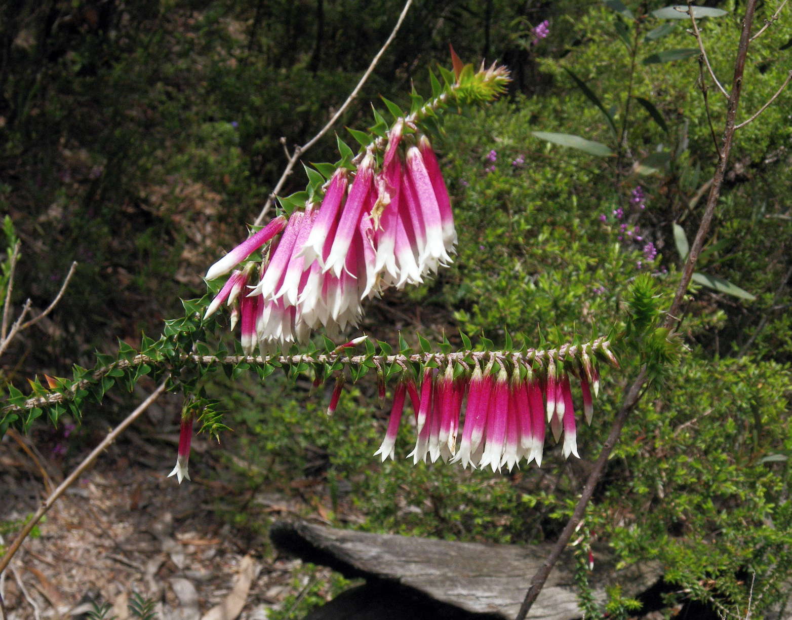

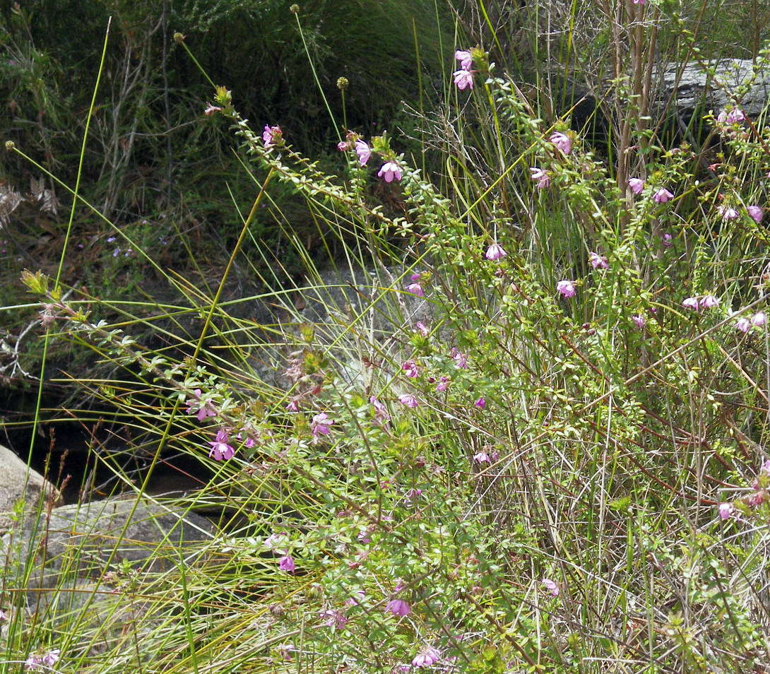
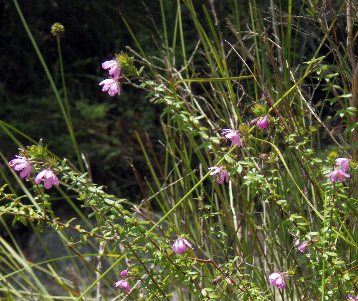
The Fuchsia Heath, Epacris longiflora is a showy epacris which can be found in quite shady places. The tough, prickly, heart-shaped leaves are 5-12mm long, with parallel veins.
The pink/red and white tubular flowers of Epacris longiflora are 12-20 mm long, growing pendulously from the leaf axils. It mainly flowers from April to November, but spot flowering may occur at any time of the year.
Photo: Don Hitchcock, November 2011
Text: Adapted from http://www.friendsoflanecovenationalpark.org.au/Flowering/Flowers/Epacris_longiflora.htm
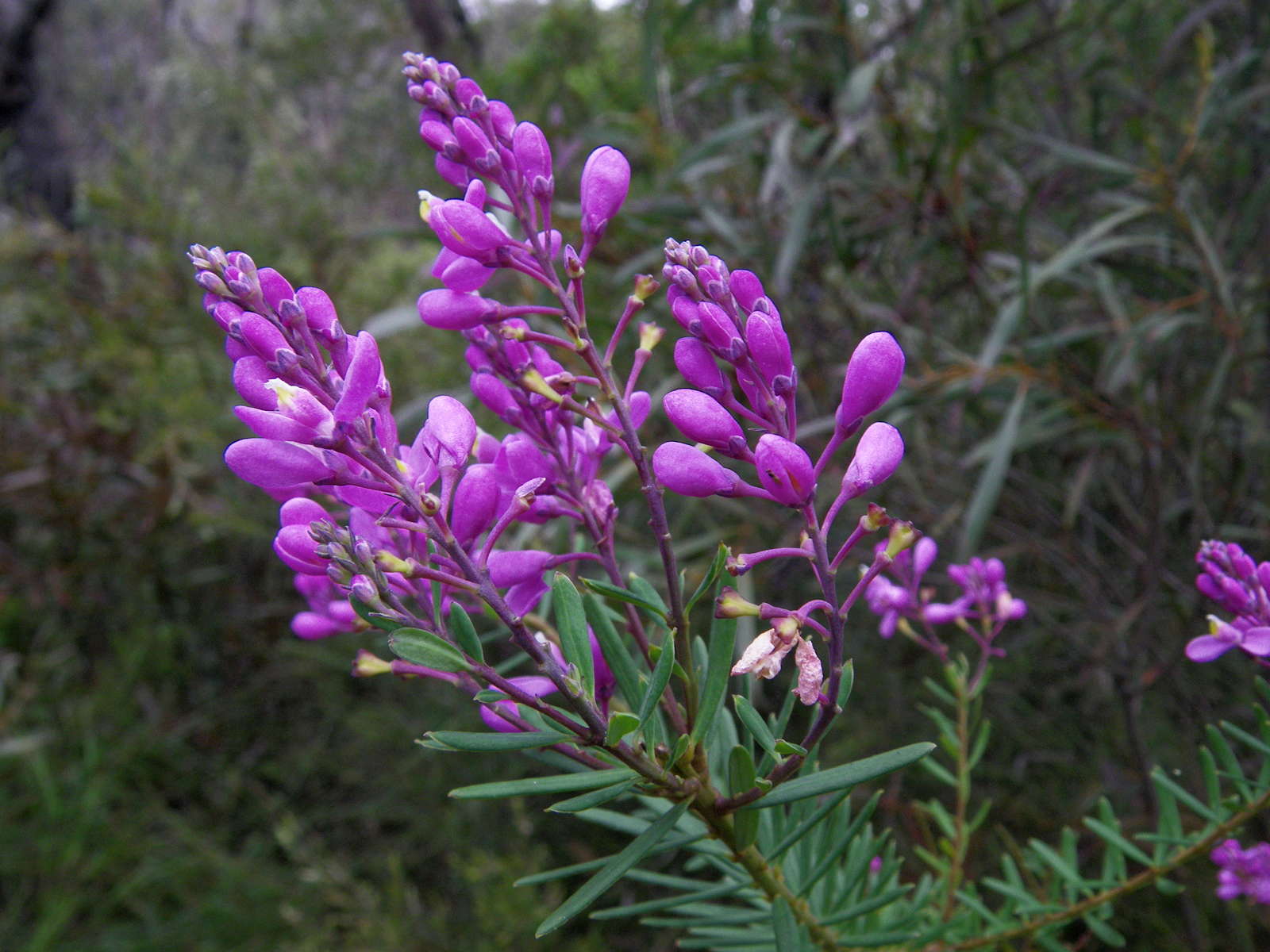
Comesperma ericinum, or Match Heads, grew in many places along this track, but this was a particularly attractive plant.
Photo: Don Hitchcock, November 2011
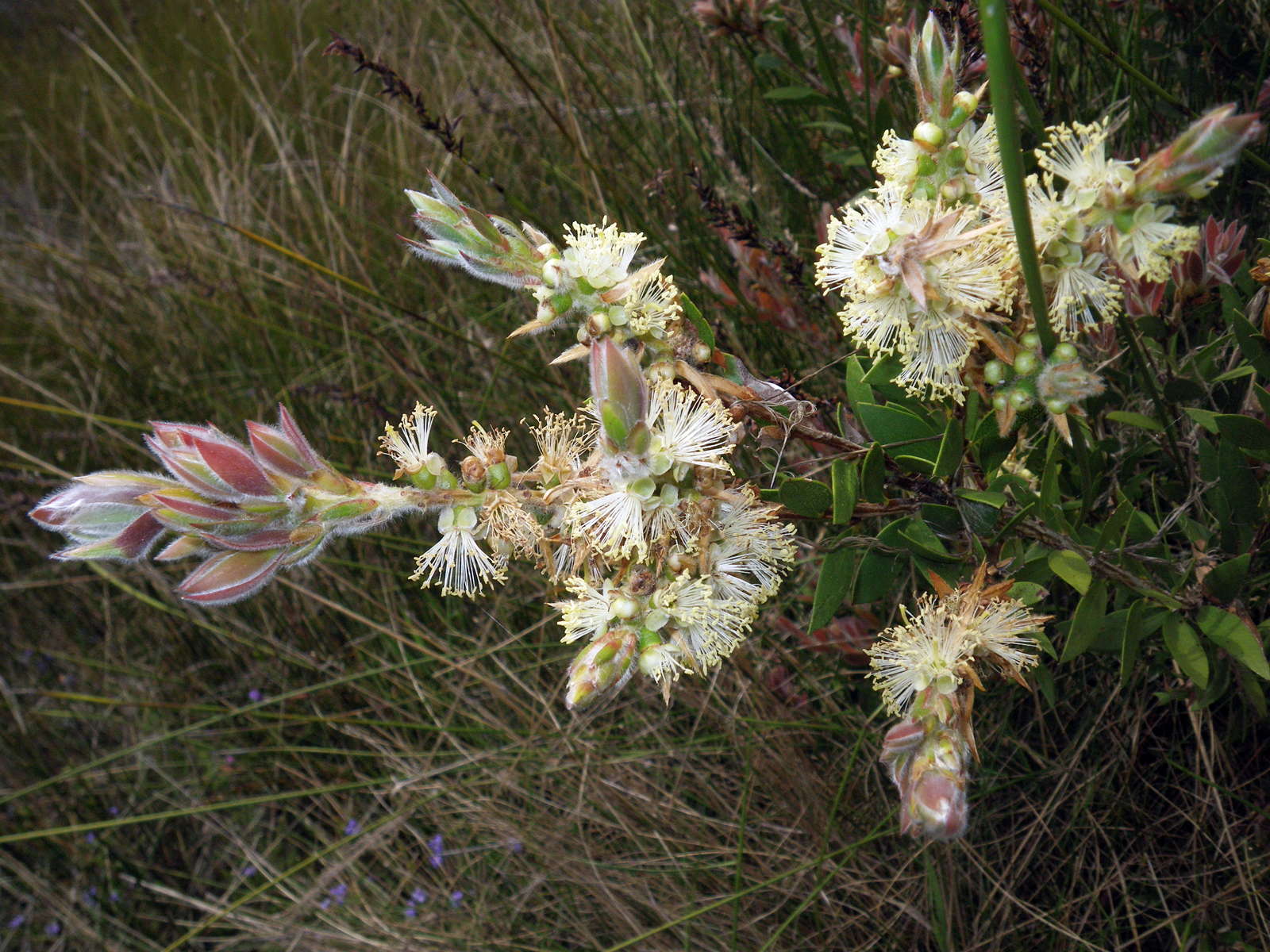
Callistemon saligna, known as Willow Bottlebrush or White Bottlebrush, has new growth which is purplish-pink. The bottlebrush flower-spikes appear during spring. They are generally creamy white to yellow.
Photo: Don Hitchcock, November 2011
Text: Adapted from Wikipedia
This is where the National Trail diverts from the fire trail to Grassy Creek, a few minutes walk past Dinner Creek.
Photo: Don Hitchcock, April 2015
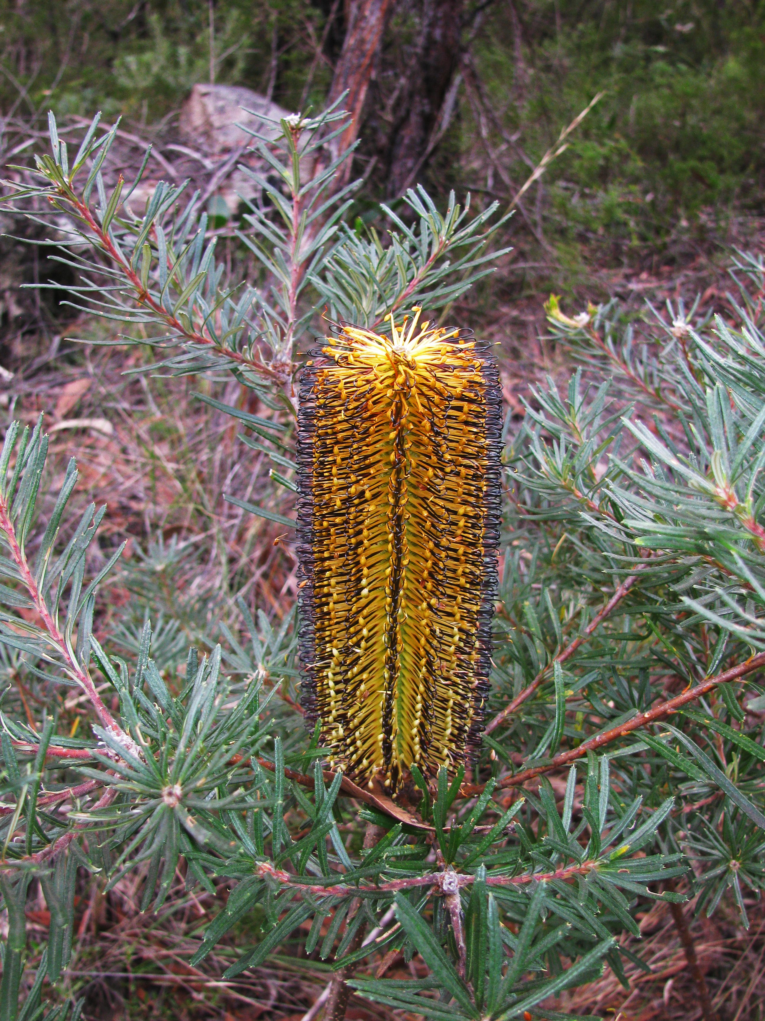
A superb Banksia brush in full flower, composed of many hundreds of individual florets
It is Banksia neoanglica, previously Banksia spinulosa var. neo-anglica.
Photo: Don Hitchcock, April 2015
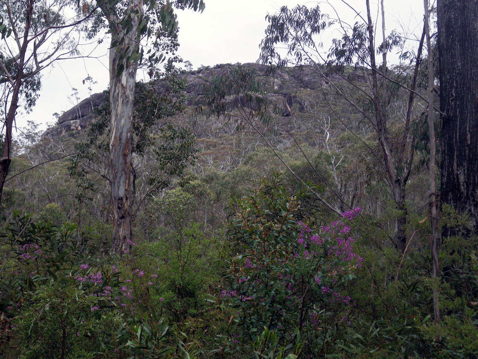
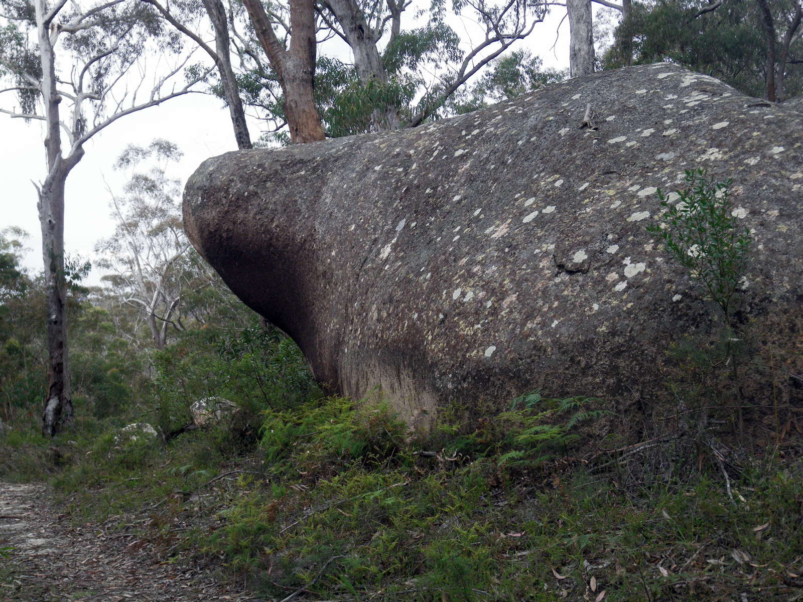
The Haystack, with Match Heads in flower in the foreground.
There is no track to the summit of this impressive granite rock formation. It is best approached from the south by following the contour to its base. Aboriginal ceremonies by members of the Bundjalung people were conducted on the top of the Haystack, and it is recognised as a site of significance. From the top there are stunning views of untamed wilderness in all directions. The Demon Fault, seen to the north-west, scars a great expanse of forested ridges from Ebor to Tenterfield.
Photo: Don Hitchcock, November 2011
Text: Adapted from the Walks Guide, 'A Walk on the Edge of Wilderness, The Gibraltar - Washpool World Heritage Walk', a free booklet from NPWS.
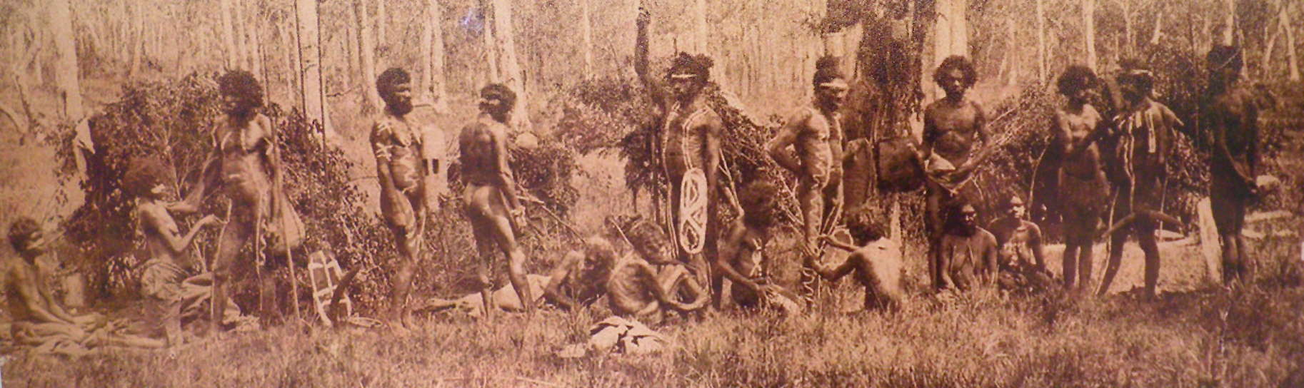
Bundjalung people, about 1865
The Bundjalung people are a large Aboriginal nation, a federation of a number of groups of clans which occupy the land from Grafton on the Clarence river of northern New South Wales north to the town of Ipswich and the Beaudesert, in southern Queensland, and down around the other side of the Great Dividing Range and back to Grafton.
In pre-colonial times, the Bundjalung Nation encompassed some of the richest hunting and fishing grounds anywhere on the Australian continent, including the area encompassed by the Gibraltar Range National Park.
Photo: NPWS display
Text: Adapted from Wikipedia
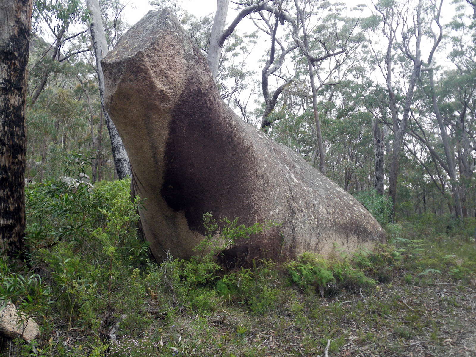
Sabrina's Rock, apparently named after Norma Ann Sykes (born 19th May 1936), better known as Sabrina, who was a 1950s English glamour model who progressed to a minor movie career. Her main claim to fame was her hourglass figure of prodigious breasts coupled with a tiny 17 inch waist.
Photo: Don Hitchcock, November 2011
Text: Adapted from Wikipedia

Sabrina signing a £100 000 insurance policy for her breasts.
Photo: © http://nylon.net/sabrina/
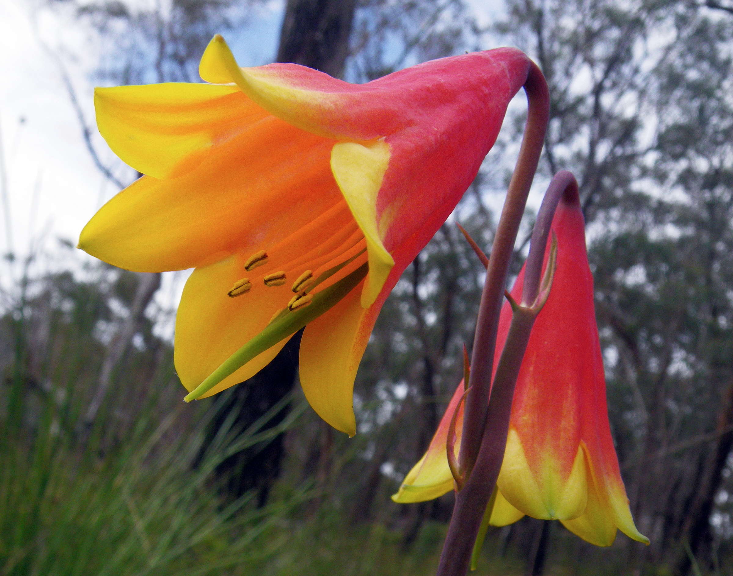
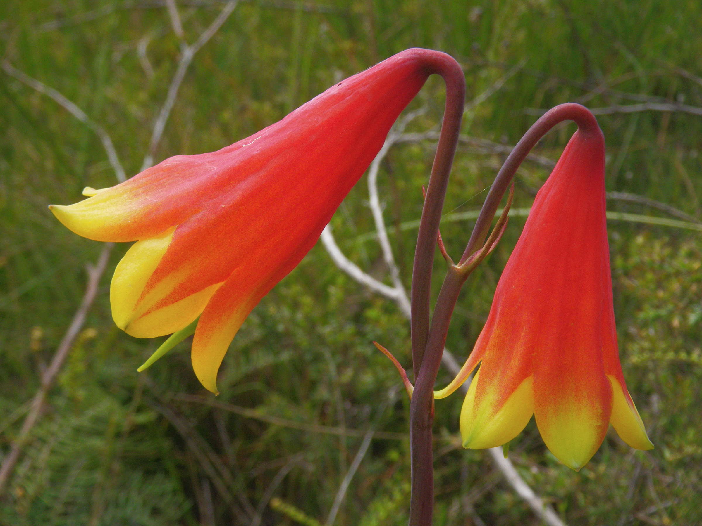
The Christmas Bell, Blandfordia grandiflora, grows in damp conditions, in this case in a hanging swamp on the lower side of the track. Blandfordia grandiflora is a very slow growing plant, so more aggressive plants easily swamp it in the wild, which is one reason it has evolved to prefer swampy areas, where there is less competition.
They are a spectacular flower, but there were only a few out, since it was only at the start of the flowering season.
Photo: Don Hitchcock, November 2011
Text: Adapted from Wikipedia
Hakea macrorhyncha has beautiful foliage and interesting seed cases. It is a rare plant, bordering on endangered. The plant in this situation seemed to be more of a shrub than a tree, with many canes growing to about two metres in height.
Photo: Don Hitchcock, November 2011

Ruby Creek, passing under the road through a culvert, fed by a hanging swamp on the right hand side of the road. There are many such hanging swamps in the area, possibly a leftover from the semi-permanent snowfields here during the last ice age, though there were no glaciers in this area.
Photo: Don Hitchcock, April 2015
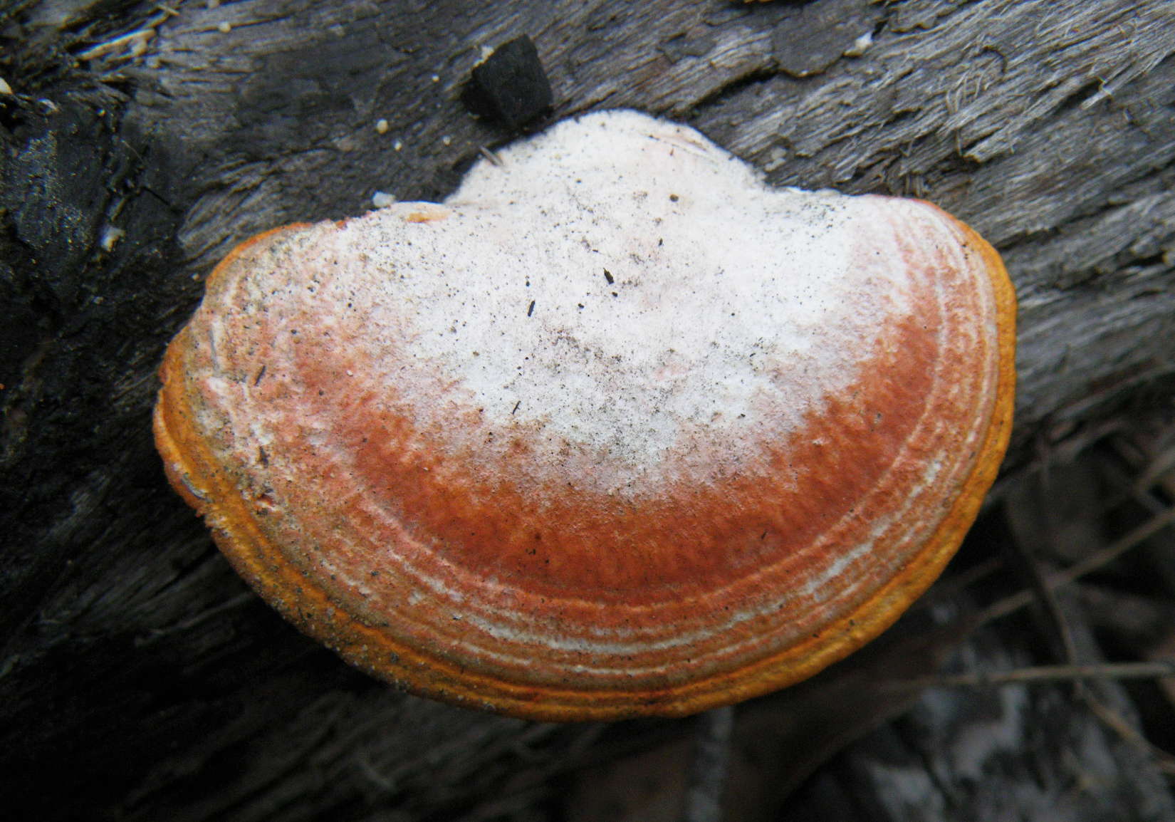
Bracket fungus, growing on dead wood. There must be many thousands of species of these in Australia.
Photo: Don Hitchcock, November 2011
Leptospermum sp.
Photo: Don Hitchcock, November 2011

And finally, Grassy Creek Camping Area, well set up with a fireplace, picnic table, and plenty of spots for camping.
Photo: Don Hitchcock, April 2015
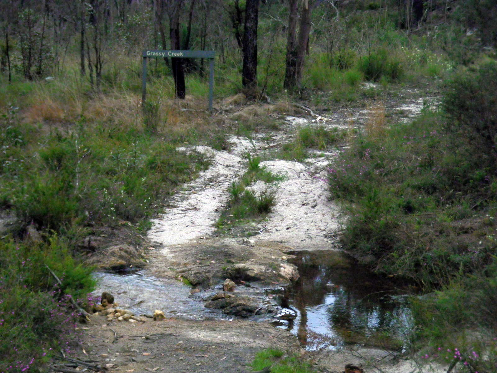
Grassy Creek.
It is a beautiful little stream, and a very welcome source of good water.
Photo: Don Hitchcock, November 2011


The water looked crystal clear, and it was, but the tank water from home on the right was clearer!
I have used muddy water from a dam, which had ducks, yabbies and tortoises swimming in it, and was glad to have it. Most water in the bush has some cloudiness or colour to it, even if it is only peat discolouration as in this case. The peat gives a lot stronger colour in Tasmania - you hardly need to add tea for a cup of tea!
Photo: Don Hitchcock, November 2011
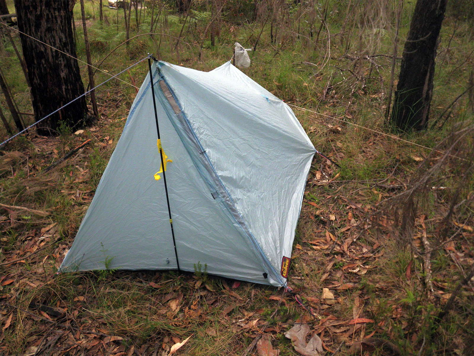
I set up my tent on a level bit of grass, got a fire going, made dinner, and went to bed.
I made the tent out of silnylon, which is very light and waterproof. It is a single wall tent but with insect protection, weighs about 600 grams, and works well.
I got up early the next morning to continue the walk to Mulligans Hut.
Photo: Don Hitchcock, November 2011
Bushwalking Index
The walk from Grassy Creek to Mulligans Hut via O'Hara's Gap and the Tree Fern Fire Trail
The walk from Mulligans Hut to Boundary Creek via Surveyors Creek and Dandahra Crags