Back to Don's Maps
 Back to Beach Walking index
Minnie Water to Diggers Camp Beach Walk

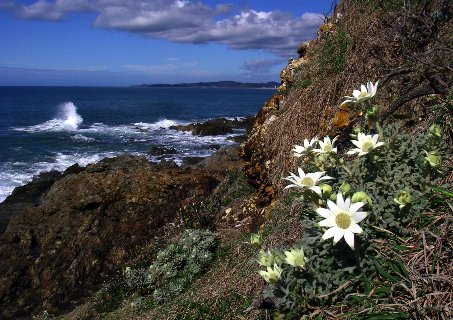
The Headland at Minnie Water, looking towards Diggers Camp and Wooli, with Flannel Flowers in the foreground
Photo: Don Hitchcock, September 2009
One Tree Point, the headland near Minnie Water.
Photo: Don Hitchcock, September 2009
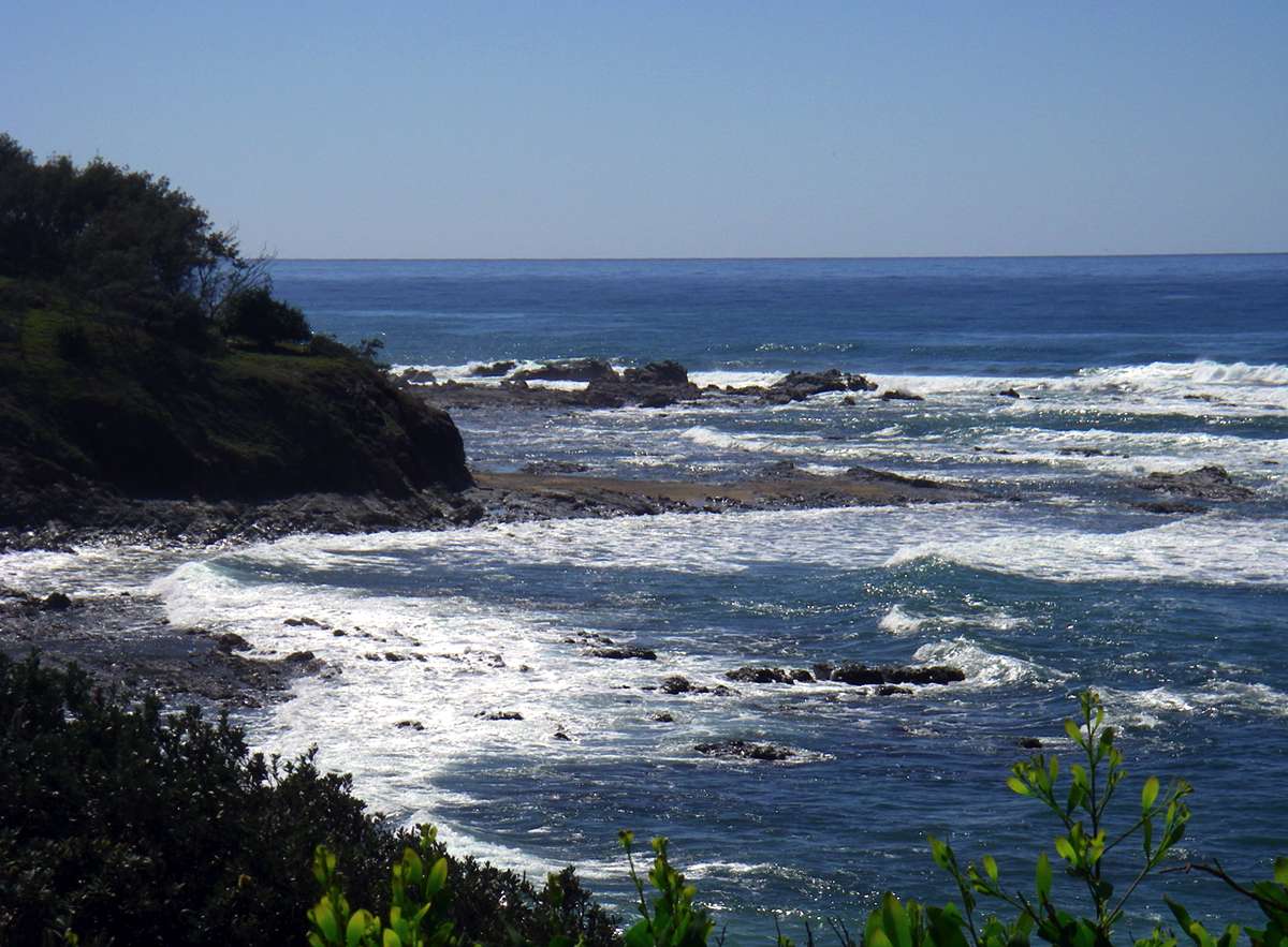
Looking north from One Tree Point towards Sandon.
Photo: Don Hitchcock, September 2009
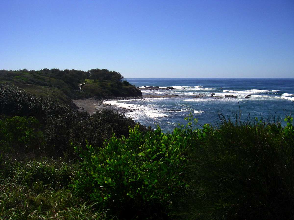
Looking south from One Tree Point towards Diggers Camp.
Photo: Don Hitchcock, September 2009
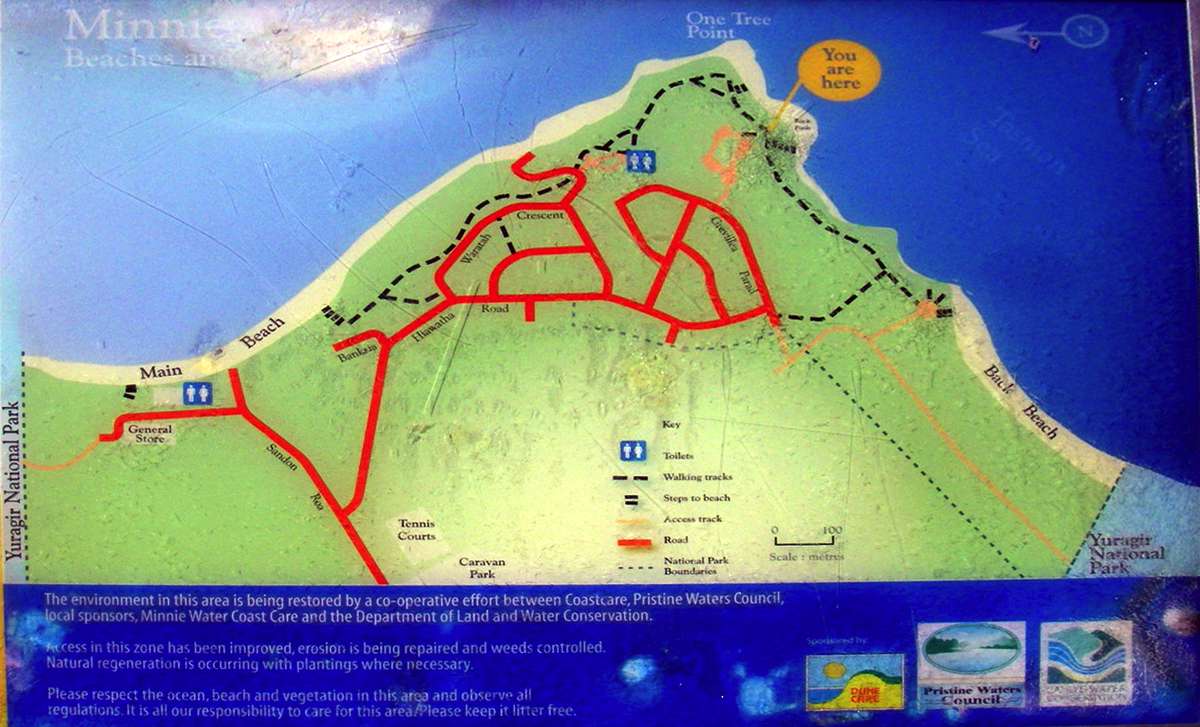
Map of the area served by well maintained tracks on the headland of Minnie Water.
Photo: Don Hitchcock, September 2009
There are several coves in the Minnie Water headland.
Photo: Don Hitchcock, September 2009
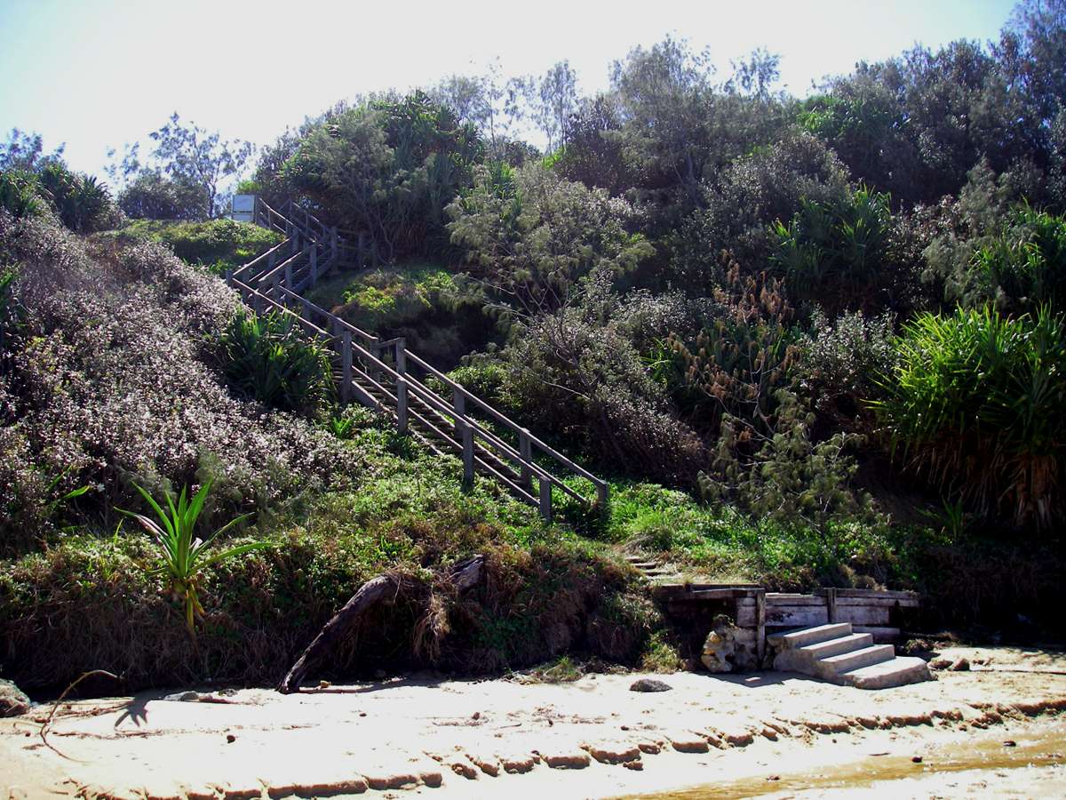
Looking north at a set of stairs to a small sand and shingle beach from the One Tree Point at Minnie Waters. Taken from a well maintained track along the headland.
Photo: Don Hitchcock, September 2009
The stairs leading down to Back Beach from the headland at Minnie Waters.
Photo: Don Hitchcock, September 2009
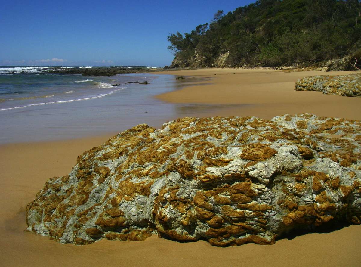
This multi-coloured rock on Back Beach was exposed as the tide went out.
Photo: Don Hitchcock, September 2009
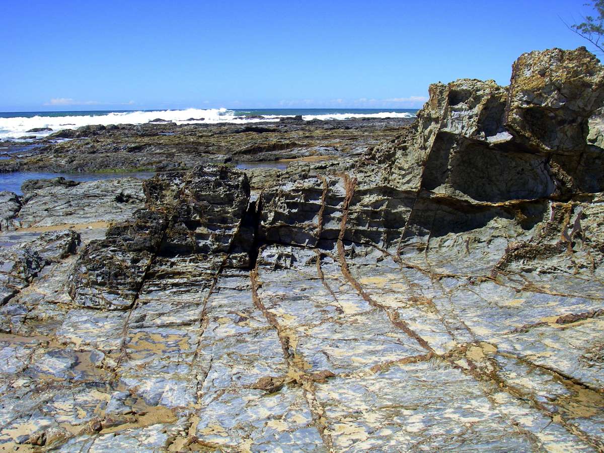
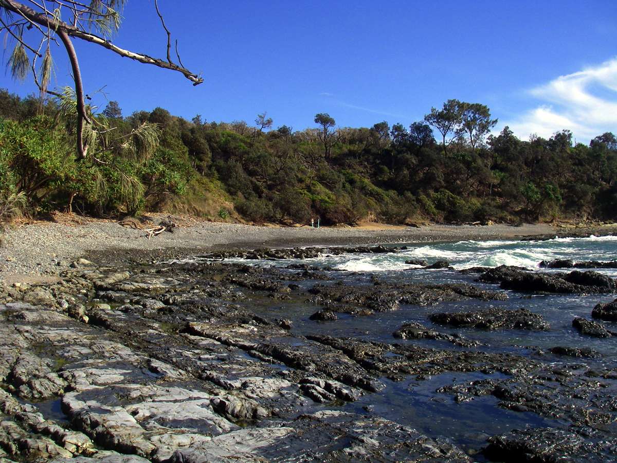
The large rock platform here provides many ecological niches.
Photo: Don Hitchcock, September 2009
Pandanus and Casuarina trees, rocks, sand and surf - a typical mix on this section of the Australian coast.
Photo: Don Hitchcock, September 2009

Coffee Rock, occurring in a visible dark brown band along the shore, as well as a Coffee Rock boulder eroded by heavy seas from the consolidated sand dunes fringing the shore.
Coffee Rock is impermeable to water, and there are often fresh water springs cascading or dripping onto the beach. The water should not be used for drinking or cooking.
Photo: Don Hitchcock, September 2009
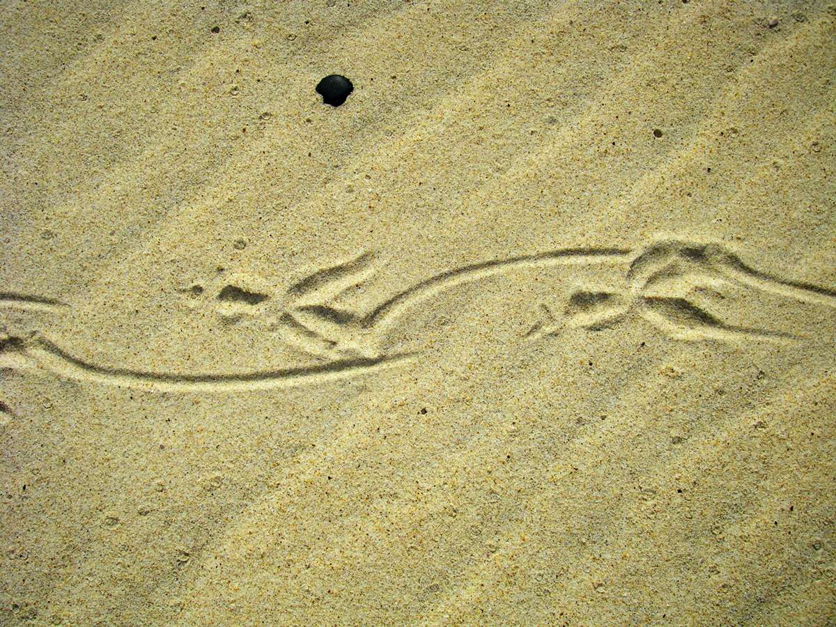
Prints from a shore bird, left on the sand, showing the way the bird trails one toe as it walks.
Photo: Don Hitchcock, September 2009

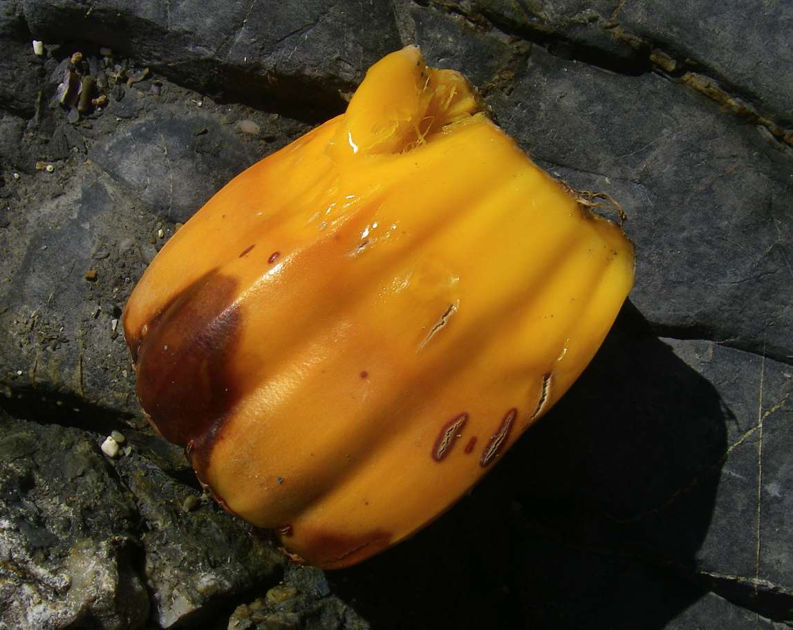
Sponge washed up on shore, torn from its rocky reef by rough seas. Sponges do not need sunlight to grow, and often form large communities known as sponge gardens, in suitable environments, along with many other species of marine life, in shaded or deep water.
Photo: Don Hitchcock, September 2009

Fresh water cascading onto the beach from the water table, where it overlies the impervious coffee rock strata.
Photo: Don Hitchcock, September 2009
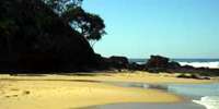
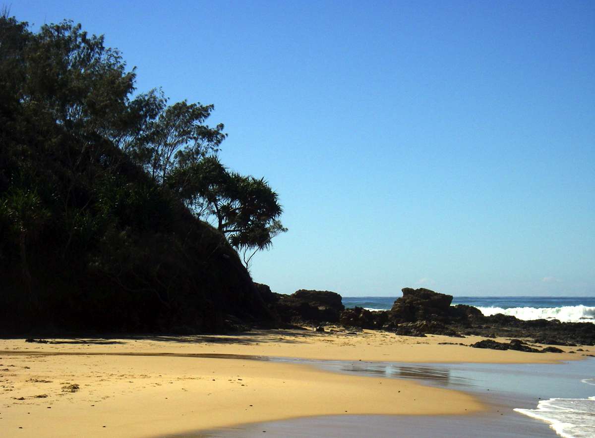
Diggers Camp Beach from the low headland to the north.
Photo: Don Hitchcock, September 2009
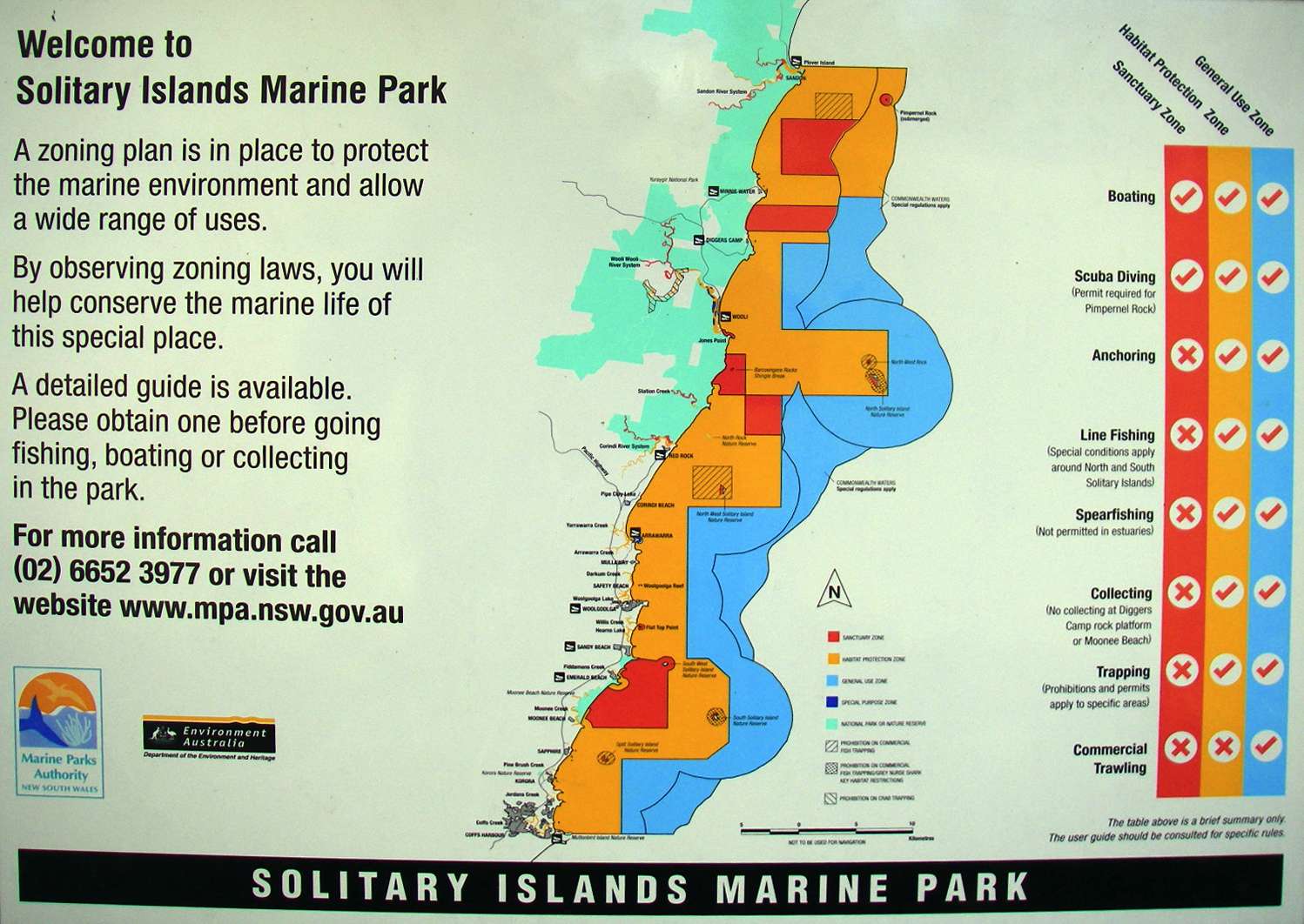
Zoning laws have made a huge difference in the preservation of selected marine and coastal environments. By zoning, all sections of the community benefit by having areas in these areas of national importance set aside for particular uses.
The NSW system of marine protected areas encompasses six multiple use marine parks, 12 aquatic reserves and 62 national parks and reserves with marine components.
The first marine park established in NSW, the Solitary Islands Marine Park stretches over 75 Km from Muttonbird Island in the south to the Sandon River and Plover Island in the north. The marine park incorporates estuaries to their tidal limit, foreshores to the mean high water mark and extends offshore to the 3 nautical mile state waters boundary.
It covers an area of around 71 000 hectares.
Adjacent is the Commonwealth Solitary Islands Marine Reserve of 160 square Km. The Marine Parks Authority manages the Reserve under an annual business agreement.
Text adapted from the Marine Parks Authority NSW website, at http://www.mpa.nsw.gov.au/simp.html
Photo: Don Hitchcock, September 2009
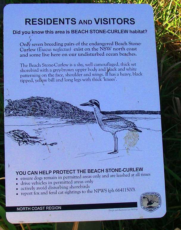
Only seven breeding pairs of the Beach Stone Curlew (Esacus neglectus) exist on the NSW north coast.
Photo: Don Hitchcock, September 2009

Parts of the beach at Diggers Camp have either shingle slopes or mixed shingle and sand areas.
Photo: Don Hitchcock, September 2009

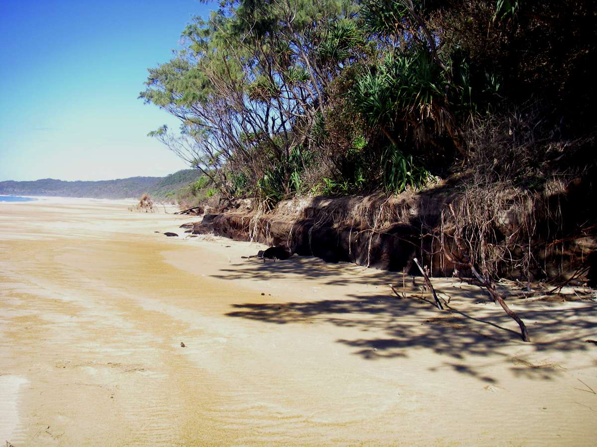
Winter storms and rising sea levels have eroded some parts of the foreshore.
Photo: Don Hitchcock, September 2009
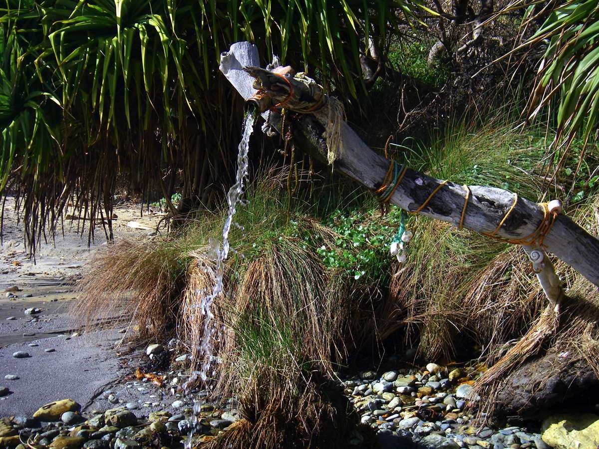
There is more to this convenient place to wash off sea water after swimming and surfing than meets the eye.
The reason that the ground water can be tapped for a makeshift shower is because of 'Coffee Rock', a layer of impervious sand of a deep coffee-brown colour, which exists up and down this coast. Just by putting a tube into the sand above the Coffee Rock, you can get quite a flow of fresh water.
It is not suitable for drinking or cooking, however.
Photo: Don Hitchcock, September 2009

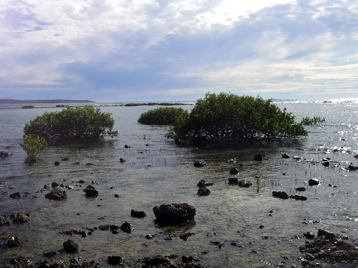
This rock fringed lagoon on the edge of the sea is interesting in that the water is calm enough to support several mangroves, with the surf beating on the rocks close by.
Photo: Don Hitchcock, September 2009
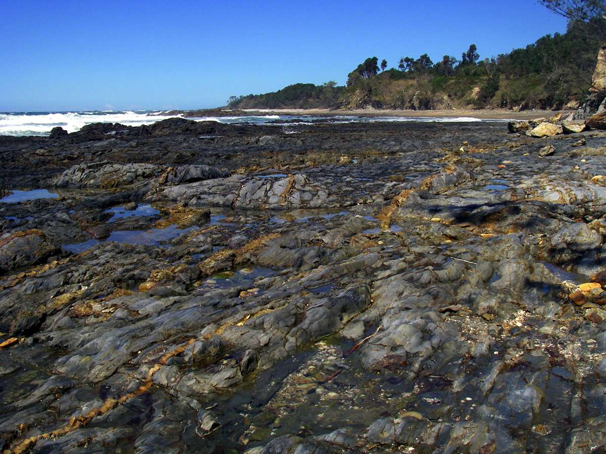
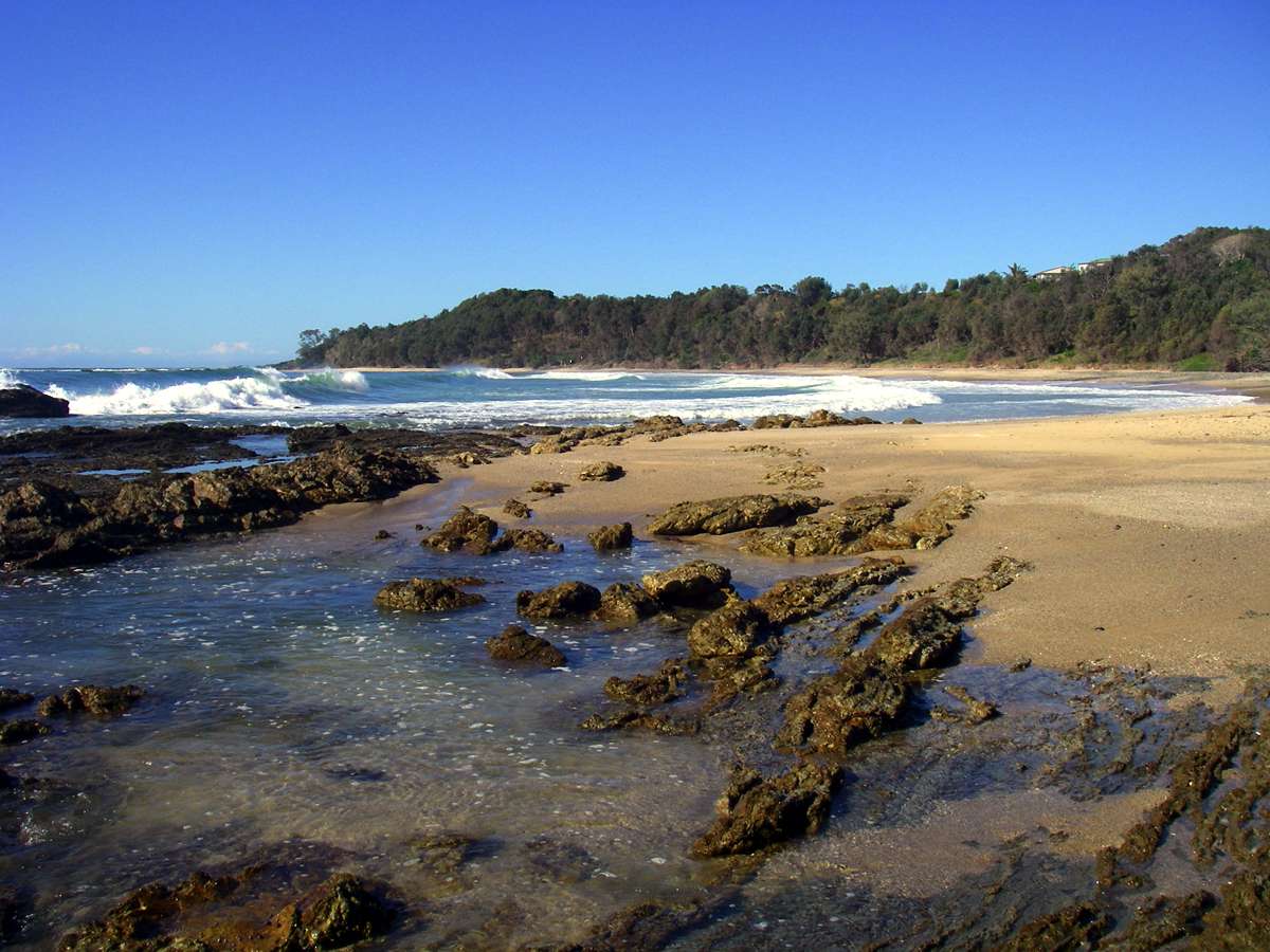
Rock platforms like this provide habitat for many organisms, with their own unique ecosystems, adapted to periodic wetting by sea water, and drying out, as well as rock pools which are always full of water.
Photo: Don Hitchcock, September 2009
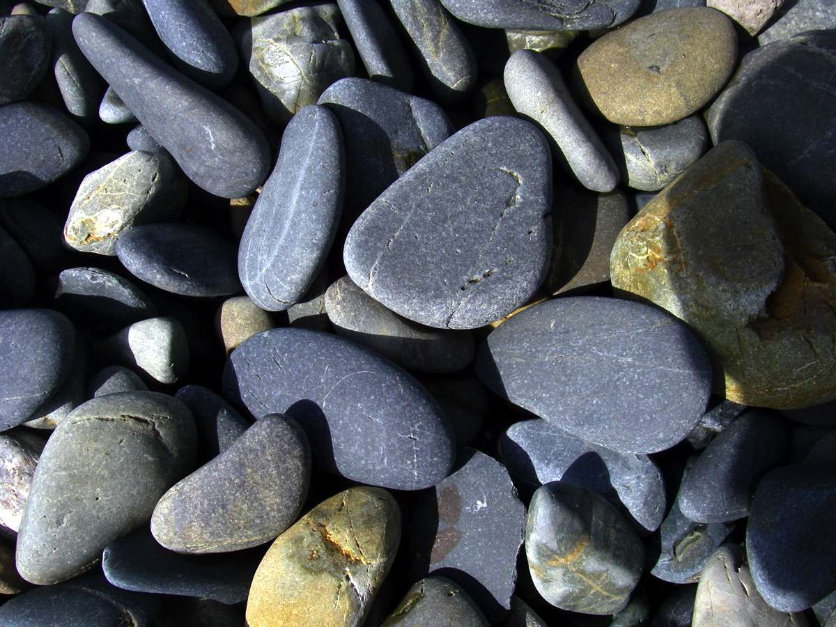
The shingle on sea shores is quite different to the rocks found in streams. Sea shingle pebbles tend to be flat on two sides, where they slide up and down the beach, whereas river pebbles roll along the bottom, developing a sub-spherical shape.
Photo: Don Hitchcock, September 2009

Marine shells cast up on the rocks by the surf.
Photo: Don Hitchcock, September 2009
A ripe pandanus fruit. They are very fibrous, but can be eaten either raw or cooked.
Photo: Don Hitchcock, September 2009
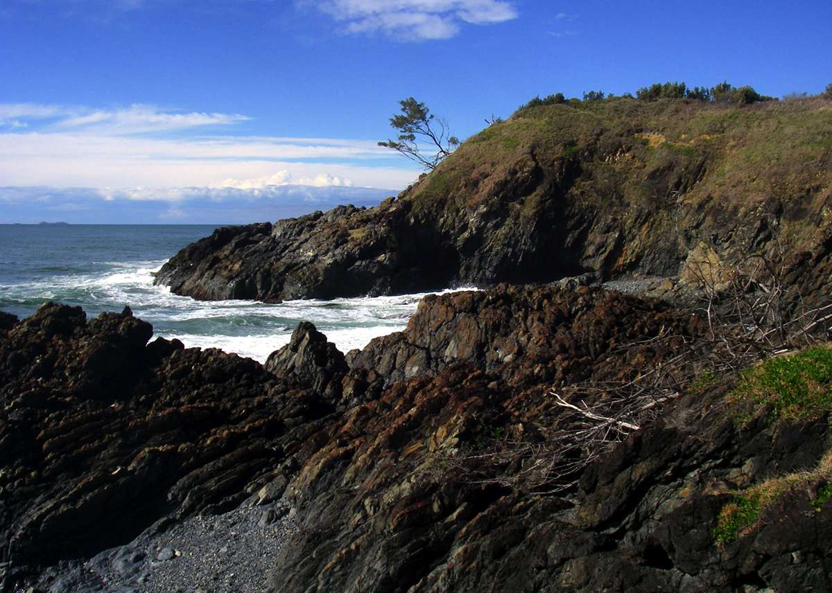
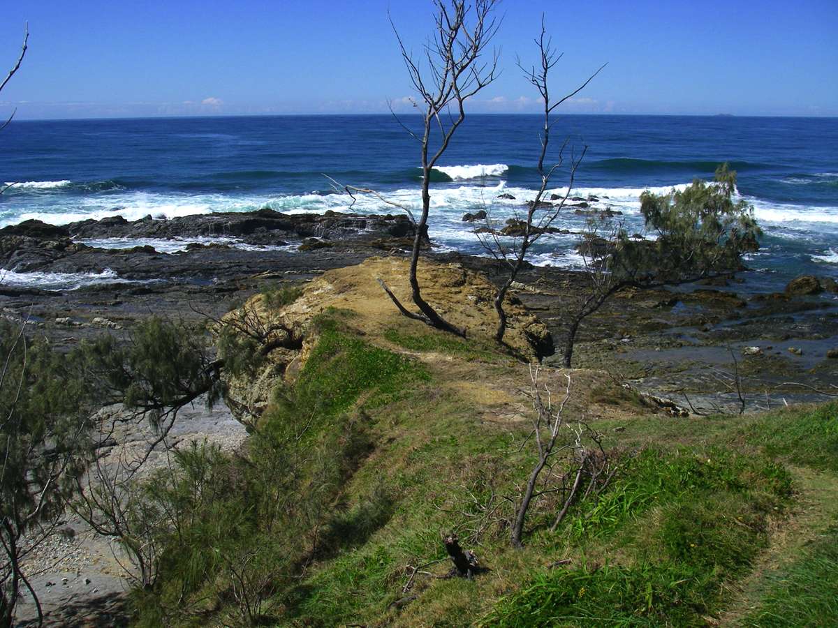
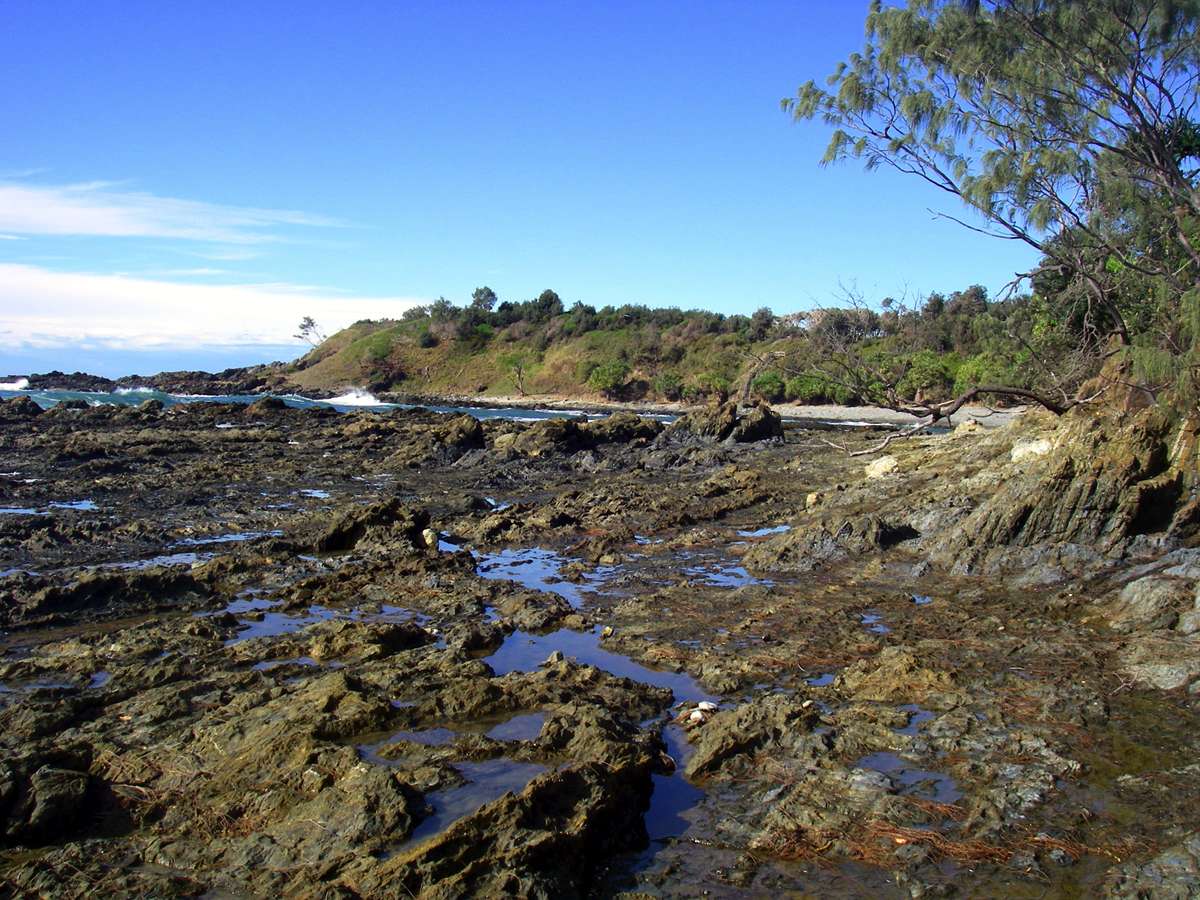
Looking north and south when starting to climb the headland to the south of Diggers Camp Beach.
Many east coast Australian beaches have rocky headlands at each end, with a curve of sandy beach between the headlands. Some beaches are only a few hundred metres long, some stretch for many kilometres.
Photo: Don Hitchcock, September 2009

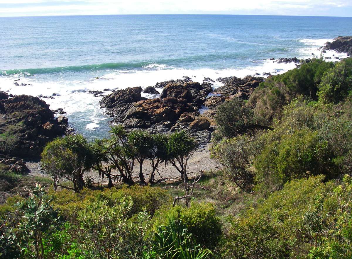
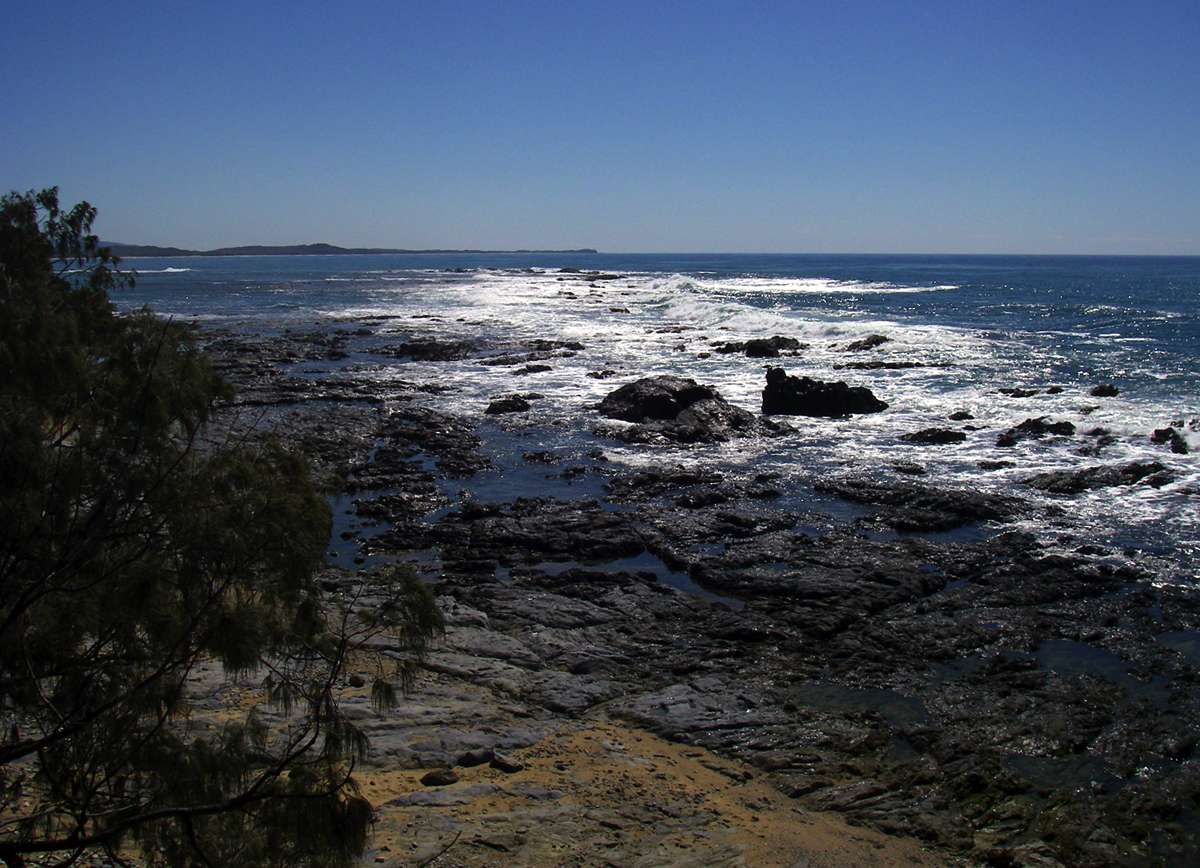
The headland to the south of Diggers Camp Beach, like many others in the area, has been made more accessible with good paths and bridges over deep gullies.
There are often secluded little coves nestled in the headlands, fringed with Pandanus.
The right hand photo is taken from a high enough vantage point to be able to see the curvature of the earth.
Photo: Don Hitchcock, September 2009
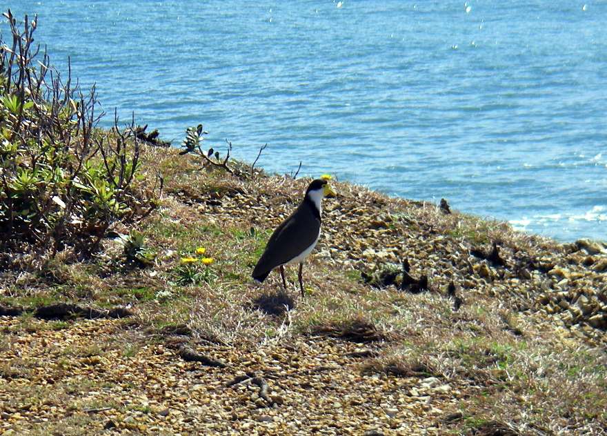
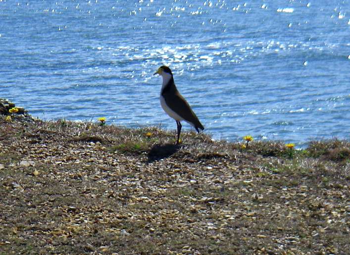
Spur Winged Plover on the headland.
It is a quite different species to the Northern Hemisphere bird (Vanellus spinosus) with the same common name, and the Australian bird is now theoretically called the Masked Lapwing (Vanellus miles), though the name has not taken on in Australia.
Photo: Don Hitchcock, September 2009
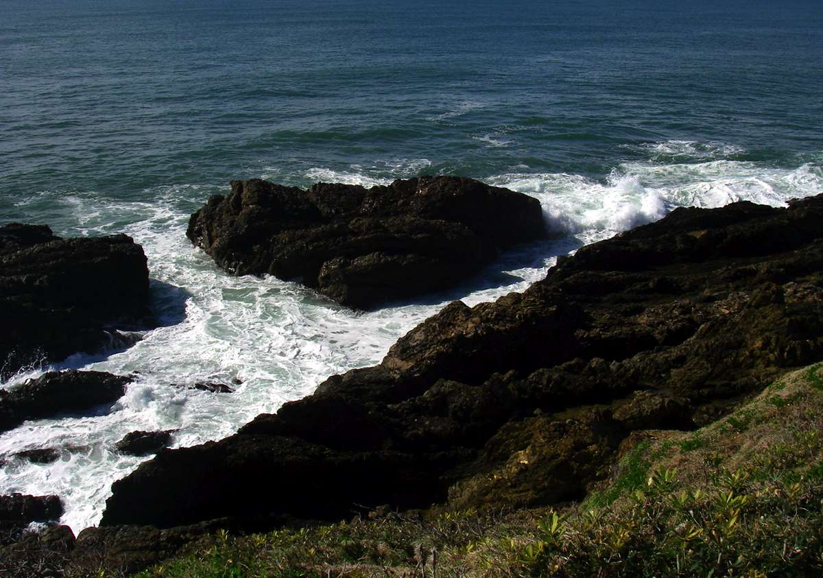
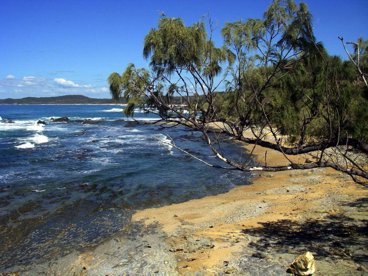
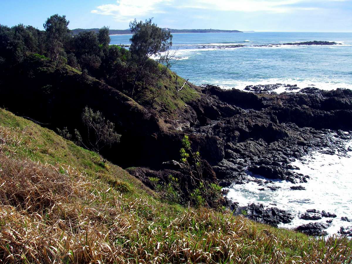
In places the headland has been carved into islands, providing shelter for many marine organisms.
Photo: Don Hitchcock, September 2009
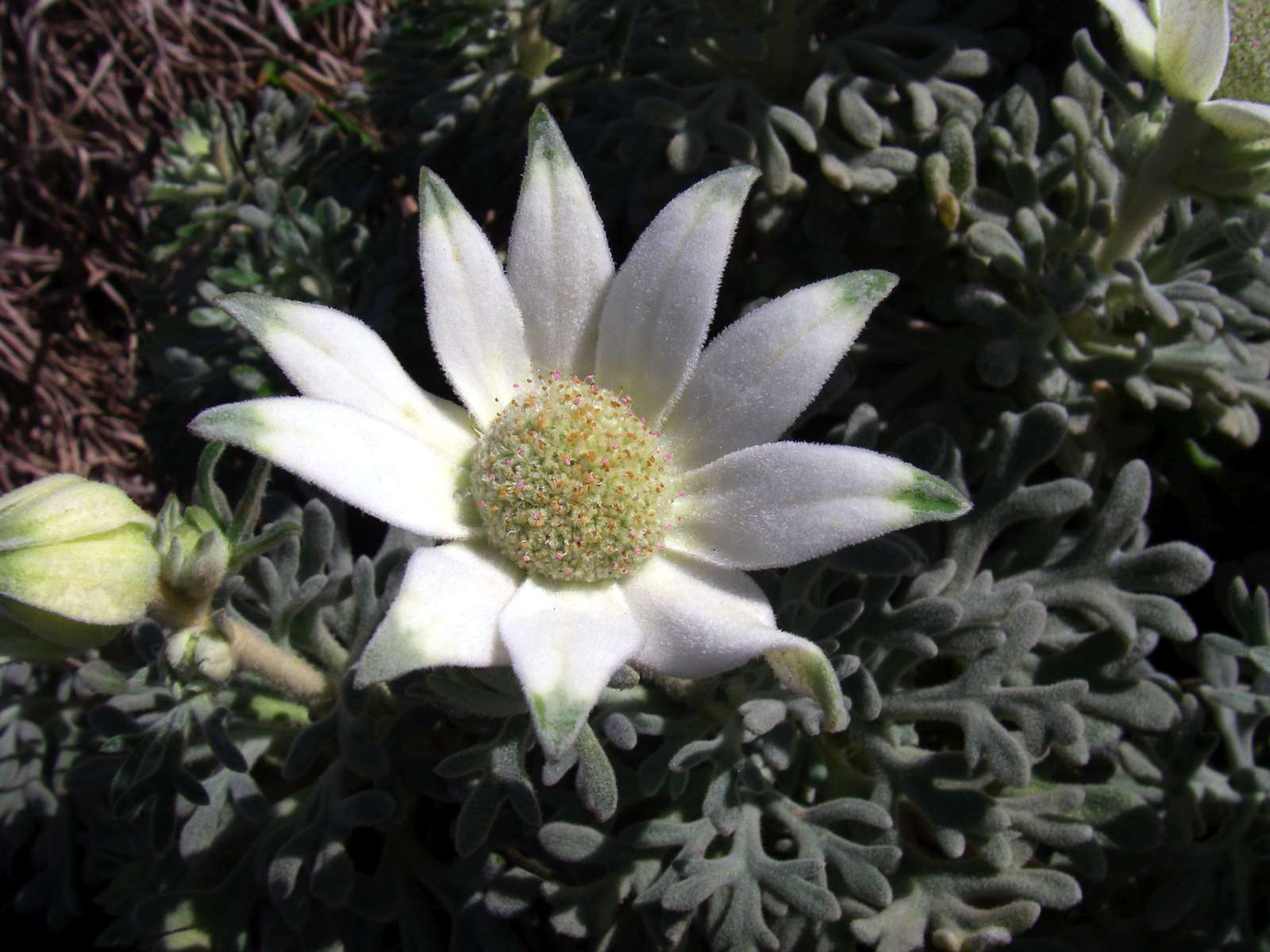
The Flannel Flowers were superb, bigger than I have seem them elsewhere, and in a spectacular setting.
Photo: Don Hitchcock, September 2009
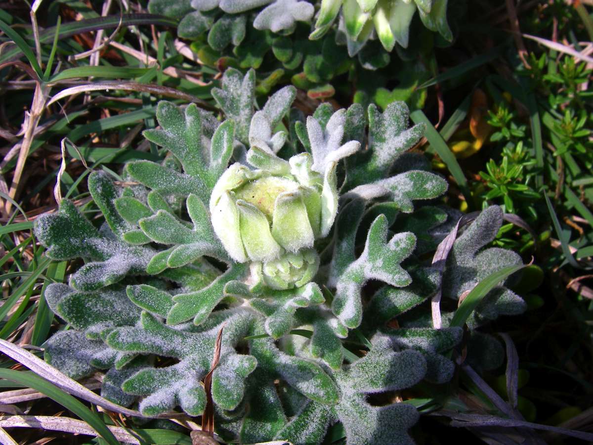
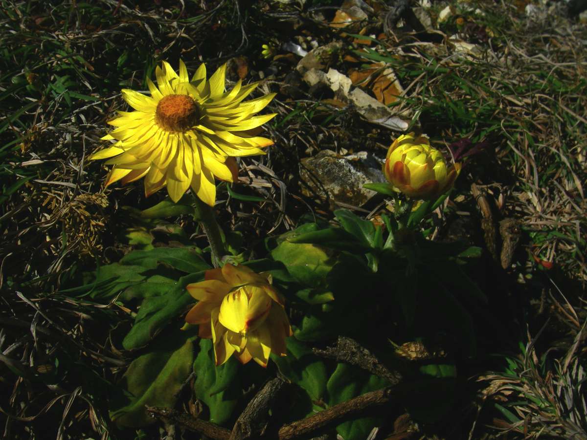
Flannel Flower bud, and Bracteantha Sp., a variety of paper daisy.
Photo: Don Hitchcock, September 2009
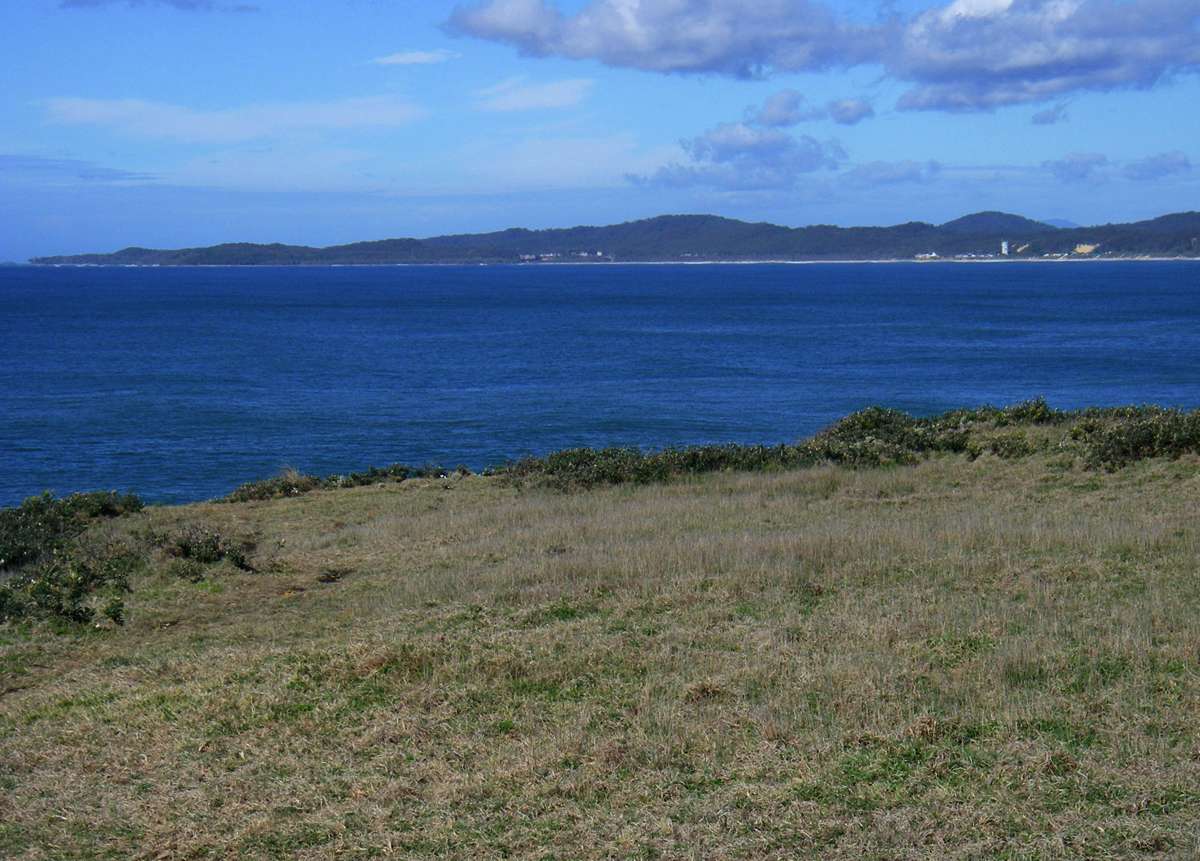
View to the south towards Wooli and the coast beyond. Wooli is separated from the coast to the south by the Wooli Wooli River, a swift flowing stream which is difficult to cross except at the slack water of high and low tide.
By landing on the other side at Jones Point at high tide, it is possible to walk south to Red Rock, and reach it at extreme low tide, allowing the walker to cross to Red Rock, with some difficulty.
Photo: Don Hitchcock, September 2009