Back to Don's Maps
Back to the Iron Gates - Location of the Sharamudoi
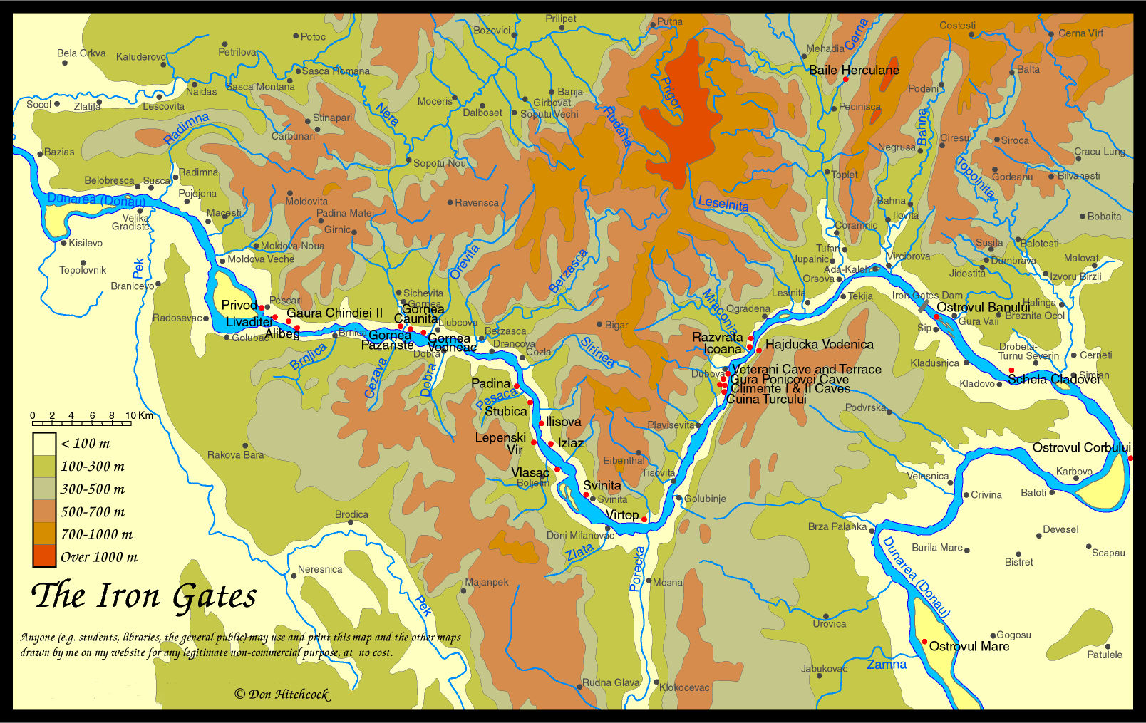
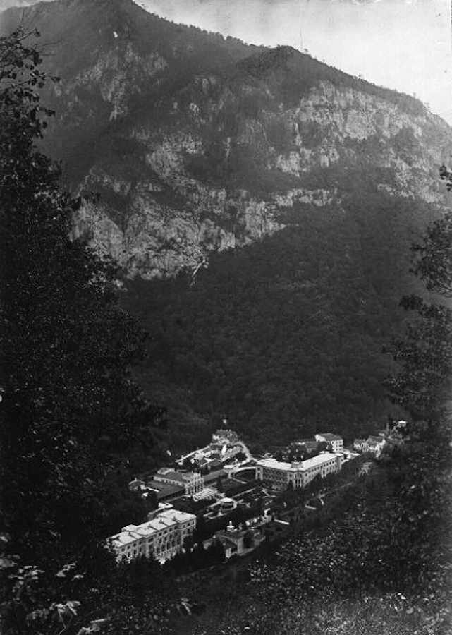
Baile Herculane
Baile Herculane is a resort town in SW Romania, population 6,076 (July 1, 1991). located between the Mehedinti Mountains in the east and the Cerna Mountains in the west, spread along the valley pass of the Cerna River, between high limestone walls, 19 km from the storage lake of the Danube River (at Orsova), and 40 km from Drobeta - Turnu Severin. The spa is part of the Cerna-Domogled National Park.
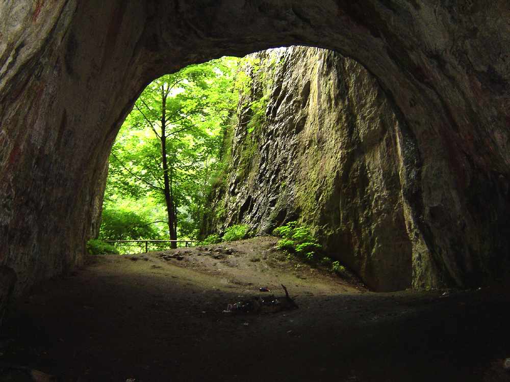
The site of Pestera Hotilor (The Cave of Thieves, the Outlaws' Cave) or Pestera Haiducilor is located under the Ciorici Peak at an altitude of 160 metres, at the town of Baile Herculane (The Baths of Hercules), and is located in perhaps the most picturesque locale in all of Romania. The site itself is a rather large and impressive cave, with three large mouths to the east and southeast and three front inner chambers. The cave is on the side of a sheer cliff overlooking the fast-running Cerna River. Immediately below the cave bubble up hot sulphur springs which are tapped today to make Baile Herculane an important spa. Archaeologically the site is unique, with numerous levels including Mousterian, Palaeolithic, Mesolithic, as well as Late Neolithic to Medieval periods.
The cave is medium-sized (143 m long), horizontal, old, and developed on a system of fissures.
Map of the Iron Gates region, with the position of Baile Herculane marked.
Photo: Don Hitchcock 2014
|
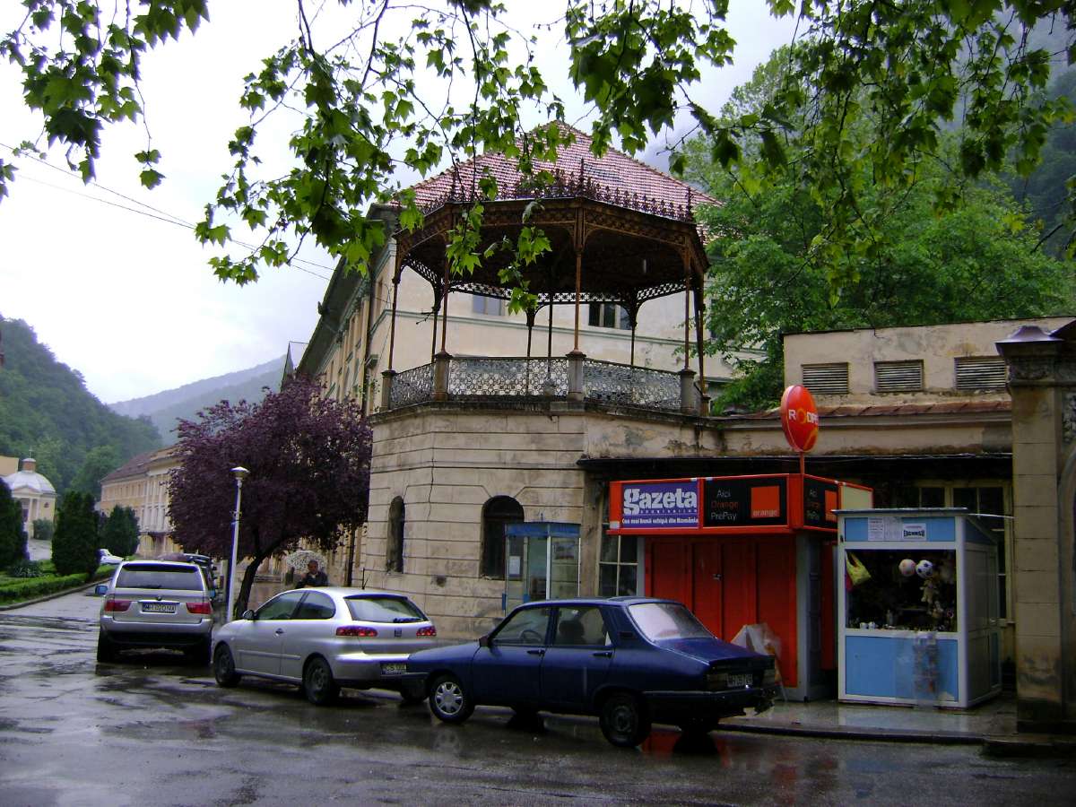
Baile Herculane has seen better days, but it has some beautiful old buildings, and has a superb setting beside the Cerna River. The maximum and minimum temperatures are 31.1 C (1953) and -18 C (1950), respectively. Average: 10.5 C |
From: Elizabeth H. Dinan, 1996 'A preliminary report on the lithic assemblage from the early Holocene level at the Iron Gates site of Baile Herculane', Mesolithic Miscellany 15 Volume 17 Number 2
The site of Pestera Hotilor (The Cave of Thieves) at the town of Baile Herculane (The Baths of Hercules) is located in perhaps the most picturesque locale in all of Romania. The site itself is in a rather large and impressive cave, with three large mouths to the east and southeast and three front inner chambers. The cave is on the side of a sheer cliff overlooking the fast-running Cerna River. Immediately below the cave bubble up hot sulphur springs which are tapped today to make Baile Herculane an important spa.
Archaeologically the site is unique, with numerous levels including Mousterian, 'quartzitic Palaeolithic', one early Holocene (or Mesolithic) level referred to as Late Epigravettian, as well as numerous later levels, including Late Neolithic to Medieval periods.
The most intensive excavation of the Early Mesolithic level occurred in 1960 - 1961 under the direction of Alexandru Paunescu. The site has been erroneously reported to have two late Pleistocene/early Holocene levels, approximately contemporary with the two levels at Cuina Turcului. In fact there is only one undated level, with a remarkably small lithic material assemblage - 107 pieces in all. Although there are no radiocarbon dates, this level appears to belong to the early Holocene on the basis of the lithic assemblage typology which is similar to that of levels I and II at Cuina Turcului, the faunal remains found in the hearths, the floral (macrobotanical) remains, and the superposition of the level directly on cryoturbated sediments, (sediments disturbed by freezing) said to represent the final stadial of the Wurm, which was particularly harsh.
The faunal and floral remains all indicate a much cooler environment such as that of the very early Holocene when spruce dominated but more diverse forests were invading.
| Taxon | Common Name |
| Apodemus sylvaticus | Common wood mouse |
| Chionomys nivalis | Snow vole |
| Clethrionomys glareolus | Northern bank vole |
| Microtus agrestis | Field vole |
| Microtus arvalis | Common vole |
| Microtus nivalis | snow vole |
| Microtus subterraneus | Common pine vole |
| Sorex araneus | Common shrew |
| Ursus arctos | Brown bear |
| Cervus elaphus | Red deer |
| Castor fiber | Eurasian beaver |
| Cyprinus carpio | Carp |
| Aspiu rapas | (fish) |
| Thymalus thymalus | Grayling |
| - | snails |
| Picea sp. | Spruce |
| Alnus sp. | Alder |
From:
http://infocib.ase.ro/rom/b-herc.html
The Thieves' Cave or Outlaws' Grotto is located under the Ciorici Peak at an altitude of160 m. The cave is medium-sized (143 m long), horizontal, old, and developed on a system of fissures.
It contains the following areas:
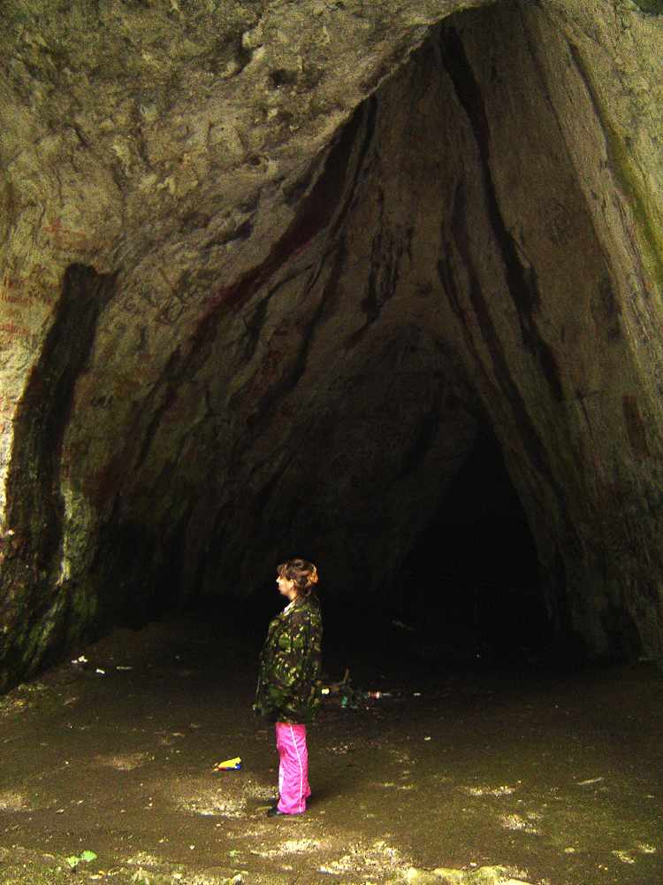
The main gallery, not very high (2 to 4 m)
The signatures room ( 3 to 7 m high)
The digging rooms ( the larger one is 50 m long and 10 to 13 m high)
The calcite wall gallery whose height diminishes gradually to the cave end.
It is a warm humid cave.
It was inhabited as far back as the middle palaeolithic. The cave was first included in the tourist circuit at the beginning of the 19th century.
The Thieves' Cave is very important from an archaeological and biological point of view.
The complex researches performed so far have revealed the most complete archaeological profile in Romania with a habitation continuity from the middle Palaeolithic to the 16th and 17th centuries.
Also here some cave and endemic species of isopoda and diplopoda as well as microscopic crustaceans (especially in the calcite wall room) were discovered and described for the first time.
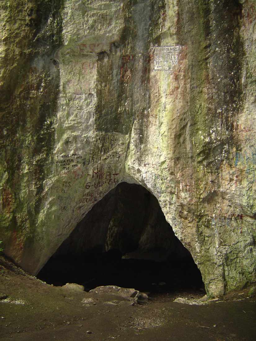
To all these we have to add the wall inscriptions, some of them from the 19th century.
In 1960 and 1961, the speleologist St.Negrea dicovered the signatures of N.Golescu, the minister of Domestic Affairs of the 1848 Provisional Government. It was dated 1836 but after 1972 it was covered over by other inscriptions.
|
Photo: http://www.answersingenesis.org/home/area/magazines/docs/v21n3_emil.asp |
|
Carciumaru, 'Mediul geografic in pleistocenul superior si culturile plaeolitica din Romania, Editura Acadamiei Republicii Socialiste Romanaia, Bucuresti, 1980, p.93:
Pollen Analysis, Baile Herculane (c. 8100 B.C. uncalibrated)
arboreal pollen: 82%
| Taxon | Common Name | % |
| Pinus sp. | pine | 2% decreasing |
| Quercus sp. | oak | 5% |
| Ulmus sp. | elm | 4% |
| Tilia sp. | linden | 4% |
| Carpinus sp. | hornbeam | 1% |
| Alnus sp. | alder | 5% |
| Fagus sp. | beech | 1% |
| Betula sp. | birch | 1% |
| Salix sp. | willow | 1% |
| Corylus sp. | hazel | 48% |
non-arboreal pollen: 18% (decreasing).
| Graminae | 5% | |
| Cerealia | 1.2% | |
| Compositae | 4% |
Visit by the Alexis Phoenix Team to Baile Herculane
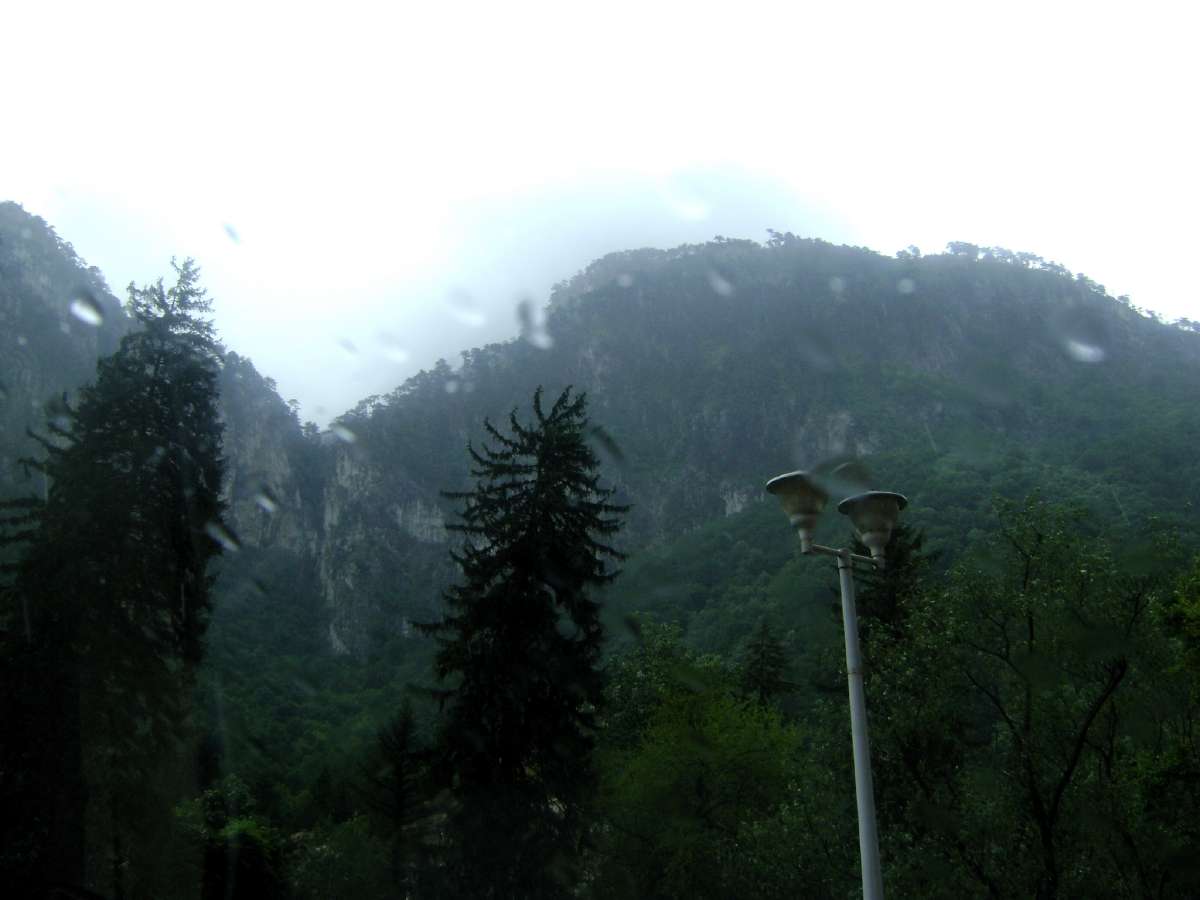
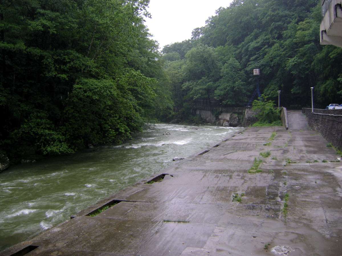
It was cold and raining in the Cerna River valley when the Alexis team visited. The river was swollen with the rain.
Photo: Adrian Gheorghe, 15th May 2010
The well built buildings are now part of a ghost town. Few live here.
Photo: Adrian Gheorghe, 15th May 2010
Water was streaming down the steep sides of the valley
Photo: Adrian Gheorghe, 15th May 2010
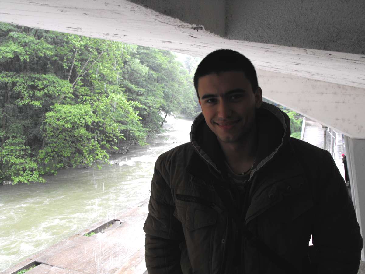
Alexandru taking shelter from the heavy rain.
Photo: Adrian Gheorghe, 15th May 2010
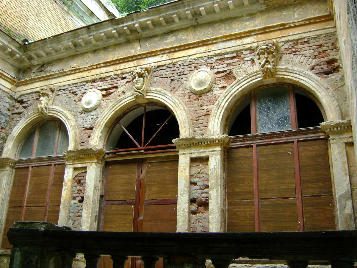
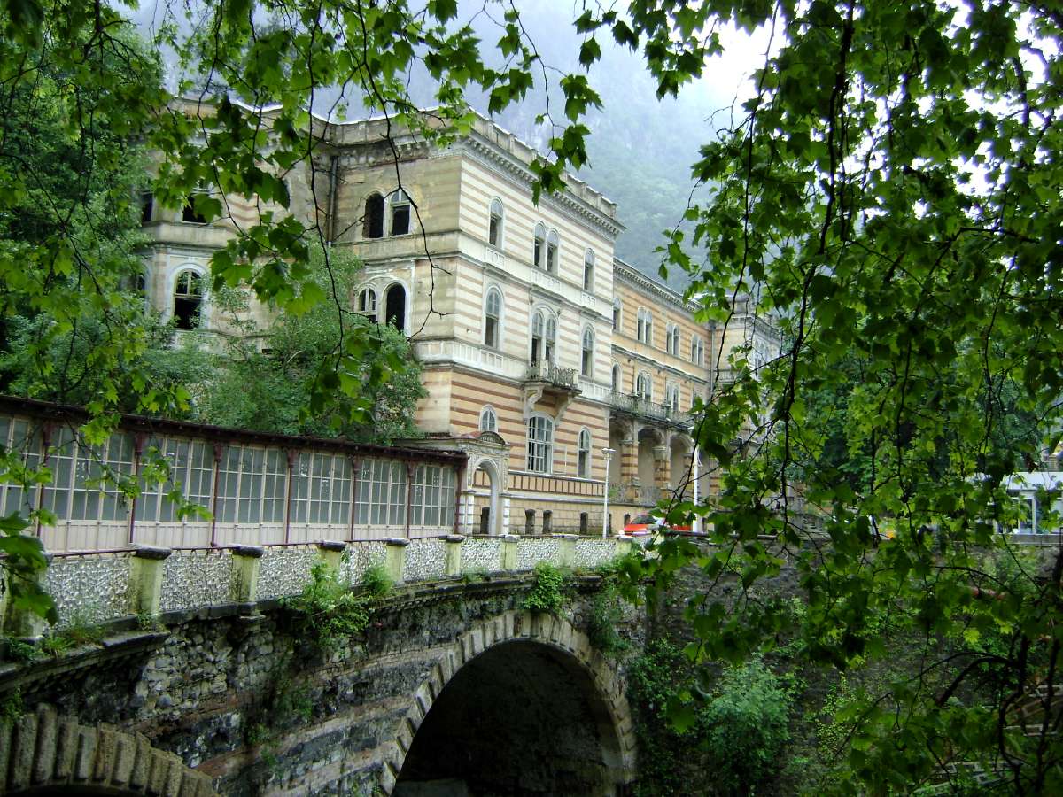
At one time the town of Herculane was famous throughout Romania and abroad. Today it is a ghost town.
In the 19th century and after, this town was well known for its high life. It is a strange feeling to see ghost buildings, dead under cold rain and crying in the cold wind.
Photo: Adrian Gheorghe, 15th May 2010
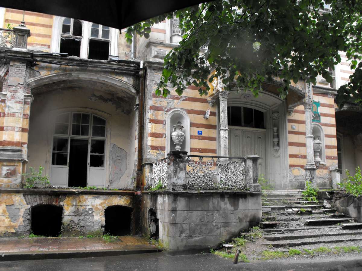
Sometimes, a man, like a ghost himself, passes on the road, while the mountains around are guarding the grave of Herculane, like another Pompei.
Perhaps during the night, sometimes behind broken windows, you can see candles and hear sweet music from past centuries.
Photo: Adrian Gheorghe, 15th May 2010
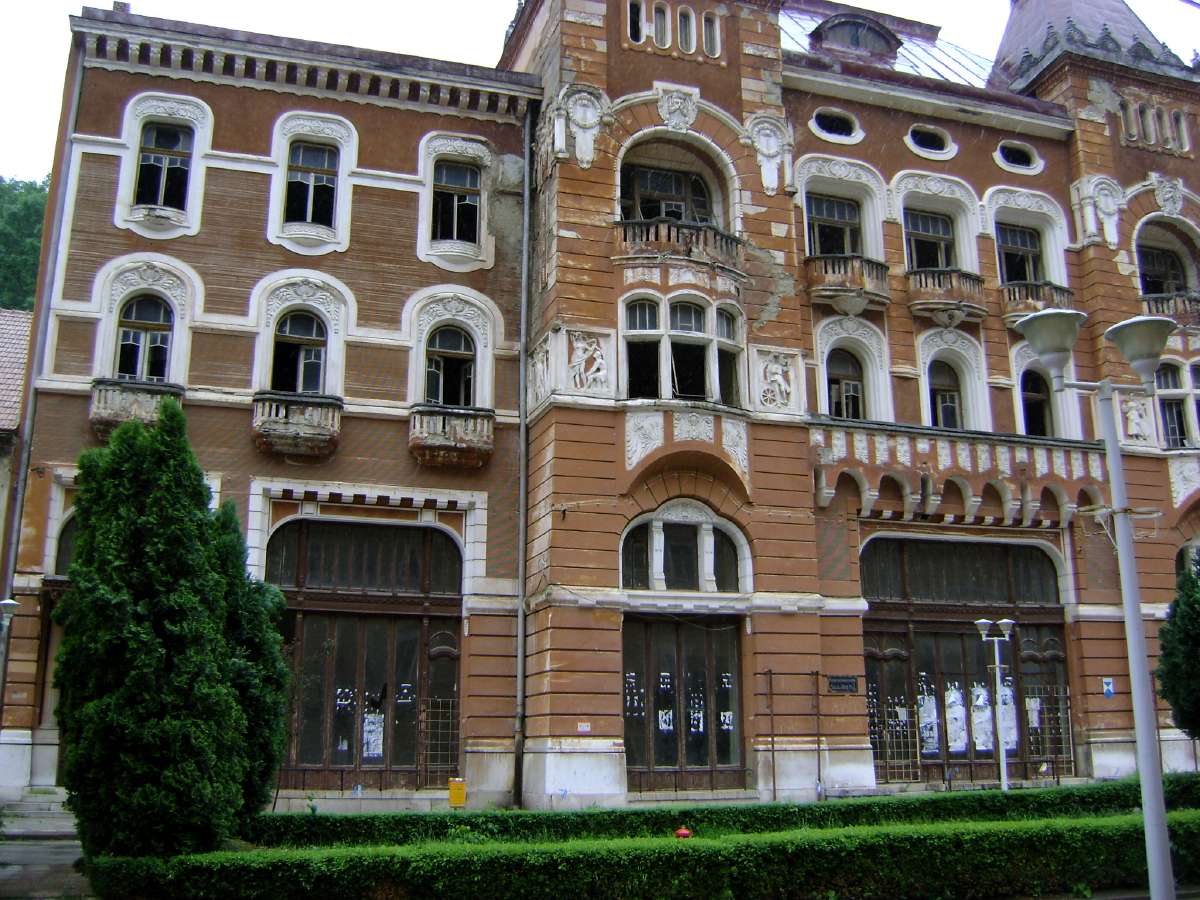
Although the buildings have now been abandoned, most of the structures are still sound. The town is a beautiful tribute to a past time, when tourists came to bathe in the hot springs, and the town was full of laughter and song.
Photo: Adrian Gheorghe, 15th May 2010
Today, the tourists who visit are simply passing through the area, and they only stop for a short time.
Photo: Adrian Gheorghe, 15th May 2010

The town has been noted for its hot springs since Roman times.
Photo: Adrian Gheorghe, 15th May 2010
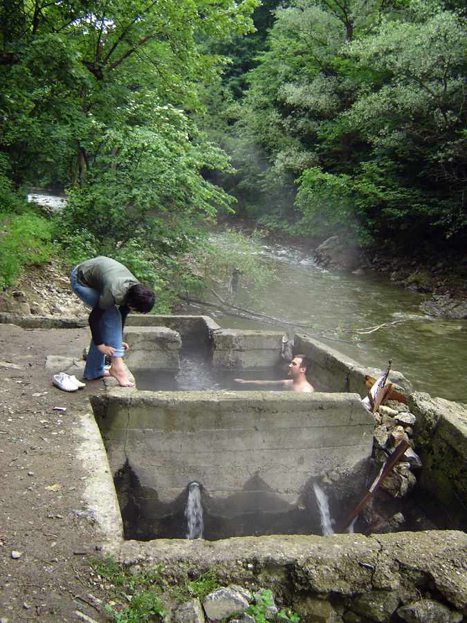
These warm water sources are close by the Cerna River in the Mofete area.
Photo: Adrian Gheorghe
The water comes from deep underground, and is used to help with a long list of ailments such as diseases of the eye, liver, and for rheumatism.
Photo: Adrian Gheorghe

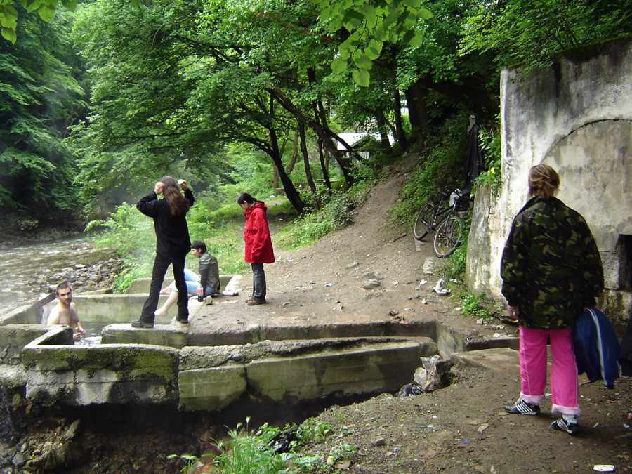
Concrete structures have been built to contain the warm spa waters, and allow visitors to bathe in the health giving waters.
Photo: Adrian Gheorghe

As with other springs in Romania, often elaborate structures are built to preserve the continuity of the water.
Photo: Adrian Gheorghe
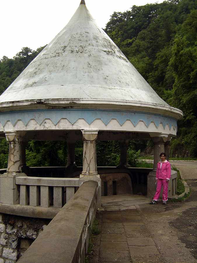
This rotunda has been built above the banks of the Cerna River, and may be seen in the photograph of Băile Herculane at the top of this page.
Photo: Adrian Gheorghe
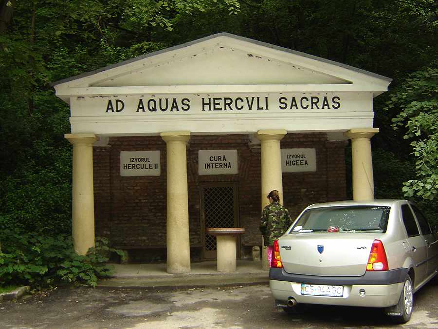
The warm waters have been used for many hundreds of years. The sign in Latin reads "Ad Aquas Herculi Sacras" which I translate as "Sacred to the spa of Hercules".
Photo: Adrian Gheorghe

Herculane is named after the hero Hercules, and this large statue of him is placed in the middle of the town.
Photo: Adrian Gheorghe
Historical photographs
These photographs come from an excellent site, http://orsova.xhost.ro/_sgg/f10000.htm, with many superb historical photographs of Băile Herculane, Orsova and the Iron Gates area.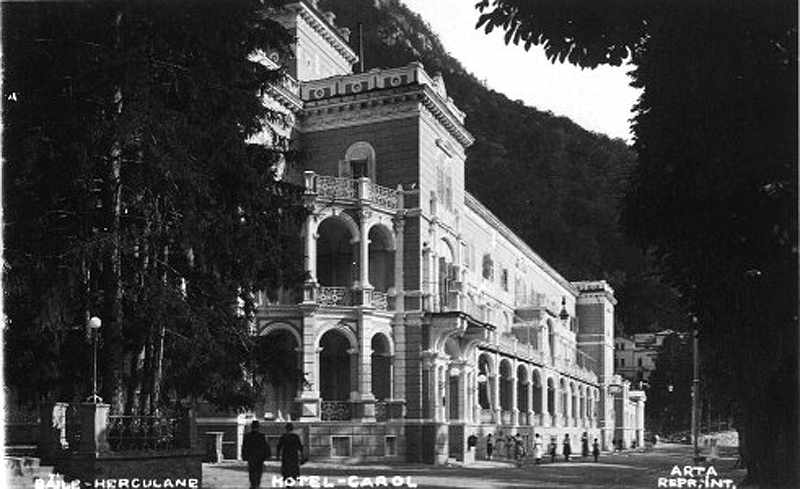
The Hotel Carol in Băile Herculane
Photo: http://orsova.xhost.ro/_sgg/f10000.htm
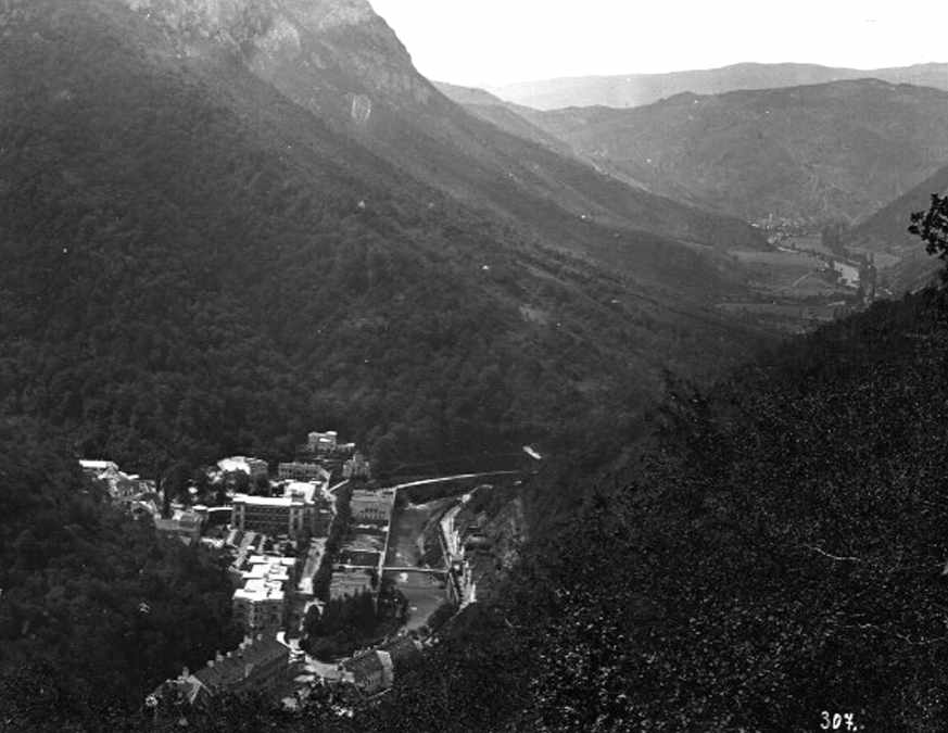
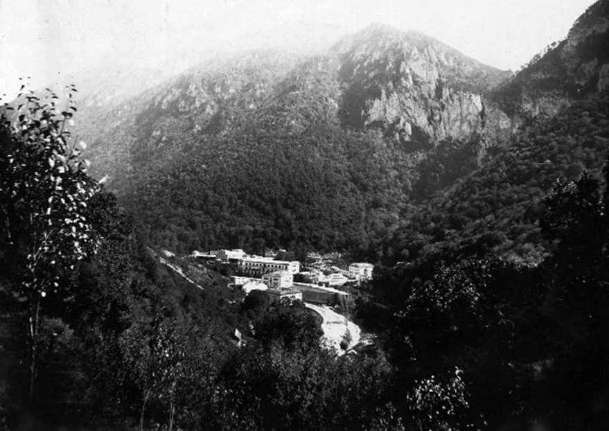
The position of Băile Herculane deep in the Cerna Valley is well shown in these photos.
Photo: http://orsova.xhost.ro/_sgg/f10000.htm
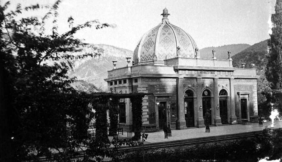
The Railway Station in Băile Herculane
Photo: http://orsova.xhost.ro/_sgg/f10000.htm
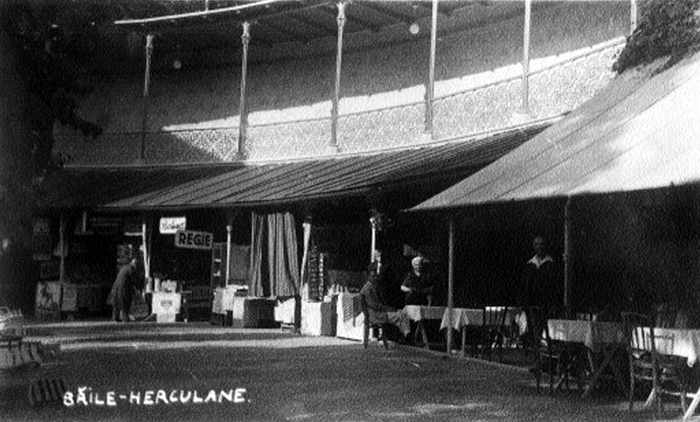
Cafe and stores in Băile Herculane
Photo: http://orsova.xhost.ro/_sgg/f10000.htm
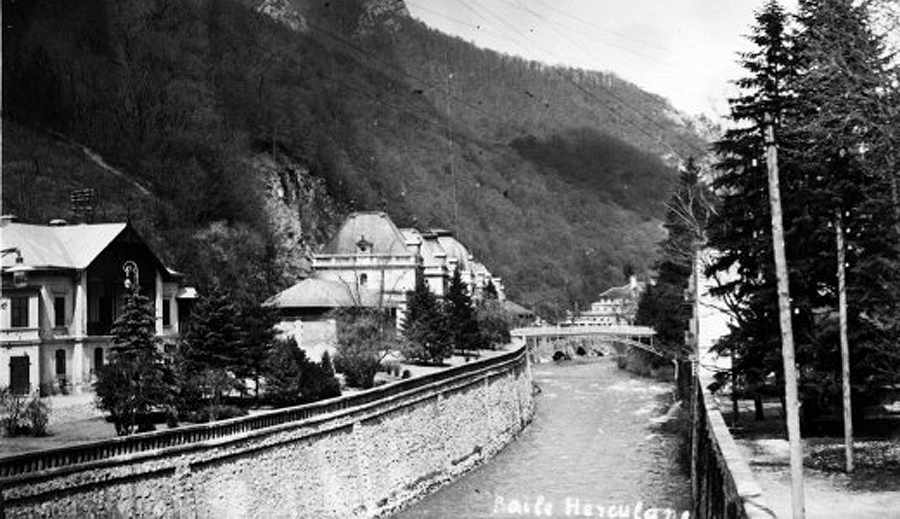
The Cerna River was enclosed in well constructed stone walls to maximise the available land area for buildings and public space.
Photo: http://orsova.xhost.ro/_sgg/f10000.htm
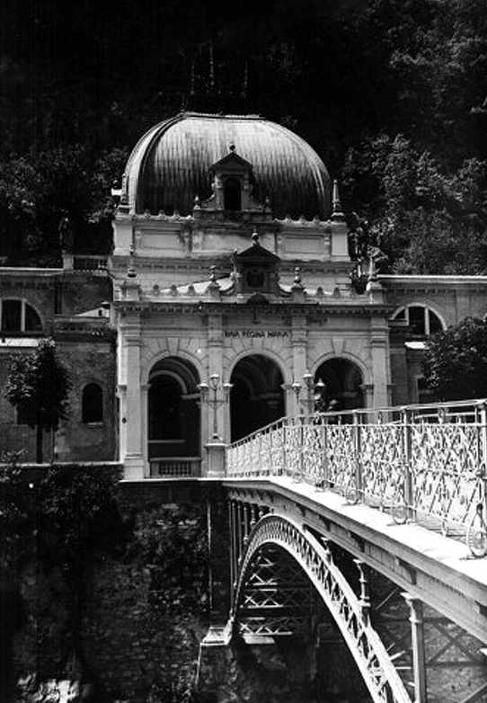
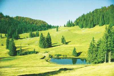
A superb iron bridge over the Cerna River in Băile Herculane. At this time the area was very popular, and there was money for this sort of expensive infrastructure.
Photo: http://orsova.xhost.ro/_sgg/f10000.htm
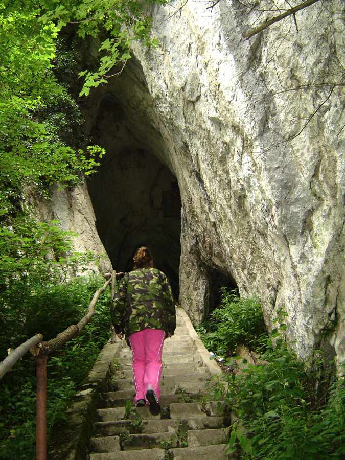
Outlaw Cave - Peştera Haiducilor
Outlaw Cave
The Thieves' Cave or Outlaws' Grotto is located under the Ciorici Peak at an altitude of 160 metres, near the resort town of Baile Herculane. The cave is medium-sized (143 m long), horizontal, old, and developed on a system of fissures.
Text from: http://infocib.ase.ro/rom/b-herc.html
Photo: Adrian Gheorghe
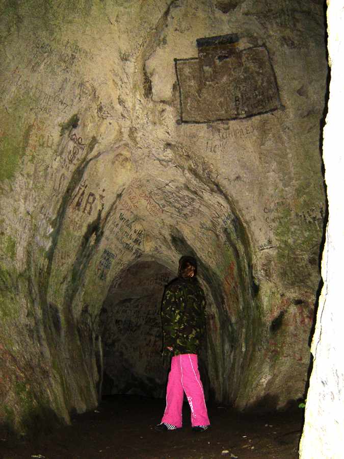
It contains the following areas:
The main gallery, not very high (2 to 4 m)
The signatures room ( 3 to 7 m high)
The digging rooms ( the larger one is 50 m long and 10 to 13 m high)
The calcite wall gallery whose height diminishes gradually to the cave end.
It is a warm humid cave.
It was inhabited as far back as the middle palaeolithic. The cave was first included in the tourist circuit at the beginning of the 19th century.
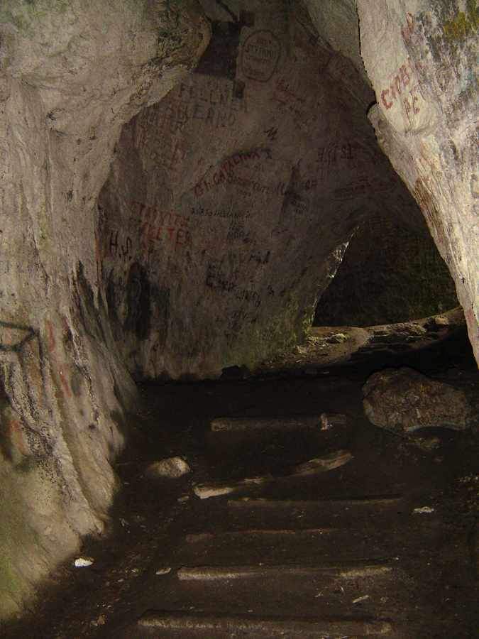
The Thieves' Cave is very important from an archaeological and biological point of view.
The complex researches performed so far have revealed the most complete archaeological profile in Romania with a habitation continuity from the middle Palaeolithic to the 16th and 17th centuries.
Photo: Adrian Gheorghe
Also here some cave and endemic species of isopoda and diplopoda as well as microscopic crustaceans (especially in the calcite wall room) were discovered and described for the first time.
Photo: Adrian Gheorghe
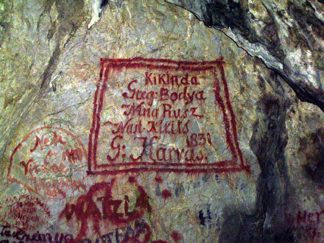
To all these we have to add the wall inscriptions, some of them from the 19th century.
In 1960 and 1961, the speleologist St. Negrea dicovered the signatures of N. Golescu, the minister of Domestic Affairs of the 1848 Provisional Government. It was dated 1836 but after 1972 it was covered over by other inscriptions.
Shown here is an inscription from 1831.
Photo: Adrian Gheorghe
From: Elizabeth H. Dinan, 1996 'A preliminary report on the lithic assemblage from the early
Holocene level at the Iron Gates site of Baile Herculane', Mesolithic Miscellany 15 Volume 17 Number 2
The site of Peştera Hotilor (The Cave of Thieves) at the town of Baile Herculane (The Baths of Hercules) is located in perhaps the most picturesque locale in all of Romania. The site itself is in a rather large and impressive cave, with three large mouths to the east and southeast and three front inner chambers. The cave is on the side of a sheer cliff overlooking the fast-running Cerna River. Immediately below the cave bubble up hot sulphur springs which are tapped today to make Baile Herculane an important spa.
Photo: Adrian Gheorghe
Archaeologically the site is unique, with numerous levels including Mousterian, 'quartzitic Palaeolithic', one early Holocene (or Mesolithic) level referred to as Late Epigravettian, as well as numerous later levels, including Late Neolithic to Medieval periods.
The most intensive excavation of the Early Mesolithic level occurred in 1960 - 1961 under the direction of Alexandru Paunescu. The site has been erroneously reported to have two late Pleistocene/earlyHolocene levels, approximately contemporary with the two levels at Cuina Turcului. In fact there is only one undated level, with a remarkably small lithic material assemblage - 107 pieces in all.
Photo: Adrian Gheorghe
Although there are no radiocarbon dates, this level appears to belong to the early Holocene on the basis of the lithic assemblage typology which is similar to that of levels I and II at Cuina Turcului, the faunal remains found in the hearths, the floral (macrobotanical) remains, and the superposition of the level directly on cryoturbated sediments, (sediments disturbed by freezing) said to represent the final stadial of the Wurm, which was particularly harsh.
The faunal and floral remains all indicate a much cooler environment such as that of the very early Holocene when spruce dominated but more diverse forests were invading.
Photo: Adrian Gheorghe
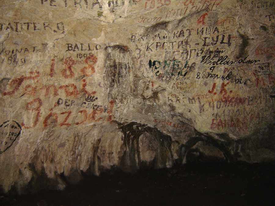
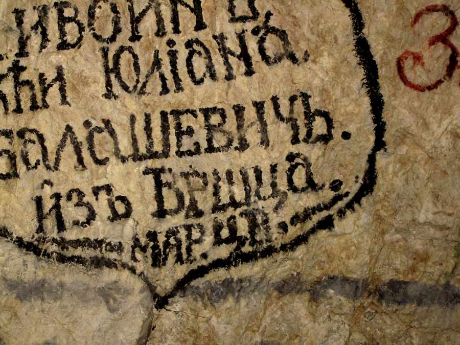
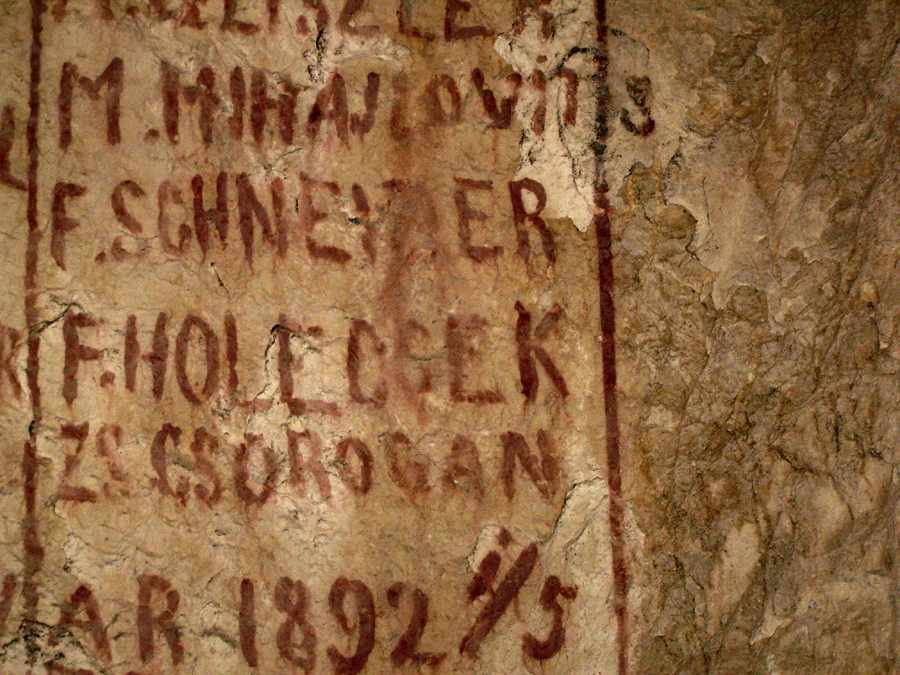
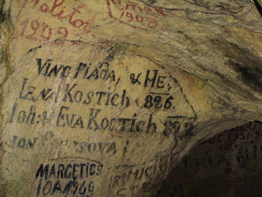
There are many signatures on the walls of the cave.
Photo: Adrian Gheorghe

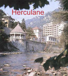
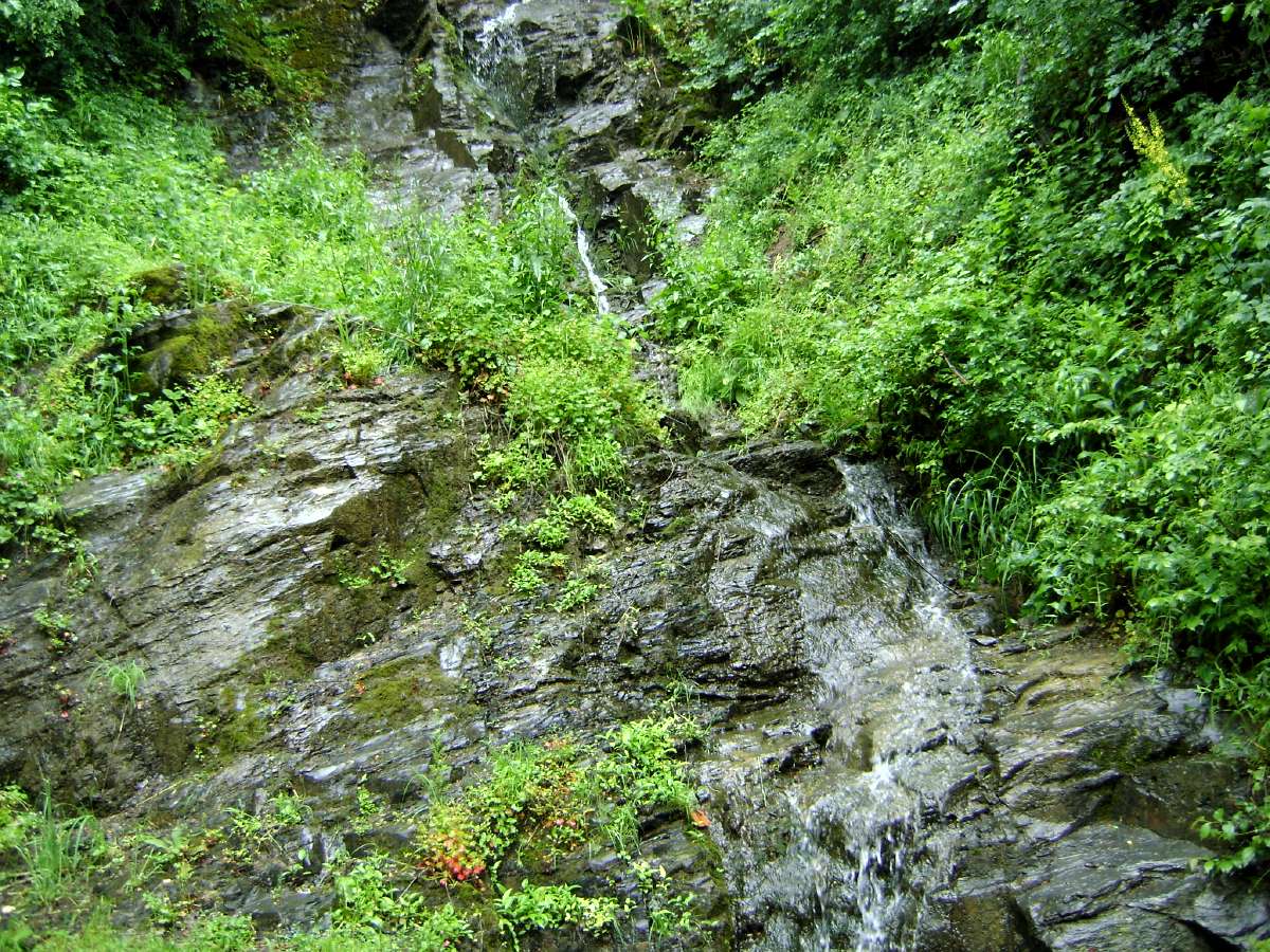
The forest near the outlaw's cave.
Photo: Adrian Gheorghe