Back to Don's Maps
 Back to Archaeological Sites
 The Paisley Caves complex - when did people first reach North America?
The Paisley Caves complex is a system of four caves in an arid, desolate region of south-central Oregon, United States. One of the caves contains archaeological evidence of the oldest definitively-dated human presence in North America. The site was first studied by archeologists in the 1930s. Scientific excavations since 2002 have uncovered substantial new discoveries.
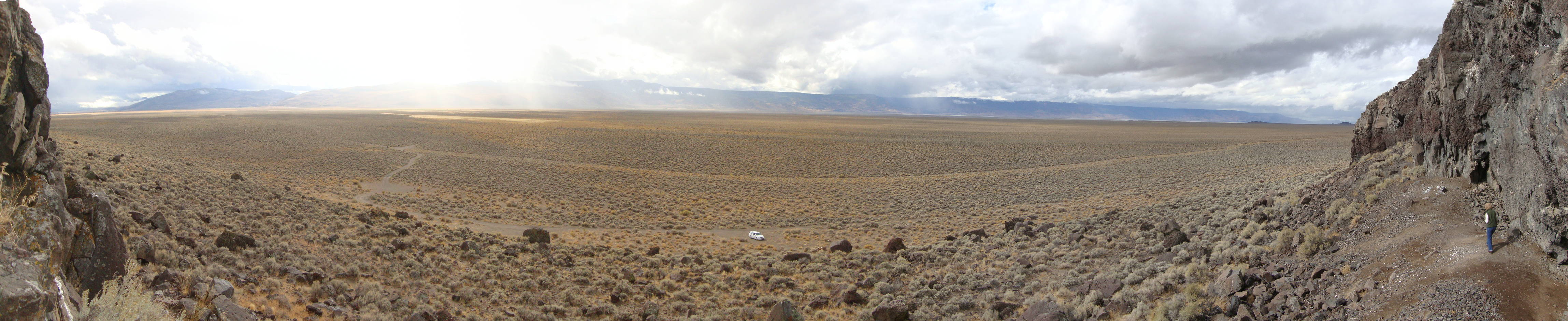
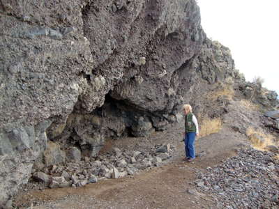
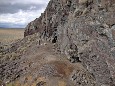
The old Lake Chewaucan, now a dry lake bed, at the Five Mile Point Cave
14 000 years ago, however, it was a seemingly inexhaustible source of water, and teemed with life, providing game and an idyllic habitat on its shores for the human inhabitants of the caves and rock shelters on its shoreline.
(Note that as with all 180 degree panoramas, this photo gives the false impression of an embayment rather than a straight cliff line - Don )
Photo: Courtesy Darrell Mintz 2011.10.16
Panorama of the Five Mile Point Cave area, taken from the former lake bed.
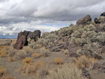
The rocks lined up in front of the cliff like a man made rock berm may have rolled down the slope from the cliff line, and stopped when they reached the edge of the water of the former lake when it was full.
Photo and text: Courtesy Darrell Mintz 2011.10.16

Paisley Caves location map.
Photo: http://mediad.publicbroadcasting.net/p/nwpr/files/styles/medium/public/201207/paisley_caves2_0.jpgbrassempouymapsmbrassempouymapsm

The Paisley Caves are located in the Summer Lake basin near Paisley, about 220 miles southeast of Eugene on the eastern side of the Cascade Range. The series of eight caves are westward-facing, wave-cut shelters on the highest shoreline of pluvial Lake Chewaucan, which rose and fell in periods of greater precipitation during the Pleistocene.
The photo shows Dennis Jenkins in his University of Oregon lab, displaying a drawer full of artifacts, including ropage and threads, found in the Paisley Caves. "To find these threads was just incredible," he said.
Photo: Jim Barlow
Photo and text: University of Oregon Media Relations site.
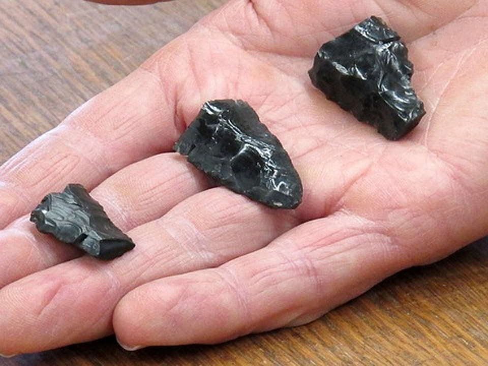
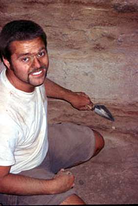
University of Oregon archaeologist Dennis Jenkins holds three ancient tools known as Western Stemmed projectiles from the Paisley Caves in Oregon.
It was long thought that the Clovis people were the first North American human settlers, and that they appeared on American soil some 13 000 years ago after traveling across a land bridge from Asia. They preyed on extinct mammals like the mastodon, used distinctive stone tools and were named after a town in New Mexico, where those tools were first found. But archeologists have unearthed strong evidence of another group of early Americans with their own distinct technology, from the Paisley Caves in Oregon's Northern Great Basin. The area, a volcanic region located on the eastern side of the Cascade Mountain range, is so arid and the caves so dry that artifacts and ancient remains have been extremely well preserved over time.
In 2008, scientists from the University of Oregon and the University of Copenhagen found dried feces, from which they extracted human mitochondrial DNA, dated 14,300 years ago. They published their results in the journal Science. But the results at the time sparked debate among scientists in the field: Could the material have been contaminated by younger DNA - urine, for example, that leached through the cave deposit? And could material in the cave have churned up over time, upsetting the levels and confusing the dates? In the years since, archeologists have dated 190 objects - artifacts, bones, sagebrush twigs and ancient dried feces, also known as coprolites - from silt in the ancient caves. Among the objects dug up were discarded tools called Western stemmed projectile points, believed to have derived in form from even older tools in Asia and Siberia.
'It's absolutely phenomenal that anything 14 000 years old can be found,' said Dennis Jenkins, the study's lead author. 'Usually we think of poop as disappearing pretty quick. In this case, we also have camel bones of the same age with blood, fat and sinew attached to them.' A new paper published Thursday in the journal Science addresses the original questions. Thomas Stafford, a geologist from the University of Oregon, extracted water soluble material from samples of the coprolites by soaking them 'like a tea bag' in distilled water, thus extracting the potentially contaminating carbon from the feces, and then radiocarbon dated both remaining parts. And he found 'no substantial evidence' of younger DNA being carried into the material.
'The hypothesis is that if water is moving down through the deposit, then the material we were going to date from the distilled water should be younger than the material in the coprolite,' Jenkins said. 'What we found is that in 11 out of the 12 cases, it was older or the same age.' And as to whether it was churned up, more than 100 radiocarbon dates taken from cave samples showed that the deposits had remained in chronological context, said Jenkins, which was consistent with their findings. One sample of human feces dated to 137nbsp;100 years old was found in the same stratum as the oldest Western stemmed projectile point. And five centimeters down, in the deposit, another sample of feces dated at 13 230 years old.
But Just as striking is what wasn't found in the Paisley Caves: any defining features of the Clovis culture. 'The big 'aha',' Jenkins said, 'is that we have demonstrated that these Western Stemmed projectile points are the same age as Clovis.' And while they overlapped in time, he added, there is no evidence of Clovis or any precursor to Clovis in the cave, indicating that these tools were made and passed on by a different group of people. 'How different, we don't know,' Jenkins said. 'We don't know what language these folks spoke or an awful lot about them - or how they thought or how they organized themselves.'
Tom Dillehay, an archeologist with Vanderbilt University, who was not involved with the research, said of the finding: 'This is another database that shows this regional diversity very early on…In North America, people have been reluctant to buy into cultural diversity. Until several years ago, the Clovis-first model dominated. ' But Dillehay added that he's still puzzled as to why scientists haven't identified more human artifacts at the deeper levels.
An important question for future research will be learning more about where the early settlers arrived from. While genetic evidence still clearly points to Siberia and Asia, 'that does not mean that there might not have been secondary or tertiary migrations of people coming in from other places,' Dillehay said. 'And that may help account for the different regional and cultural diversity that we're seeing.'
Photo: © Jim Barlow
Text: http://www.pbs.org/newshour/rundown/2012/07/it-was-long-thought-that.html
Text above adapted from Wikipedia.
The arid lands around Summer Lake were once lush. During the Pleistocene Era, vast areas of this region of south central Oregon were covered by lakes and wetlands. As the last ice age was ending, rain and runoff from melting snow filled the lowlands throughout this region of the Great Basin, creating an immense, freshwater lake called Lake Chewaucan. The lake covered 461 square miles (1 190 km²) at depths of up to 375 feet (114 m).
Lake Chewaucan covered the Summer Lake basin and drainage system during much of the late Pleistocene Era. The last high water period is thought to have occurred about 13 000 years ago.
Lake Chewaucan began to dry up at the close of the Pleistocene Era. As it shrank, salts and alkali were concentrated in its remaining waters. The exposed lake bottom sediments were blown by the prevailing westerly winds to form the sand dunes that still lie on the east side of Summer Lake.
Today, Summer Lake and Abert Lake are separated by twenty miles, and are the only remnants of Lake Chewaucan. Summer Lake is approximately 20 miles (32 km) long and 10 miles (16 km) wide; however, the lake shrinks during summer and expands, sometimes dramatically, in spring time. -
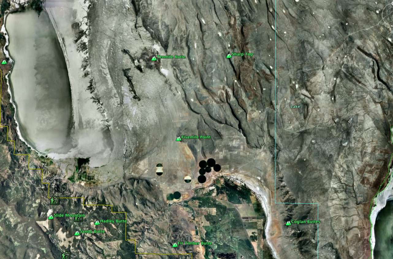
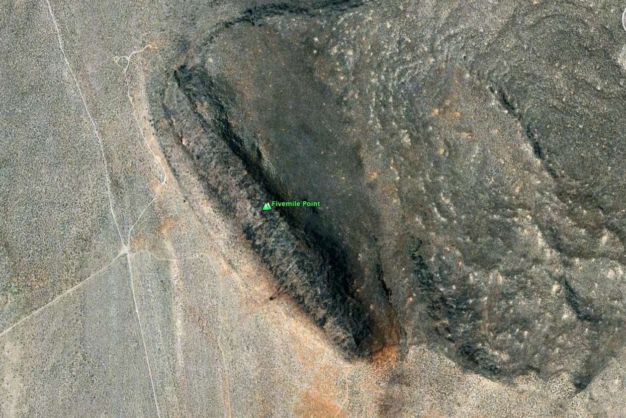
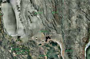
Photo: Google Earth. The caves are at Five Mile Point, labelled, half way between Summer Lake in the top left of the left hand image, and Abert Lake in the bottom right of the left hand image. On the right is a close up of the ridge where the caves lie.
By looking where the vehicle tracks lie in the closeup, you can work out where the photo at the top of this page was taken.
Text above adapted from Wikipedia.
Dennis Jenkins at Cave 5, July 2011. There is ongoing field work at the site.
Photo: http://odellcross.blogspot.com/2011/07/paisley-cave-site.html
A very good shot showing the field work being undertaken in July 2011, at cave 5.
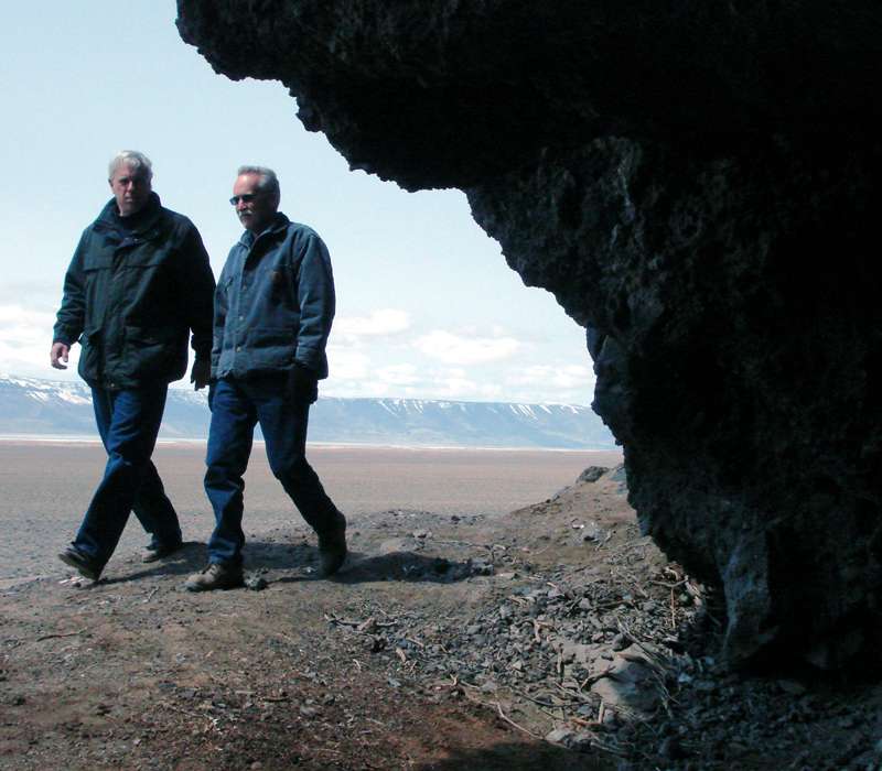
When Darrell Mintz visited the site in November, he was quite impressed at how well the University of Oregon crew had removed all traces of their presence at the caves, and how well the whole site is preserved. He did not see one cigarette butt, nor any trash anywhere, even down by his vehicle on the lake bottom.
Photo: http://odellcross.blogspot.com/2011/07/paisley-cave-site.html
Site location map.
(A) Location of Paisley Caves in the western Great basin. (B) Spatial location of coprolites in cave 5. (C) Stratigraphic profiles in cave 5.
Photo: Shillito et al. (2020)
Source and text: Shillito et al. (2020)
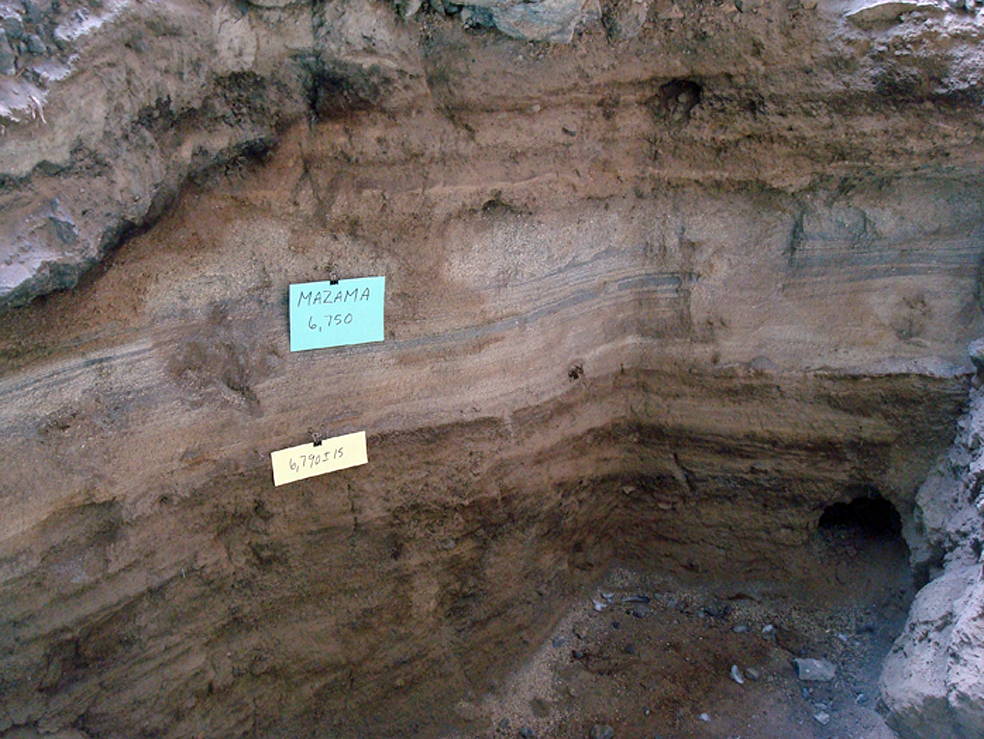
Solid Dating to earlier than 12 273 ± 56 14C yr BP
A bulrush shaft from Cave 5 has been dated to 12 273 ± 56 14C yr BP. It was found above a coprolite identified as human, and which was itself dated to 12 290 ± 60 and 12 345 ± 55 14C yr BP, the bulrush shaft having the features of an S-twist (clockwise) twined basket or mat weft fragment (fig. S3), was submitted for accelerator mass spectrometry (AMS) radiocarbon analysis.
Twining, the only basketry type known from the region before the late Holocene, uses a pair of weft elements twisted around a warp in a clockwise (stitches oriented up to the right) or counterclockwise (down to the right) direction.
The dated element has a slight clockwise twist and is crimped and flattened, where it would press against opposing warps. Bulrush is one of the most common basketry fibres in the region; it is not natural to the cave deposits and is a cultural addition. This confirms the pre-Clovis age and stratigraphic integrity of the deposit.
( My thanks to Darrell Minz for access to this information - Don )
Photo: advances.sciencemag.org/cgi/content/full/6/29/eaba6404/DC1
Source and text: Shillito et al. (2020)
Cave 5 in November. Notice how well the whole area has been cleaned up.
Photo: Courtesy Darrell Mintz 2011.10.16
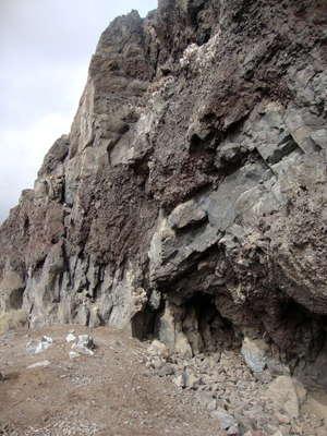
The end of the line of cliffs further along to the left of the photo above.
Photo: Courtesy Darrell Mintz 2011.10.16
This photo was taken further along to the left still, at the end of the line of cliffs, looking back at them end on.
Photo: Courtesy Darrell Mintz 2011.10.16
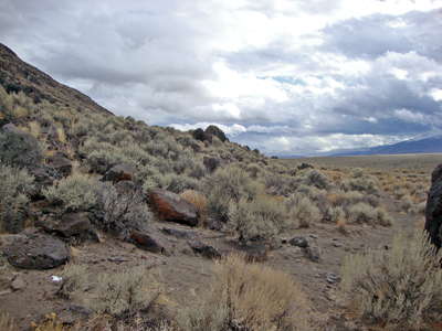
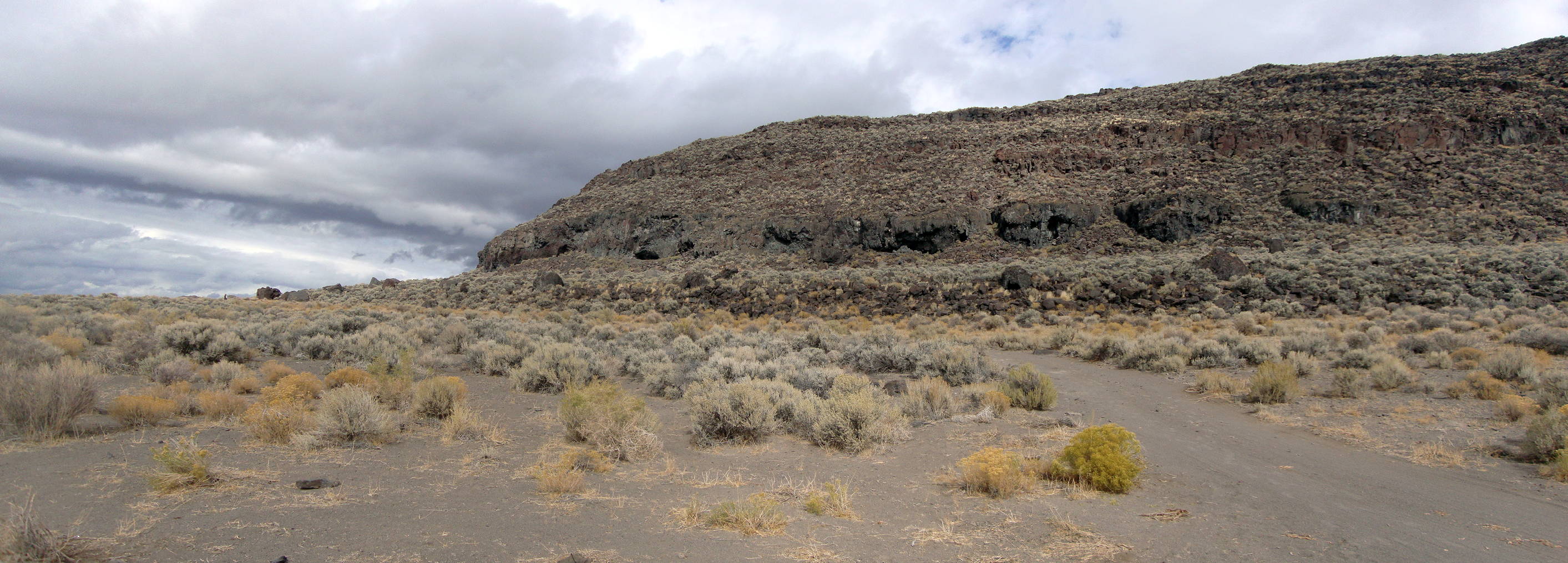
There are many instances of rocks like this which have been eroded from the cliff line and rolled down the slope.
Photo: Courtesy Darrell Mintz 2011.10.16

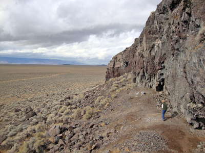
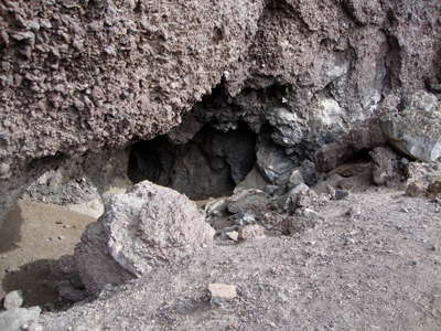
It might be thought that these are pretty inconsequential caves, but for one thing they may well have been larger at the time of occupation, having filled up in the meantime, and for another, even a small recess in a cliff line is a huge advantage when setting up camp.
The rocks radiate heat during the winter, and provide protection from winds not only from behind the cliff line but even directly at it, and even a small dry recess is invaluable for storing clothes, baskets, food, and anything else that needs to be kept really dry. The cliff also provides at least one completely solid, reliable and high wall for any shelter, either of brush or hides, that you wish to put up.
Photo: Courtesy Darrell Mintz 2011.10.16
This cave turns out to be quite substantial, and would have provided excellent shelter, with just a little help from a quickly thrown up structure of poles, brush and hides.
Photo: Courtesy Darrell Mintz 2011.10.16
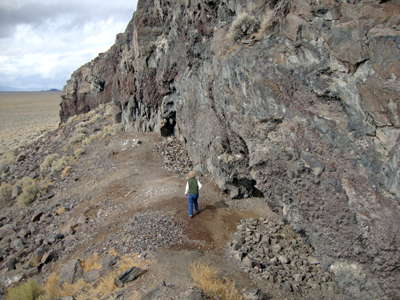
Walking along the cliff line.
Photo: Courtesy Darrell Mintz 2011.10.16
It is difficult now to work out what is spoil from the excavations, and what the original area in front of the caves was like at the time of occupation.
It may well have provided a reasonably flat area like this for activities such as flint knapping and preparation of hides and baskets, food preparation and so on.
Photo: Courtesy Darrell Mintz 2011.10.16
With access to water and the life within it, plus the grazing animals attracted to the lake, and a certain refuge from the weather, this would have been a very attractive area for early man.
Note the eagle's nest high up on the wall here. Other life forms in the area found it an important resource.
Photo: Courtesy Darrell Mintz 2011.10.16

It would be fascinating to travel back in time and see the way that the original inhabitants made use of this wonderful resource.
Photo: Courtesy Darrell Mintz 2011.10.16
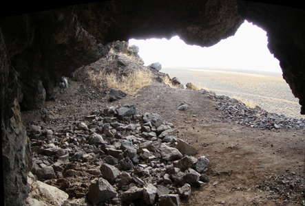
A sweeping view looking out from inside one of the Paisley Caves.
The Paisley Caves complex is a system of caves and rock shelters in an arid, desolate region of south-central Oregon, United States. One of the caves contains archaeological evidence of the oldest definitively-dated human presence in North America. The site was first studied by archeologists in the 1930s. Scientific excavations since 2002 have uncovered substantial new discoveries.
Photo: University of Oregon Media Relations site.
A field school from the University of Oregon has been examining the site since 2002 and analyzing its pre-Clovis artifacts. In the summer of 2007, they identified the oldest human DNA yet discovered in the American continents. This assertion is based on several samples of coprolite (fossilized excrement) found in the Paisley Caves complex, between Lakeview and Bend, Oregon, on the eastern side of the Cascade mountain range.
The Paisley Caves were cut by waves at a time of high water levels in the nearby lake, which is now a flat, dry area near the caves.
The fossils were found in Paisley Five Mile Point Cave at the same level as a small rock-lined hearth some 7 feet (2 m) below the modern surface. At that level was also discovered a large number of bones from waterfowl, fish, and large mammals including extinct camel and horse. Radiocarbon dating places these coprolites between 12 750 and 14 290 calendar years before the present, probably representing a pre-Clovis occupation. DNA analysis provides apparent genetic ties to Siberia or Asia.
Photo: University of Oregon Media Relations site.
Fossilised faeces found in the caves
Evidence at other archaeological sites — as well as 1930s work at Paisley Caves — had also been thought to provide such evidence, but questionable excavation techniques clouded the issue. Knowing this, the University of Oregon team worked carefully to avoid the mistakes of the past. The theory that Pre-Clovis immigrants traveled to North America down the Pacific Coast suggests that the travelers would have passed through the hinterlands of what is Oregon today. The Paisley Caves, up-river from the Pacific Ocean along the Klamath River, are therefore an ideal spot to search for the evidence of such people. The fossils provide evidence of the groups possibly having lived there. DNA from coyote, fox, and dog (or wolf) were also found.
Photo: http://news.bbc.co.uk/2/hi/science/nature/7329505.stm
The caves are in the Summer Lake basin at 4 520 feet (1 380 m) elevation and face to the west in a ridge of Miocene and Pliocene era basalts mixed with soft volcanic tuffs and breccias from which the caves were carved by Pleistocene era waves from Summer Lake. The caves are located north of the city of Paisley, Oregon.
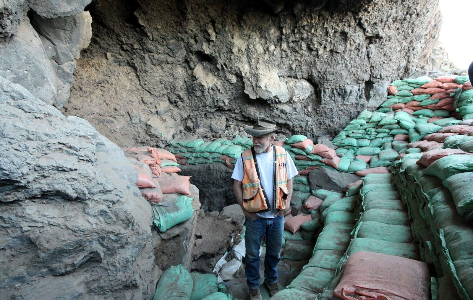
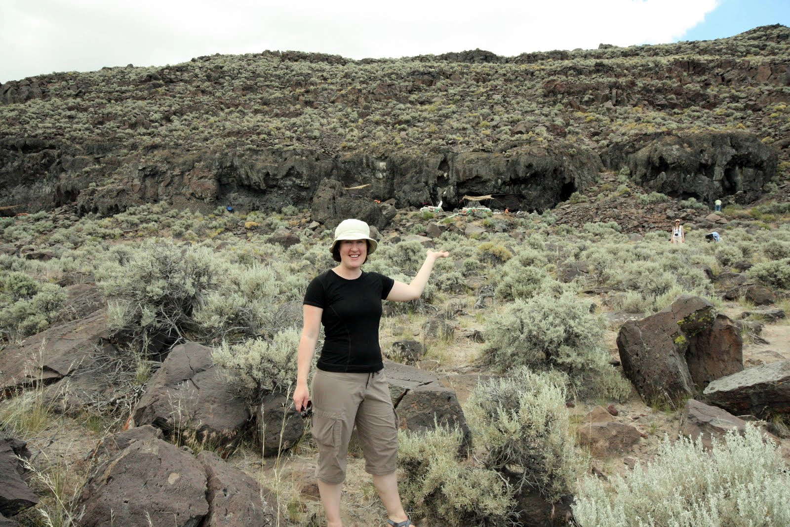
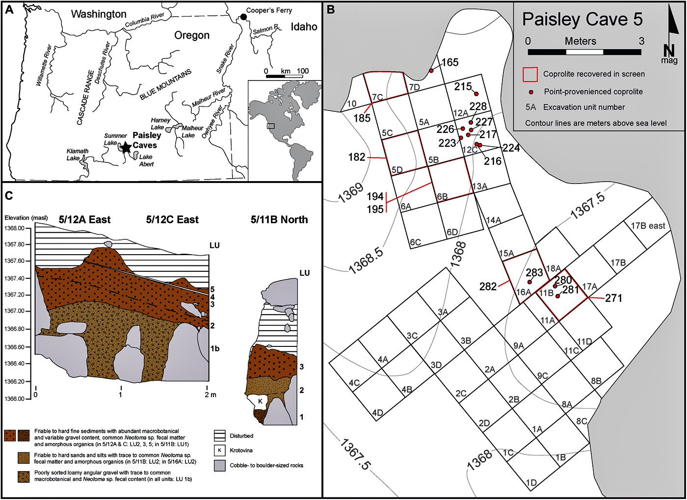
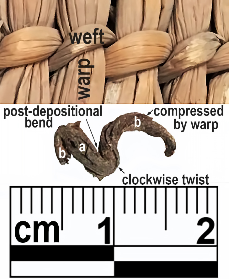
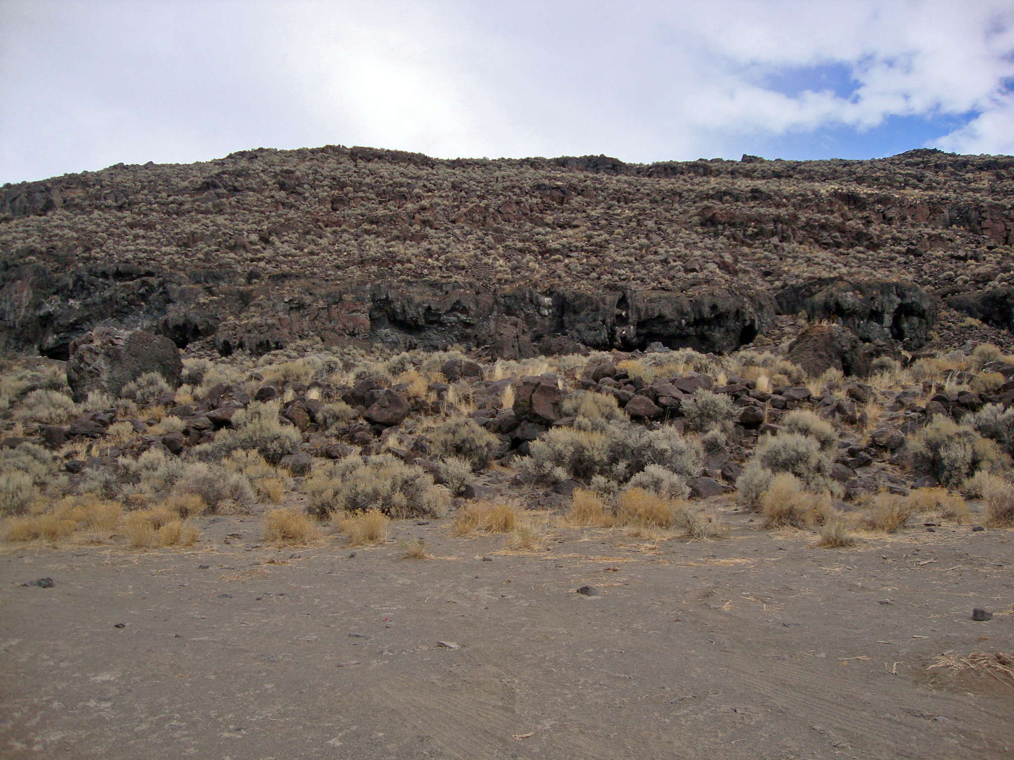
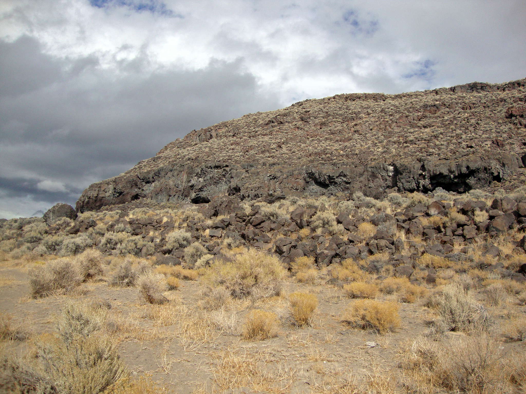
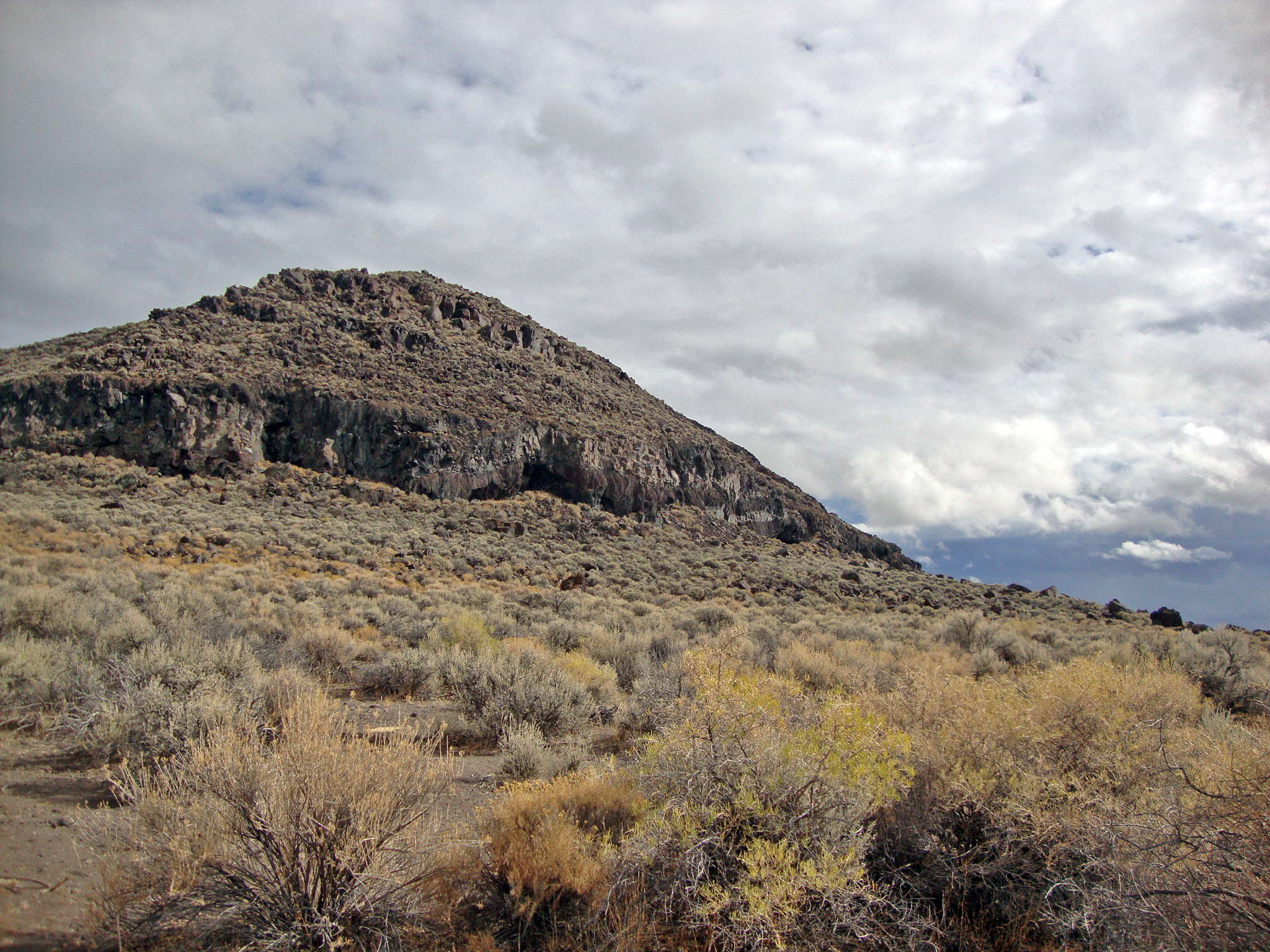


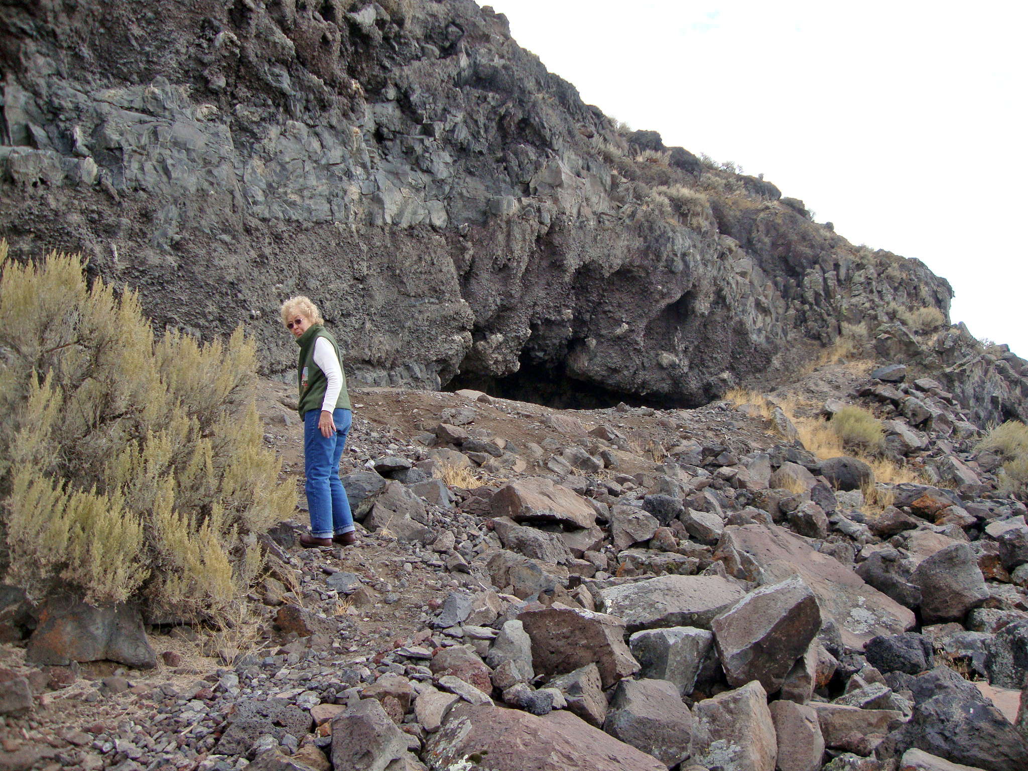

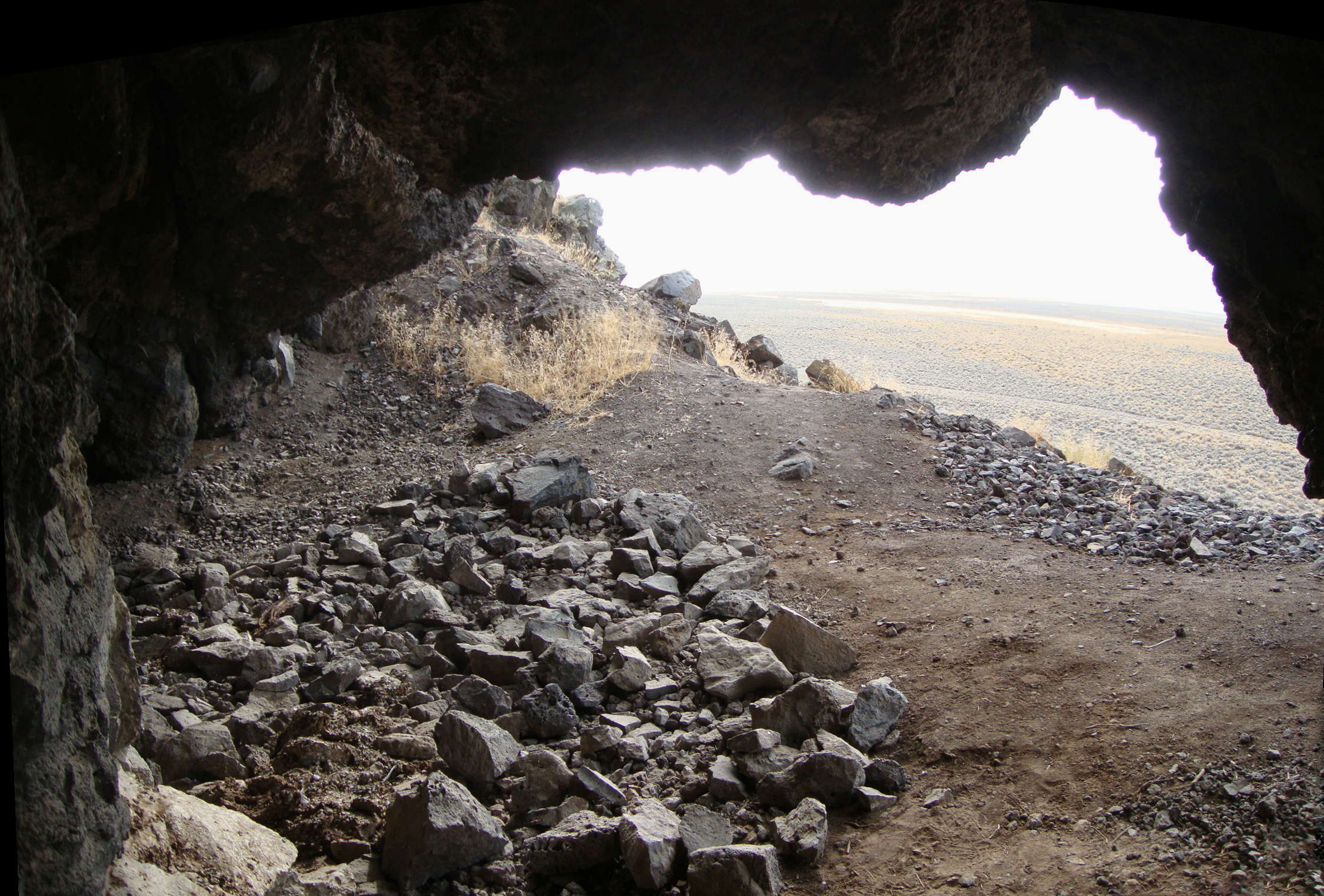


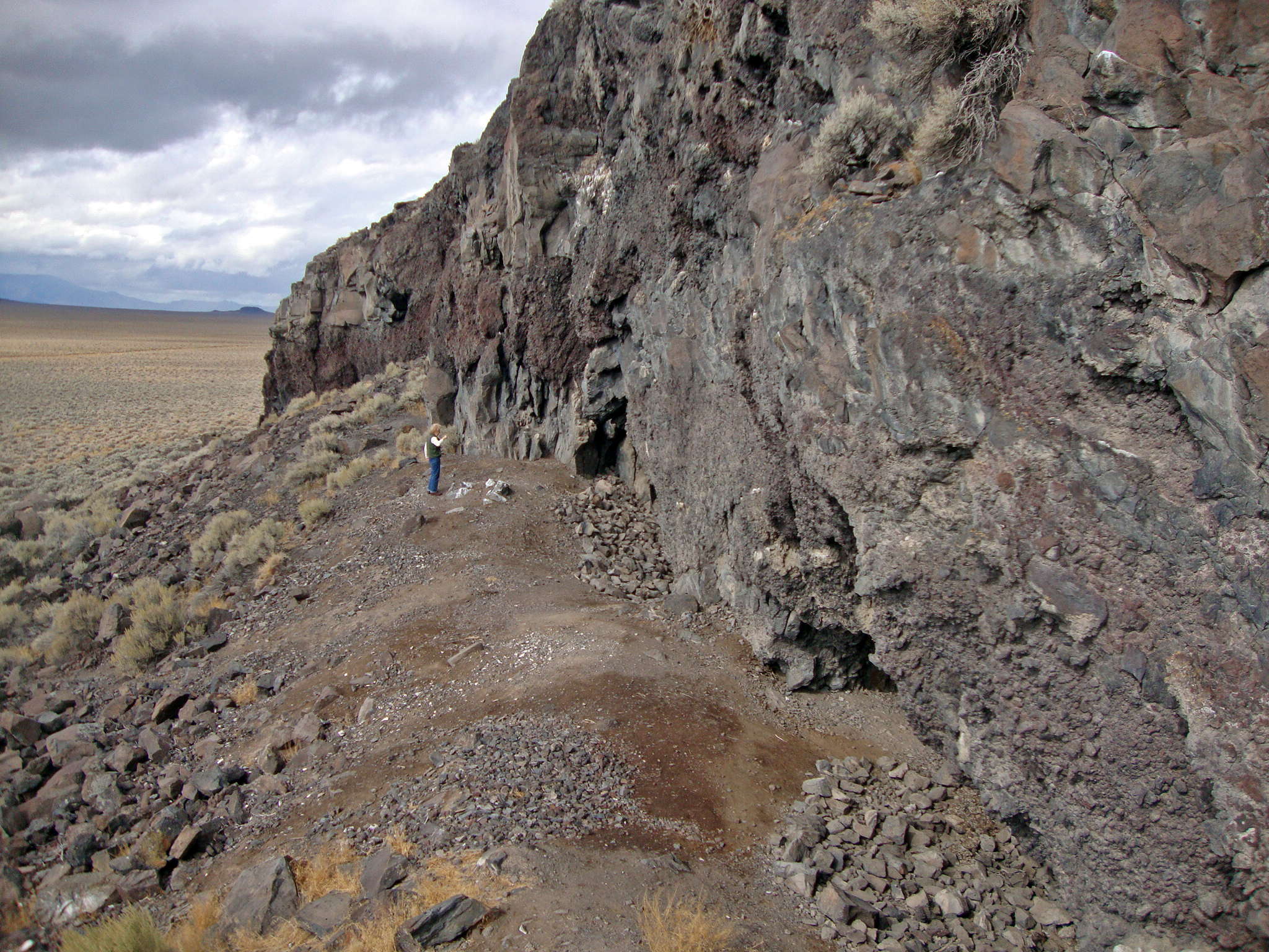

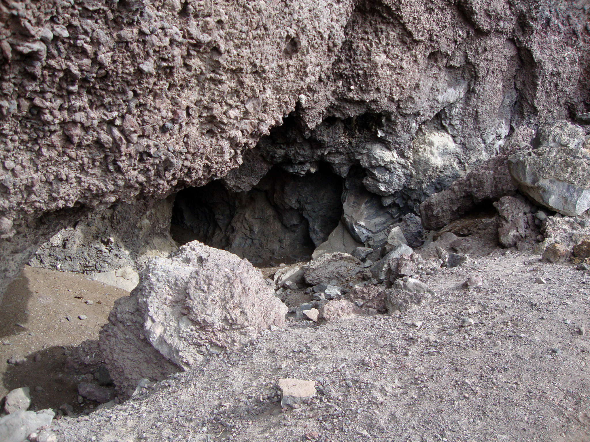
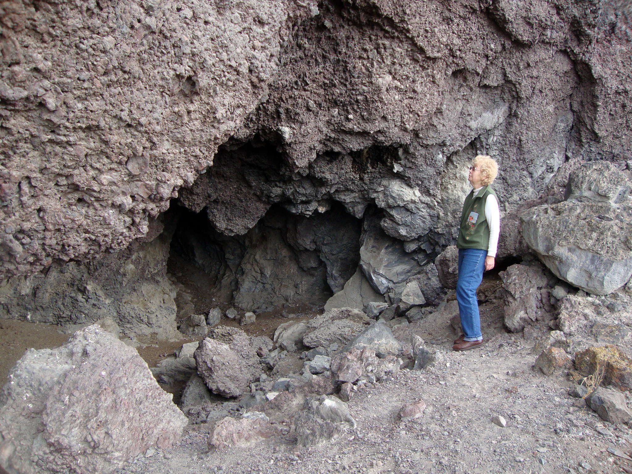
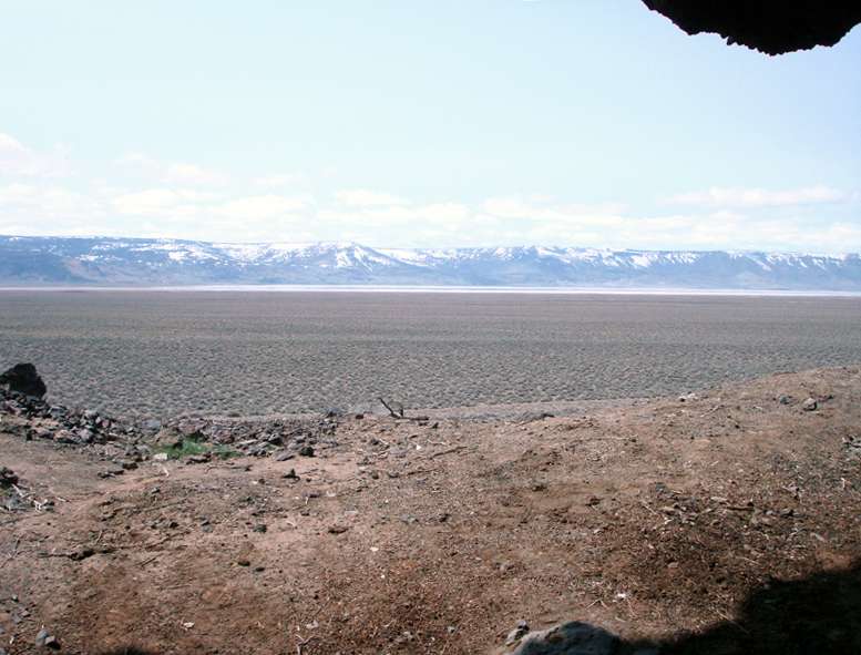

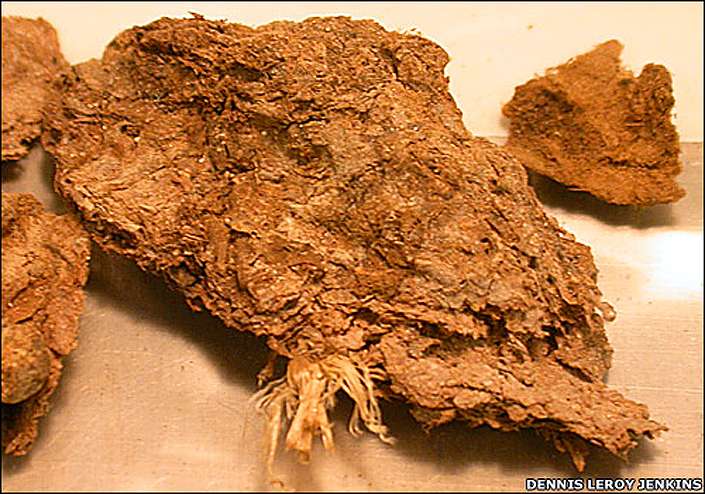

Photo from 1966 showing the University of Oregon's Luther Cressman, considered the "father of Oregon anthropology" on location at a small cave at Fort Rock Cave in Oregon. Cressman, acting on information given to him, found the Paisley Caves in about 1937, and, by 1940, he theorized that artifacts he had uncovered were older than those found at many other North American sites, but a lack of documentation hurt his cause.
Photo and text: University of Oregon Media Relations site.
Luther Cressman
1897-1994
Luther Cressman was born in 1897 in Pennsylvania, one of six sons born to a Pennsylvania country doctor and his educator/musician wife. Ordained in 1923 by the Episcopalian church, in 1928 Luther Cressman left the church, pursuing his career at the University of Oregon in 1929. For six years he was as a Professor of Sociology. He then was instrumental in the development of the Department of Anthropology and was Chair of the Department from 1935 – 1963. While at the University of Oregon, Cressman organized the University of Oregon’s Museum of Natural History and was a founding Director of the Oregon State Museum of Anthropology.
Luther Cressman is known as the father of Oregon anthropology for work that punched holes in the standing theories of the prehistoric Northwest. Cressman firmly believed that early man moved from south to north along the western side of North America, not the traditional north to south beliefs. He claimed that culture among prehistoric Oregon Indians predated known civilization. In 1938, he discovered immaculately preserved 9 000 year old shredded sage back sandals at Fort Rock Cave, Oregon. Until radiocarbon dating verified his find, the belief was that human occupation of the far west went back no further then 4 000 years. In 1968, Cressman discovered ashes from a fire at the Fort Rock Basin that suggested humans moved from Alaska to the New World at least 30 000 years ago.
(Note that the story is not so simple as that. See this story from http://www2.wi.net/~census/lesson40.html)
At Fort Rock Cave in 1938 archaeologists discovered nearly 100 sandals woven of sagebrush that had been shredded and twisted into strands. Many had mud baked into them and most were charred, for they lay beneath volcanic ash that apparently rained into the cave while still hot. At first the ash was identified as from an eruption of Mount Newberry (southeast of Bend); but now, with better methods of analysis, it is recognized as having come from Mount Mazama. This alone would indicate an age of at least 7 000 years.
Radiocarbon dating had not been developed at the time of the discovery, and even when it did become available the sandals could not be used. They had been sprayed with resin as a preservative and the radiocarbon method requires material absolutely free of contamination. There seemed to be no way to place the chronology of the sandals more precisely than sometime before the Mazama eruption. Then, by luck, someone digging about in Fort Rock Cave ten years after the original excavations found another sandal and some basketry. Radiocarbon dating of the sandals pushed the age back to 9 000 years.
Luther Cressman married anthropologist Margaret Mead in 1923. They were together for 5 years, divorcing in 1927. Later he married Dorothy “Cecilia” Loch. They were married until her death in 1977. They were married for 49 years, raising one daughter. In 1988 he wrote A Golden Journey: Memoirs of an Archaeologist - an autobiography dedicated to his second wife.
In the course of Cressman’s life he wrote two books, The Sandal and the Cave and Prehistory of the Far West: Homes of Vanished Peoples.
Biographical notes on Luther Cressman adapted from:
http://www.mnsu.edu/emuseum/information/biography/abcde/cressman_luther.html
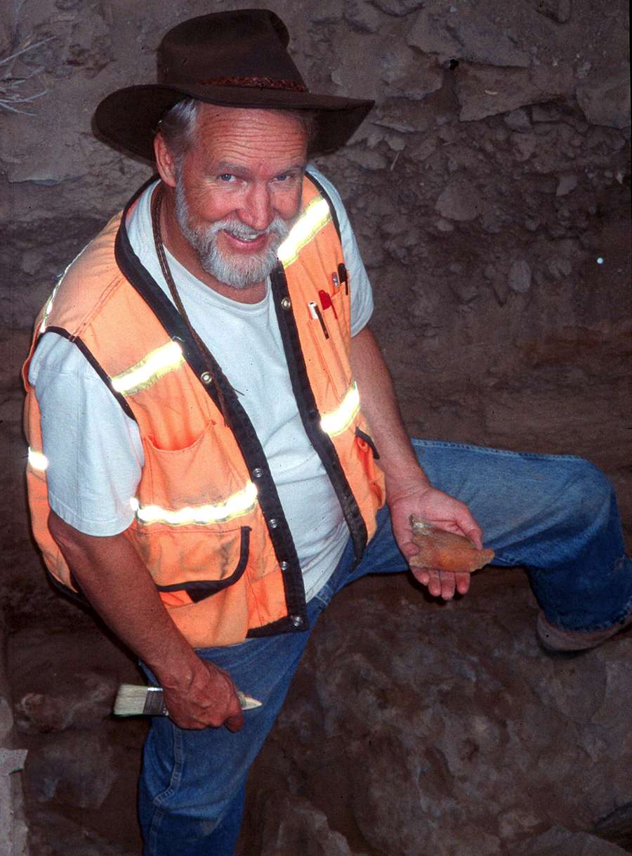
This excellent summary of the 2008 Summer Session, Northern Great Basin Prehistory Project, Archaeology Field School, NGBPP Research at the Paisley Caves is by Dennis L. Jenkins, Director, Northern Great Basin Field School, Museum of Natural and Cultural History, University of Oregon.
It happens too often that this sort of reporting is hidden away in obscure journals accessible only to those willing to pay exorbitant fees to access them. Dr. Jenkins is to be congratulated on making this information available to all. I usually have to summarise reports like this to get rid of extraneous material uninteresting to the general reader. This time I couldn't find anything to cut, it is a very tight, very well written report. - Don
Adapted from:
http://www.uoregon.edu/~ftrock/paisley_caves_description.php
The Paisley Caves are located in the Summer Lake Basin north of Paisley in south-central Oregon. The site is composed of 8 caves and rockshelters in a west facing ridge of scoriacious basalt.

Dennis Jenkins points to an area inside one of caves during a discussion with NewsHour correspondent Lee Hochberg.
Cut by waves at the height of the Pleistocene, these caves lie at an elevation of 4520 ft. above two prominent beach lines cut into the talus slope. As lake levels fell at the end of the Pleistocene the current Summer Lake Basin was hydrographically separated from the Chewaucan Basin sometime between 17 000 and 18 000 cal. BP. Water levels in both basins continued to fall until about 14 500 cal. BP when a resurgence in the Chewaucan Basin caused lake levels to rise above the 4388 ft. sill separating the two basins. The Chewaucan River then breached the gravel fan separating the two basins and began flowing north into the Summer Lake Basin. Over the next 2000 years high lake stands established prominent shorelines at elevations of roughly 4330, 4360, and 4380 ft. During much of this period water stood within one mile of the Paisley Caves, making occupation of the caves substantially more attractive than it has been since.
Photo: University of Oregon Media Relations site.
Luther Cressman had a crew test the Paisley Caves in 1938, trenching caves 1, 2, and 3 from the mouth to the back wall in each case. His crews returned the following year to complete the excavation of the cave interiors. They removed the deposits in three stratigraphic units: sediments above Mazama ash, in the ash, and below the ash. In the pre-Mazama deposits of Cave 3 they recovered the remains of late Pleistocene camel, bison, and horse in apparent association with artifacts. Cressmen returned to the site one last time in 1940 to verify this apparent association of megafauna and artifacts. While Cressman believed he had demonstrated the association of artifacts with extinct Pleistocene fauna, few other researchers have formally accepted his interpretations due to the lack of adequate documentation for these finds.
To test Cressman's theories, the UO field school conducted new excavations at the Paisley Caves during the 2002 and 2003 field seasons. Investigations were conducted in caves 1, 2, 3, and 5. Sediments were removed by arbitrary 5 centimeter levels dug within strata. Students were closely supervised at all times. Our emphasis was on the recovery of in situ bone and cultural materials. Photographs were taken of all large mammal bones and artifacts found in situ. Soil samples were recovered from around those that could possibly be late Pleistocene in age.
Mike Fallon, Cave 1 Stratigraphy
Cave 1, located at the south end of the site, is about 6 m long and 4 to 5 meters wide. The roof at the mouth of the cave has fallen since 1939. A pair of huge boulders now block direct access to the interior of the cave, covering a good portion of the deposits in the cave mouth. A narrow concavity extending under the larger of the two offered the near perfect location in which to excavate a series of 1x2 m test units in predominantly undisturbed deposits. Excavations continued to 230 cm through extremely dry deposits. The upper 80 cm of sediments contained sparse Middle and Late Holocene cultural deposits. Deposits between 80 and 160 cm are, for all practical purposes, culturally sterile though a small hearth and a few artifacts were encountered just below a lens of Mazama ash at approximately 120 cm. The oldest and densest cultural remains encountered in any of the caves were located between 190 and 230 centimeters. Radiocarbon dates of 8440, 7540, and 7445 have been obtained from sage brush charcoal, human feces, and a basketry fragment. Obsidian hydration readings on debitage recovered from 200 cm suggest that the earliest occupation samples date from about 11 000 cal. BP.
Photo: http://www.uoregon.edu/~ftrock/paisley_caves_description.php
NewsHour correspondent Lee Hochberg and Jenkins walk by a cave entrance while the film is rolling for an upcoming story.
Cave 2, located next to Cave 1, is roughly 7 meters long and 6 meters wide. Large boulders extend across most of the entrance at the dripline and access to the lower, central portion of the cave is obtained by way of a narrow path along the northeast wall. Intact deposits were encountered near the bottom of this path. UO excavations reached depths of 240 centimeters along the cave wall. Coprolites and perishable artifacts were relatively common in Late Holocene deposits. A thick lens of Mazama tephra marked the boundary of Early Holocene deposits. A coprolite located below Mazama tephra was dated to 8620 cal. BP. A small but dense charcoal lens, suggesting the presence of a hearth, was encountered at a depth of 200 centimeters, more than a meter below the tephra lens. What appear to be predominantly artiodactyl bones (cloven-hooved mammals ), split to facilitate the removal of the marrow, were recovered in large quantities around this feature along with lithic debitage and tools of various kinds including a short length of sagebrush rope, a wooden peg, a pumice abrader, and scrapers. A short fragment of Western Stemmed or Foliate point base was the only projectile point found in apparent association with the hearth. Charred processed edible tissues recovered from the charcoal lens were radiocarbon dated to a mean age of ca. 12 000 cal. BP. The sagebrush rope also produced a date of ca. 12 000 cal. BP. Horse and camel bones were encountered well above this hearth, but the presence of rodent dens near the location of their recovery suggests they may be in disturbed contexts.
Photo: University of Oregon Media Relations site.
Cave 2 strata.
Photo: © MNCH, University of Oregon
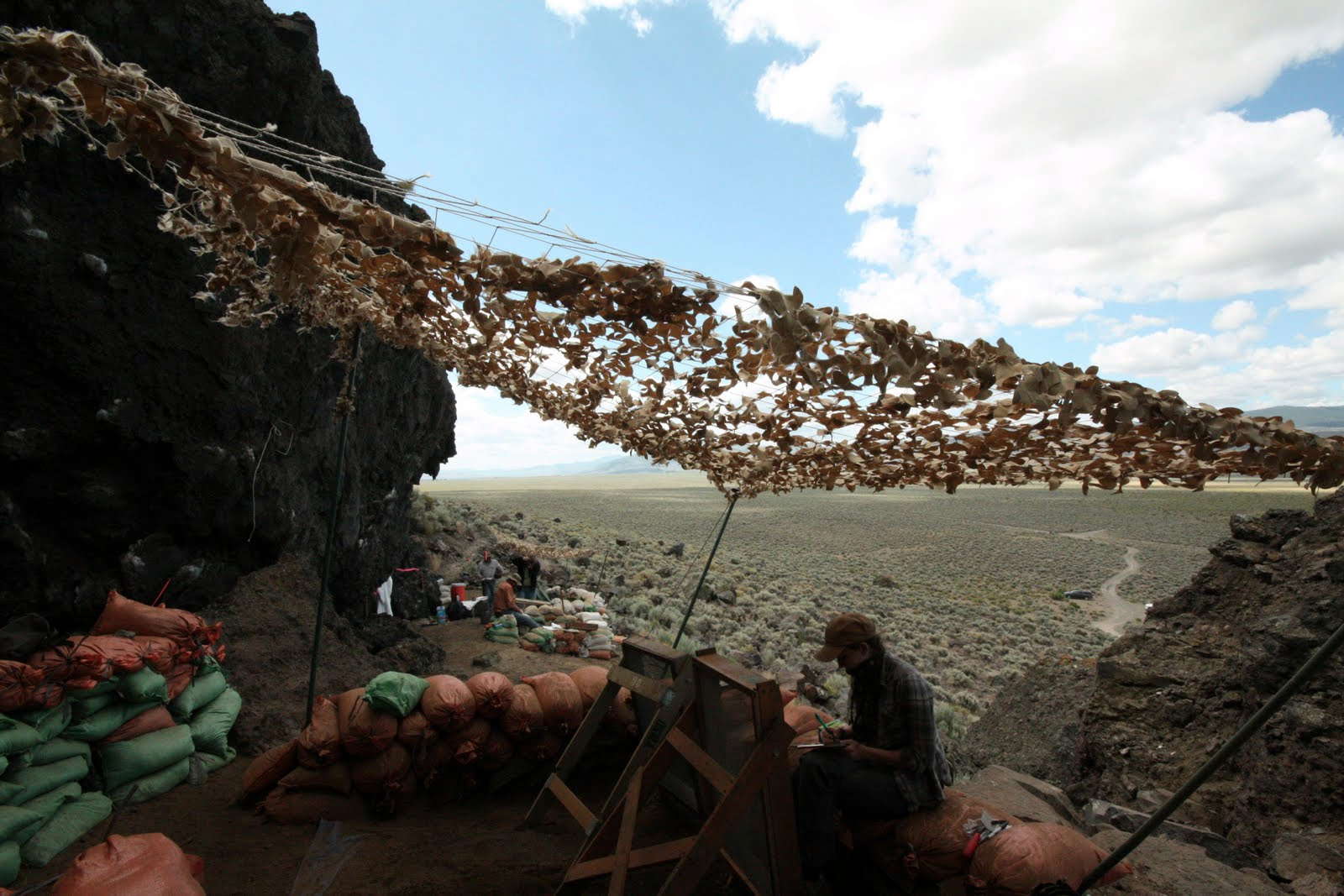
Sieving under a shade screen at the field work in July 2011.
Photo: http://odellcross.blogspot.com/2011/07/paisley-cave-site.html

Cave 3, mistakenly numbered Cave 4 by the field school, is roughly 4 meters deep and 7 meters wide. This is the cave from which Cressman recovered bones of bison, camel, horse, large dog (possibly wolf), fox and probably bear, as well as hawk, sagehen, pintail, and teal. UO excavations conducted during the 2002 field season were situated at the mouth of the cave in the area of a prominent berm composed of disturbed midden deposit. Excavations reached nearly 4 meters and were terminated among the heavily rounded boulders near the floor of the cave but not on bedrock. Cultural materials and bone were bimodally distributed in the undisturbed deposits below the disturbed deposits of the berm. Obsidian hydration measurements indicate the upper meter of deposits contain Middle and Late Holocene cultural materials. Mazama tephra deposits occur at about 130 cm, corresponding well with an obsidian hydration reading of 5.1 microns and a slight increase in cultural materials. After dropping off again to sterile deposits, cultural materials, particularly bone, increased again between circa 280 and 370 cm with the most notable peak occurring between 280 and 290 cm. Cave 5, located next to Cave 4, was not investigated by Cressman but has been heavily vandalized for many years. It is more than 6 m deep and 9 m wide. Our excavations generally skirted the vandalized portions of the cave, focusing on the south-central and north ends of the cave. A large block excavation removed part of the berm of disturbed midden in the south-central portion of cave mouth. Excavations there reached a maximum depth of 300 cm in a fine, moist, gravelly silt. Bone preservation was generally poor below a prominent lens of Mazama tephra due to the saturation of the sediments.
Photo: http://www.uoregon.edu/~ftrock/paisley_caves_description.php
Deposits at the north end of the cave were extremely dry, unconsolidated—though generally compact—wood rat midden. This deposit exhibits incredible preservation of perishable materials. These smelly, dusty deposits are largely comprised of rat feces, bone fragments, twigs, straw, sand, and gravel. The bottom of the deposit was generally reached among wave-rounded boulders at depths of about 260 cm though cultural remains continued to depths of 300 cm in pockets among the boulders.
Perishable artifacts comprise the largest portion of the cultural assemblage. Tiny fragments of very fine netting occur in the upper 50 cm of deposits and processed sinew was recovered between 225 and 300 cm in deposits among the boulders. Three strands of processed grass fiber thread were required to get an AMS date of 12 750 cal. BP.
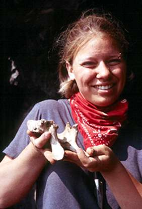
Cassie Albush with Camel Vertebra
A camel vertebra was encountered at a depth of 224 cm, a camel astragalus was recovered at 228 cm, and various other camel foot bones were recovered scattered throughout the deposit. The astragalus was AMS dated to 14 290 cal. BP. Bison long bone fragments and a patella were also recovered along with the mandibles of an extinct goat. It is interesting to note that few of these bones can be considered good meat bones and none exhibit obvious evidence of butchery. However, two fragments of long bone do appear to have been broken by impact fractures while they were fresh to facilitate the removal of marrow.
Photo: http://www.uoregon.edu/~ftrock/paisley_caves_description.php

University of Oregon archaeologist Dennis Jenkins hands a heat-measuring device to a fellow excavator at the Paisley Caves.
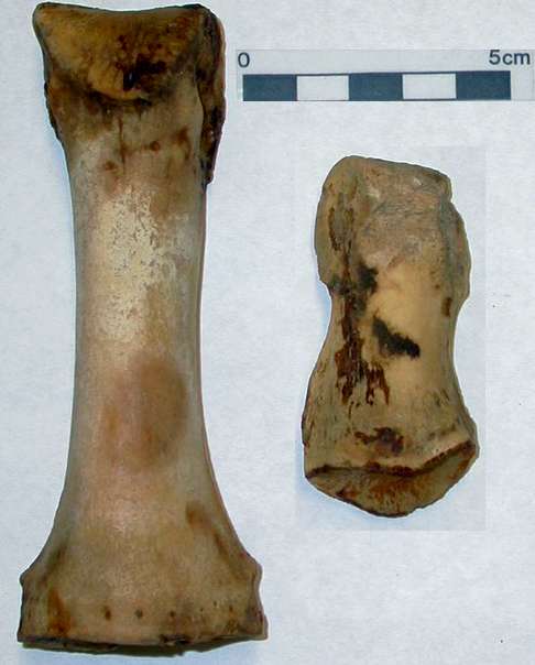
A burned horse phalanx was recovered from a small charred feature that may have been a hearth. This small bowl-shaped ash feature, discovered at a depth of about 200 cm, may be cultural. It appears to have a rock lined base, and is at the depth that large mammal bones, waterfowl, and fish remains first increase dramatically over previous numbers, suggesting that this feature could have had a cultural origin and that it may date from an early time period. However, accepting it as a cultural feature must be approached cautiously since these highly organic deposits are prone to smolder for long periods of time once they begin to burn. Oxygen in rodent passages has allowed smoldering to continue deep below the surface in at least one instance in this portion of the cave. Consequently, this feature has not yet been dated, though ash samples were recovered from it for that purpose. However, a second horse phalanx was recovered from an adjacent 1x1 meter excavation unit at a depth of 210-215 cm. It produced an AMS date of 13 140 cal. BP. Human coprolites from this deposit have produced AMS radiocarbon dates as old as the camel astragalus.
Photo: http://ancient-tides.blogspot.com/2008/09/more-details-on-paisley-cave-discovery.html
Summary and Conclusions
UO field school excavations were conducted in Paisley Caves numbers 1, 2, 3, and 5. Field methods were intensively focused on recovering cultural materials and faunal remains in situ within stratigraphic context. Lithic debris was generally found to be very sparse and the proportion of tools to debitage unusually high. This pattern suggests that occupations were generally limited to very brief stays and that the site was not generally a destination camp. The pattern changes somewhat for the lowest terminal Pleistocene/Early Holocene cultural component, where lithic debitage is much more common though never truly dense.
The majority of the faunal assemblage is comprised of microfauna deposited by raptors and carnivores between human occupations of the caves. Fish and waterfowl are most common in the Late Pleistocene/Early Holocene deposits at the bottom of the caves though they also occur in smaller numbers in the Late Holocene deposits. Large mammal bones are most commonly confined to deposits which also include artifacts. However, they may occur practically anywhere throughout the deposits due to various kinds of disturbances.
Consequently, establishing the true associations of materials recovered within the caves is absolutely vital to our analysis. We have responded to this challenge by restricting our radiocarbon dating efforts to the sampling of artifacts and bone that is identifiable to species. AMS dates indicate that the Pleistocene cultural deposits range from ca. 12,000 to 14,340 cal. BP. Camel, bison, horse, and extinct artiodactyl remains have been recovered in deposits with perishable items of human manufacture.
Dry desert caves, like those at Paisley 5 Mile Ridge, are wonderful repositories for perishable items that do not ordinarily survive in open sites. Unfortunately, humans are not the only process by which remains come to be deposited in caves. Rats, squirrels, raptors, carnivores, wind, water, and gravity all contribute to the formation and alteration of cave deposits. This fact makes it extremely dangerous to assume that items found together in caves belong together, or that they even date from the same time period. Cressman failed to adequately account for this fact in his analysis of the oldest deposits in the Paisley Caves. Consequently, his interpretations have not been widely accepted. To verify the association of Pleistocene mammals with humans at the Paisley Caves we will have to proceed much more cautiously with our analyses and interpretations. At this point we have proven that people occupied the caves during the time that camels and horses were present in the region. We have not yet demonstrated that people had anything to do with the deposition of their bones in the Paisley Caves. That remains for future analysis.

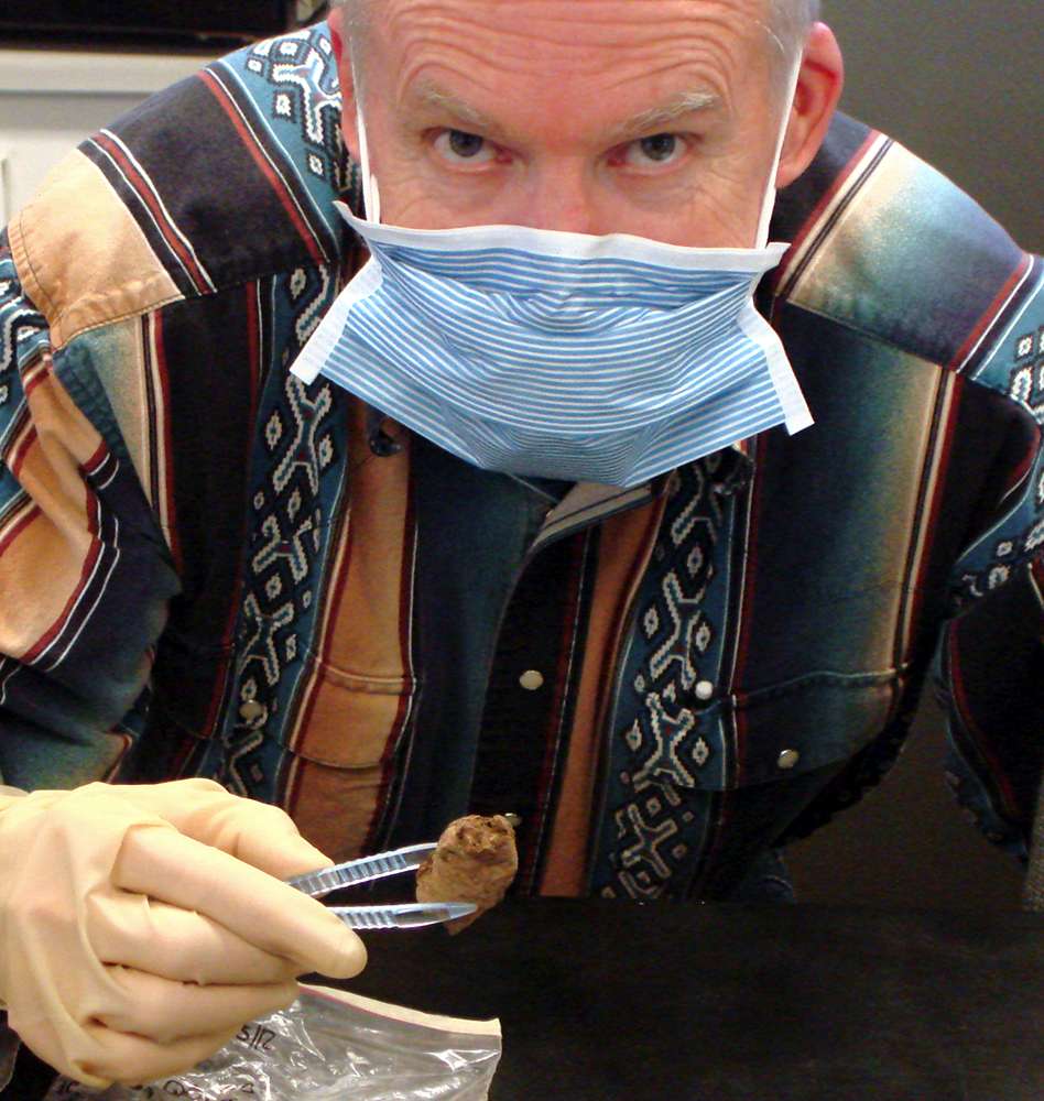
A student collecting coprolites, July 2011. The suit is not for protection, but to avoid introducing foreign DNA to the sample, and so that accurate carbon 14 dating can be completed.
Photo: http://odellcross.blogspot.com/2011/07/paisley-cave-site.html
Dennis Jenkins holding a bison bone on site at Paisley Caves on the east side of the Cascades, about 220 miles southeast of Eugene, Ore.
Jenkins' recent work, including the discovery of camel bones and other foot bones, along with dried human faeces, coprolites, has proven - with the help of new technology - that Cressman was indeed correct.
Photos and Text: University of Oregon Media Relations site.

Camel foot bones and a camel ankle bone.
Photos and Text: University of Oregon Media Relations site.
In this photo Dr. Jenkins is shown holding a piece of human coprolite (dried faeces) that dates to 14 300 years ago.
Photos and Text: University of Oregon Media Relations site.
- But how did they get there?
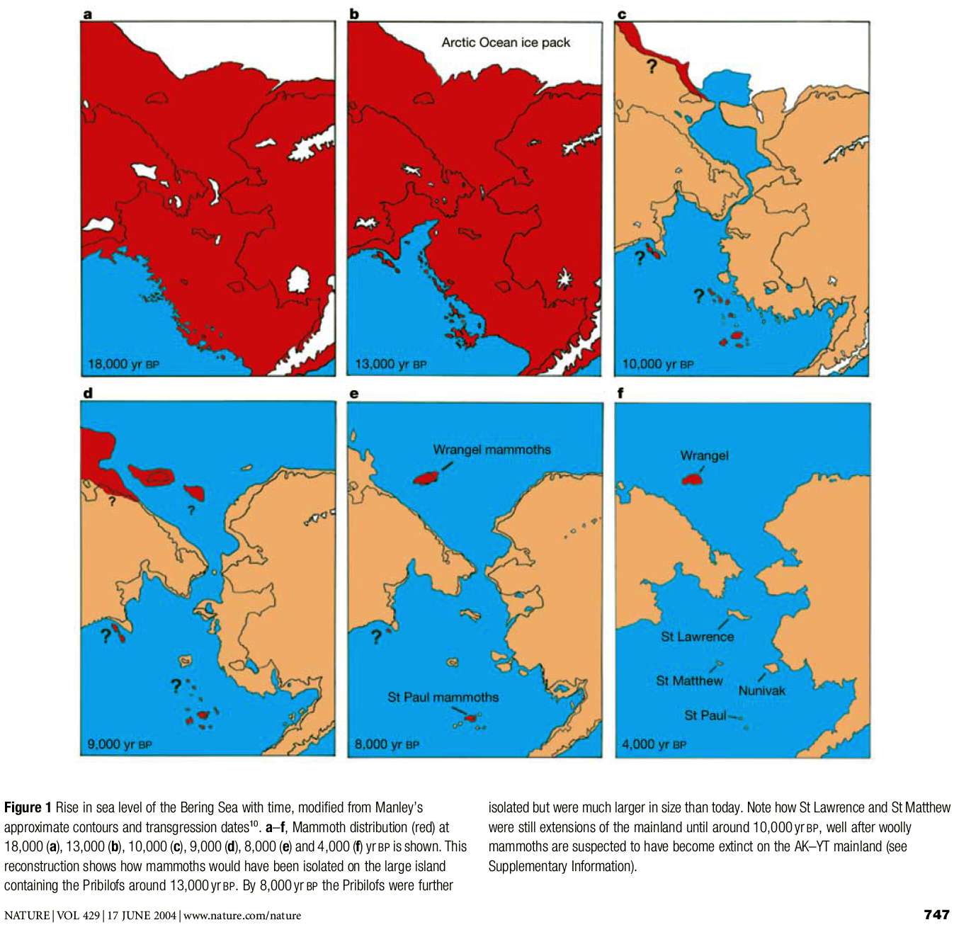
This is a question which is being hotly debated.
However this map of sea levels may give a clue as to the route taken, if not the method used - overland or via kayak, or some combination of both?
The photo was drawn to show the movement of mammoths at the end of the last ice age, but is invaluable for showing sea levels at the time humans first came to the Americas.
Red is for land above sea level containing mammoths, brown for land above sea level without mammoths.
Photo: Radiocarbon evidence of mid-Holocene mammoths stranded on an Alaskan Bering Sea island
R. Dale Guthrie
Institute of Arctic Biology, University of Alaska, Fairbanks, Alaska 99775, USA
NATURE | VOL 429 | 17 JUNE 2004 pp 746-749
References
- Shillito L. et al., 2020: Pre-Clovis occupation of the Americas identified by human fecal biomarkers in coprolites from Paisley Caves, Oregon, Science Advances , 15 Jul 2020: Vol. 6, no. 29, eaba6404 DOI: 10.1126/sciadv.aba6404