Back to Don's Maps
 Back to Archaeological Sites
The Rock Engravings of Gobustan
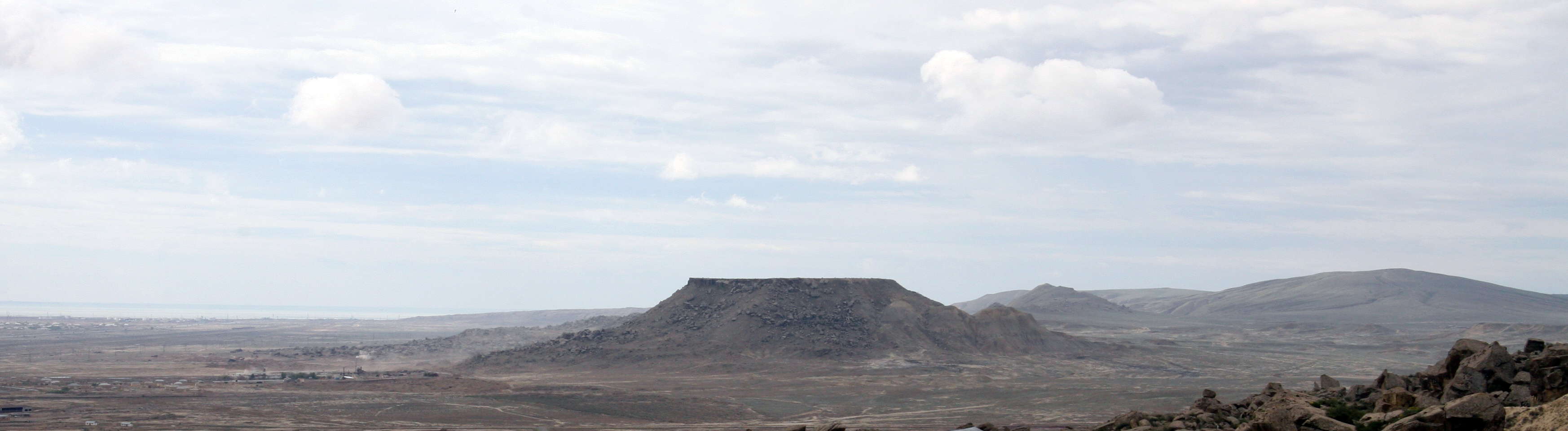
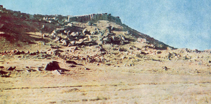
Gobustan panorama, showing the typical landscape of the area.
Photo: Maris Teteris via Panoramio

Sketch map of the area and the locations of various artworks.
Photo: hasan67 via Panoramio.
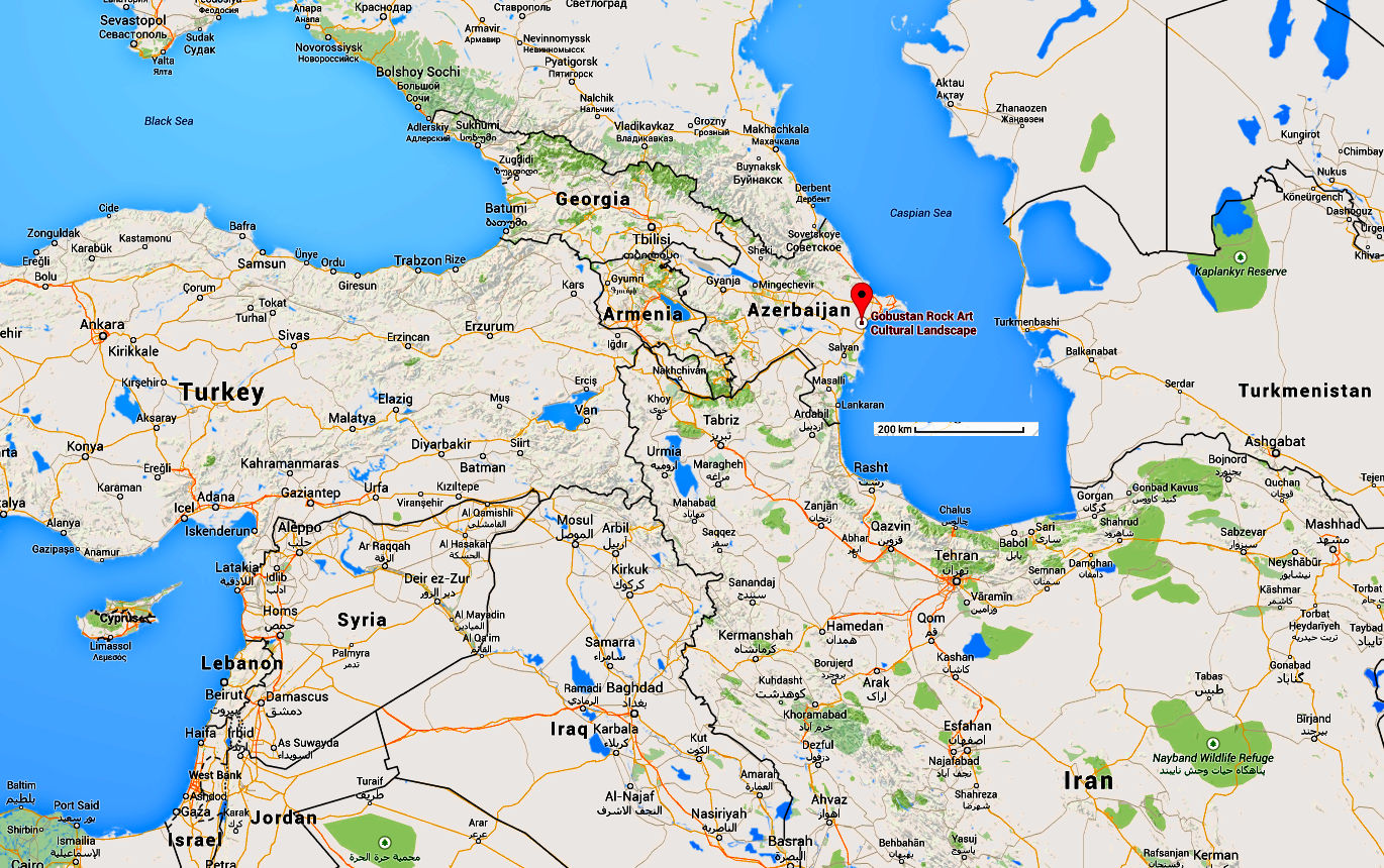
Location of Gobustan.
Photo: Google Maps
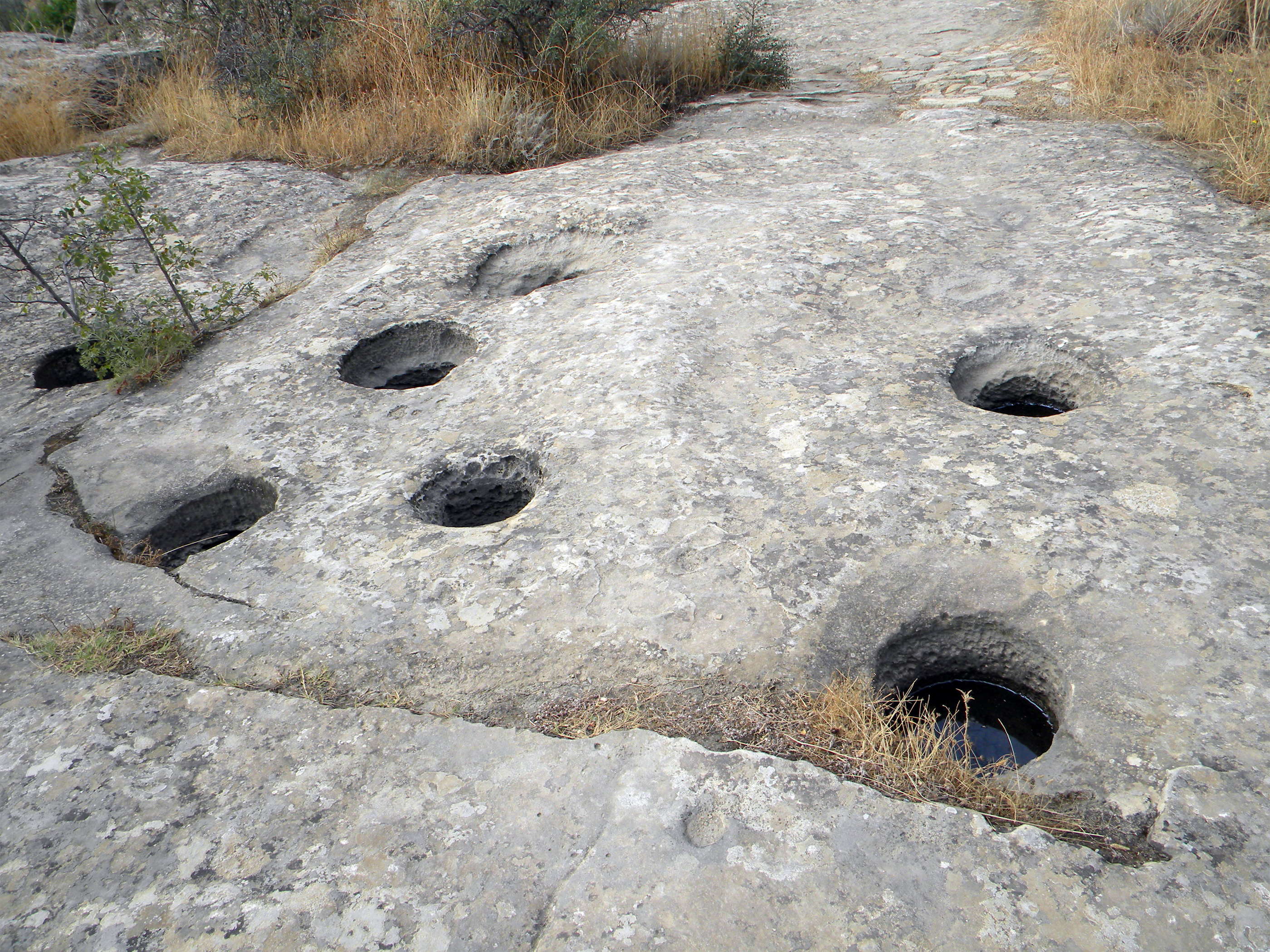
Cupules at Gobustan. It would be interesting to know what purpose they served.
According to the UNESCO office in Moscow, they are a form of prehistoric art found on megaliths and isolated stone boulders. They have a size of 20-100 mm diameter by 30 mm deep and date back to Neolithic or Bronze Age (5600-3500 BP).
Photo: Dimit via Panoramio.
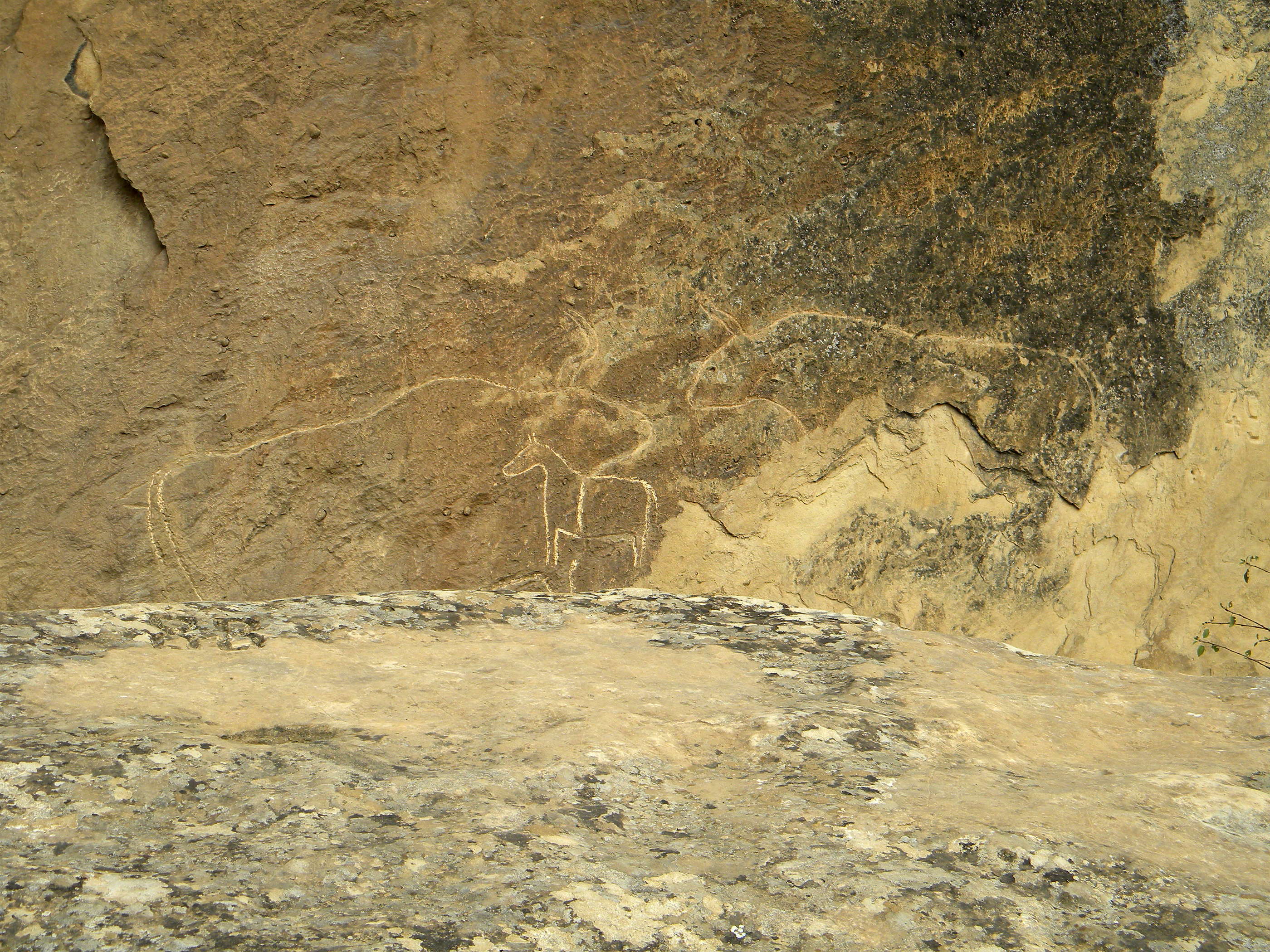
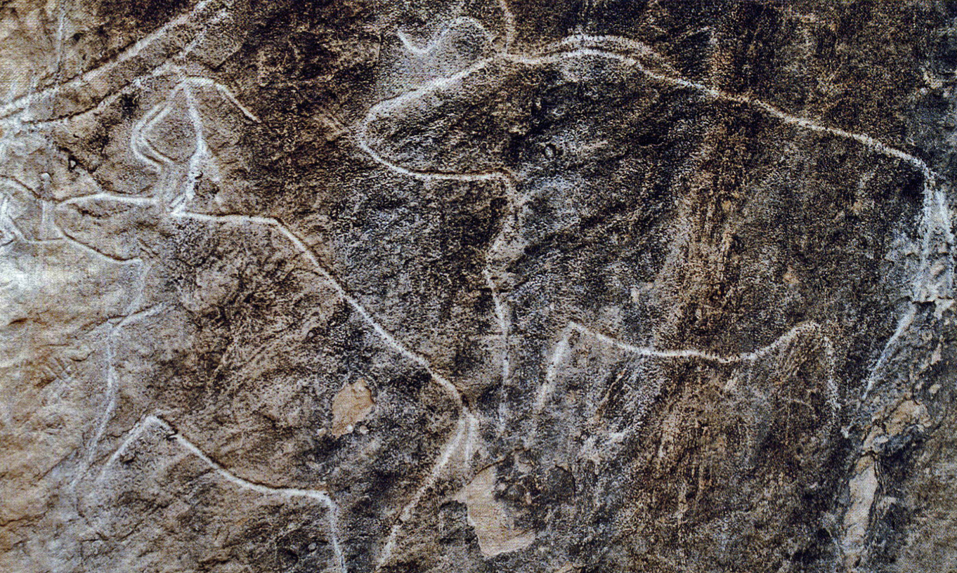
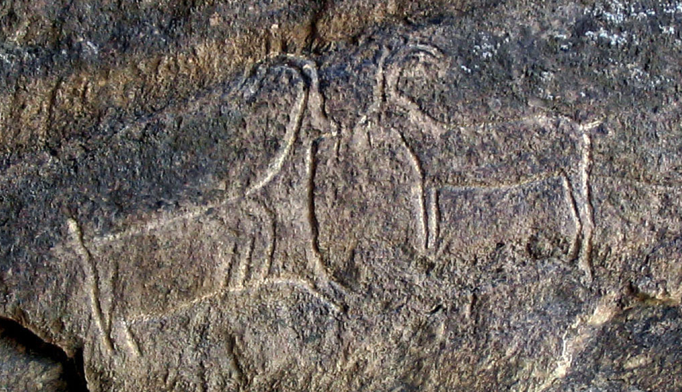
Two aurochs and a horse.
It would be interesting to know the date of the outline of the horse. It looks as though it is later than the aurochs, and appears to have a saddle girth marked, although this could simply be part of the original drawing of the aurochs, incorporated into the engraving of the horse.
Photo: Dimit via Panoramio.
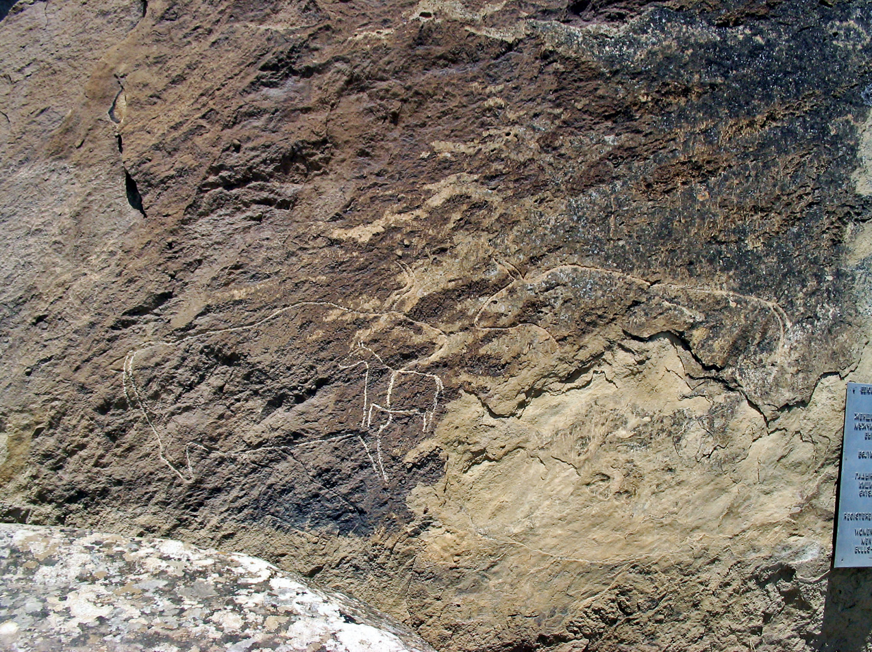
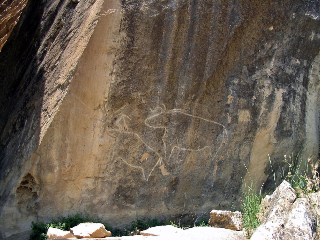
Aurochs and horse, as above.
Photo: Ibragimov (2012)
The most likely origin for Jean Auel's version of the Sharamudoi boats, from the Earth's Children series of books, is in Azerbaijan, on the ancient shores of the highly expanded Caspian Sea. At that time, (? 10 000 - 8000 years ago?) the greatly expanded Caspian and Black Sea were joined by a wide strait.
Since the area is today very flat, apart from the low hills which rise from the plains and on which the petroglyphs have been carved, it is likely that the shores would have provided an ideal area for the growth of huge areas of reeds, ideal for boat building.
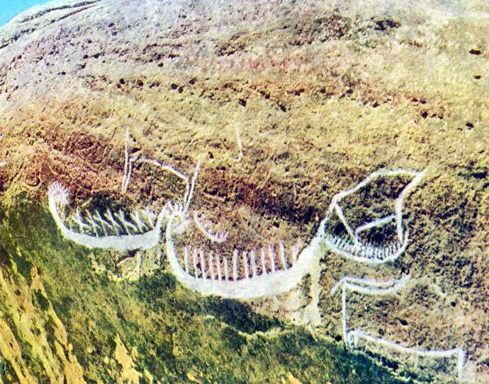
At a site dated to around 5000 - 8000 years BP, at a place called Gobustan, there are paintings or etchings (petroglyphs) of what appear to be long boats in the style of the Viking ships of more recent times. Thor Heyerdahl is convinced that people from the area went to Scandinavia in about 100 AD and took their boat building skills with them, and transmuted them into the viking boats we know from digs in Northern Europe.
Carvings of reed boats at Gobustan that attracted Norwegian explorer Thor Heyerdahl to visit the site.
Photo:
www.azer.com/aiweb/categories/magazine/
62_folder/62_articles/62_gobustan.html
Petroglyphs in the National Park Gobustan in Azerbaijan. These ancient rock carvings date back to 12 000 BP and they indicate a thriving culture. It is a UNESCO World Heritage Site considered to be of 'outstanding universal value'
Photo: Azeri, July 2011
Permission: This file is licensed under the Creative Commons Attribution-Share Alike 3.0 Unported license.
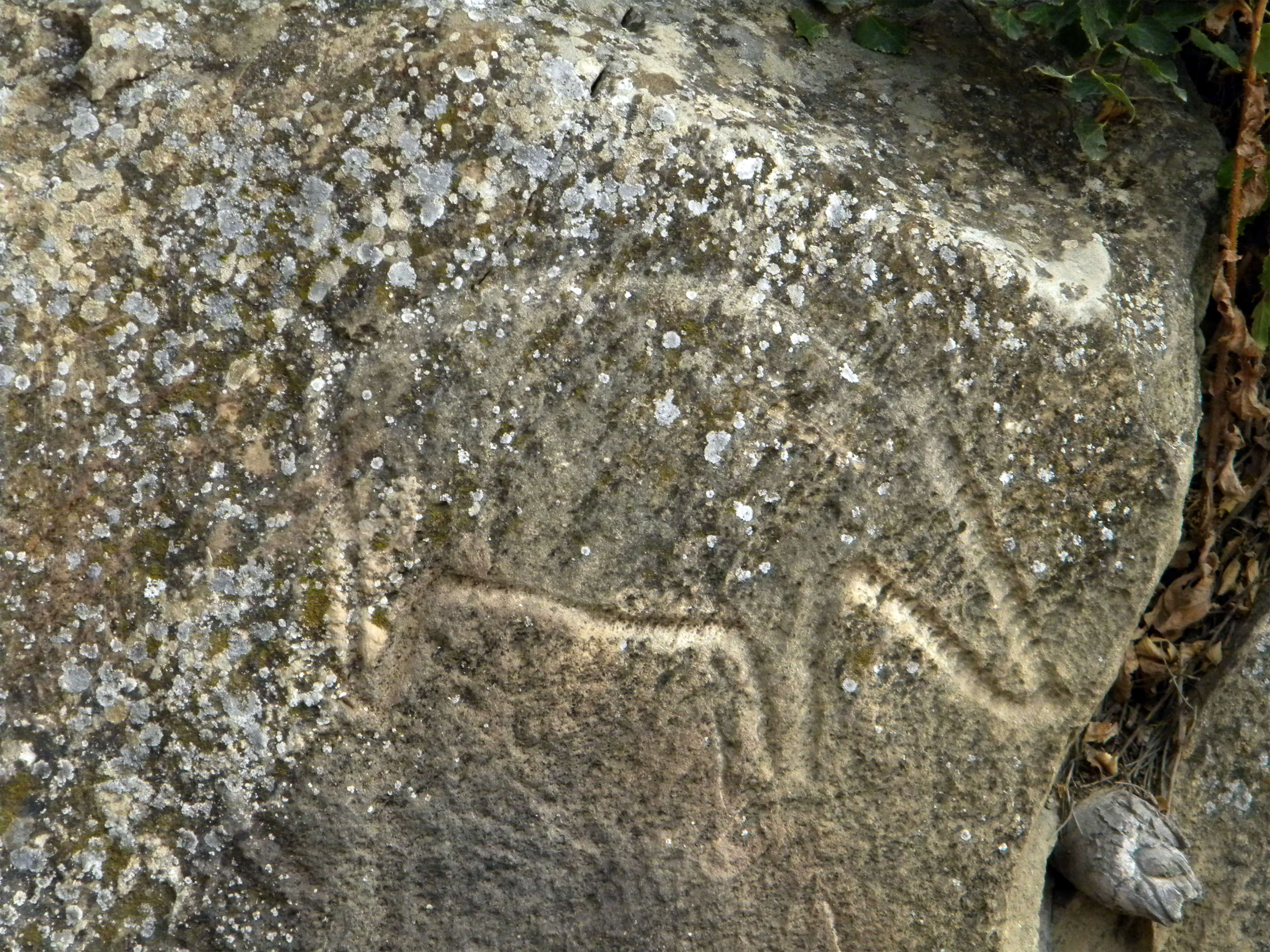
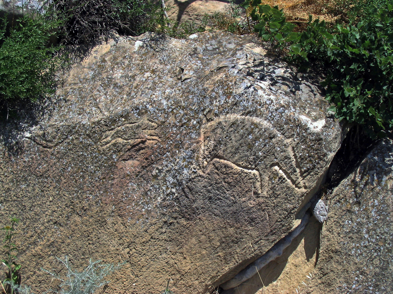
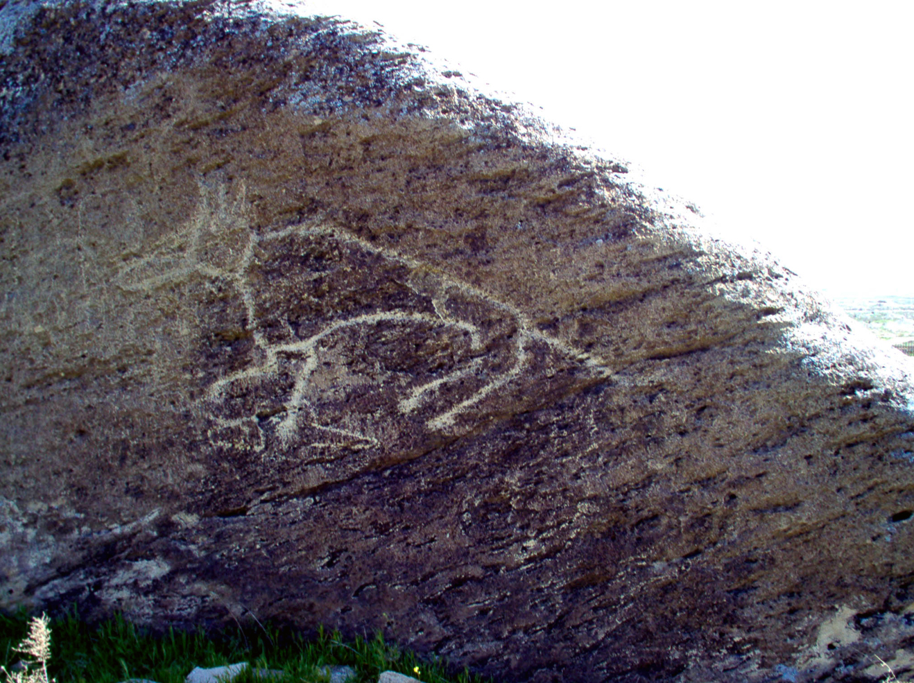
Animal, possibly a horse, pecked out in outline.
Photo: Dimit via Panoramio.

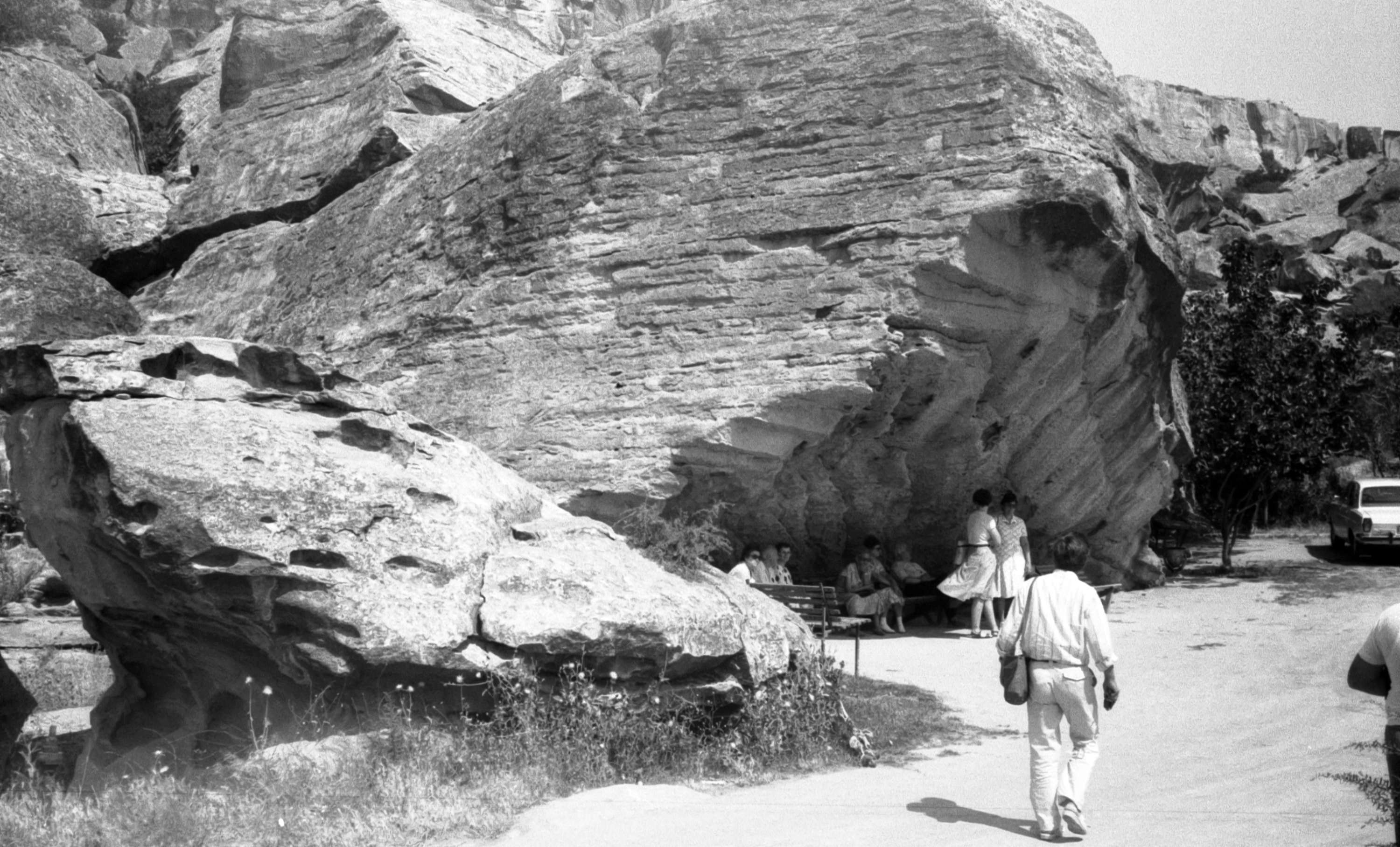
Entrance to Qobustan Petroglyph site, Azerbaijan
Photo: Kristian Ellis Wood
Permission: This file is released into the Public Domain
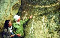
There are a number of images here, the most prominent being two human figures and an aurochs.
High on the left side of the centre of the image, above the large aurochs, is a goat (or ibex) and a long necked animal.
Photo: Dimit via Panoramio.
Gobustan Petroglyph site, Azerbaijan, 1987.
Permission: This file is licensed under the Creative Commons Attribution-Share Alike 3.0 Unported license.

Aurochs carved into the rock at Gobustan.
Заповедник Гобустан - Древние наскальные рисунки (Gobustan Reserve - ancient rock carvings).
Photo: Руслан Внедорожный via Panoramio.
Aurochs engravings.
Photo: Ibragimov (2012)
Aurochs engravings.
Photo: Ibragimov (2012)
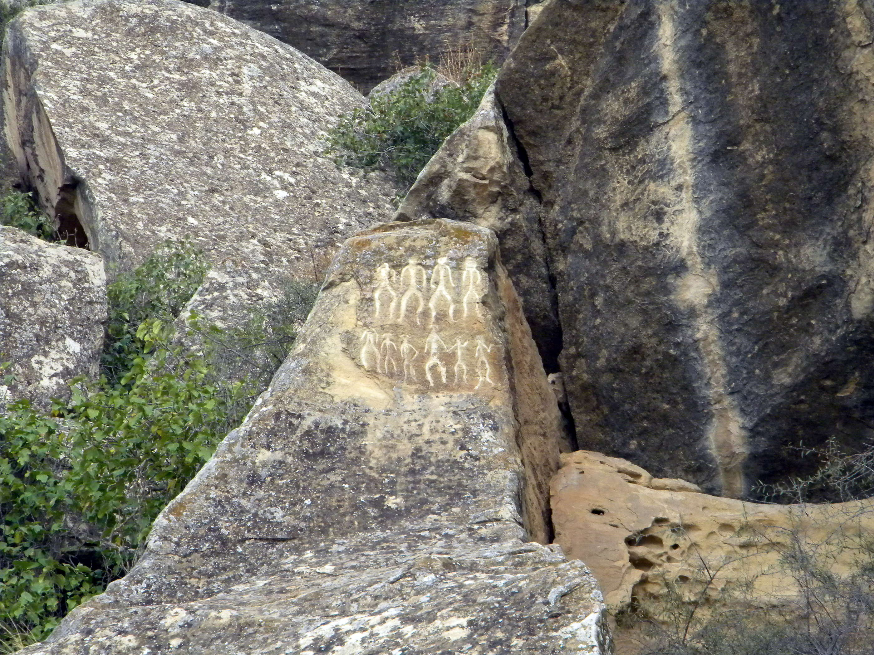
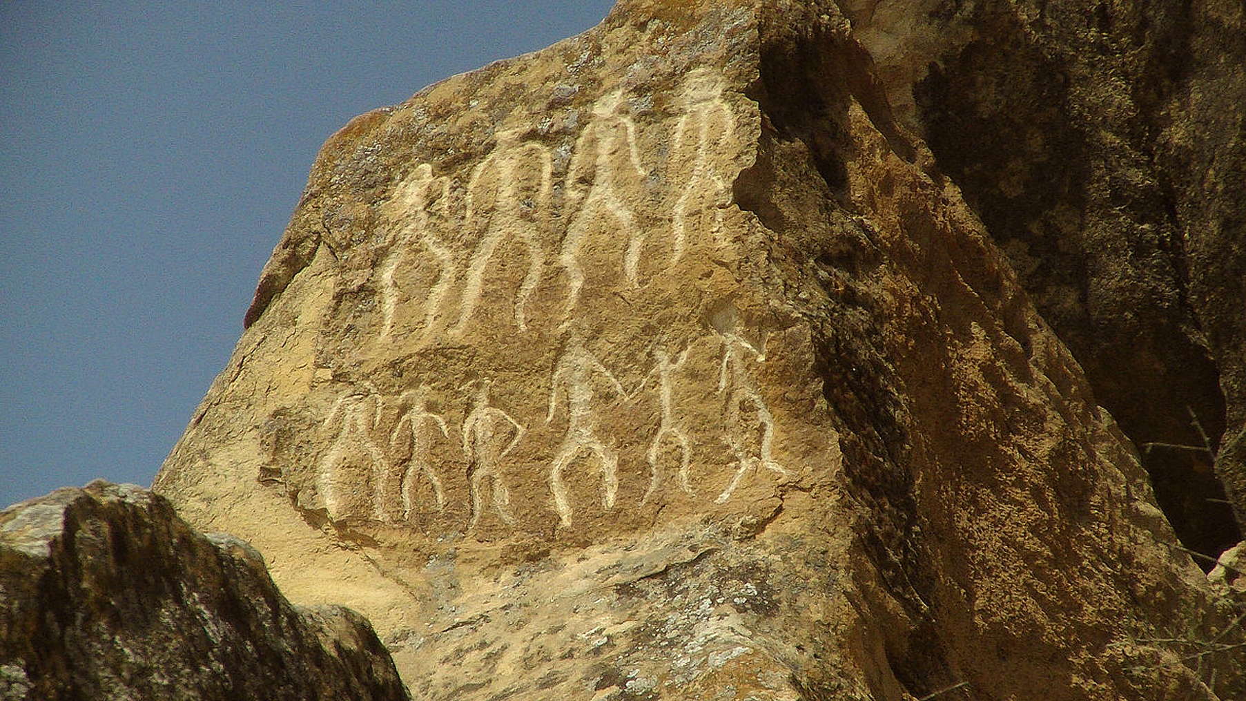
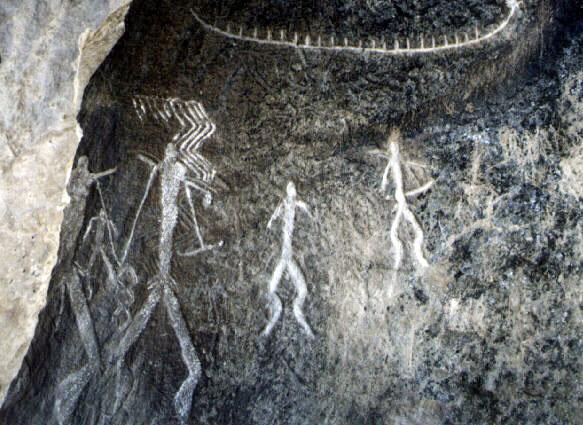
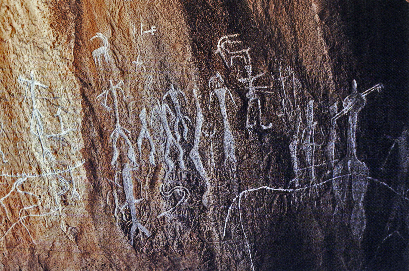
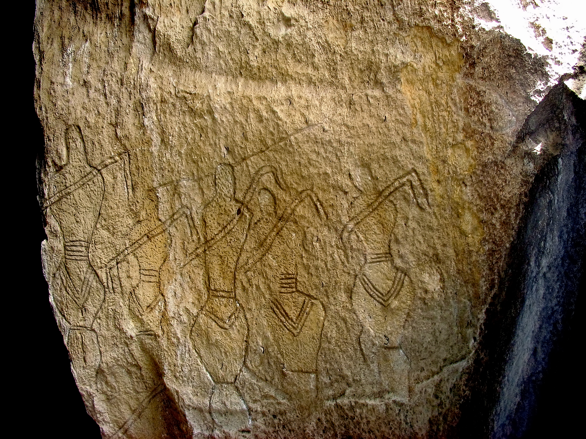
Dance scene at Gobustan.
Photo: Dimit via Panoramio.
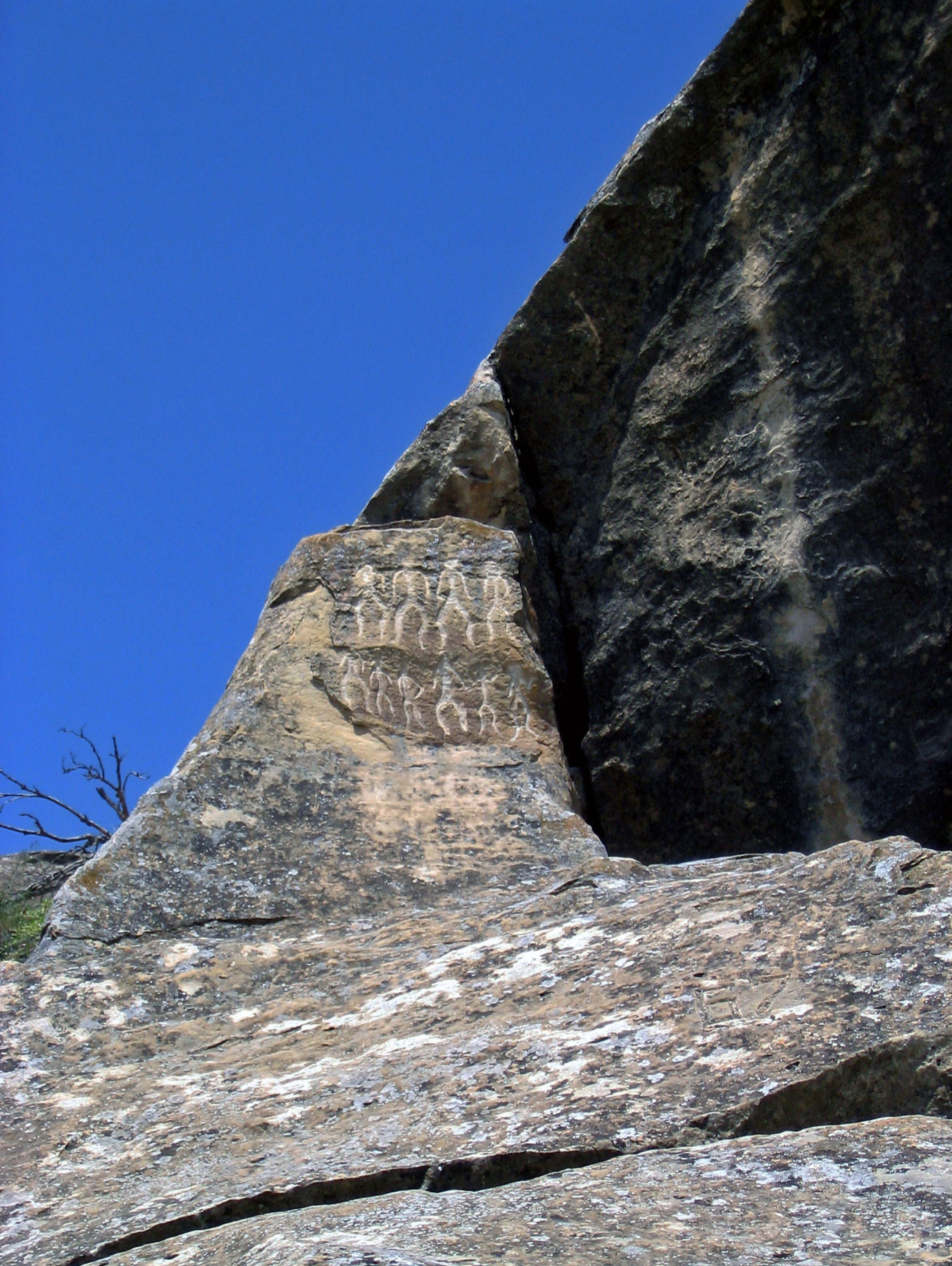
Dancing male figures, as above.
Photo: Ibragimov (2012)
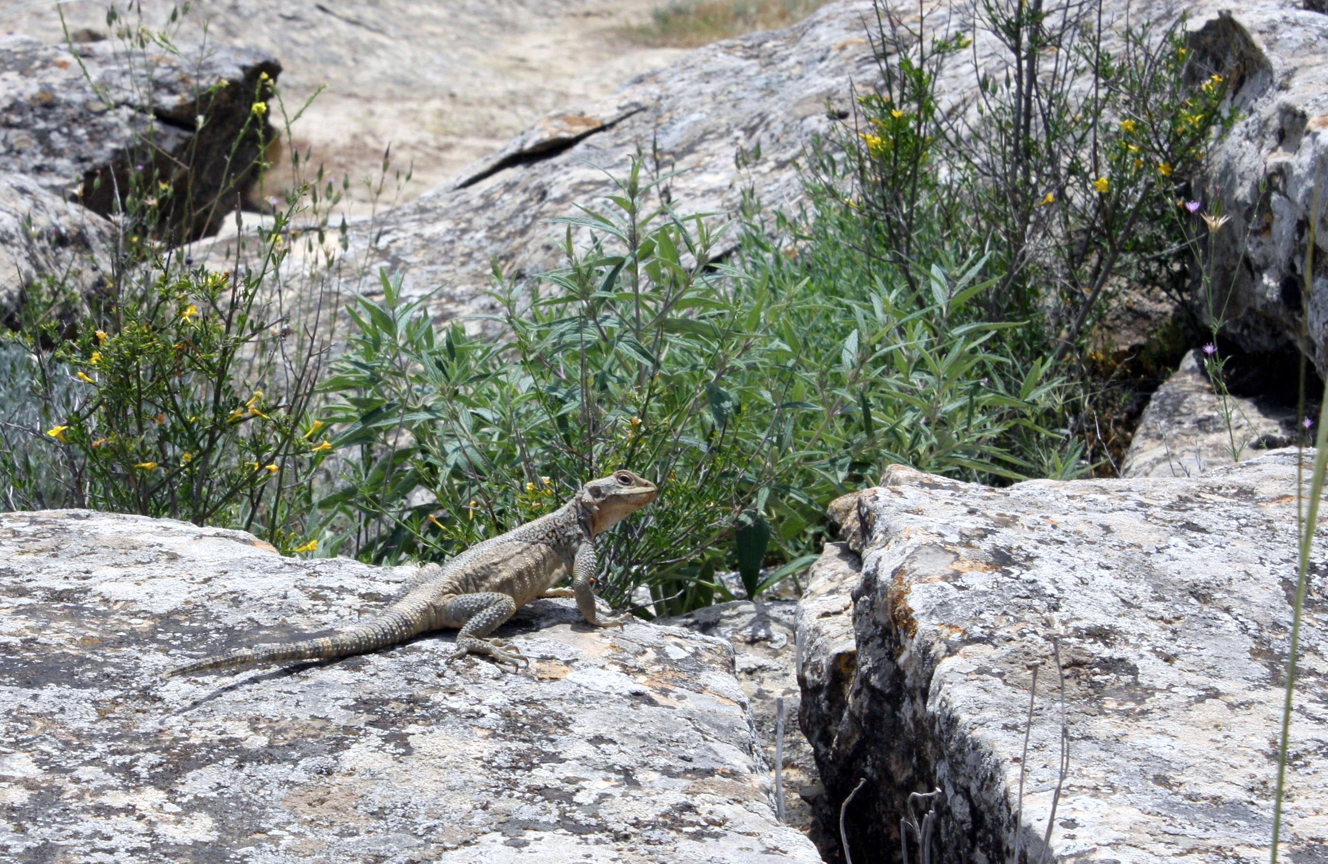
The rocks provide ideal habitat for lizards.
Photo: Rafael Dostali-zada via Panoramio.
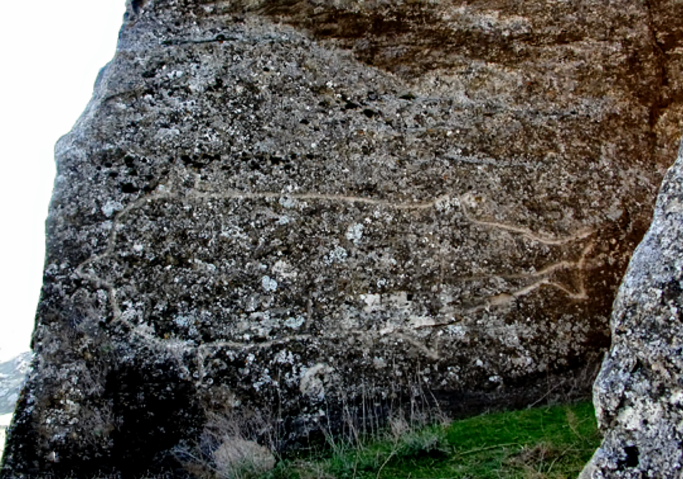
Engraving of what might be a boar, at Gobustan.
Photo: Dimit via Panoramio.
Horse and rider.
Photo: Ibragimov (2012)
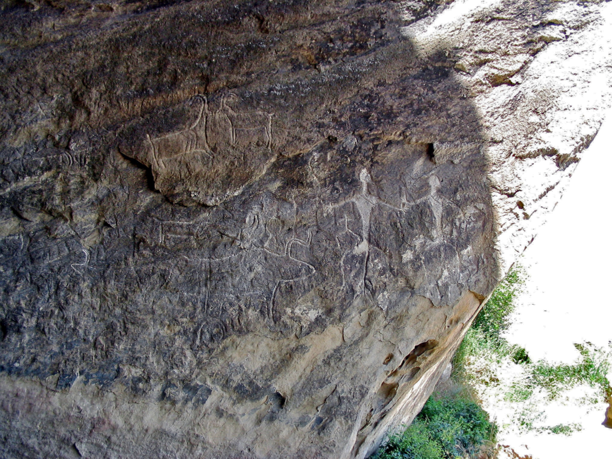
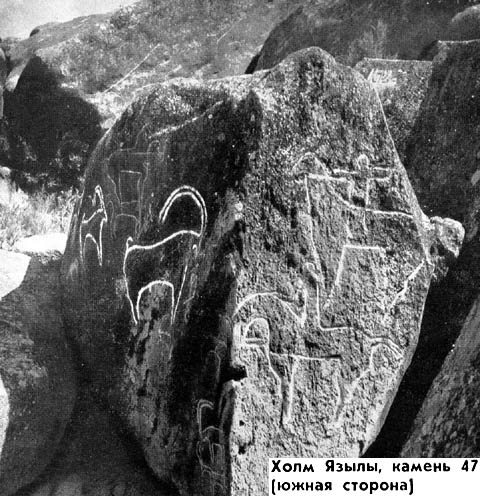
Aurochs, ibex/goats, dancers.
Photo: Ibragimov (2012)
Close up of the ibex/goats above.
Photo: Ibragimov (2012)
Sow with young.
Photo: Ibragimov (2012)
The following is by Nigar Abbaszade, from the site
http://www.azer.com/aiweb/categories/magazine/62_folder/62_articles/62_gobustan.html
When I was just a kid in high school, our ancient history teacher took us to see the Stone Age petroglyphs at Gobustan. It wasn't far away-only 54 km southwest of Baku. I was amazed by the carvings I saw there-ancient peoples, goats, deer, boats and hunting scenes. The images made a deep impression on me and led me to do historical research about the "Magical Images in Ancient Art in Azerbaijan" for my Bachelor's degree at Baku State University in the Department of Culture and Art.
Carvings of people and a boat
Photo: http://home.cerge.cuni.cz/kadlec/98kavk/e98kavk.html

Dance scene with boat, as above.
Photo: Dimit via Panoramio.
Large fish, possibly a sturgeon.
Photo: Ibragimov (2012)
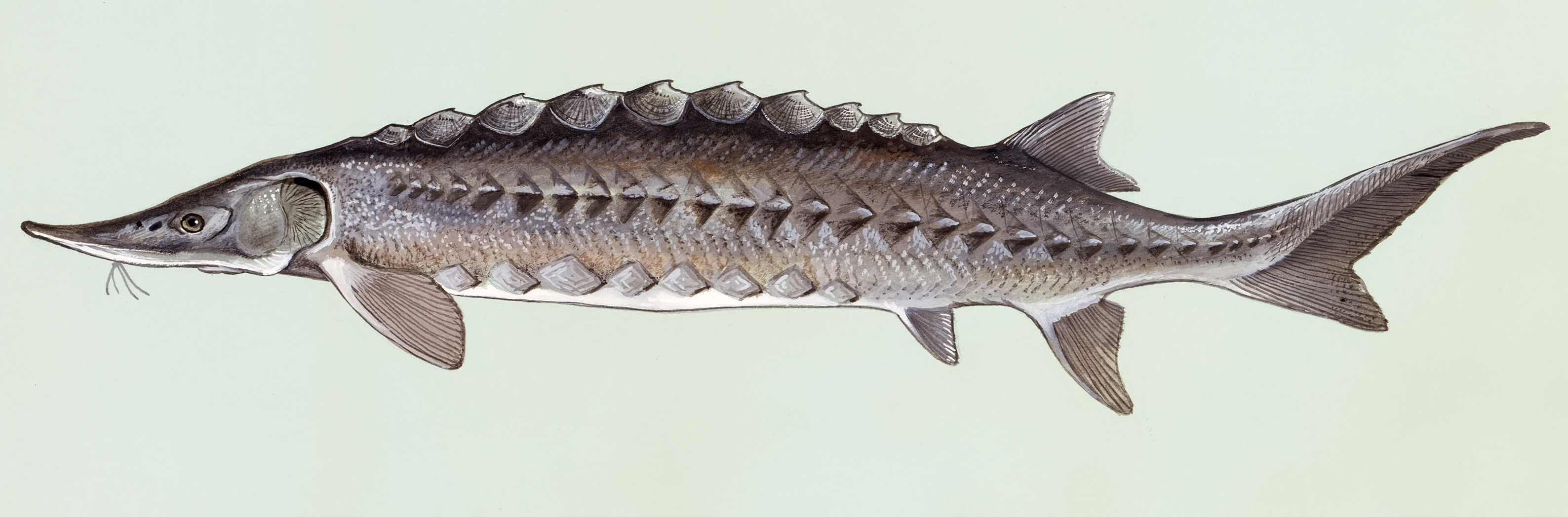
Atlantic Sturgeon, Acipenser oxyrhynchus.
Source: Scan of artwork commissioned by the Fish and Wildlife Service in the 1970's. Original art is kept at NCTC museum.
Permission: As a work of the U.S. federal government, the image is in the public domain.
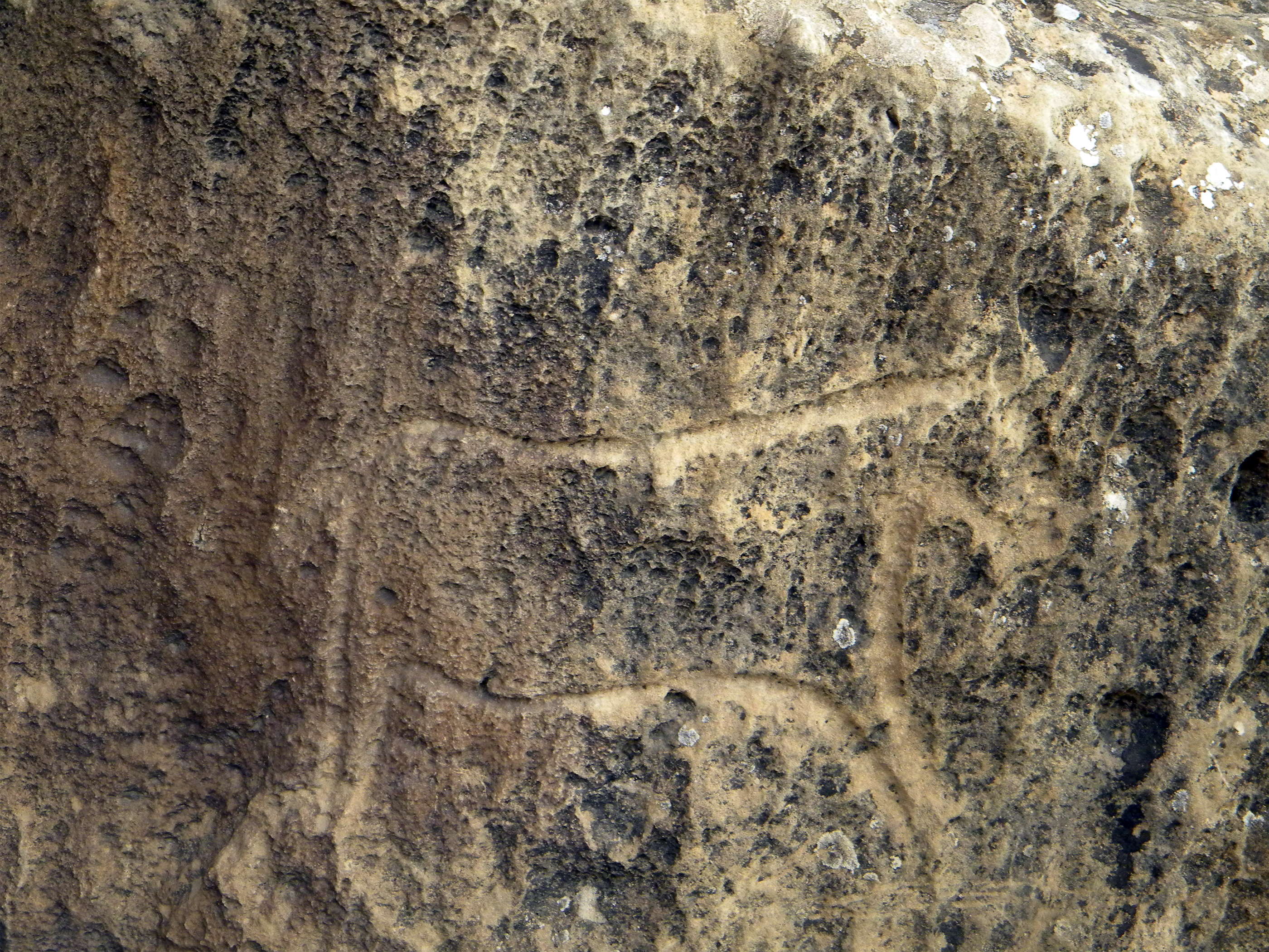
Aurochs and what may be an antelope.
Photo: Dimit via Panoramio.
Standing man, with arms outstretched.
( Note that the engraving has been enhanced for greater visibility with whitewash or similar - Don )
Photo: Ibragimov (2012)
Dancers, and Ibex.
Photo: Ibragimov (2012)
Female dancers and a stick figure.
Photo: Ibragimov (2012)
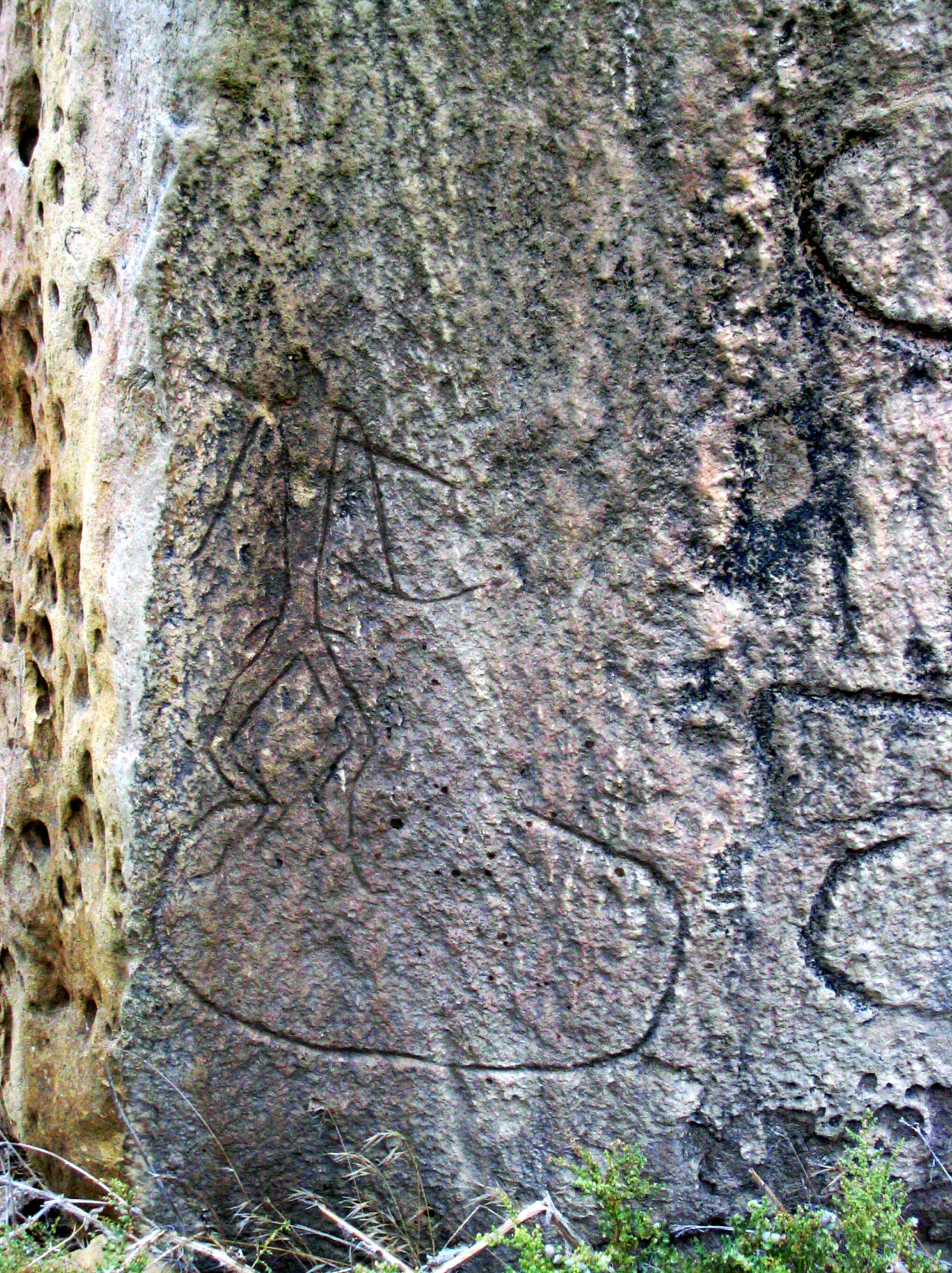
Canine (?)
Photo: Ibragimov (2012)
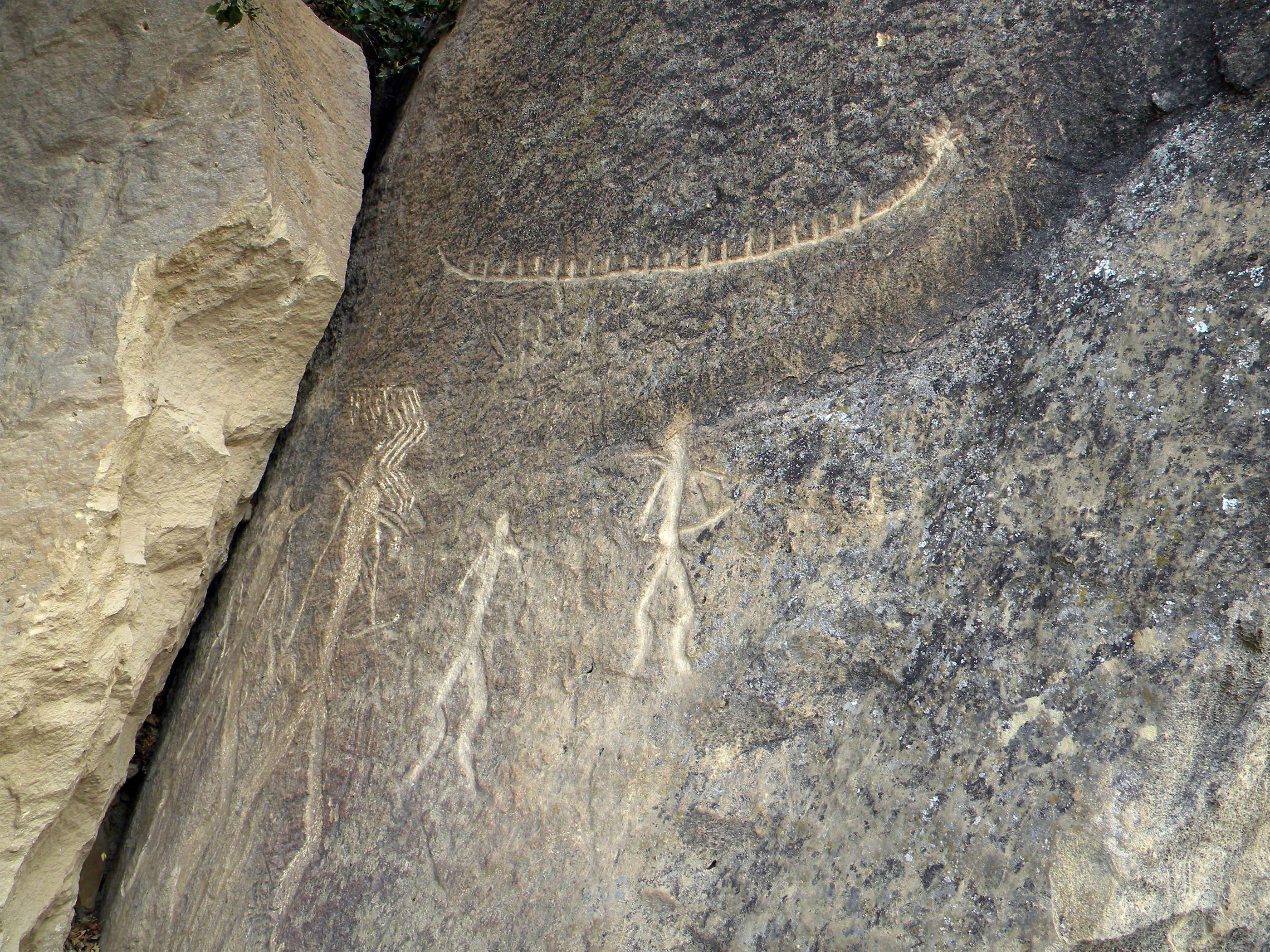
Man with a bow.
Photo: Ibragimov (2012)
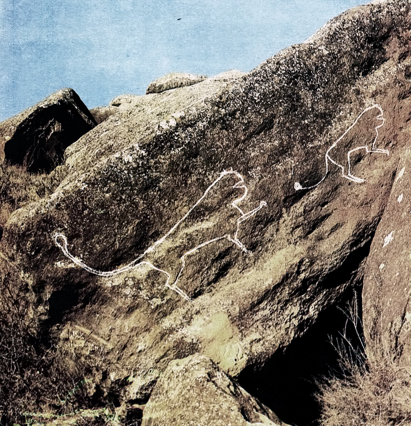
Felines, probably lions.
Photo: Ibragimov (2012)
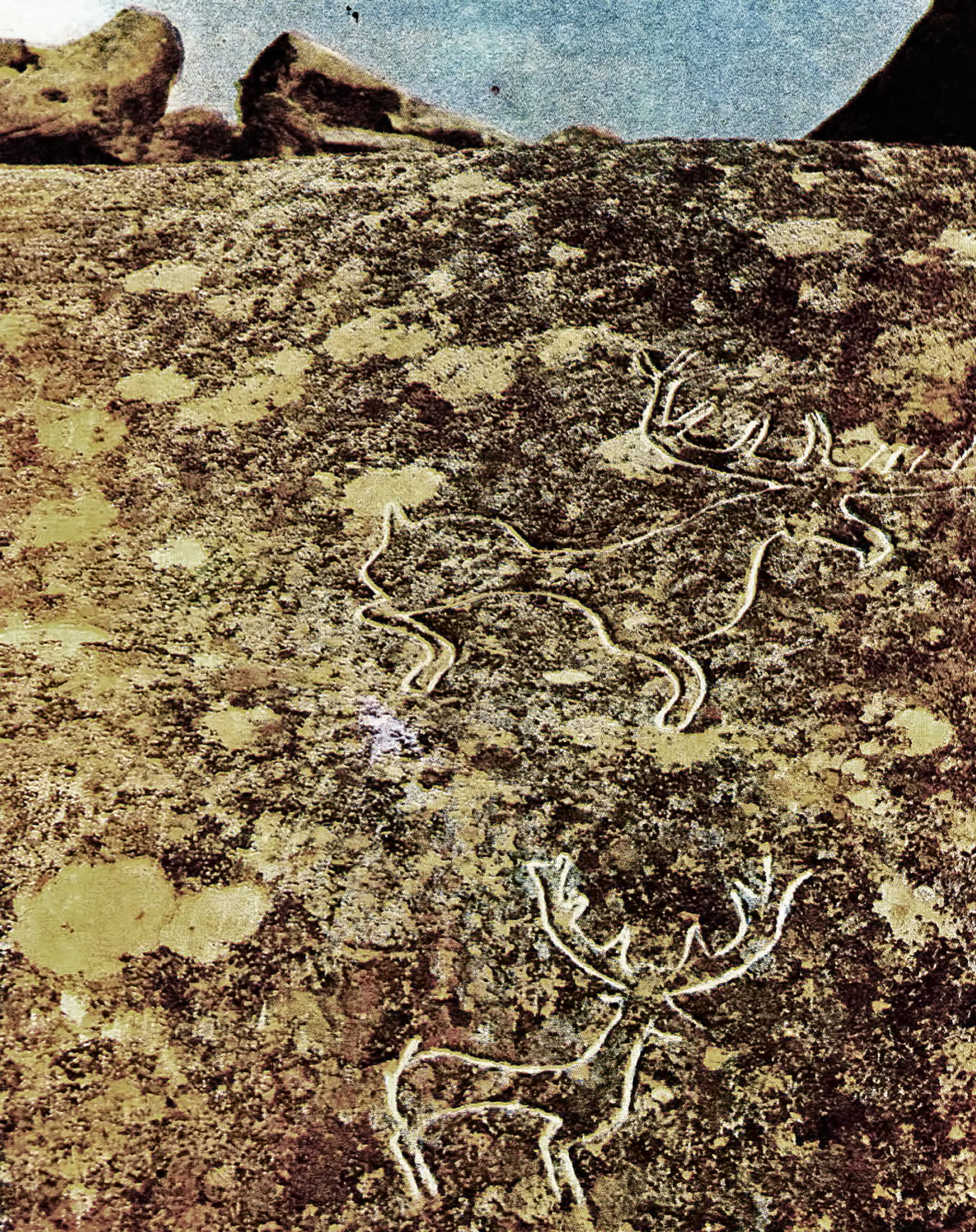
Stags.
Photo: Ibragimov (2012)
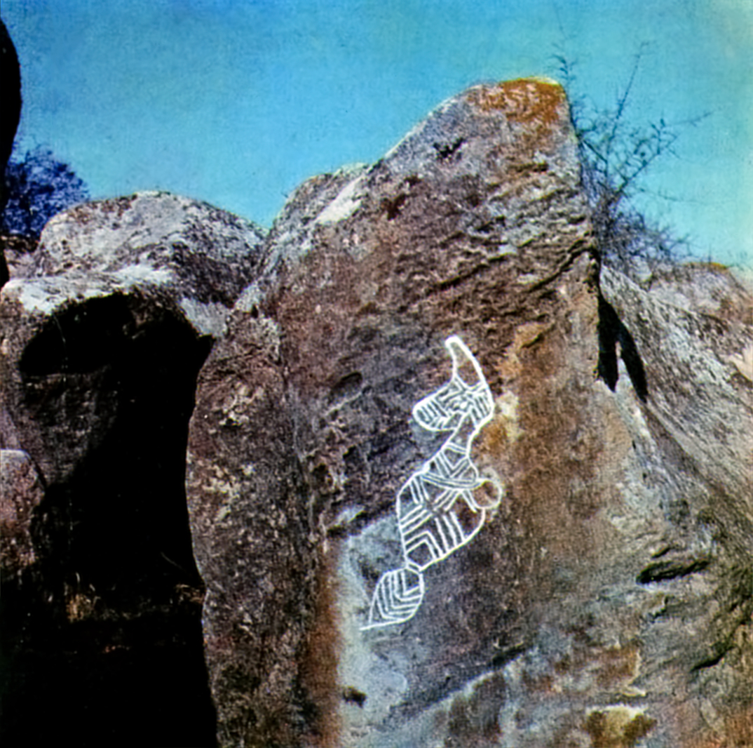
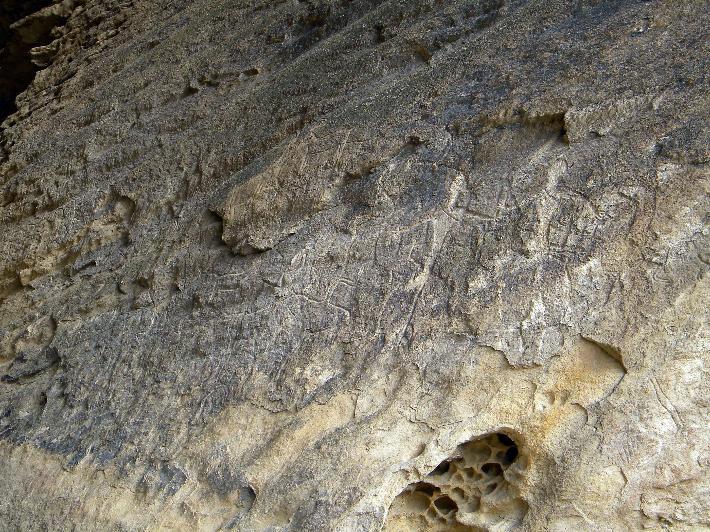
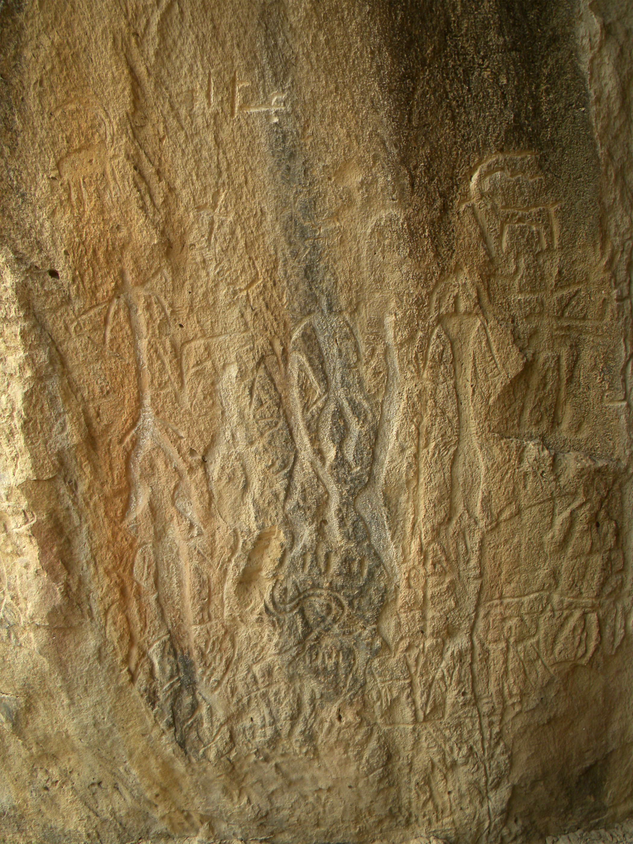
Anthropomorphic design.
( Note that the design has been artificially enhanced, either by tracing out the petroglyph on the rock itself, or later on the photographic image - Don )
Photo: Ibragimov (2012)
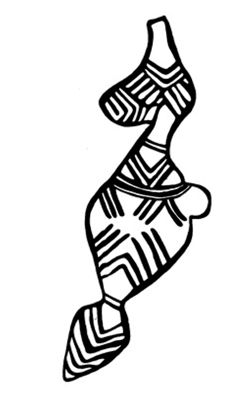
Anthropomorphic design, as above.
Photo: Ibragimov (2012)
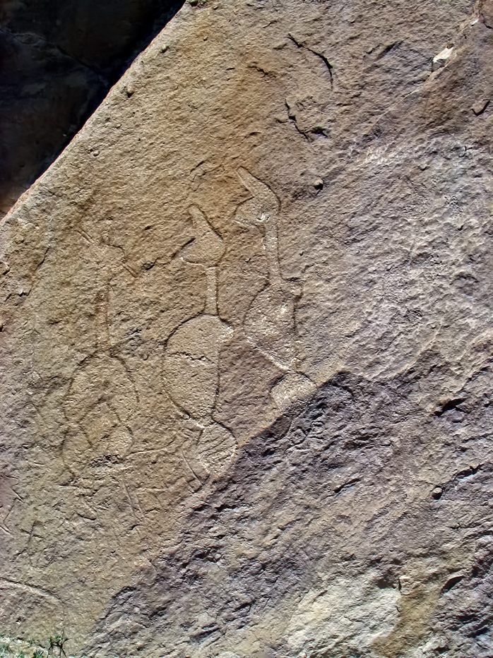
Stylised human figures, in the same format as the above.
Photo: Ibragimov (2012)
Discovery of Gobustan
The petroglyphs of Gobustan were not discovered by an archeological expedition. In fact, their revelation came about quite by accident. In the 1930s, work was going on there in a stone quarry. The area is full of huge boulders and rock formations. One of the quarry workers noticed some unusual carvings on the rocks. The more the rocks were cut out, the more the paintings could be seen. (Before they had been hidden from view inside a huge pile of boulders.) Even more paintings were found inside what appeared to be man-made caves. Work at the quarry soon stopped so that the paintings could be examined more carefully.

In 1939, archeologist Isaak Jafarzade began the first archeological investigation of the petroglyphs at Gobustan. Between 1940 to 1965, teams identified and documented approximately 3,500 individual rock paintings on 750 rocks. The most ancient petroglyphs have been identified as belonging to the 12-8th century B.C. However, it is assumed that life existed here even earlier and that Gobustan was one of the cradles of civilization. This research was published in a book entitled "Gobustan" in 1973.
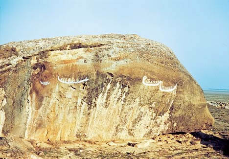
Photo: http://www.azer.com/aiweb/categories/magazine/82_folder/82_articles/82_heyerdahl.html
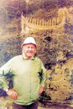
Photo: http://www.azer.com/aiweb/categories/magazine/82_folder/82_articles/82_heyerdahl.html
From:
http://geo.ya.com/travelimages/az-gobustan.html
Caves and rock outcroppings surround this village, whose name can be translated as "ravine land". The spurs of the Great Caucasus Range descend to the Caspian along the Djeirankechmez river. Settled since the 8th millennium BC, the area contains thousands of rock engravings spread over 100 square kilometres depicting hunting scenes, people, ships, constellations, animals, etc.
Click on the photo for a larger version.
Photo: Caferzade (1973)
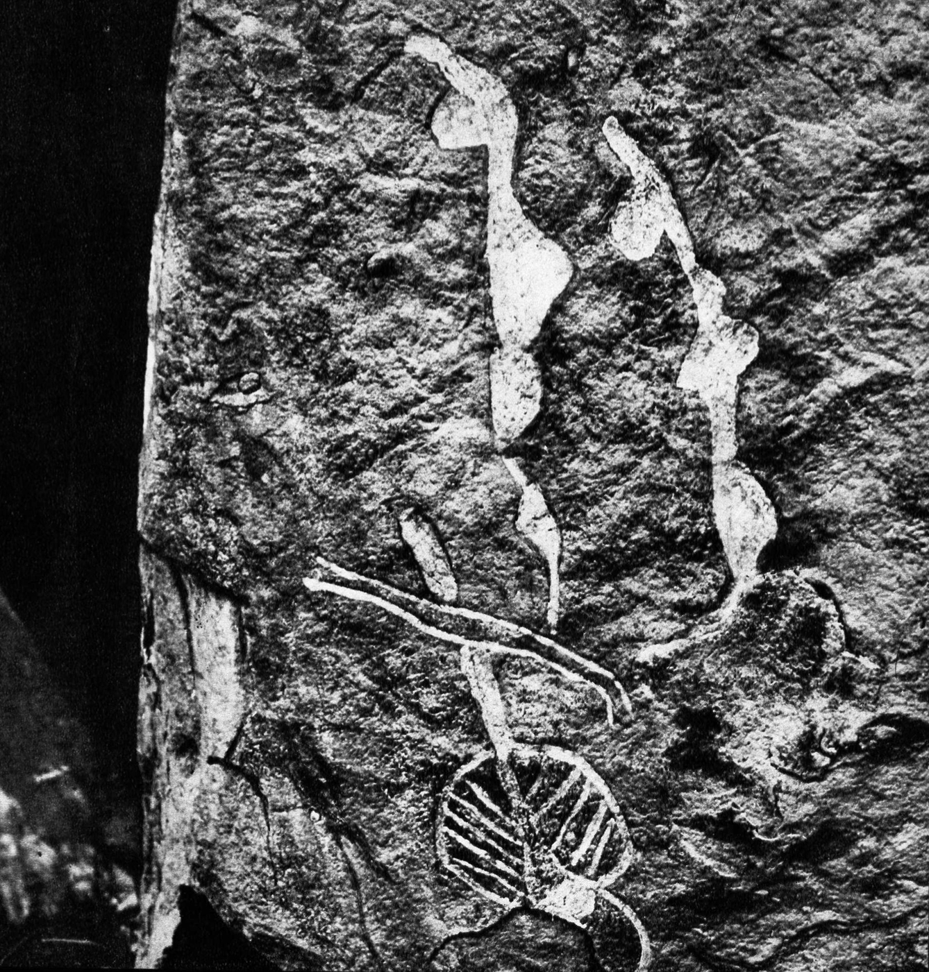
Engraving of a boat, men and some signs
Photo: Dimit via Panoramio.
This dance scene overlies, or is overlain by, other images, possibly animals. The horns and head of an aurochs are visible at the bottom of the image.
Photo: Dimit via Panoramio.
View across the plain from Gobustan.
Photo: Maris Teteris via Panoramio

Two figures, possibly human with tall hairstyles or hats.
Photo: Dimit via Panoramio.
The oldest petroglyphs date from the 12th century BC. Later, the European invaders also left their marks: inscriptions left by Alexander the Great's cohorts in the 4th century BC and 2,000-year-old graffiti written by Trajan's Roman legionnaires! Should you want to get the perfect photos as seen on the postcards, the trick is simple: fill the carvings with toothpaste.
The petroglyphs of Gobustan were discovered accidentally by quarry workers only in the 1930s. In addition to the rock carvings, traces of Mesolithic period occupation are to be seen, with numerous burial mounds and graves, the most interesting at Firuz, where eleven skeletons were found. Don't miss the Gaval-Dashy, a resonant stone that rings like a gong when struck.
The local museum adjacent to the site houses the ornaments, flints, shells, ceramics, beads and primitive tools that were found inside the caves - often objects of non Caspian origin, evidence of links with Europe and the Indian sub-continent. At the museum you can also recruit the services of a guide.
Based on the archeological finds and on content of the petroglyphs, recently it has be theorized that a connection exists between the ancient Azeris and the peoples of Scandinavia, which is not surprising at all, since some of the original habitants of the region, the Medes, were not a Turkic people, but an Indo-European people.
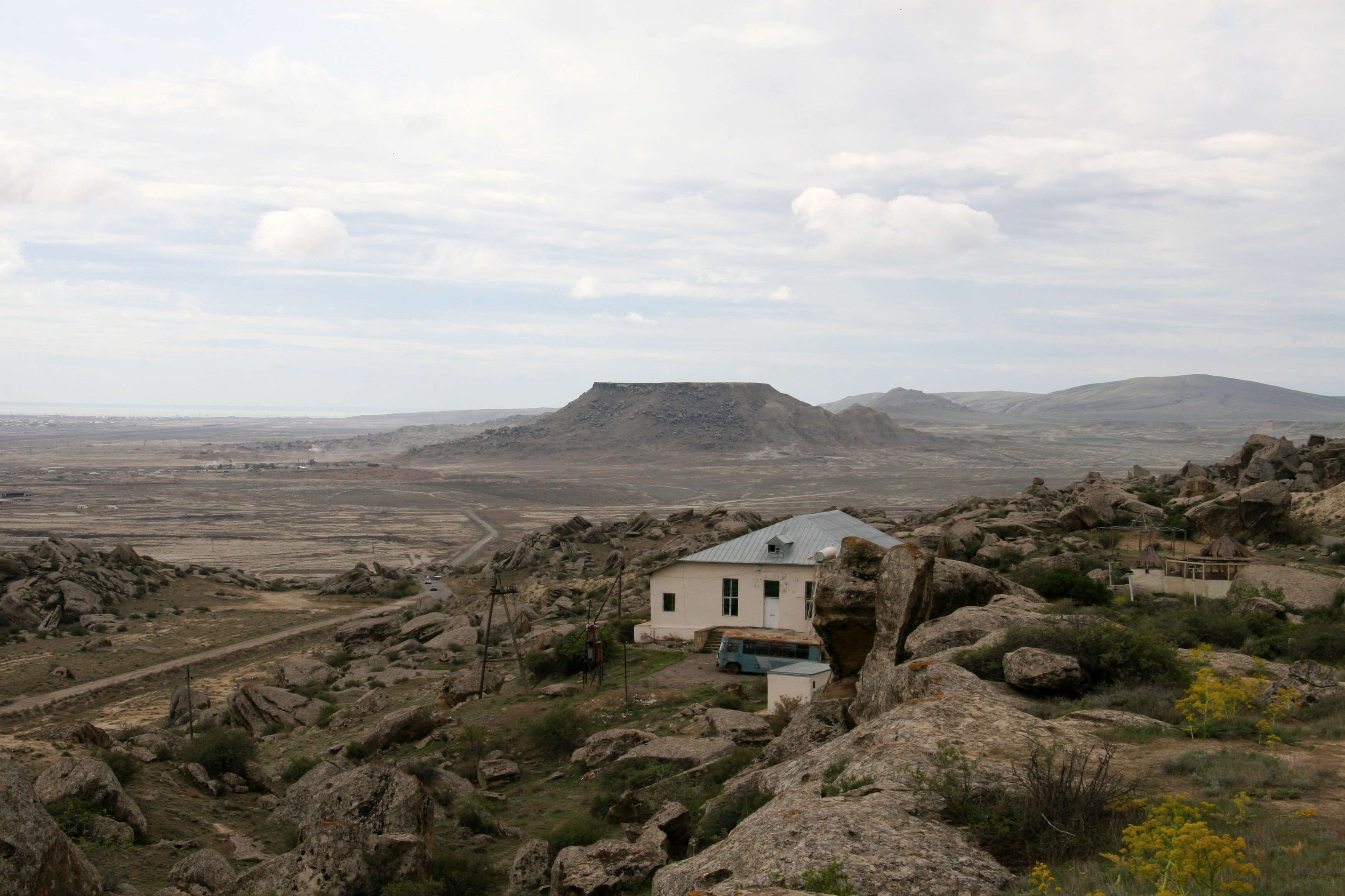
Besides being famous for the petroglyphs the Gobustan are also has some amazing landscape, particularly an area filled with mud volcanoes, which provide a quasi-lunar horizon. You can find the most spectacular mud volcanoes about 7km south of Gobustan near the road to Alat.
If you are travelling from Baku you can reach Gobustan on the bus to Alat. The main petroglyphs site is about 5km west of Gobustan itself, after the jail. Plan your journey carefuly as currently there is no hotel in Gobustan!
(60 km southwest of Baku)
From:
http://www.azer.com/aiweb/categories/magazine/61_folder/61_articles/61_sixties.html
The Gobustan cave dwellings were inhabited at least 5,000 years ago. Located about 30 minutes west of Baku, the cave features drawings of animals, people, dancers and reed boats. In the Sixties, rock drawings in Sakhara and Nepal were made known to the whole world through UNESCO [United Nations Educational, Scientific and Cultural Organization]. Azerbaijan became sensitive that the outside world had no clue about our own pre-historic drawings at Gobustan.
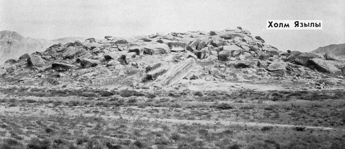
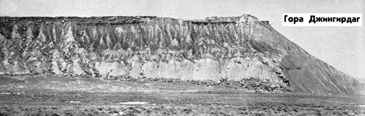
Gobustan National Protected Heritage Site is situated in the South, 60 km from Baku, with an area of 4400 ha. There are mountains of Boyukdash, Kichikdash, Jinqirdaq and Yazilidjte in the area of Heritage Site. Due to assiduity of the archeologists such as I.M. Jafarzade, D.Rustamova, F.M. Muradova and so on, from 1940 to nowadays about 6000 rock pictures were founded in Gobustan. As a result of archeological excavations 40 barrows and scientifically attributed 105 thousand subjects of material culture were found. Rock pictures were first found in 1939 by the archeologist Jafarzade.
Photo: http://irs.bak.net.az/3/gobustan.html
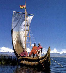
Photo: http://kota-mama.awc.co.uk/explore/reed/reed.html
Gobustan
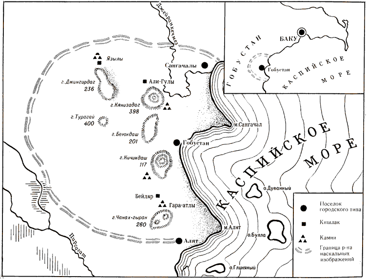
Gobustan occupies the south-eastern spur of the Great Caucasian Range and lies west of the Apsheron Peninsula in the basin of the Jeirankechmez between the mid-channel and lower reaches of two other river: the Pirsagat and the Sumgait. It is a monticulate semi-desert area dissected by numerous gullies and ravines. The climate of Gobustan is dry subtropical, the soil is clayey and partly salinized.
The first rock drawings in Azerbaijan were discovered in 1939-1940 in the southeastern part of Gobustan (Mts. Beyukdash, Kichikdash, and Jingirdag, and Yazily Hill) some 50 - 60 kilometres southwest from Baku in the vicinity of Sangachaly and Duvanny railway stations situated not for from the Caspian Sea. The mountains there are separate elevations straggling among mud volcanoes, which are called "pil-pile" by the local people. These volcanoes periodically erupted in ancient times throwing out millions of tons of mud and billions of cubic metres of combustible gases, which blazed up from every spark caused by a collision of flying stones. The sudden appearance of gigantic columns of flame, the deafening rumble, the clouds of smoke shading the daylight inspired the aborigines with awe and fear. These natural phenomena, which could not be explained in the remote past, favoured the emergence of many places of worship in this area. During the Middle Ages some of them were changed to the Moslem religion.
The upper plateau of Mts. Beyukdash and Kichikdash is covered by a bed of shell limestone 10 - 15 metres thick, which is characteristic of the Apsheron rocks. The upper plateau of Mt. Jingirdag is also covered by shell limestone but only 1-2 metres thick. In the course of ages these limestone beds fractured and split into fragments under the action of natural forces, atmospheric precipitation, wind, etc., and covered the slopes (predominantly eastern ones) and feet of the mountains dotting them with numerous large and small blocks and piles of limestone. During the same period of time big scarps about 10-15 metres deep occurred round the tops of Mts. Beyukdash and Kichikdash. Later the tops of these mountains were used by local inhabitants as natural traps when hunting. Piles of stones looking like huge labyrinths appeared in some areas among the "sea of rocks" giving the stranger a sensation of mysterious fear.
On the clumpy rocks one can see whimsical aeolian relief forms, hollow mushroom-like jointings, some of them with through openings, many of them even with smooth surfaces and lace and honey-comb patterns. They can all be rightfully regarded as classical specimens of geological and natural phenomena of this type.
It was here, in the area of this fantastic destruction of mountains, in the 'sea of rocks', sometimes under the heaps of stones (e. g. in the vicinity of Mt. Beyukdash) that some 20 under rock caves and rock shelters were formed, which could protect people from bad weather. Since time immemorial and up to the beginning of the 20th Century the local population used to cover the stone blocks near the caves and the walls of the caves with images of human beings and animals and various signs. They hollowed semispherical bowl-like depressions to collect rain-water and sacrificed blood, and chopped holes to tether domestic animals. Now some of these stones are covered with lichen, greenish-gray, sometimes with large reddish-ochre or silvery white patches, under which vague drawings are barely visible in the slanting rays of the sun.
The rock drawings in the area of Mts. Beyukdash, Kichikdash and Jingirdag and Yazily Hill have been studied since 1947. A colossal number of rocks were investigated. Some 750 of them revealed drawings and signs on their surfaces, which had been carved with stone implements and, sometimes, with metal tools. More than 3,500 drawings have been discovered and recorded.
Click on the photo for a larger version.
Photo: Caferzade (1973)
Click on the photo for a larger version.
Photo: Caferzade (1973)
Click on the photo for a larger version.
Photo: Caferzade (1973)
These rock drawings dating back to remote centuries suggest that the climate of Gobustan in the distant past was damp and close to subtropical. This is evidenced by the pictures of people wearing loin-cloths as being typical of the inhabitants of tropical countries, and also by the representations of bulls, deer, and pigs whose existence is impossible without perennial water reservoirs and rich pastures. Rainfall was heavy enough in those ancient times, rivers and springs abounded in water, the herbage of the area was rich and diverse. An abundance of food made it possible for countless herds of herbivorous animals to graze in the pastures of Gobustan.
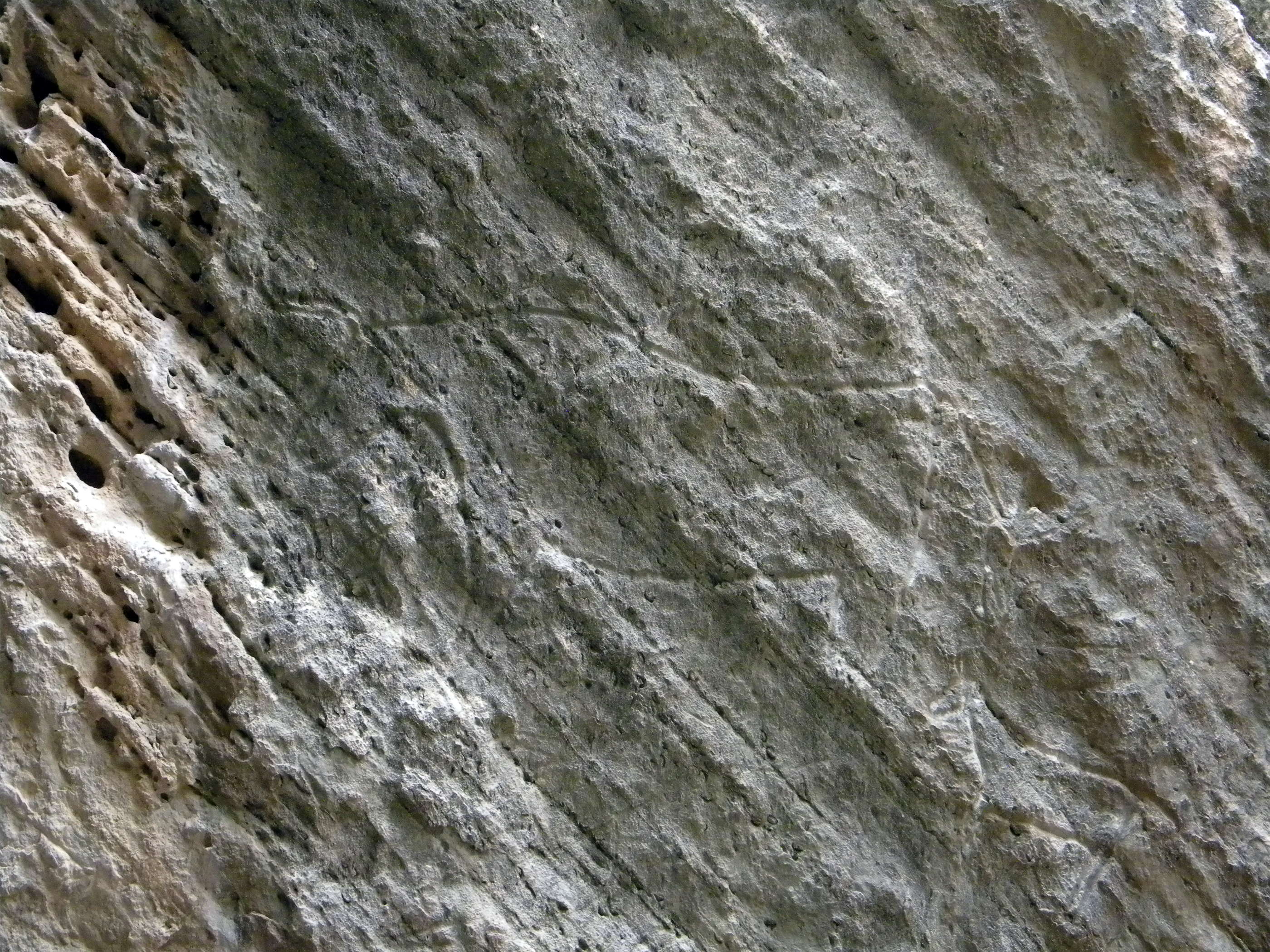
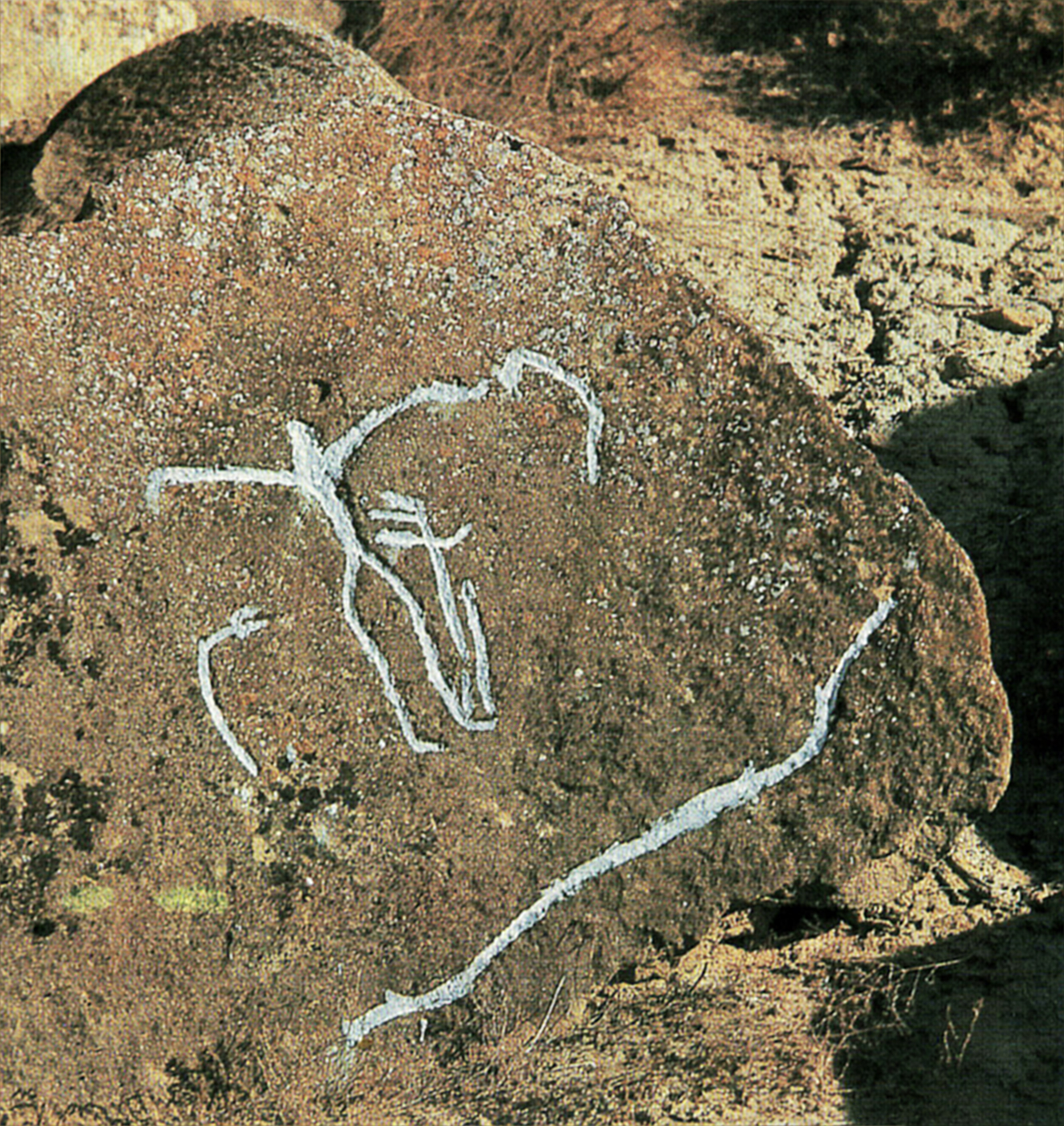
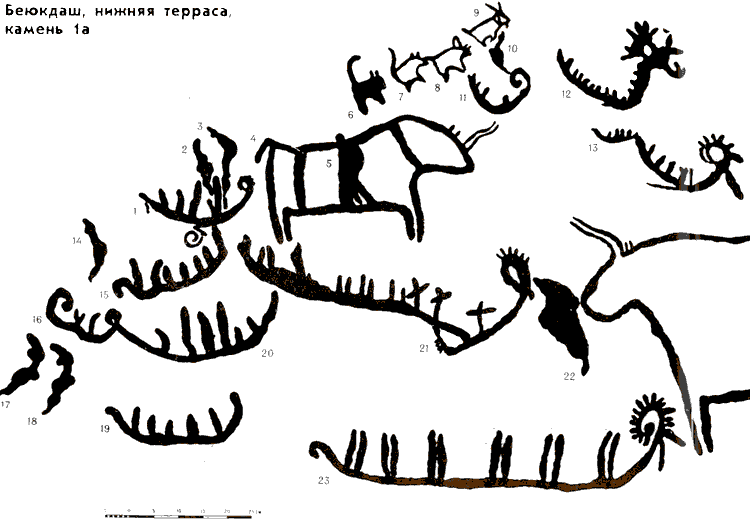
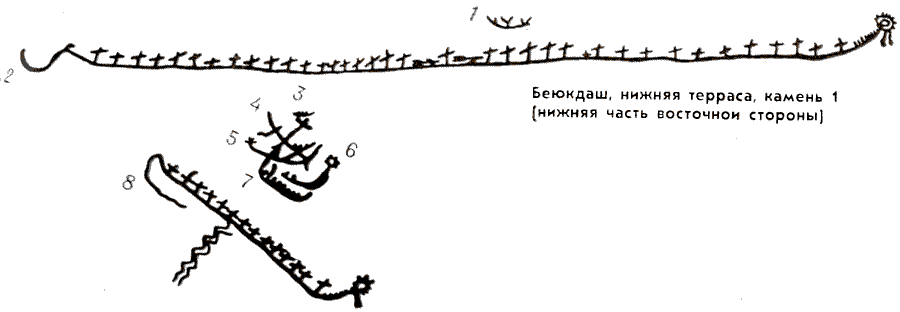
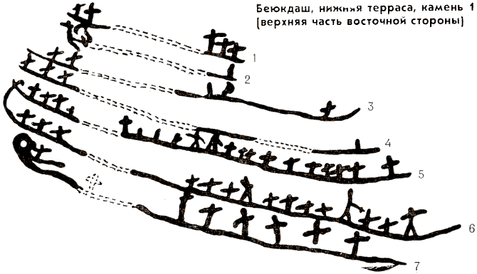
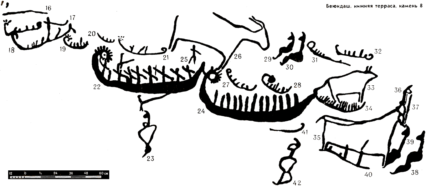
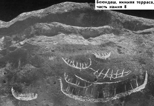
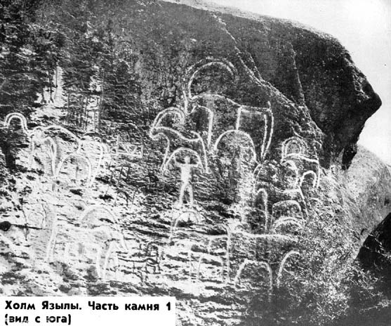
The rock drawings of Gobustan are very diverse as to their themes and content. Among them one can find pictures of human beings, wild bulls, deer, bezoar goats, lions, gazelles, horses, wild asses, some of them being nearly life-size. Some of the animals are of unidentified species. There are also drawings on some rocks, representing collective labour processes, reaping, sacrifice, hunting scenes, fighting goats, dogs chasing a wolf and a deer, lions attacking goats, abduction of women, battle scenes, camel caravans. Outline drawings of large sized fish were also discovered on the rocks.
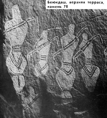
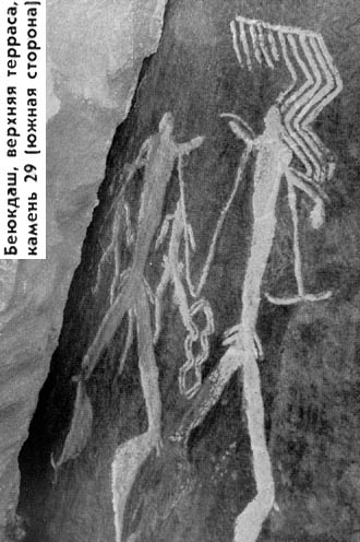
Dancing women at Bejukdash, stone 78.
Photo: Ibragimov (2012)
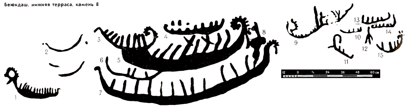
Quite a number of drawings represent boats with both armed and unarmed oarsmen and with an image of the sun on their bows. Discovered on the rock was a picture of a two-wheeled araba (bullock cart) The pictures of single and group ritual dances resembling a modern Azerbaijanian dance, the Yally, have also been spared by time. Some of the drawings represent an outline of a human foot and a relief arch, which were probably of some ritual importance. Drawings are also registered representing snakes, lizards, swastikas, crosses, solar signs, tamgas (stamps), inscriptions in Arabic letters, etc. On the surface of several large stone blocks one can find separate groups of depressions (7, 10 or more in each group) 2-3 cm deep and 6-10 cm in diameter. They were possibly used for a game similar to a national table game known among the local population as "Ev kechdu" (changing the house), "mere-mere" (game with holes), or "pula-pula" (sheep's droppings). Depicted on three big stones are small rectangles divided into relief squares and looking like a draught-board. They are called "dama-dama" and were most probably employed for a more involved table game resembling draughts.
A very attractive relic of the past is so called "gaval chalan dash" (tambourine stone), an ancient percussion musical instrument.
One of the rocks bears a Latin inscription dating back to the reign of the Roman emperor Domitian (81-96 A. D.), which denotes the sojourn of the 12th Roman Legion led by Fulminate on the shores of the Caspian Sea.
Of the rocks mentioned above, 120 are represented in this book by 135 expositions comprising a total of more than 1,500 separate pictures. Each of these pictures has been described and tentatively dated. The expositions represent unique and valuable complexes of drawings distinguished for the variety of themes and content and are of great scientific, historical, and artistic importance.
The carefully selected expositions enable the reader to get acquainted with all types of drawings, their meaning, style of performance, design of human figures and animals, compositional solution, and carving technique. The contour lines (grooves) of the drawings are some 10 to 50 mm wide and I to 30 mm deep. Some of the drawings are bounded by scarcely visible contour lines, which have been smoothed off in the course of time. The silhouette drawings are about 2 to 10 mm deep. Certain silhouette pictures of men, some 20-30 mm deep, look like a kind of relief depressions in the rock.
A thorough and detailed study of Gobustan's rock drawings, particularly their overlapping and also their style, themes, way of composition, and technique of performance as well as comparison with similar dated rock drawings in this and other countries allow the following suggestions about their dating:
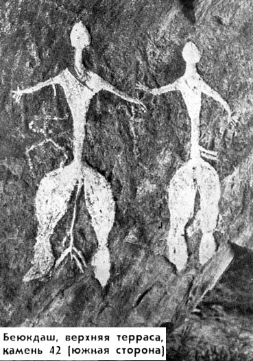
1. The earliest period is responsible for almost life-size silhouette representations of men and women full face and in profile in standing and squatting positions with bows over their shoulders. The women are naked, with big bosoms, narrow waists, wide hips, and thick legs; they have no arms though they carry/wear bows. The men in loin-cloths have tall and slender bodies, their strong legs with well defined muscular calves are slightly bent and planted wide apart. Their arms are marked with thin straight lines. In many pictures they have a kind of weapon, resembling an axe or a knife, in one or both hands. Heads and necks of the men and women are represented as short spikes.
There is a colour version of this photo further up this page.
Click on the photo for a larger version.
Photo: Caferzade (1973)
Click on the photo for a larger version.
Photo: Caferzade (1973)
These human figures were carved when the climate in Gobustan was most probably tropical and its landscape resembled that of a savannah with rich flora and fauna.
Using the available data as the base, these drawings were dated as far back as early Neolithic stage, i.e. the period from the 8th to 6th millennia BC, when mother was the head of the family commune.
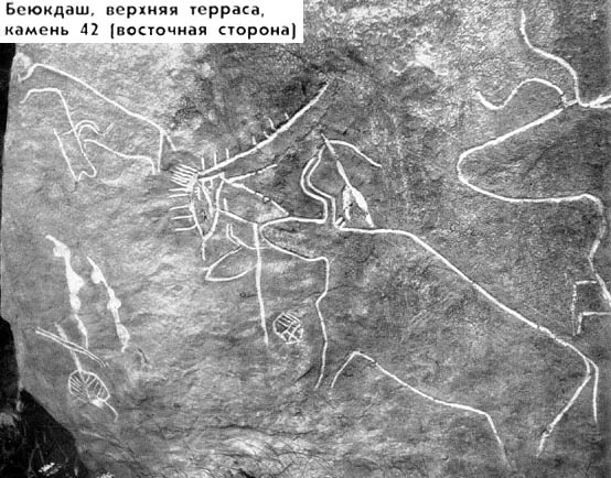
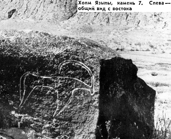
2. The silhouette drawings of human beings are followed by life-size contour pictures of wild bulls, some of them about 240 cm long and about 140 cm high. Most of these drawings were discovered near Mt. Beyukdash, none of them were found in the vicinity of Mt. Jingirdag and Yazily Hill.
Big and also smaller contour drawings of wild bulls and small pictures of people wearing loincloths and armed with bows are dated as belonging, to the period from the 6th millennium to the verge of the 3rd millennium BC when hunting still retained its leading position in the life of man. The pictures of boats with the image of the sun in their bows are also dates back to that period. Along with the pictures of bulls, they were only found in the rear of Mts. Beyukdash and Kichikdash.
Click on the photo for a larger version.
Photo: Caferzade (1973)
Click on the photo for a larger version.
Photo: Caferzade (1973)
 3. The big drawings of deer, some 180 and 120 cm long and 110 and 85 cm (and slightly smaller) in height, were carved in the early neolithic and somewhat later, i. e. in the 4th - 3rd millennia B C, and strike the onlooker with the skill of their performance. These profiled pictures are remarkable for their vividness, irreproachable preciseness of proportions, dynamic representation of motion. The animals have slender bodies and graceful heads and necks. Their big antlers are often drawn full face. The poses of the animals express inner strength. These pictures were undoubtedly represented from life.
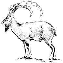
No less beautiful are the drawings of gazelles and bezoar goats. They are always depicted in profile. The oldest of them are bigger than life-size (up to some 240 cm long and 160 cm high).
Bezoar Goat (also known as the Persian Ibex)
The main ancestor of modern goats.
Photo: http://iatp.r.am/grants/
red_book/efiles/17.htm
Click on the photo for a larger version.
Photo: Caferzade (1973)
Click on the photo for a larger version.
Photo: Caferzade (1973)
The large in profile representations of the two lions below (120 and 83 cm long and 70 and 50 cm high) date from this period as well.

Click on the photo for a larger version.
Photo: Caferzade (1973)
The pictures of goats and, more rarely, deer and horses are crossed by straight furrows dividing their bodies in the middle or cutting off their heads or other parts of the body. The existing ethnographic parallels give good grounds to assume that these furrows were of ritual significance; the primitive people imagined that they would bring them good luck during hunting expeditions.
In the neolithic and Bronze Age the representations of animals and people came to be gradually transferred to ceramic and metal articles.
4. In the Bronze Age and later the rock drawings of Gobustan began to show an increasing tendency to be diminished in size. The technique of drawing was changing: the realistic manner of representation was preserved only in some instances. Silhouette pictures of human figures tended to be replaced by linear ones. Representations of gazelles, horses, pigs, dogs, and other animals, including beasts of prey, are common among the drawings of that period.
As a result of using improved tools made of bronze, developing cattle-breeding, and cultivating land, hunting gradually lost its significance in the life of local inhabitants. Since the end of the Bronze Age (2nd millennium B. C.) and later, hunting was predominantly an occupation of the tribal nobility. These persons were frequently represented on horseback.
Due to decreasing importance of hunting in the life of local people, the ritual furrows on the drawings representing animals were gradually losing its meaning and vanished in the passage of time. However, hunting still assumed a significant place in the economy and was represented in many drawings. The people armed with bows and arrows, spears, tridents, swords, lassos, and bolos were hunting on foot and on horseback, using dogs and birds of prey as well as various appliances, such as traps.
5. In the period from the Iron Age (2nd3rd millennia B. C.) and up to the beginning of our era, the rock drawings continued to diminish in size. The shapes of the animals, however, retain their correctness in many cases.
The ritual furrows on the pictures of animals became very rare. 6. In the Middle Ages (8th-Ilth century A. D. and somewhat later), in view of ever decreasing economical importance of hunting, more frequent transfers of the pictures onto ceramic and metal articles, and negative attitude of the Moslem religion to representation of human beings and animals, the drawings on the rocks of Gobustan became even more outlined; they were drawn in straight lines only and resemble distorted geometrical figures. They changed their shape and, at times, became meaningless. The then artists hardly followed nature. The pictures became even smaller in size. Traces of metal tools that were used to carve the drawings can be easily discerned but some of the pictures were also cut with stone implements.
Most of the drawings of this period merely imitate the ancient rock drawings. They were possibly carved by shepherds in their spare time without a definite aim. This manner of representation was preserved in Gobustan up to the end of the 19th century and, in some cases, even later.
Characteristic of the mediaeval period are also drawings representing camel caravans and horsemen armed with swords and spears, A major part of signs, tamgas (stamps) and Arabic inscriptions also date back to this period.
The rock drawings of Gobustan occupy a prominent place among the similar cultural monuments of Karelia, Siberia, Central Asia, and other parts of the U.S.S.R. Many of them possess quite a number of common features with kindred rock drawings of Scandinavia, the Pyrenees, and Africa.
The rich heritage of ancient culture situated in the south-eastern part of Gobustan along with natural remnants of the past in this area is,,of paramount importance for many domains of science, such as geology, botany, pedology, etc. In total this complex constitutes a valuable museum in the open air ranking high among the other reserves of All - Union importance.
The present book is an attempt to show a general outline of Gobustan's rock drawings, to acquaint the reader, even if cursorily, with the scientific-historical and artistic significance of this remarkable relic of the remote past left by ancient people. May the reader judge of how the author succeeded in achieving this goal. The only thing to add is that the monuments of Gobustan are really worth seeing with one's own eyes. For a wise popular proverb has it: "He knows much who has been everywhere and seen much, but not who has only read much".
Photo: Caferzade (1973)
References
- Caferzade, I., 1973: Gobustan: Naskal'nye izobrazenija, Akademija Nauk Azerbajdzanskoj SSR, Institut istorii, 1973. 348 pages
- Ibragimov, T., 2012: Rock drawings of Gobustan. Archetypes of our artistic consciousness, archive.org, Open Source, ark:/13960/t85j46k15