Back to Don's Maps
Back to the Iron Gates
Schela Cladovei
Schela Cladovei is a site discovered by Dr Vasile Boroneanț, and excavated since by a team of fine archeologists led by Dr Boroneanț and by another distinguished scholar and field worker, Dr Clive Bonsall. Designing how the dig will proceed, and organising and managing a team of workers for an extended period is a very difficult and highly skilled undertaking, which has been managed with great professional integrity. We are indeed fortunate that the excavations have been completed, recorded and analysed so thoroughly and professionally.The Schela Cladovei site, essentially part of the town of Drobeta Turnu-Severin in Romania, is on the left bank of the Danube, between the river and the railway and road from Timisoara to Bucharest. The site is sometimes referred to in the Romanian language as Cladovo or as Kladovo in the Serbian language, after the Serbian town of Kladovo just across the river Danube from the site.
Dr Adrian Gheorghe, a Romanian physician with a keen interest and great knowledge of Romanian prehistory, recently (2007) visited the site, and reports that although many of the people in the area remember the English archaeologists who had digs there, there will be no more digs in the foreseeable future. The whole site is covered with concrete to protect the railway line and the houses nearby from the erosion of the Danube, erosion which has been accelerated by the construction and subsequent outflow of the Iron Gates Dam. A chapter has been closed.
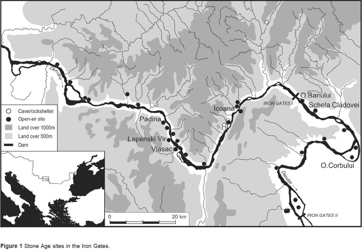
Stone Age sites in the Iron Gates region.
Photo: Climate, floods and river gods: environmental change and the
Meso–Neolithic transition in southeast Europe by Clive Bonsall, Mark G Macklin, Robert W Payton, Adina Boroneanț.
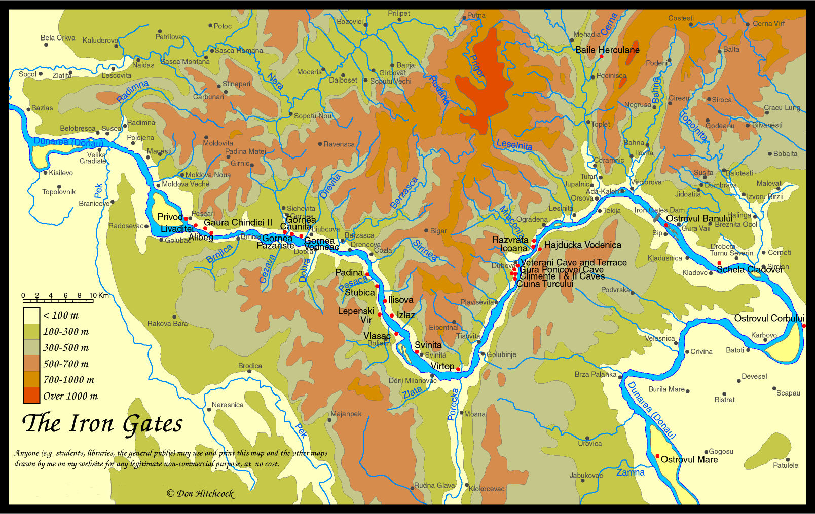
Map of the Iron Gates region, with the position of Schela Cladovei marked.
Photo: Don Hitchcock 2014
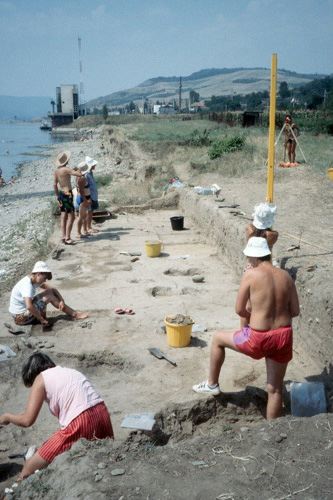
View of the excavation at Schela Cladovei
Since 1989 Clive Bonsall has co-ordinated a major interdisciplinary research project in the Iron Gates, in collaboration with specialists from Great Britain, Hungary, Romania, Serbia and the USA. The research has focused on the period from 7000 to 5000 BC during which farming was introduced to the region. Dietary tracing of human remains from Lepenski Vir and Vlasac (sites that are now submerged and no longer available for excavation) has provided a new perspective on subsistence practices and their changes through time. A more reliable chronological framework for the stone age settlement of the Danube gorges is being created by direct AMS 14C dating of bone artefacts and human remains from these and other sites in the region.
Between 1992 and 1996 Clive Bonsall conducted excavations at Schela Cladovei in partnership with the Romanian archaeologist, Vasile Boroneanț. This late Mesolithic and early Neolithic site is situated on the Romanian bank of the Danube, about 65km down river from Lepenski Vir. By employing strict sampling and recovery techniques, the excavations have provided better information on the economies of the two periods of occupation, and added substantially to our knowledge of architecture, burial practices and technology.
Text and Photo from: http://www.arcl.ed.ac.uk/arch/clivebonsall/page7.htm

Dr Vasile Boroneanț is a distinguished Romanian researcher. He was the discoverer of several prehistoric civilizations in Romania such as Clisurean and Schela Cladovei - Lepenski Vir, from the Iron Gates Region, of rock paintings and engravings in the caves of Gaura Chindiei, Limanu, Bozioru, in collaboration with many museums - Arad, Drobeta Turnu Severin, Alexandria, Craiova, Bacau, Resita etc.
Text adapted, and photo from:
http://www.cimec.ro/livingpast/nr1/boroneant/v_boroneant.htm.
Clive Bonsall is a graduate of Sheffield University. His research interests include hunter-gatherer societies, the transition to farming in Europe, early technology, and palaeodietary reconstruction. He has conducted fieldwork in northwest England, Romania, Slovenia and western Scotland. He is a Corresponding Member of the Romanian Academy of Scientists, and Editor of the international newsletter, Mesolithic Miscellany. Among his publications are The Mesolithic in Europe (edited, 1989) and The Human Use of Caves (edited with C. Tolan-Smith, 1997).
Text and photo from http://www1.arcl.ed.ac.uk/arch/clivebonsall/
Sarah Mason has great skill in determining plant material in archeological sediments. From the 1994 excavations, she has found wood charcoal as usual, as well as possible parenchyma (i.e., root / tuber or similar remains) as well as one or two seeds/fruits in one of the samples.
The above text adapted from:http://www.ucl.ac.uk/archaeology/research/profiles/smason/smschela.htm
The Iron Gates has an abundant and continuous record of human occupation in open-air settlements from the Late Mesolithic into the Early Neolithic, c. 8500 - 6500 BP (7500 - 5450 cal BC). While early farming settlements are well represented in other parts of the Balkan peninsula, Mesolithic sites are uncommon and there are few if any sites that were inhabited continuously from one period to the next. Therefore, the Iron Gates is arguably the only area of southeast Europe where the transition from Mesolithic to Neolithic can be studied in detail.
Text from Stable Isotopes, Radiocarbon and the Mesolithic - Neolithic Transition in the Iron Gates, UDK: 581.13+591.13:902.65/4-924.56)"633/634"
Documenta Praehistorica XXVII
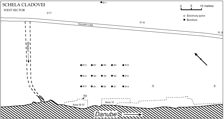
Plan of the excavation at Schela Cladovei, showing the areas investigated in 1991-1992.
Diagram above and text below adapted from: A Mesolithic burial area at Schela Cladovei, Romania, by Vasile Boroneanț, Clive Bonsall, Kathleen McSweeney, Robert Payton and Mark Macklin. It is highly recommended that students refer to the original paper.
Schela Cladovei is one of number of stone age sites in the Iron Gates section of the Danube Valley investigated prior to the flooding of the valley that resulted from the construction of two dams for hydro-electric power generation. It lies some 7km below the exit from the Danube gorges, in an area that would have been part of an extensive floodplain throughout the Holocene, and thus differed in its environmental setting from the majority of the Iron Gates sites. Excavations have been in progress at Schela Cladovei since 1965. Twelve field seasons were completed between 1965 and 1990 under the direction of V. Boroneanț, working with limited resources. Since 1991 the excavations have been conducted as a joint Romanian - British research project, co-directed by V. Boroneanț and C. Bonsall. The site was occupied on many occasions during the Holocene. In the areas investigated the best-preserved remains are those relating to the Late Mesolithic and Early Neolithic (Starcevo-Cris culture). They include over fifty burials.
The paper named above describes a further group of burials excavated in 1991 - 1992.
The excavation at Schela Cladovei is located on the first terrace of the Danube which lies at 6 - 8m above the original river level. The terrace has been progressively eroded by the river following completion of the Iron Gates II dam. The eroding edge of the terrace forms a section through the site, in which archaeological remains can be traced over a distance of ca. 1.5km. To the NE the first terrace abuts on a higher terrace composed largely of pleis- tocene sands and gravels. Numerous freshwater springs occur at the base of the pleistocene deposits and, traditionally, have been important sources of drinking water. They feed small streams that are incised into the lower terrace and flow into the Danube. One such stream cuts across the archaeological site from NE - SW (fig. 1). Although neolithic remains occur over most of the site area, traces of mesolithic occupation have been found only in the area to the E of the stream, where, prior to erosion, they could be traced for ca. 200 m along, and up to 70m back, from the terrace edge. The terrace on which the archaeological site lies consists of 1.5 - 2.0 m of silty early holocene river alluvium resting upon older, very poorly-sorted fluvial gravels which show evidence of having been deposited in a periglacial environment. The alluvial sediments have been affected by soil-forming processes for the greater part of the holocene resulting in the development of a calcareous brown earth. The soil profile extends throughout the full depth of the silty alluvial material and all signs of sedimentary stratification have been eliminated. The soil has been decalcified through leaching to a variable depth of 34 - 55cm.
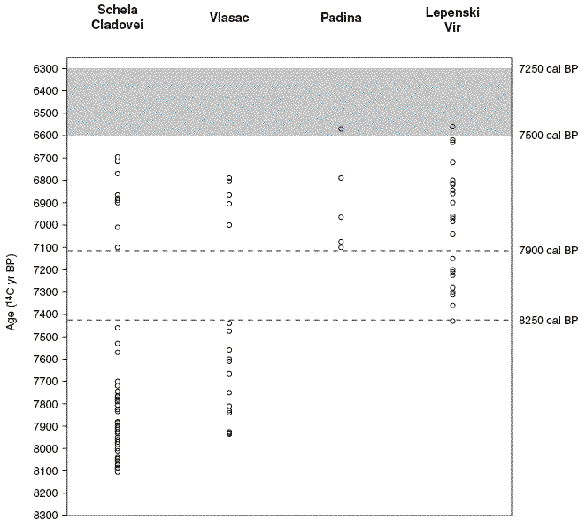
Radiocarbon mean ages for Schela Cladovei, Vlasac, Padina and Lepenski Vir — see figure 1 (the map of stone age sites at the top of this page) for site locations.
Data are from Srejović & Letica (1978), Bonsall et al (1997, 2000, and unpublished data) and Cook et al (2002). The 14C ages on human bone have been corrected for the freshwater reservoir effect according to Method 1 of Cook et al (2002).
This figure shows clearly an archaeological discontinuity in the Iron Gates area. Where were the occupants of Schela Cladovei, Vlasac and Padina between 7460 and 7100 BP (or 8250 and 7900 cal BP)?
Somewhere else, it seems, for a period of around 550 years.
Yet they were still occupying Lepenski Vir at this time.
Something important happened here, but what? Why was Lepenski Vir occupied at a time of significant flooding elsewhere, but not at equivalent sites in a very similar environment?
Photo: Climate, floods and river gods: environmental change and the
Meso–Neolithic transition in southeast Europe by Clive Bonsall, Mark G Macklin, Robert W Payton, Adina Boroneanț.
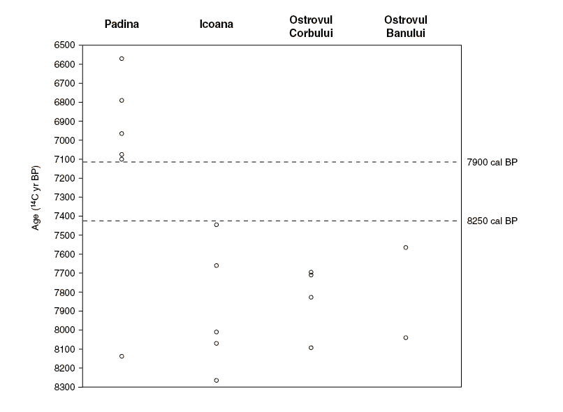
Radiocarbon mean ages for Padina, Icoana, Ostrovul Banului and Ostrovul Corbului — see Figure 1 (the map of stone age sites at the top of this page) for site locations. Data are from Radovanović (1996) and Boroneanț (2000).
The occupancy discontinuity between 7460 and 7100 BP (or 8250 and 7900 cal BP) is shown also for these other sites in the Iron Gates.
Photo: Climate, floods and river gods: environmental change and the
Meso–Neolithic transition in southeast Europe by Clive Bonsall, Mark G Macklin, Robert W Payton, Adina Boroneanț.
This period of site abandonment in the Iron Gates corresponds in timing with a distinct global climatic cooling phase, known as the '8200 BP event' (eg, Alley et al 1997; Johnsen et al 2001).
The Holocene has been characterised by significant short-term climatic variability. Oxygen isotope and palaeotemperature records from Greenland ice cores show a number of centennial-scale cooling events, of which the '8200 BP event' is arguably the most pronounced.
The δ18O profile from the GISP2 ice core shows this event to have had a duration ofaround 330 years, from c 8290–7960 cal BP (Nesje & Dahl 2001). The 8200 BP event appears to have been accompanied by an abrupt change in atmospheric and oceanic circulation patterns, which at the regional level was reflected in changes in weather and precipitation patterns (eg, Street-Perrott & Perrott 1990; Stager & Mayewski 1997).
The 8200 BP event is registered in a variety of climatic archives from Europe. For example, it has been recognised in oxygen isotope records from the Ammer Lake in southern Germany (von Grafenstein et al 1998) and from a speleothem in south-west Ireland (McDermott et al 2001). Lake sediment and palaeobotanical records from the Alpine region indicate cooler and wetter conditions at that time (Haas et al 1998).
In the NE part of the trench (Area III) at a depth of ca. 1.00 m, there was a dense concentration of stones ca. 2.5 m across. Within it was a trapezoidal setting of large tabular stones. It is probable that these features are the remains of some form of structure, possibly the base of a dwelling. The trapezoidal setting of stones is reminiscent of the stone-lined 'hearths' found within the houses of Lepenski Vir and Vlasac. No postholes were identified in proximity to the structure; nor could it be determined whether the stone concentration/' hearth' lay within a pit, though on pedological evidence this is considered likely (see below). About 2 m to the SW of the 'hearth', at approximately the same level, there was a large irregularly-shaped stone with a shallow rounded depression in its upper surface. This has parallels in the so-called stone 'altars' found at some other Iron Gates sites.
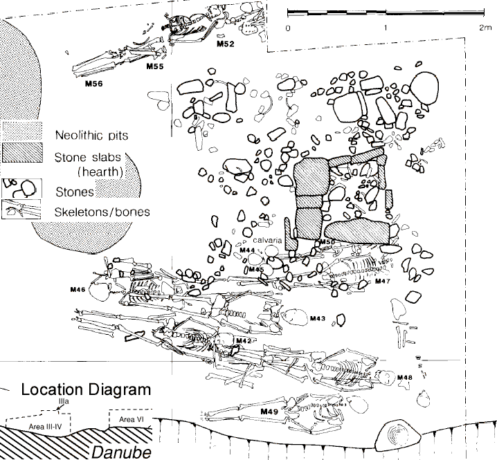
Burials diagram in Area III-IV
Diagram above and text below adapted from: A Mesolithic burial area at Schela Cladovei, Romania, by Vasile Boroneanț, Clive Bonsall, Kathleen McSweeney, Robert Payton and Mark Macklin.
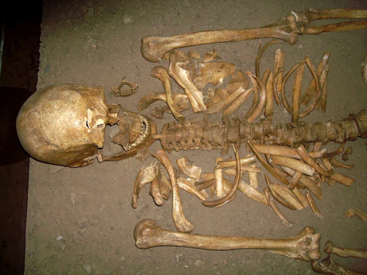
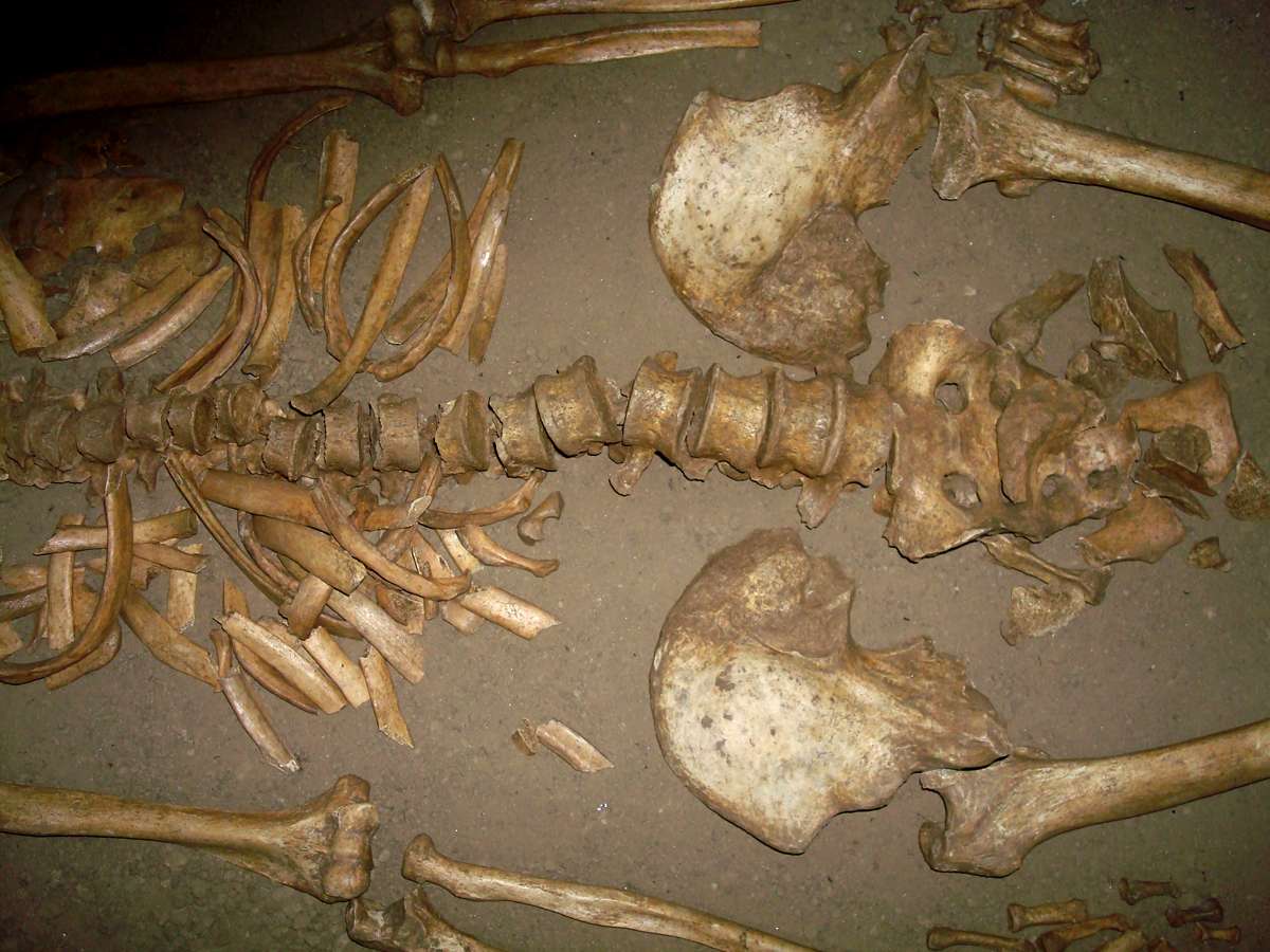
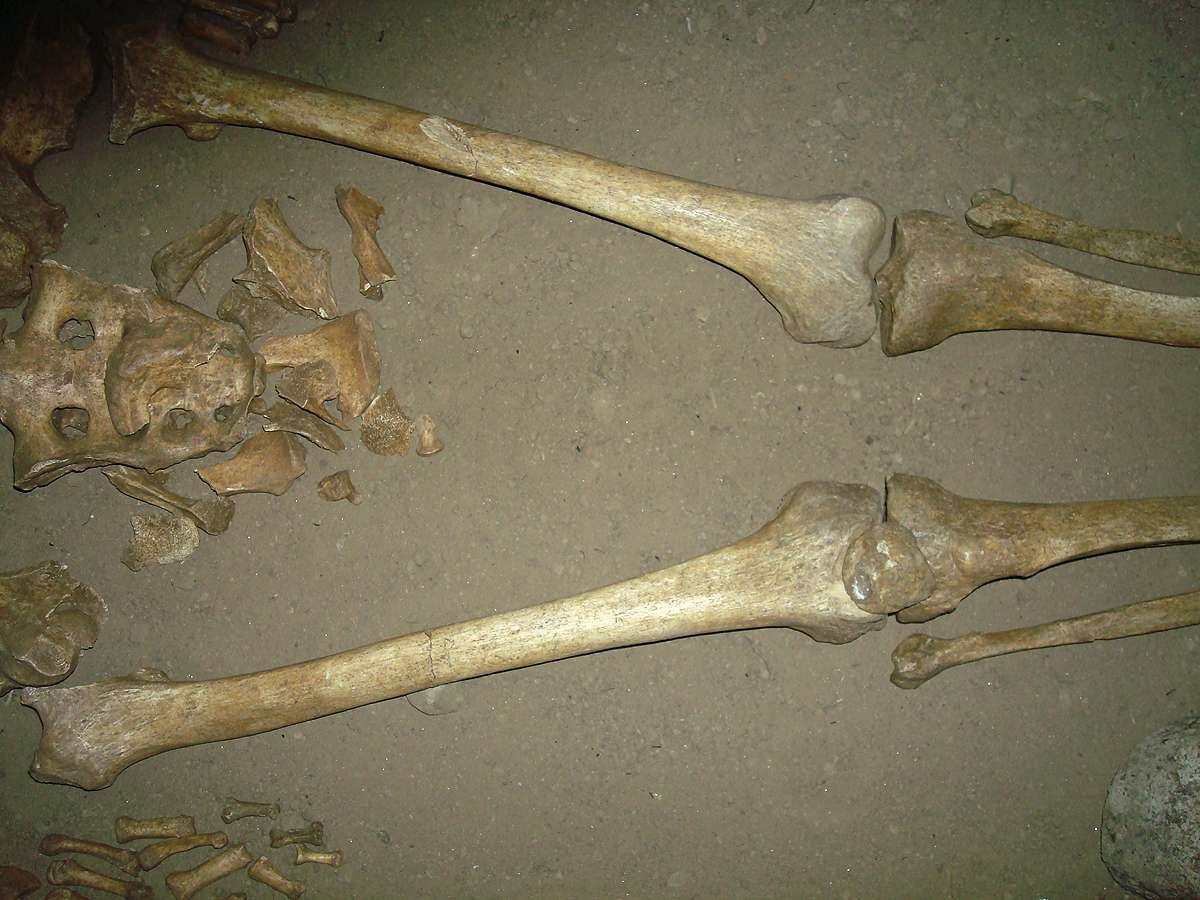
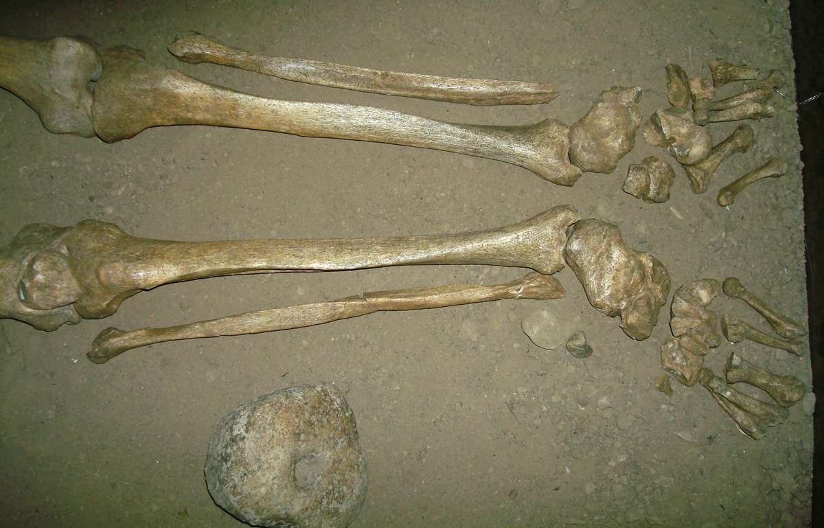
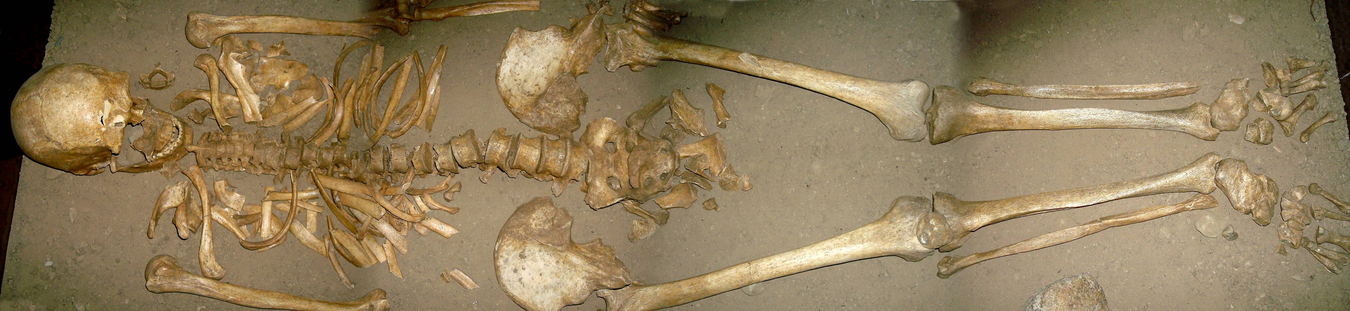
Schela Cladovei.
Complete skeleton.
The lower image is stitched together from the upper four.
Display: Iron Gates Museum, Drobeta Turnu Severin
Photo: Adrian Gheorghe 2007
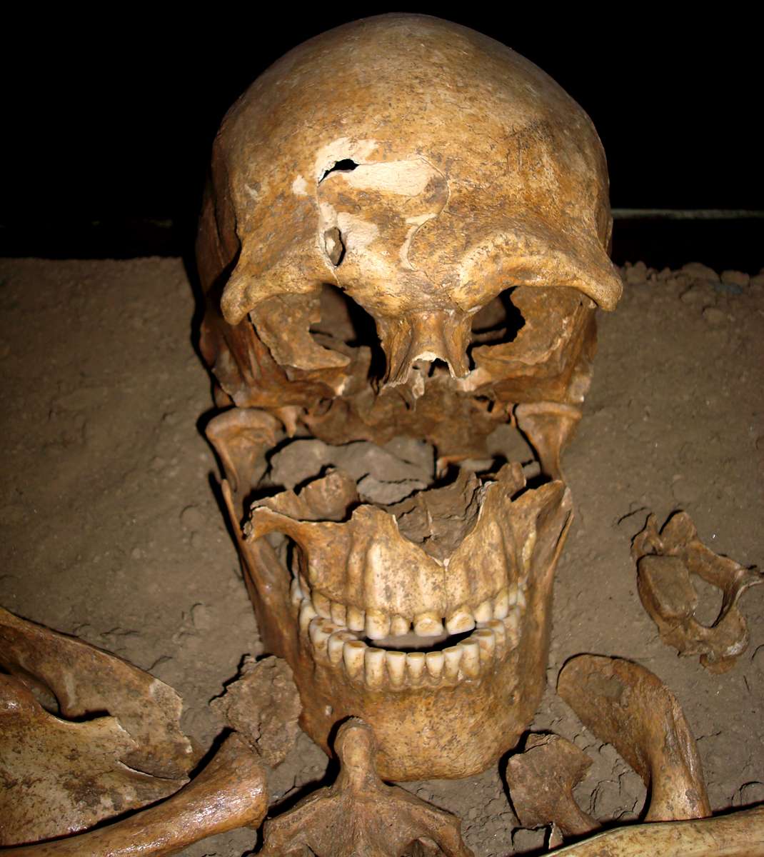
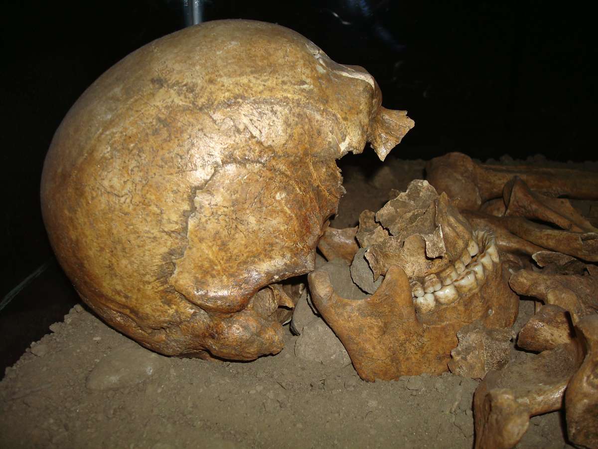
Schela Cladovei.
Views of skull.
Display: Iron Gates Museum, Drobeta Turnu Severin
Photo: Adrian Gheorghe 2007
Immediately to the SW of the structure, between the 'hearth' and the 'altar', there were abundant human skeletal remains that evidently represent formal burials. They comprised a number of articulated skele- tons (M42, M43, M46, M47, M48, M49, M50). .... In the case of the articulated skeletons the bodies were laid out in an extended position, on their backs, with long axes lying approximately NW-SE. In three instances (M47, M50, M52) the skull was missing.
In two cases (M42, M49) traces of red ochre occurred around the body ; in the case of M42 ochre was found around the skull and in the pelvic area ; in the case of M49 it occurred on and around the skull. Fish teeth and/or shells of freshwater molluscs (some with artificial perforation) occurred near to some skeletons (M43, M47, M48, M50, M52), and may represent remains of personal ornaments. In three instances bone arrowheads occurred close to the skeleton. A complete example was found adjacent to M47, while fragments of single arrowheads occurred with M42 and M50.
Conclusions:
The burials excavated from Area III at Schela Cladovei are a significant addition to the human skeletal material previously recovered from the site, and give an important insight into the nature of burial activity during the late mesolithic occupation. Mortuary practices resemble those at other Iron Gates sites. Burials were placed in relation to some form of structure. The dead were deposited in grave pits in an extended, supine position, and provided with few grave goods. The majority of burials are of adults who were tall, physically robust and showed few signs of disease. Many individuals had sustained injuries, often as a result of violence. In several cases the injuries proved fatal. The AMS 14C dates obtained on bones from eight skeletons are the first direct age estimates for human burials at Schela Cladovei, and represent a significant contribution to the knowledge of mesolithic settlement in the Iron Gates region.
References
Boroneanț (V.), Les enterrements de Schela Cladovei : nouvelles donnees. In P.M. VERMEERSCH, P. VAN PEER (eds.) Contributions to the Mesolithic in Europe. Leuven University Press, Leuven 1990, p. 121-125.
BORONEANȚ (V.), NICOLAESCU-PLOPSOR (D.N.), Lesions traumatiques violentes datant de l'Epipaleolithique tardif du sud-ouest de Roumanie. L'Anthropologie (Brno) 28(1), 1990, p. 55-65.
NICOLAESCU-PLOPSOR (D.N.), Deux cas de mort violente dans l'Epipaleolithique final de Schela Cladovei. Annuaire Roumaine de l'Anthropologie 13, 1987, p. 13-54.
PRINZ (B.), Mesolithic Adaptations in the Lower Danube : Vlasac and the Iron Gates Gorge. BAR International Series 330. British Archaeological Reports, Oxford, 1987.
STUIVER (M.), REIMER (P.), Extended 14C Database and Revised CALIB 3.0 14C Age Calibration Program. Radiocarbon 35(1), 1993, p. 215-230.
Earlier Digs at Schela Cladovei
Text and photos below from :
http://www.cimec.ro/livingpast/nr1/boroneant/mesolithic.htm#schela
The Schela Cladovei-Lepenski Vir cultural complex
This last stage had a sudden development, though in steps. It occurred when changing from the Clisurean complexes, based mainly on flint exploitation from the local resources, to a lessening of this activity and a change to an intensive processing of the river boulders and other types of rocks. Predilection was shown to locally exploited quartz ( seldom obtain from natural deposits, more often from the rocks available on the beach). Climatically, the process corresponds to the Boreal and beginning of Atlantic period, after the end of the Pinus phase. During this stage the landscape suffered a great change. It involved the warming of the climate, the stabilisation of the Danube course( first at a lower level than the present one, then reaching the one existent nowadays). Man gradually descended from the caves situated on the upper levels of the karst (Climente II cave (178m) to Climente I cave (62m) and the shelter under the rock at Cuina Turcului (60m)). During the period of time when Schela Cladovei-Lepenski Vir culture flourished, the Danube had the lowest level. It has only happened twice since, between III-I centuries BC and IX-XIII centuries AD.
The 1982 - 1985 digs
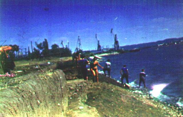
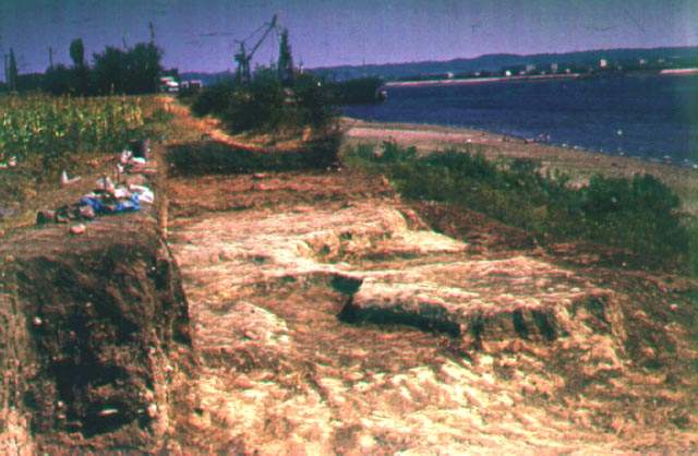
View 1 of the Schela Cladovei site looking downstream
Photo: http://www.cimec.ro/livingpast/nr1/boroneant/more/situl_schela/index_sit_schela.htm
Click on the image for a larger view.
View 2 of the Schela Cladovei site looking downstream
Photo: http://www.cimec.ro/livingpast/nr1/boroneant/more/situl_schela/index_sit_schela.htm
Click on the image for a larger view.
View 3 of the Schela Cladovei site looking upstream
Photo: http://www.cimec.ro/livingpast/nr1/boroneant/more/situl_schela/index_sit_schela.htm
Click on the image for a larger view.
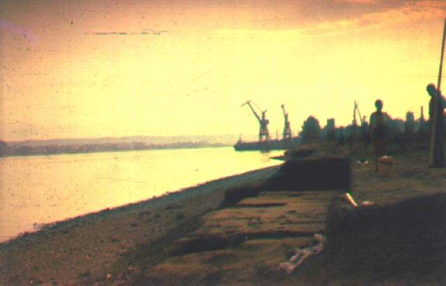
View 3 of the Schela Cladovei site looking upstream
Photo: http://www.cimec.ro/livingpast/nr1/boroneant/more/situl_schela/index_sit_schela.htm
Click on the image for a larger view.

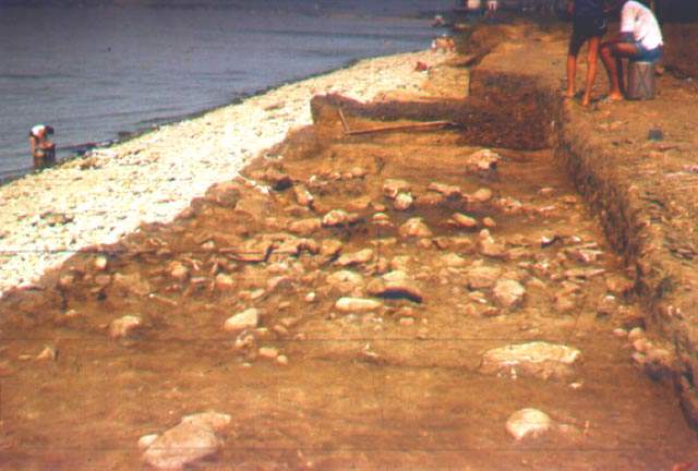
Fireplace at the Schela Cladovei site, section 6. Note the flat fireplace surrounds and the burials apparently on top of the fireplaces
Photo: http://www.cimec.ro/livingpast/nr1/boroneant/more/situl_schela/index_sit_schela.htm
Click on the image for a larger view.
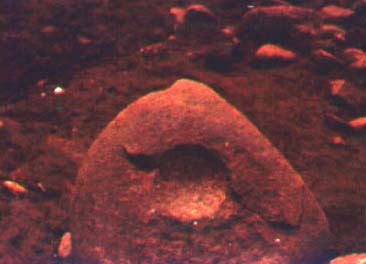
Stone sculpture, possibly of a human.
(This looks to me much more like a stone anchor, common in the area, with the central groove being pecked in the stone to accept a rope. - Don)
Photo: http://www.cimec.ro/livingpast/nr1/boroneant/more/situl_schela/index_sit_schela.htm
Click on the image for a larger view.
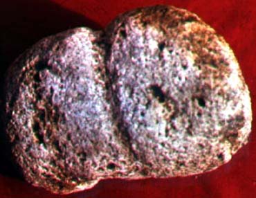
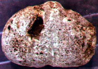
Stone used for grinding ochre, possibly for a ritual function.
Photo: http://www.cimec.ro/livingpast/nr1/boroneant/more/situl_schela/index_sit_schela.htm
Click on the image for a larger view.
Stone sculpture, probably of a human.
Photo: http://www.cimec.ro/livingpast/nr1/boroneant/more/situl_schela/index_sit_schela.htm
Click on the image for a larger view.