Back to Don's Maps
Norwegian Rock Art - Alta Fjord
The Rock Drawings of Alta constitute the most important piece of evidence in favour of the existence of human activity in the confines of the Great North during the prehistoric period. Studied from 1967, the petroglyphs of the Alta fjord in the province of Tromsø were immediately classed among the leading rock art sites in the world. Close to the Arctic Circle, they are a valuable illustration of human activity between 6 200 and 2 500 BP in the Northern Hemisphere.
They are primordial evidence of the fauna, representing reindeer, elks, bears, dogs and/or wolves, foxes, hares, geese, ducks, swans, cormorants, halibut, salmon and whales, and of the environment. They also depict boating, hunting, trapping and fishing scenes, as well as people taking part in dances and ritual acts. In the final phase, some agricultural activities, rendered precarious by the climate, appear to have supplemented certain staples traditionally provided by hunting and fishing.
Photo: Ralph Frenken 2012
Text: adapted from: http://whc.unesco.org/en/list/352/
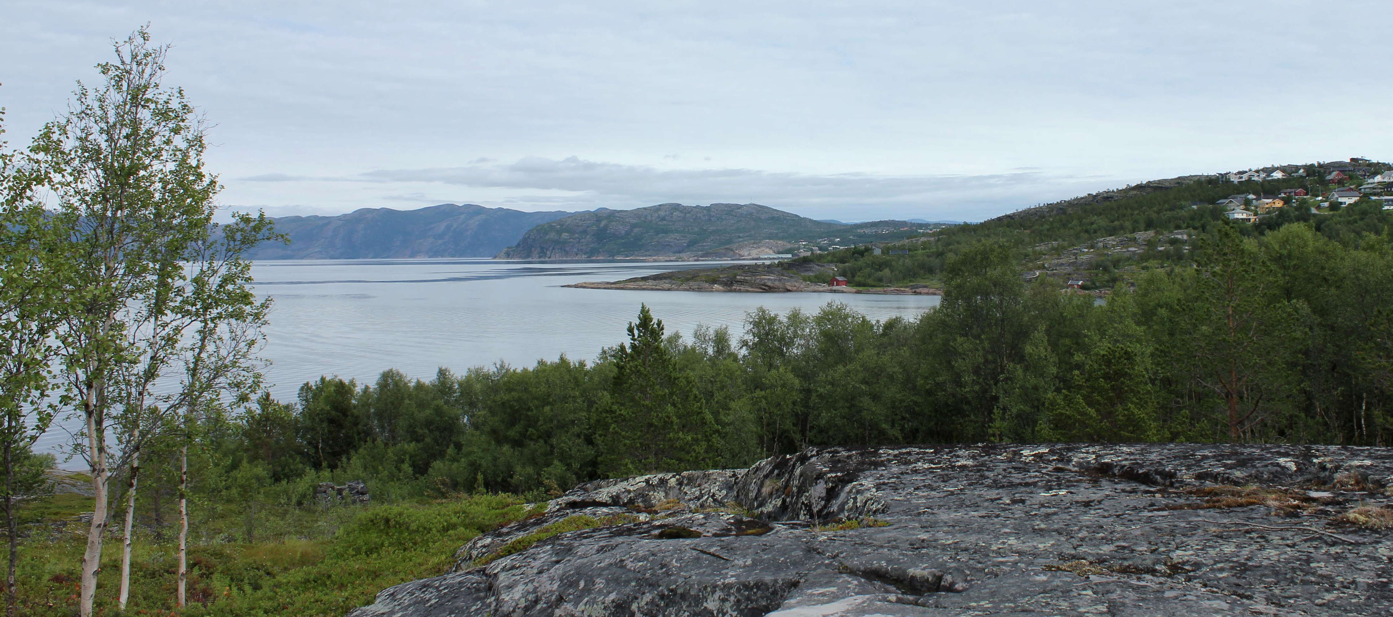
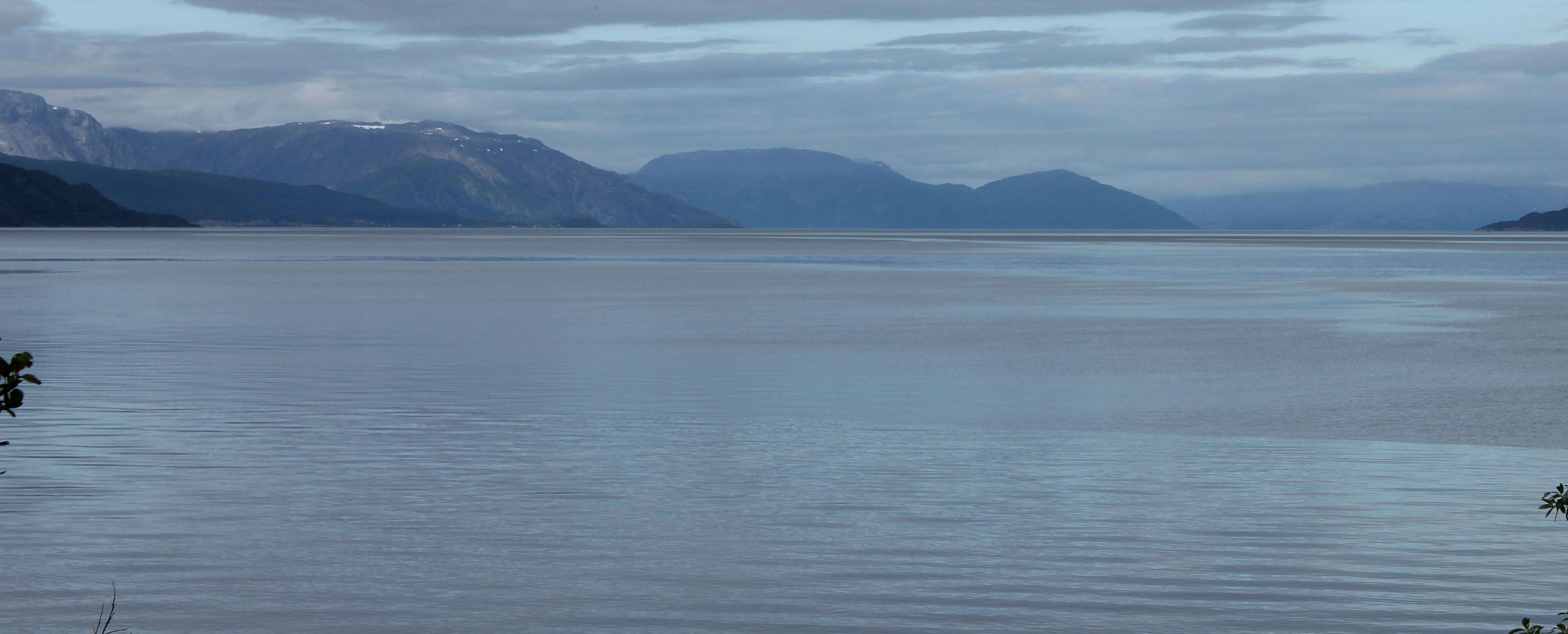
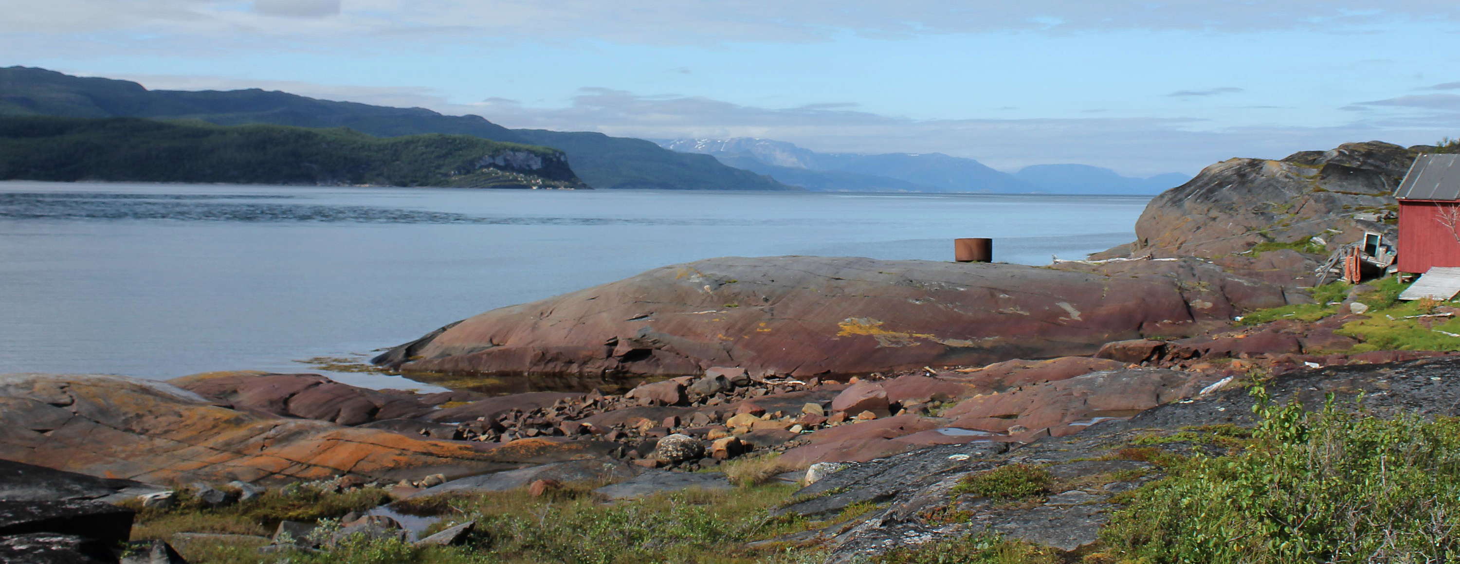
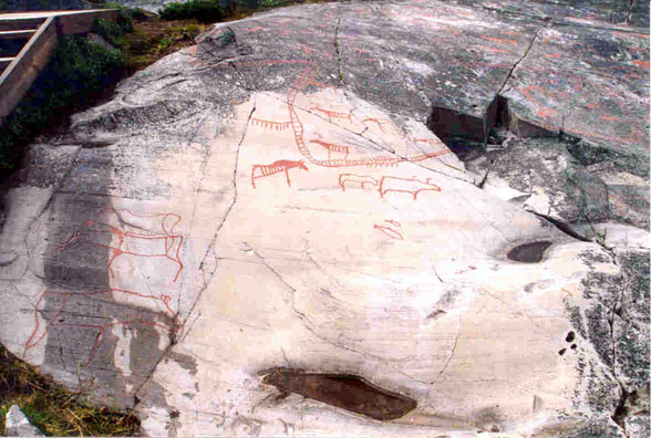
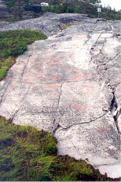
This is the view from near the Alta Museum over the Alta Fjord, Altafjorden. The rock engravings lie between here and the water line, with the youngest engravings closest to the high water mark. According to the principle of reverse stratigraphy, the most ancient works are generally the highest, the most recent being closest to the present sea level. The height difference is roughly 26 m.
The apparent peninsula on the right of this photo, really just the edge of the bay, is an area with many rock engravings. Note the small red building on this peninsula, it is shown in photographs further down this page.
Photo: Ralph Frenken 2012

The Alta site, circled in red on this image, is at the head of the fjord, and is very well protected from the swells of the Norwegian Sea. The depth of the fjord increases rapidly from about 60 metres close in shore to more than 400 metres further out in the fjord. It was used as an anchorage by the German battleships Tirpitz and Scharnhorst in 1943 during WWII.
Photo: Google Earth
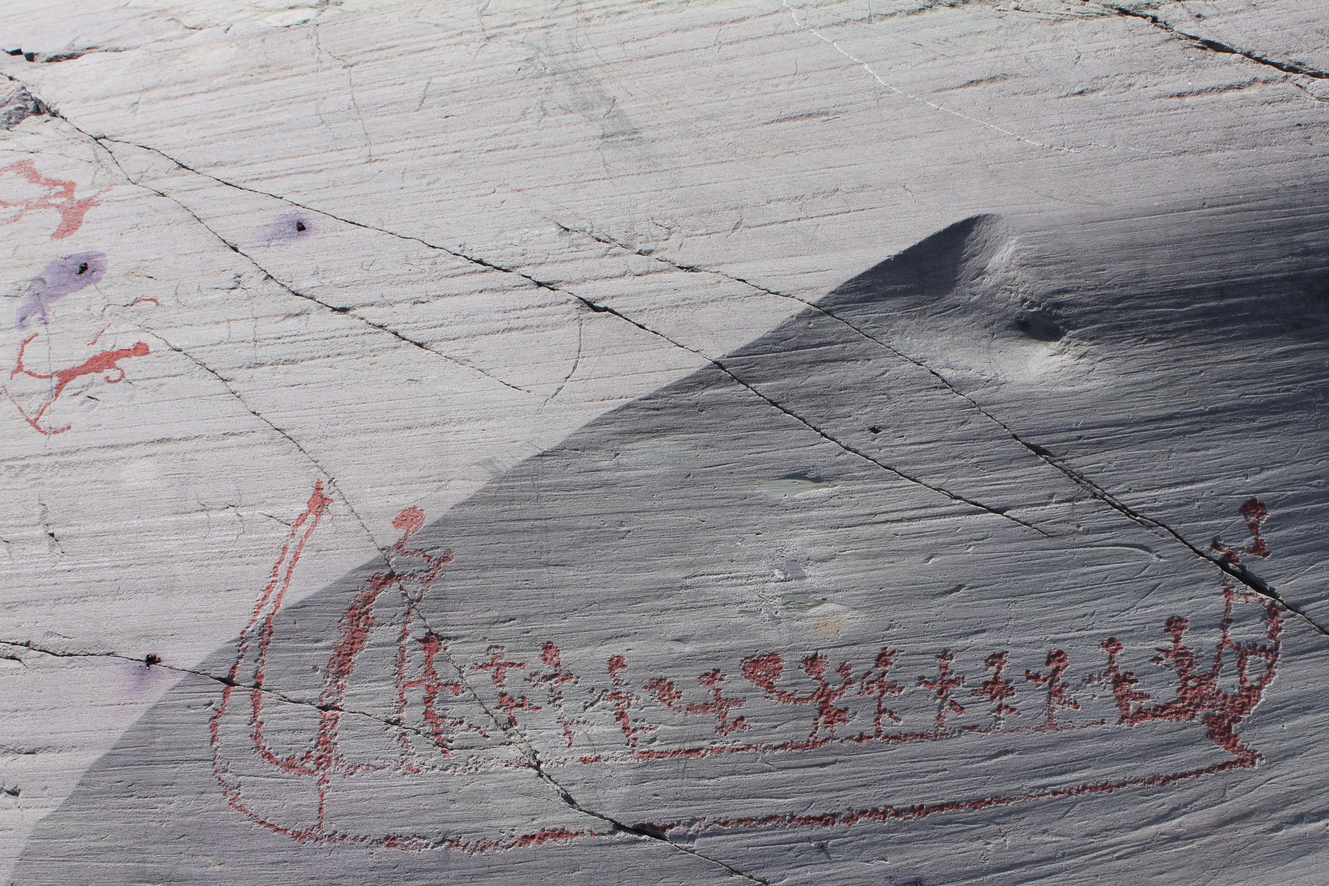
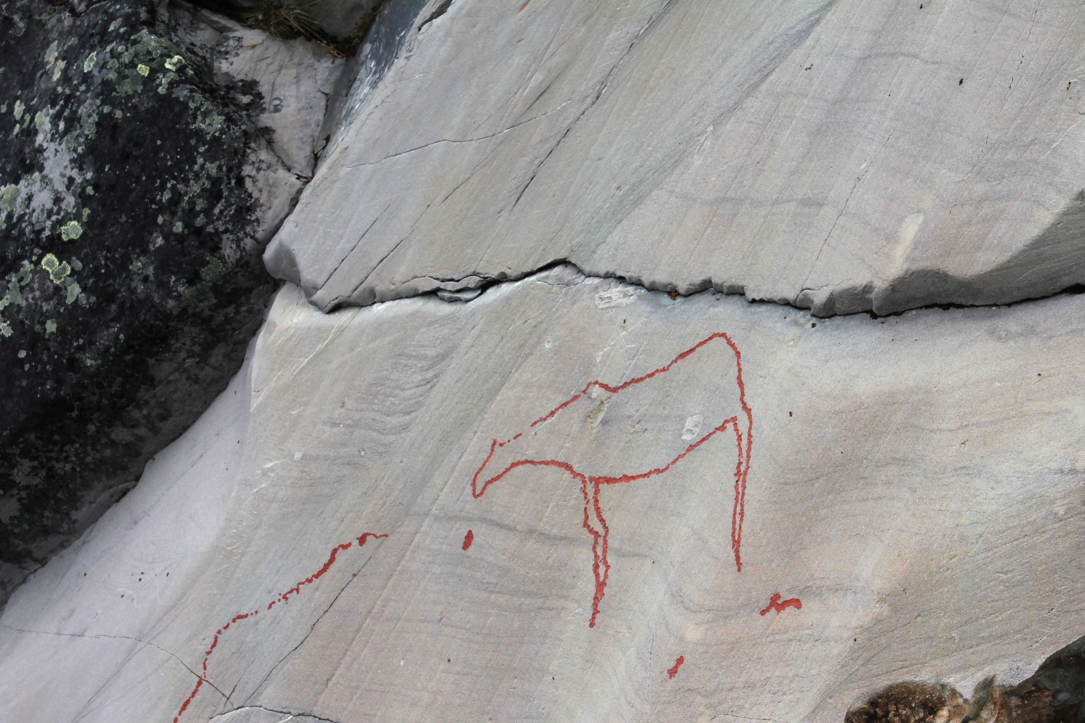
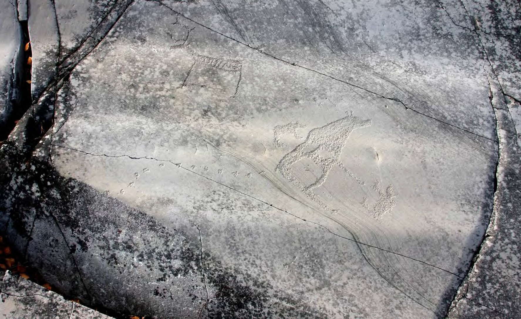
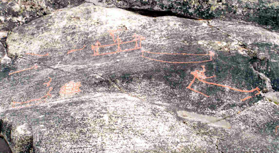
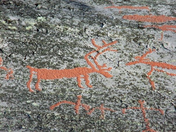
This is a vertical panorama stitched together from two images. Here we can see a male hunter with a bow and arrow, reindeer (shown with forward projecting antlers) and their young, deer, elk (shown with heavier neck and head), and a fishing net.
Photo: Ralph Frenken 2012
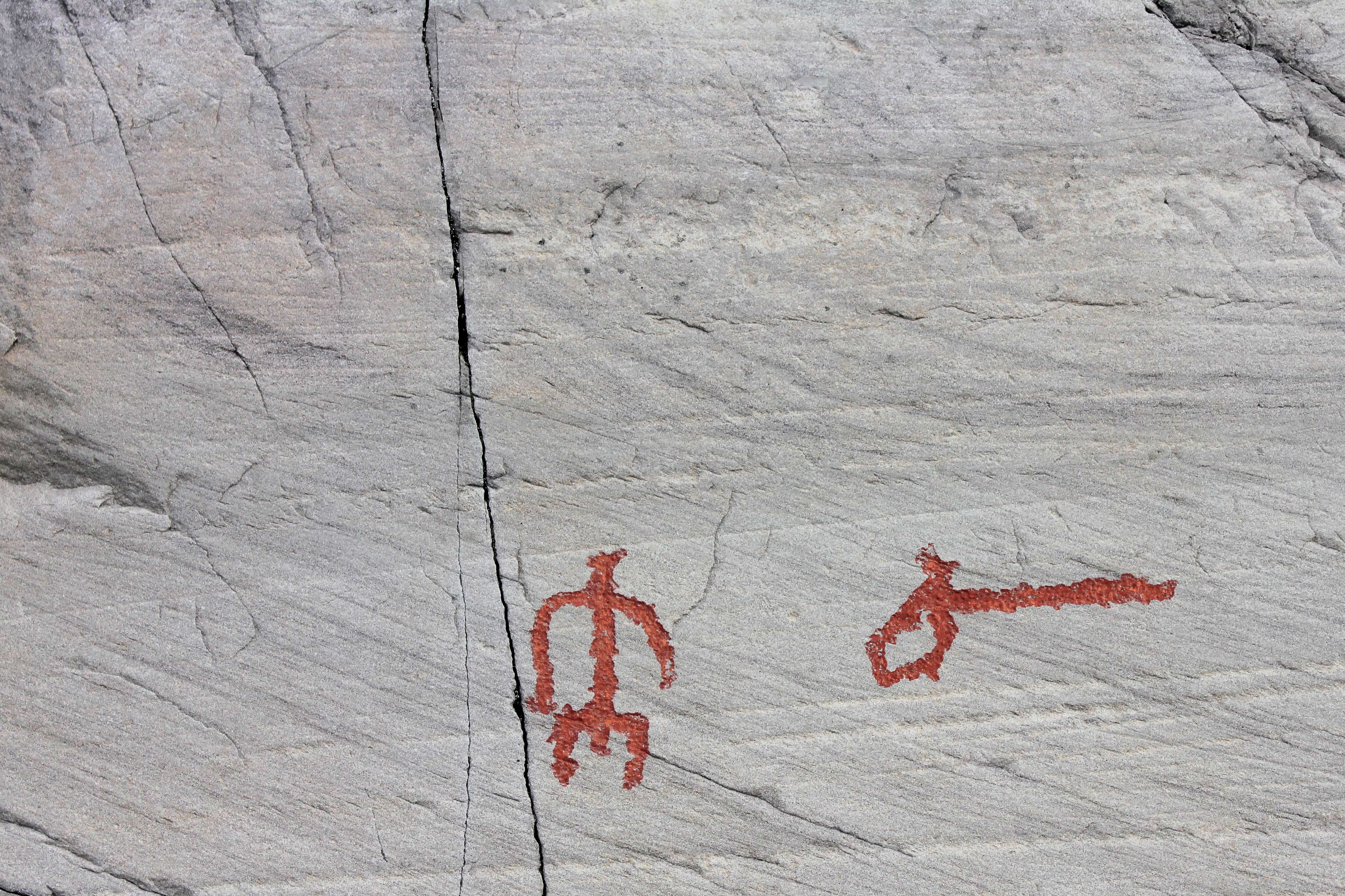
A close up shot of the man with the bow and arrow. A quiver with a shoulder strap is nearby.
Note the double bow, a feature which is difficult to interpret, but which may be simply the string of the bow.
Photo: Ralph Frenken 2012

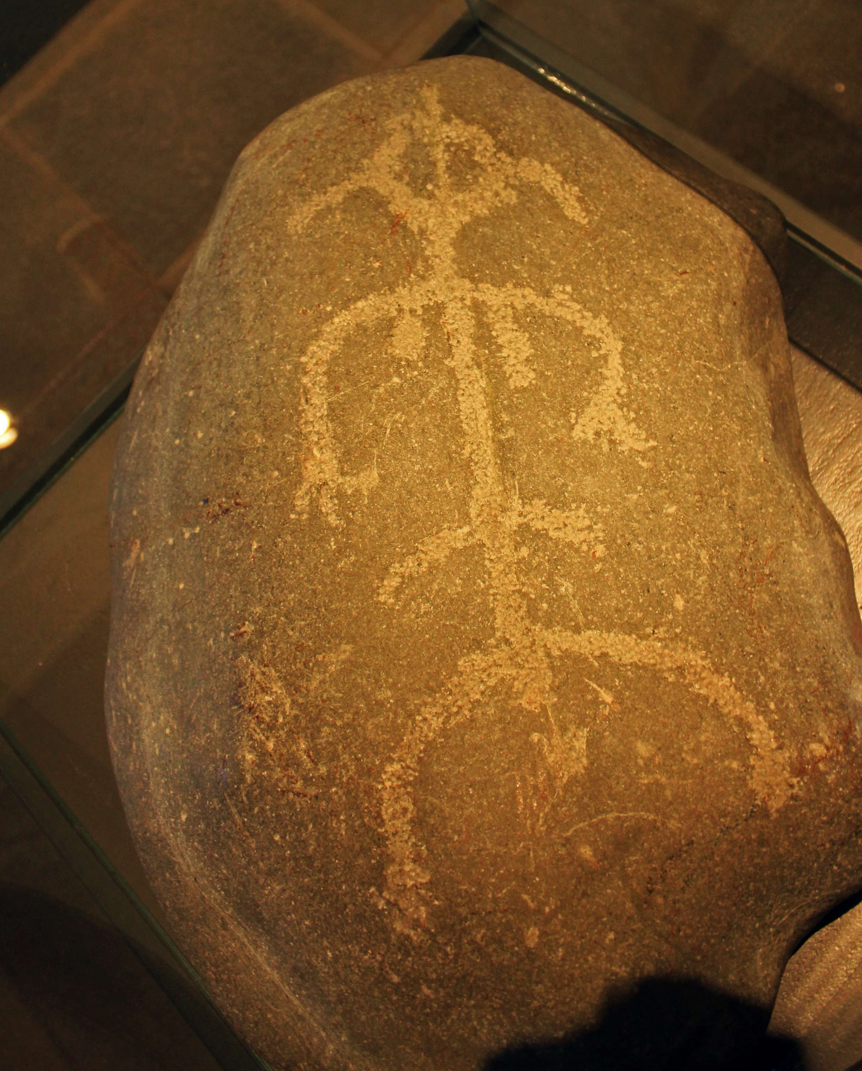
The Pippi Stone
Discovered by Fredrik Falsen when ploughing a field around 1950. The carving on this stone was the first rock art discovered in Alta. The next was not found until 20 years later.
The stone was in a potato field on the Langnes Farm near Isnestoften some kilometres from Alta Fjord. The figure was made approximately 4 000 - 5 000 years ago.
Archaeologists named it 'Pippi' after Astrid Lindgren's famous children's book heroine, Pippi Longstocking, a book cover of which shows the plaits sticking out on either side of Pippi's head, which unintentionally mimics the engraving.
Photo (right): Ralph Frenken 2012
Photo (left): http://wordsandeggs.tumblr.com/page/199
Text: Display at Alta Fjord Museum

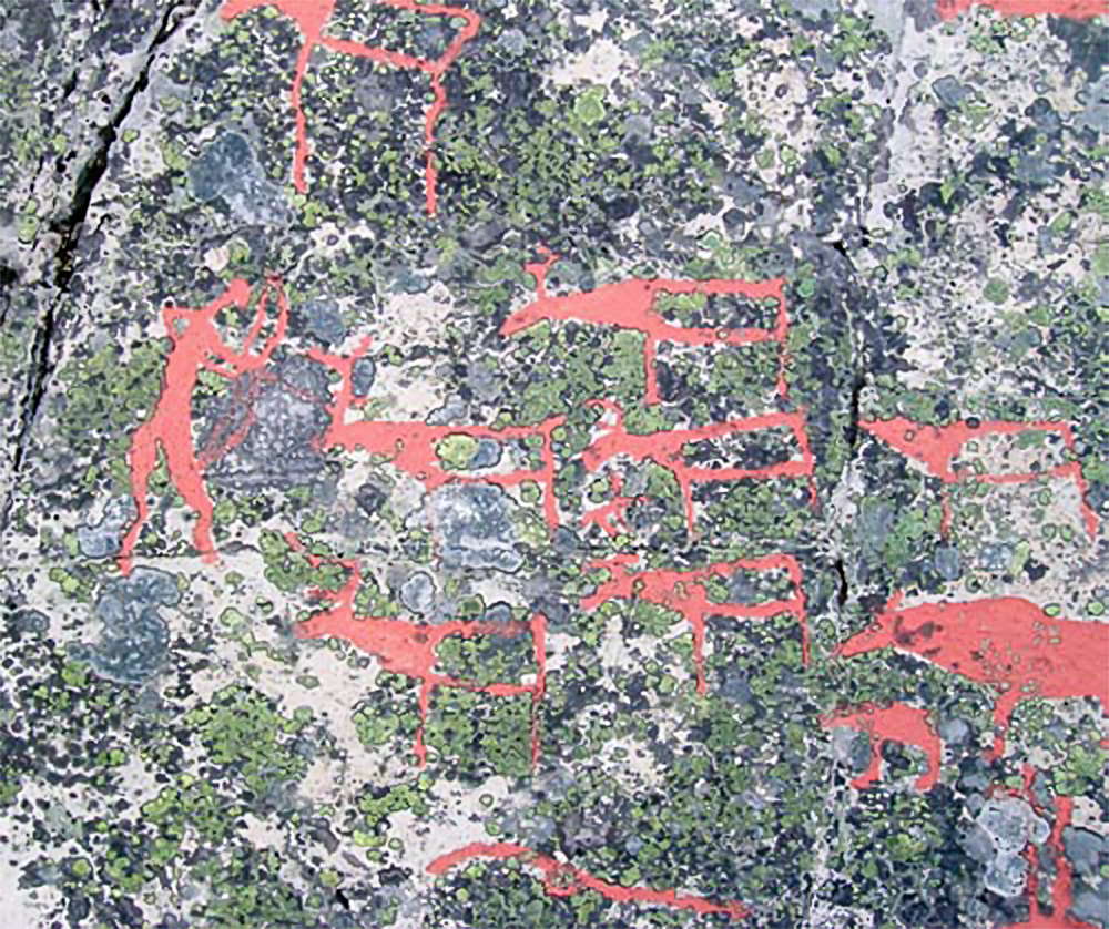
Three figures. The one on the lower left may be carrying a bola or a club, the one on the right may be carrying a bird in one hand and an elk staff in the other.
Staffs were part of the shaman's costume and were used for dealing with the upper world. According to Shirokogoroff (1935), staffs were part of the shamans costume and were used for dealing with the upper world. These staffs are used by the shamans during travelling.
Staffs, or elk-head sticks, are found at several rock art sites in northern Fennoscandia. They occur in Alta, Kanozero, Nämforsen and Vyg. At Alta, they are frequently depicted in association with the elk, while they also occur next to a bear, as at Nämforsen. These sticks have been interpreted as ritual staffs and could have been part of the actual hunt.
Photo: Ralph Frenken 2012
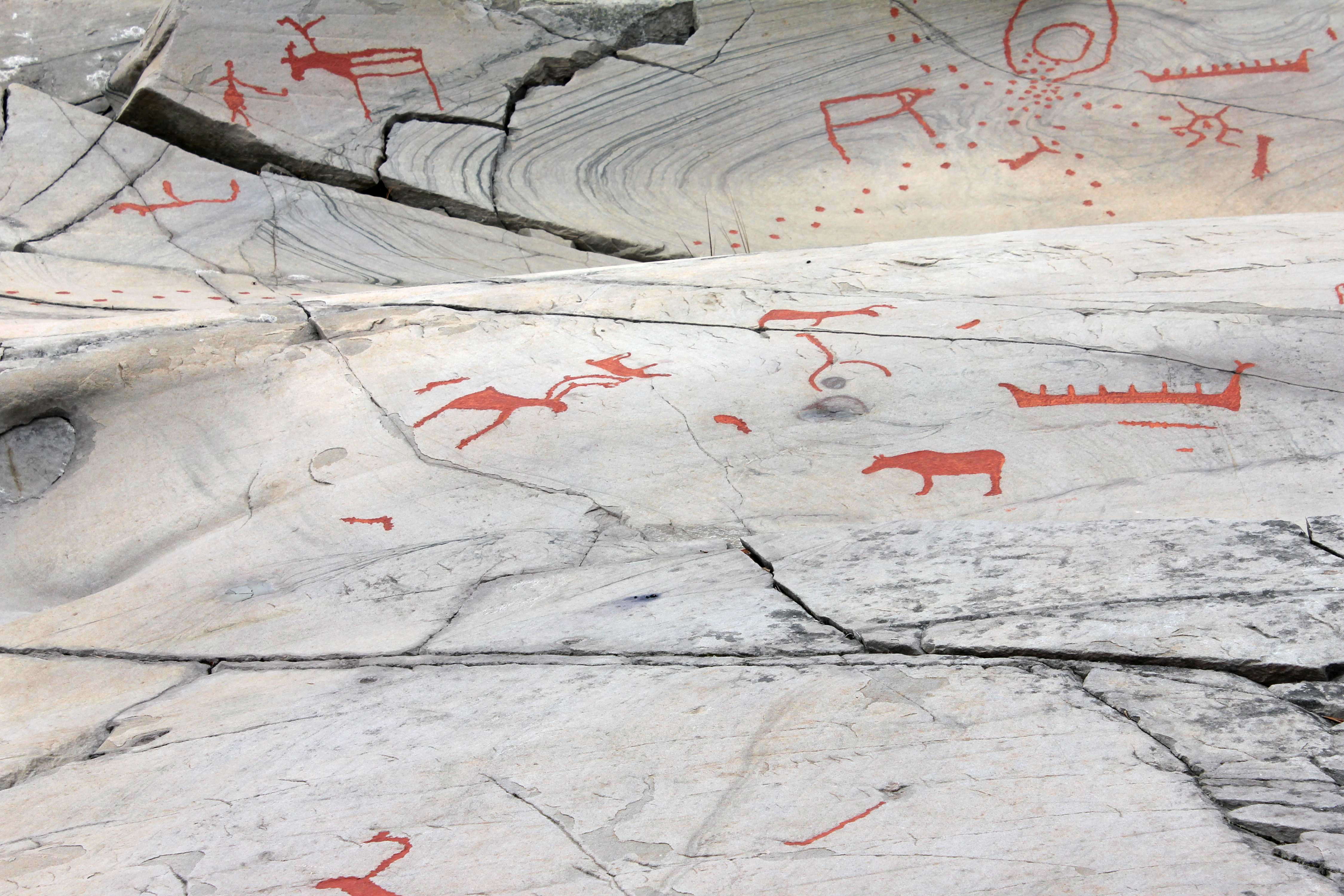
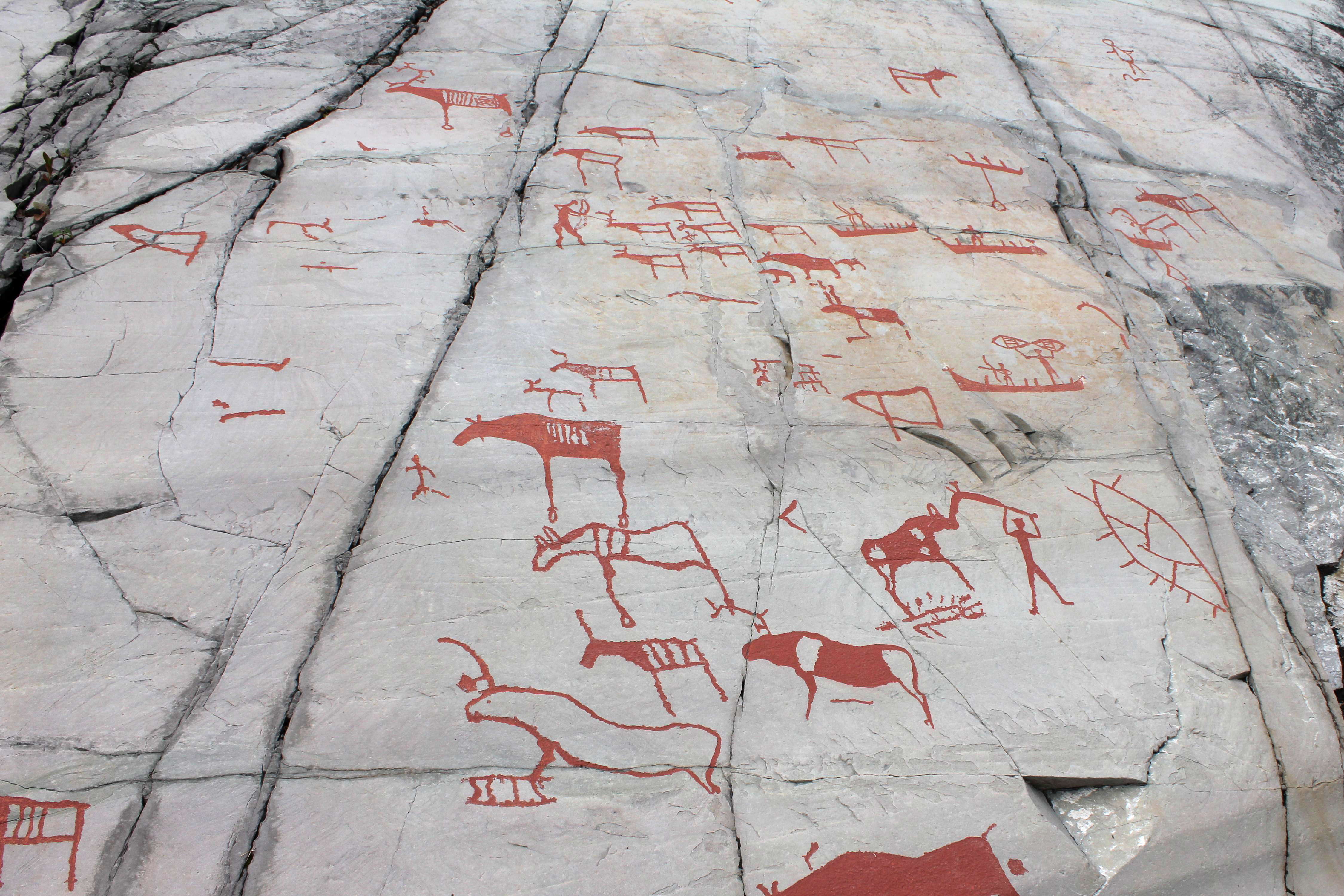
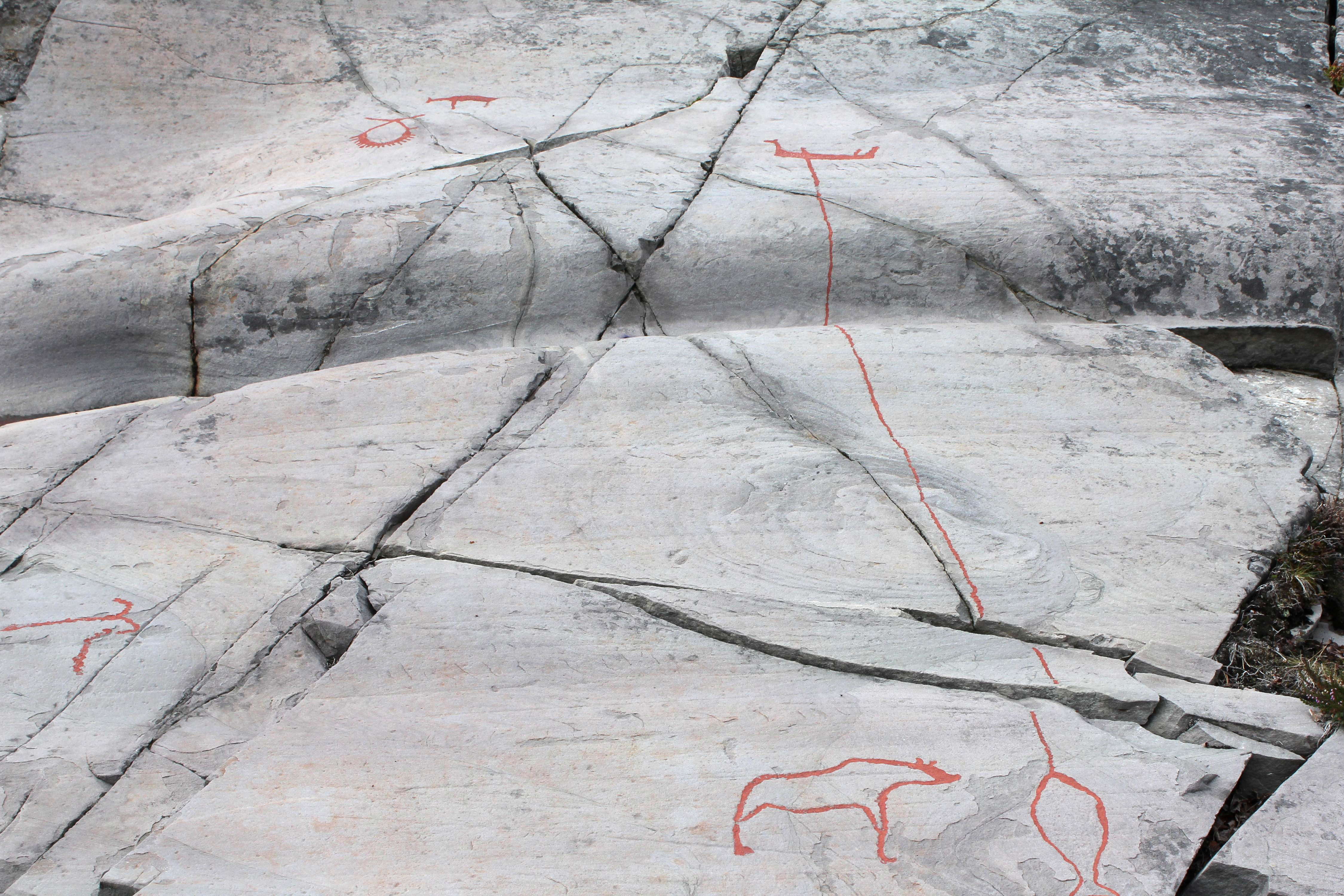
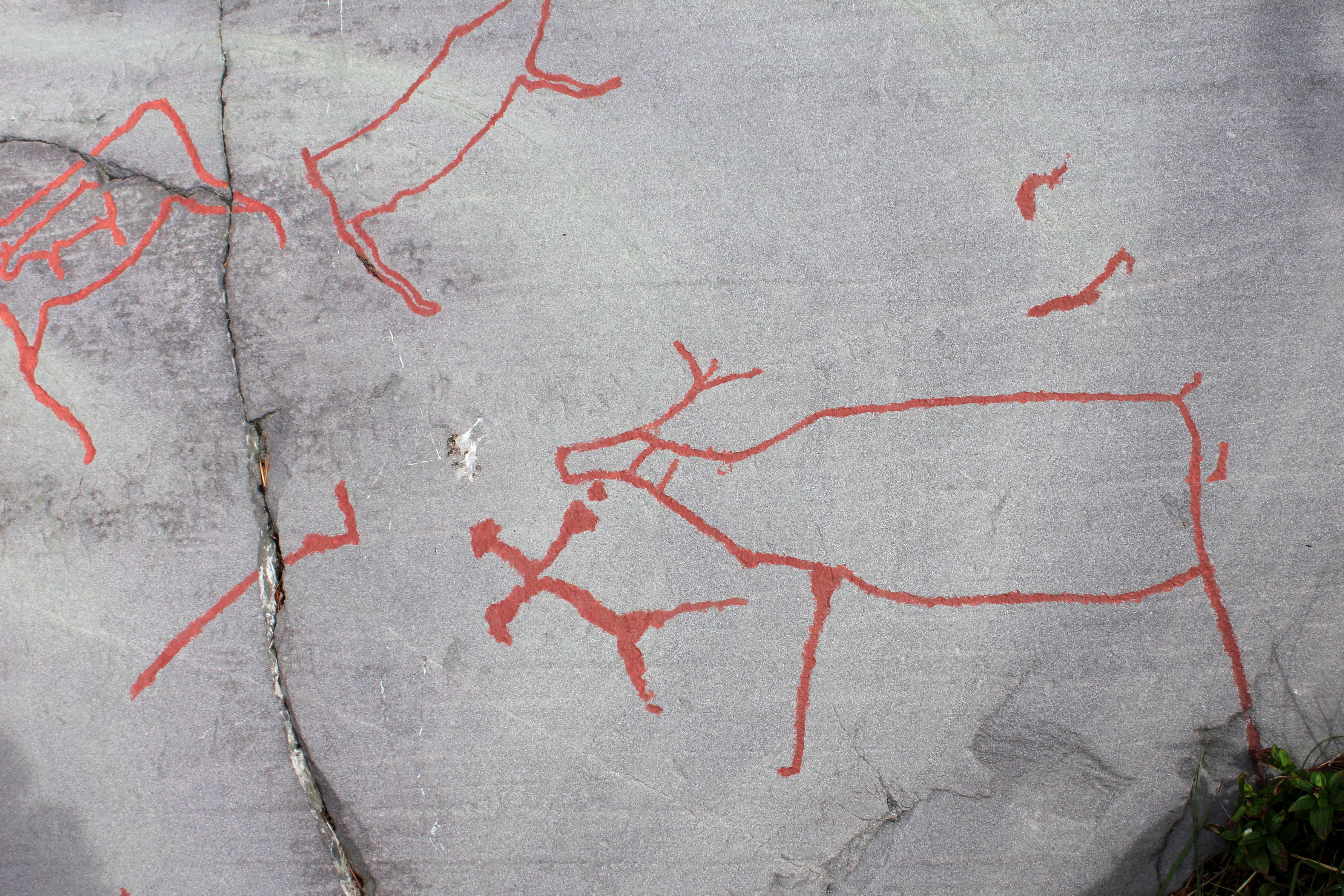
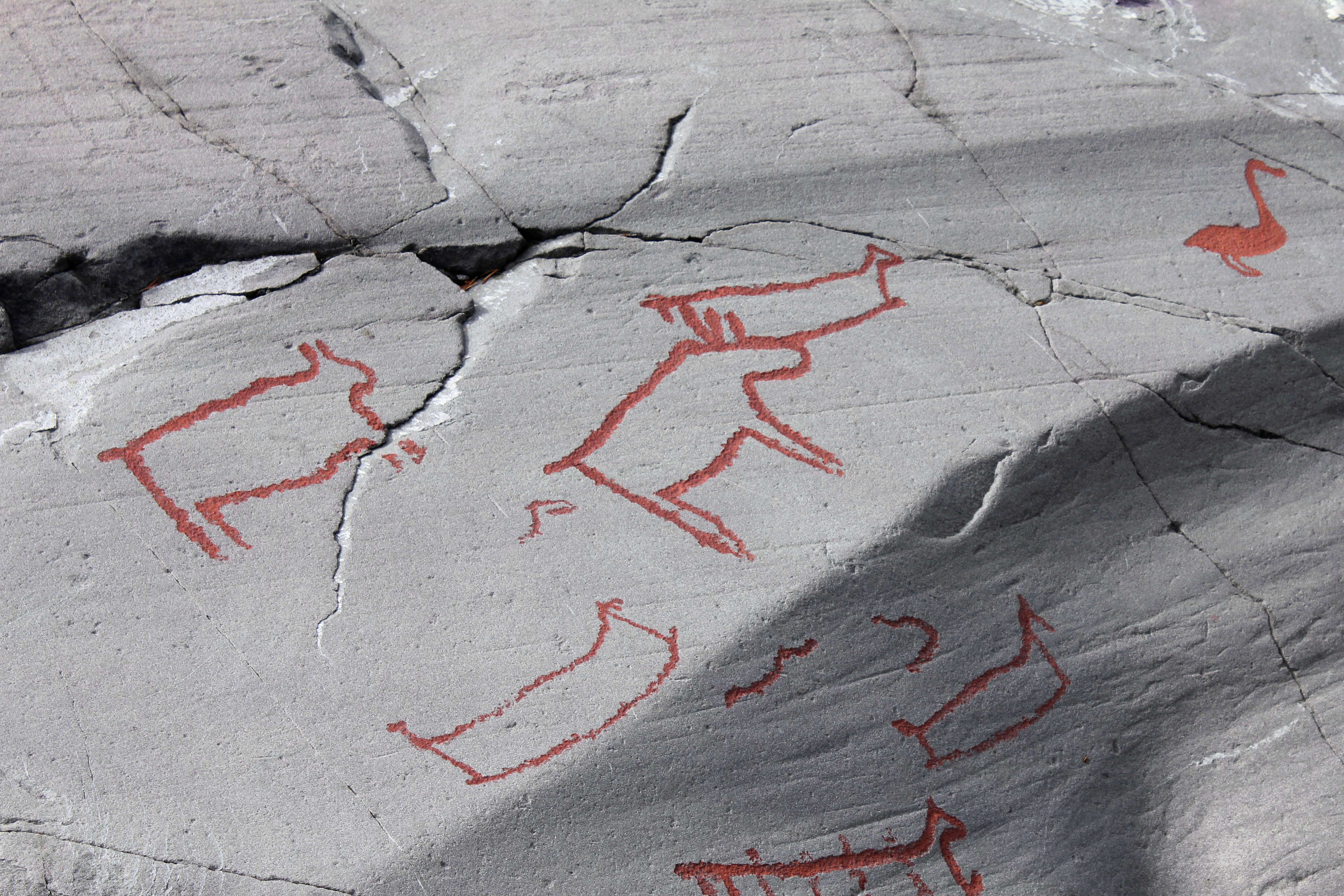
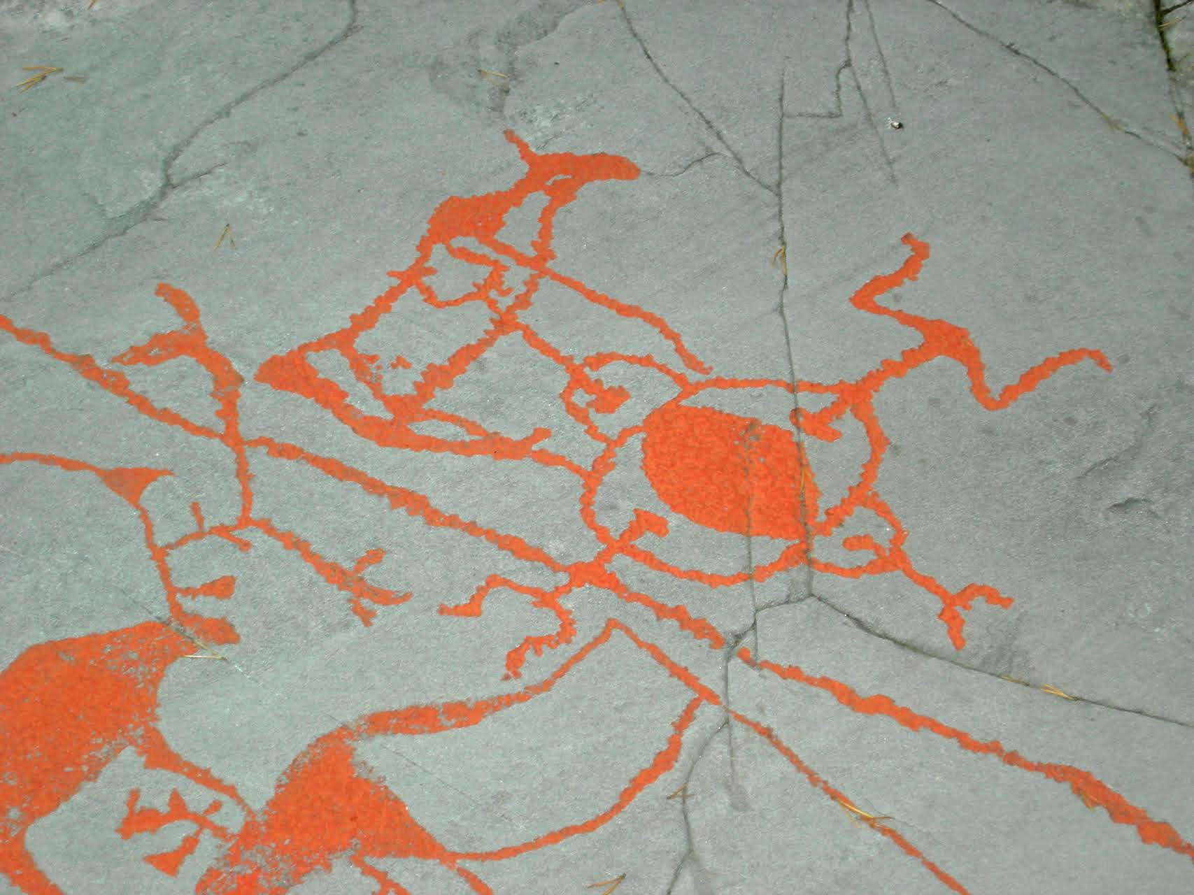
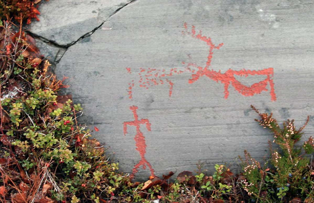
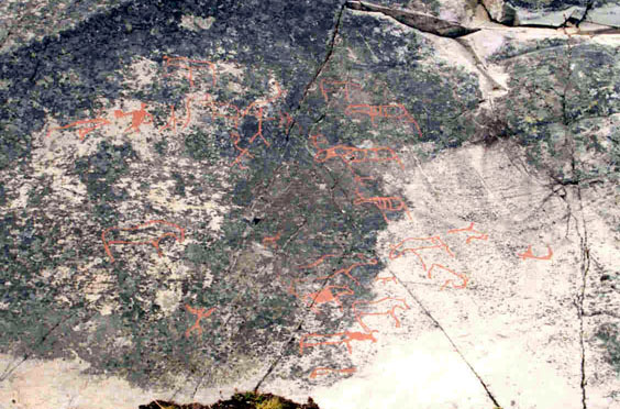
This swirling image shows, in the foreground, several reindeer, a bear, and a boat with a high prow and stern, with six rods sticking out of it, possibly representing the ends of the ribs of the boat. In other similar images of boats, men in the boat are shown as recognisable figures between these rods.
In the background is what may be a bola, a man hunting an elk with a bola or a club, the elk with an object embedded in its shoulders, many dots spilling from what may be a bowl, an enigmatic symbol rather like a head with spikes sticking out of it, and another boat with high ends, with nine men indicated in it.
The dots have been interpreted as bear tracks, with bears filling an important part of the mythology of the artists here.
Photo: Ralph Frenken 2012
Dating of the rock carvings
It is assumed that the rock carvings in Alta were made close to the sea, on rocks by the beach. As the land rose and new, smooth rocks appeared, these were used for carvings. The oldest panels are therefore high above the modern sea level, while the younger carvings are located further down in the landscape. It is unclear whether the rock paintings had the same close attachment to the sea and the beach.
Based on the metres above sea level (26,5-8,5 m.a.s.l.), professor Knut Helskog at Tromsø Museum - The University Museum has dated the rock carvings in Alta to the period from around 4200 B.C. to 200 A.D. Within this long period of time the rock carvings are divided into five different phases based on stylistic changes (Helskog 2000):
Phase 1: 4200-3300 B.C.
Phase 2: 3300-1800 B.C.
Phase 3: 1800-900 B.C.
Phase 4: 900-100 B.C.
Phase 5: 100 B.C.-200 A.D.
In his thesis for the dissertation for the degree of Philosophiae Doctor at the University of Tromsø, Jan Magne Gjerde (Gjerde, 2010) suggests that the rock carvings in Alta are thousand years older than previously assumed:
Phase 1: 5200-4200 BC
Phase 2: 4200-3000 BC
Phase 3: 3000-2000 BC
Phase 4: 1700-1200 BC
Phase 5: 1100-200 BC
Text above from http://www.alta.museum.no/sider/tekst.asp?side=24

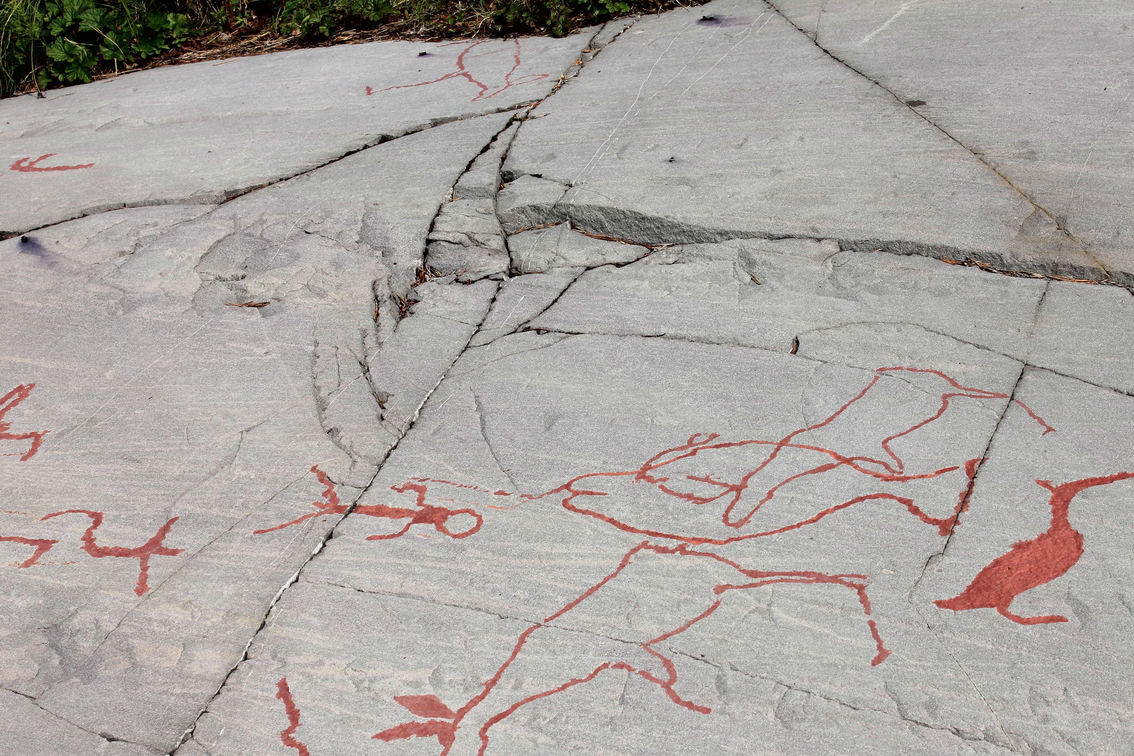
There is a simple reason for the 'banding' of the Alta rock engravings. As this photo shows, no matter what the season, the area between high and low tides will always be available for artworks, no matter whether there is snow on the ground or not. Thus the engravings at any particular time are confined to a narrow area beside the water where the tides have melted any snow that falls.
At the end of the last ice age, the land 'rebounded' after the bulk of the ice melted, and so this part of Norway slowly lifted by a process known as isostasy. The ice sheet reached its greatest extent and thickness 20 000 years ago, and most melting occurred between 16 000 and 10 000 years ago. As the ice retreated, coastlines rebounded. This uplift did not stop when the ice had melted, it continues to this day.
Thus any particular group of hunters and fishers had only a limited band of glacier-smoothed rock on which to make their engravings, with later groups forced (except during the short summer) to use the intertidal zone for their artworks.
This photo graphically shows this phenomenon.
Photo: Gjerde (2010)
(Another reason for choosing the intertidal zone, even in summer, is the lack of lichen. The lichen grows over the rock very quickly, making the creation of the engravings difficult or impossible. By using the intertidal zone the artist is ensured both a snow-free and lichen-free blank canvas on which to draw - Don )
Shown here are some of the figures on Bergbukten 4B in Hjemmeluft (part of the Alta site) before and after treatment with ethanol to remove the lichen that almost completely covered them.
When the rock carvings in Hjemmeluft and Amtmannsnes were discovered in the 1970s, they were partly covered with thick layers of turf. The turf was removed, and lichenfree rock surfaces with clearly visible rock carvings were revealed. The surfaces that were covered in lichen were scrubbed and cleaned. After a few years the lichen began to return, and around the turn of the century the rock carvings were almost covered again. The painted carvings in Hjemmeluft were hardly visible anymore, and questions were raised about whether they could still be presented to visitors.
Photo and text: K. Tansem, WAM, in Tansem et al (2008)

At this point in time ethanol was the method of choice for removing lichen. In 1999 some of the surfaces were cleaned with ethanol in connection with documentation work, seemingly without much effect. After a few years, however, the surfaces were completely free of lichen.
The ethanol did not work immediately, but it is a process that takes several years, depending on the amount used, and if the surfaces are covered to let the ethanol work for a while. In 2003 the systematic use of ethanol on the panels in Hjemmeluft started, and the carvings and the details of the rock surfaces are now significantly clearer. The use of ethanol and the removal of lichen from rock carvings are controversial practices, both because of possible harmful effects, and for visual and ethical reasons.
Photo and text: K. Tansem, WAM, in Tansem et al (2008)
This is what the rock carvings may have looked like.
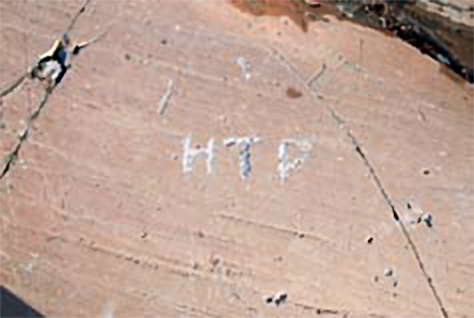
HTP carved his initials into the rock in the 1940s, and they are still clearly visible against the red-brown color that covers the rocks on the beach.
Photo and text: K. Tansem, WAM, in Tansem et al (2008)

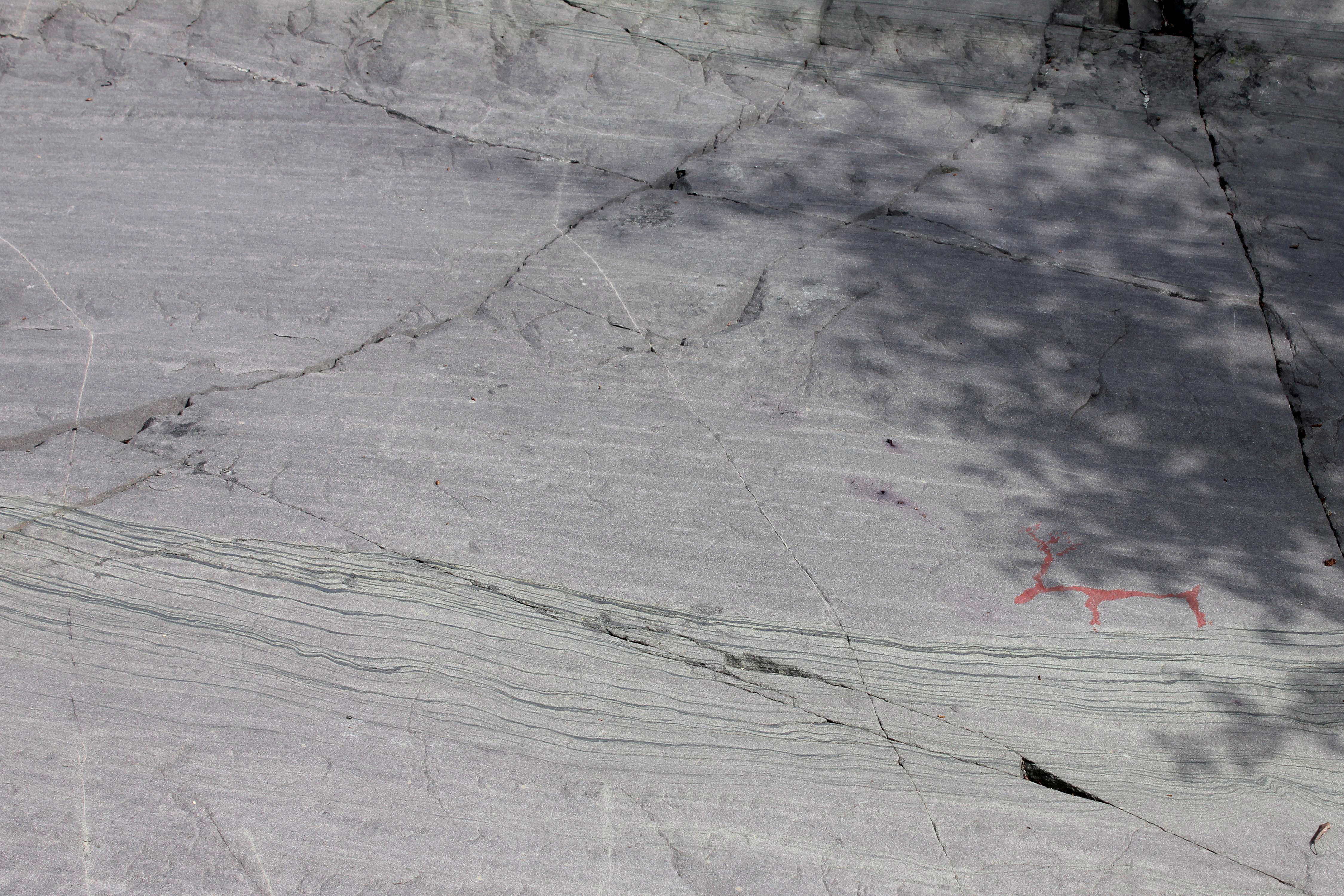
Images placed on any available flat surface. In the foreground, a reindeer and a man, in the background the same engraving shown in the photo above of what looks like a head with rays coming from it.
Photo: Ralph Frenken 2012

A man with a stick in his hand chasing a small animal. Also shown is a very large animal that may be an elk. Note the stripes used as infill in the body.
Photo: Ralph Frenken 2012
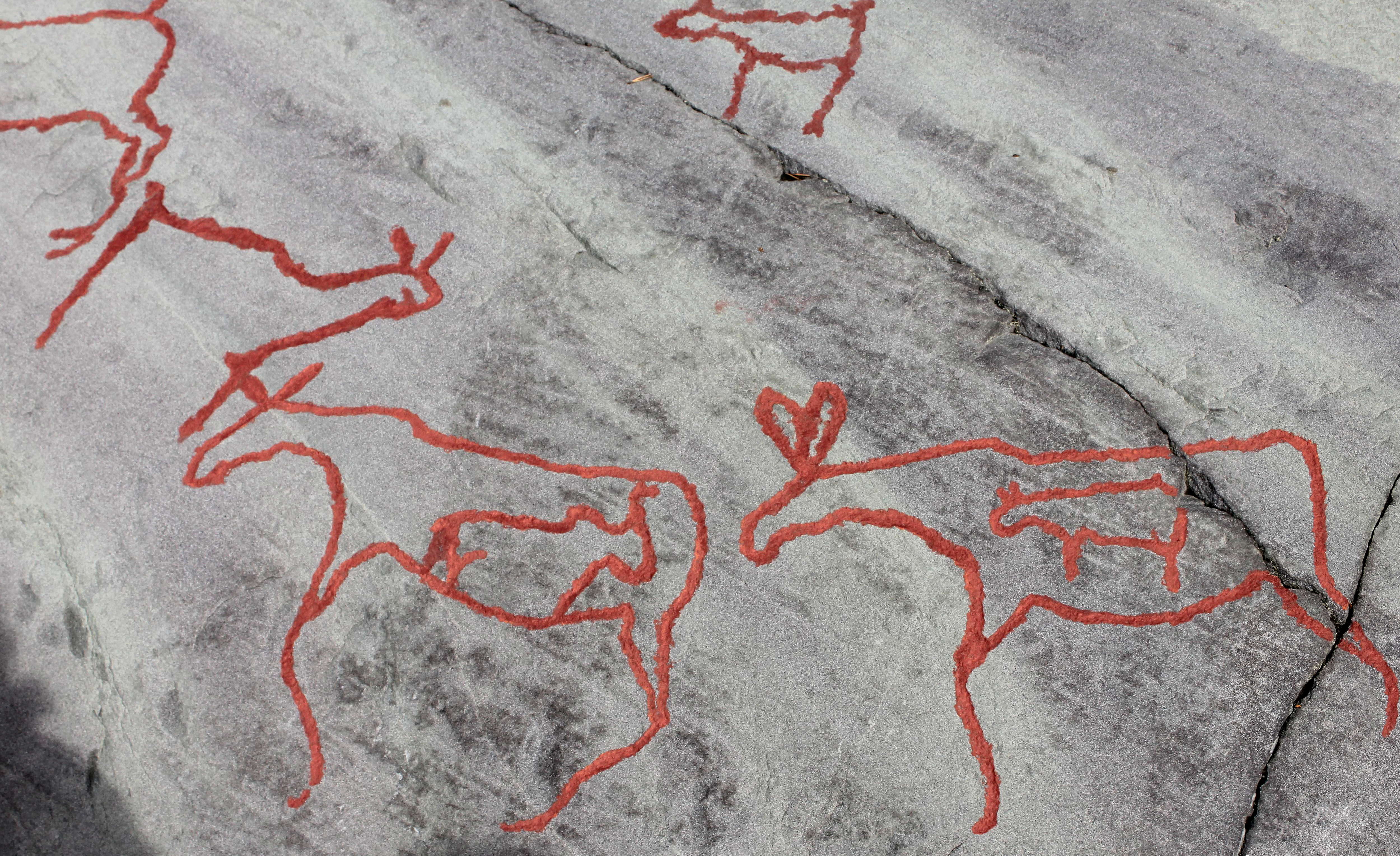
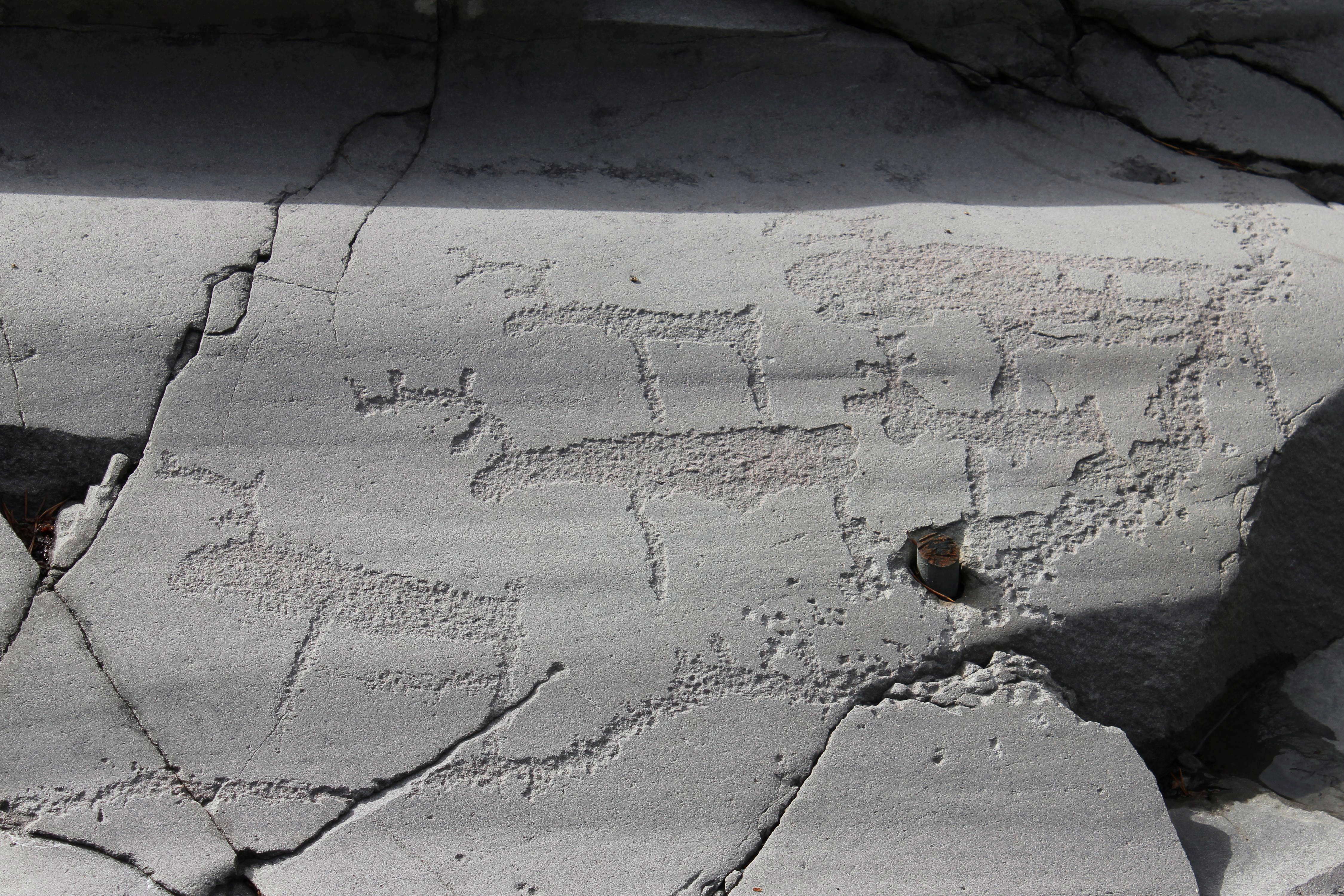
Animal figures, mostly outlines only, including elk and reindeer.
Photo: Ralph Frenken 2012
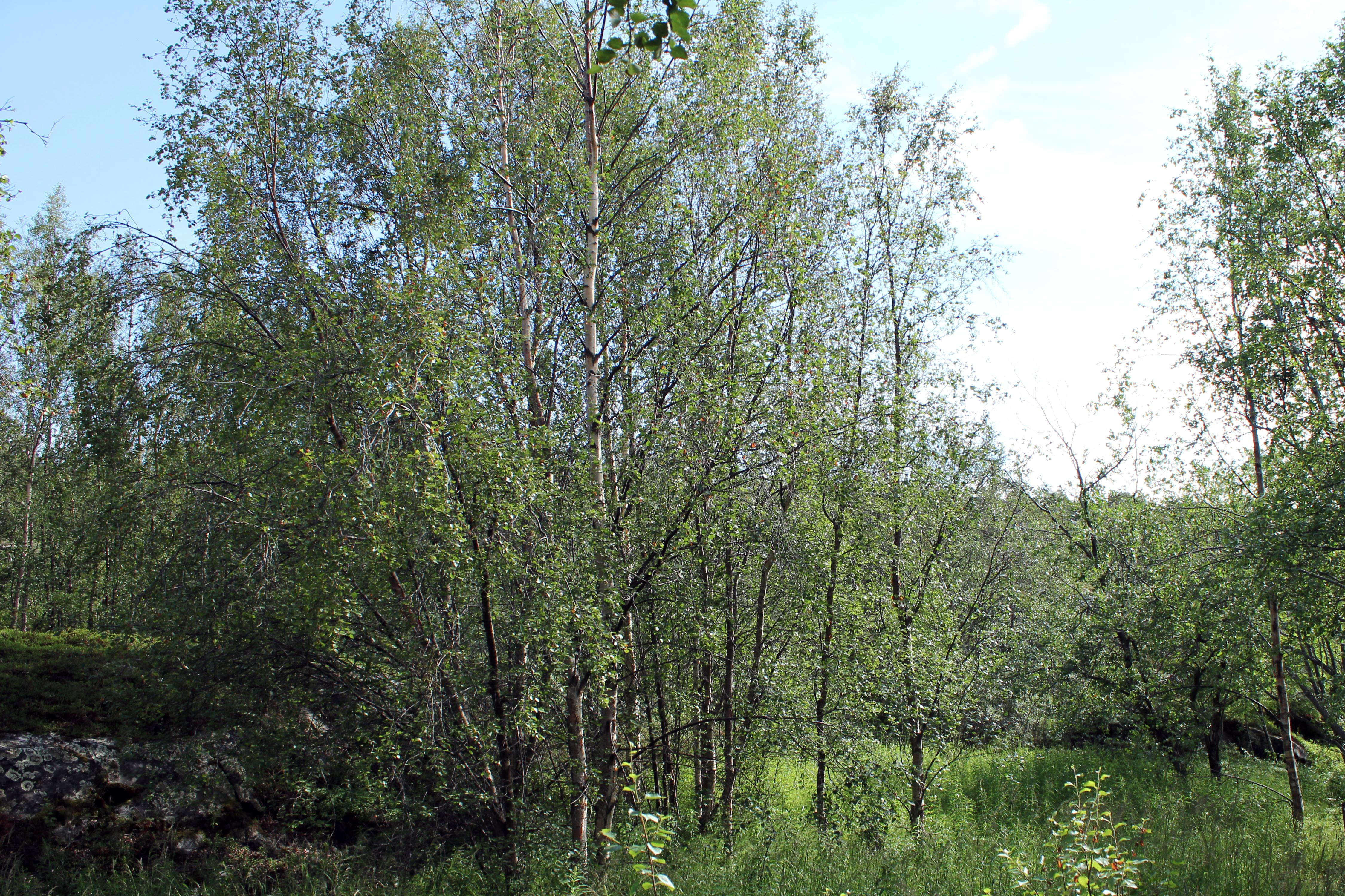
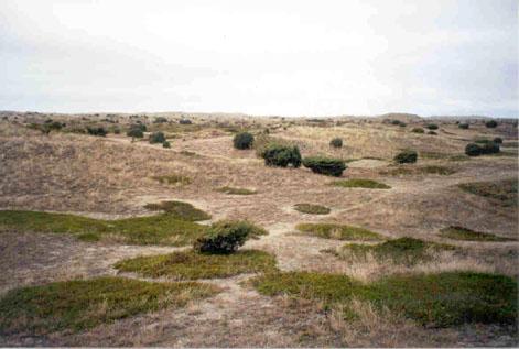
A grove of willow trees, typical now for this area of Lapland.
The panels in Hjemmeluft were previously in an open landscape, and one used to have a clear view from one panel to another, and to the Altafjord. During the last 20-30 years the vegetation in Alta has changed because the landscape is overgrown with deciduous trees. It became necessary to slow the development down, especially on and close to the rock carving areas. The forest was thinned in 2004 and 2005, and the areas around the rock carvings were opened so that the visual contact between the rock carving panels, the landscape, and the ocean could be reestablished.
Photo: Ralph Frenken 2012
Text: K. Tansem, WAM, in Tansem et al (2008)
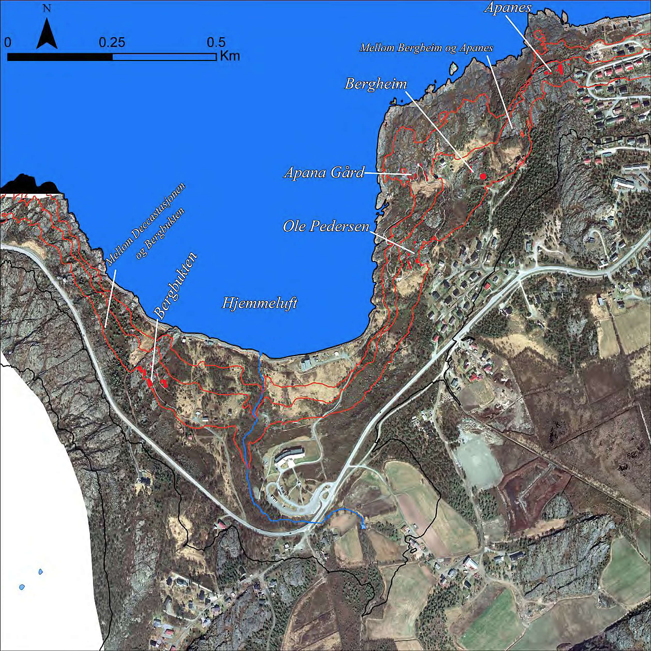
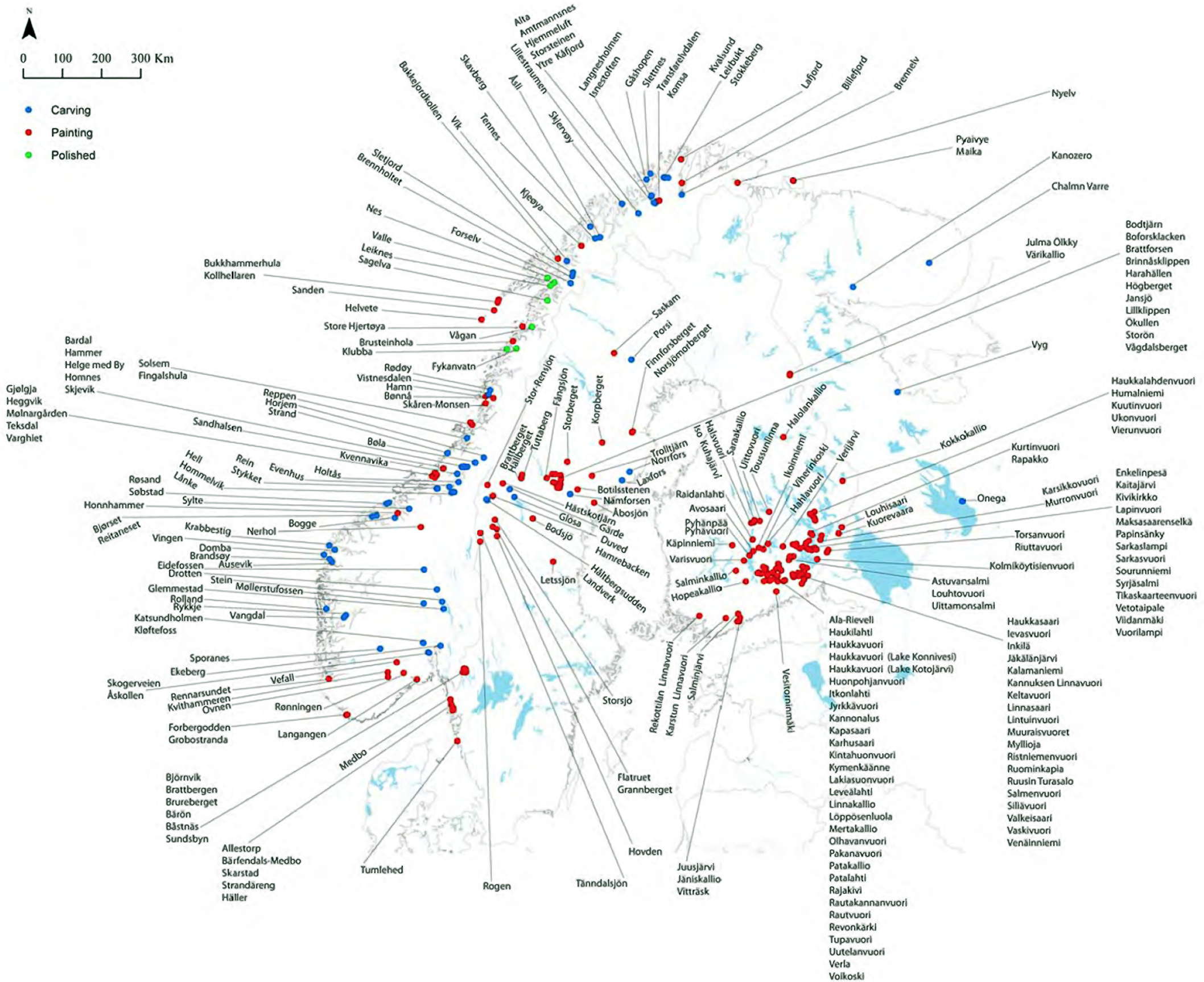
This is a very useful map. Many of the sites at Alta are referred to by their names detailed here.
The red lines are the former shore lines, as the land continually rises in isostasy, even today, because of the removal of the weight kilometres of ice during the last ice age, which pushed the whole area down in elevation. Now it is 'bouncing' up again, at the rate of a few millimetres a year.
Photo: Gjerde (2010)
(This is to illustrate the Alta site (which gets its name from the Alta River) in its environment, at what is now called Hjemmeluft - Don )
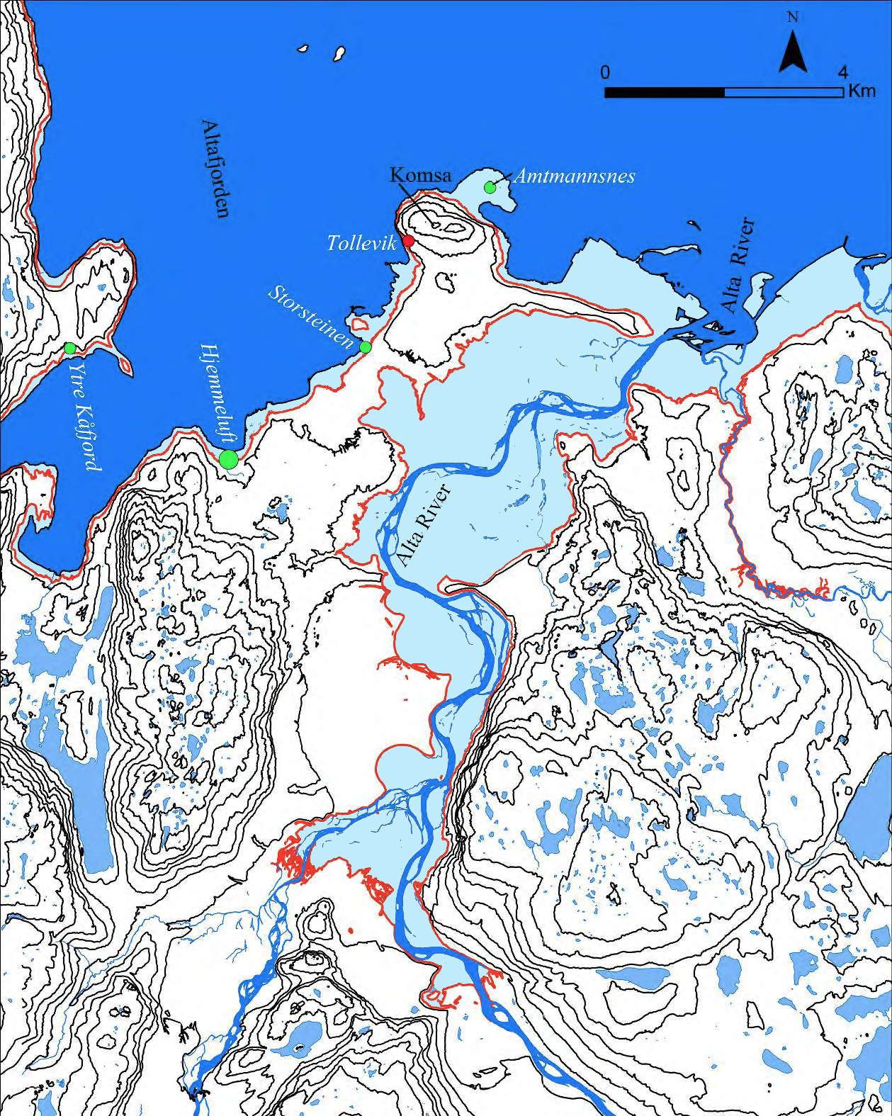
Map of the rock art sites at the head of the Alta-fjord. The carvings sites are marked with green dots and the paintings sites with red dots. The red line is placed at 25 metres above sea level.
This is to illustrate the landscape at the time of the first carvings.
Contour lines at 50m.
Notice how the Alta river was a massive shallow riverine landscape, virtually like a tiny shallow fjord stretching more than 10km inland, at the time of arrival of the first settlers.
The Komsa Peninsula stands out in the landscape with the Komsa mountain and is located between the Kåfjord fjord in the west and the Alta River fjord in the east. Notice the small island east of the Ytre Kåfjord site (at present named Auskarnes) The point west of the Hjemmeluft Bay is the Saltvikneset.
(I have coloured the previously submerged land with a pale blue colour to make the change more obvious - Don )
Photo and text: Jan Magne Gjerde, Gjerde (2010)
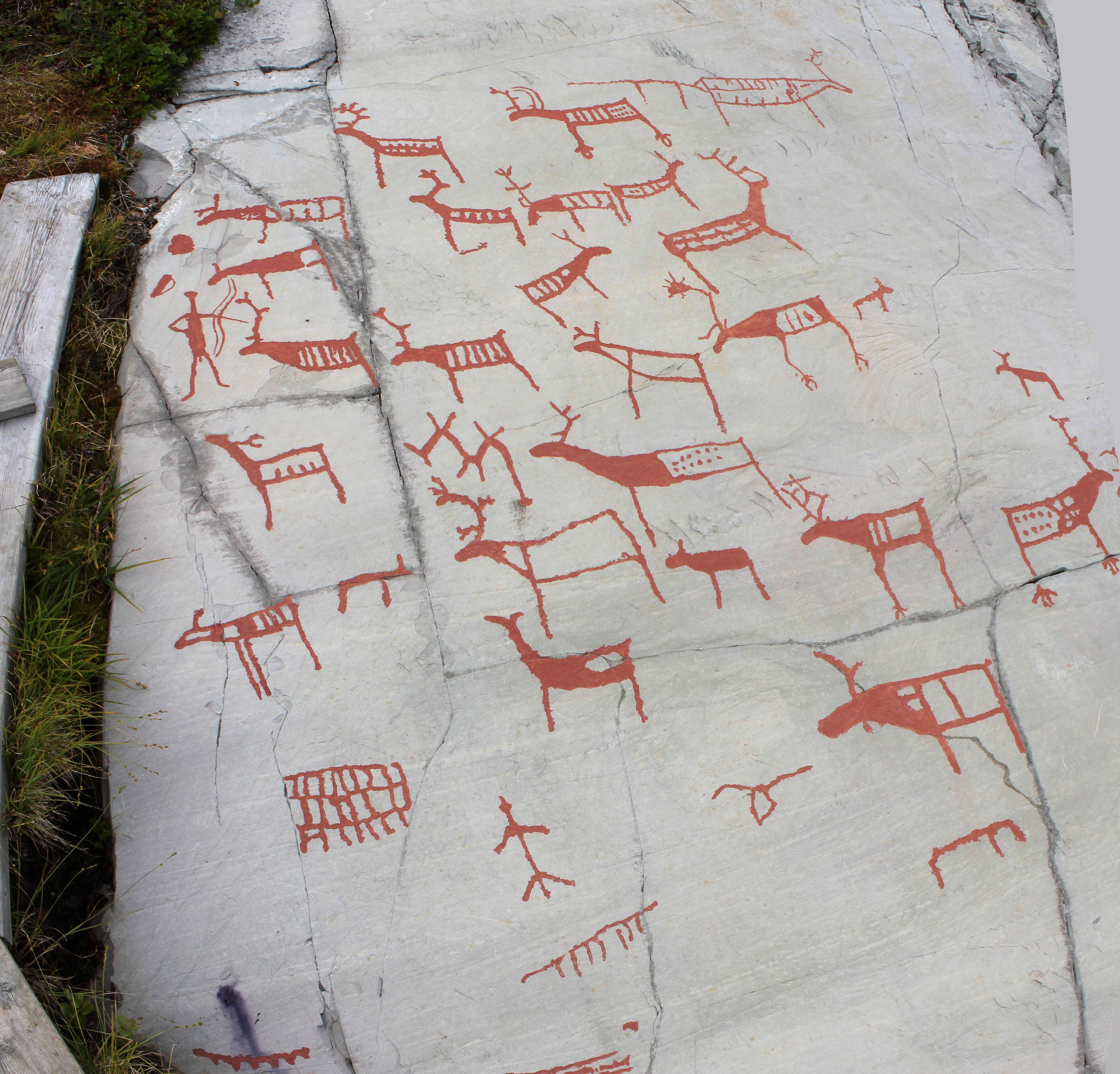
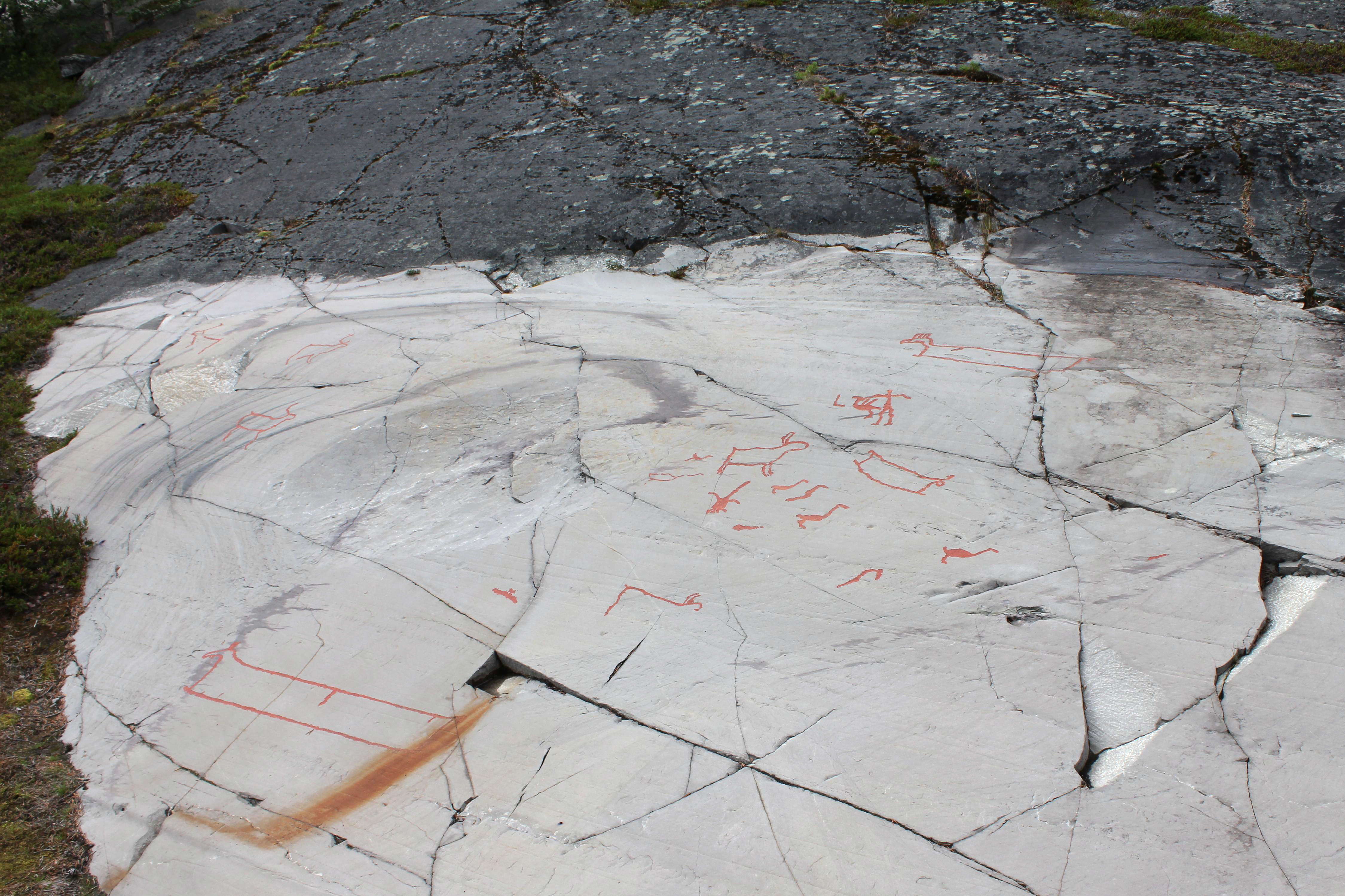
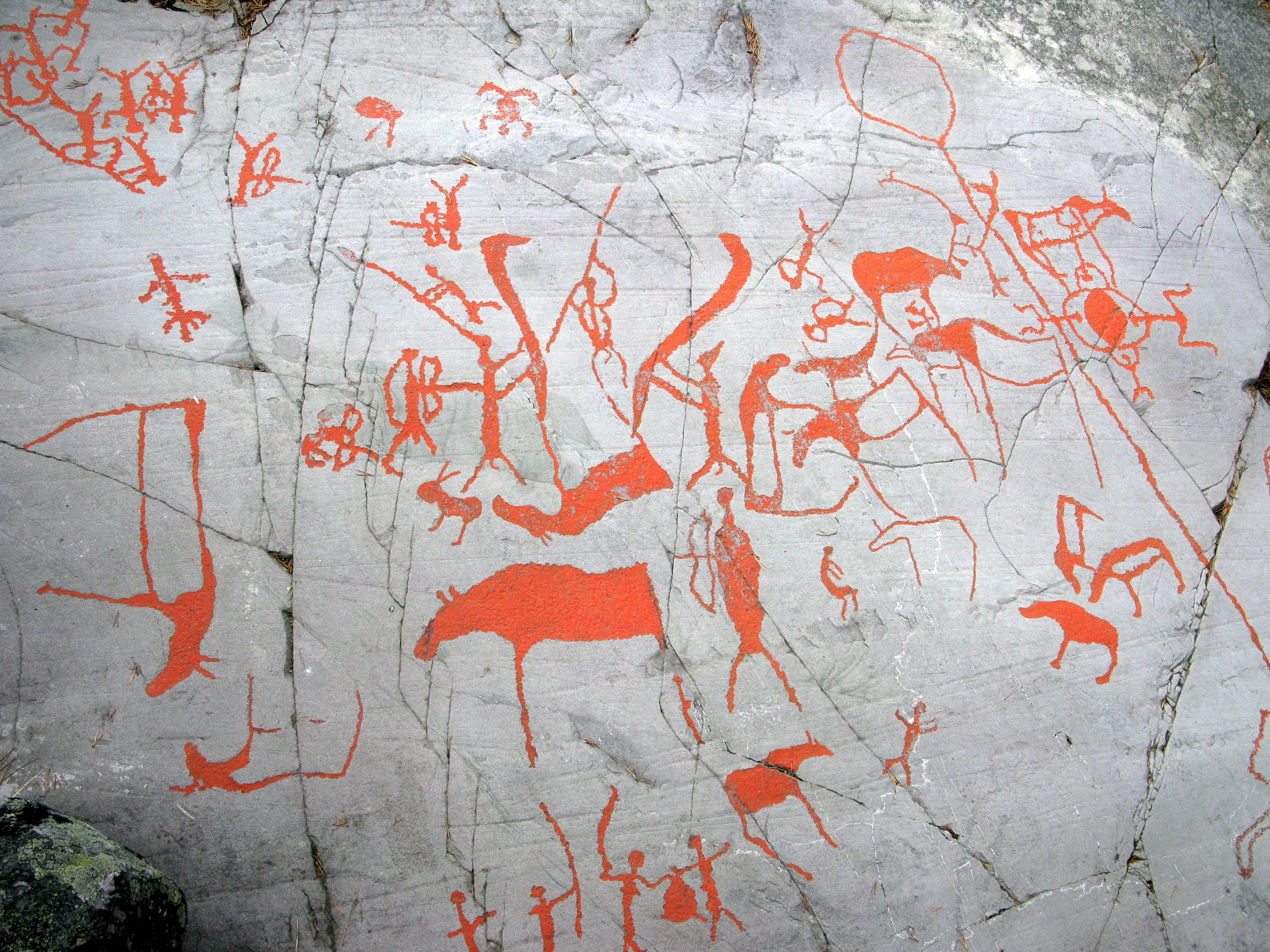
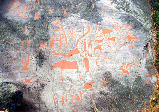
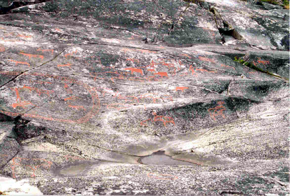
A highly complex series of images.
Three areas of this image are examined in detail below.
Photo: Ralph Frenken 2012
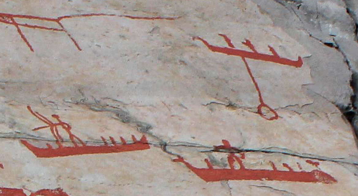
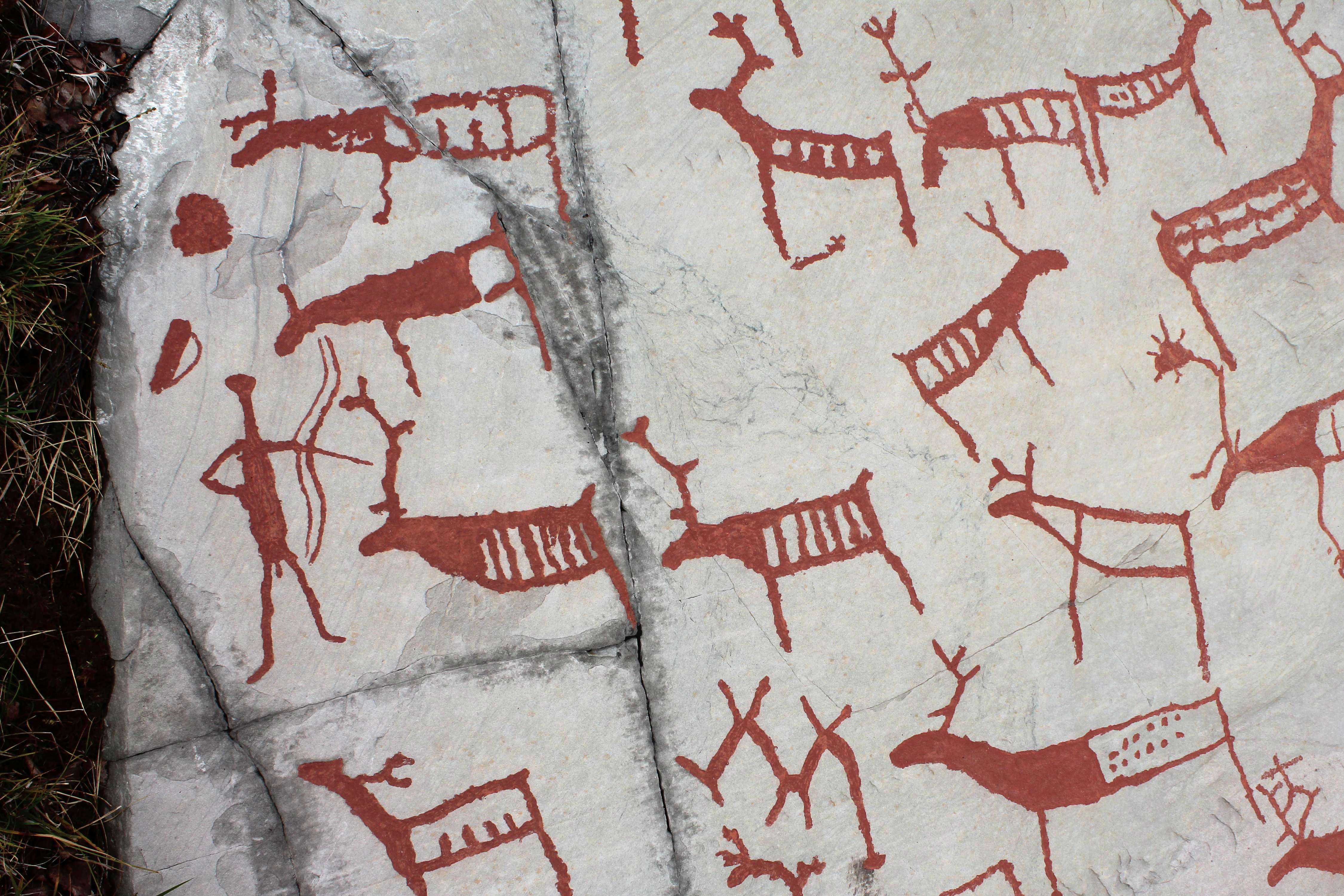
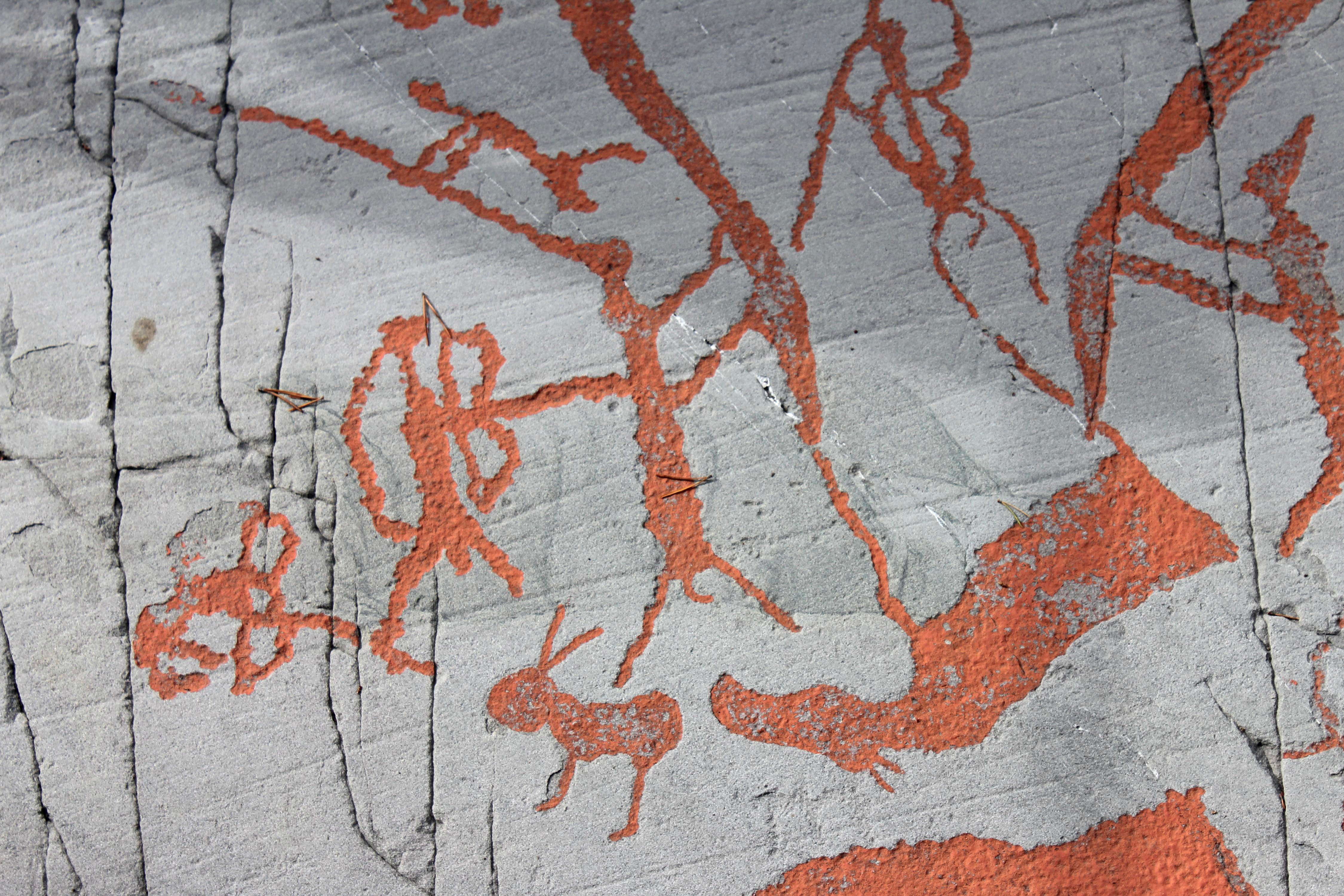
This image of three boats demonstrates three facets of daily life. The boat on the top right has a rock anchor below it, anchoring it in place. The boat on the left has a man hunting fish with a bow, and the third image is a man standing in a boat. The stance of the two men shown indicates that the boats were stable in the water, and that the men who used them were totally confident in their use, certainly in the protected waters of the fjord.
The area offered both shallow (especially just over the rise in the flooded Alta River, a huge shallow marine lake, see the huge pale blue area on the map further up this page) and deep water environments, but in one sense an unusual marine environment in that the long narrow fjord (an underwater valley carved out by a glacier during colder times) provided both transport and fishing opportunities, with the open sea providing replenishment of fish stocks, a protection against the depletion of food resources.
The apparent double bow of the man on the left is difficult to interpret. The second line follows the curve of the bow, and is apparently not the string of the bow. The possibility of a compound bow cannot be ruled out.
However other images make it clear that the second line is actually the string of the bow in at least some cases.
Photo: Ralph Frenken 2012
In this image it is clear that the second line is actually the string of the bow.
PhotoK. Tansem, WAM, in Tansem et al (2008)
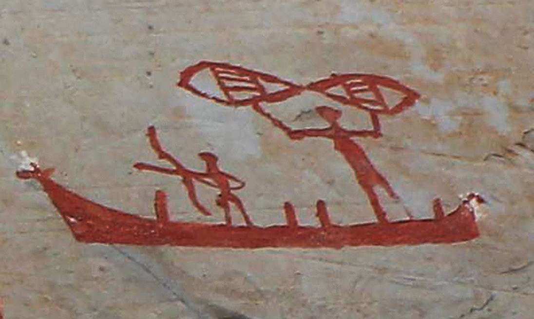
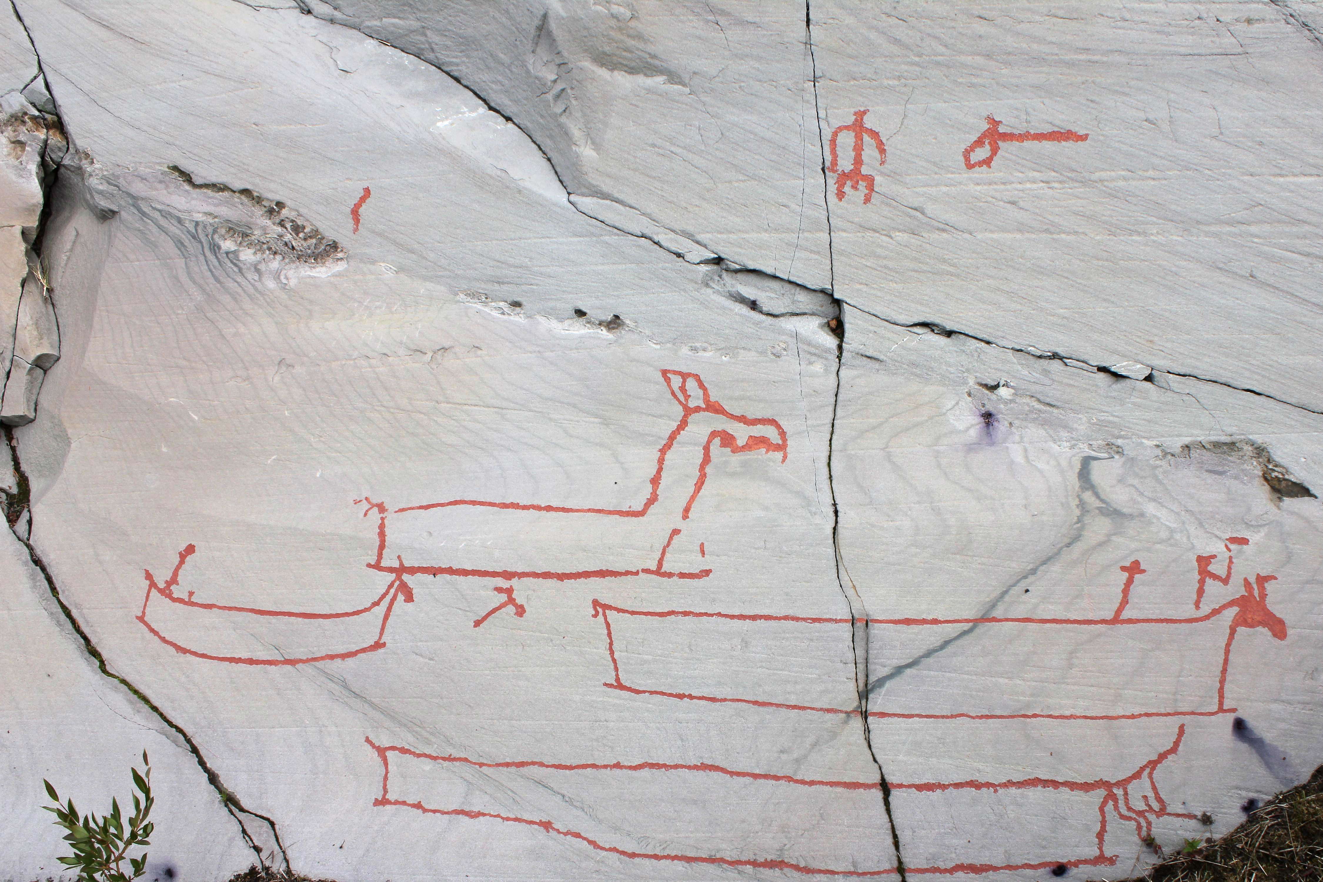
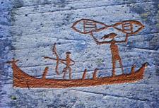
In this well known image, we see two men in a small boat with an elk head prow. One of the hunters has a bow, indicating that some fish were speared, while another is in the act of casting a net.
In addition we can see 'posts' sticking out of the boat, as though the ribs have been extended above the gunwhale forming stanchions, possibly to provide points of attachment for oars or for fishing lines and nets.
Photo: Ralph Frenken 2012
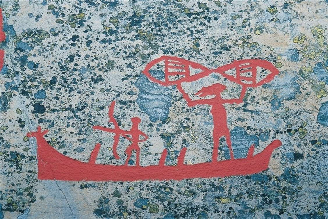
An older version of this image. The smaller person with the bow and arrow is probably a child.
Comparing the red colouring in this photo with the present version in the photo just above, we can see that an area formerly thought to be an extended front of the face is now considered to be just a natural feature of the rock.
Note that this image was taken at a time when the rock surfaces were beginning to be colonised with lichen again. The lichen is now systematically removed with ethanol on a regular basis as needed.
Photo: Kurt Hamann/www.visitnorway.com
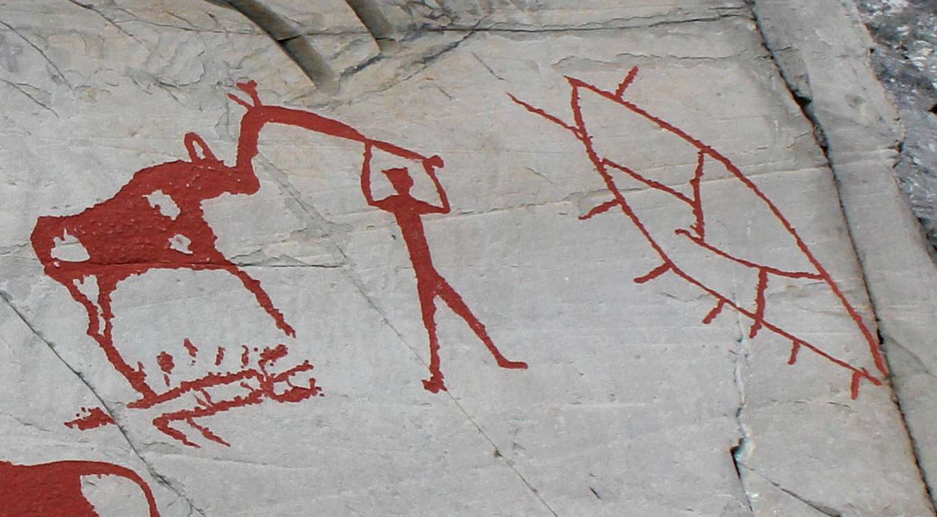
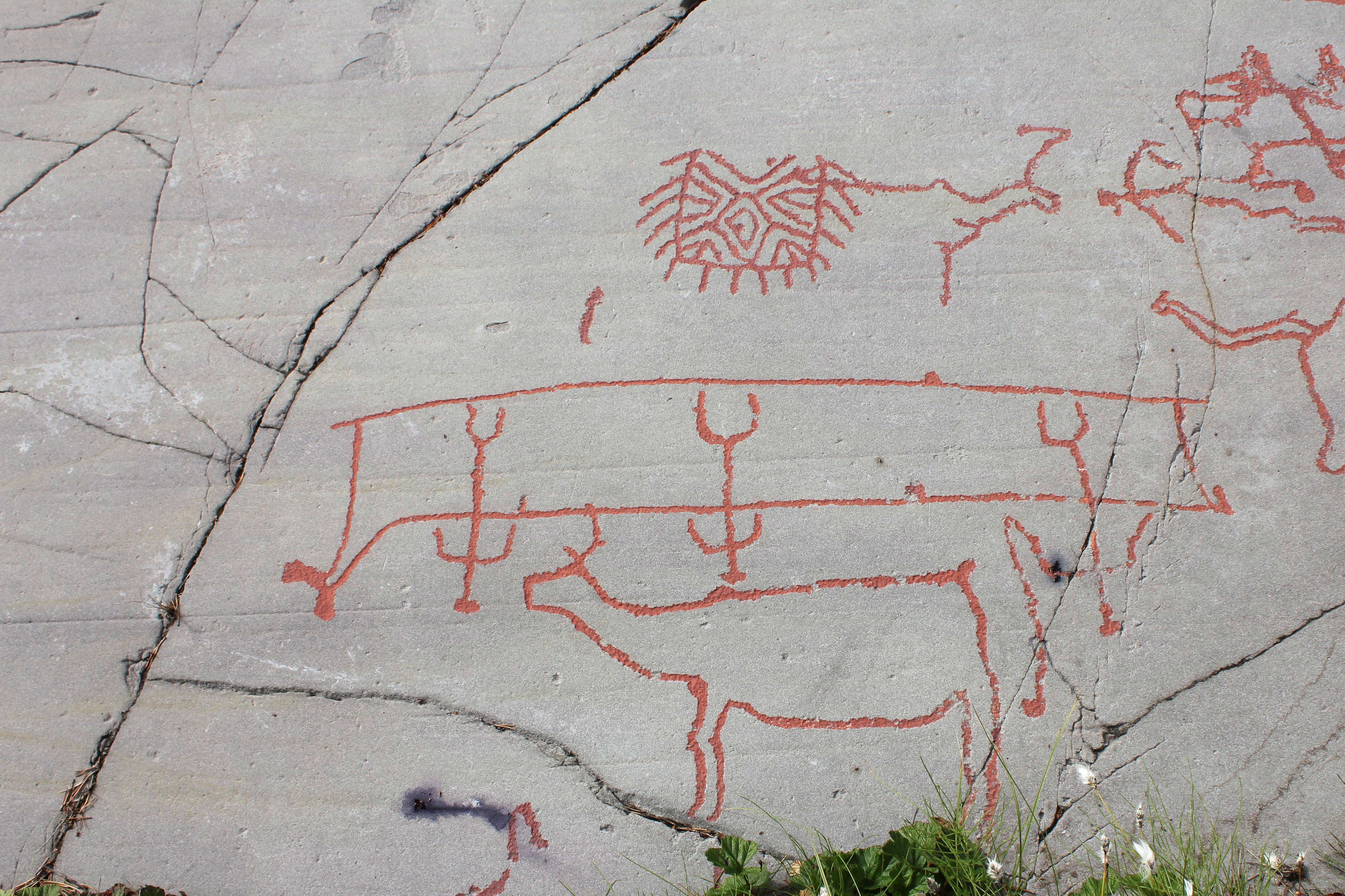
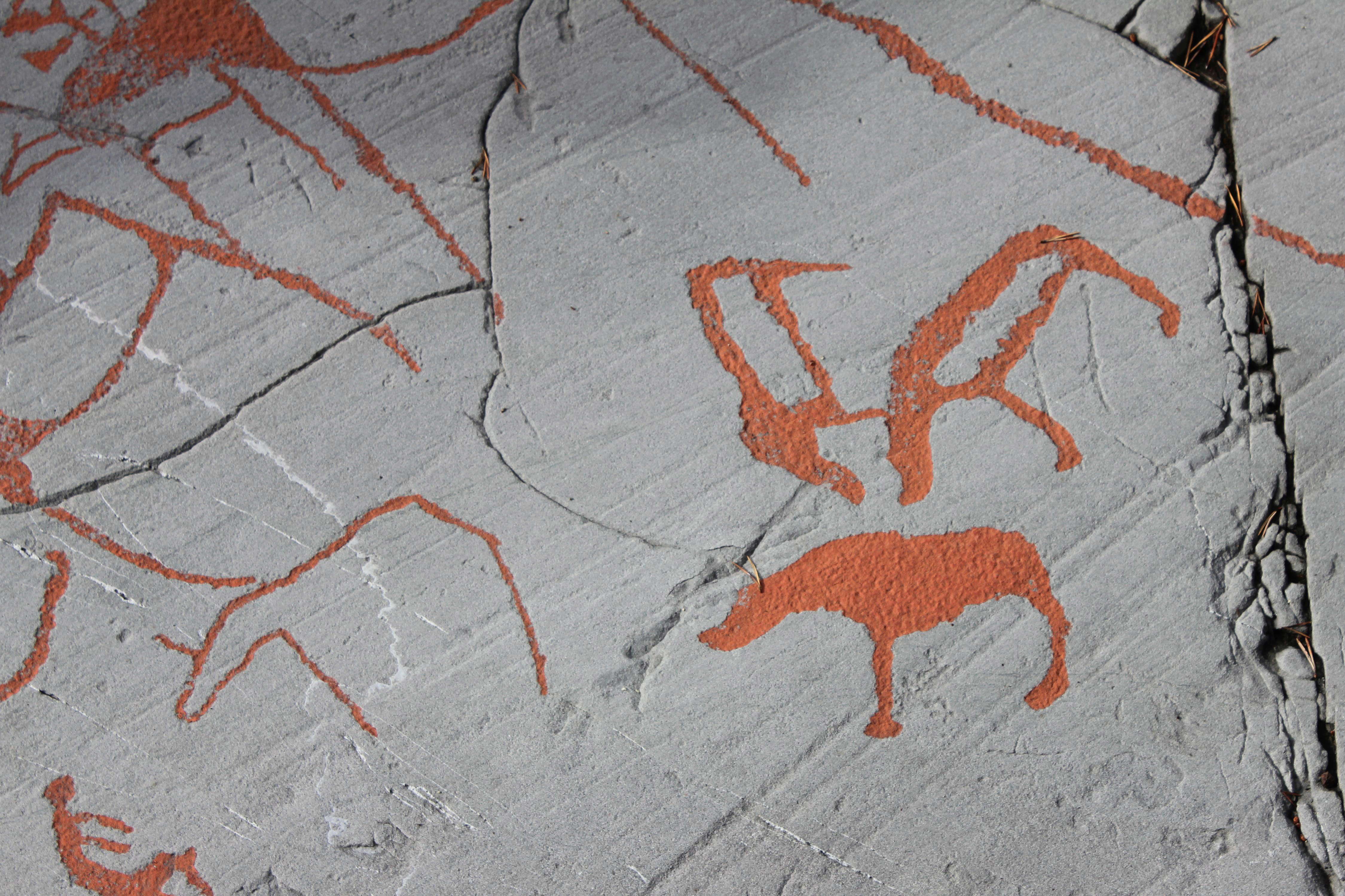
This image shows a man and an elk. The man appears to be using some sort of 'bent club' (see below) to hit the elk on the head in the region of the nose. The club has projections at the bend. The club is at least partly ceremonial, and represents the head of an elk.
Below the elk is what may be interpreted as a pit trap. The object to the right of the man and elk has been interpreted by Gjerde (2010) as a pit trap.
However, the 'bent club' is a shaman's staff. According to Shirokogoroff (1935), staffs were part of the shamans costume and were used for dealing with the upper world. Among the Tungus they were called 'horses' or 'reindeer'.
These staffs are used by the shamans during travelling (Shirokogoroff, 1935). Staffs, or elk-head sticks, are found at several rock art sites in northern Fennoscandia. They occur in Alta, Kanozero, Nämforsen and Vyg.
At Alta, they are frequently depicted in association with the elk, while they also occur next to a bear, as at Nämforsen. These sticks have been interpreted as ritual staffs and could have been part of the actual hunt, as shown in the image at left. Such elk-head sticks have been found in graves in northwestern Russia dating from the Early Stone Age and the Early Metal Age. It has been suggested that they belong to ritual leaders (shamans). Like the long-lasting motifs in rock art, the elk-head sticks were connected to burial practice for a long time.
Photo: Ralph Frenken 2012
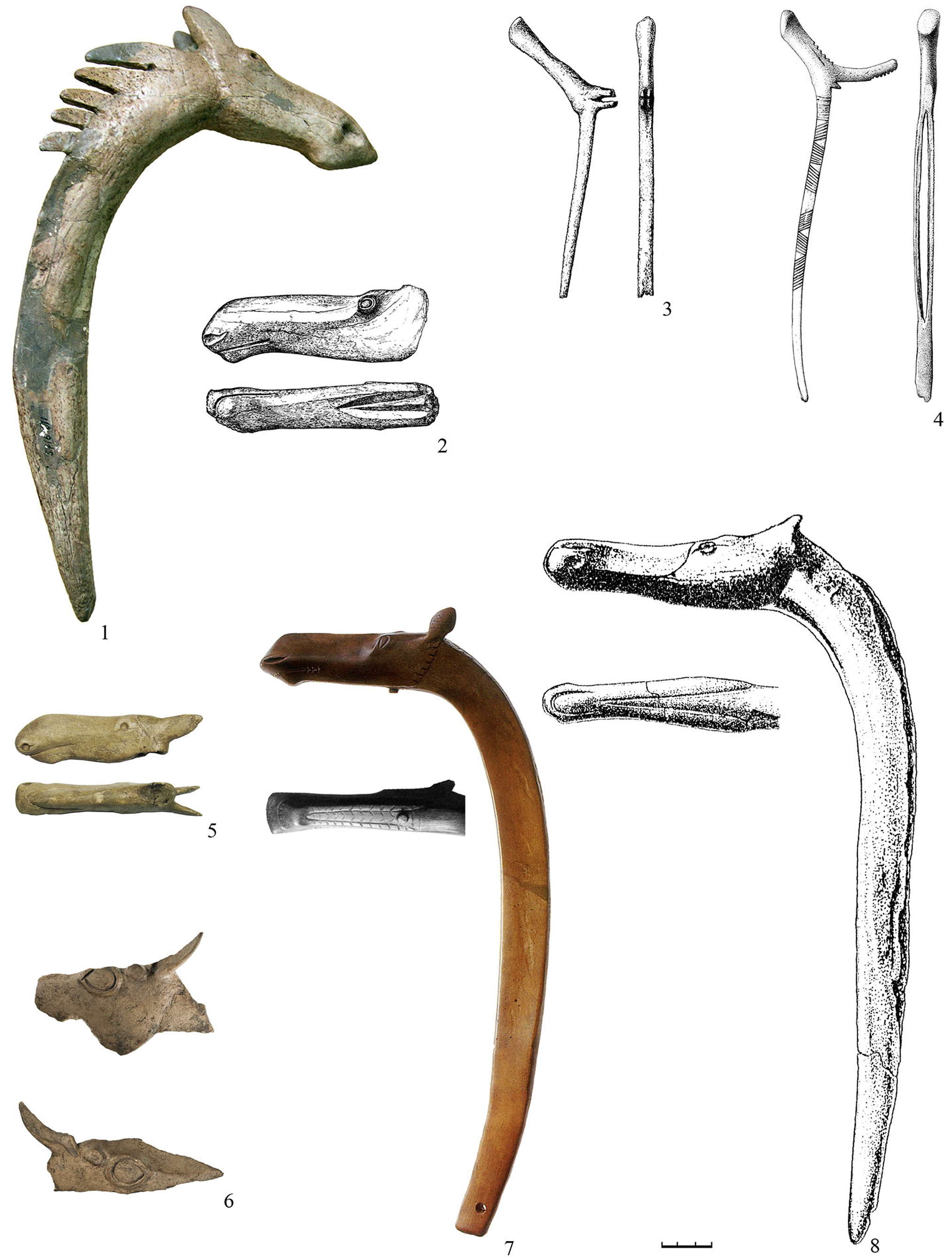
Carved rods with elk/reindeer heads.
1 Southern Oleniy Ostrov burial ground
2 Shigir peatbog
3, 4 Oleniy Ostrov burial ground (burials 16-2 and 19-4)
5 Volodary
6 Annin Ostrov
7 Sventoji 3
8 River Tok burial
Rods with sculptural elk/reindeer heads and their analogues in rock art are important elements for reconstructing the North Eurasian prehistoric inhabitants social structure and mythology in the period from the Mesolithic to Early Metal Age.
The extremely long period of their existence from the VII millennium to the second half of the II millennium cal BC for rods and from the VI millennium to the III millennium cal BC for rock art images and the huge territory of their spread (northern Europe and beyond the Urals) obviously provide some evidence of the common world outlook of many archaeological cultures in the Eurasian forest zone.
Carved items have the angle between the head and the rod from 90 to 120 (rarely to 150) degrees. All items are made extremely carefully all of them are burnished and polished. Their lengths range from 10 to 47 cm. A total of 48 pieces can be divided into two groups according to their size.
Group I small rods
From 10 to 25.3 cm, consists of 12 pieces from Mayak II, Oleniy Ostrov burial ground (7 pieces), Southern Oleniy Ostrov burial ground on Onega Lake, Zvejnieki burial ground, ventoji IV, Modlona
Group II big rods
From 40 to 49 cm, includes 16 pieces from the Southern Oleniy Ostrov burial ground (2 pieces), Riigiküla III, Villa, the Malmuta river estuary, Sventoji III (2 pieces), Kretuonas I, Sakhtysh I, Zamostye II, Chornaya Gora, the Tok river burial, Shigir peat bog (2 pieces)
Photo and text: Kashina et al (2011)
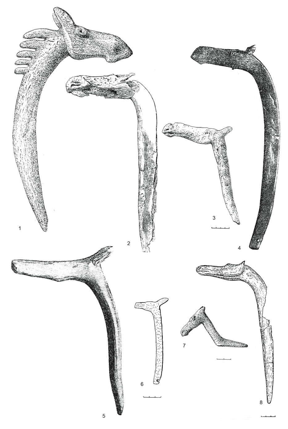
Elk-head antler staffs.
1, 2, 3 Olenii Ostrov (after Gurina 1956, Figs. 114, 113, 119.4);
4, 5 Šventoji 3B (after Rimantienė 1979, Figs. 85, 86);
6 Šventoji 4 (after Rimantienė 1998, Fig. 43.2);
7 Zvejnieki (after Zagorskis 1987, Table XXX.6);
8 Turganika (after Morgunova 1984).
The best examples of Stone Age art to be found in Lithuania are the two curved elk antler staffs with figures of elk heads carved at their tops that were found in the third settlement at Šventoji around 1972 (4,5). We can ascertain the species of the depicted animal only from one staff, as this staff was carved most realistically, with the proportions and details characteristic of an elk’s head: a humped nose, protruding lips, nostrils and prominent eyes (Rimantienė 1979, p.106).
In 1989, in the Šventoji 4B settlement, one more staff, this time flat, of only 14 centimetres in length, was found (6). At the curved top of the staff, the schematic silhouette of an animal of the deer family was carved (Rimantienė 1996, p.56). The sites at Šventoji have been dated to 4000–3000 cal. BC, and ascribed to Narva culture.
Three staffs of the same type, however, were also found in the Olenii Ostrov burial ground in Russian Karelia 1, 2, 3) (Gurina 1956), and these have been dated to the period ranging from late 7000 to mid-5000 cal. BC (Grünberg 2000, p.250).
According to an analysis of geological layers and pollen, a wooden elk’s head found in the Lehtojärvi site near Rovaniemi has also been ascribed to the Mesolithic Period (Erä-Esko 1958).
One further small staff, only this time curved slightly differently, was found in grave 274–278 in the Zvejnieki burial ground in Latvia (7). This staff is linked to Comb Ware culture, and has been dated to 4000 cal. BC (Zagorskis 1987, pp.57, 76-77, Fig. 28).
Photo and text: Irsenas (2010)
Head of a doe-elk
3rd-1st millennia B.C.
Shigir peat bog, Sverdlovsk region, Eastern Urals
Russia
Polished horn (antler? )
Length 195 mm
Photo: http://www.hermitagemuseum.org/

This elk-head stem is dated to the latter parts of the Early Stone Age, and comes from Lehtosjärvi near Rovaniemi in
northern Finland. It is made of pine.
The elk-head is ca 50 cm long and the hole to the right has been suggested as the place for a seating device attaching the head to the stem of a boat.
It has been dated to more than 8 000 BP.
Photo: Erä-Esko (1958)
Text: Gjerde (2010)

This is a photograph of the original elk head above, from a display at the Helsinki Museum.
It would appear that the stem passed through the elk head just behind the stub of the ears, probably finishing there, with a wooden dowel through the neck and the stem of the boat which would effectively hold the head in position, at the correct angle.
Photo: Ralph Frenken 2012
Source: Display, Helsinki Museum
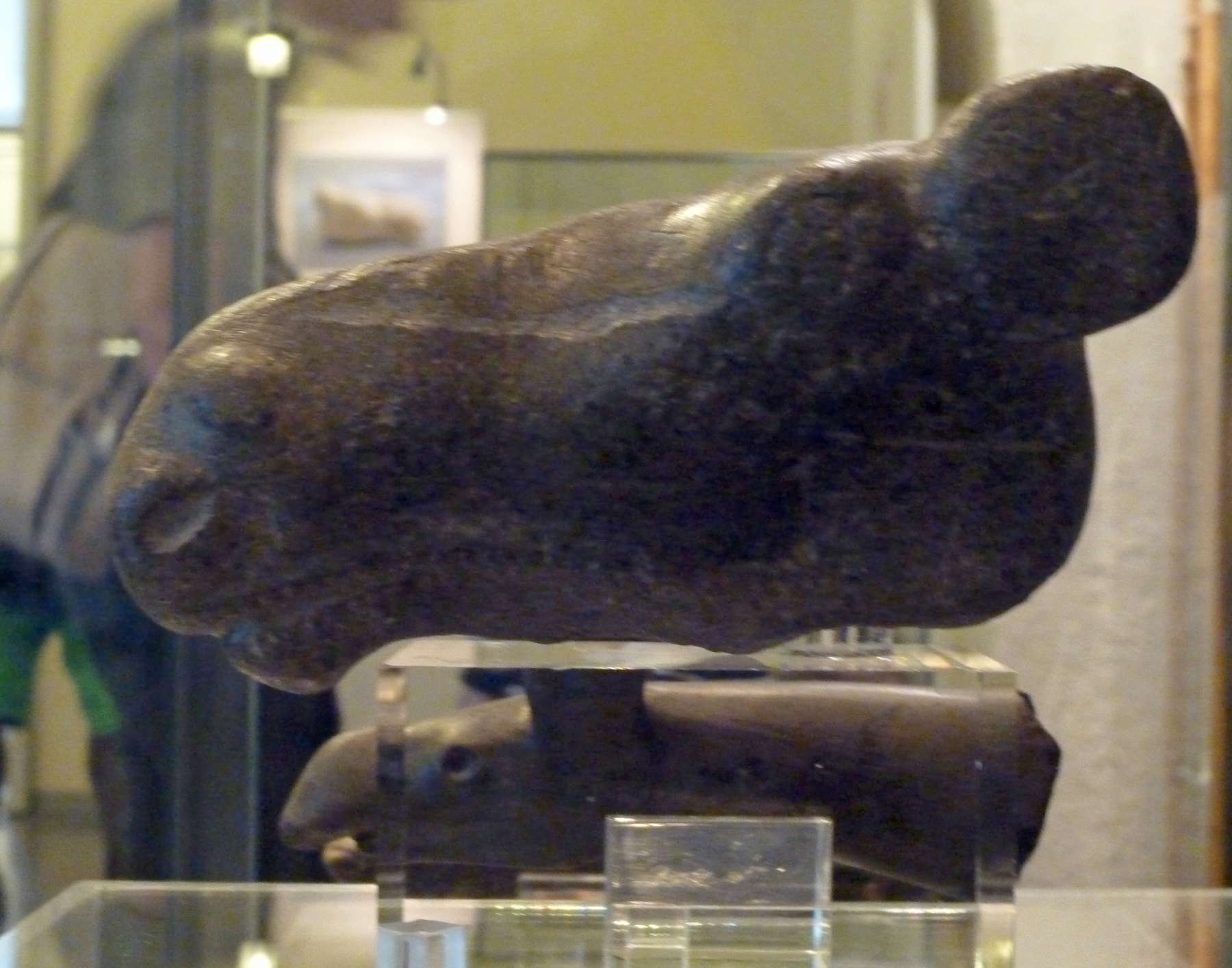
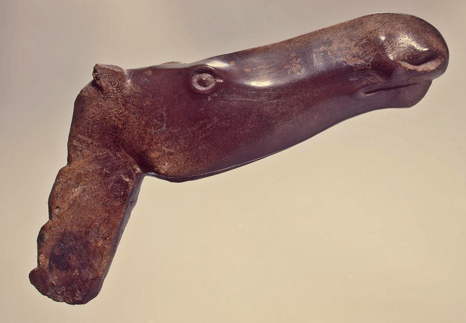
Elk head. This example is finely and accurately modelled, and polished to a high lustre.
Elk-head soapstone sculpture from Huittinen, Western Finland, from Stone Age 7 000 - 6 000 BC.
Photo: Ralph Frenken 2012
Source: Display, Helsinki Museum
Text: Helsinki Museum site, http://www.nba.fi/en/nationalmuseum/exhibitions/permanent
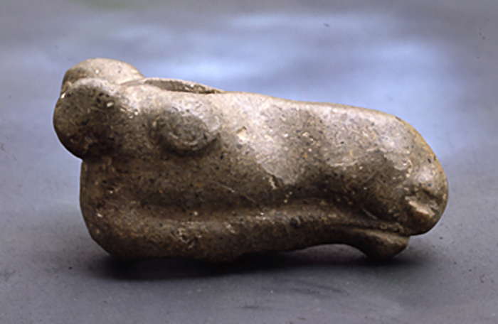
Another version of this soapstone sculpture, shown from the other side.
It was found in a field by a farmer 1903.
Photo: Helsinki Museum site, http://www.nba.fi/sv/nationalmuseum/undervisning/undervisningspaket/forhistoria/information/stenaldern/sten14
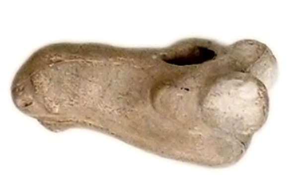
This copy shows that the object is pierced by a hole, so that it can be mounted on a rod.
Photo: http://www.helsinki.fi/taidehistoria/tietoa/kokoelmat/Kipsit/Veistokuva/VeistoEn.htm
An elk, apparently defecating.
Photo: Ralph Frenken 2012
A young elk, judging by the proportions of the body and head.
Photo: Ralph Frenken 2012
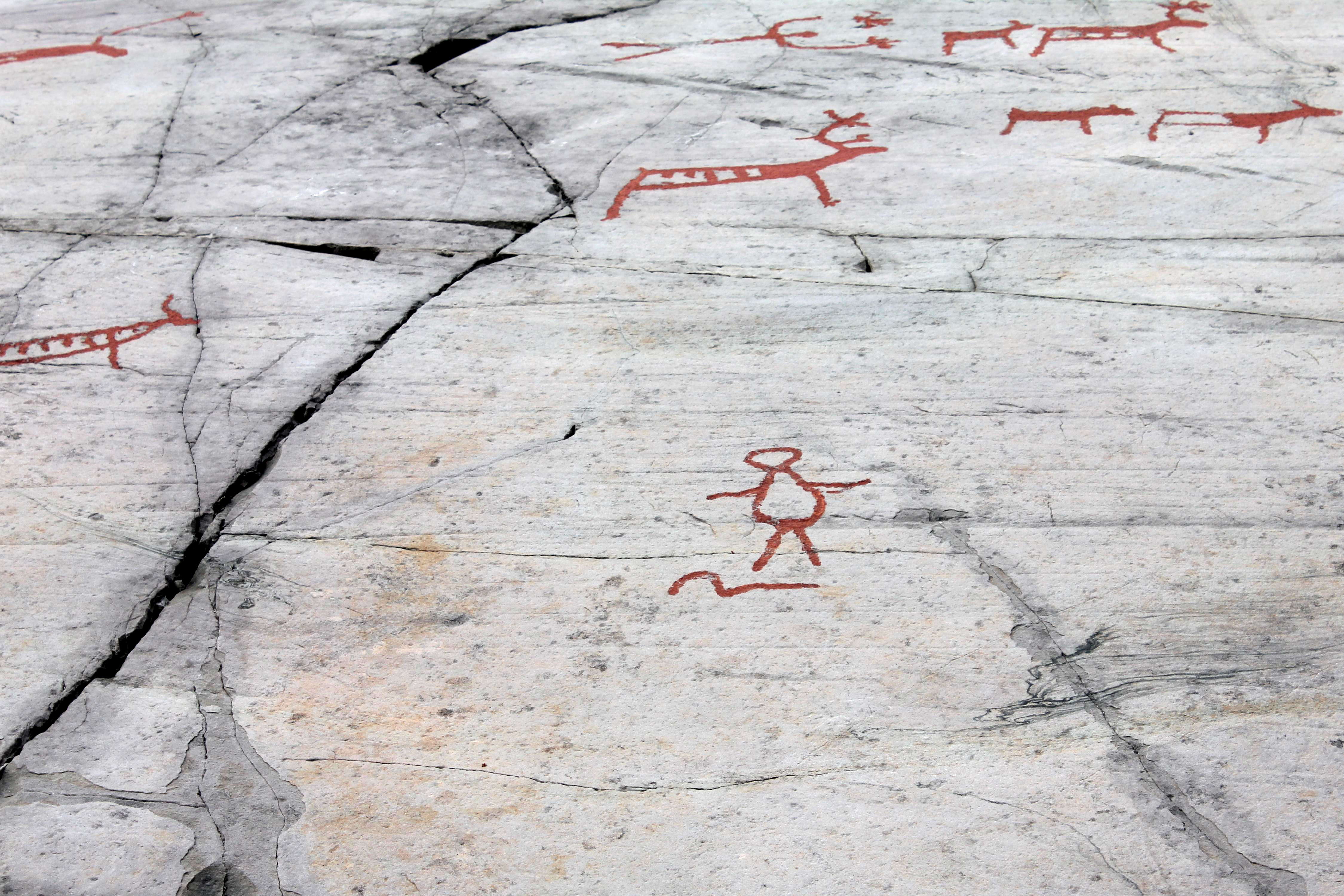
A human figure, possibly with a snake at its feet.
Photo: Ralph Frenken 2012
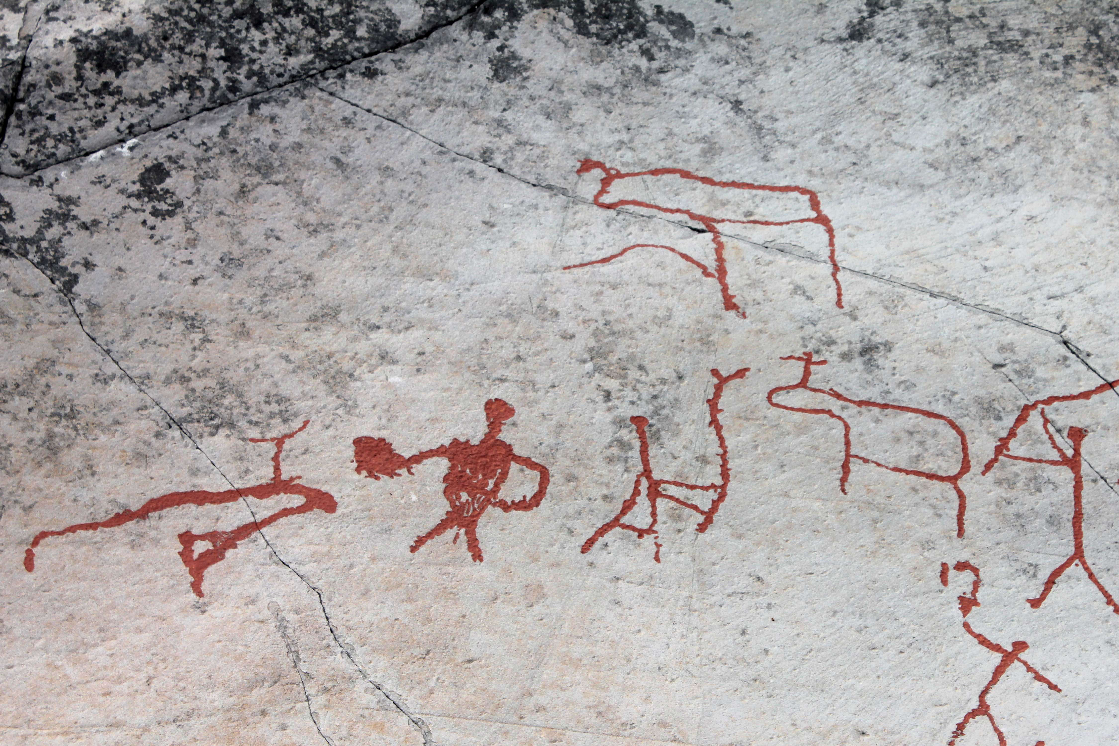
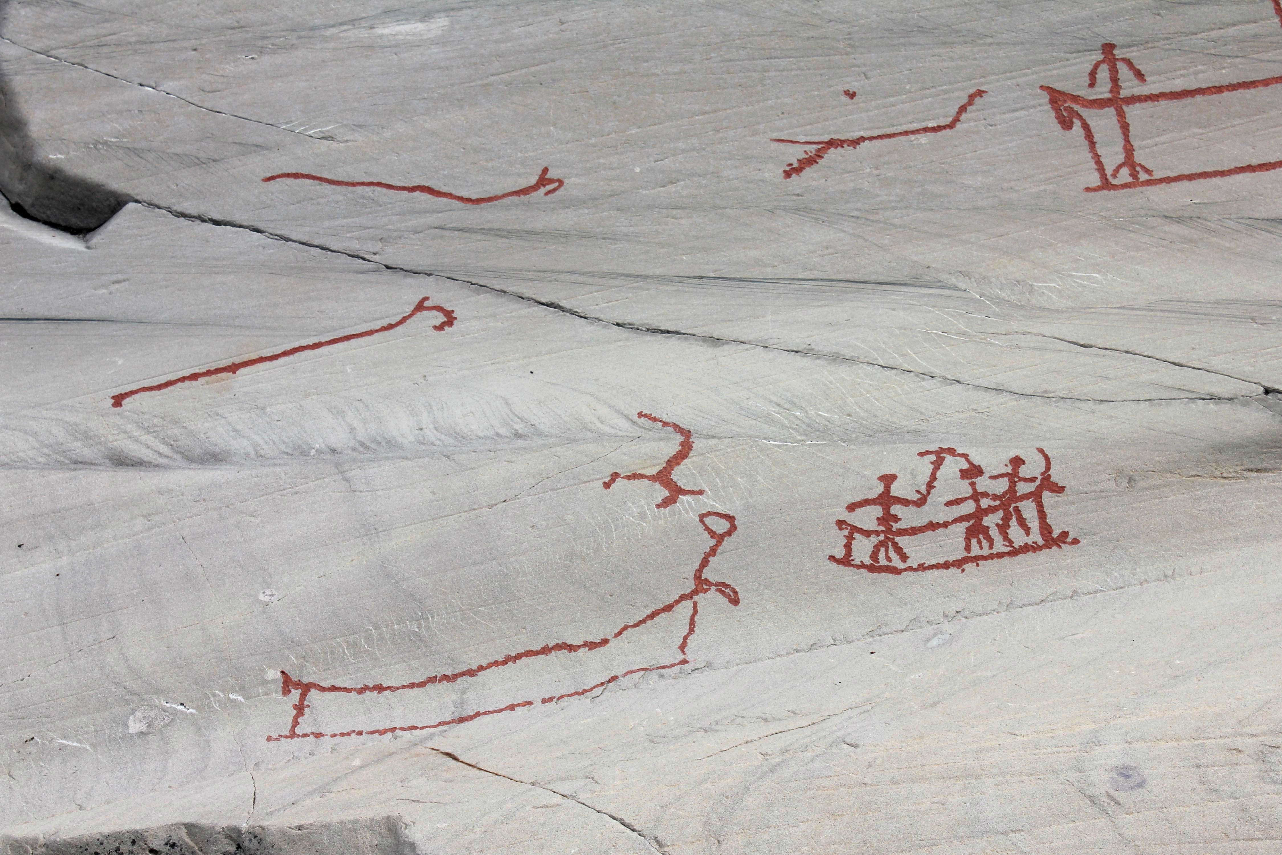
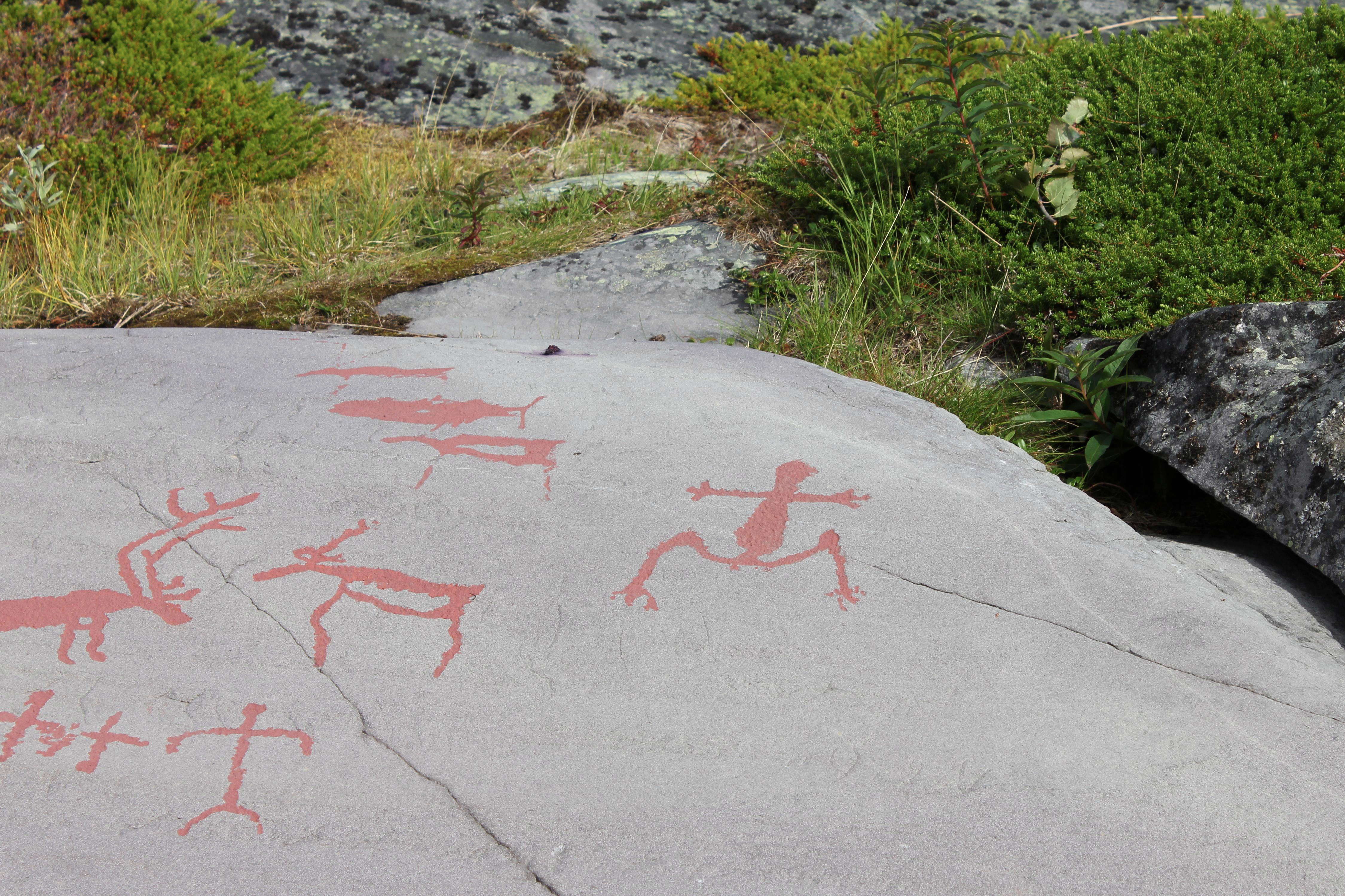
Four humans cooperating in a hunt. One, a shaman, has a drum in his hand, with the usual fringes hanging from it, the figure in front of him has an elk staff, another approaching from the other direction to the quarry also has an elk staff, while yet another hunter, facing right, further down the image, has what may be a bola, a throwing stick, or a smaller elk staff, though he is hunting a different animal, out of frame.
Also out of frame in this shot is another hunter approaching the hunt from the right, facing left, with a bow and arrow.
Photo: Ralph Frenken 2012
The same rock slab as above, a little further down. Here it is obvious that the man with the possible bola or elk staff is hunting another animal, possibly a deer, while further down a man is driving several animals, including a young animal, presumably as part of the hunting method.
Photo: Ralph Frenken 2012
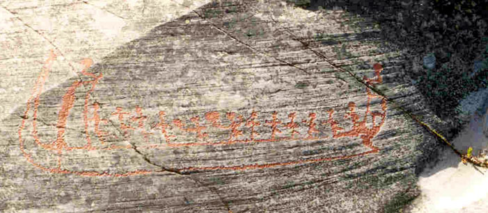
This image is remarkable for the boat, with a high prow in the form of an elk, and a high stern, and the fishing line with a fish attached.
The artist appears to have been indicating, as all fishermen do, how large the fish was, but in this case also demonstrating the length of the fishing line used.
The fishermen must have spent considerable time and resources in the construction of their lines and nets.
When I first saw this, I thought that the image of the elk was possibly done at a different time by a different artist, since it does not seem to be related to the boat and the fish. However, it may well form part of a more complex story, see below.
Gjerde (2010) notes that there are no fishing scenes in Alta depicted on horizontal rock surfaces. They are always depicted in vertical locations mirroring the depth of the fish in the fishing scene.
Gjerde (2010) says about this image: 'halibut fishing scene at Bergbukten 4. This seems like a representation of the three worlds, the upper, middle and the lower world where the reindeer and the 'necklace' is in the upper world. The people in the boat fishing in the middle world and the halibut and the elk situated in the lower world. It also brings the real aspect in as the halibut fishing is performed at deep water. Looking at all the halibut fishing scenes, this is by far the longest fishing line representing deep-sea fishing. It is also the one which is depicted furthest towards the fjord in relation to the interpretation of Bergbukten 4 in Figure 181. This also shows the elk depicted with the halibut in the Lower World. '
Photo: Ralph Frenken 2012
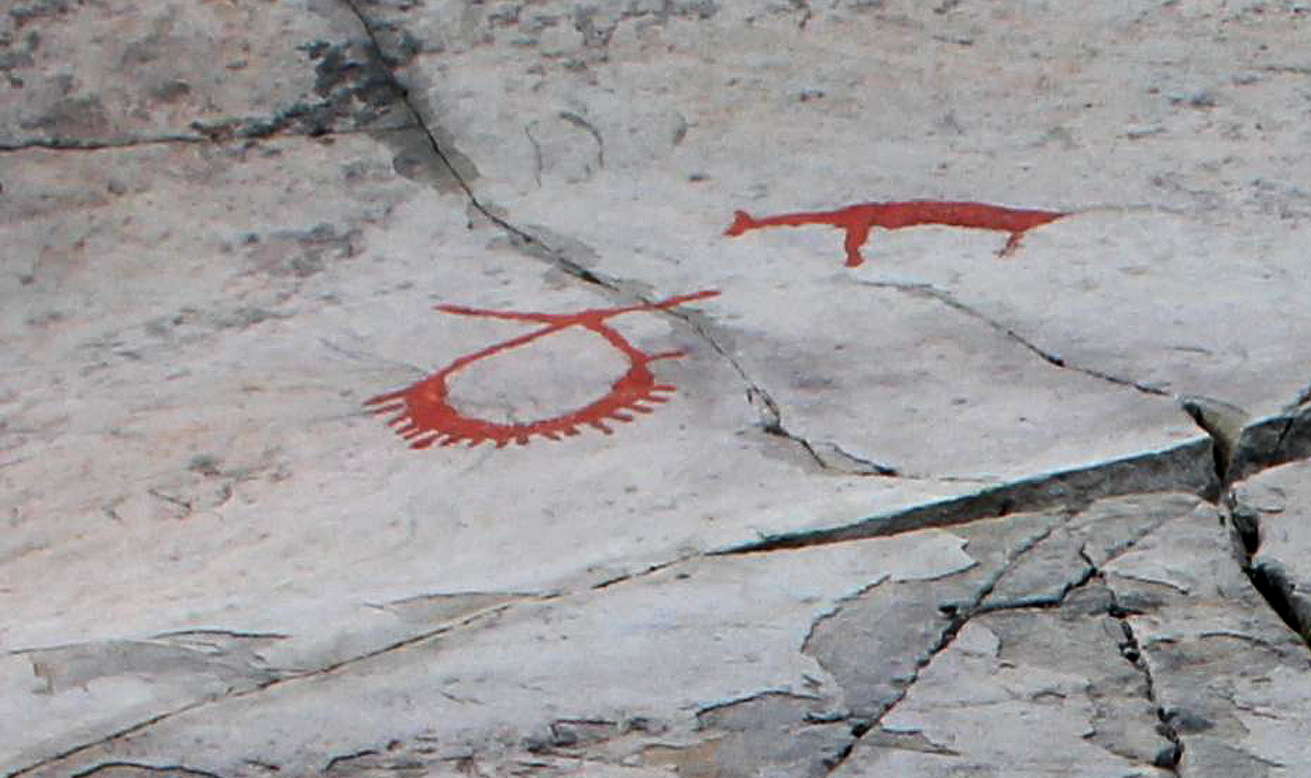
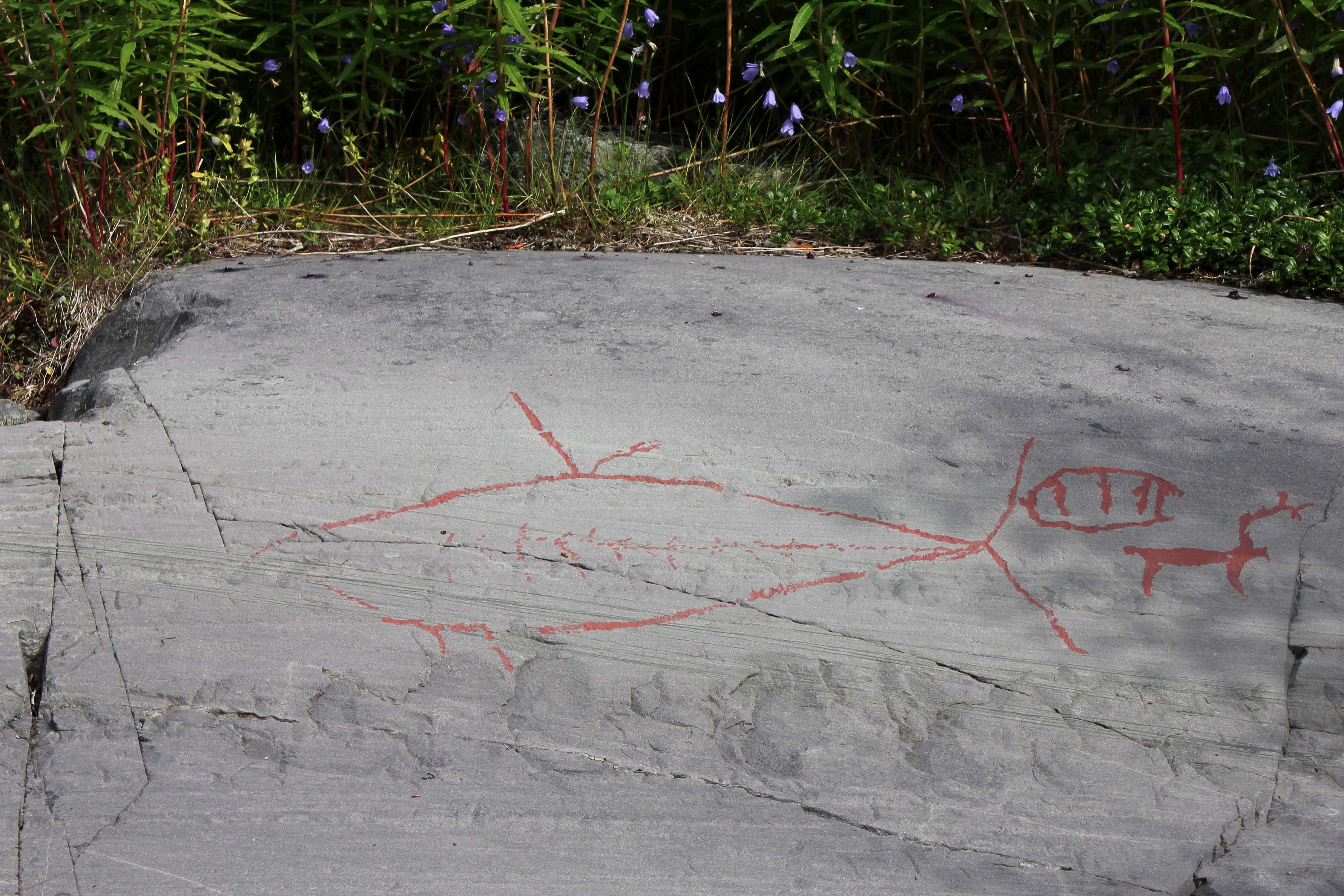
Almost unnoticed in the photo above is this image of what looks at first sight like a necklace.
Beside it is an animal with a neck and body apparently stretched by foreshortening,
Photo: Ralph Frenken 2012
(The 'necklace' shown above is probably a representation of the communication between a shaman and the ancestors of the spirit world, as shown in this photo from the Ytre Kåfjord site, which is about six kilometres in a direct line from Alta - Don )
Kåfjord is one of the five sites with rock art on the UNESCO World Heritage List. The rock carvings in Kåfjord were discovered in 1978, and about 1500 carvings have been registered to date. The area is only 3 km from Hjemmeluft on the other side of the entrance to the Kåfjord. The rock is a soft clay slate with red and green vertical stripes.
A characteristic element of the rock carvings in Kåfjord are the many tracks. We can follow reindeer herds that are being driven towards hunting fences, and bears walking between the other figures on the panel. There are more than 350 bear tracks on the panel, but also a lot of foot prints and snow shoe prints. A lot of the scenes show humans gathered in activities or rituals. On one unique composition we can see 19 human figures holding hands in a circle around what could be an animal, a person, or possibly a shaman. Another group of human figures are gathered around what could be two mating dogs.
Photo: Gjerde (2010)
Text: adapted from http://www.alta.museum.no/sider/tekst.asp?side=81
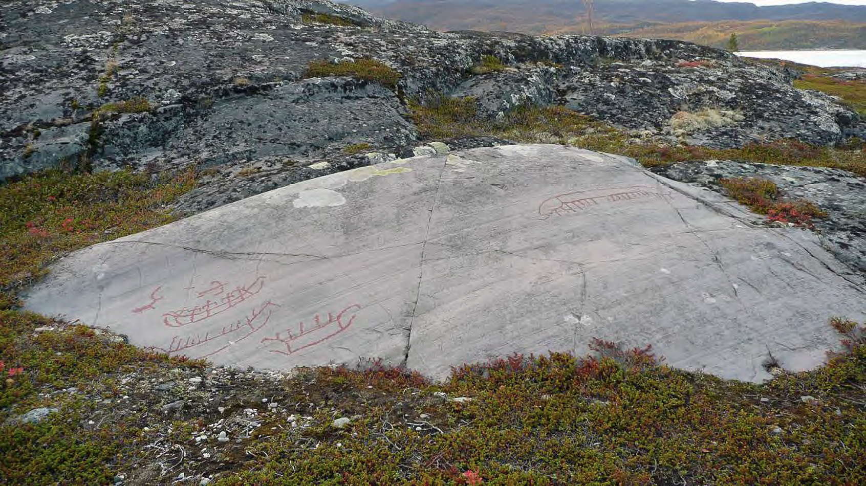
In the complete panel, we can see more clearly than at Alta Fjord the strange 'hockey stick' implements used by the former inhabitants, presumably to catch or dispatch game.
The rock carvings in Kåfjord are around 18-26 m.a.s.l., and can therefore be dated to phase 1 and 2 (ca 7000-5000 years old). The rock carvings in Kåfjord have a lot in common with carvings from the same phases in Hjemmeluft, but some scenes and figures found in Kåfjord have not been found in Hjemmeluft. The rock carvings in Kåfjord are concentrated to a small area, whereas the panels in Hjemmeluft are spread over a large geographical area.
The panels in Kåfjord are very detailed and varied, with many characteristic scenes and figures that give a unique insight into a complex and rich world of beliefs. Depicted on the rock surfaces are images of hunting, fishing, animals, boats, tools and equipment. Human figures are depicted in various situations – on snow shoes, hunting, performing rituals. There are hunting fences for hunting wild reindeer, and different geometric patterns. Various species of animals are represented in Kåfjord, such as reindeer, elk, dog, grouse, halibut, whale, as well as bears, bear dens and bear tracks. The bear probably had a special significance in beliefs and rituals.
Photo: Gjerde (2010)
Text: adapted from http://www.alta.museum.no/sider/tekst.asp?side=81

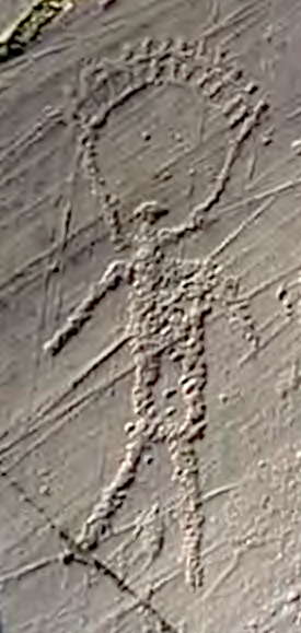
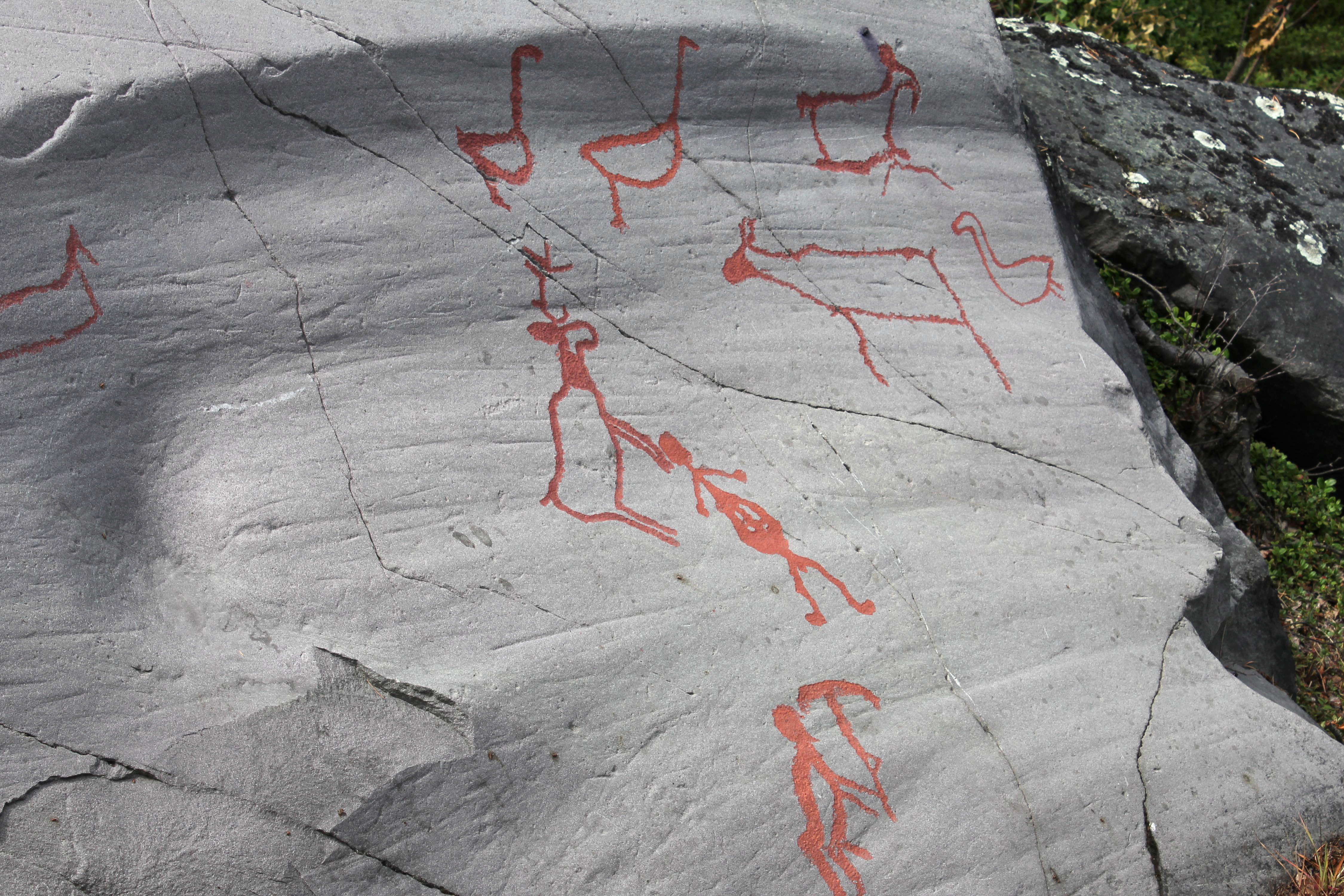
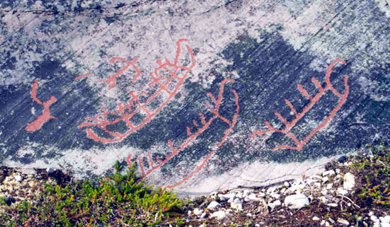
The shamans (?) At Ytre Kåfjord in Alta, northern Norway, depicted as if they have contact with their ancestors (spirits from the upper world). The left is interpreted as a female shaman where it looks like she is giving birth, thereby linking the ancestors to the child. The right is interpreted as a male shaman. For the internal relation between the figures that are located ca. 20cm apart, see the lower left of the image below. The figures are ca 40 cm high.
Photo and text: Jan Magne Gjerde, Gjerde (2010)

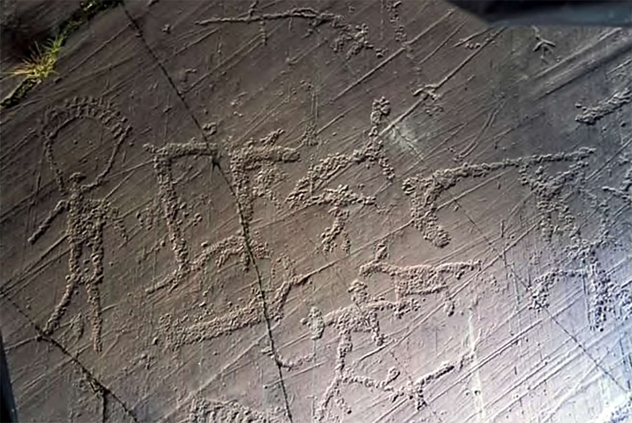
Scanning of a section of the large Ytre Kåfjord panel.
The shamans in the image above are in the bottom left quadrant, below the black triangle.
Scanning by METIMUR and the figures are traced from the scanning by Karin Tansem, VAM.
Top left is the small reindeer corral. To the right is the large reindeer corral. The distance between the entrances of the two reindeer corrals is c. 6.4m. The bear tracks run more than 8m on the panel and the large reindeer corral is c. 3m in diameter. The boulder is situated to the left in the middle. Bottom left of the boulder from a crack can be seen the bear tracks ending in the bear-den, then continuing to the right into the large reindeer corral. The amount of figures and the size of the composition at Ytre Kåfjord is the most impressive in northern Fennoscandia.
Photo and text: Jan Magne Gjerde, Gjerde (2010)

In this 3D drawing of the Bergbukten 1 panel in Alta, northern Norway, we can see how many of the elements relate to each other.
Photo: Helskog et al (2004) in Gjerde (2010)
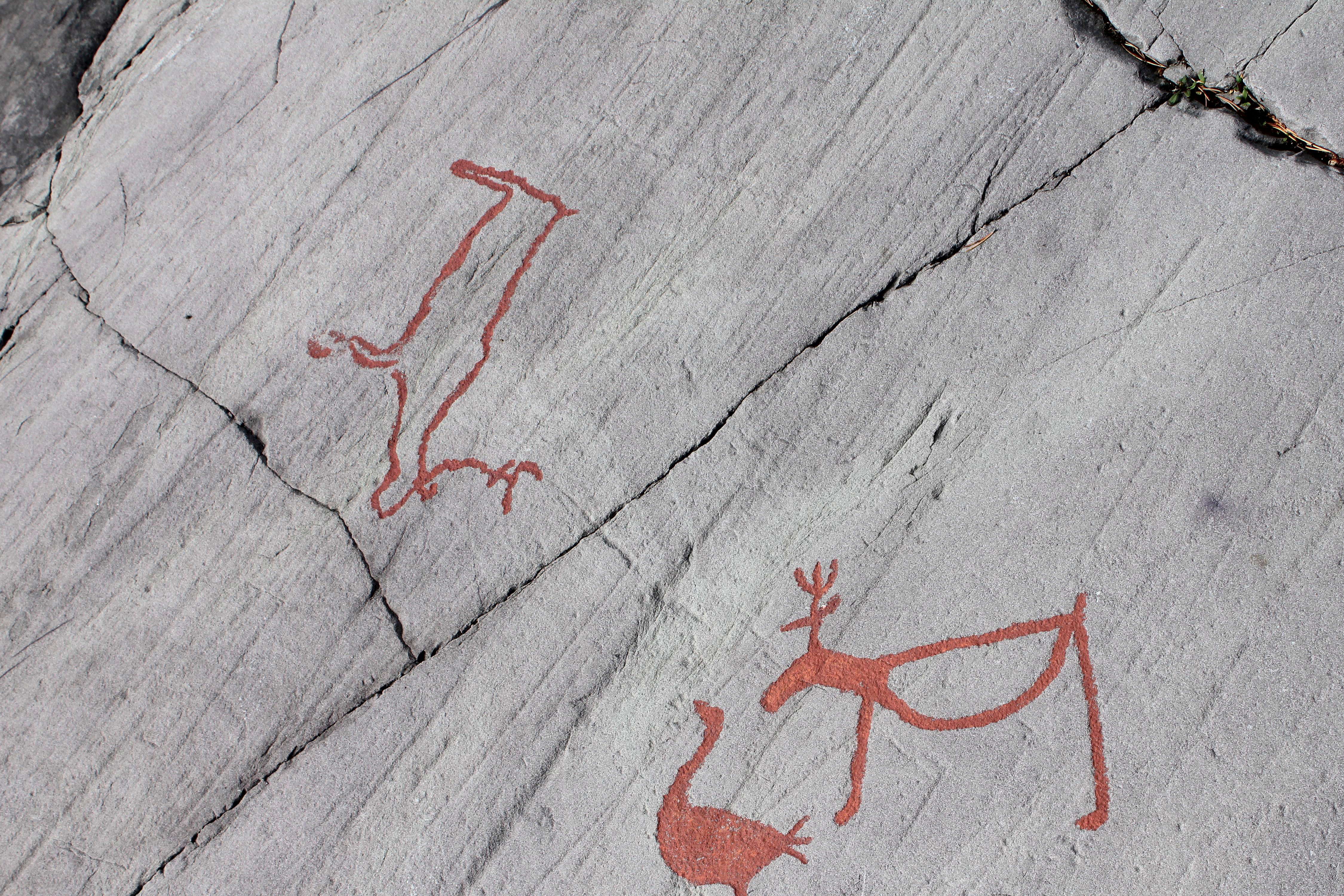
Two reindeer.
Photo: Ralph Frenken 2012

The photo on the left shows two boats made quite differently to the ones above. They are a very much deeper draught vessel, both with what may be elk on the prow.
These images may be from a later time, when boats were made which could leave the sheltered waters of the fjord, and could make long sea voyages with relative safety, even when there was a heavy swell, protected by their high sides. They would have required a large crew to paddle and steer them on the open sea.
These images (on the right in closeup) are also remarkable for their depiction of large birds with long necks, possibly geese, with one man in the act of catching a goose with its wings outspread. Beside him on the ground is what may well be a throwing stick used to bring down the bird.
Photo: Ralph Frenken 2012
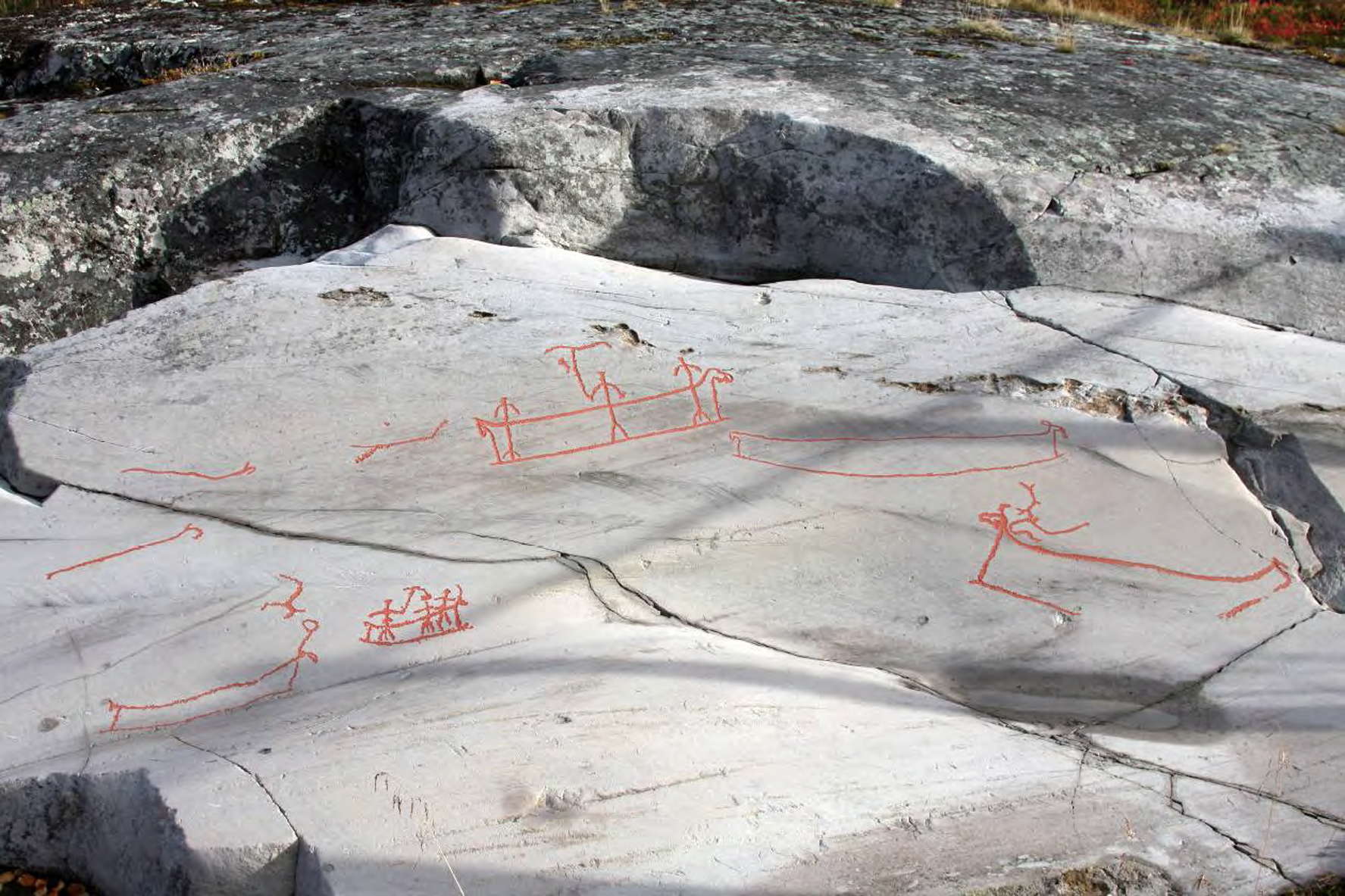
Several boats of the high sides variety, but shown here as relatively small craft, holding only three (as shown here) or four people maximum.
Photo: Ralph Frenken 2012
Boat images at Bergbukten 3 in Hjemmeluft, Alta. The size of the large boat, above the middle of the photo, with three crewmembers, is about 67cm long. These boats belong to phase 2 and are dated to about 4 200 BC - 3000 BC.
Photo and text: Jan Magne Gjerde, Gjerde (2010)

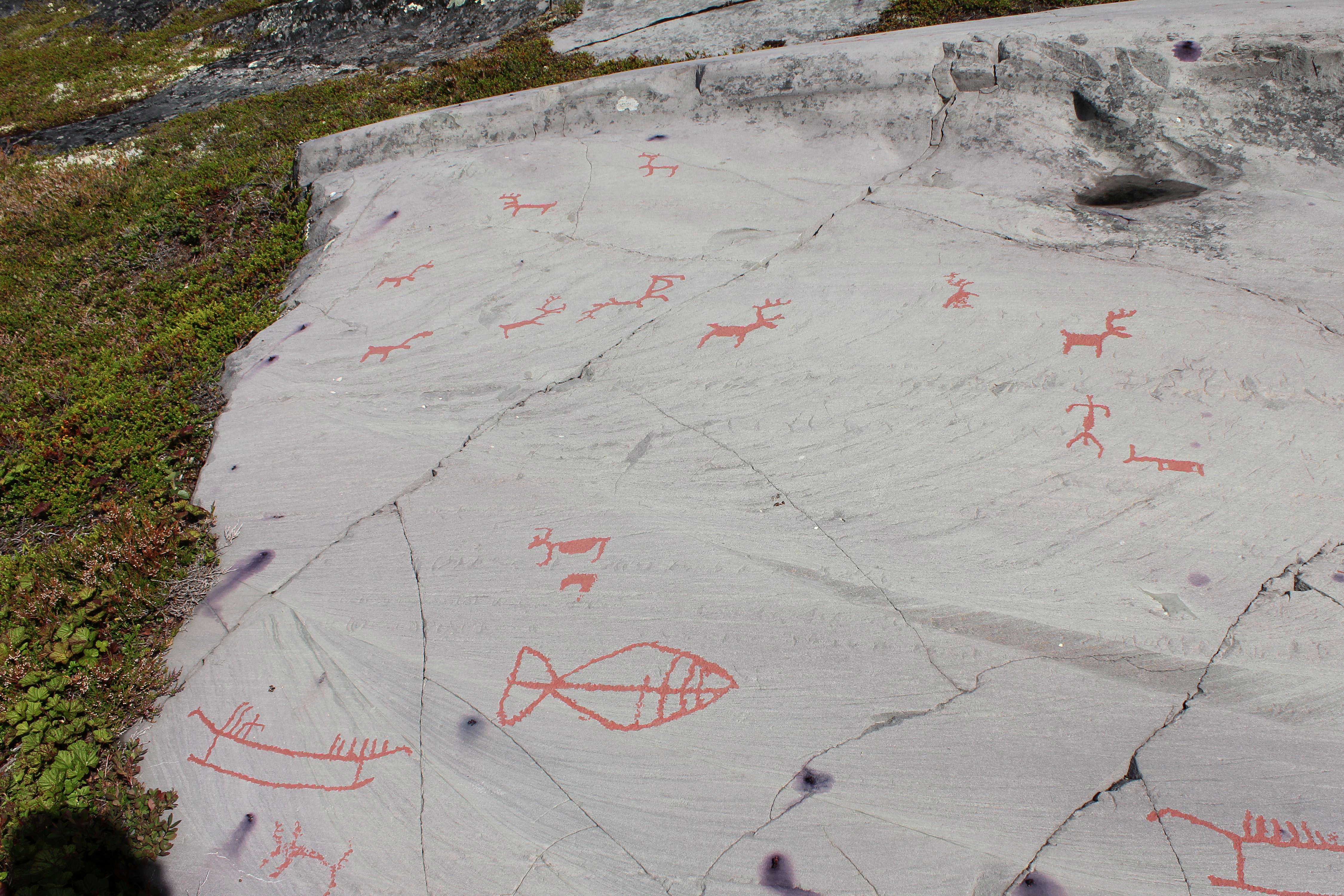
Fences were used to corral animals in order to hunt them.
This is from Bergbukten 1, and is the largest panel at Bergbukten.
Photo: © Stefano Parad via Flickr
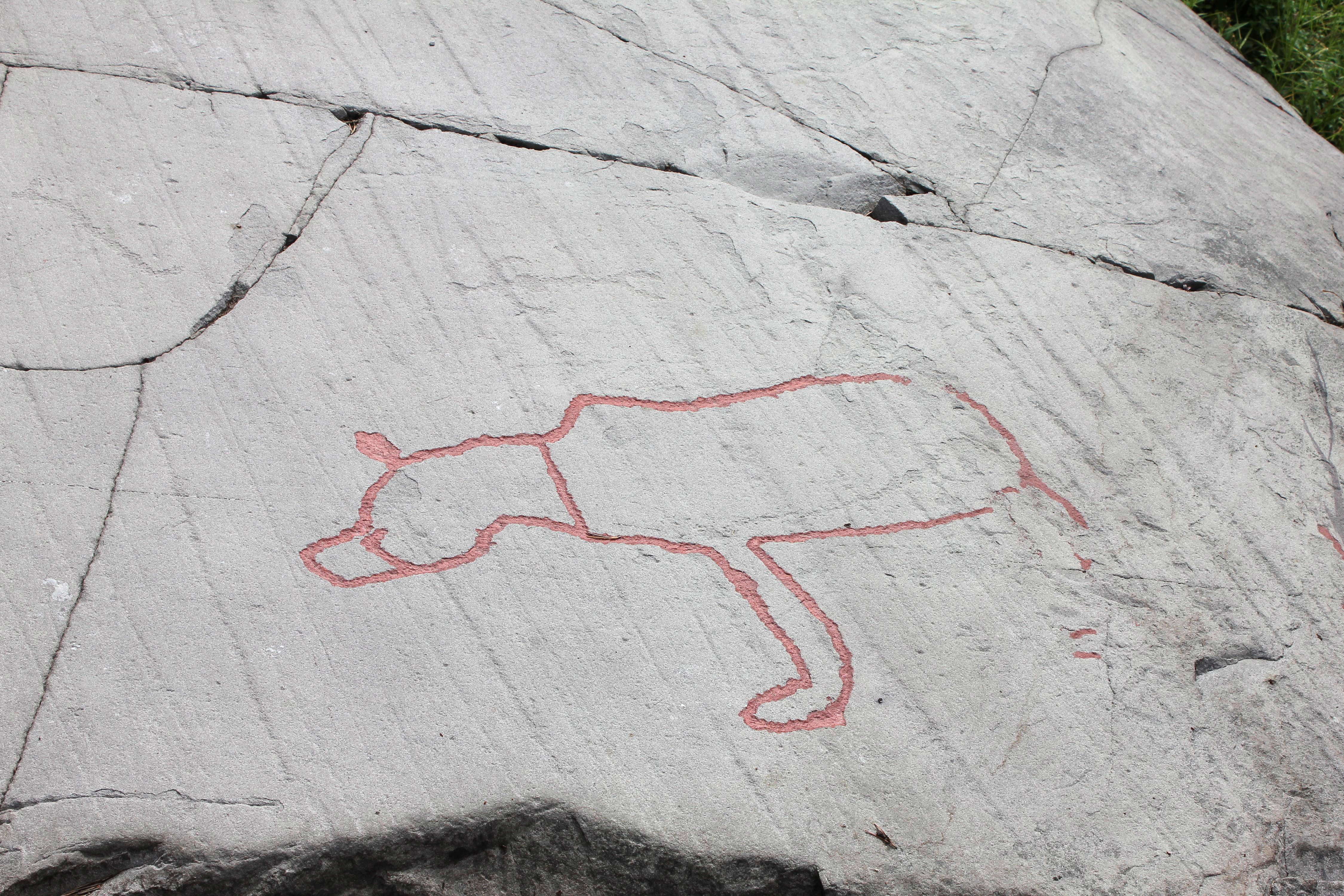
An isolated animal shown without antlers.
Photo: Ralph Frenken 2012
Several of the high sided type of vessel, one with two small figures in a craft clearly designed for more.
Photo: Ralph Frenken 2012
Male stick figure and an unidentifiable object, a close up of the top of the image above.
Photo: Ralph Frenken 2012
Looking out to sea from the rock platform near the Museum.
Photo: Ralph Frenken 2012

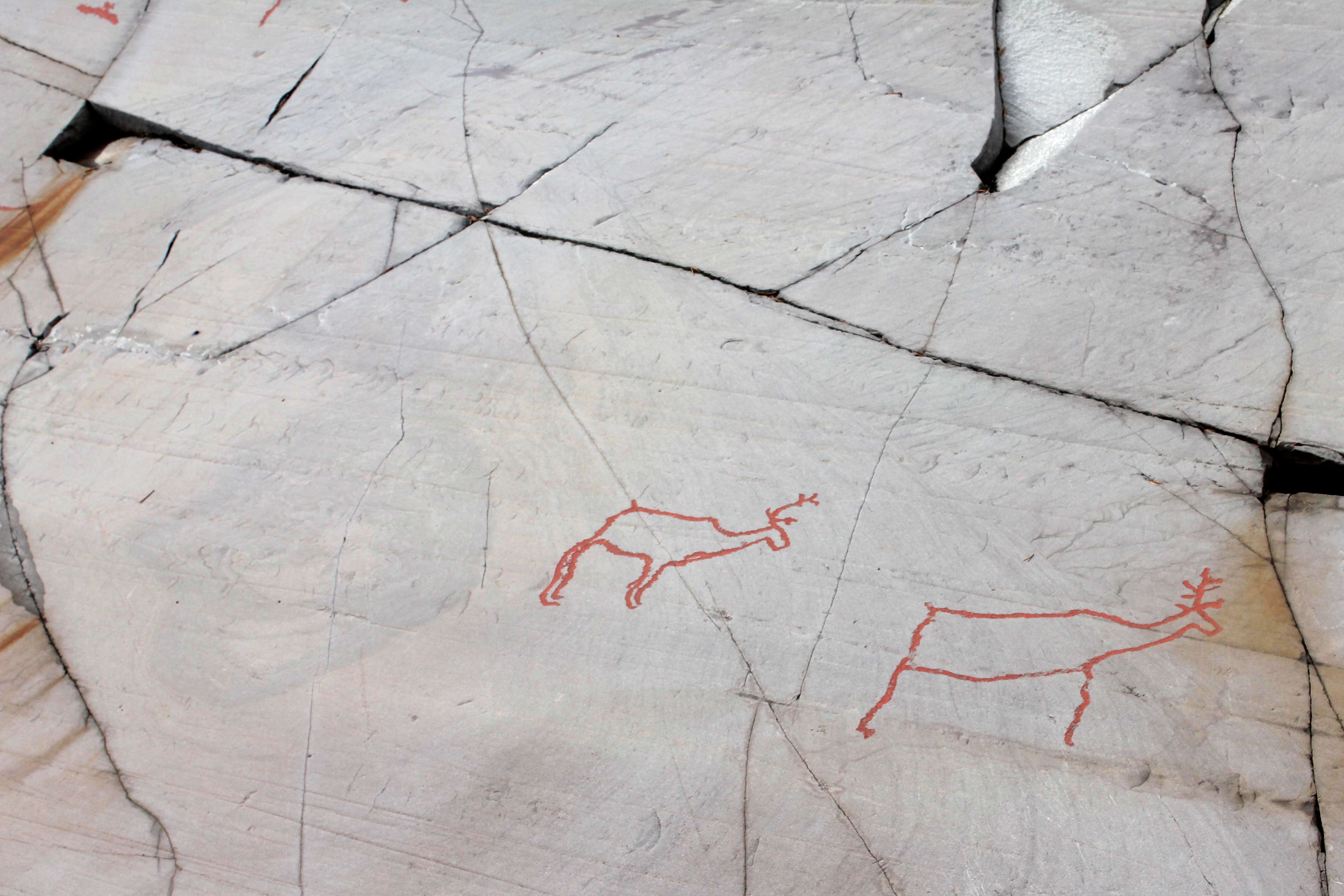
Reindeer, with the diagnostic forward facing antlers.
Photo: Ralph Frenken 2012
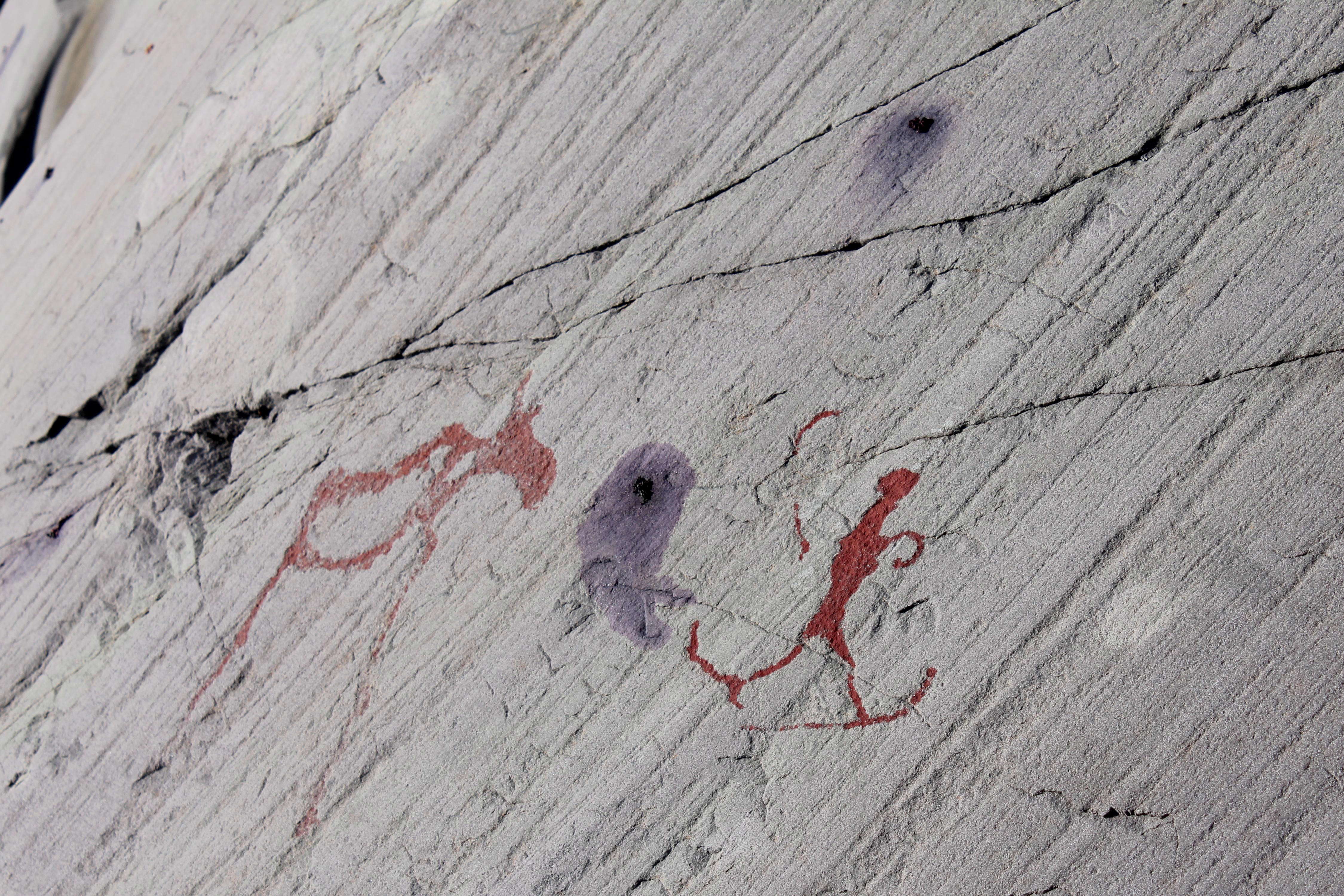
An elk which has knocked over a hunter, as well as a part image of a pregnant animal at the upper left, with the complete image below.
Photo: Ralph Frenken 2012
Two pregnant elk, from two images stitched together.
This image is at Stop 7, Ole Pedersen 11A
Photo: Ralph Frenken 2012
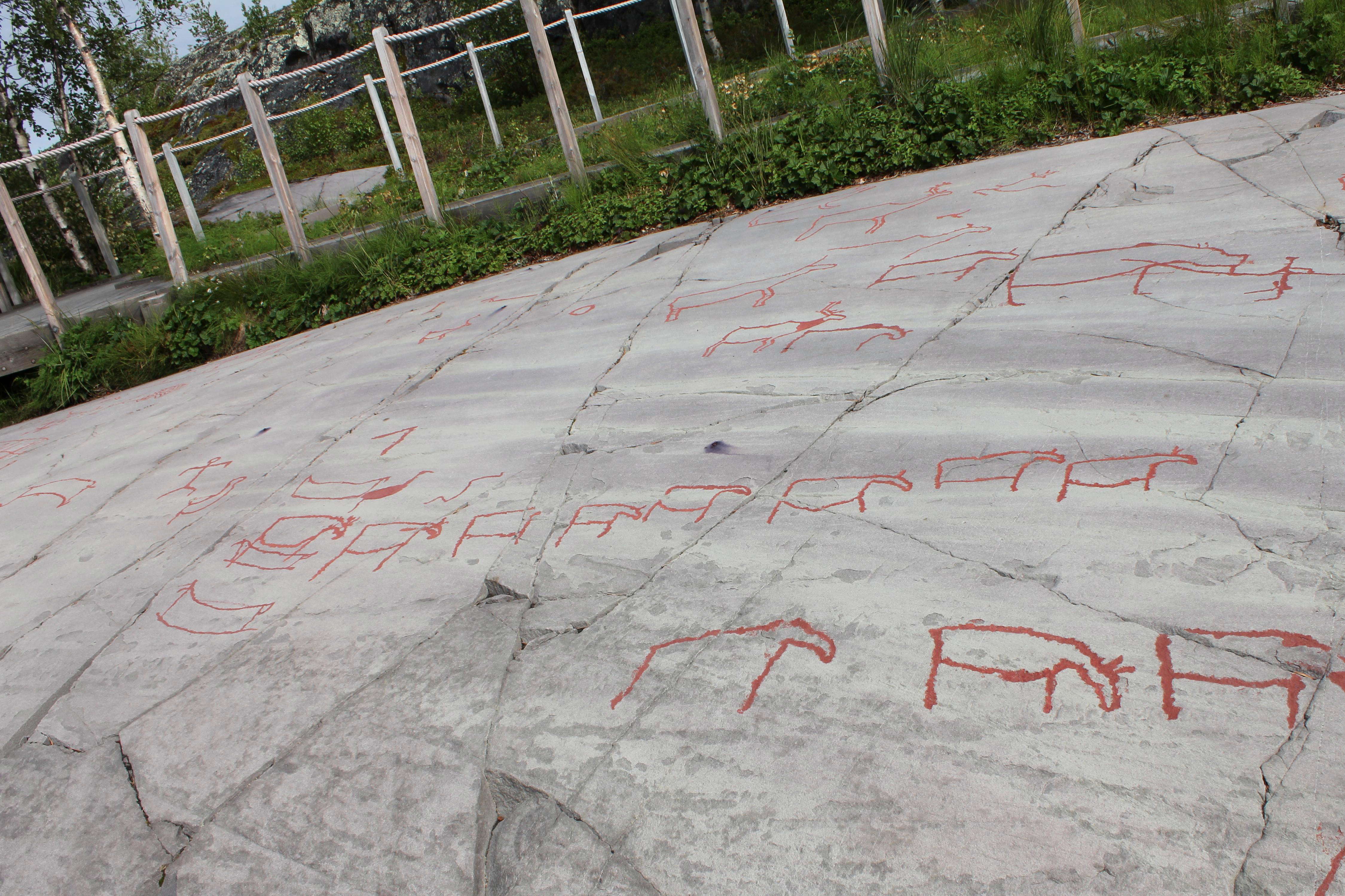
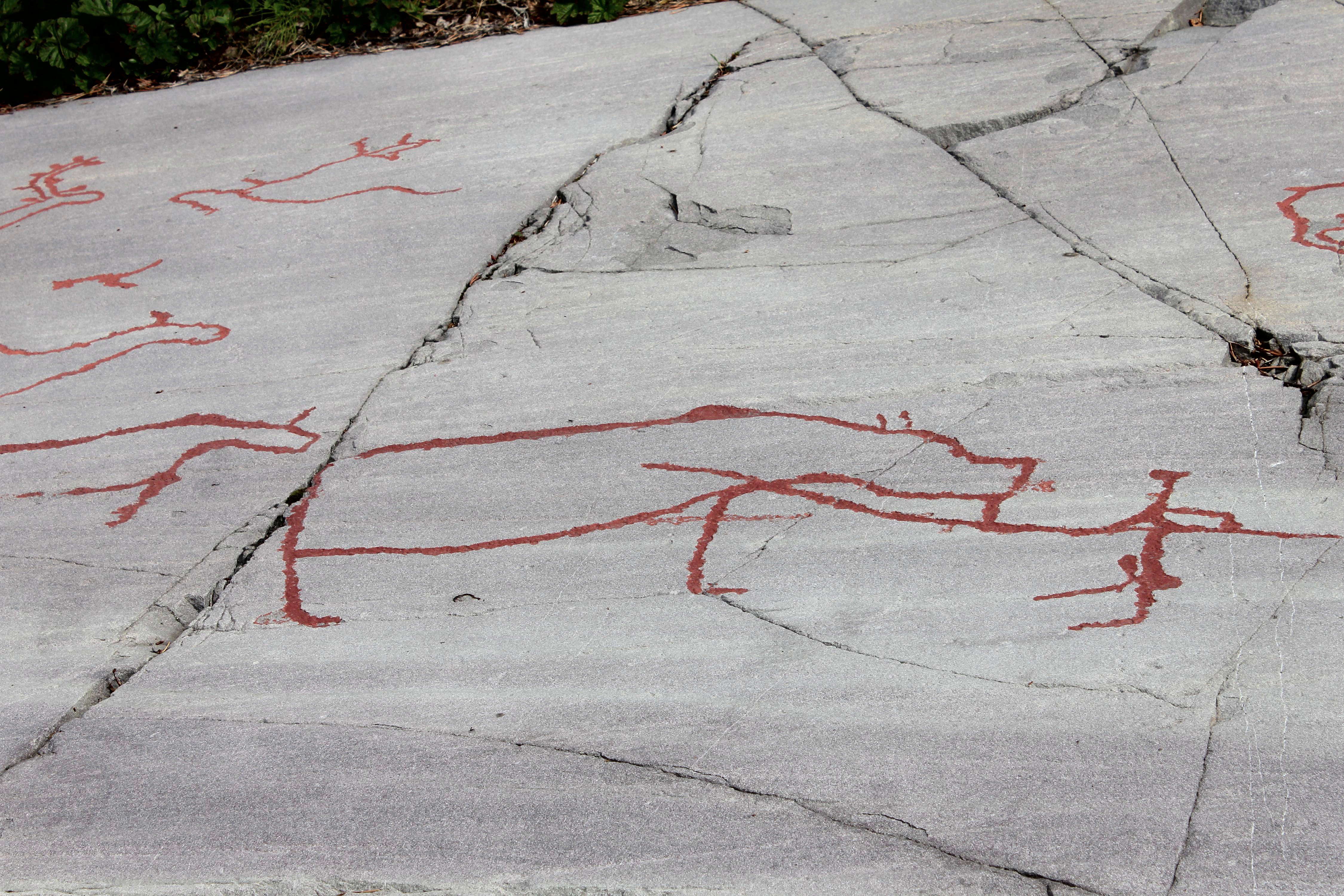
Wooden walkways with rope railings have been set up, to control the movement of those who come to look at the engravings.
Photo: Ralph Frenken 2012
Here we can see what might be a confrontation between a man and a bear, the man holding a long spear.
Photo: Ralph Frenken 2012
A goose is shown with its shape completely pecked out on the interior.
A whale is depicted, apparently connected to the man by a rope. It seems that fishermen have always been the same with regard to tall stories!
To be fair, it is a very small whale…
Photo: Ralph Frenken 2012
A relatively small boat with three men, one of whom is swinging a line with a hook.
The pattern should also be noted, possibly a rug or an item of clothing.
This has been interpreted as a hunting pit by Gjerde (2010)
Photo: Ralph Frenken 2012
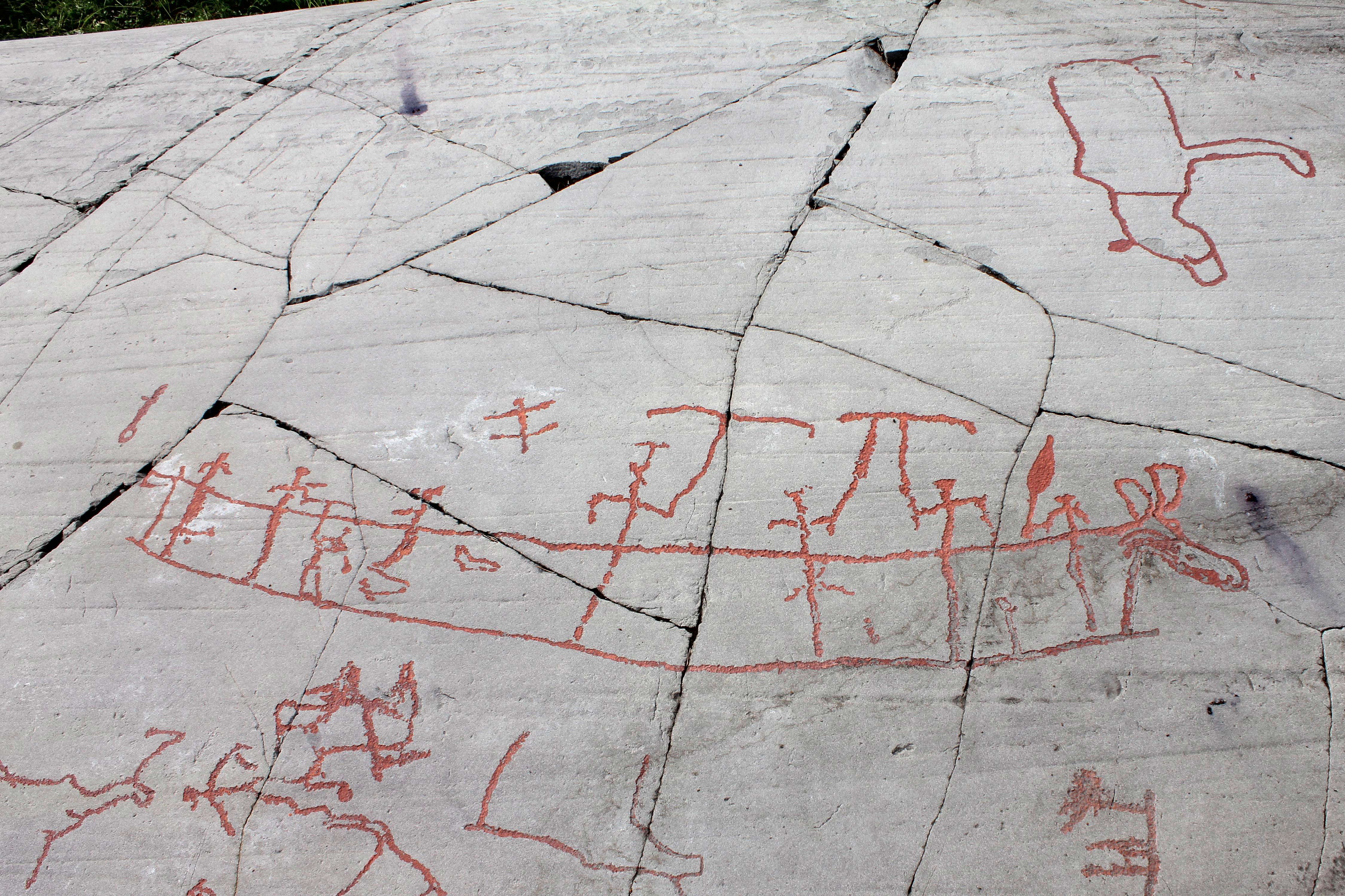
Eight men in a large boat, the sides of which reach waist high. The man in the prow of the boat, next to the ornately carved elk head forming a figurehead for the vessel, carries what may be an oar.
Four of the other men are carrying a T shaped object, the purpose of which is unclear. Just one might be interpreted as an anchor, but four seems excessive. One pair of the T shaped obects overlap in a π shape.
Given the number of whales engraved at the site, it is possible that the T shaped objects are designed to be plunged into the side of a whale, attached to ropes either tethered to the boat, or attached to floats.
Further up the photo is the image of a bear.
Photo: Ralph Frenken 2012
This is the bear shown in the photo above.
Given the latitude of these engravings, one can't help wondering if it is a polar bear.
Photo: Ralph Frenken 2012
The rock art in this photo shows a reindeer and a bear with two cubs. The bear tracks are coming out of the large crevasse in the left of the photo as if the bear has appeared from the lower world.
Photo and text: Jan Magne Gjerde, Gjerde (2010)

Two or three men in a large boat. The sides are not shown, although the ribs are, in what seems to be a crude engraving.
Photo: Ralph Frenken 2012
Reindeer (left) and possibly a deer on the right, given the shape of the antlers.
Also shown is a goose, with three tail feathers sticking out.
Photo: Ralph Frenken 2012

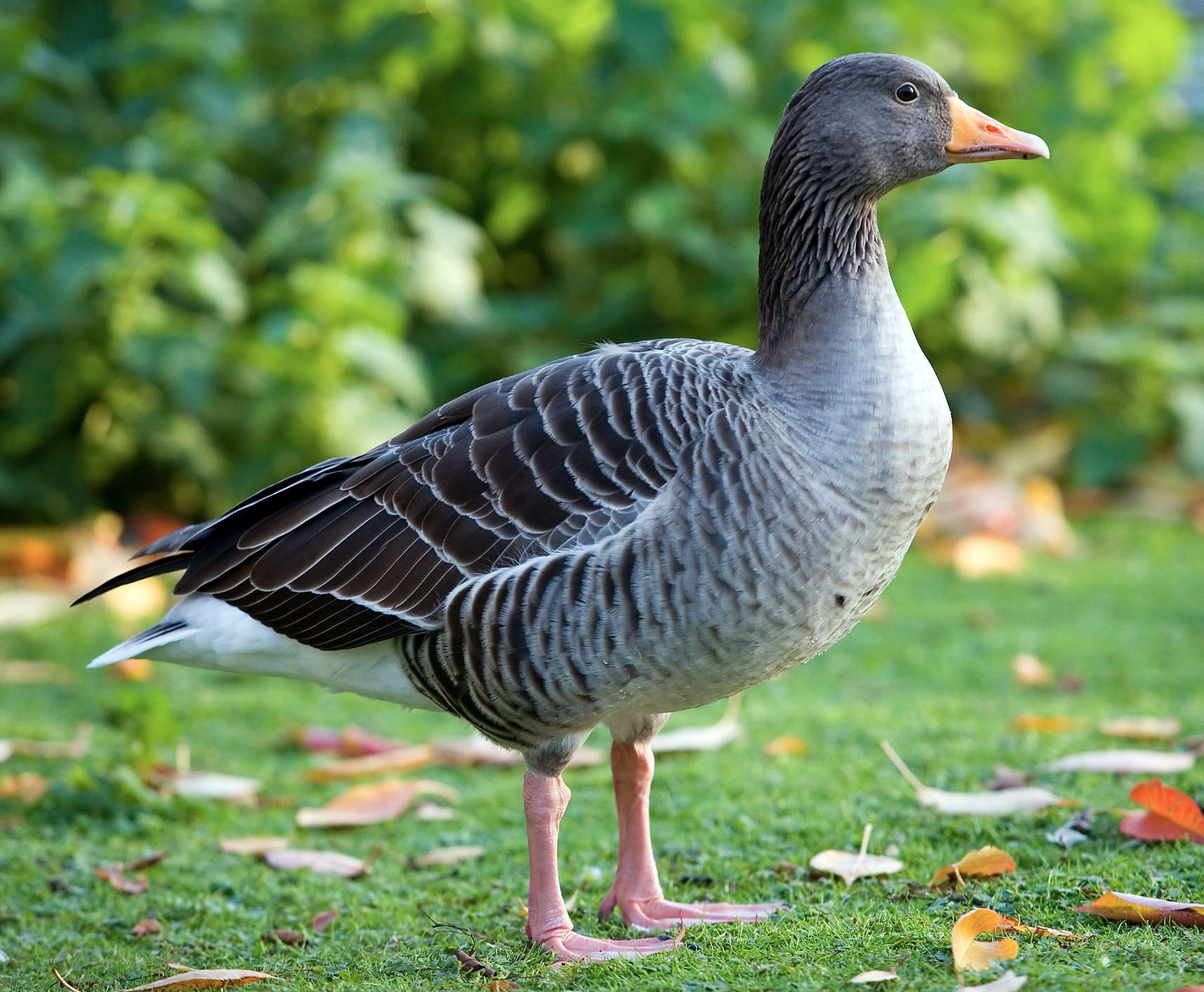
The geese shown in the engravings are possibly either the Greylag Goose, Anser anser or the Barnacle Goose, Branta leucopsis. This is a Barnacle Goose standing in a field in Finland, 25th July 2009, 18:43. At the present time it breeds on the east coast of Greenland, and on Arctic semi-desert tundra and coastal islands.
Barnacle Geese moult, and are flightless for some of that time, from early July to late August. It is at this time that they would have been hunted by the people of the Alta Fjord. Most are shown without wings in the engravings, which is how they would appear during molting.
The Barnacle Goose (Branta leucopsis ) belongs to the genus Branta of black geese, which contains species with largely black plumage, distinguishing them from the grey Anser species.
The Barnacle Goose is a medium-sized goose, 55–70 cm (22–28 in) long, with a wingspan of 130–145 cm (51–57 in) and a body mass of 1.21–2.23 kg (2.7–4.9 lb). It has a white face and black head, neck, and upper breast. Its belly is white. The wings and its back are silver-grey with black-and-white bars that look like they are shining when the light reflects on it. During flight a V-shaped white rump patch and the silver-gray underwing linings are visible.
Barnacle Geese breed now mainly on the Arctic islands of the North Atlantic. Barnacle Geese frequently build their nests high on mountain cliffs; away from predators (primarily Arctic Foxes and Polar Bears) but also away from food. Like all geese, the goslings are not fed by the adults. Instead of bringing food to the newly hatched goslings, the goslings are brought to the ground. Unable to fly, the three day old goslings jump off the cliff and fall; their small size, feathery down, and very light weight helps to protect some of them from serious injury when they hit the rocks below, but many die from the impact. Arctic foxes are attracted by the noise made by the parent geese during this time and capture many dead or injured goslings. The foxes also stalk the young as they are led by the parents to wetland feeding areas. Its call is a 'kaw'.
Photo: Andrey from Finland
Permission: licensed under the Creative Commons Attribution 2.0 Generic license.
Text: Wikipedia
The geese shown in the engravings are possibly either the Barnacle Goose, Branta leucopsis or the Greylag Goose, Anser anser. The Greylag Goose breeds at present all along the coast of Norway, extending to the north of Alta, as well as many other areas in Europe.
Greylag Geese moult, and are flightless for some of that time, during June. It is at this time that they would have been hunted by the people of the Alta Fjord. Most are shown without wings in the engravings, which is how they would appear during molting.
The Greylag is the largest and bulkiest of the grey geese of the genus Anser. It has a rotund, bulky body, a thick and long neck, and a large head and bill. It has pink legs and feet, and an orange or pink bill. It is 74 to 91 cm (29 to 36 in) long with a wing length of 41.2 to 48 cm (16.2 to 19 in). It has a tail 6.2 to 6.9 cm (2.4 to 2.7 in), a bill of 6.4 to 6.9 centimetres (2.5 to 2.7 in) long, and a tarsus of 7.1 to 9.3 centimetres (2.8 to 3.7 in). It weighs 2.16 to 4.56 kg (4.8 to 10.1 lb), with a mean weight of around 3.3 kg (7.3 lb). The wingspan is 147 to 180 cm (58 to 71 in). Males are generally larger than females.
The plumage of the Greylag Goose is greyish-brown, with a darker head and paler belly with variable black spots. Its plumage is patterned by the pale fringes of its feathers. It has a white line bordering its upper flanks. Its coverts are lightly coloured, contrasting with its darker flight feathers. Juveniles differ mostly in their lack of a black-speckled belly. It has a loud cackling call, HOOOOOONK!, like the domestic goose.
Photo by DAVID ILIFF. License: CC-BY-SA 3.0
Text: Wikipedia
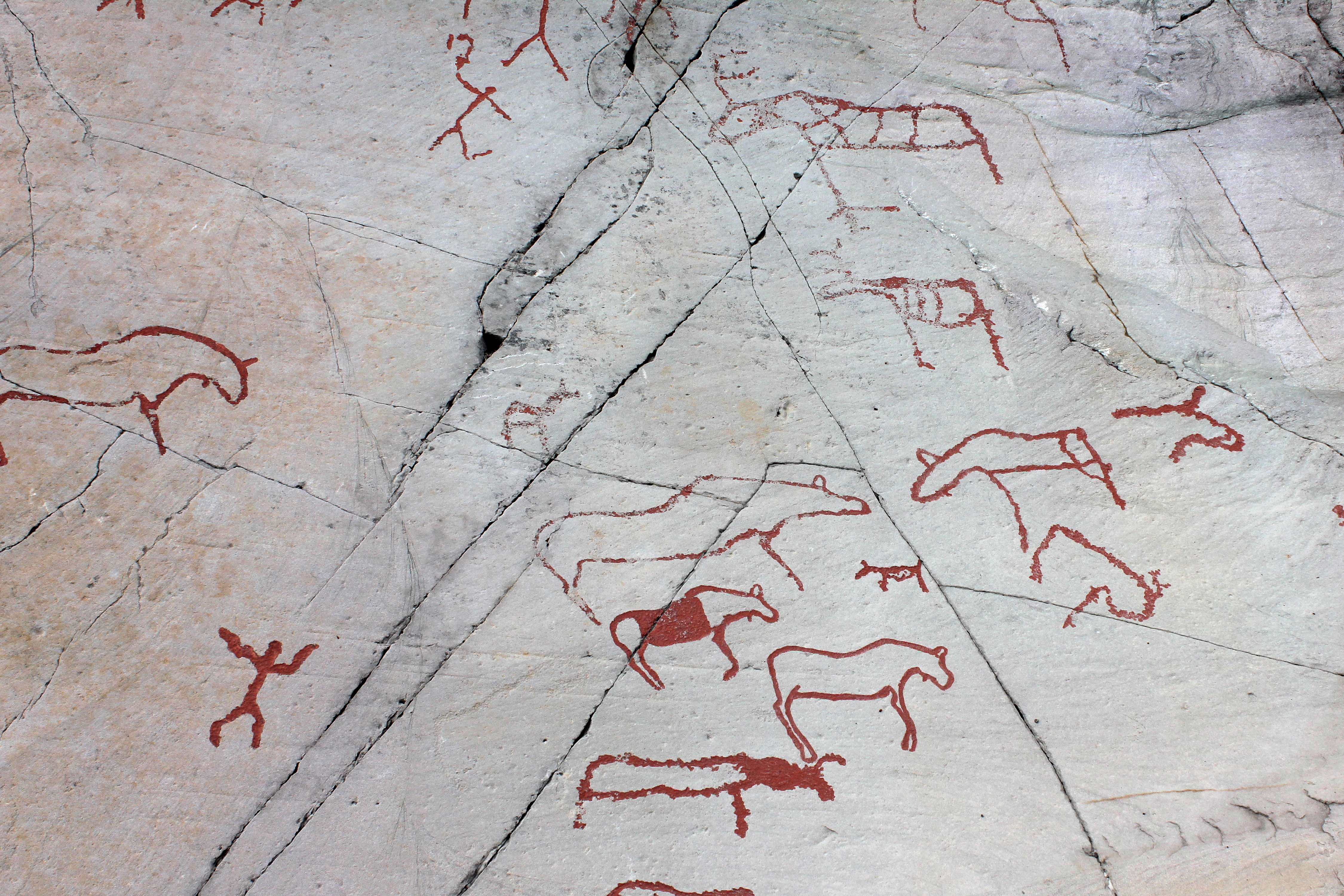
Several geese are shown in this image, as well as a reindeer, what may be a goat, and an elk.
In addition some humans are shown.
Photo: Ralph Frenken 2012
Two elk, a goose, and four high sided boats are shown.
Photo: Ralph Frenken 2012
These reindeer have been left uncoloured. It is not certain whether the original artists coloured the engravings or not.
Photo: Ralph Frenken 2012
Elk, showing the complete range of options for depiction: Thin outline, thick outline, completely pecked within the boundaries of the image.
Photo: Ralph Frenken 2012
This is a very good photo showing the engravings in the setting in which they were created.
Photo: © Marie-Laure Even
A lonely looking reindeer on an otherwise undecorated stone slab.
Photo: Ralph Frenken 2012
A whale blowing, or possibly with spears in it. Note the indication of a spine. The enigmatic object at the tail of the whale may be a float, attached to a spear cast into the whale and used to tire the whale. With large boats with eight or more occupants, whale hunting is a distinct possibility.
Photo: Ralph Frenken 2012

A long rod with a fork at the end, and a reindeer, apparently pregnant.
Photo: Ralph Frenken 2012
This photo contains a large number of important and interesting images.
In particular, the outsize elk staffs should be noted, taller than the humans wielding them, the men having ceremonial head-dresses that extend behind and above them, with one head-dress being held onto by yet another figure.
The image also includes the four figures in a circle, dancing with an object between them.
There is a balloon like object on a cord, the cord passing through the impossibly ornate antlers of a reindeer.
There are many stories on this one panel, but unfortunately the key is missing.
Photo: © bubbahop via Flickr
This small part of the panel above itself is a very complex image with many components.
The elements include five or six humans with weapons, and an elk, as well as an animal that may be a hare or rabbit.
Note the hat distorting the shape of the head of one of the humans, with the hat of the other incredibly lengthened, and being held onto by another anthropomorphic figure.
Photo: Ralph Frenken 2012
This image from the panel above shows four men carefully arranged in a circle, dancing with an oval object between them.
One opposite pair of men is larger than the other two, and the edges of the object in the middle are difficult to interpret, with the smaller pair of men holding just the edge, but the larger have their heads within the edge of the object, which has another oval pecked in its centre.
Photo: © Carlo7 --> via Panoramio
The most interesting part of this panel is the figure with arms outstretched, and legs wide spread, who may be dancing.
Photo: Ralph Frenken 2012
A large bony fish, and two boats, barely sketched out.
Photo: Ralph Frenken 2012

Three boats.
The top boat shows five occupants, with one holding what may be a steering oar. The photo on the left gives a good idea of how the stone relates to the surrounding landscape. A man seems to be flying above the boats, with what may be either a reindeer or more likely an elk staff on the left above the boats as well.
This may represent a shaman's journey, where a human figure is depicted 'flying' over a boat. Further to the right and closer to the sea (that can be seen in the upper right corner of the photo, and that was close to this rock when the image was engraved), a boat is depicted upside down, maybe representing the analogous boat from the lower world at Apana Gård, Hjemmeluft, Alta.
Photo (left) Jan Magne Gjerde, Gjerde (2010)
Photo (right): Ralph Frenken 2012
Text: Gjerde (2010)
This represents a shaman's journey through the reindeer. The shaman joined his mind with that of the reindeer, taking on the powers and characteristics of the animal.
Apana Gård, Hjemmeluft, Alta.
Photo and text: Jan Magne Gjerde, Gjerde (2010)

This is an even more graphic representation of the powers of the shaman. Gjerde (2010) interprets this as a flying shaman transforming from a reindeer to a shaman and then back into a reindeer.
Location: Bergbukten 1, Hjemmeluft, Alta.
Photo (stitched from three photos) and text: Jan Magne Gjerde, Gjerde (2010)
This is a fascinating image. It appears to have men at each end on an elevated platform, something which must have been difficult to achieve without compromising the stability of the boat.
Note the carefully drawn or pecked keel at the rear of the boat, and a prow which has been extended vertically in a manner which must have had more to do with custom and culture than with utility.
Certainly it is a very large boat indeed, with 14 occupants. Two of the men in the boat have a large object in one hand, possibly a fishing net ready to be cast.
In addition, the boat seems to have a deck, since the men are standing above the hull of the boat, instead of their bodies being shown x-ray style inside the boat, which is common in other images.
On the left is a man on skis hunting an elk.
Photo: Ralph Frenken 2012
Close up of the man on skis with a bow pursuing an elk. This is the only image of a skier in the entire Alta area.
Photo: Ralph Frenken 2012
There are many rock art sites in the Scandinavian area. This map details some of them.
Photo: Gjerde (2010)
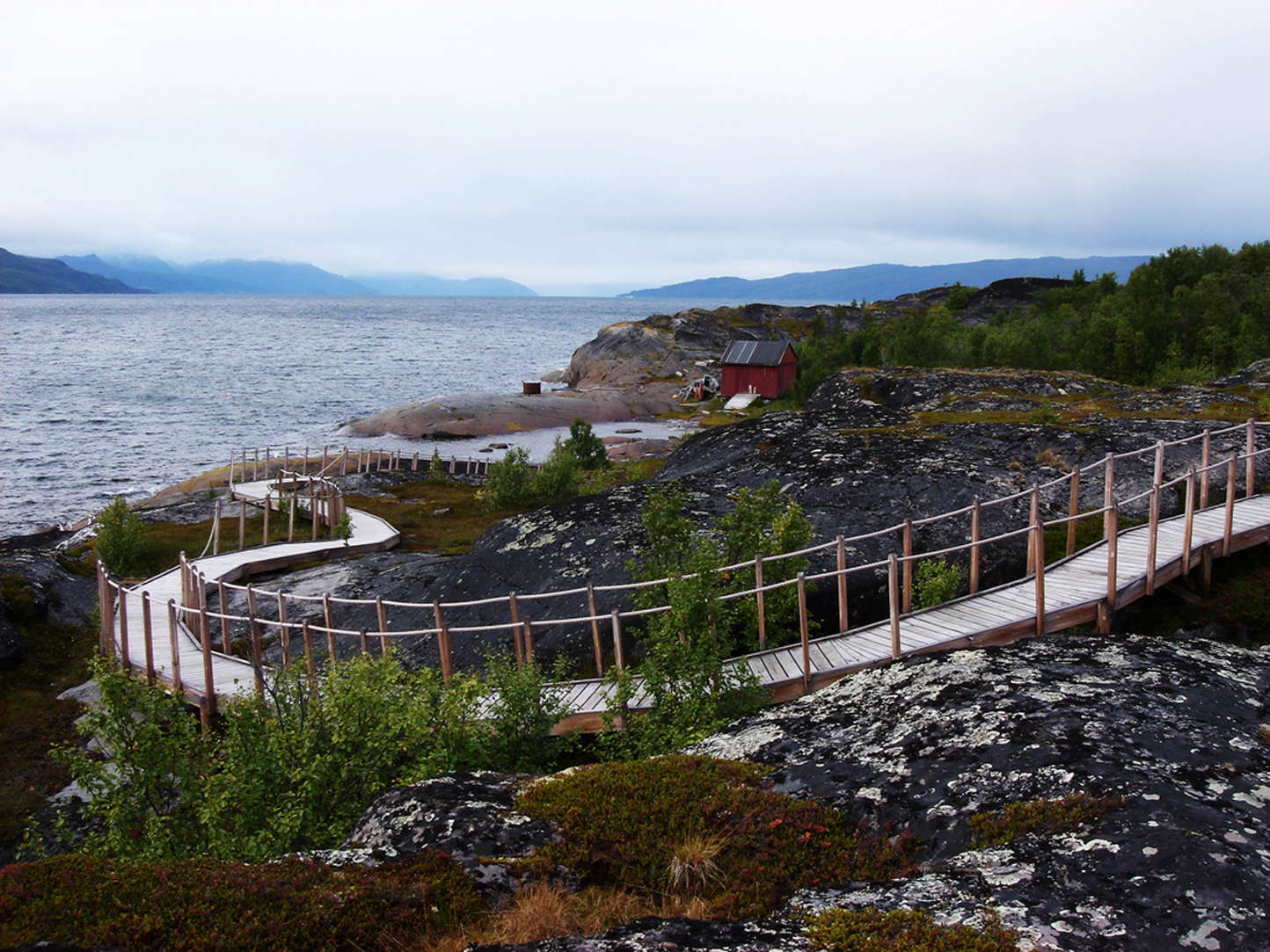
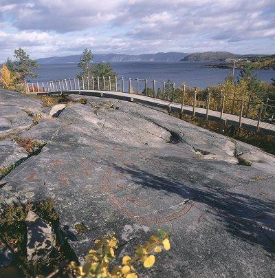
This is the wooden trail which leads past the petroglyphs at Alta.
Note how the rocks in the intertidal zone are clean and smooth, ideal for making engravings, but the rocks above are covered with lichen. This demonstrates the reason for the banding of the engravings. As the land rose, the rocks which had been engraved rose too, and became covered with lichen (and snow for most of the year) but the rocks at the shore line were blank canvases waiting to be used by the next generation of artists.
Photo: © Gregor Samsa
Looking out to sea from the area of engravings at the end of the bay, near the small red building shown from afar in the photo further up this page.
Although this is the view that the first settlers would have had of the sea from which they got much of their sustenance, and from which they came in the first place from places further south, it should be realised that the sea was higher at the time, and these rocks in the foreground would have been under water.
The first engravings were about 26 metres above the last, an indication of how much the sea had dropped in the meantime, exposing blank canvases for the artists to use.
Photo: Ralph Frenken 2012
This is the view from the area of engravings on the point or peninsula projecting into Alta Fjord, looking back to the museum on the rise behind the fjord, from the vantage point of the small red building, taken a few seconds later than the photo above looking out to sea.
Photo: Ralph Frenken 2012
Text adapted from: http://whc.unesco.org/en/list/352/
The thousands of paintings and engravings located at 45 sites scattered over seven localities illustrate a chronological sequence consisting of four phases. The largest area is at Hjemmeluft/Jiepmaluokta, where Alta Museum is situated. Approximately 3 000 figures have been found here. This is the only area open to the public. In addition, there is an area with rock paintings. Some of the panels at Hjemmeluft/Jiepmaluokta are linked by wooden footways.
Hunters and fishers in the late Stone Age/early Metal Age, between 6 200 and 2 000 years ago, made the rock carvings in Alta. During this period, Hjemmeluft/Jiepmaluokta was where people from the coast and inland regions, who gathered here several times a year perhaps in connection with seasonal, nomadic journeys, performed ritual ceremonies. The rock carvings depict some of the beliefs held by these people and the rites they practised. The rock carvings were probably elements in myths and stories about the worlds inhabited by the people and the spirits.
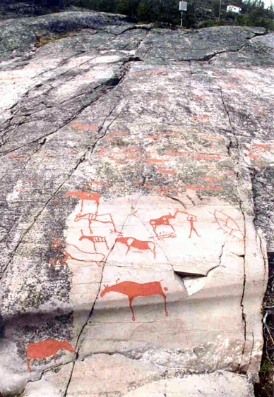
The rock carvings at Hjemmeluft/Jiepmaluokta were hewn into the massive and hard sandstone using one stone as a chisel and another stone or an antler as a hammer. The outlines of the figures were pecked out first, and then the lines and surfaces were chiselled out. Today many of the figures are difficult to see, and, therefore, some of the figures along the wooden footway are painted with a red colour resembling the colour of the rock paintings in Scandinavia. However, the majority of the rock carvings in Alta are not painted.
The rock carvings in Alta indicate that this was a religious meeting-place in the late Stone Age (6 200-3 800 BP) and early Metal Age (3 800 BP). Various types of bear-hunting scenes are common among the oldest rock carvings, suggesting that the bear may have been viewed in a similar way 5 000 - 6 000 years ago as it was in the pre-Christian Sámi religion. The Sámi gods are presented as they are depicted on the Runebommen (magic drum).
Norwegian Rock Art - Per's photos
Photographs and much of the text by Per, unless otherwise indicated

Click on the photo to see the full size version
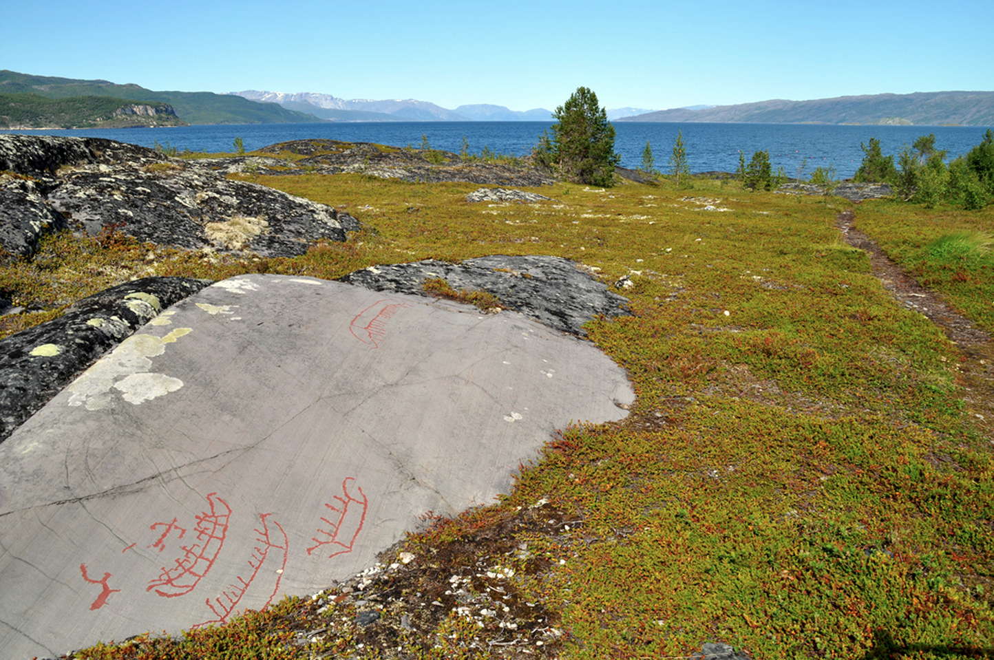
Alta Fjord, taken just in front of the museum. The point (not quite a peninsula) on the right side of the picture is where the first people came ashore (i.e the oldest finds). The two people in the picture are returning from the rock carvings which are approximately 100m from the water. This is a composite of three photos joined to give a panorama which is very evocative of the fjord area. Per should be proud of all these photos, but this one in particular is a superb composition.
It is idyllic in this shot, but I can imagine the wind howling and the snow driving across this landscape in winter. In the ice age, all of this would have been under a very thick layer of ice and snow. Fjords are formed by glaciers as they plough through the landscape to the sea in almost a straight line, unlike a river which twists and turns. When the glacier retreats, the sea comes in to form a fjord in its place.
The drawings were made over a long period of time and the most ancient were carved in the rock over 6200 years ago, while the younger ones are 2500 years old.
Boardwalk built so that the rock carvings could be viewed without damaging them.
From: http://news.bbc.co.uk/hi/english/sci/tech/newsid_904000/904501.stm
There are more rock carvings in Alta than anywhere else in northern Europe, a total of about 3,000 individual figures.
They depict people, animals, including reindeer, bears, elk, fish, birds, and boats and weapons. Some carvings appear to show hunting scenes, and others are thought to represent musicians holding instruments like the "runebommen", the shamanic drum used in rituals by the Sami people of Norway, Finland, Sweden and Russia. The entire site was placed on Unesco's World Heritage List in 1985. It lies at the head of the Alta fjord, at Jiepmaluokta, a Sami word meaning "seal bay".
When the first carvings were cut into the rock the sea level was between eight and twenty-six metres higher than today, and the climate much milder, more like modern southern Norway's.
But the land rose as the north European icecap withdrew, exposing new rock surfaces to the carvers.
Their work is believed to fall into four distinct phases, from the earliest markings 6 000 years ago to the most recent, just 500 years before the birth of Christ.
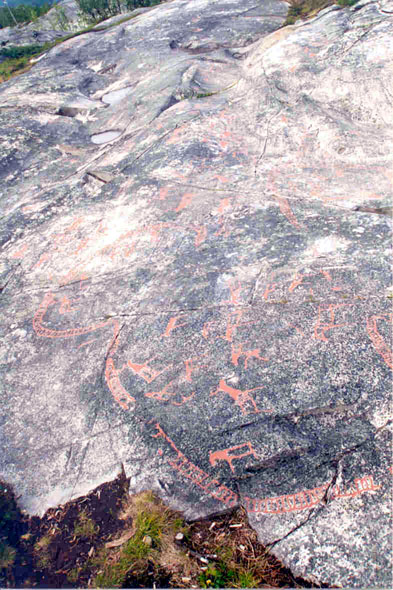
Rockcarvings from Alta in the far north of Norway.
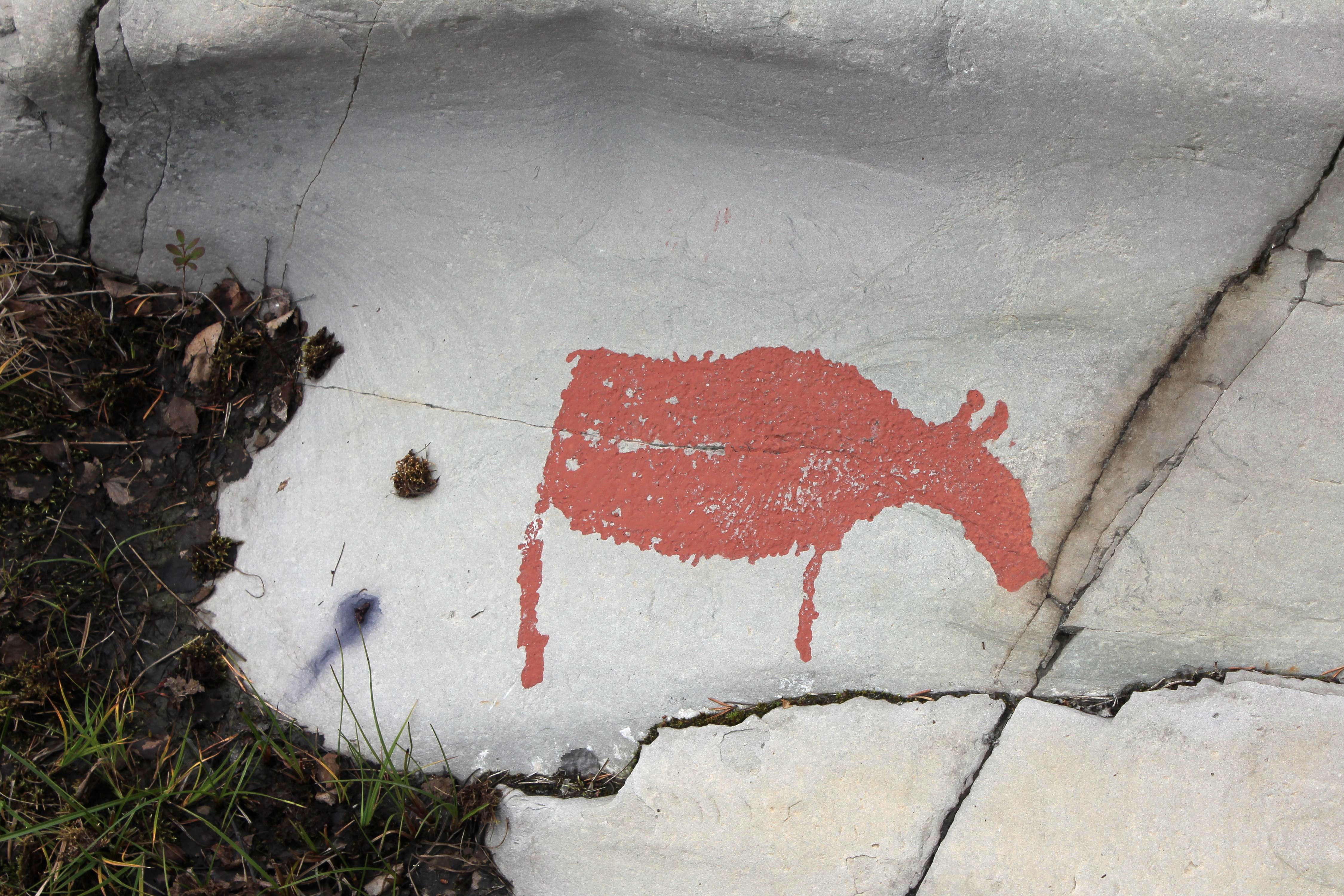
The red paint is done by an archaeologist to make it easier to see the carvings. It is not known whether they were coloured at the time they were completed. Per went to a lecture by the director of a Danish museum who said that the carvings most likely weren't coloured originally, but they were very visible just around sunset, and almost invisible for the rest of the day.
Per writes: 'I've seen on Swedish TV that the scientists use water on the rocks when looking for them. This changes the way the light reflects from the surface and make them visible. They then use chalk to highlight them and later use paint when they are sure about their interpretation. To me it makes sense that they weren't painted then. You'll have to know where to be and look and at the right time of day they would appear before your eyes as by magic, making them seem more mystic and powerful.'
Rockcarvings from Alta in the far north of Norway.
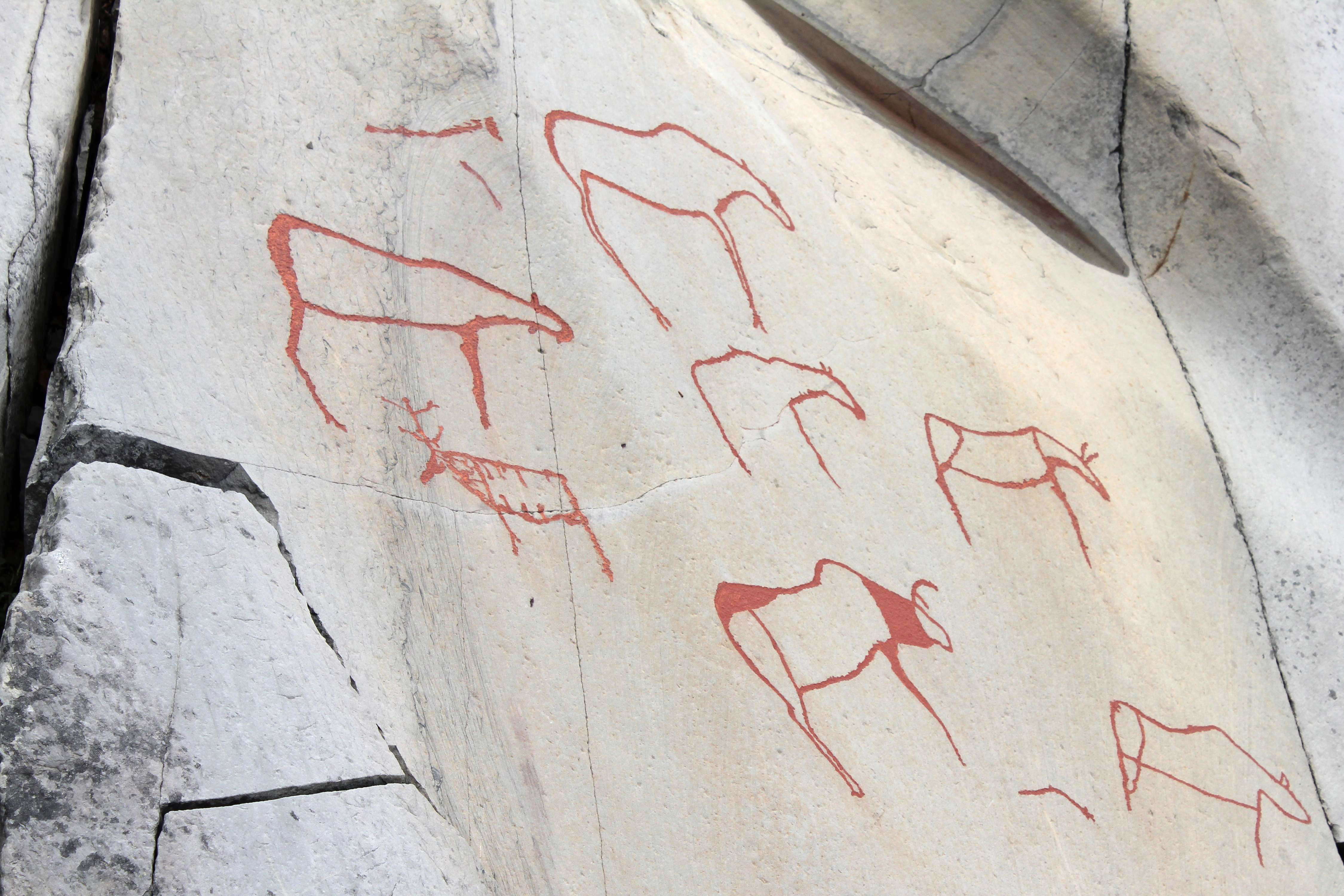
These images appear to be of reindeer and elk.
The 'ladders' are fences, either traps into which the hunters drove the animals to spear them, or fences to guide the herd to the waiting hunters.
Photo: Per, 2001
Rockcarvings from Alta in the far north of Norway.
These appear to be of boats with people standing in them, possibly casting a net for fish. See below for the reconstruction of this particular boat.
Photo: Per, 2001
Rockcarvings from Alta in the far north of Norway.
Another view of the person casting a net. Note also the person with the bow and arrow.
Photo: http://home.zonnet.nl/tonpors/alta.htm
Rockcarvings from Alta in the far north of Norway.
These appear to be hunting scenes, with hunters carrying bows to shoot arrows at the game. Note the 'balloon' shape with 'string' which may be a rope and anchor, or possibly a bladder float with fishing line, or...
Photo: Per, 2001
Rockcarvings from Alta in the far north of Norway.
Hunters, elk and reindeer. The stripes on the reindeer are interesting. Do they represent places to spear the reindeer, where to cut them up, or were these reindeer striped?
Photo: Per, 2001
Rockcarvings from Alta in the far north of Norway.
Elk, reindeer, and possibly aurochs.
Photo: Per, 2001
Rockcarvings from Alta in the far north of Norway.
Rock carving of people in a long boat. Note that there appear to be people on raised platforms at the bow and stern of the boat.
Photo: Per, 2001
Rockcarvings from Alta in the far north of Norway.
Three smaller boats. One has five people in it.
Photo: Per, 2001
Rockcarvings from Alta in the far north of Norway.
Deeper, shorter boats. These give the impression of being for cargo rather than for travelling at speed.
Photo: Per, 2001
Rockcarvings from Alta in the far north of Norway.
Boats and animals. These boats appear to be for cargo also.
Photo: Per, 2001
Rockcarvings from Alta in the far north of Norway.
A fisherman in a boat, a long line, a holy fish (Halibut or possibly a flounder) and a bear, the most holy animal. They believed that the bear could travel between the different (spirit) worlds. You can see the fish again in the photo below.
Photo: Per, 2001
Rockcarvings from Alta in the far north of Norway.
Fish and boats.
Photo: Per, 2001
Rockcarvings from Alta in the far north of Norway.
Reindeer carved into the rock face.
Photo: Per, 2001
Rockcarvings from Alta in the far north of Norway.
Reindeer.
Photo: http://en.wikipedia.org/wiki/Image:Alta.jpg Uploaded by "Zoph"
Rockcarvings from Alta in the far north of Norway.
Enigmatic symbols - they may be fish, and reindeer further up.
Photo: Per, 2001
Rockcarvings from Alta in the far north of Norway.
Hunters and animals.
Photo: Per, 2001
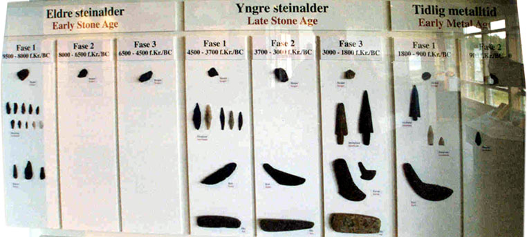
Museum at Alta in the far north of Norway.
This display shows various artefacts from the region. Note that the names are not standard. Early stone age is given as 9 500 - 8 000 BC. This is usually categorised as the upper paleolithic, and grades into the start of the mesolithic, often taken as 8 000 BC, (~10 000 BP) after the final retreat of the ice.
Photo: Per, 2001
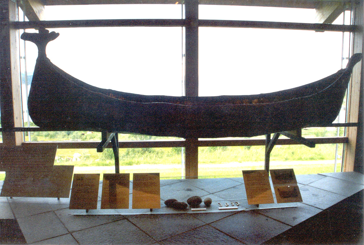
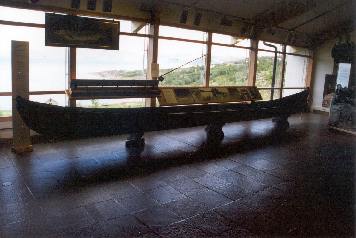
Below are two pictures of reconstructions of the old local boats from Alta, as shown on the rock carvings above.
Click on the photo to see the full size version
This is a reconstruction of a small boat, done with a wooden frame and reindeer hides. Notice the "head" at one end. It is the boat shown clearly in the rock carvings above where someone is throwing a net. The design is from at least 6 000 years BP and is pictured on the oldest of the rock carvings.
Photo: Per, 2001
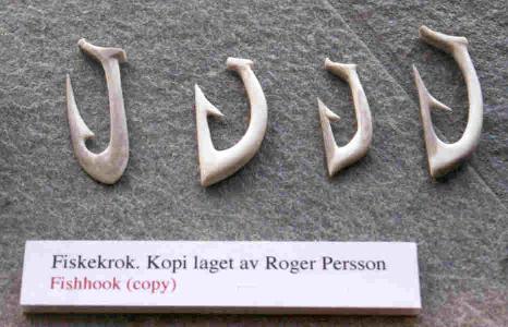
These are copies of fish hooks used in the stone age as shown in the display above, below the boat. They are of superb workmanship, and as is so often is the case, the care lavished on them is out of all proportion to their use. People like to make beautiful things.
Click on the photo to see the full size version
This is a reconstruction of a larger boat. It is a later design boat seen on other rock carvings from around 4 500 BP. This design is still used today for sailing on the Alta and Tana rivers, with only two modifications to accommodate a small outboard engine and to protect the propeller in the shallow water.
The one above is a boat used for fishing and maybe hunting. It's long and slender, something in between a canoe and a kayak. Per says: 'I can't imagine more than four people aboard such a vessel, because it's narrow and I expect that you used to sit on the bottom. It's ideal for use on rivers and smaller fjords.'
It should be noted that neither of these is a Viking ship. Viking ships have wider seating, accommodating at least two persons rowing side by side and have a raised stern and deck making them seaworthy even in rough waters and high seas, and they were apparently the first ones to have a mast. This size would be used as a trading vessel on rivers and as a raider. The Vikings also had a much bigger ship type called a "Knarr" where the ballast alone would be more than 10 metric tons.
The following were photos sent by Per which may be of interest to others, as they were to me:
Anholt - the only desert in Denmark
The 22 square kilometre island of Anholt in the middle of the Kattegat between Denmark and Sweden is composed of two different parts: 30-50 m high moraine hills in the west, Vesterlandet, shaped by the inland ice at the end of the last Ice Age, and a large marine foreland in the east, osterlandet. Anholt was originally forested mainly by scotch pine, Pinus sylvestris.
In the 17th century the inhabitants felled what remained of the forest. Therefore the former woodland was transformed into a large infertile area, the so-called desert. However, nowadays the Anholt desert constitutes the largest, connected area of the north-western European lowlands containing the rare and very vulnerable type of lichen heath, connected with large areas of inland dune, heath, crowberry and grass heaths as well as good-sized white and grey dunes. These are habitats of European Union interest, and several are classified as habitats with a high priority, furthermore they include a number of uncommon and rare species.
Over the last decades, considerable parts of this valuable natural territory had become heavily overgrown with self-sown mountain pine Pinus mugo, in total the equivalent of about 25% of the Anholt desert was under direct threat of being overgrown.
Text: http://www.coastalguide.org/dune/anholt.html
This is a reconstruction of the largest Viking "farm" inhabited by a local Chieftain on Lofoten.
Photo: Per, 2001
References
- Erä-Esko, A., 1958, Die Elchkopfskulptur vom Leärojärvi in Rovaniemi Suomen MuseoLXV, 8-18.
- Gjerde J., 2010, Rock art and Landscapes: Studies of Stone Age rock art from Northern Fennoscandia Dissertation for PhD, University of Tromsø, July 2010
- Helskog, K. and Høgtun E., 2004, Recording landscapes in rock carvings and the art of drawing, Prehistoric Pictures as Archaeological Source. Förhistoriska bilder som arkeologisk källa Tanumshede: Tanums Hällristningsmuseum, 23-31.
- Irsenas, M., 2010, Anthropomorphic and zoomorphic stone age art In Lithuania, and its archaeological cultural context Archaeologiabaltica13, Klaipėda, 2010
- Kashina, E. and Zhulnikov, A., 2011, Rods with Elk Heads: Symbol in Ritual Context, Estonian Journal of Archaeology 2011, 15, 1, 1831
- Shirokogoroff S., 1935, Psychomental Complex of the Tungus London: Kegan Paul, Trench, Trubner.
- Tansem, K. and Johansen H., 2008, The World Heritage Rock Art in Alta, Adoranten 2008