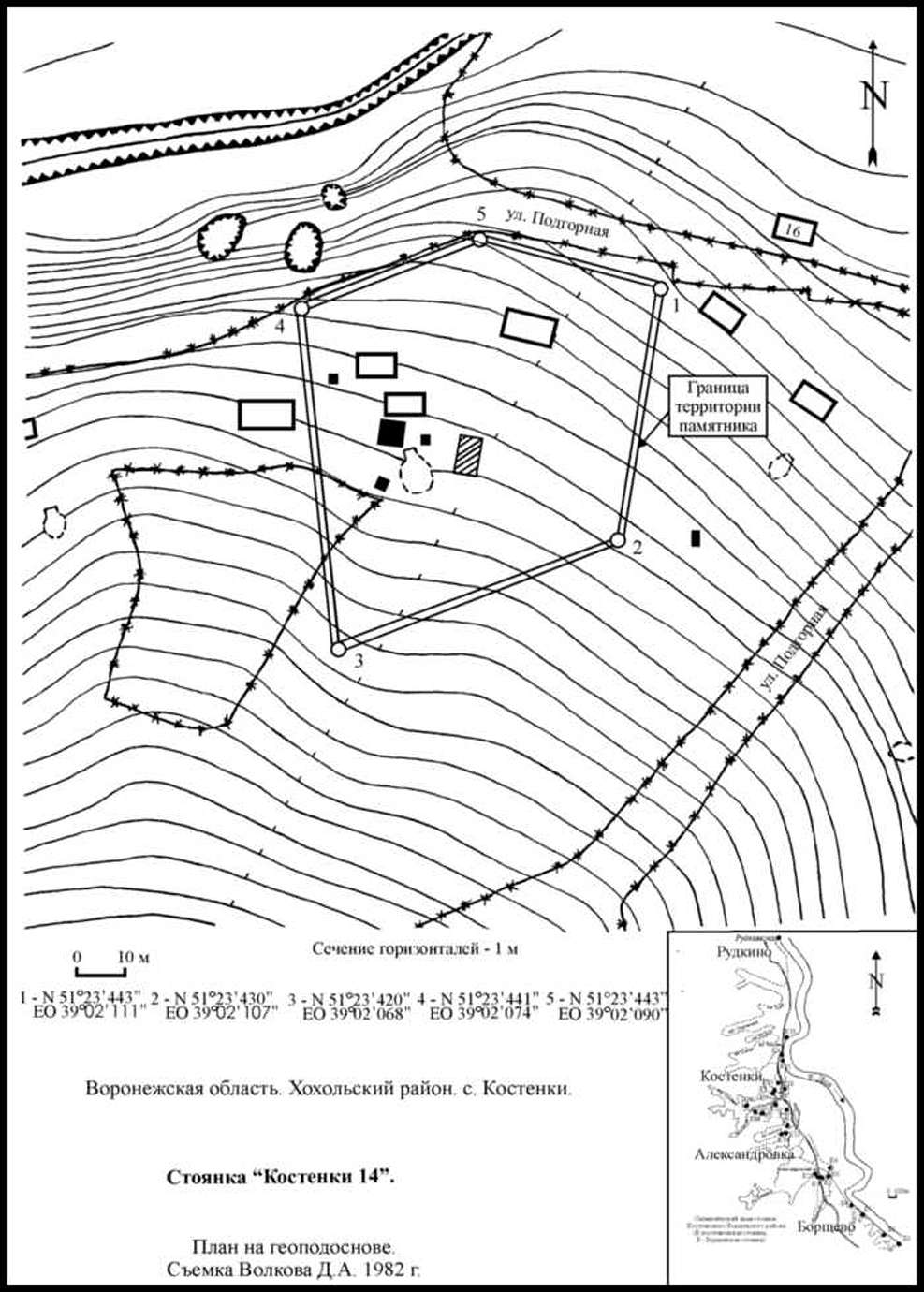
Back to Don's Maps
 Back to Archaeological Sites
The Kostenki - Borshevo, Костенки - Борщево region on the Don River
Kostenki is a very important Paleolithic site on the Don River in the Russia. It was a settlement which contained venus figures, dwellings made of mammoth bones, and many flint tools and bone implements. Kostenki / Kostienki is not actually a single site but really an area on the right bank of the Don River in the regions of the villages of Kostenki and Borshevo, consisting of more than twenty site locations, all dating to the Paleolithic.
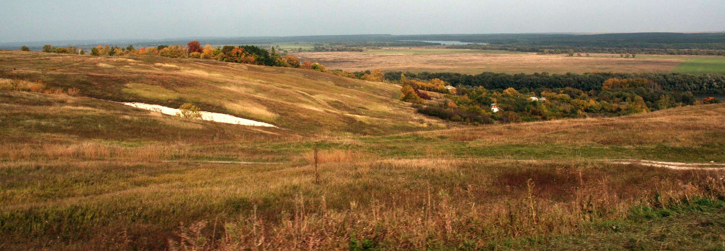
Photo: Vladimir Gorodnjanski, 2006
The view 35 000 years ago in late summer would have been very similar, but there would have been many fewer trees (spruce, and the plants which typically accompany it, such as the lesser club moss or spikemoss Selaginella selaginoides, as well as larch, willow and aspen), and then only along the edge of the river as a gallery forest, and the trees would have been much smaller because of the harsher climatic conditions, equivalent to those prevailing now 10 degrees further north, at around 61° north. The river would have been smaller also, since there was less precipitation, and the viewpoint would have been only a few metres in altitude above the river. Springs and seeps, which are still present in the area today, emanated from the bedrock valley wall. Their presence may account for the unusually high concentration of Upper Paleolithic sites in this part of the central East European Plain.
A series of uplifts over the last 35 000 years created three terraces, raising the viewpoint nearly seventy metres above the river.
The villages of Kostenki and Borshevo are located in the Don Valley, roughly forty kilometres south of Voronezh. The western slope of the Don Valley in the vicinity of the villages and for some distance further south forms the eastern boundary of the Central Russian Upland, the eastern slope, the western boundary of the Tambov Lowland. The eastern part of the Central Russian Upland, in contrast to the Tambov Lowland, appears to have been undergoing continued uplift, and partly as a consequence, the Don Valley in the Kostenki - Borshevo region is markedly asymmetrical - the western slope is quite steep, the eastern one quite gentle.
(Klein, "Man and Culture in the Late Pleistocene", 1969)
(Thus the Don River flows down the fault line between the uplifted Central Russian Upland and the Tambov Lowland. This fortuitous circumstance means that there developed a geological method of preserving the evidence of habitation in this area. The uplift provided ravines and associated springs for water during winter, and also provided high ground above the river terraces which gradually covered the settlements by colluvial action, as well as successive uplifts of the land, so that successive settlements were separated first (vertically) by colluvial sediments and secondly by the uplift, leading to the settlements being separated by (horizontal) distance as well on the three main terraces.
Further, modern settlers found the area to be congenial, and sunk house foundations and cellars which uncovered the mammoth bones which first alerted people to the unusual nature of the area, and erosion of the ravines also provided access to evidence of previous settlements. However the houses are scattered widely over the area, and excavations of sites can be made without greatly inconveniencing the local population, as would be the case in a large town or city. There is a good road to the region from a major city not far away, but the road does not cross the area of interest, which is serviced by a network of minor, mostly dirt roads. The area is not under threat of flooding or other disturbance, and the area is politically stable, so long term careful explorations can be made.
A (dateable) fall of volcanic ash conveniently delineates the oldest sediments from the younger ones.
Archaeologists could hardly ask for more. - Don)

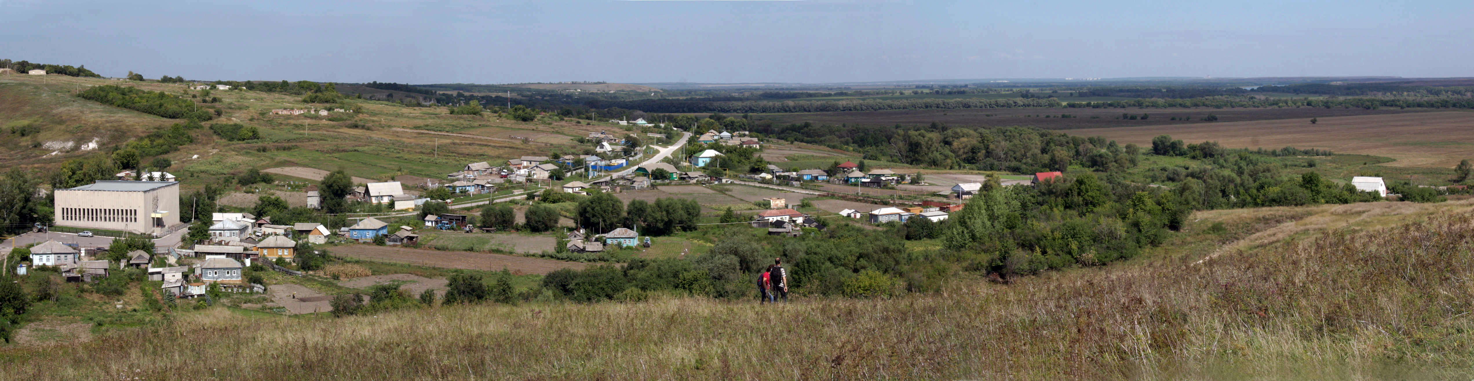
Kostenki Panoramas. The Museum may be seen in both photos, and the Don River in the right background of the second photo.
Photo: Vladimir Gorodnjanski 2011
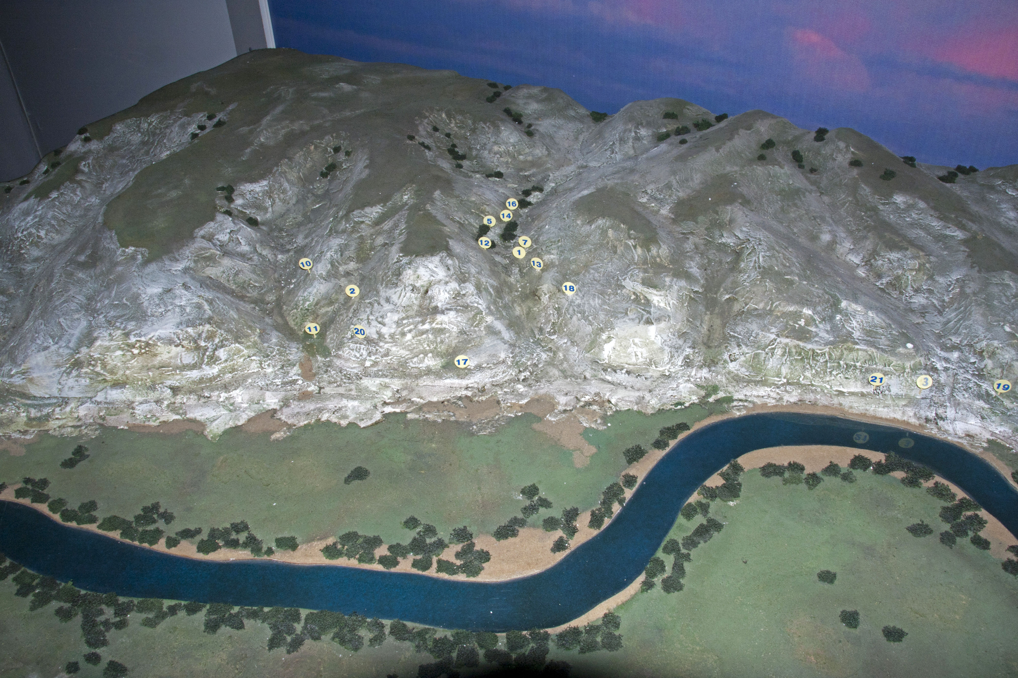
Diorama of the Don valley at Kostenki.
Photo: Vladimir Gorodnjanski, 2014
Source: Display at Kostenki Museum


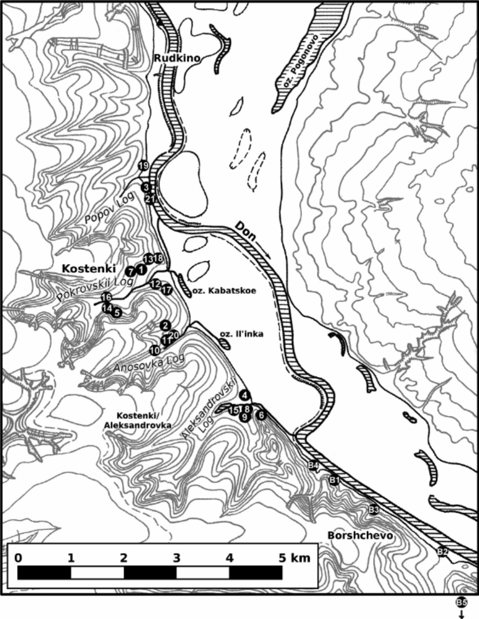
Map of sites in the Kostenki-Borshevo district during the Wurm glaciation.
Photo: Vladimir Gorodnjanski 2014
Source: Kostenki Museum
Map of sites in the Kostenki-Borshevo district during the Würm glaciation.
Photo: Dinnis et al. (2018)
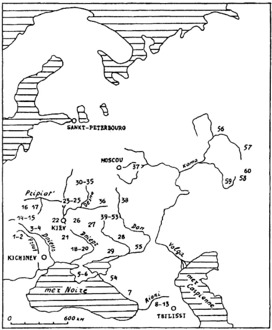
Distribution of mobile art in Eastern Europe.
1 Staryé Duruitory, 2 Brynzeny, 3 Kosseoutzy, 4 Klimaoutzy, 5 Suren' 1, 6 Chan-Koba, 7 Apiantcha, 8 grotte d'Uvarov, 9 Sakagia, 10 Sagvardgilé, 11 Gvardgilas-Kldé, 12 Devis-Khvreli, 13 Taro-Kldé, 14 Molodova V, 15 Lissitchniki, 16 Lipa VI, 17 Klinetz, 18 Ossokorovka, 19 Dubovaya Balka, 20 Kaïstrovaya Balka, 21 Mejiritch (Mezhirich), 22 Kievo-Kirillovskaya, 23 Mézine (Mezin), 24 Novgorod Severskyi, 25 Puchkari I, 26 Dobranitchevka, 27 Gontzy, 28, Rogalik, 29 Amvrossievka, 30 Eliseevitchi I, 31 Eliseevitchi II, 32 Yudinovo, 33 Khoylevo II, 34 Timonovka, 35 Suponevo, 36 Avdeevo, 37 Sungir', 38 Gagarino, 39 Kostienki 19, 40 Kostienki 21, 41 Kostienki 13, 42 Kostienki 1, 43 Kostienki 14, 44 Kostienki 12, 45 Kostienki 17, 46 Kostienki 2, 47 Kostienki 11, 48 Kostienki 4, 49 Kostienki 15, 50 Kostienki 9, 51 Kostienki 8, 52 Borchtchevo 1, 53 Borchtchevo 2, 54 Ilskaya, 55 Murakovka, 56 Ostrovskaya, 57 Bez'imyannyi, 58 Smelobskaya, 59 Kapova, 60 Ignatievskaya.
Photo: Abramova (1995)
Locations of Eastern European sites of the Kostenki Late Gravettian culture.
Photo: Reynolds et al. (2019)


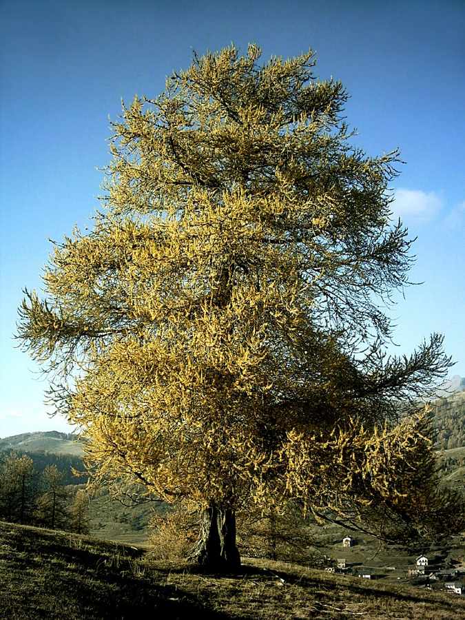

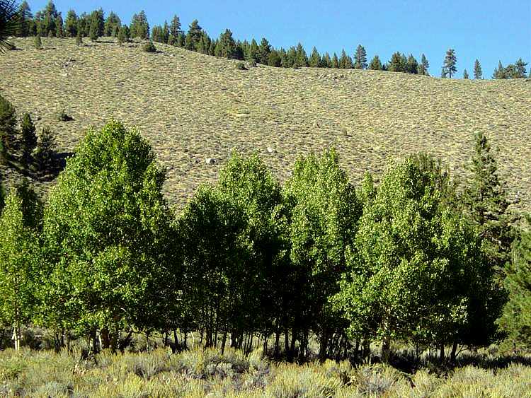
Spruce, clubmoss, larch, willow and aspen (shown here in order) were the major species in the area 30 000 years ago.
Photos: Wikipedia, Wikipedia, Wikipedia, http://herba.msu.ru/pictures/Dietrich/pages/616.htm, Wikipedia by Daniel Mayer.
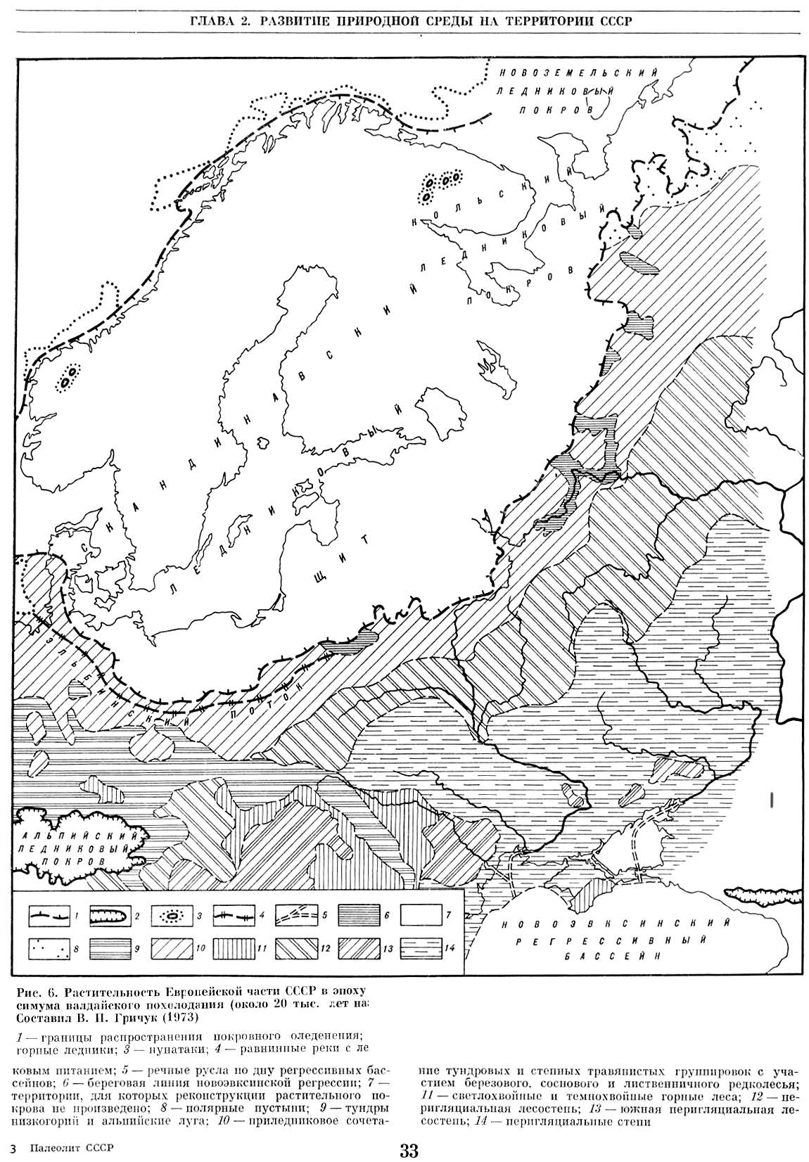
Fig.6
Растительность Европейской части СССР в эпоху максимума валдайского похолодания (около 20 тысяч лет назад)
Палеолит СССР. Составил Гричук (1973)
Vegetation of the European part of the USSR during a maximum of the Valdai cold snap (about 20 thousand years ago)
Photo: Paleolithic of the USSR. Grichuk (1973)
- Границы распространения покровного оледенения.
- Горные ледники.
- Нунатаки.
- Равнинные реки следниковым питанием.
- речные русла по дну регрессивных бассейнов.
- береговая линия новоэвксинской регрессии.
- Территории для которых реконструкции растительного покрова не произведено
- полярные пустыни
- тундры низкогорий и альпийские луга.
- преледниковое сочетание тундровых и степных траваянистых группировок с участием березового, соснового и лиственного редколесья.
- Светлохвойные и темнохвойные горные леса.
- перигляциальная лесостепь
- южная перигляциальная лесостепь
- перигляциальные степи
- edge of the ice sheet.
- mountain glaciers.
- nunataks. A nunatak or nunataq is the exposed summit of a ridge, mountain, or peak not covered with ice or snow within an ice field or glacier. The term is typically used in areas where a permanent ice sheet is present. (Wikipedia)
- edge of the lakes fed by the ice sheet.
- river channels feeding lakes
- coastal line of the Novoevksinskogo province (?) lakes.
- areas for which the vegetative cover has not been determined
- polar deserts
- tundras and alpine meadows.
- a combination of tundra and grassy steppe with the inclusion of birch, pine and deciduous light forest.
- light conifers and wooded mountains.
- forest-steppe
- southern forest-steppe
- steppes

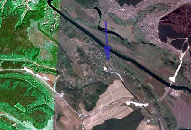
Panorama looking eastwards, of the Don River. The photograph is taken from 'Hill 190', showing the village of Borshevo on the left of the photograph. This point is about five kilometres south of Kostenki, with Kostenki upstream to the left of the hill in the panorama. The point from which it was taken may be seen on the google earth image above and on the roadmap further down this page, at the point where "190" is printed below the main Borshevo village area. This west bank (true right) of the Don Valley is composed of Cretaceous marl and sand that unconformably overlie Devonian clay.
The bridge to the right of the photo is not yet in service, and will be one of the few ways of getting across the Don River in this area.
Photo: Vladimir Gorodnjanski, 2006 and Google Earth
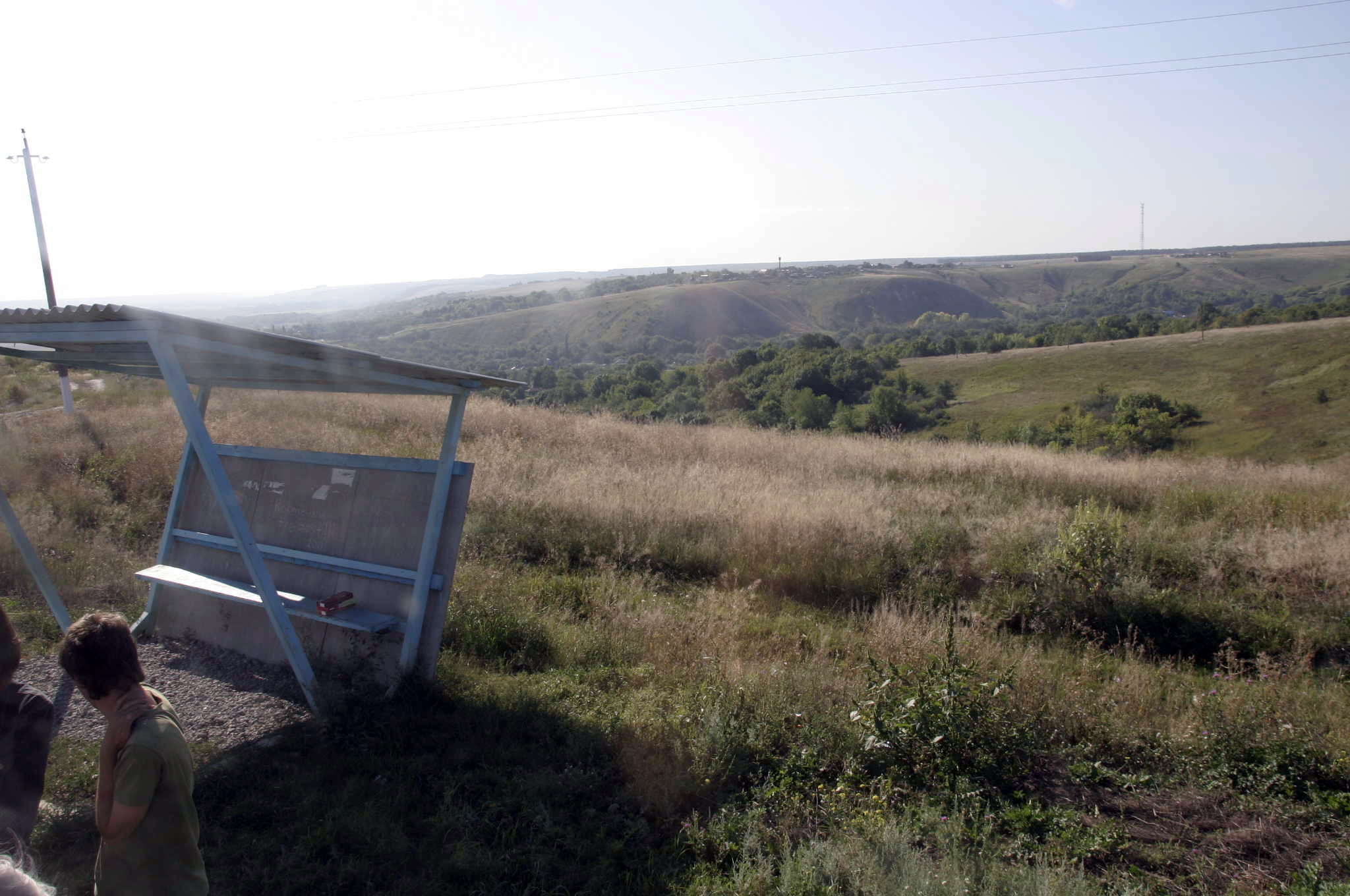
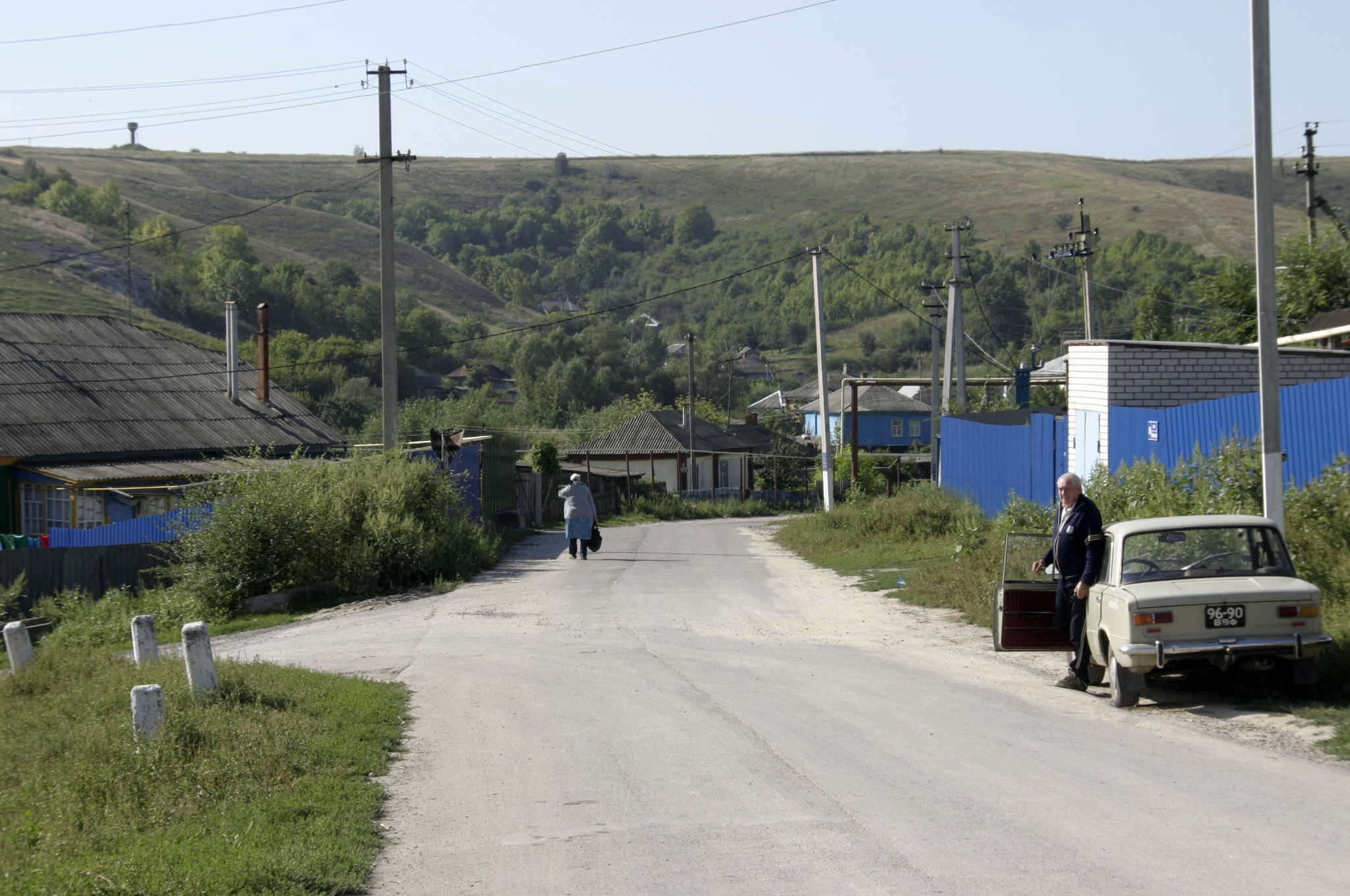
The bus stop where travellers alight for Kostenki has a good view of the general area.
Travellers then walk down the hill to the village. Local people will be able to direct you to the museum.
Photo: Vladimir Gorodnjanski 2011

Soon the Museum appears over the roofs of the houses. Since the Museum was built on the site of Kostenki 11, which was found when a villager started digging a cellar, the Museum is in the middle of the village.
Photo: Vladimir Gorodnjanski 2011
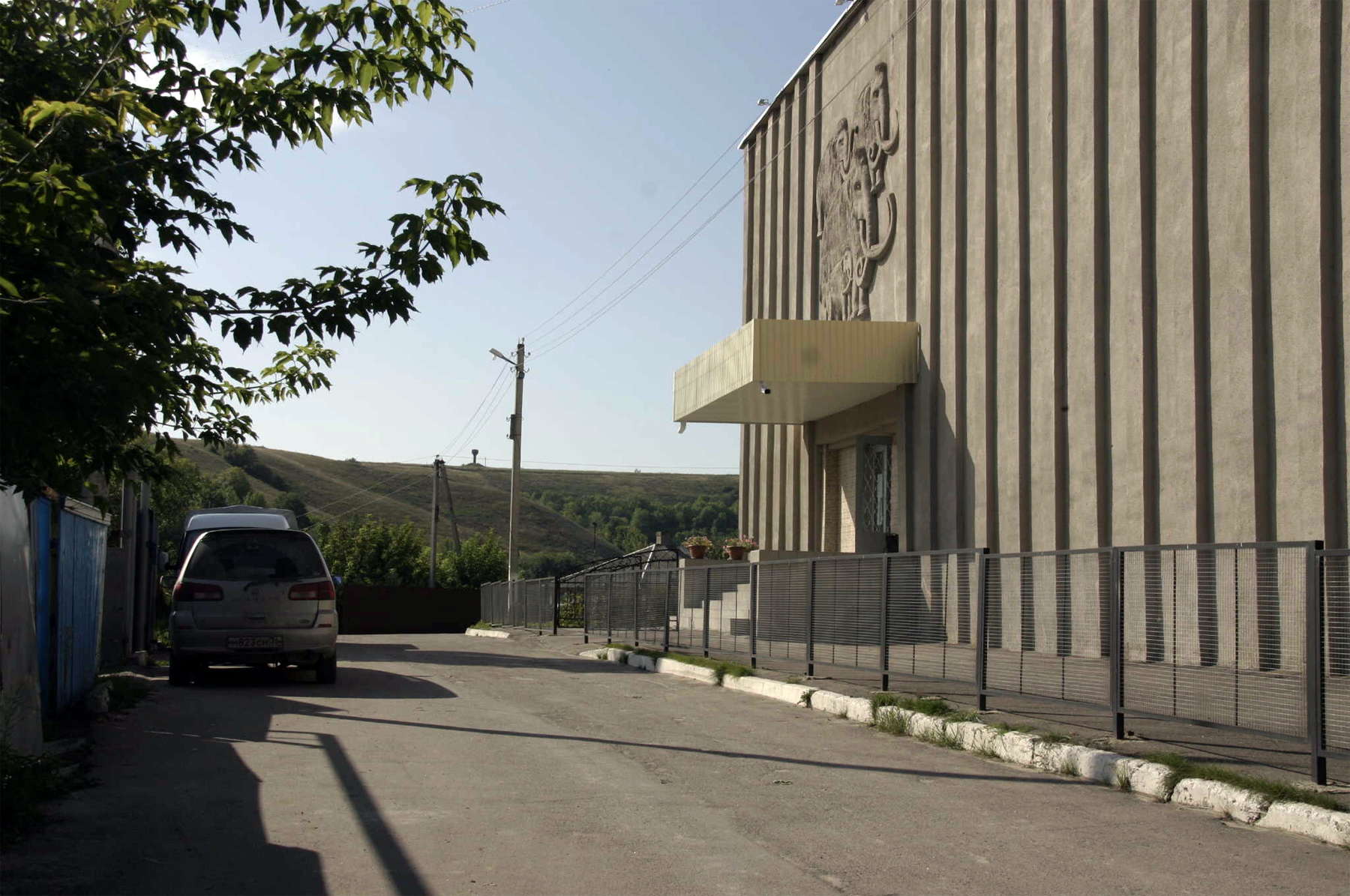
The Kostenki Museum has an imposing facade.
Photo: Vladimir Gorodnjanski 2011
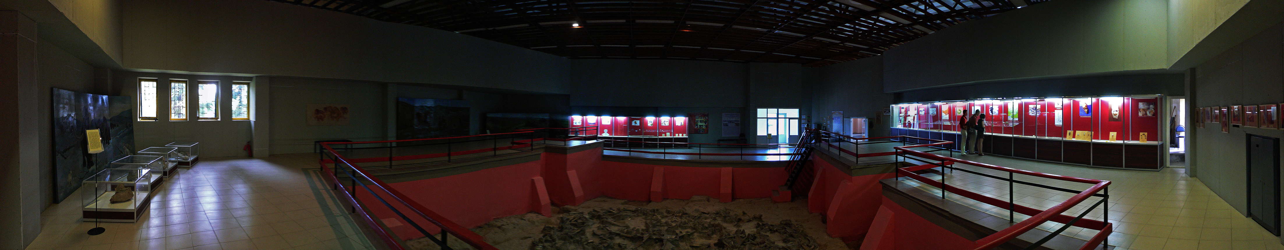
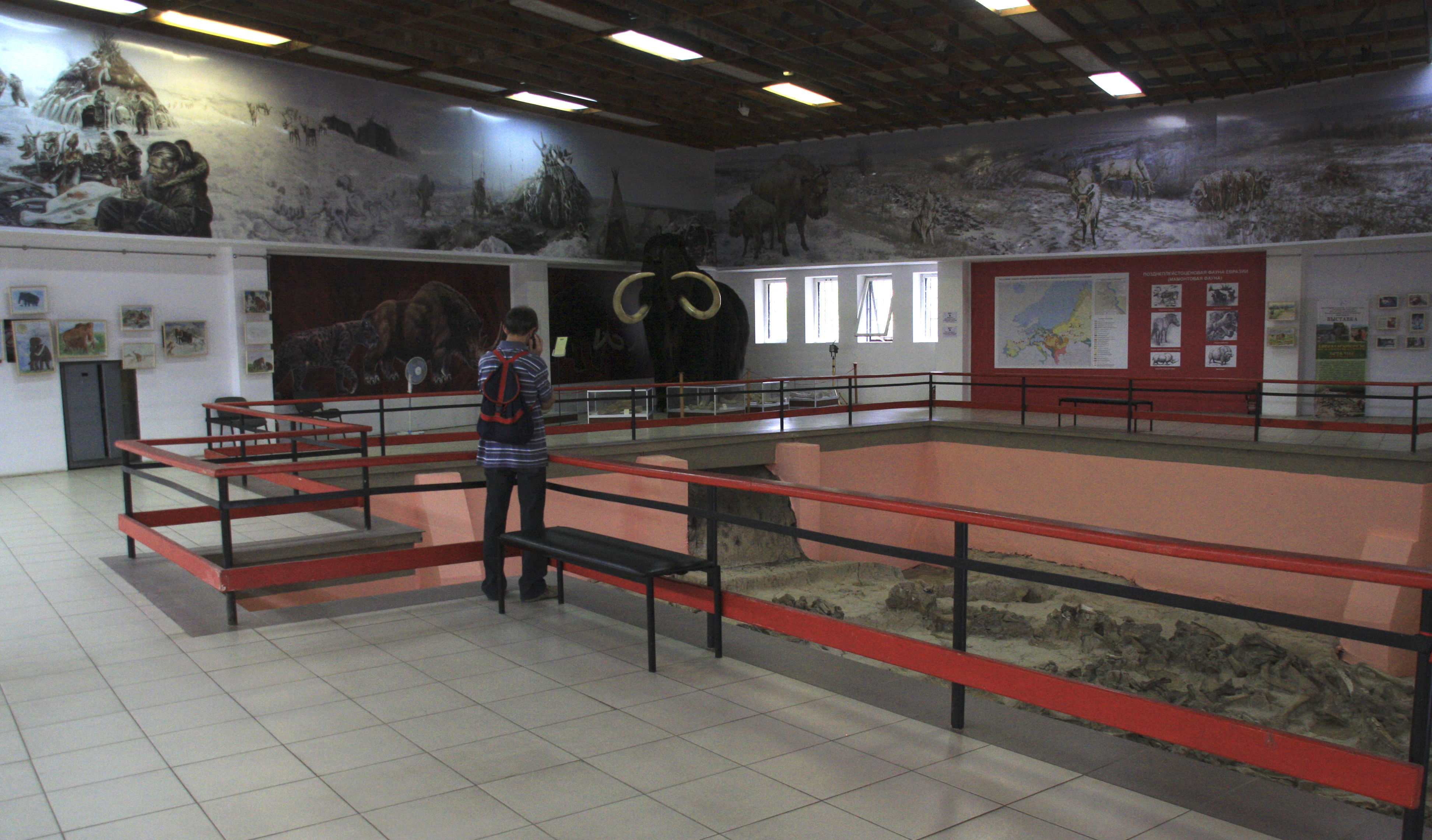
The Kostenki Museum is very well organised and presented.
Photo: http://baida.su/2010/07/progulka-na-20-000-let-nazad/
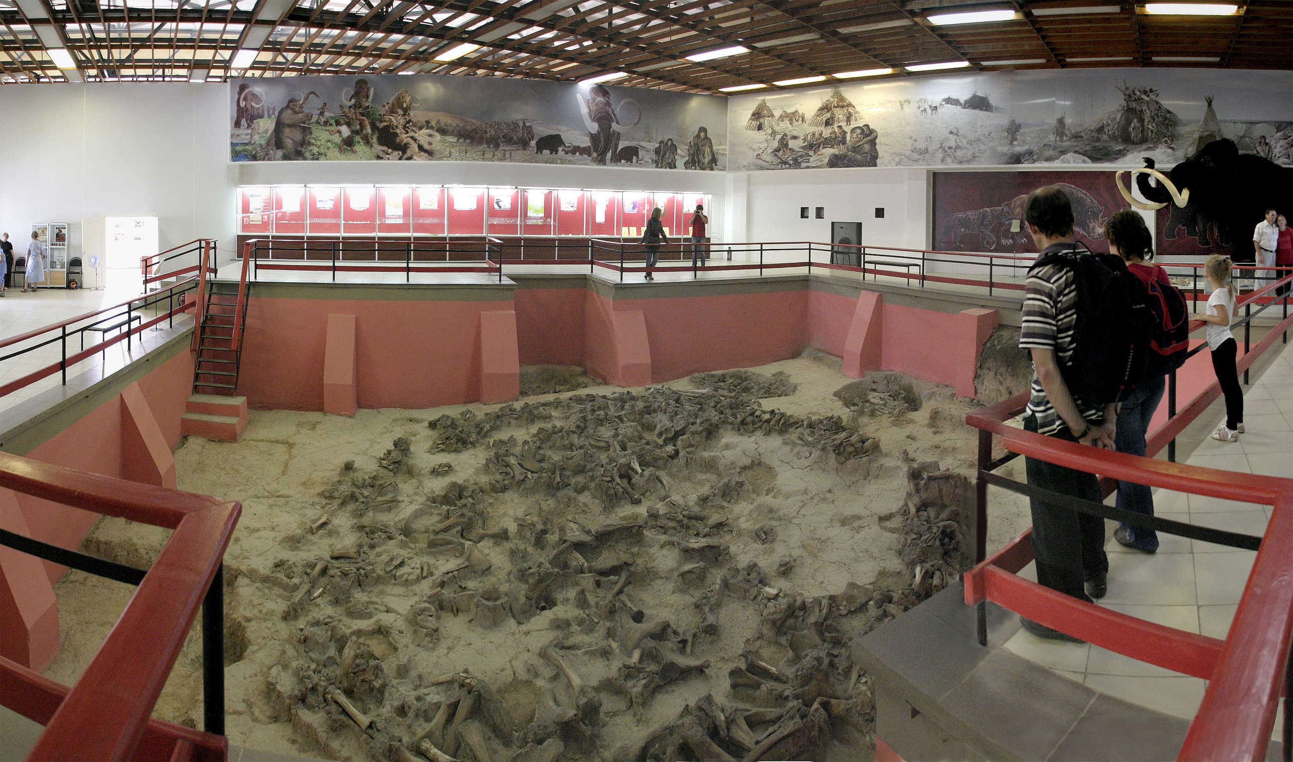
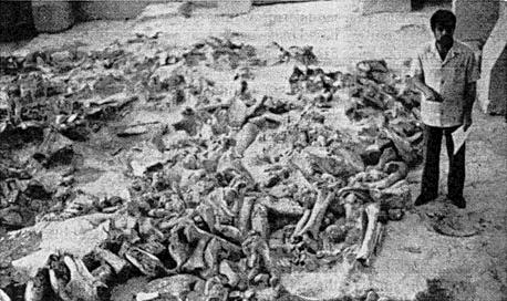
The main display room in the Kostenki Museum shows a dig partially excavated, with the remains of mammoths strewn across the floor. Mammoth bones and tusks were used as structural supports for houses constructed during the last ice age. The dig was originally Kostenki 11, and was discovered in 1949 when a local villager, Ivan Ivanovich Protopopov, was digging a hole for a cellar.
Photo: Vladimir Gorodnjanski 2011
Source: Kostenki Museum

The display in the Kostenki Museum.
Photo: Vladimir Gorodnjanski 2011
Source: Kostenki Museum

The display in the Kostenki Museum.
Photo: Vladimir Gorodnjanski 2011
Source: Kostenki Museum
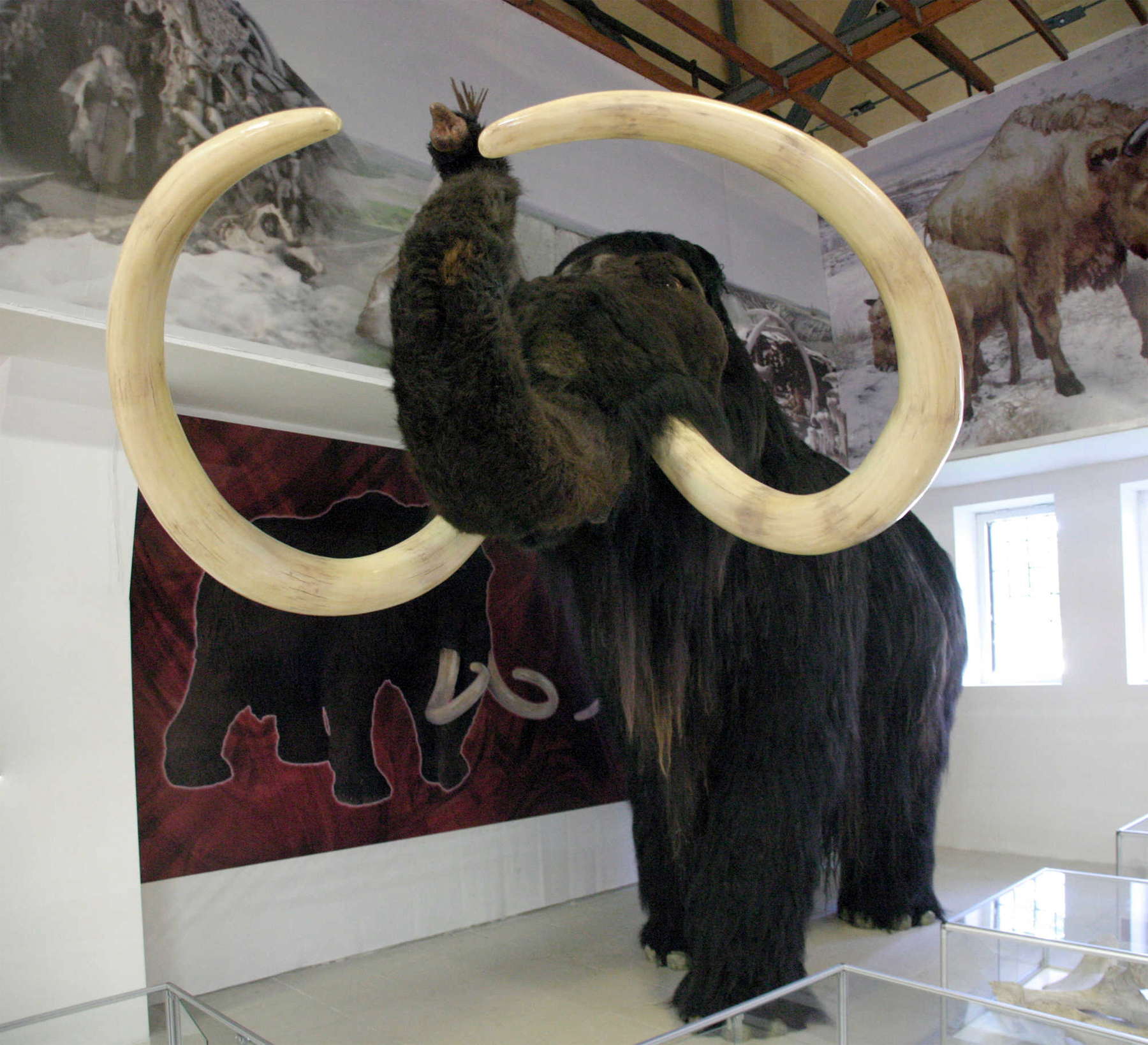
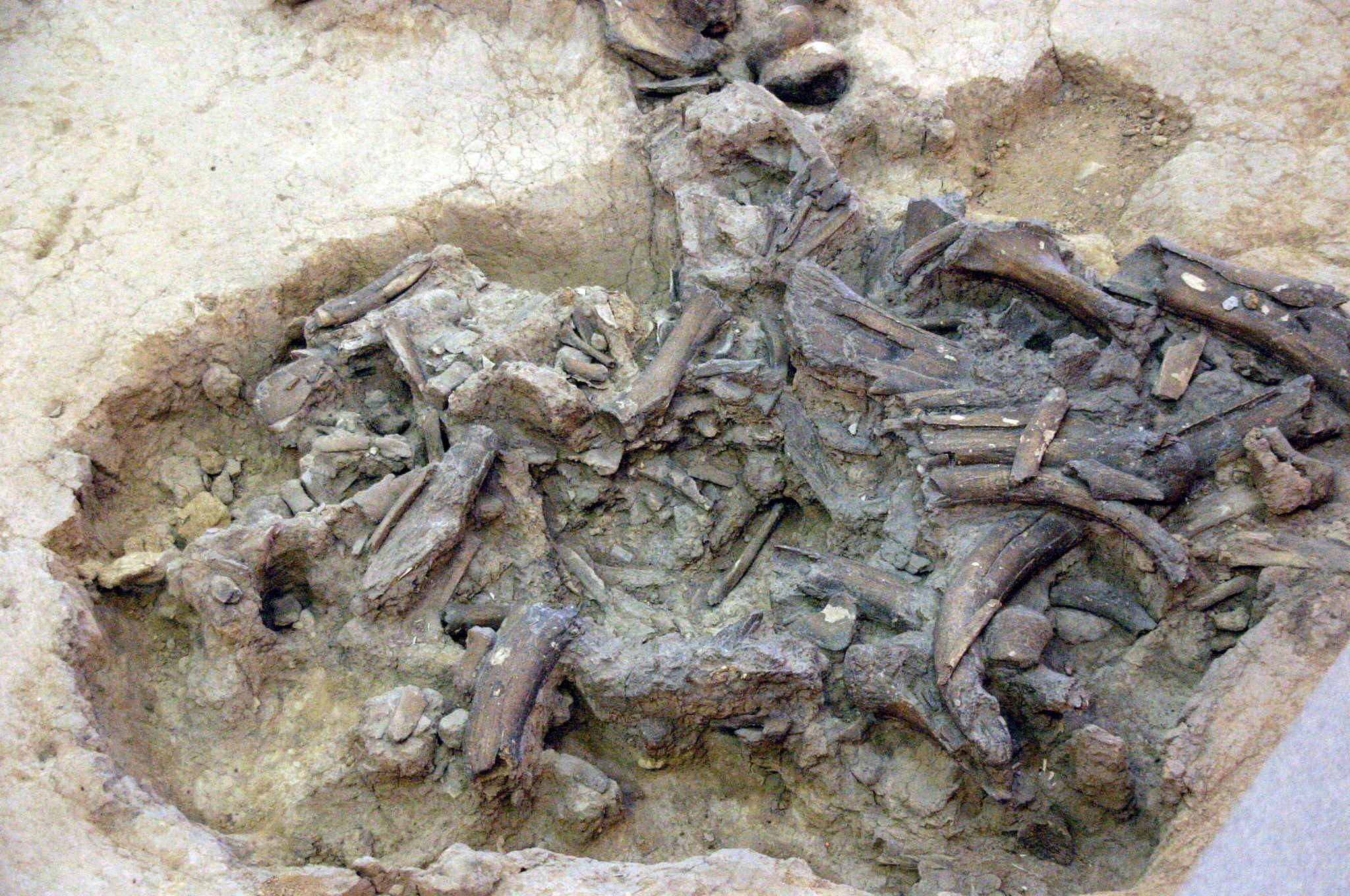
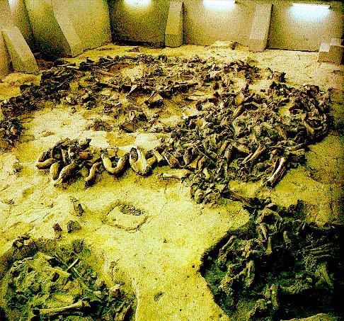
Mammoth bones used for the construction of houses during the last ice age at Kostenki.
Photo: Vladimir Gorodnjanski 2006
Source: Kostenki Museum
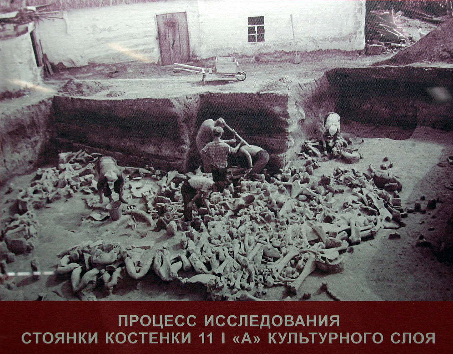
ПРОЦЕСС ИССЛЕДОВАНИЯ СТОЯНКИ КОСТЕНКИ 11 | «А» КУЛЬТУРНОГО СЛОЯ
The research process. Kostenki 11 I 'A' cultural layer
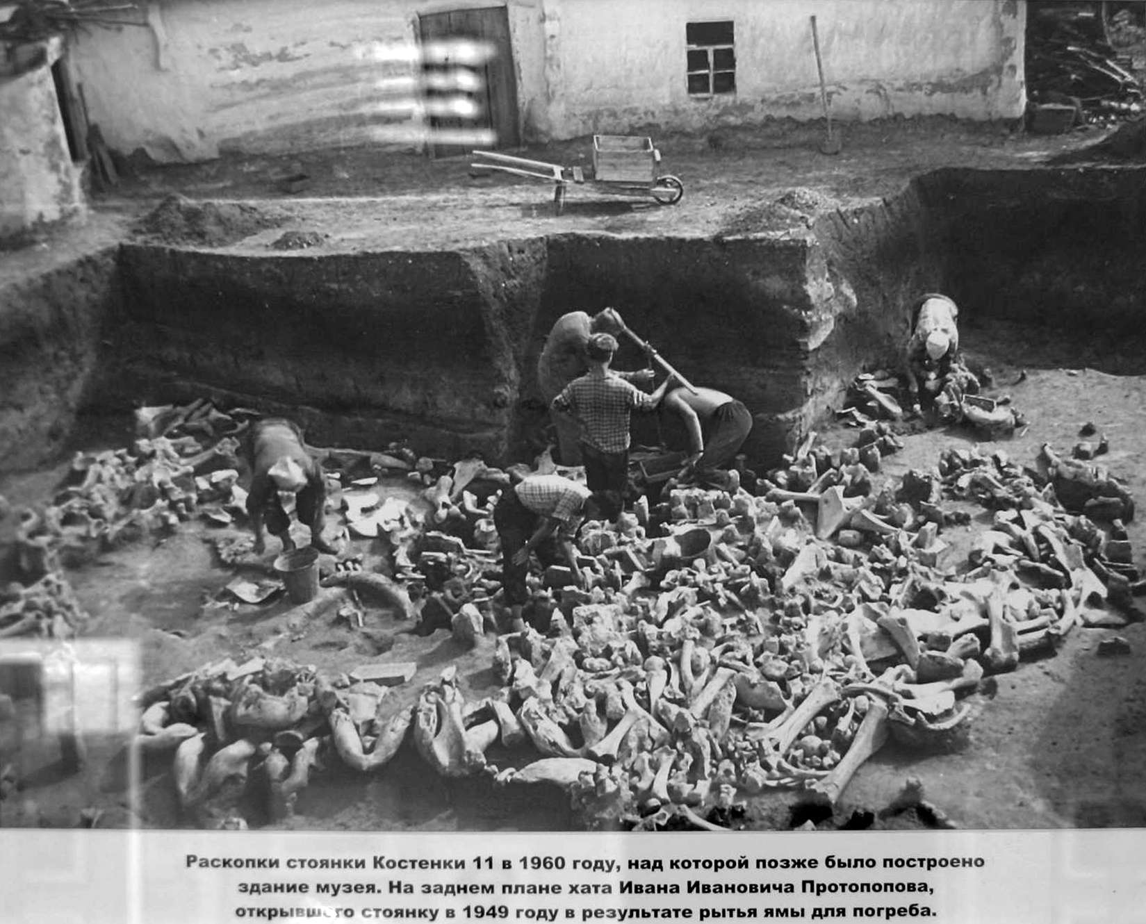
Раскопки стоянки Костенки 11 в 1960 году, над которой позже было построено здание музея. На заднем плане хата Ивана Ивановича Протопопова, открывшего стоянку в 1949 году в результато рытья ямы для погреба.
Excavations at Kostenki 11 in 1960, over which were later built the museum building. In the background, the cottage of Ivan Ivanovich Protopopov who first found the site in 1949 when digging a hole for a cellar.
(This photograph was taken in 1960. There is no protection as yet for the bones discovered at the site. Careful comparison with the photo above this pair of photos, taken from within the new pavilion, shows that the bones were left exactly as they were found. A.N. Rogachev, the leader of the dig, had already decided that the site was important enough to be protected from the elements, so that researchers could continue their work in any weather, the deterioration of the site would be minimised, and to act as a public education centre. He was a far seeing scientist - Don )
Photo: Vladimir Gorodnjanski 2011
Source: Kostenki Museum
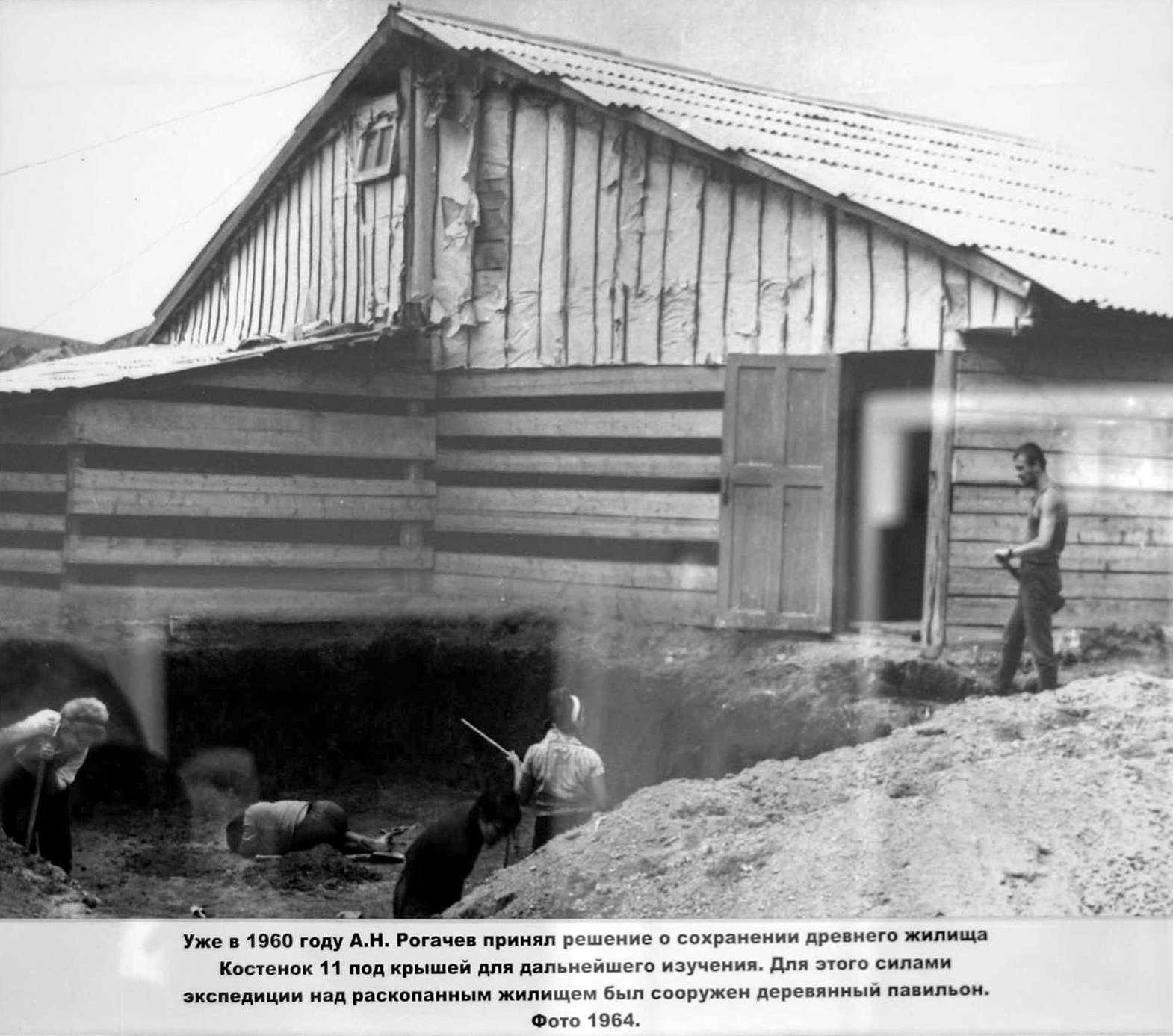
Уже в 1960 году А.Н. Рогачев принял решение о сохранении древнего жилища Костенок 11 под крышей для дальнейшего изучения. для этого силаии экспедиции над раскопанным жилищем был сооружен деревянный павильон. Фото 1964.
By 1960, A.N. Rogachev had decided to protect the ancient dwellings of Kostenki 11 under a roof for further study. During this strong campaign a wooden pavilion was built over the unearthed habitation. Photo 1964.
Photo: Vladimir Gorodnjanski 2011
Source: Kostenki Museum
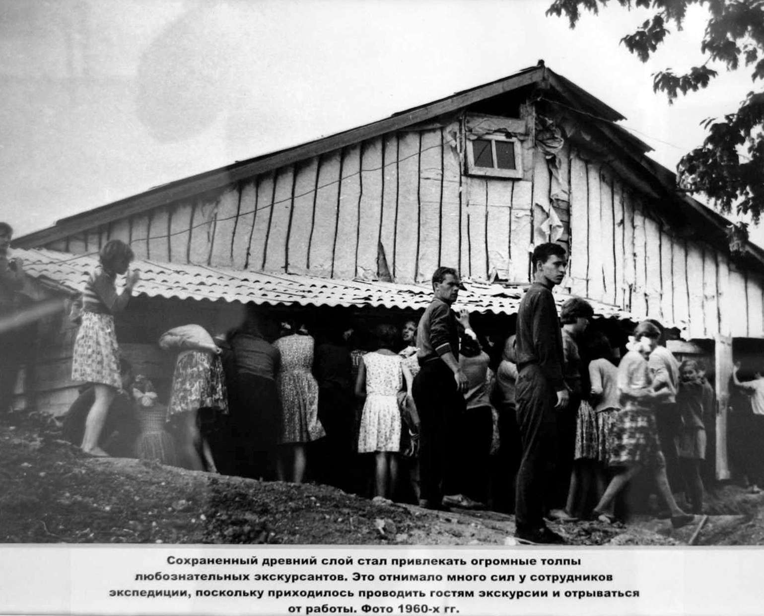
Сохраненный древний слой стал привлекать огромные толпы любознательных зкскурсантов. Это отнимало много сил у сотрудников экспедиции, поскольку приходилось проводить гостям экскурсии и отрываться у от работы. Фото 1960-х гг.
The protected ancient site began to attract huge crowds of curious students. It took a lot of effort by the staff members of the expedition, as visitors had to be conducted on guided tours and it interfered with their work. Photo 1960.
Photo: Vladimir Gorodnjanski 2011
Source: Kostenki Museum
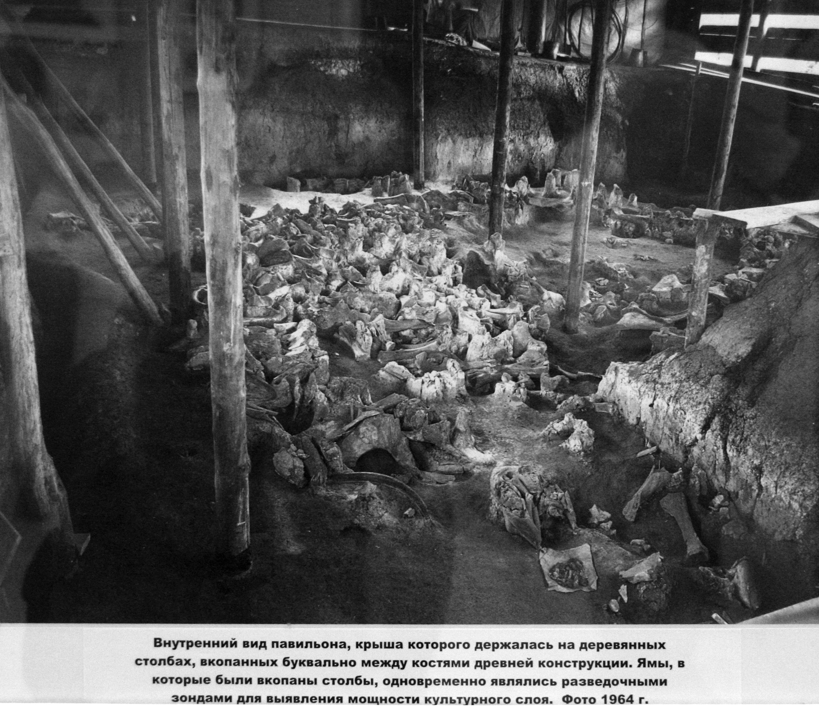
Внутренний вид павильона, крыша которого держалась на деревянных столбах, вкопанных буквально между костями древней конструкции. Ямы, в которые были вкопаны столбы, одновременно являлись разведочными зондами для выявления мощностн культурного слог. Фото 1964 г.
Thus, before the present pavilion was built, a wooden structure was placed over the Kostenki 11 site. In this interior view of the pavilion, the roof rested on the wooden poles which were literally dug between the ancient bones buried at the site. The holes for the poles were used as exploration pits into the lower levels of the site, to identify cultural artefacts.
As can be seen, this structure fulfilled only the limited purpose of protecting the site from the weather, with little opportunity for visitors to see the site properly.
When this structure fell into disrepair, the present well designed and constructed pavilion was erected in its place.
Photo 1964
Photo: Vladimir Gorodnjanski 2014
Source: Kostenki Museum

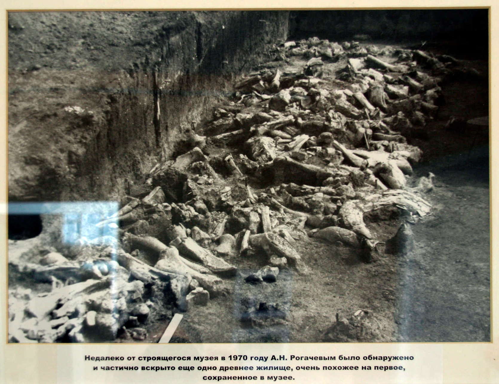
Недалеко от строящегося музея в 1970 году А.Н. Рогачевым было обнаружено и частично вскрыто еще одно древнее жилище, очень похожее на первое, сохраненное в музее.
Not far from the present museum, in 1970 A.N. Rogachev discovered and partially excavated another ancient dwelling very similar to the first.
Photo: Vladimir Gorodnjanski 2014
Source: Kostenki Museum
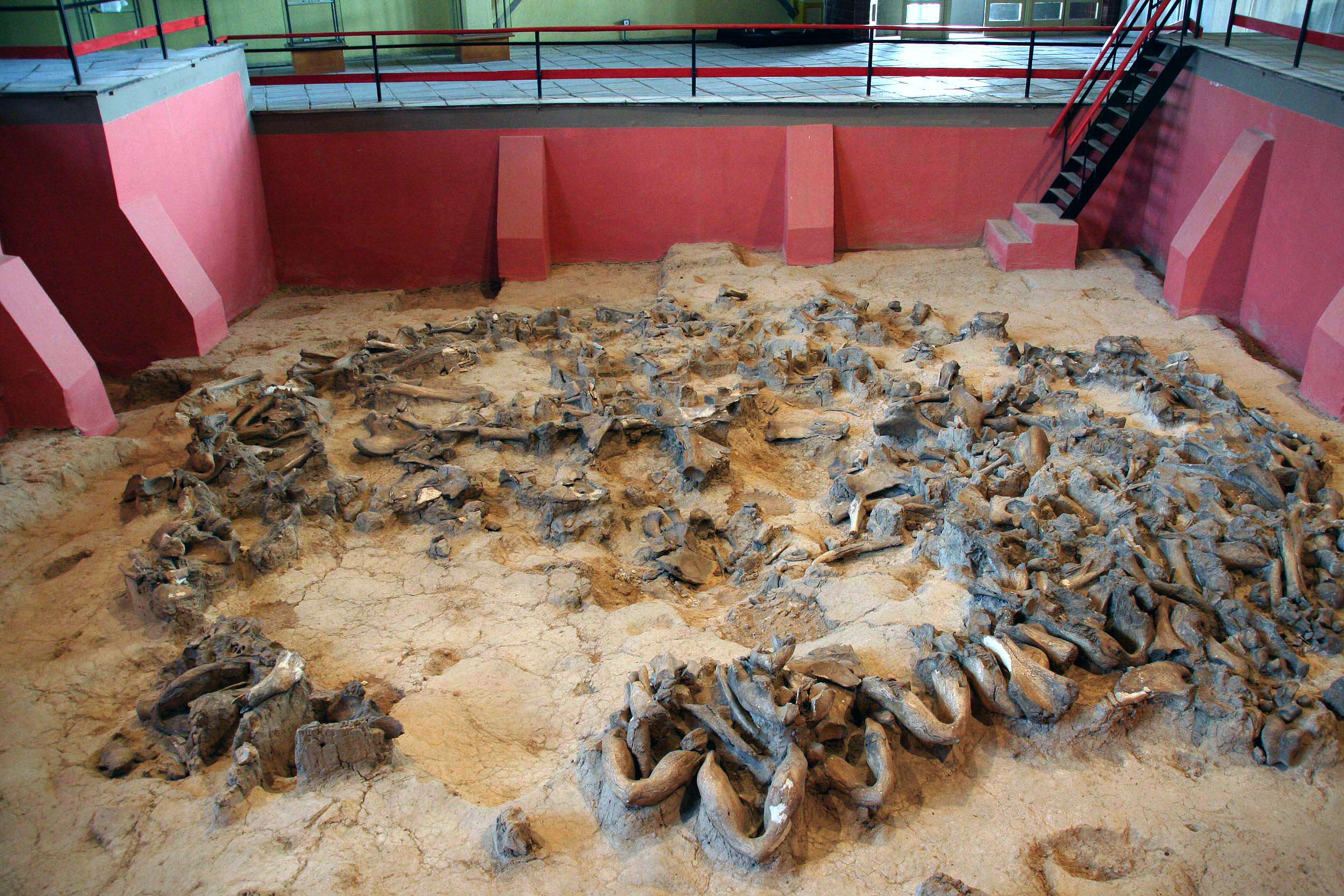
New bone structure discovered at Kostenki 11
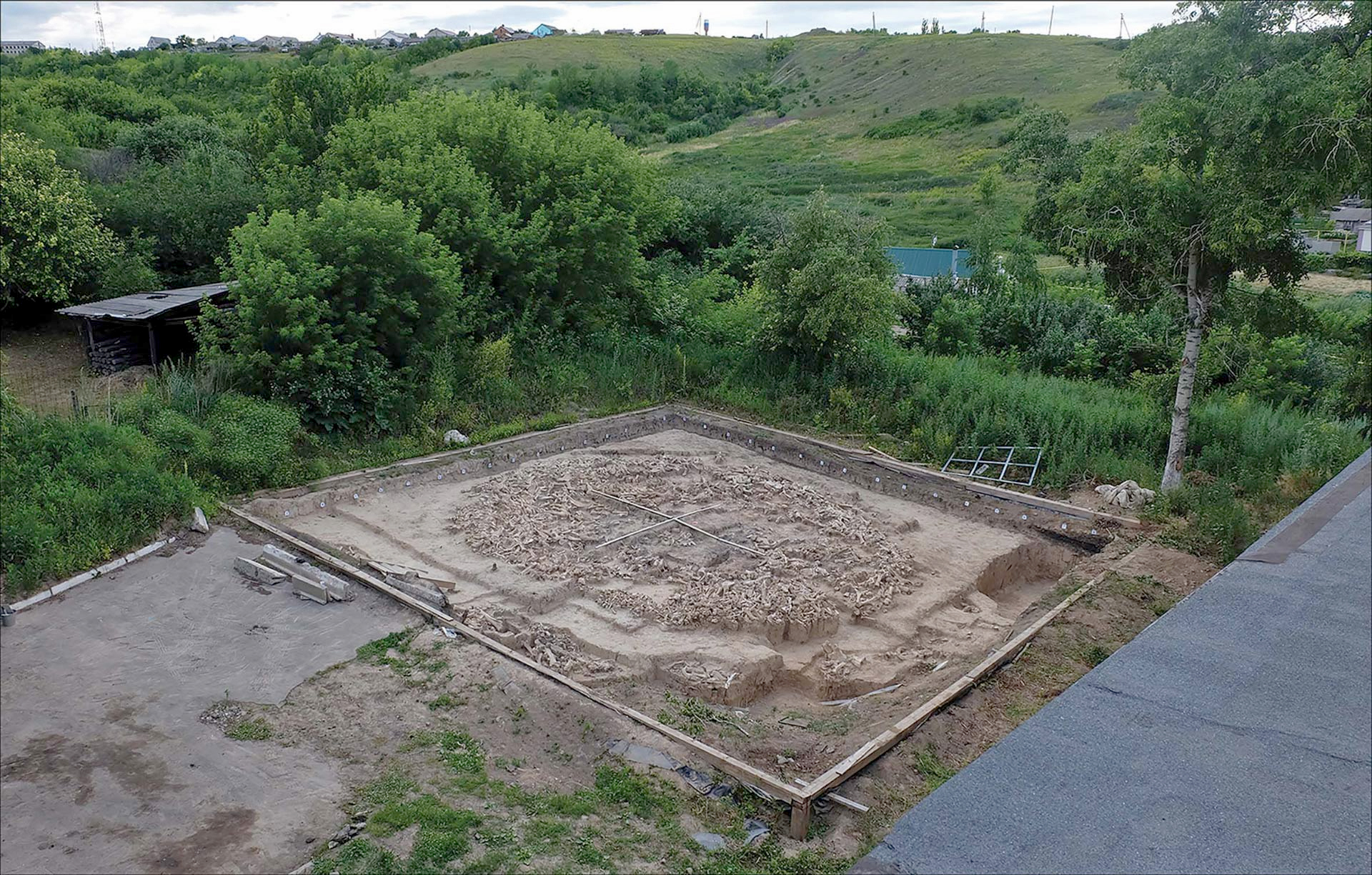
The newly-discovered mammoth-bone structure at the site of Kostenki 11. The two visible scales are 5 and 6 m long, respectively.
( The photograph is taken from the roof of the existing museum. The museum protects the original Kostenki 11 site from weather, and allows it to be viewed from a walkway above by researchers, students, and the general public - Don )
Image credit: A.E. Dudin.
Modern humans who first arose in Africa had moved into Europe as far back as about 25 000 years ago, according to a new study by an international research team led by the Russian Academy of Sciences and the University of Colorado at Boulder.
The evidence consists of stone, bone and ivory tools discovered beside the Don River in Russia, some 250 miles south of Moscow, said John Hoffecker, a fellow of CU-Boulder's Institute of Arctic and Alpine Research. The site also has yielded perforated shell ornaments and a carved piece of mammoth ivory that appears to be the head of a small human figurine.
'The big surprise here is the very early presence of modern humans in one of the coldest, driest places in Europe,' Hoffecker said. 'It is one of the last places we would have expected people from Africa to occupy first.'
A paper by Michael Anikovich and Andrei Sinitsyn of the Russian Academy of Sciences, Hoffecker, and 13 other researchers was published in the Jan. 12 issue of Science.
The excavation took place at Kostenki, a group of more than 20 sites along the Don River that have been under study for many decades. Kostenki previously has yielded anatomically modern human bones and artefacts dating between 30 000 and 40 000 years old, including the oldest firmly dated bone and ivory needles with eyelets that indicate the early inhabitants were tailoring animal furs to help them survive the harsh climate.
Most of the stone used for making tools at the newly discovered site was imported from between 60 miles and 100 miles away, while the perforated shell ornaments discovered at the lowest levels of the Kostenki dig were imported from the Black Sea more than 300 miles away, he said. 'Although human skeletal remains in the earliest level of the excavation are confined to isolated teeth, which are notoriously difficult to assign to specific human types, the artefacts are unmistakably the work of modern humans,' Hoffecker said.
The sediment overlying the artefacts was dated by several methods, including optically stimulated luminescence dating - which helps them determine how long ago materials were last exposed to daylight - as well as palaeomagnetic dating based on known changes in the orientation and intensity of Earth's magnetic field and radiocarbon calibration.
Anatomically modern humans are thought to have arisen in sub-Saharan Africa around 200 000 years ago.
Kostenki also contains evidence that modern humans were rapidly broadening their diet to include small mammals and freshwater aquatic foods, an indication they were 'remaking themselves technologically,' he said. They may have used traps and snares to catch hares and arctic foxes, exploiting large areas of the environment with relatively little energy. 'They probably set out their nets and traps and went home for lunch,' he said.
Photo: A.E. Dudin
Source and text: Mar 19, 2020 by Enrico de Lazaro, https://www.sciencedaily.com/releases/2007/01/070111181736.htm
Reference: Pryor et al. (2020)
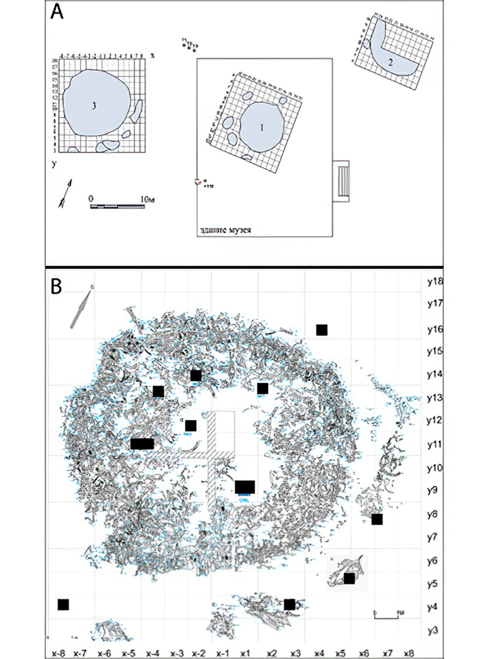
A:
Relative locations of three mammoth-bone features from Kostenki 11-Ia (image credit: I.V. Fedyunin of LLC ‘Terra’). Feature 1 is preserved today in the Kostenki Museum.
B: plan of the third mammoth-bone structure as it appeared at the end of the 2015 excavation season. Sampling locations for floated sediments are indicated by black rectangles (plan by E.M. Ikonnikova & A.E. Dudin).
The newly discovered mammoth-bone structure is located approximately 20m west and slightly upslope of the first discovered structure, also in layer K11-Ia (Figure 1; Dudin & Fedyunin in press).
At the time of discovery, this area was covered with birch, pear and cherry trees, together with shrubby undergrowth. As the uppermost bones of the structure lay within 0.6m of the modern ground surface, and partly within the B-horizon of the modern soil, much of layer K11-Ia was disturbed by modern tree and shrub roots and animal burrows. Nonetheless, the bones themselves were remarkably well preserved and appeared to lie largely intact and undisturbed in their original positions.
Source and text: Pryor et al. (2020)
Dates: Circa 25 000 cal BP - 24 000 cal BP
Source and text: Pryor et al. (2020)
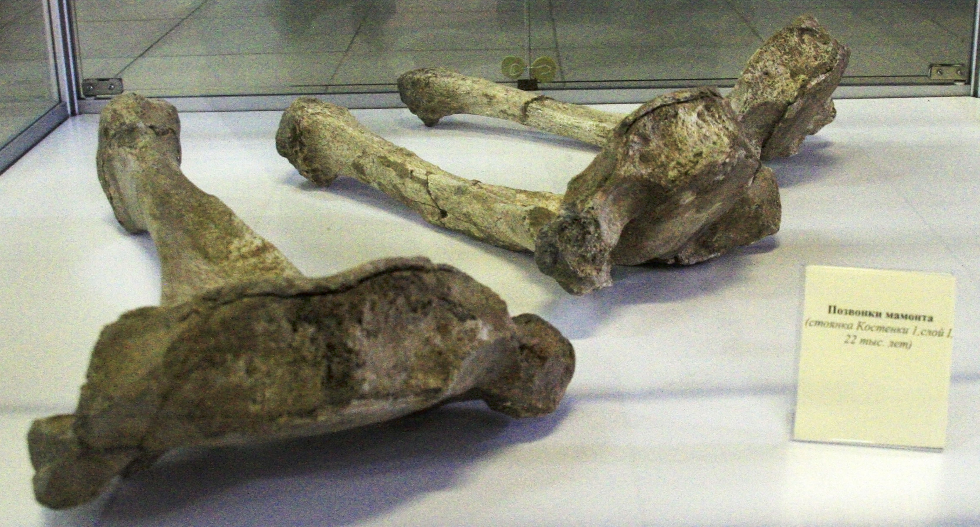
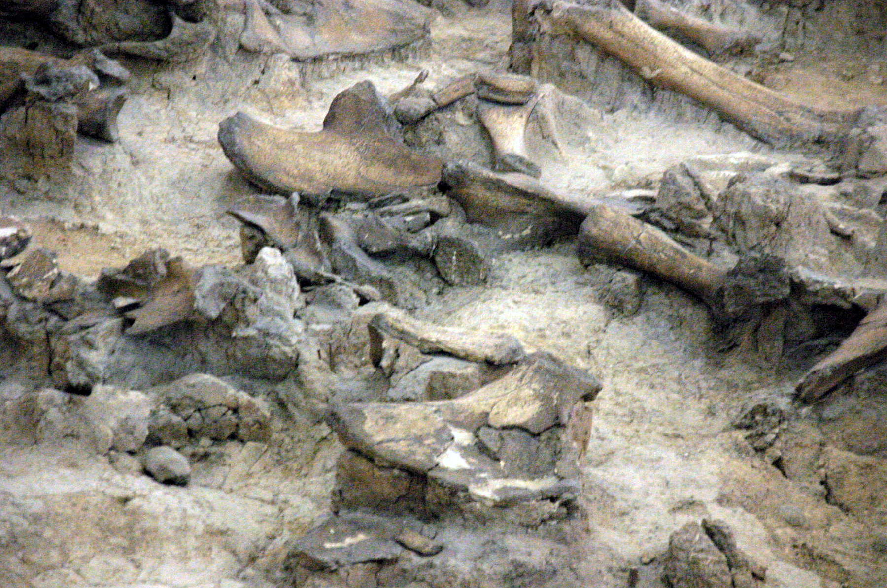
Mammoth vertebrae.
Photo: Vladimir Gorodnjanski 2014
Source: Kostenki Museum
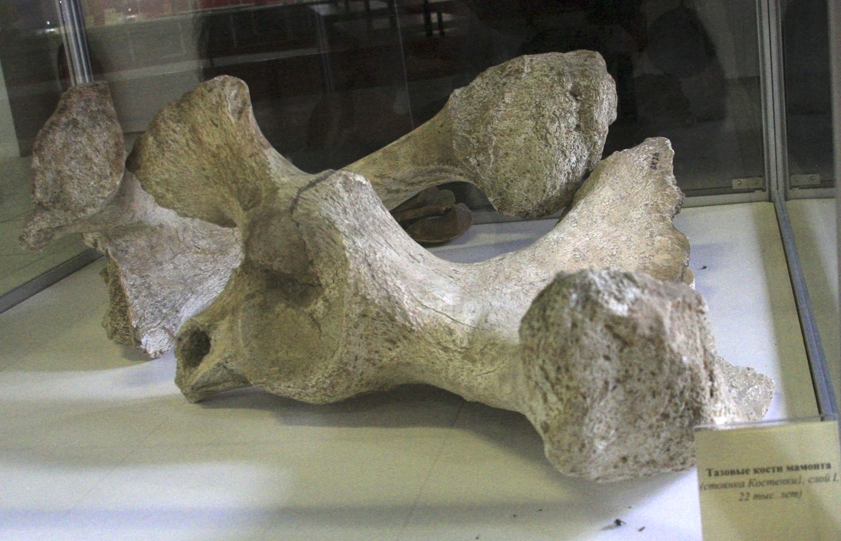
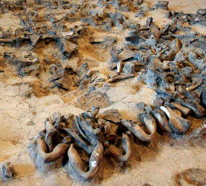
Mammoth bones
Photo: Vladimir Gorodnjanski 2014
Source: Kostenki Museum

Mammoth mandible and teeth.
Photo: Vladimir Gorodnjanski 2014
Source: Kostenki Museum

Ожерелье, клыки песца, муляж
Necklace of fox teeth.
Photo: Vladimir Gorodnjanski 2014
Source: Facsimile, Kostenki Museum
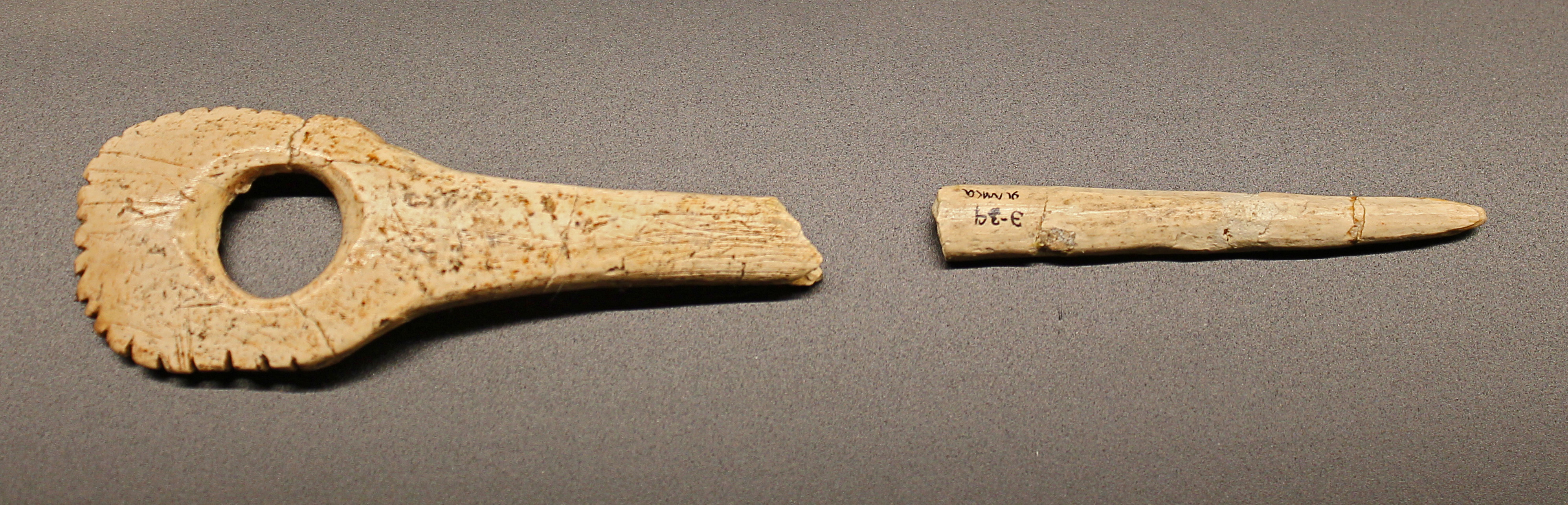
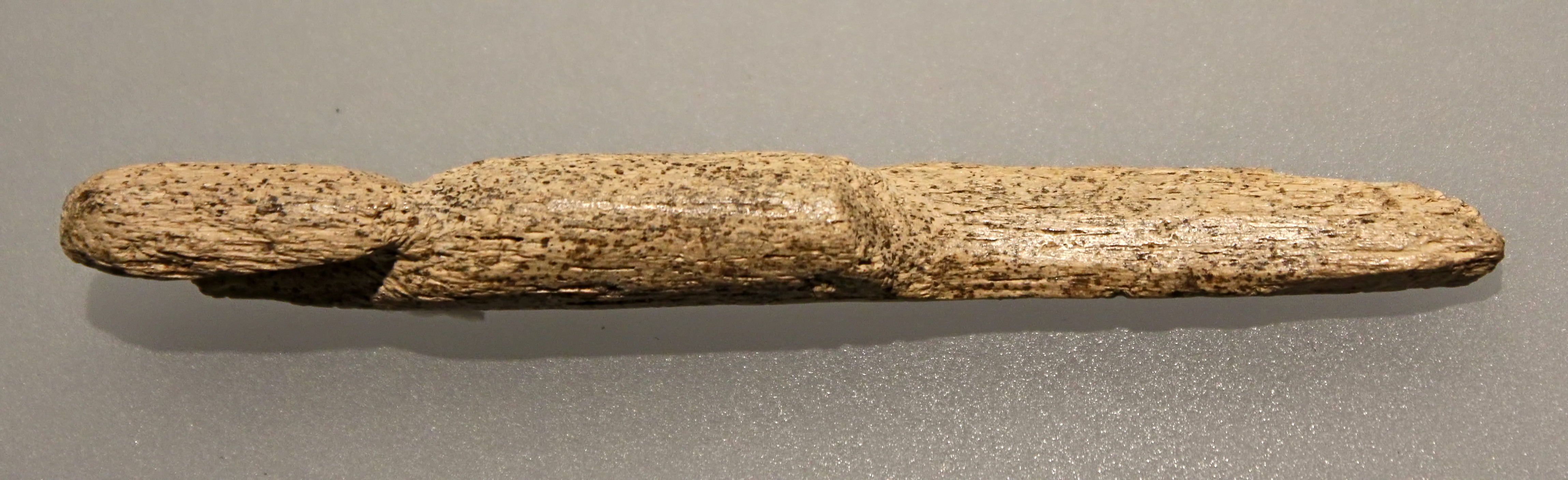
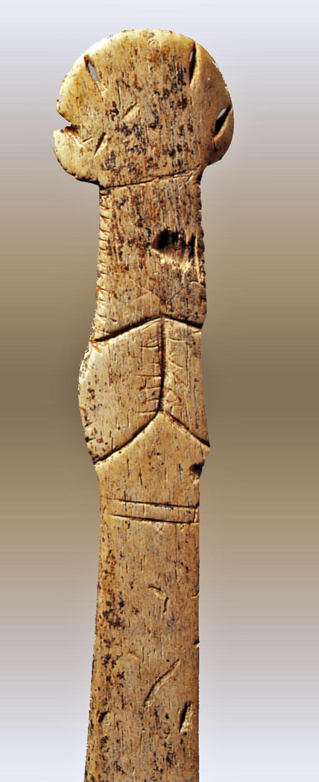
Kostenki, 25 000 BP - The use of this pierced rod is uncertain, though it must have been a tool. Similar objects were found in the Sungir burial on the belt of the younger of the two boys.
Photo: Ralph Frenken
Source: Original, exhibited at the Archeological Museum Hamburg (Ice Age - The Art of the Mammoth Hunters from 18 October 2016 to 14 May 2017)
On loan from the Hermitage Museum, Saint Petersburg, Russia.
Kostenki, 25 000 BP.
If only the heads of animal figures are preserved, it is often difficult to determine the type of animal.
However, the top two images and the one on the left are of cave lions.
Photo: Ralph Frenken
Source and text: Original, exhibited at the Archeological Museum Hamburg (Ice Age - The Art of the Mammoth Hunters from 18 October 2016 to 14 May 2017)
On loan from the Hermitage Museum, Saint Petersburg, Russia.


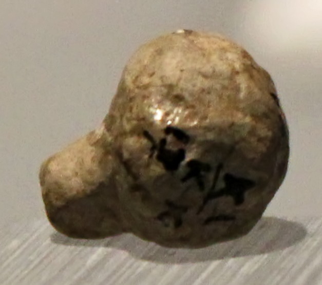
Kostenki, 25 000 BP.
Bear head.
Photo: Ralph Frenken
Source and text: Original, exhibited at the Archeological Museum Hamburg (Ice Age - The Art of the Mammoth Hunters from 18 October 2016 to 14 May 2017)
On loan from the Hermitage Museum, Saint Petersburg, Russia.

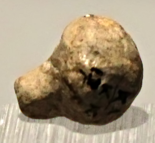
Kostenki, 25 000 BP.
Bear head.
Photo: Ralph Frenken
Source and text: Original, exhibited at the Archeological Museum Hamburg (Ice Age - The Art of the Mammoth Hunters from 18 October 2016 to 14 May 2017)
On loan from the Hermitage Museum, Saint Petersburg, Russia.
Kostenki, 25 000 BP.
In this limestone plate the outlines of a woman were engraved, which in their proportions correspond to the general picture of other ice age women's statuettes.
Photo: Ralph Frenken
Source and text: Original, exhibited at the Archeological Museum Hamburg (Ice Age - The Art of the Mammoth Hunters from 18 October 2016 to 14 May 2017)
On loan from the Hermitage Museum, Saint Petersburg, Russia.
Kostenki, 25 000 BP.
This object was carved from reindeer antler, and probably shows a human figure with an offset head and narrow legs.
Photo: Ralph Frenken
Source and text: Original, exhibited at the Archeological Museum Hamburg (Ice Age - The Art of the Mammoth Hunters from 18 October 2016 to 14 May 2017)
On loan from the Hermitage Museum, Saint Petersburg, Russia.
Kostenki, 25 000 BP.
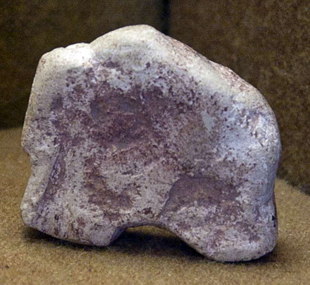
This limestone head was not a part of female statue, but was made as a separate piece. It shows a face, indicated by engravings.
Photo: Ralph Frenken
Source and text: Original, exhibited at the Archeological Museum Hamburg (Ice Age - The Art of the Mammoth Hunters from 18 October 2016 to 14 May 2017)
On loan from the Hermitage Museum, Saint Petersburg, Russia.
Kostenki, 25 000 BP.
This limestone head was not a part of female statue, but was made as a separate piece. It shows embellishments which can be interpreted as either a head covering or as hair.
Photo: Ralph Frenken
Source and text: Original, exhibited at the Archeological Museum Hamburg (Ice Age - The Art of the Mammoth Hunters from 18 October 2016 to 14 May 2017)
On loan from the Hermitage Museum, Saint Petersburg, Russia.
Distinct localities are in the most recent research labeled with an Arabic number and the "cultural layer" is given a Roman numeral, e.g., "Kostenki 12/III." These localities comprise a majority of the initial Upper Paleolithic sites on the Russian Plain, and the archaeological and the earliest occupation stages have been dated to between 39 000 and 34 000 years ago.
(Note that the localities may be further divided, as in "Kostenki 14 IVb" or "Kostenki 14 IVб" where the cultural layer is further subdivided, using either english or cyrillic letters.
Note also that this system was not always used. Early investigators used the opposite system, with a Roman numeral for the site and an arabic number for the cultural layer. For example students of archaeology may well come across references such as this: ...the site of Kostenki IV (Alexandrovka) This site was discovered by S. N. Zamiatnin, during the reconnaissance work of 1927. It is situated in the village of Kostenki... - Don)
Kostenki 1 - Kostenki I - Polyakov Site
Text below from Grigor'ev (1967)
Kostenki I is one of the most important of the famous group of Late Pleistocene occupation sites found in the vicinity of Kostenki-on-the-Don, about 40 km south of Voronezh. Systematic investigation of Kostenki 1 was begun by I.S. Polyakov in 1879 ("Polyakov's site" is still an alternative designation for Kostenki I) and continued sporadically by a series of workers, among whom the two latest, P.P. Efimenko (working at Kostenki I in 1923, 1926, 1931-1934, and 1936) and A.N. Rogachev (working in 1938, 1948, 1951, and 1953) have contributed most to our knowledge of the site.
Five distinct occupation horizons have been disclosed at Kostenki I. These all occur in a series of deposits overlying the second suprafloodplain terrace of the Don. The stratigraphy within these deposits has been repeatedly and intensively studied (see especially Grishchenko 1950, Lazukov 1957, and Velichko 1961: 197-212), and those of the other sites in the vicinity have been largely established (see especially Rogachev 1957:122) Recently, the application of radiocarbon dating to materials from the Kostenki sites has shown great promise of providing a substantial basis for the temporal comparison of the Kostenki occupation horizons with those from far-distant sites. Of particular relevance in the context of this note is the date of 14 020 ± 60 BP (GIN-86, Cherdyntsev et al. 1965:1414) obtained on charred bone from the uppermost level of Kostenki I.
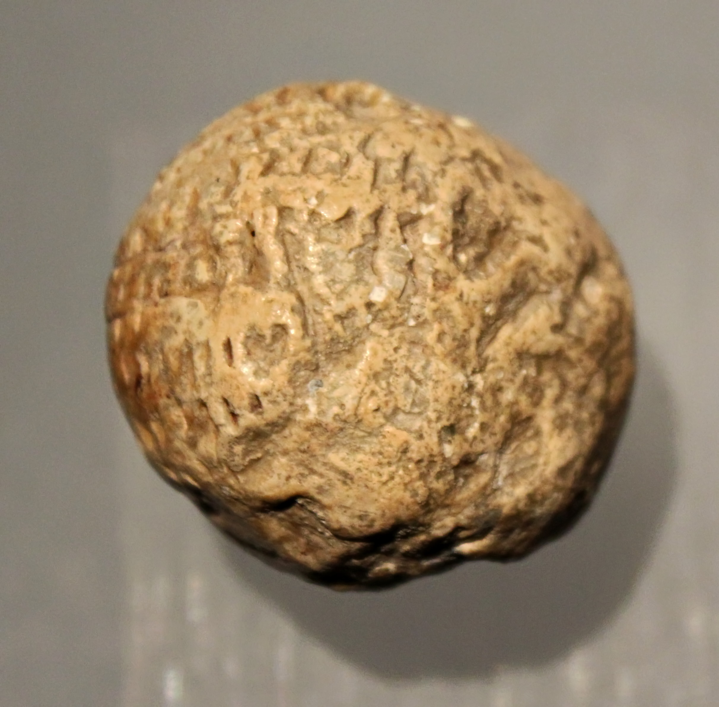
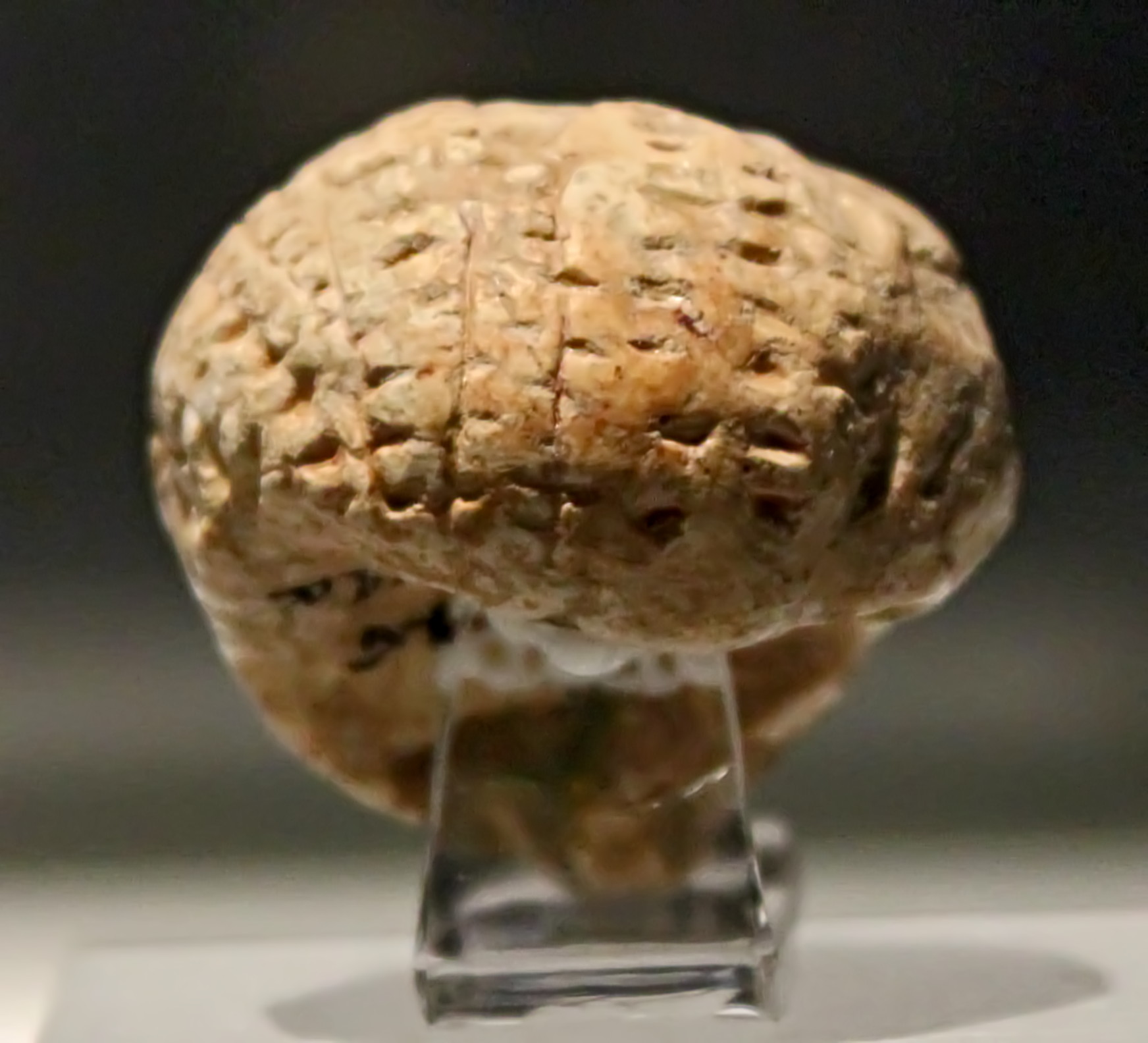
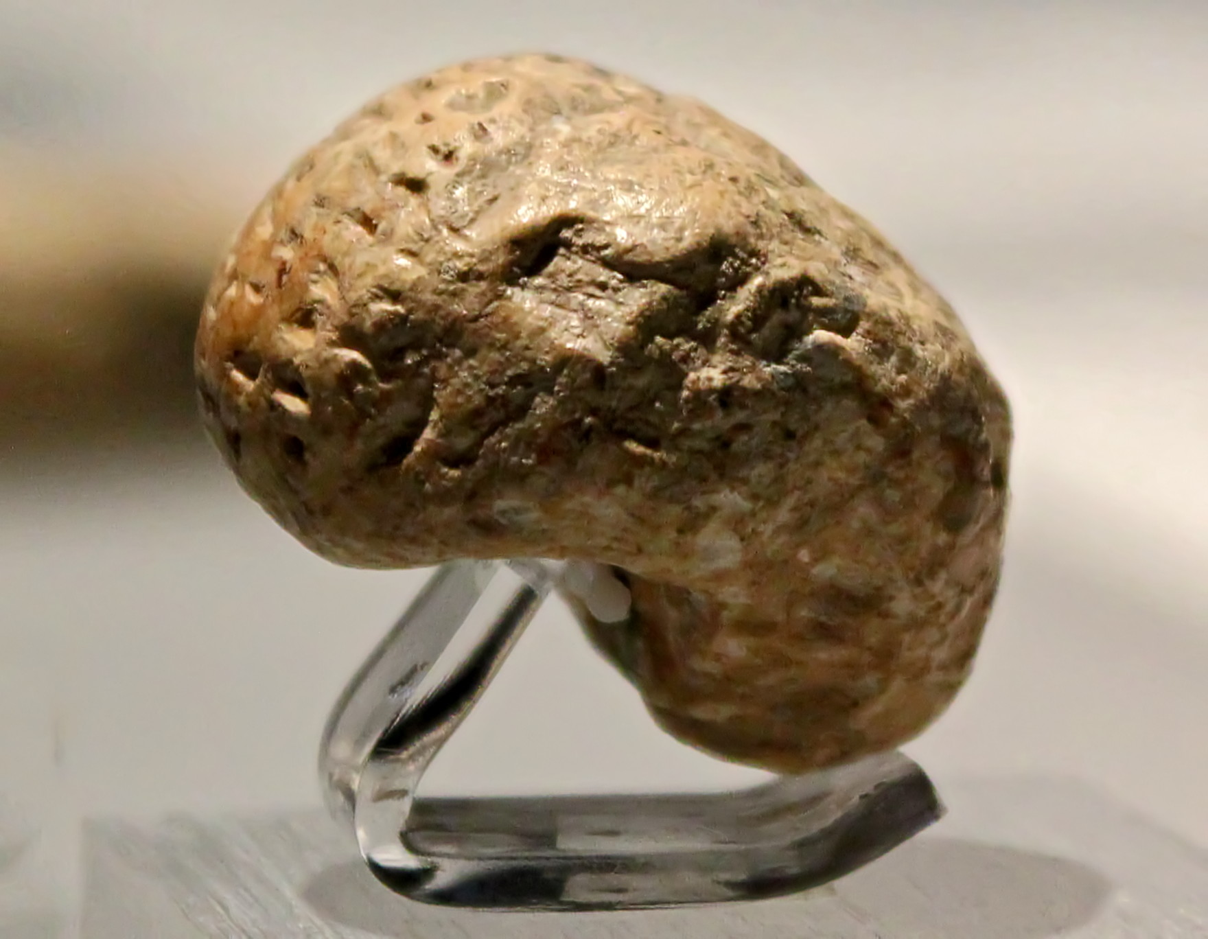
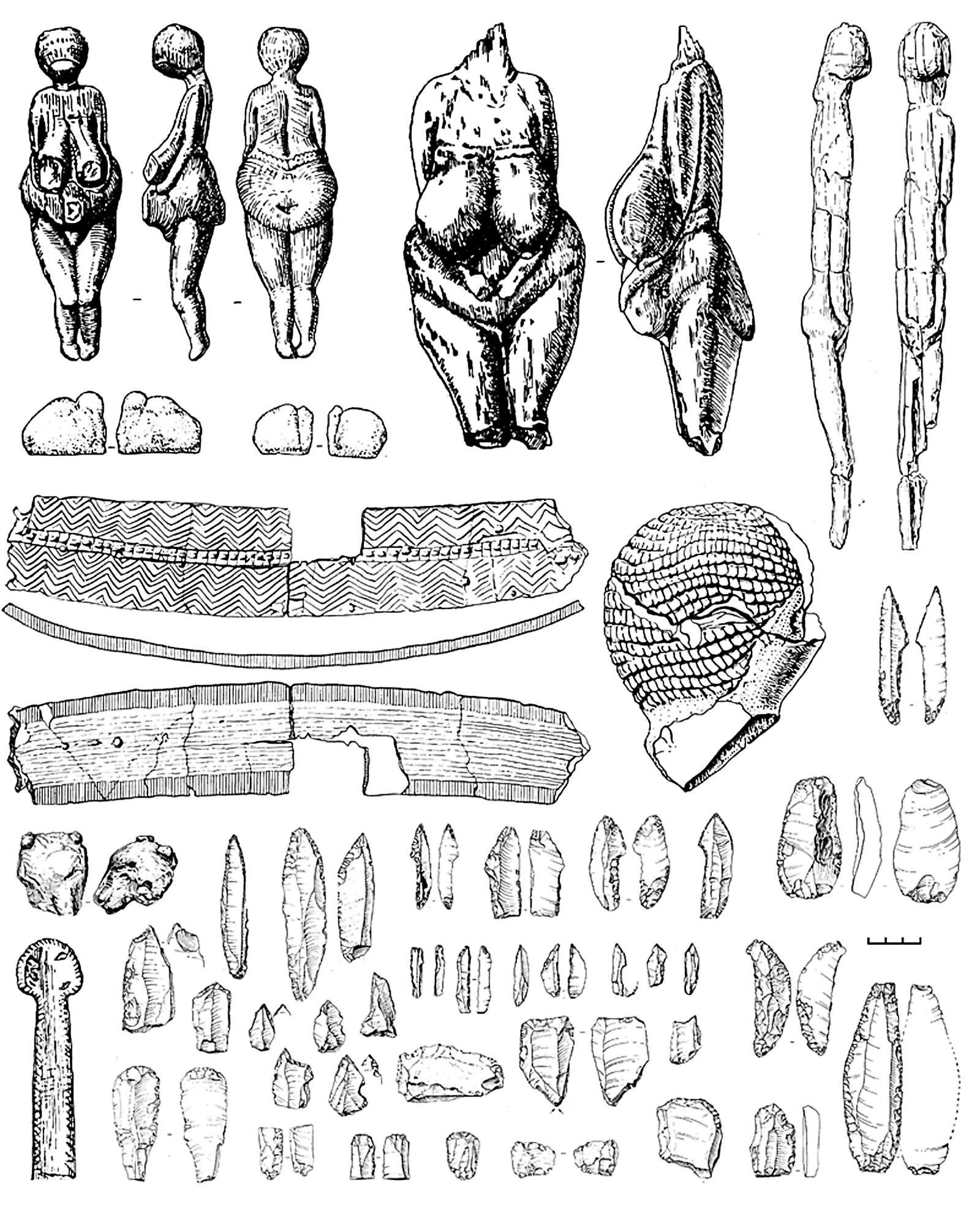
By far the most extensively excavated and best-known occupation level at Kostenki I is the uppermost. In addition to presumed remains structure(s), the reconstruction of which is the subject of the paper to follow, the uppermost level has yielded a large assemblage of flint artefacts (including numerous burins, endscrapers, backed blades, shouldered points, etc), a sizeable quantity of bone artefacts (including various objects called polishers, points, mattocks etc), and a considerable collection of bone art, including approximately 50 female statuettes, mostly fragmentary, and some animal figurines. Most numerous among the faunal remains removed from the uppermost level were those of mammoth and horse, but bones of arctic fox, lion, bear, wolf, red deer, reindeer, hare, and rodents were also present.

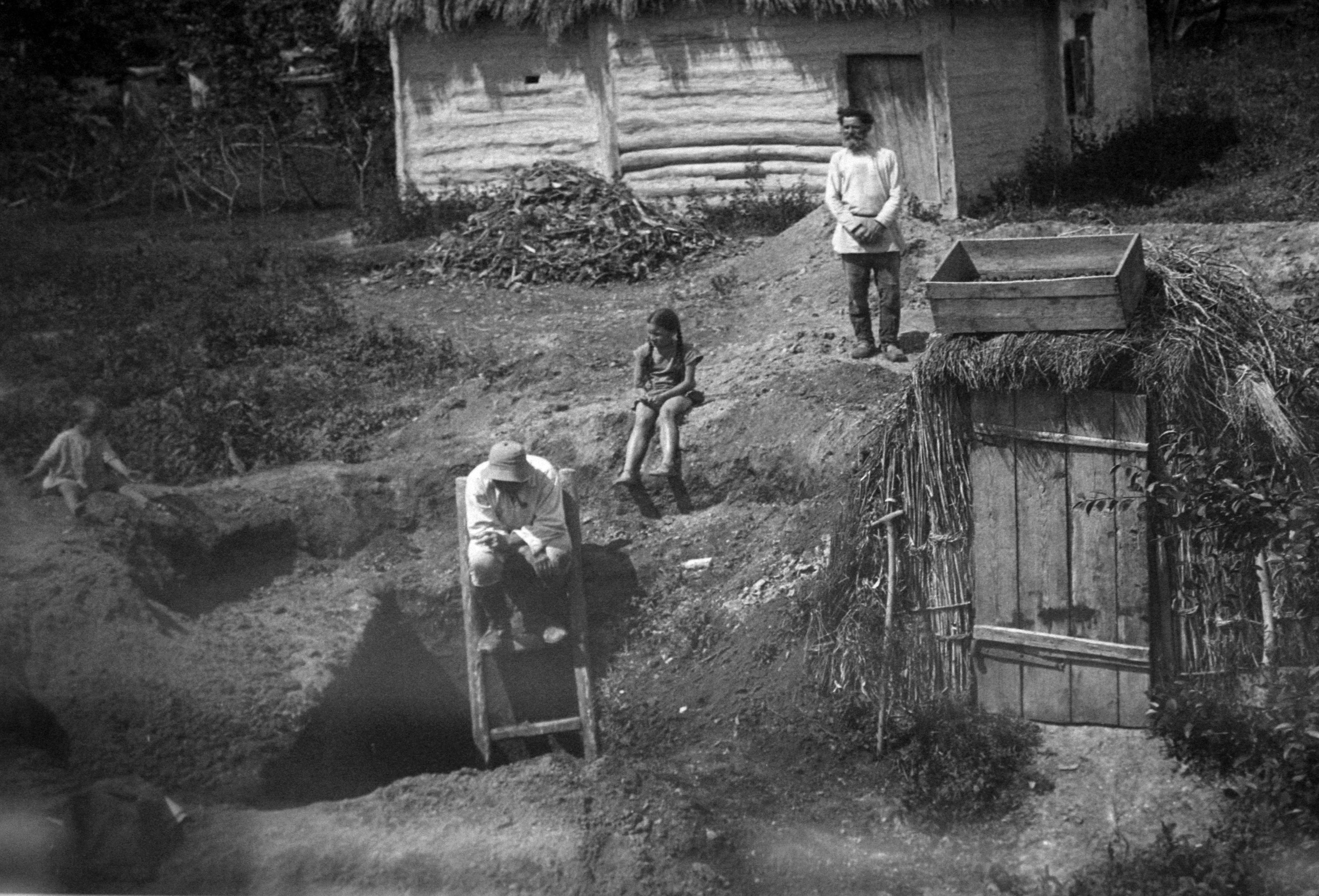
Единственное документальное свидетельство самых обширных дореволюционных раскопок С.А.Круковского 1915 года - разобранная им яма, всего лишь «задевшая» богатейший культурный слой Костенок 1.
The only documentary evidence of the most extensive pre-revolutionary excavations by SA Krukovsky in 1915 - the dig managed to just catch the edge of the richest cultural layer of Kostenki 1.
Photo: Vladimir Gorodnjanski 2011
Source: Kostenki Museum
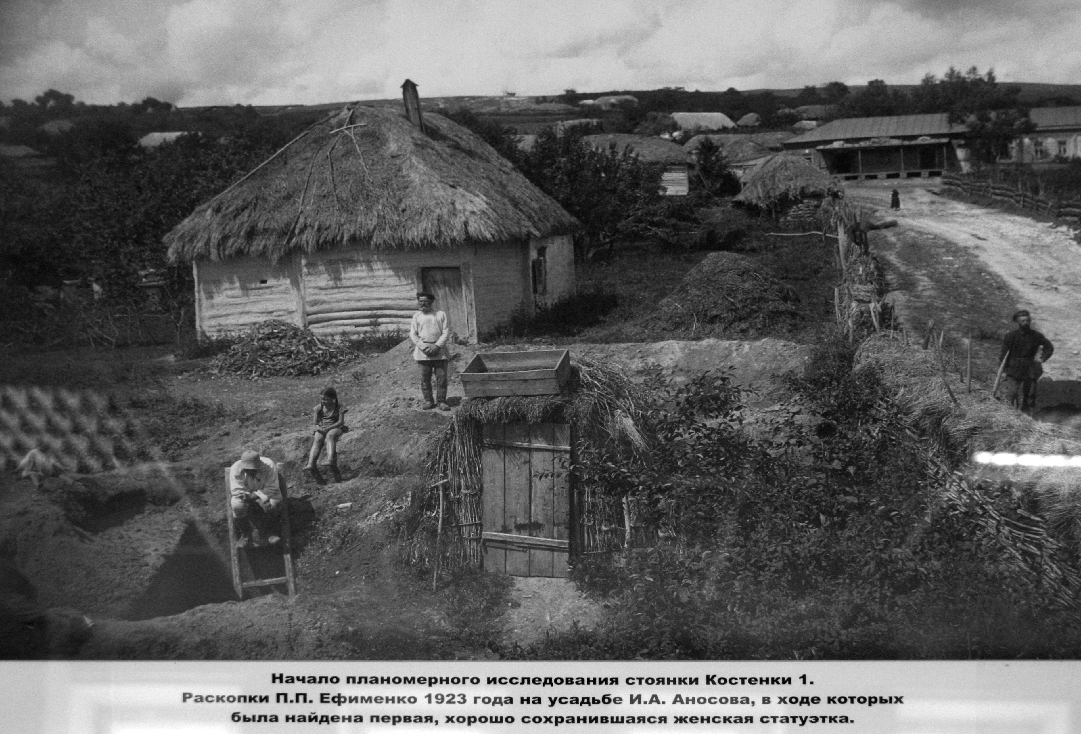
Начало планомерного исследования стоянки костенки 1.
Раскопки П.П. Ефименко 1923 года на усадьбе И.А. Аносоваm в ходе которых была найдена первая, хорошо сохранившаяся женская статуэтка.
Starting the systematic study of Kostenki 1 in 1923, after the creation of the Union of Soviet Socialist Republics (USSR) in 1922.
These are the excavations by P.P. Yefimenko at the homestead of IA Anosov, in the course of which was found the first well-preserved female figurine.
Photo: Vladimir Gorodnjanski 2014
Source: Kostenki Museum
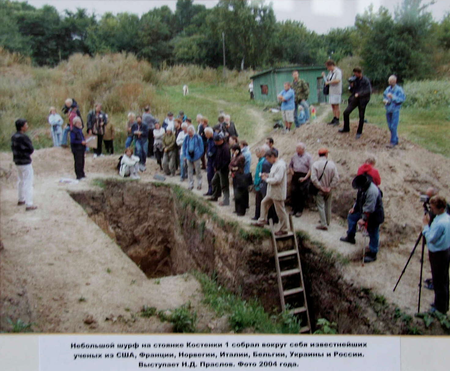
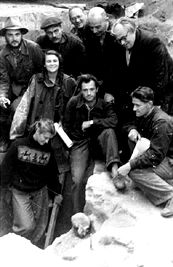
A small hole in the Kostenki 1 sediments around which is gathered a group of scientists from around the world for the conference at Kostenki in 2004.
Photo: Vladimir Gorodnjanski 2011
Source: Kostenki Museum
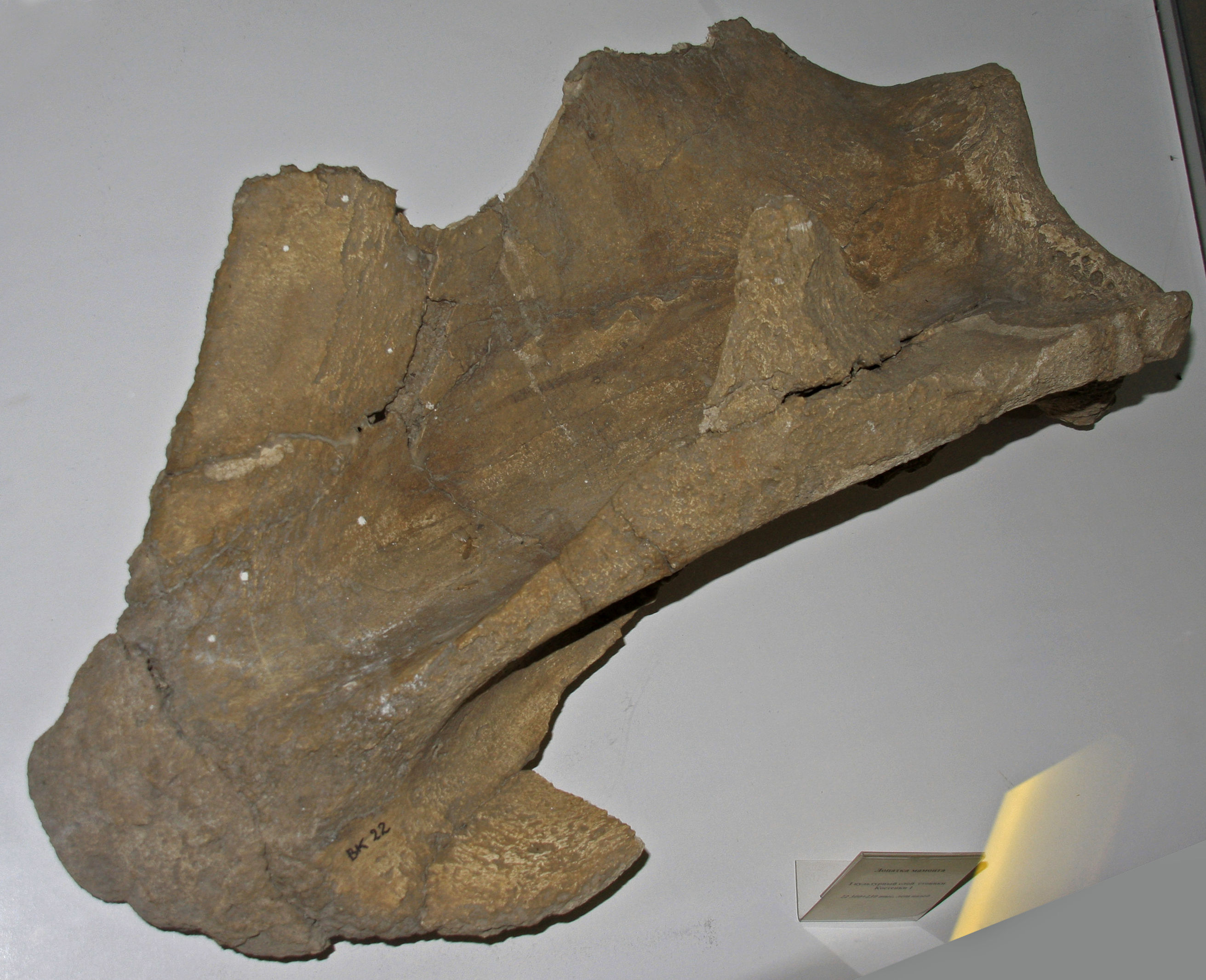
Mammoth shoulderblade, Kostenki 1.
Photo: Vladimir Gorodnjanski 2014
Source: Kostenki Museum
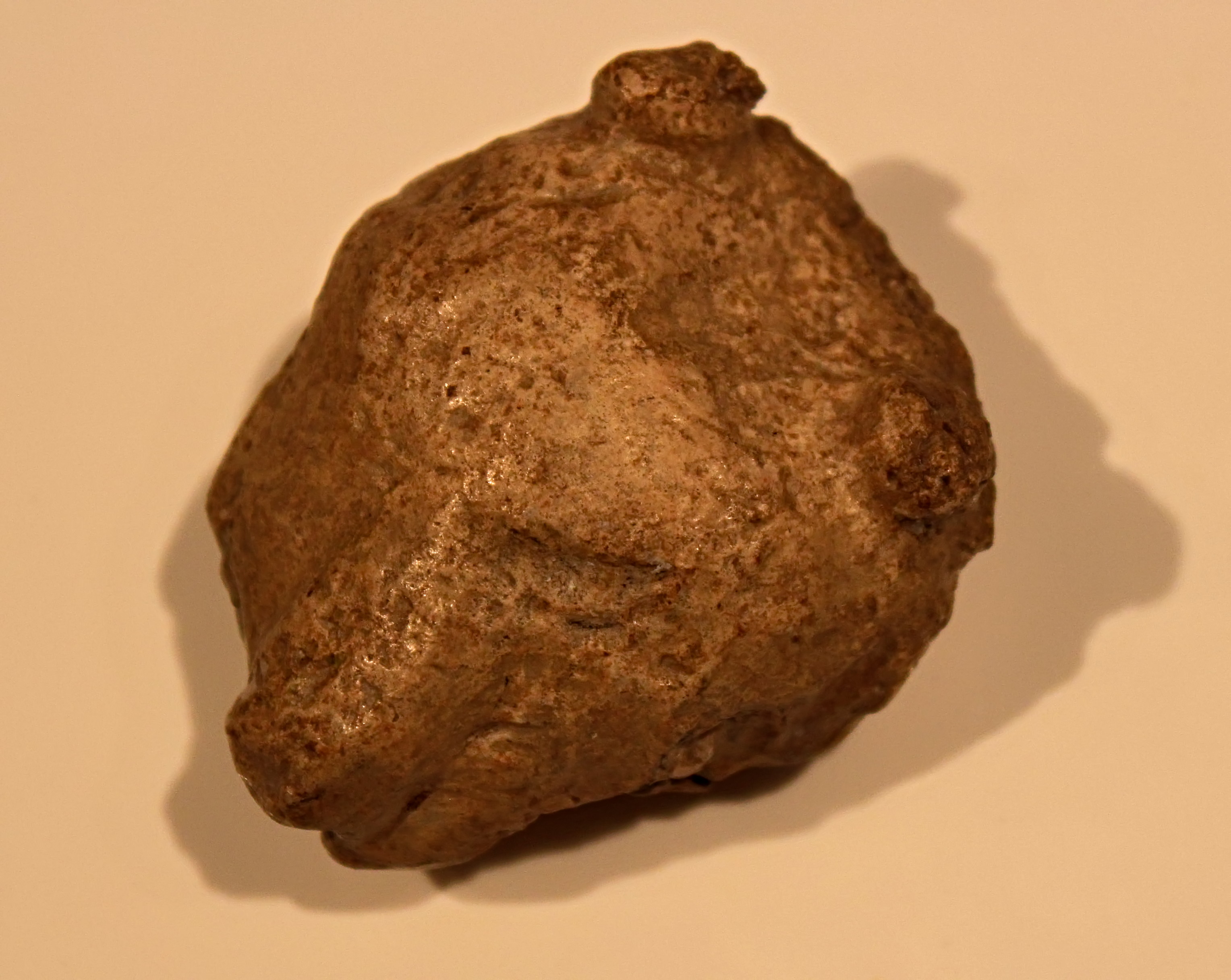
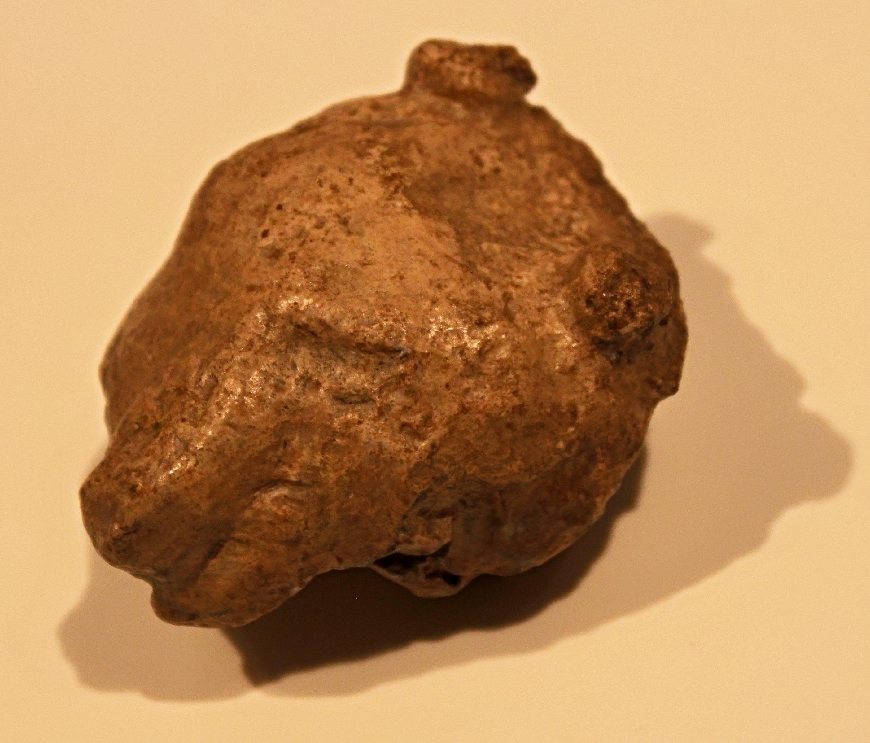
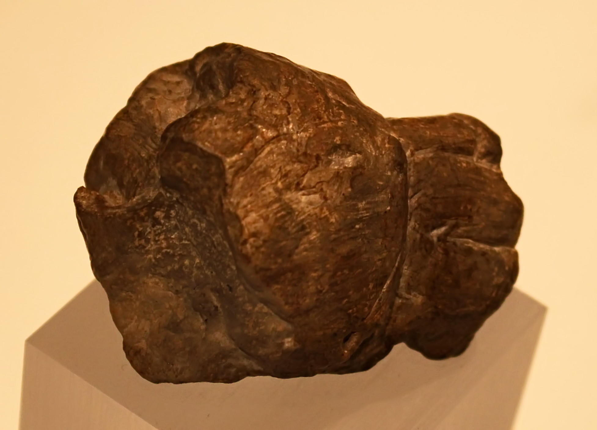
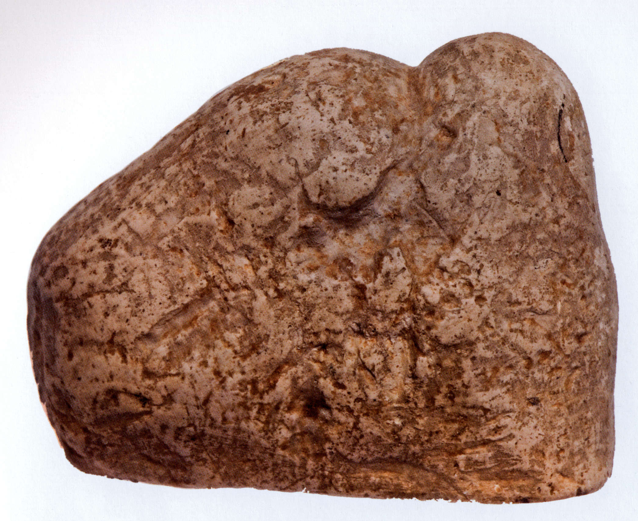
Lion head in ivory, Kostenki 1.
Photo: http://www.arretetonchar.fr/
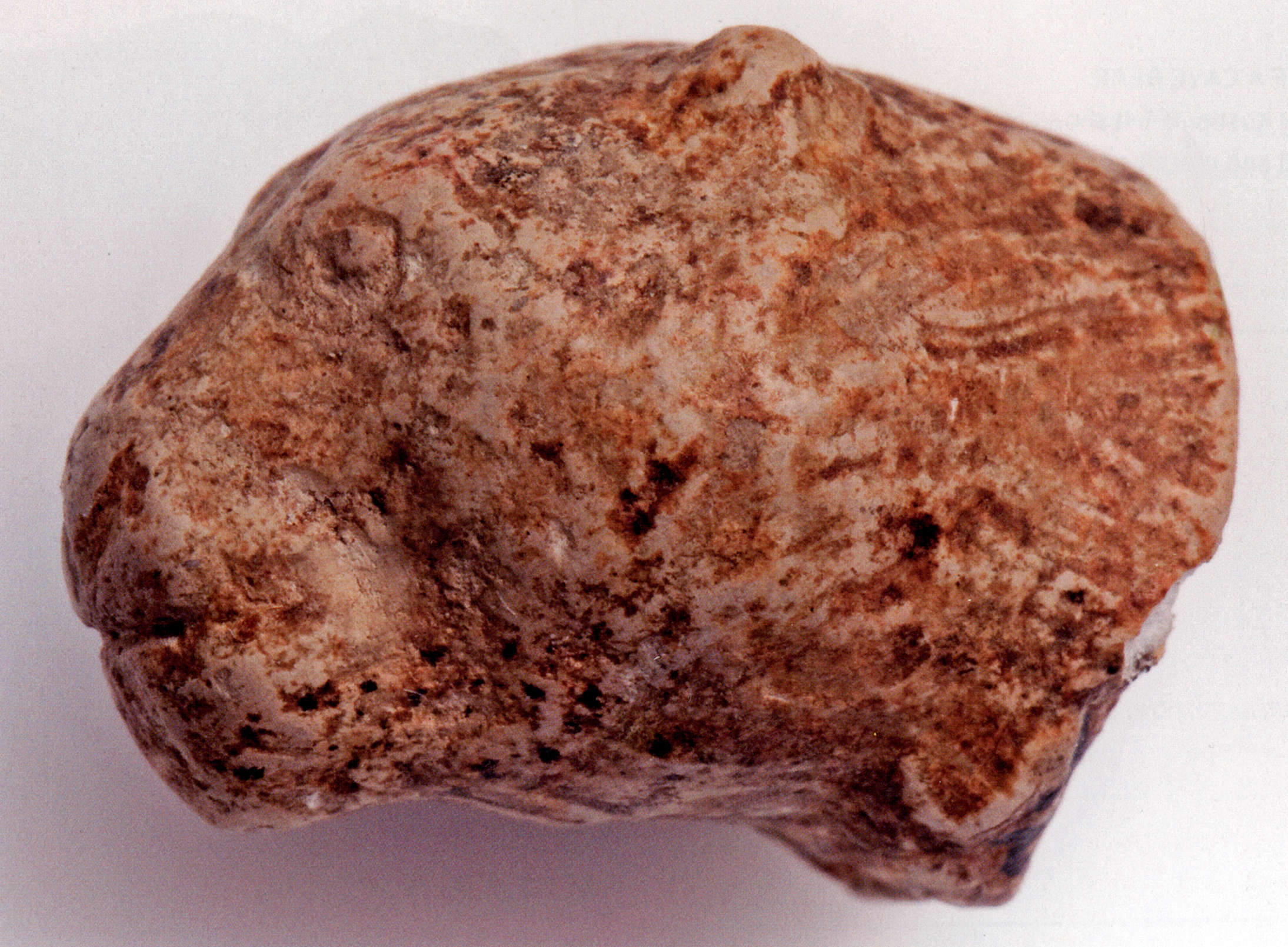
Miniature lion head, Kostenki 1.
Despite being tiny, this sculpture is realistic and vivacious.
Marl (soft, chalky limestone), height 15 mm.
Photo and text: Cook (2013)
Source: Kunstkamera, St Petersburg

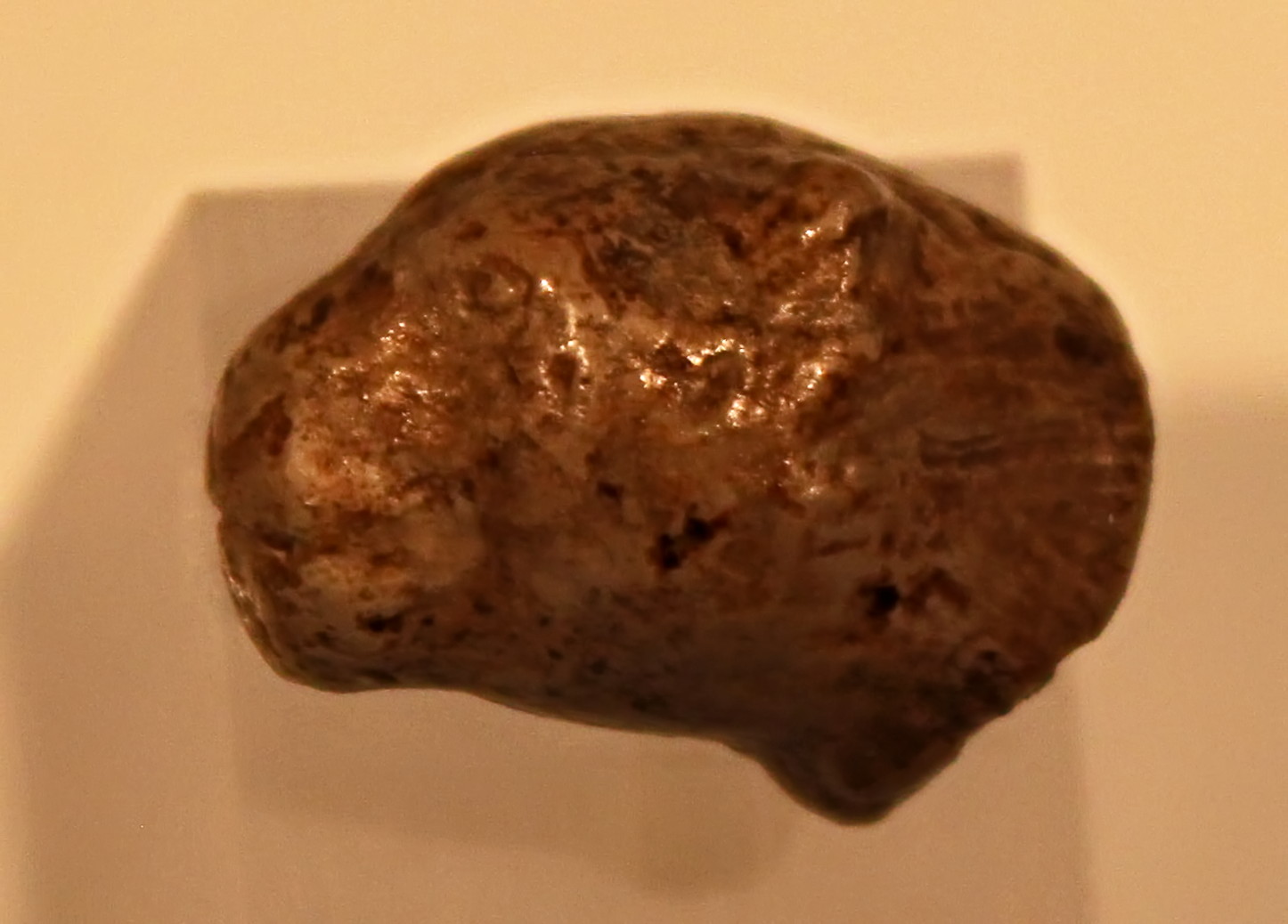
Kostenki, 25 000 BP.
Lion head.
Photo: Ralph Frenken
Source and text: Original, exhibited at the Archeological Museum Hamburg (Ice Age - The Art of the Mammoth Hunters from 18 October 2016 to 14 May 2017)
On loan from the Hermitage Museum, Saint Petersburg, Russia.
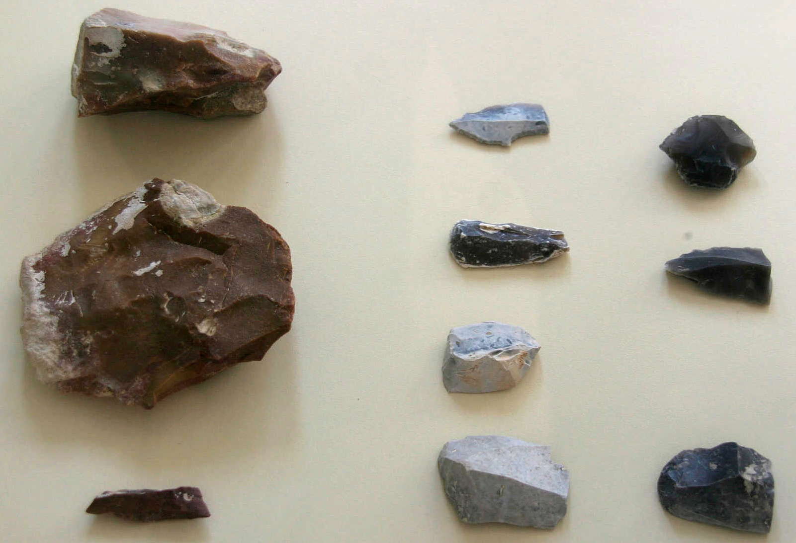

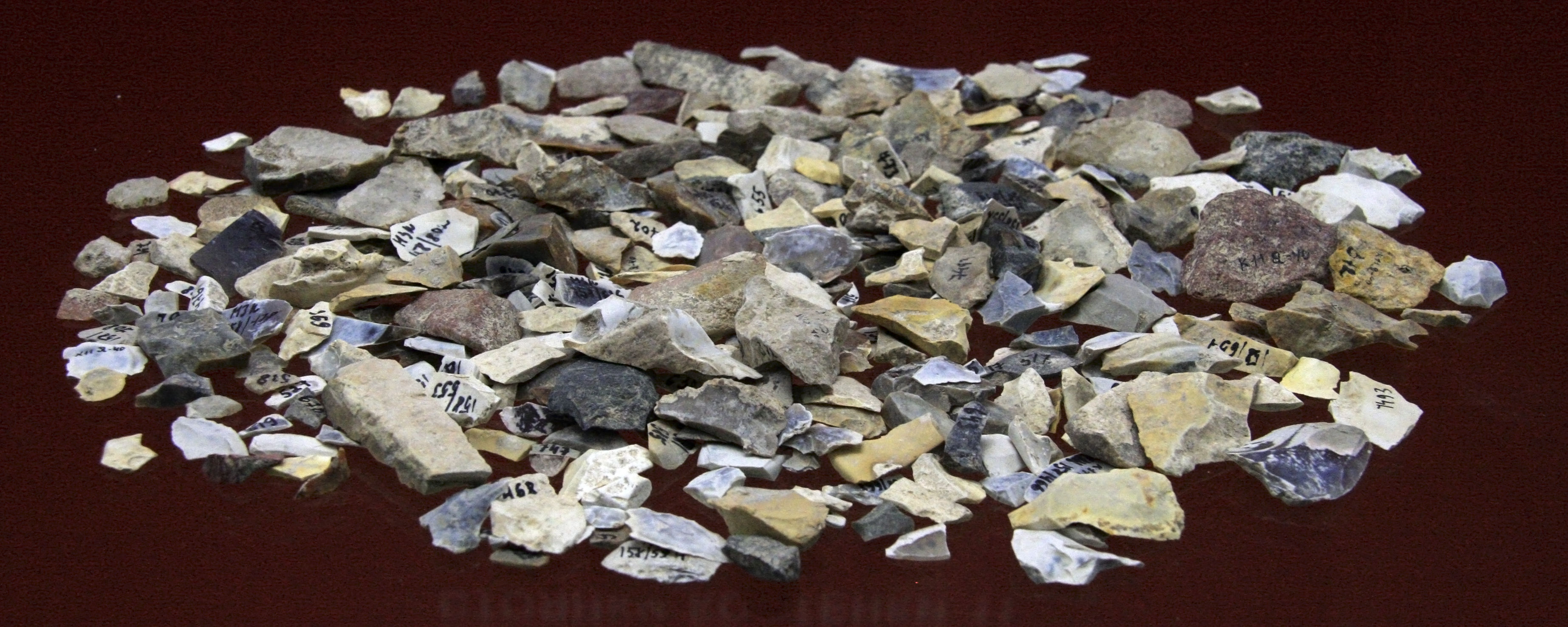
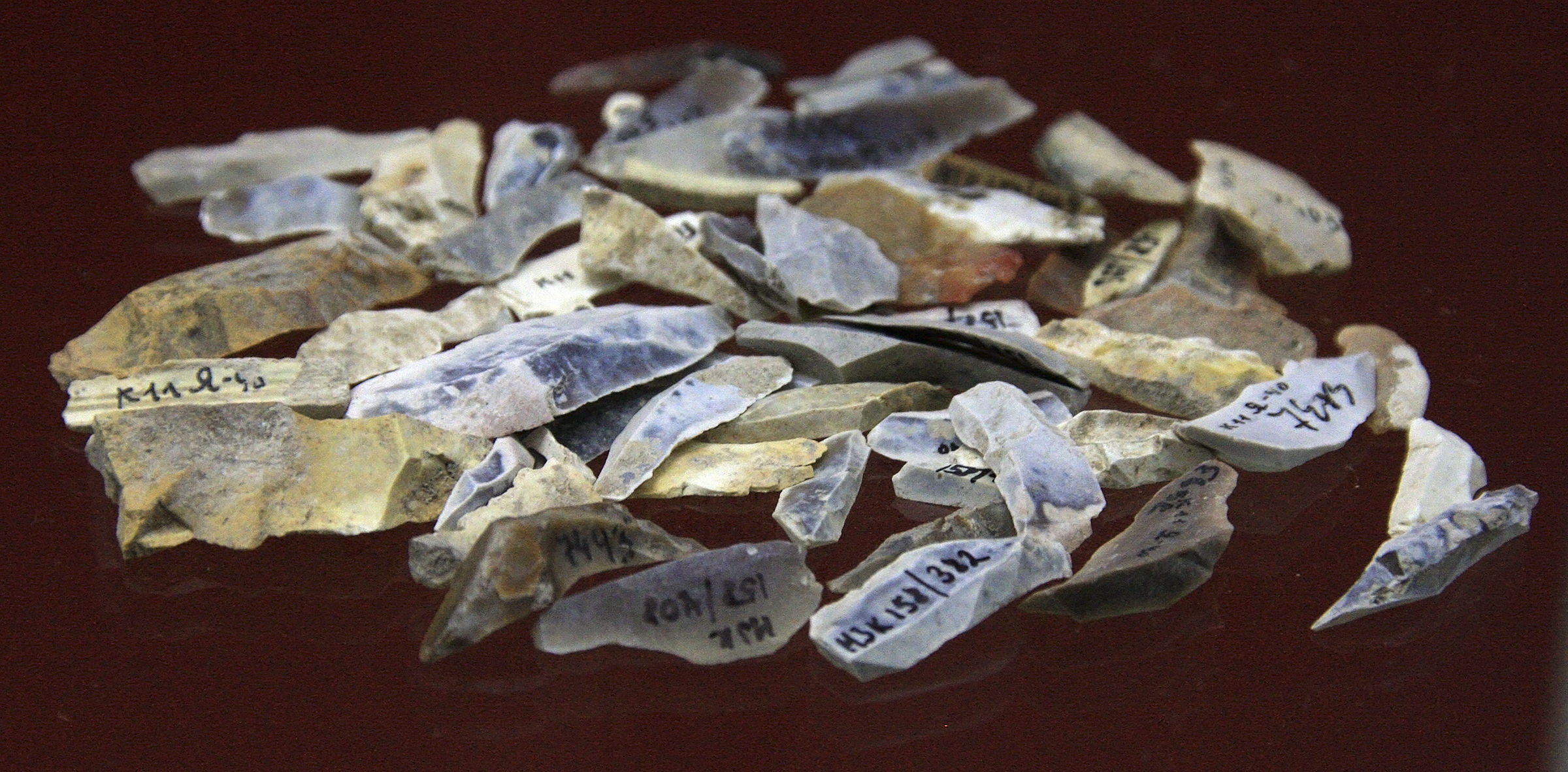
A collection of stone tools from Kostenki 1.
Excavations in 2005.
(Note the classic Kostenki shouldered or tanged point on the extreme right of the middle row of the photo on the right - Don )
Photo: Vladimir Gorodnjanski 2011
Source: Originals, Kostenki Museum.
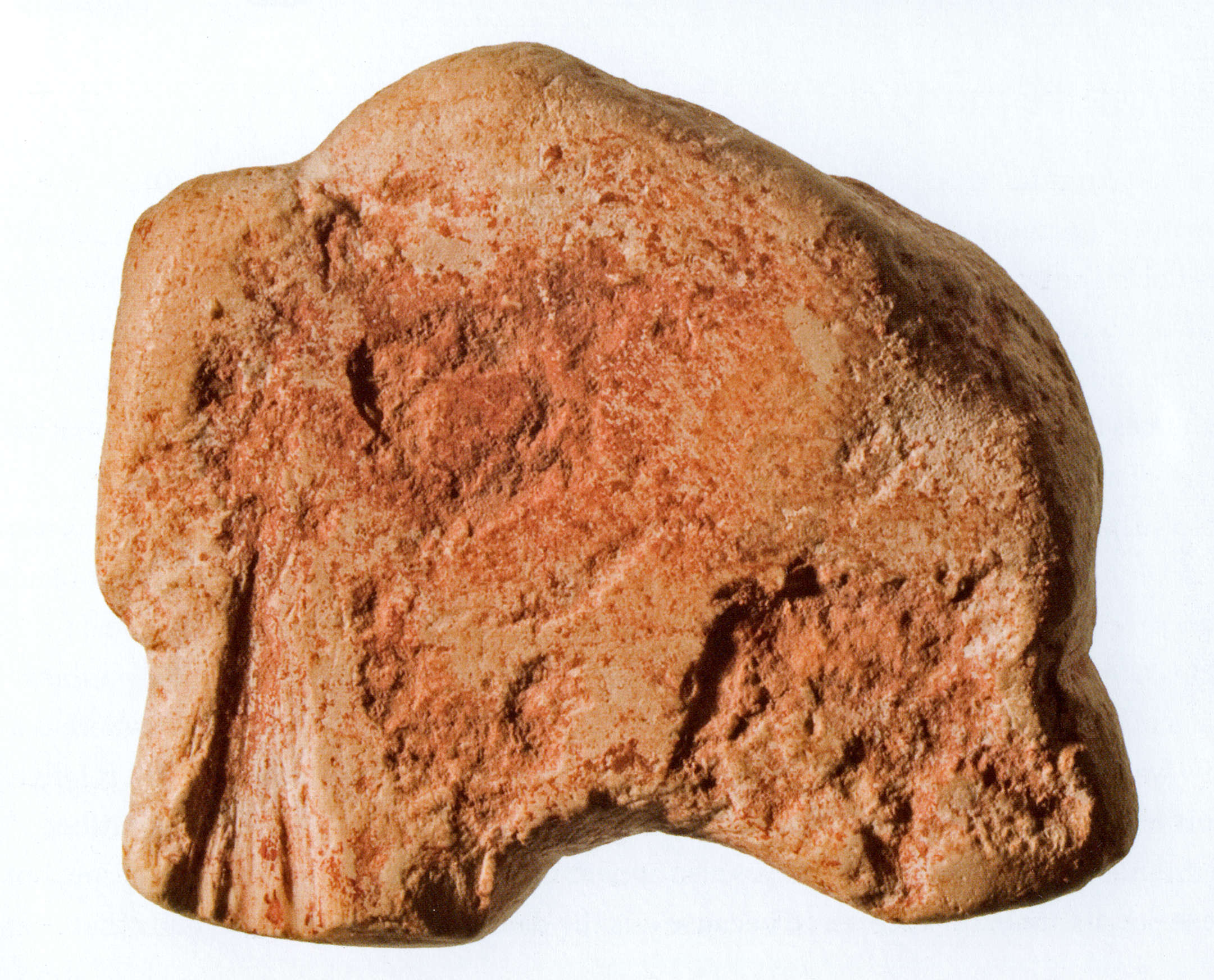
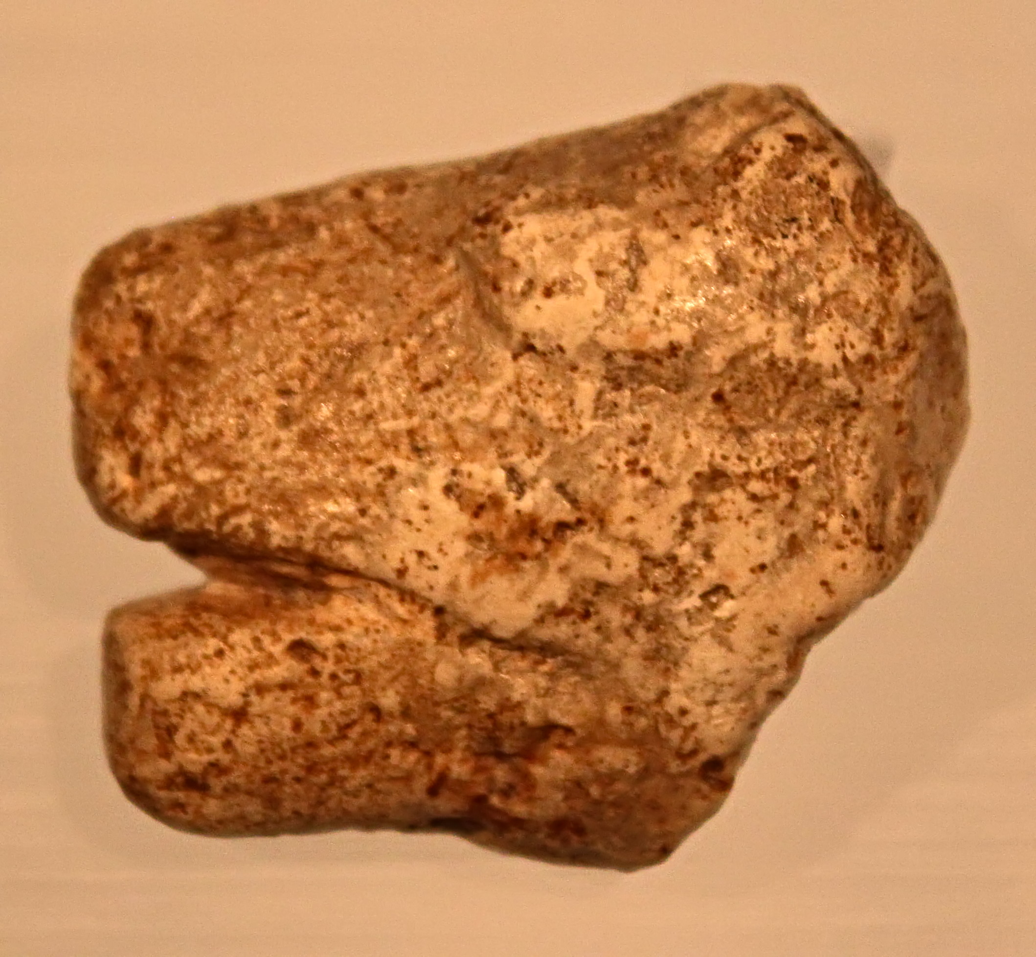
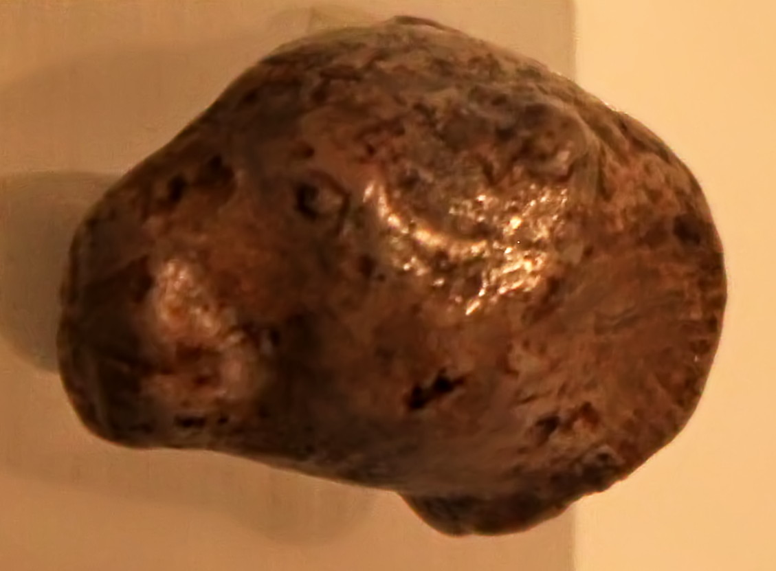
Sculptures of mammoths, Kostenki 1.
The domed head and sloping back of an adult mammoth is quite distinctive.
Marl (soft, chalky limestone) and red ochre, height (left) 28 mm, height (right) 37 mm.
Photo and text: Cook (2013)
Mammoth sculpture as in the right hand photograph above. This appears to be a facsimile.
Photo: Vladimir Gorodnjanski 2014
Source: The Hermitage Museum, Saint Petersburg
Text below from: http://www.trinitas.ru/rus/doc/0211/008a/02111056.htm
The Kostenki - Borshevo sites are a group of more than twenty settlements from the same culture on the right bank of the Don River, south of Voronezh, in the region of the next two villages - Kostenki and Borshevo .
The basic excavations were conducted in the 1920s - 1930s by P. Yefimenko, and in the 1940s - 1960s by A. N. Rogachev.
The research performed here played an important role in the development of modern techniques of excavation of palaeolithic settlements, and in the understanding of the problems which palaeolithic dwellings were designed to solve, female images as sculptures, in the allocation of late palaeolithic cultures to categories, and the establishment of their mutual relations.
Kostenki I (Polyakov site) contained five cultural layers. In the upper layer were preserved the remains of dwellings within an area of 35m by 15m, arranged in lines, with the hearths located along the central longitudinal axis of the dwellings, together with storage pits. Flint tools, hoes made from mammoth tusks, bone digging implements, a baton from deer horn, about forty female statuettes made from both ivory and marl/limestone, figurines of a bear, cavelion and anthropomorphous marl heads.
Triangular flint tools are found in the lowermost layer with a concave base, retouched with a pressure process.
Стоянка Костенки 1 ( Воронежская область) - Kostenki Site (Voronezh Region)
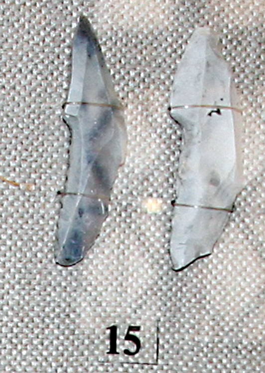
15. Наконечники с боковой выемкой - points with a tang for hafting, perhaps as a knife.
These 'shouldered points' from Kostenki 1 are very typical of the Kostenki toolkit.
Photo: Vladimir Gorodnjanski, 2007
Source: The Hermitage Museum, Saint Petersburg
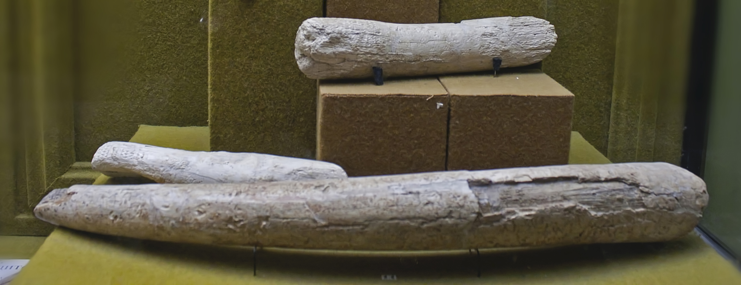
Digging sticks from Kostenki ( apparently made from mammoth tusks. These would have been used in the construction of houses, since there was certainly no agriculture - Don ).
Photo: Vladimir Gorodnjanski, 2014
Source: The Hermitage Museum, Saint Petersburg
* The Kostenki 1 type of artefacts, known as the Kostienki - Avdeevo culture, is the only Kostenki cultural entity known from four sites, but it is also found outside the Kostienki area.
* All sites are located in the Prokrovsky ravine and probably represent the remains of a large residential area.
* The culture is characterised by a specific type of spatial organisation, represented by a large house (36 x 14-15 metres) with many hearths in a line on the longitudinal axis of the house, surrounded by semi-subterranean buildings dug out to a depth of one metre and with deposits in pits.
* The three signature Kostienki fossils are the association of realistic female statuettes, notched points to specific dimensions and knives of the a specific Kostienki type. Subsequently, the number of individual typological features of this unit of local cultural Eastern Europe has increased, but the importance of this association remains the diagnostic criterion of this culture.
Photo and text: Sinitsyn (2007)
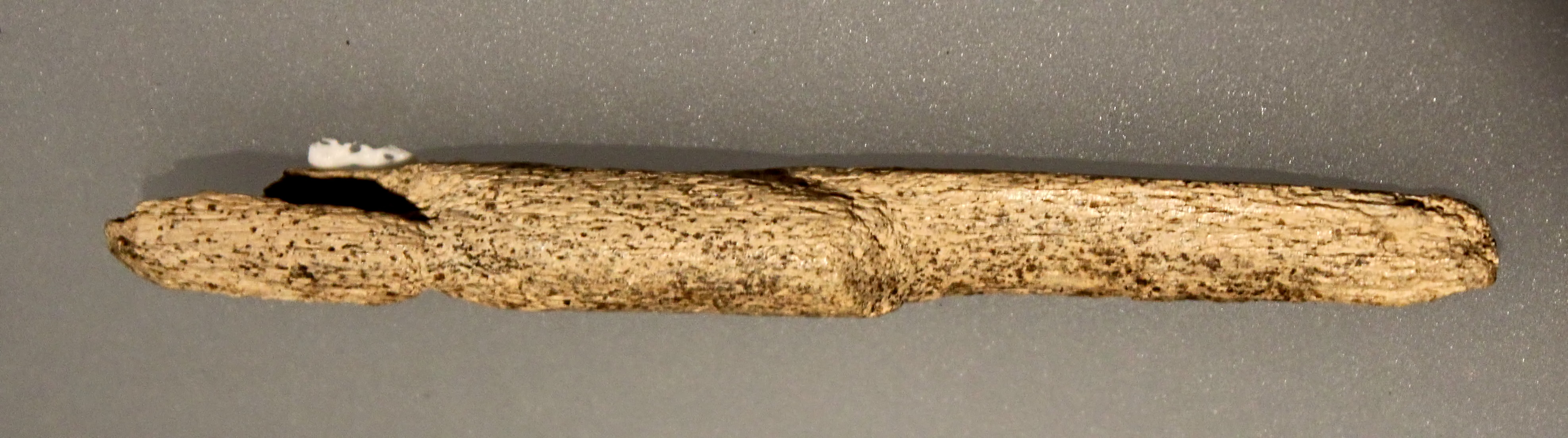
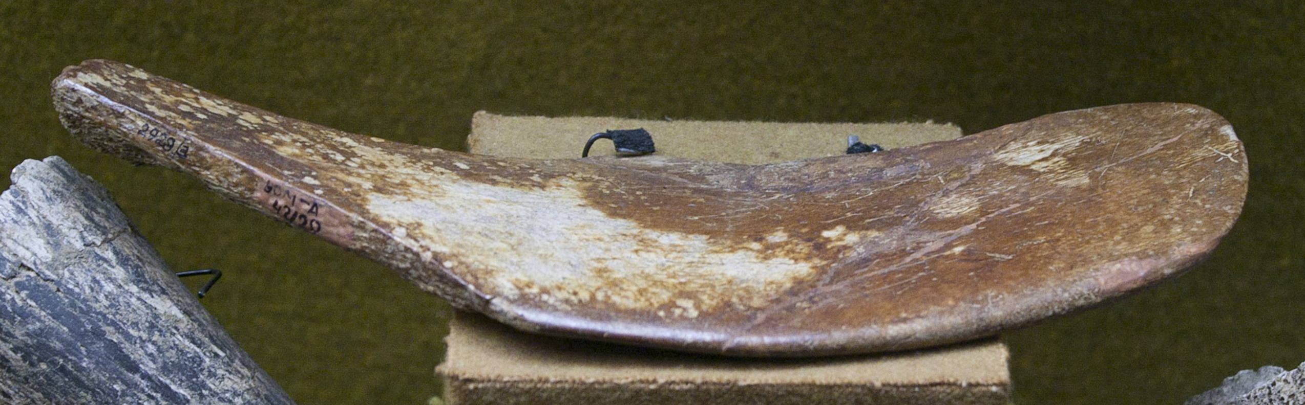
The end of a spatula made of mammoth bone, 15 cm long, from the Gravettian of Kostenki 1. This artefact is similar to one in the drawing above, at the bottom left.
Photo: http://www.arretetonchar.fr/
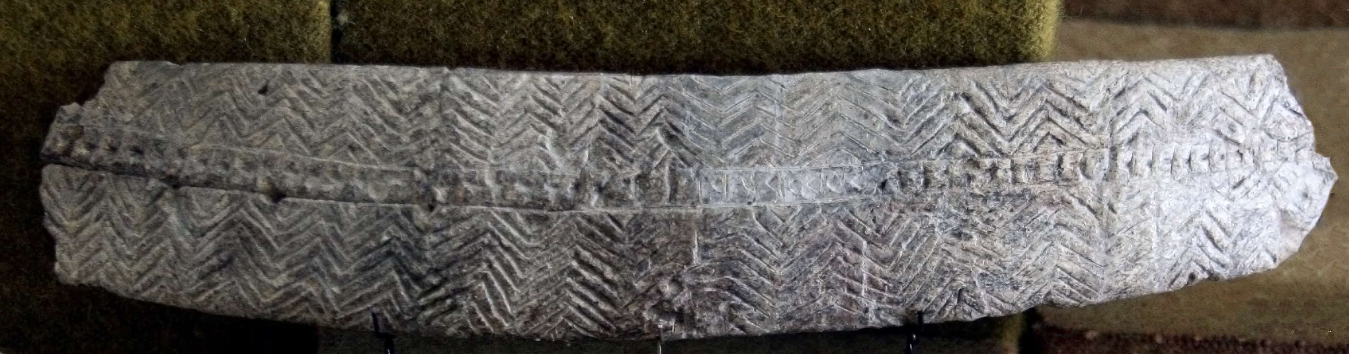
Photo: Vladimir Gorodnjanski
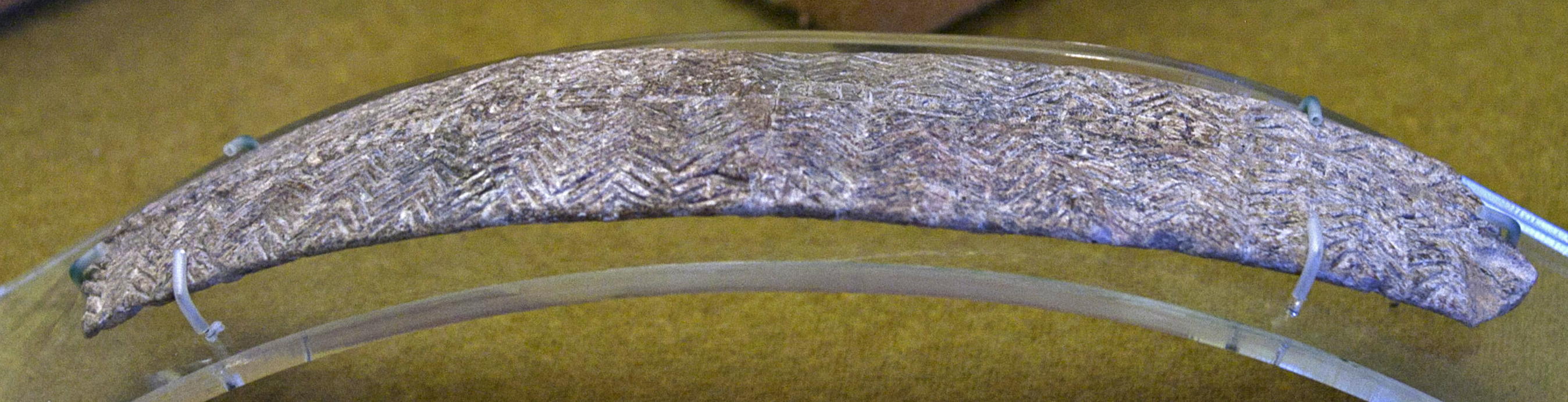
This image shows clearly the curve of the diadem.
Photo: Vladimir Gorodnjanski 2014
Source: The Hermitage Museum, Saint Petersburg
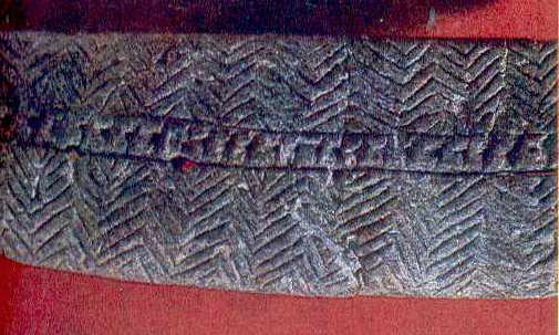
Fragment of the diadem from Kostenki 1 above.
Note that this image shows clearly that there is at least one hole through the object.
Photo: Archaeology of the USSR - The Palaeolithic of the USSR.
My thanks to Vladimir Gorodnjanski for access to this resource.

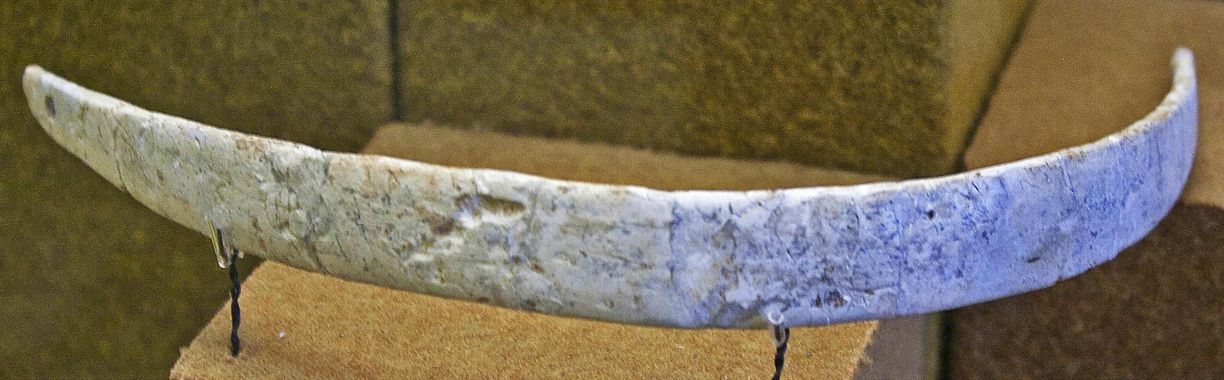
Diadem, an ornamental headband from Kostenki. Facsimile.
Photo: Vladimir Gorodnjanski
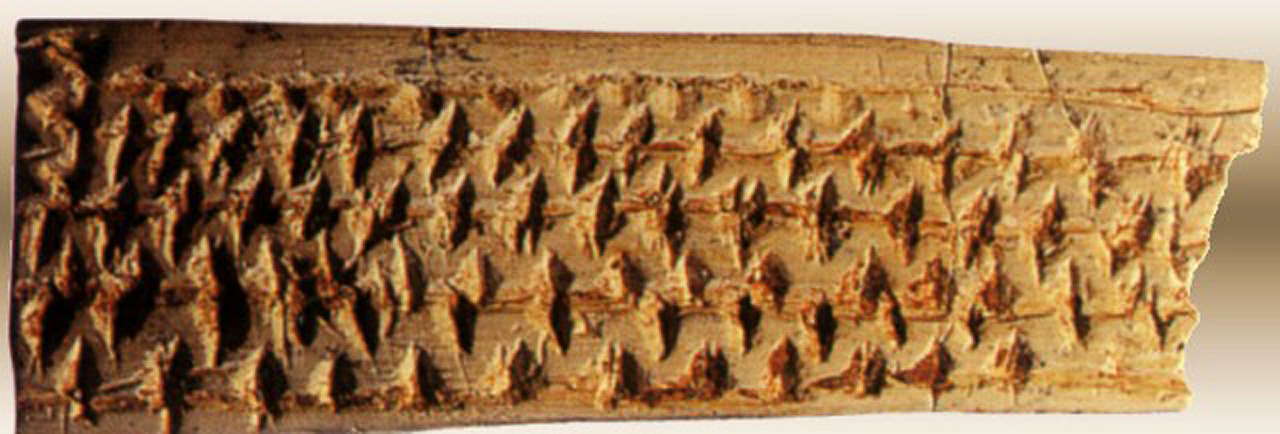
Piece of a bracelet from Kostienki 1 decorated with a geometric pattern.
Photo: http://www.istmira.com/foto-i-video-pervobytnoe-obschestvo/3924-iskusstvo-predystorii-pervobytnost-2.html
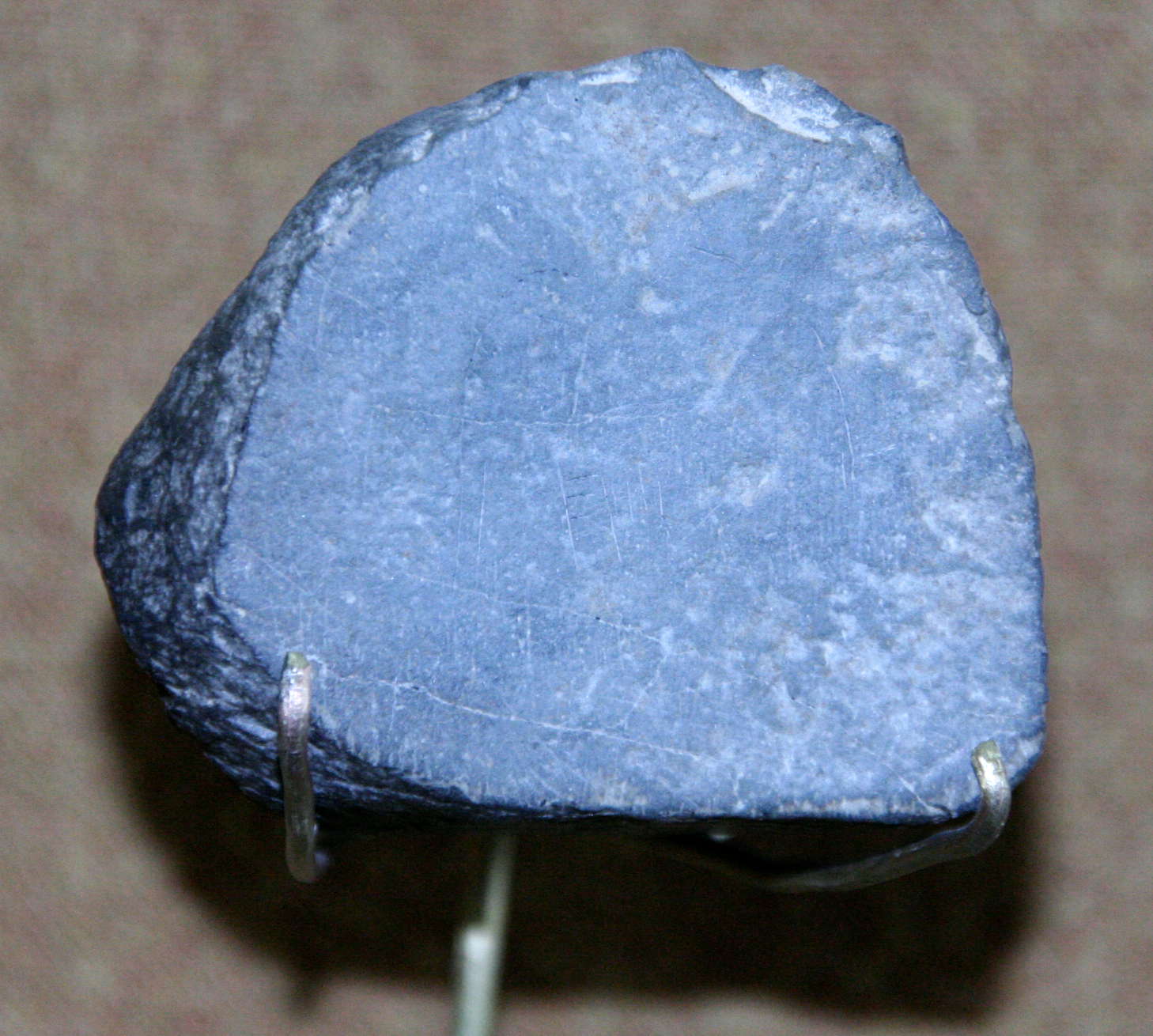
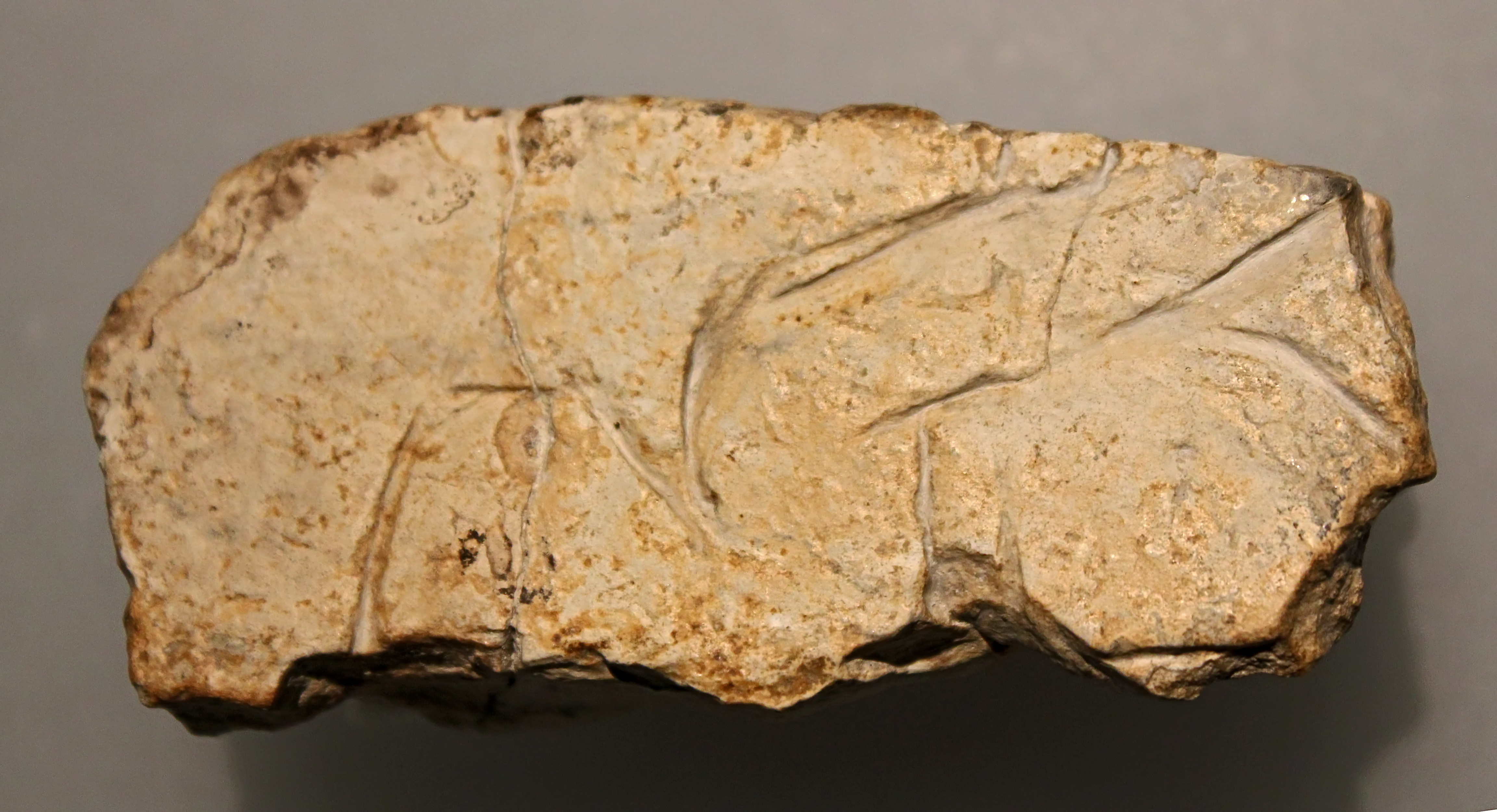
Engraving of a mammoth on a flat stone. It appears to be limestone which has been artificially made planar to accept the engraving.
Photo: Vladimir Gorodnjanski 2007
Source: The Hermitage Museum, Saint Petersburg
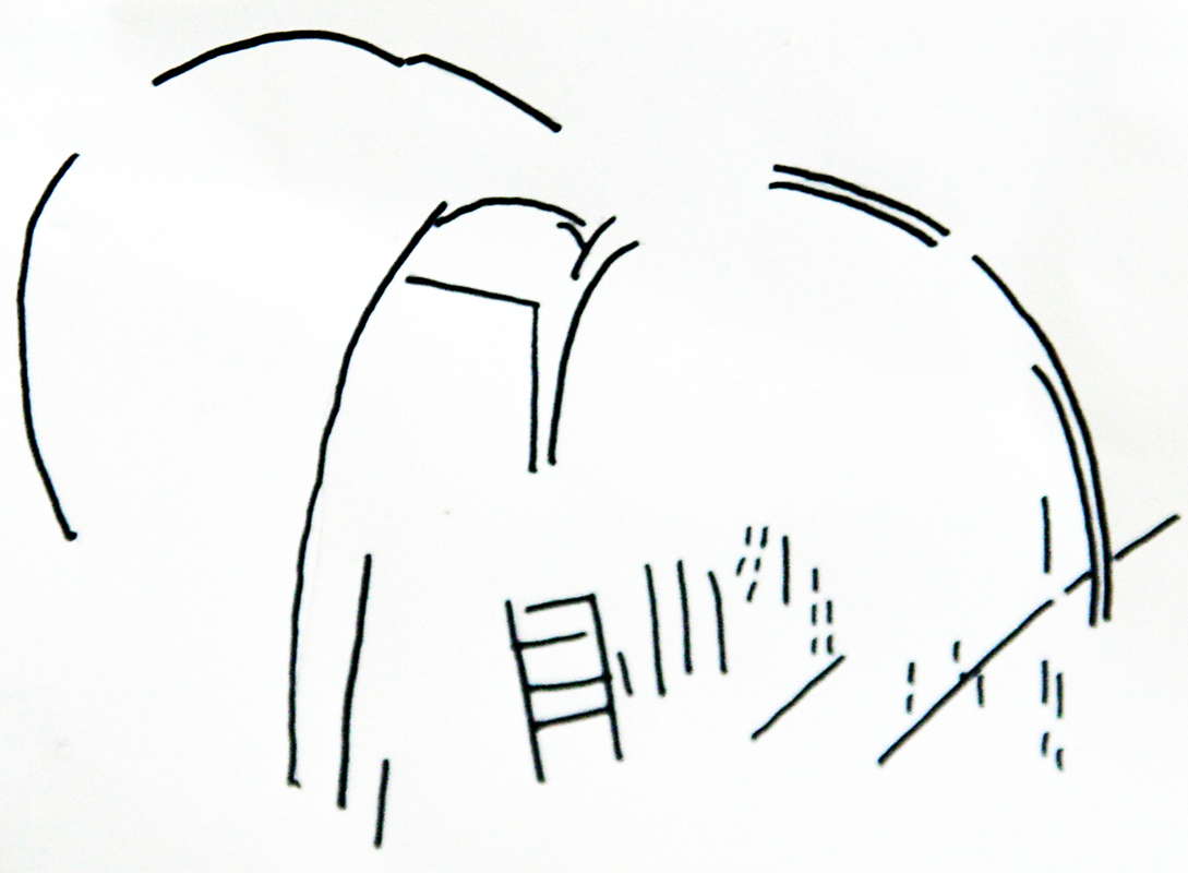
A line drawing of the engraving of the mammoth, shown above.
Photo: Vladimir Gorodnjanski 2007
Source: The Hermitage Museum, Saint Petersburg
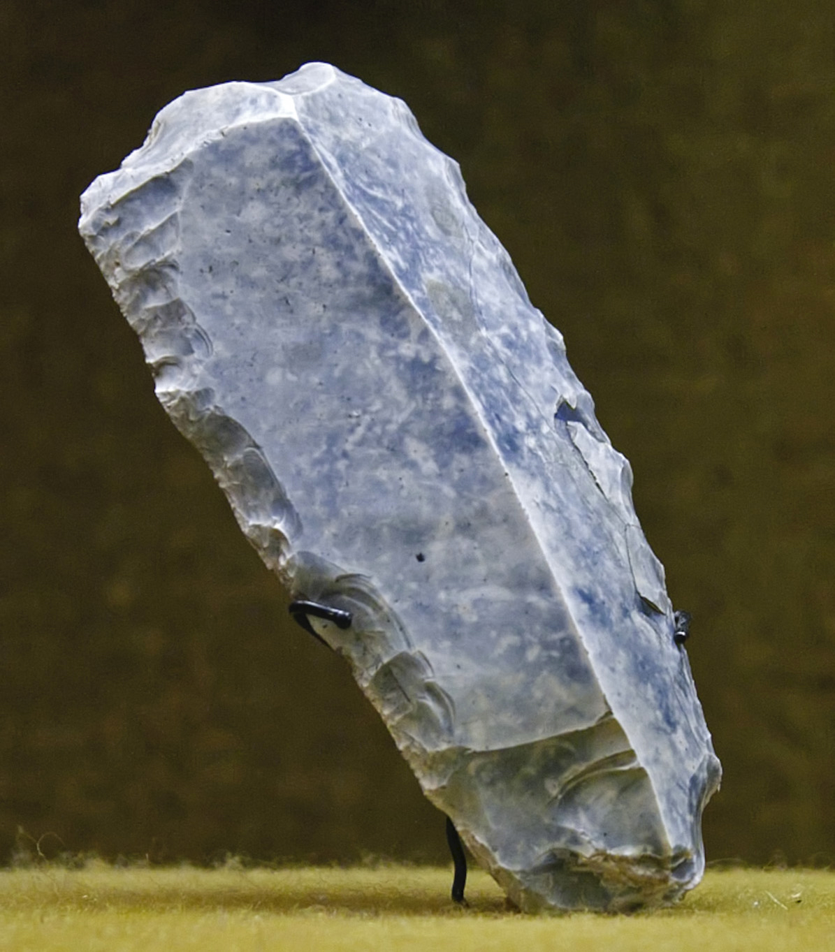
Left: Scraper
Right: Point
Kostenki.
(Note that the piece on the right seems to have been completed in poor quality stone - Don )
Photo: Vladimir Gorodnjanski 2014
Source: The Hermitage Museum, Saint Petersburg
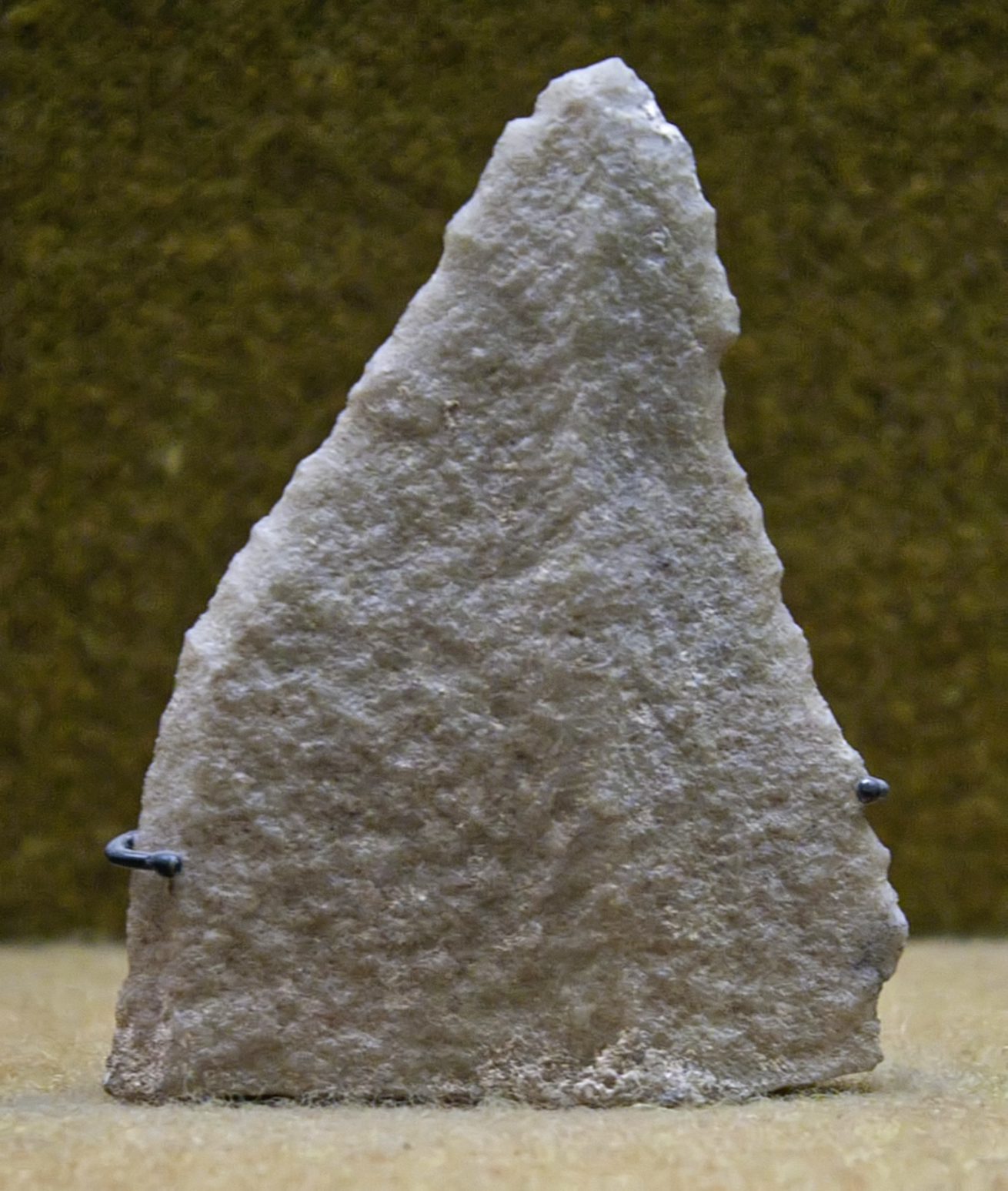
Spatula, Kostenki
Photo: Vladimir Gorodnjanski 2014
Source: The Hermitage Museum, Saint Petersburg
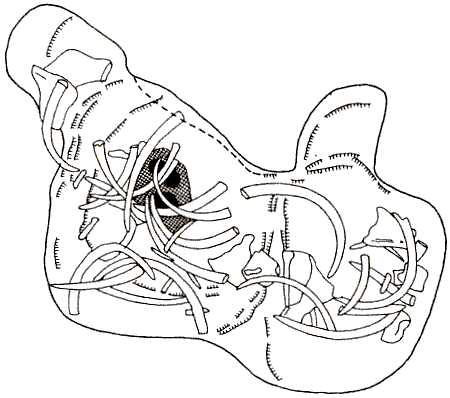
 Plan de la première structure d'habitat de Kostienki I, couche 1,
d'après P. P. Yefimenko. Reconstitution spatiale des représentations animalières d'après L. Iakovleva.
Plan de la première structure d'habitat de Kostienki I, couche 1,
d'après P. P. Yefimenko. Reconstitution spatiale des représentations animalières d'après L. Iakovleva.
Plan of the first hut of Kostienki I, layer 1, according to P. P. Yefimenko. Plan of the representation of animal remains according to L Iakovleva.
Photo and French text: "les mammouths - Dossiers
Archéologie - n° 291 - Mars 2004"
My thanks to Anya for access to this resource.
Note also the plan of the same Horizon I house, Kostienki I below after Klein, R.G. 1973.
Plan of Horizon I house, Kostienki I after Klein, R.G. 1973. Ice-Age Hunters of the Ukraine. Univ. of Chicago.
Note the alternative plan above, showing animal remains, from the source "les mammouths - Dossiers
Archéologie - n° 291 - Mars 2004".
The text below is from the very useful book 'The Prehistory of Europe' 1980 by Patricia Phillips (Allen Lane)
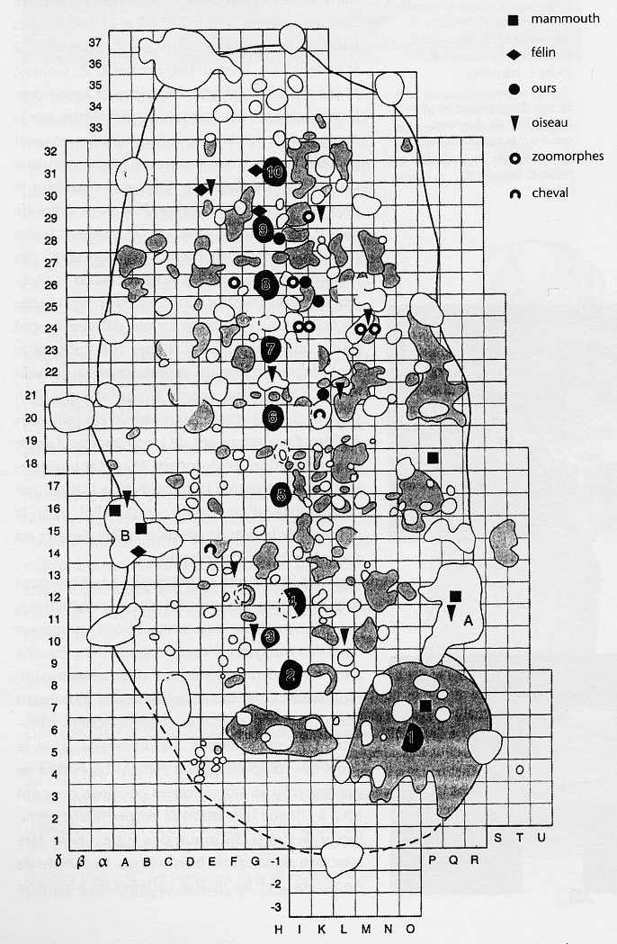
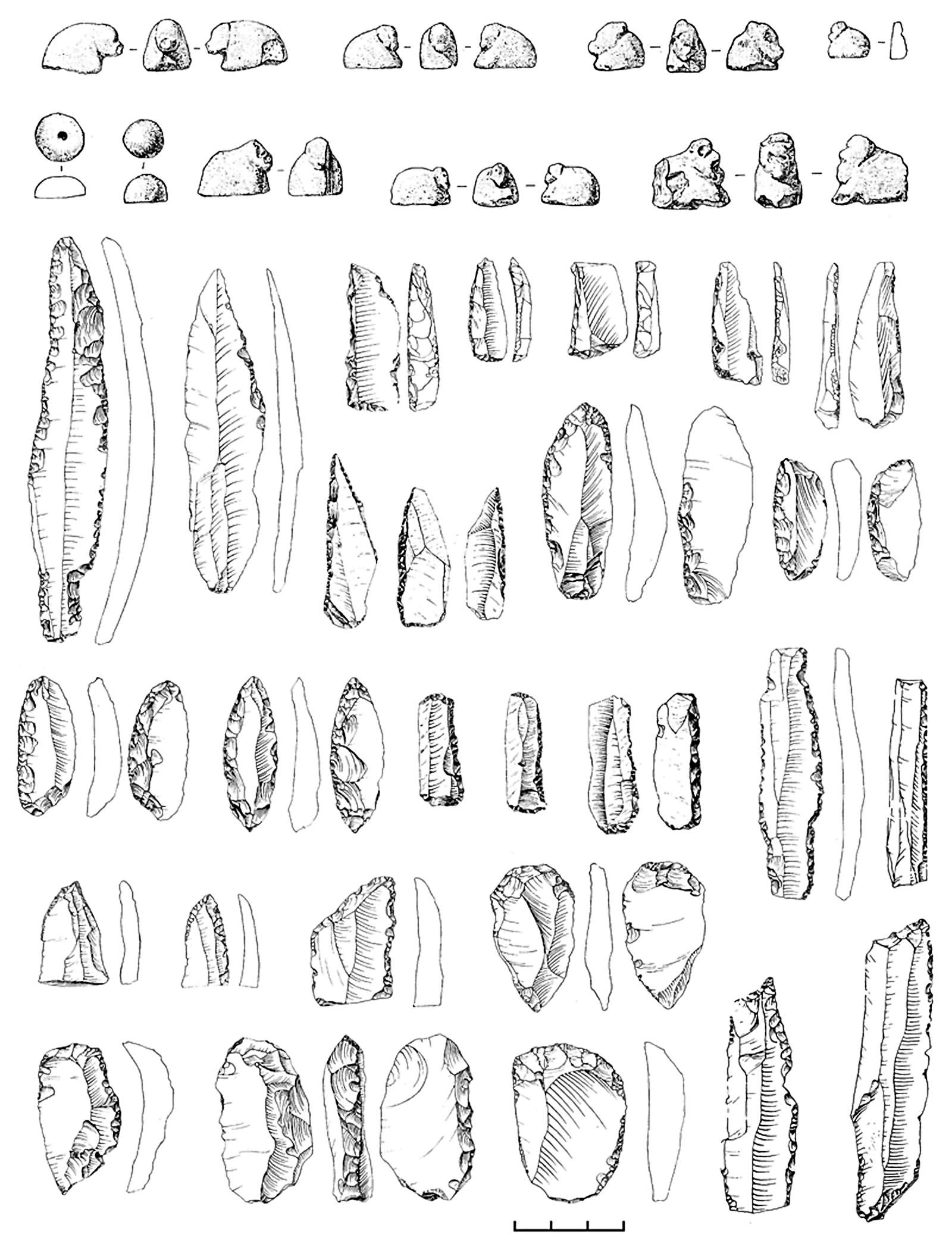
This structure described by Klein comes from the loess-like loams overlying the upper humic bed in the Kostienki-Borshevo terraces. Kostienki 1, Horizon 1, was excavated in the 1930s, and reconstructed as a 'long house' 35 metres long by approximately 16 metres wide. This colossal area encompassed nine hearth pits, mostly down the centre line of the structure, and sixteen large pits around the periphery, four of them interpreted as sleeping areas and twelve as caches, full of mammoth bone.
The rest of the floor of the supposed structure was covered with a series of little pits, again regarded as caches. Klein is not convinced by the interpretation of the structure as a single long house. The agglomeration of features is certainly of great interest, however, as is also the presence of a series of animal figurines, and bone artifacts including possible 'head' bands with incised decoration. Six female figurines from the site were made of local limestone (marl) and ivory (Klein, 1969b) (Fig. 29). Many fragmentary remains of figurines were also found. The figurines are decorated with bands incised around the waist and above the breast. Larger bone artifacts include possible mattocks. The famous Kostienki points, which are elongated flint points with an asymmetrically placed tang, have been examined by Semenov for evidence of microwear (1964). He has concluded that they were used as knives.
Another Kostienki site, No. IV, Horizon 1, consisted of two depressions 6 m apart and approximately 6 m in diameter, considered to represent hut floors. The original huts may have been larger as the finds distribution is wider than that of the actual depressions and extends particularly to the south-west where, it is suggested, the doorway was. The excavators believe that points with burin facets on the proximal end may have been used as whittle knives, with the burin end inserted into a handle. Other interesting finds from this site include ground slate discs 3 to 6 cm in diameter which, it is suggested, were used to retouch the flints. In addition there were dotdecorated stylized figurines in ivory, and ivory rods and bone 'clothes fasteners'. Bones from Horizons I and 11 at Kostienki IV were not separated during excavation, but it is assumed that woolly rhinoceros and cave lion at least derived from Horizon 1. As with the other Ukrainian sites previously mentioned, pits occurred in the Kostienki IV-I habitation units, the western hut containing eight pits in the centre, all under a layer of heavy grey ash. In the eastern depression, there were six ash-filled pits and others which seemed to have served as caches. Sandstone slabs around the periphery may have had something to do with the original wall structure, and two cave lion crania found on the top of the deposit are suggested to have been used to crown the original tents. Klein has suggested that from the calories available in the form of animals the different sites in the Kostienki-Borshevo region could have been occupied from as long as forty-three days to four years. He suggests that the sites represent longish occupation, probably during the winter.
East European archaeologists are particularly interested in the origin of raw materials used in Palaeolithic sites, and in the wear marks visible on the retouched tools; for instance, at the Kostienki sites, brown and yellow flint and quartzite are of local origin, but the black flint brought in as blanks is not. Petrographic analysis has proved that some of the black flint comes from approximately 150 km to the south-west, from the valleys of the Valuj and the Oskol rivers. Other black flint may come from as far as 300 km away.
Kostienki I is sometimes also called Polyakovo. P P Yefimenko did some research there during 1931 to 1936, and A N Rogatchev researched during 1938. Yefimenko uncovered an oval-shaped settlement measuring 14 to 15 metres by 36 metres, where numerous tools were found in the deposits inside the dwelling, although only a few implements occurred outside. It is possible that the living room was surrounded by some kind of walls. At the edge of this settlement Yefimenko found four large pits filled with deposits, and he called them the winter hut-pits. He also found twelve smaller ones which were used to keep bones in. If the building covered the whole area, as Yefimenko assumes, the pits at the edge could then be remains of the construction. It is more likely, however, that only part of the area was covered, a fact indicated by the finds. Semi-subterranean hut-pit 'A' could be described as one of the larger dwellings. It is about 2 metres by 3.5 metres and has a small terraced passage leading to the outside. A mammoth tusk and two shoulder-blades were found here with which the entrance could be covered up. Mammoth shoulder-blades were also used in the Upper Palaeolithic to cover graves, so that it is not surprising that they were also used to build huts. A similar entrance at the back of the hut was also found; it was shorter and steeper. But this could have been some kind of light shaft.
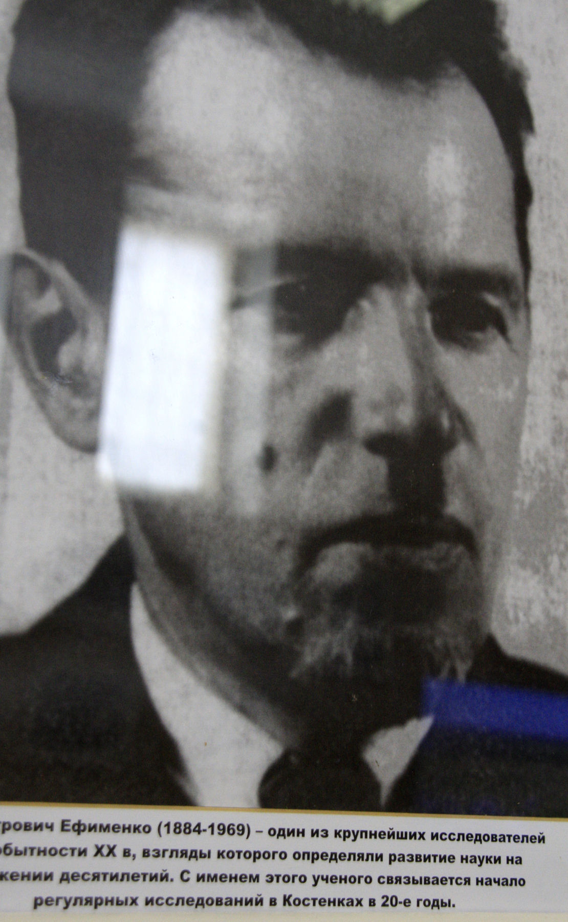
P. P. Yefimenko (1884 - 1969)
Photo: Vladimir Gorodnjanski, 2014
Source: Display at Kostenki Museum
The floor of the hut-pit was more or less flat and showed outlines of two circles. One of them was larger and had a fireplace in the centre. The smaller circle had two layers of bones. The upper layer consisted mainly of shoulder-blades, hip-bones, and tusks of the mammoth. The lower layer, which was level with the floor of the hut, consisted mainly of tusks which were laid with the points turned inwards towards the centre of the room. They were fairly regularly spaced. This was presumably the supporting framework of the dome shaped roof which collapsed once the hut-pit was empty. The floor of the hut was approximately I metre below the ground and the top of the hut rose 0.8 to 1.0 metres.
These facts led Polykarpovitch to believe that these pit-huts must have been used for sleeping and somehow were kept warm: otherwise they would not have been sufficient protection against the cold. They showed no traces of typical fireplaces; one layer of coal and ash could be found and there was only a little space left around the remains of embers. It could be that the main fire was kept somewhere else and that the inhabitants collected the hot ash and bone 'coal' in rolled up animal skins and took them back to their huts and slept on them. This hypothesis is strengthened by the fact that no traces of stone nor large bones could be found inside the huts. Rogatchev also assumed that sick people could have been cured there. But an answer to this suggestion can only be given after further research has been carried out.
Along the middle of the large settlement eleven fireplaces were found. two of them a little further away, towards the edge of it. Several irregular, bowl-shaped depressions and small holes were found inside the dwelling which might have been used as storage places. Beside some of the depressions large mammoth bones had been stuck vertically into the ground. According to Yefimenko they were used as working tables or anvils, and the pits which contained numerous implements could be thought of as the working places. Rogatchev also discovered well-preserved remains of hut constructions in Kostienki-Anosovskaya with several deep store pits, where large bones were used in their construction.
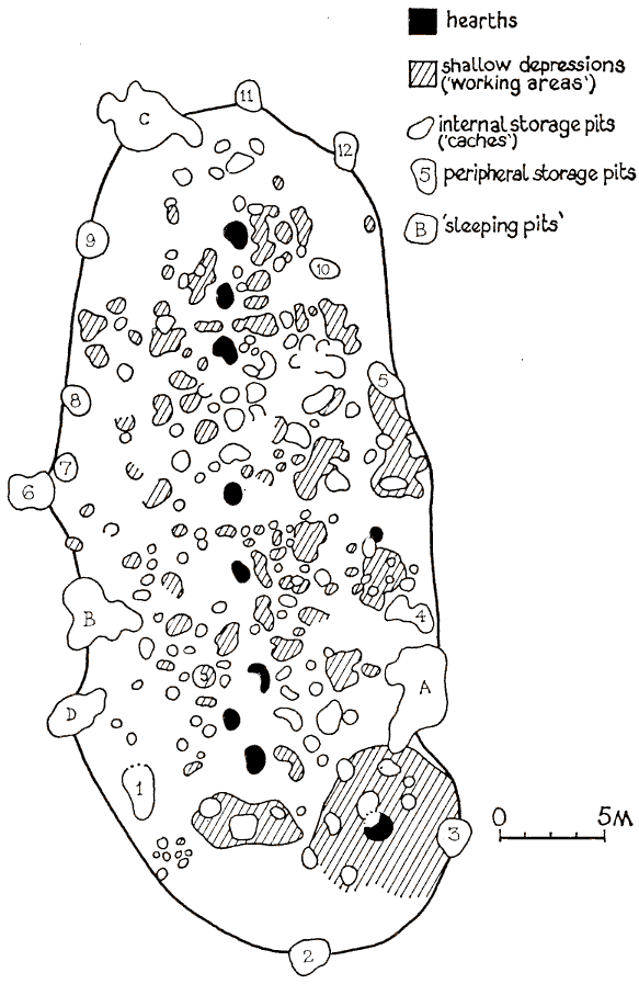
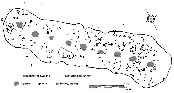
An alternative view of the layout of the Kostenki I house
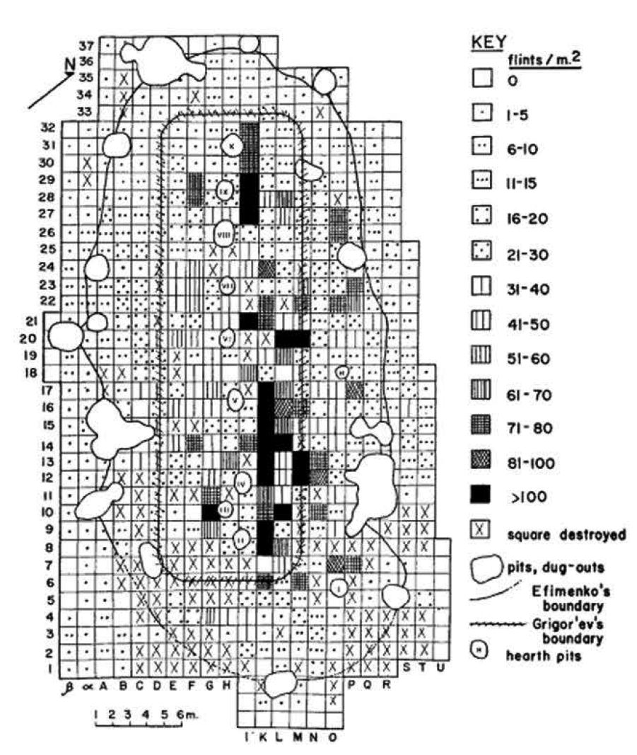
Kostenki I (uppermost level). Distribution of chipped flint on the area excavated in 1931-1937.
Note the boundary for the dwelling proposed by Grigor'ev, inside the one which was proposed by Efimenko (or Yefimenko). In support of this conjecture, Grigor'ev (1967) says:
It seems doubtful that Upper Palaeolithic peoples could have covered an expanse of 17 m. with a flat roof. Other Upper Palaeolithic dwellings (Pushkari, Aleksandrovka) were not wider than 4.5-5.5 m., and even long dwellings constructed by agriculturalists (Tripol'ye, Bandkeramik cultures, etc.) were 5-6 m., rarely 8 m., wide, although they were built with posts. Aleut houses of the 18th and 19th centuries, perhaps the only case of long houses used by a hunting people, were of approximately the same width.
The hypothesis that the Kostenki I dwelling was smaller than Efimenko's reconstruction of it is supported by detailed study of the distribution of cultural remains and comparison of this distribution with data from other Palaeolithic sites.
Photo and text: Grigor'ev (1967)
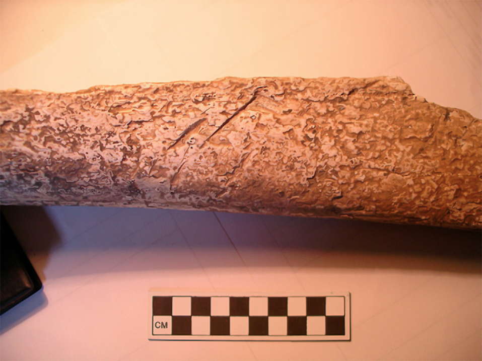
Mammoth ulna from K 1-V exhibiting cut marks (photo by JFH August 2008).
Assuming that a single mammoth is represented, it is more likely that the animal died at or near the location of the bones and teeth, and that portions of the carcass were subsequently exploited by humans and carnivores. The bones probably were exposed to sub-aerial weathering for several years. A similar pattern is evident at several sites in North America, where the partial carcass of one or two mammoths is found – with traces of tool damage on some of the bones – associated with a small quantity of artifacts. At these sites – as at K1-V – it is not always clear if the mammoth was hunted or simply scavenged by humans.
Photo and Text: Hoffeker et al. (2010)
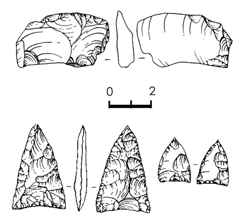
Artefacts from K 1-V, including side-scraper (upper) and small bifacial points (lower).
The artefact assemblages at K 12-III and K 1-V chiefly comprise small bifaces (including triangular bifacial points), end-scrapers, side-scrapers, and small quantities of other tools forms. Non-stone implements are
absent and the overall quantity of flaking debris is low. Local stone of poor-to-medium quality predominates, although some imported chert of good quality is present.
Photo and Text: Hoffeker et al. (2010)
Kostenki 2 - Kostenki II - Zamyatnina Site
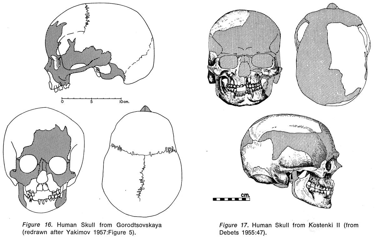
Figure 16: Human skull from Gorodtsovskaya.
Figure 17: Human skull from Kostenki II.
Photo: Klein, "Man and Culture in the Late Pleistocene", 1969
At Kostenki II (Zamyatnina site) were found the remainders of a round dwelling made of mammoth bones, seven or eight metres across, with the fireplace in the centre. This dwelling was adjoining a grave of a Cro-Magnon man buried in the seated position.
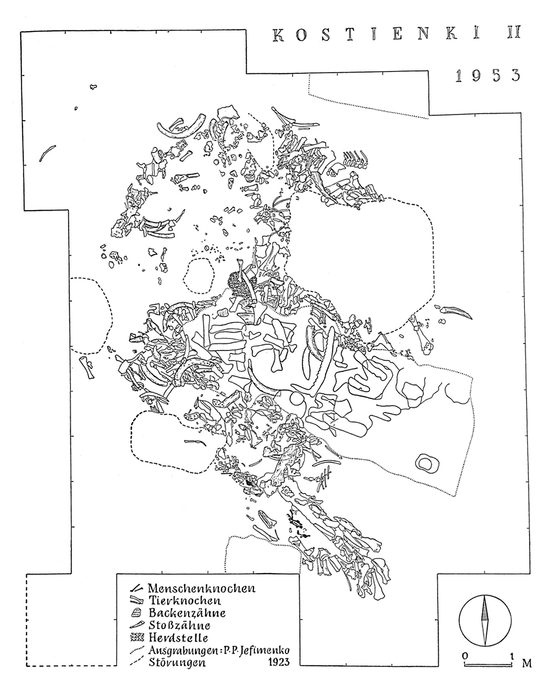
Map showing the position of the bones of Kostienki II.
Menschenknochen: human bone
Tierknochen: animal bone
Backenzähne: (mammoth) molars
Stoßzähne: tusks
Herdstelle: hearth
Ausgrabungen: excavations: P.P. Yefimenko 1923
Störungen disturbances
Photo: Boriskovskij (1953) (?) in http://kups.ub.uni-koeln.de/2079/2/Abb_Kapitel_VI-VIII.pdf
Kostenki 4 - Kostenki IV - Aleksandrova Site
At Kostienki IV /Kostenki IV (Aleksandrovka site) there was preserved in the upper of two cultural layers, the remainders of two round dwellings approximately six metres in diameter with the hearth at the centre of each.Among the findings here were ground, drilled disks of slate. In the bottom layer there were two long dwellings, with a length of 34m and 23m, and a width of 5.5m, in which were found flint leaf-like tips processed by pressure retouching. In the second layer were found fragments of human bones, partially burnt, as well as flint miniature plates (microliths?) and needle shaped points (burins?).
From Cave Men's Buildings
by V. Gordon Childe
Antiquity (Journal) 24:7 (pp4 - 9)
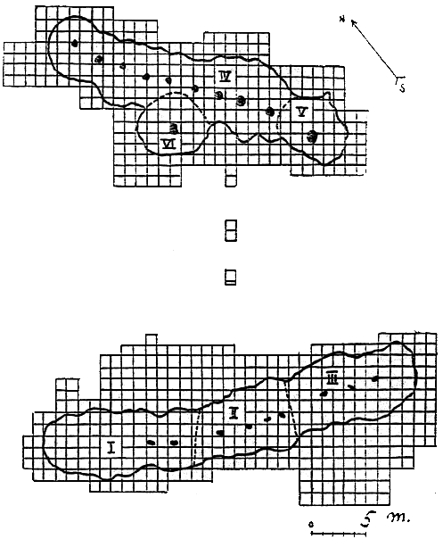
Plan of Kostienki IV
There are two long buildings separated by only twenty metres, with a long line of hearths in each. It seems obvious that the same sort of culture built both dwellings, and possibly they existed at the same time.
The excavated areas are divided up into one-metre squares ; the irregular lines mark the limits of the two excavated ' houses ' ; the broken lines, low ridges dividing the excavated area into 'rooms', numbered I to VI; the black spots mark hearths.
(after Rogachev)

Kostenki IV (Aleksandrova).
Schematic plans of the settlements of both the upper and lower horizons (after Rogachev (1957) : Fig 41, in Grigor'ev (1967))
Another view of Kostienki IV from People of the Earth by Brian Fagan
Reconstruction of a house at Kostenki which does not use mammoth bones as a primary structural material.
Photo: From the book shown, by Vinnikov.
My thanks to Vladimir Gorodnjanski for access to this resource.
(It should be noted that at Kostenki 4 mammoth bones were apparently not used as structural materials for the huts, so a method like the one shown here, using wooden poles, must have been used. The question is, however, where did they get the wood for the structural supports? The area was mostly treeless for much of the time that the people of Kostenki used the banks of the River Don for their dwellings. No doubt they found them in gallery forests along the river and in ravines protected from the strong, dry, cold winds blowing dust from the glaciers to the north. which built up the loess plains millimetre by millimetre every year, and on which the grass which fed the vast herds of grazing animals grew, but good trees suitable for house supports must have been few and far between, nevertheless - Don )

The Kostienki 4 culture, also called the Alexandrov culture after the local name of the ravine where the site is located, represents another variety of the Gravettian:
* There is a unique type of long housing structure, (35 x 5.5 and 23 x 5.5 m), buried 20-30 cm below the paleosurface and with hearths located along the axis of buildings.
the lithic assemblage characterized (Fig. 9) by strikingly the importance of the blades and points on board killed (41%), parts of various shapes esquillées (17% or 1 200 pieces).
* The lithic assemblage is characterised by the striking importance of backed blades and points (41%), parts of various types of splitting wedges (17%, or 1200 pieces). No other Gravettian assemblage has delivered these objects in such quantities.
The rarity of burins (2%) and scrapers (1%) appears to be another feature of this industry. Backed points and blades are marked by high variability.
They are significantly different from the Telmanskaia (Kostienki 8) and Kostienki type, and much closer to the points of the classical Western Gravettian.
The bone industry and ornaments are rare and represented by only a few widely scattered examples.
According to AN Rogachev, the level II Kostienki 4 culture has no direct analogy with contemporary sites in Eastern Europe.
Photo and text: Sinitsyn (2007)
Animal head (possibly a cave lion head), and two bison figurines from Kostenki 4.
Photo: Abramova (1995)
The site of Alexandrovka is known as Kostienki IV and was excavated in 1937 and 1938 by A N Rogatchev. He discovered two kinds of settlement which he later attributed to two different cultures. He uncovered two round huts in the upper layer which were overlapping on one side with huts of the lower layer, and which presented a number of fireplaces. A loess deposit, completely sterile, separated the two layers: this loess deposit was found opposite the two round huts of the upper layer. The lower deposits also showed outlines of round huts and contained large dwellings. Rogatchev felt that the two occupation layers must have intermingled at a later date, as there were different types of dwellings as well as differences in other objects. The upper layer contained several quartz, slate, and mammoth ivory flakes, and typical burins and bifacial stone tools which were all totally absent in the lower layer.
The outlines of the two round huts of the upper layer were only 100 to 400 millimetres deep, and each had a bowl-shaped fireplace in the centre of the floor. Many more implements were discovered inside the hut than outside. On the northern edge of the dwelling situated to the west the thinner cultural layer did not reach far beyond the hollowed-out space of each hut. This did not happen on the southern edge where the two round huts were connected by an ochre-coloured substance. The area was sloping slightly at this particular point, and it can be assumed that the upper deposit had slipped down at a later date.
The hut on the western side was more interesting. It was 400 millimetres deep towards its northern edge but only 100 millimetres on its eastern side. There the floor of the hut was on a level with the ground outside. Six enormous tusks were found inside, the larger part of a humerus bone, a lower jaw, part of a shoulder blade, and parts of the spines and ribs of mammoths At the edge of this deposit twenty large sandstone stabs and pieces of sandstone were found. They lay at the very top of this deposit. and may be considered to be building material.
Particularly interesting was the discovery of a lion's skull, found in the upper levels of the layer. Rogatchev thought that the skull might have been kept on top of the roof as a kind of decoration or that it might have had some ritual significance. Yefimenko made an interesting discovery of the skull of an aurochs in dwelling 'A' at the site of Kostienki 1, which might be a parallel.
The fireplace which was in the centre of the settlement was surrounded by about twenty holes, about 200 millimetres deep. They were probably used to store or prepare food, because pots or similar containers were unknown at this period. The tusks and bones of mammoths in the eastern dwelling were found at the bottom of the layer, not at the top. It can be assumed that they were not part of the construction (with the exception of the two tusks which were found in a somewhat higher level). The fireplace which was almost round, measured I metre in diameter, was approximately 100 millimetres deep, and slightly tilted in a westerly direction. It had a flat base and was bordered by a very small rim, only slightly protruding above the normal surface of the hut, Five medium-sized holes were found nearby, and from their position it would appear that they were of different periods. On the southern edge of the settlement a clay wall in good condition was found, it was 50 to 90 millimetres high and 400 to 500 millimetres wide. The clay was obviously deposited there when the living area was dug out and was then used either to stabilise the huts or to form a retaining border. The flat stones found at the western side must also have been used in the same way.
The lower layer of this site revealed two large, long dwellings. The one on the southern side was 33.5 metres by 5.5 metres and was distinguishable by the reddish colouring of its cultural layer. The other one was situated between 17 and 20 metres further north and measured 5.5 by 2.3 metres. (this length and width appear to be typographical errors) The first dwelling had more than ten (11 fireplaces are shown) centrally placed fireplaces in it and the plan shows that there must have been three different parts which are separated from one another by steps about 100 millimetres high. The first part, to the west, was 14 metres long, the centre part was 9 metres long, and the eastern section was 10.5 metres long, and also contained the richest finds. (28.6 metres by 6 metres according to the plan. This could easily be the description for 371 instead of 370) The dwelling was constructed along the slope obviously to protect its shortest side against the rain and water from melting snow. All fireplaces were built along the longitudinal axis of the dwelling, and it can be assumed that the structure must have had a roof which was highest in the middle.( no mention is made here of the add-on semicircular section) The roof was obviously anchored to the ground and cross-beams were connected to the ridge.
This is also substantiated by the way in which it was found. The middle of the dwelling produced more material probably because all activities were carried out there. On the north end of the western section was a kind of passage which was obviously the only entrance and faced the valley of the Don. Most of the stone and bone flakes were found around the fireplaces which means that meals were prepared here, and tools made. All activities were obviously carried out inside the dwelling. Most of the bones found here belonged to hares; other animals are rarely found. On the north, and south-east side of the dwelling two smaller areas were found; they were not dug out, but were covered with flaked stones and bones. In the warm season people obviously used to sit outside and work.
The outlines of the second dwelling were clearly marked by the tool-finds. This dwelling, too, was divided into three parts and had altogether nine bowl-shaped fireplaces. There were two fireplaces in the western part, four in the central section, and three in the south-eastern part. ( 33.3 metres by 6 metres according to the plan. The division of the fireplaces identifies this as plan 371) Three cooking pits and twenty five smaller holes were found around the fireplaces - they were 200 to 400 millimetres across and of the same depth. There were no holes outside the dwelling. Three upright mammoth flakes of long-bones were found on the western part 600 millimetres away from the edge of the dwelling, and they obviously were used to strengthen the clay wall around it.
Kostenki 8
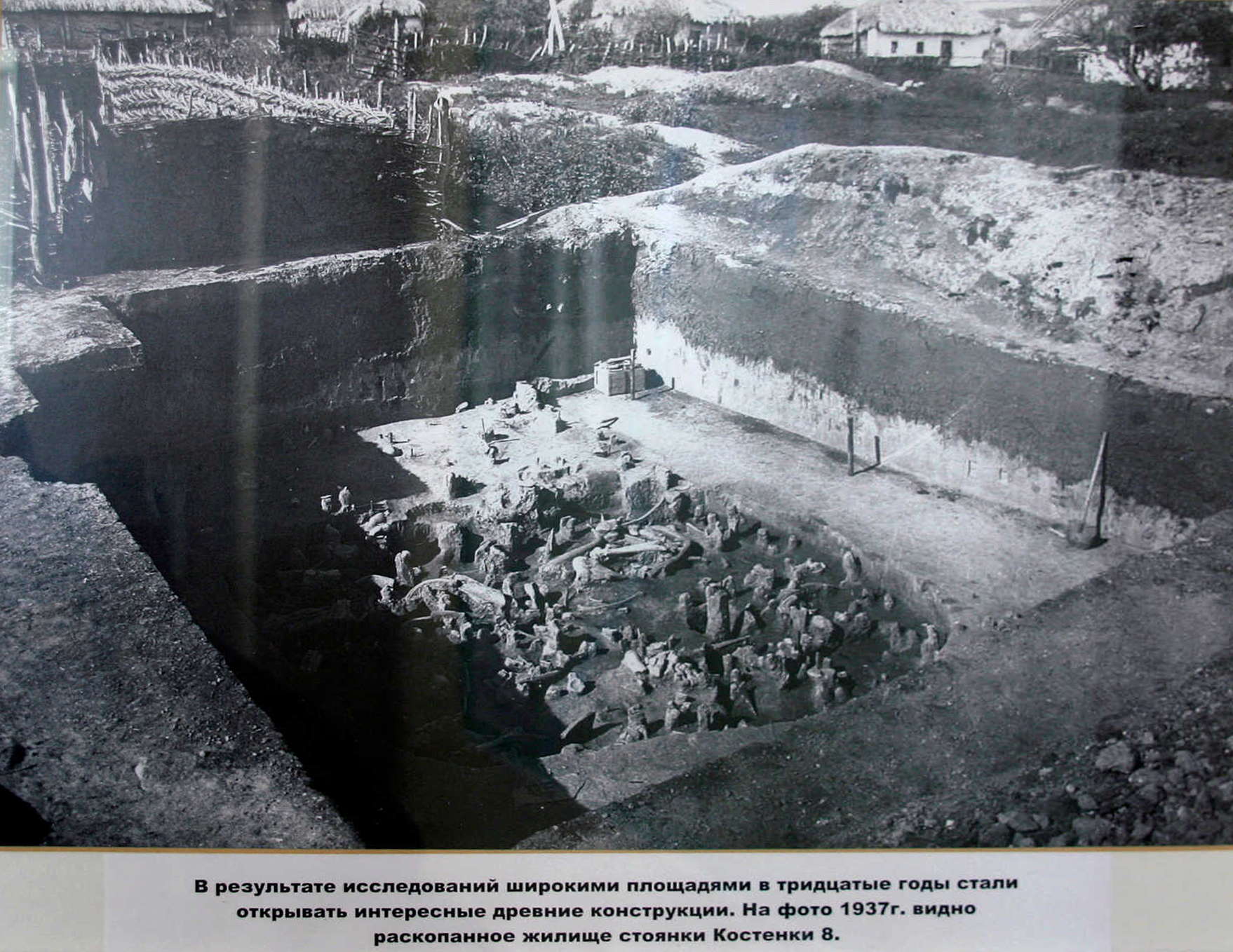
As a result of research in the thirties, interesting ancient structures began to be discovered.
In this photo from 1937, the excavation of the dwelling at the Kostenki 8 archeological site is visible.
In this photograph we can also clearly see the houses close by, and the locally sourced materials used for fencing and housing at that time.
Photo: Vladimir Gorodnjanski 2011
Source: Kostenki Museum
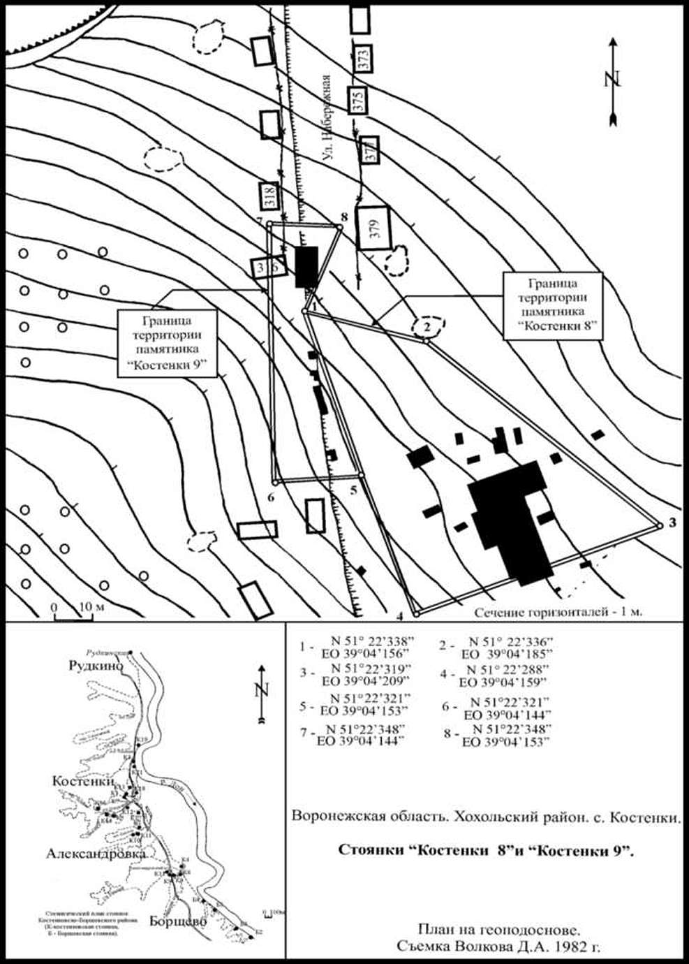
Map of the Kostenki 8 site.
The site was first excavated by AN Rogachev in 1936. The following year, PP Yefimenko and AN Rogachev continued research. In 1949 and 1950 a study was completed of the cultural layer of the upper dwellings and continued to study a large excavation layer II. A study of the monument continued in 1958-1959, 1962-1964, 1976 and 1979. In 2005-2007 the Kostenki Museum in collaboration with KBAE IHMC RAS (head of the expedition Anikovich M.V.) resumed work on the Telmanskoy archaeological site.
Fauna: many mammoth bones, wolf bones lying in front of a cave lion's skull, fox, rabbit, horse, reindeer, bison, hare, voles, rhino, marmots, beaver, birds.
Radiocarbon date: 27 700±750 BP
Photo: http://vantit.ru/antiquities/875-stojanka-8.html
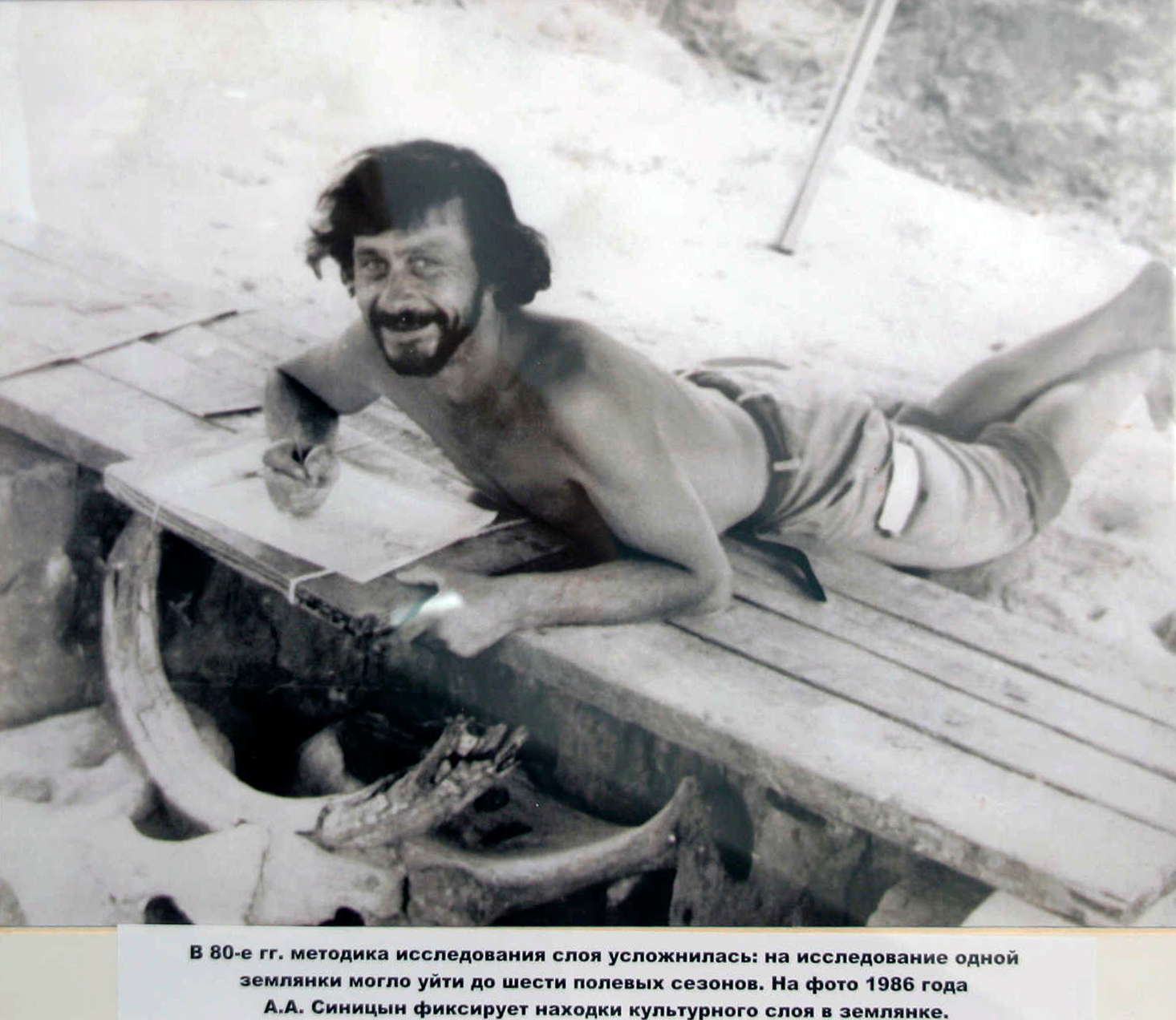
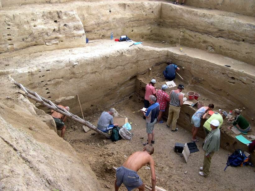
By the 1980s, the method of investigation of the layers became more complicated. The study of one site could take up to six field seasons.
In this photo from 1986 A.A. Sinitsyn records the finds in the cultural layer of the dig.
Photo: Vladimir Gorodnjanski 2011
Source: Kostenki Museum
Old Gravettian, Kostienki 8 (Telmanskaia (II) )
* The lithic industry of the layer Kostienki 8 II is the only industry attributed to the Gravettian in the group using the time line of Kostienki (terminal Upper Paleolithic European old scheme). The 14C date of 27 700 ± 750 is considered the upper limit of the age sets of the group, associated with higher levels of organic matter in the soil (32 000 - 28 000 BP).
* It is the industry of the Telmanskaya II layer which allows us to describe a Gravettian of Mediterranean type which has strong similarities to that of the grotte Paglicci. This resemblance is now confirmed by the layer having a similar age (layer 23A: 28 100 ± 400 BP, layer 22F: 28 300 ± 400 BP).
* The occupancy level of the Telmanskaya II layer is characterised by the remains of five small settlement structures with a central hearth.
* The lithic assemblage comprises nearly 23 000 objects. The technology is characterised by maximum economy of material. Given the very small size of the cores found, it is likely they were used until the end. The technique is largely the knapping of blades. The use of burins seems particularly important here.
* More than 2000 retouched tools comprise 9% of the total number of worked objects. The cluster composition of the lithic industry is characterised by the preponderance of burins (24%) over scrapers (2.5%), by the strong dominance of backed bladelets and points over retouched blades (43%).
* With points very common, there are a number of specific, varied forms. This typological variety of tips, in combination with a high degree of standardisation, reflects the changed nature of the industry or at least a relative importance of the microlithic component. Tools of the sparse group of scrapers, in contrast, are characterised by the lack of standardisation. The denticulate and notched scrapers and borers emphasise the particular composition of the industry.
* The bone industry includes ivory batons and bone awls and polishers. Ornamention is represented by long beads made of the bones of birds and small mammals, decorated with parallel incisions.
* The issue of cultural affiliation of the assembly of the layer II Kostienki 8 remains open due to the total absence in Eastern Europe of similar sites contemporary with the period 27 000 - 28 000 BP.
Photo and text: Sinitsyn (2007)
Kostenki 9
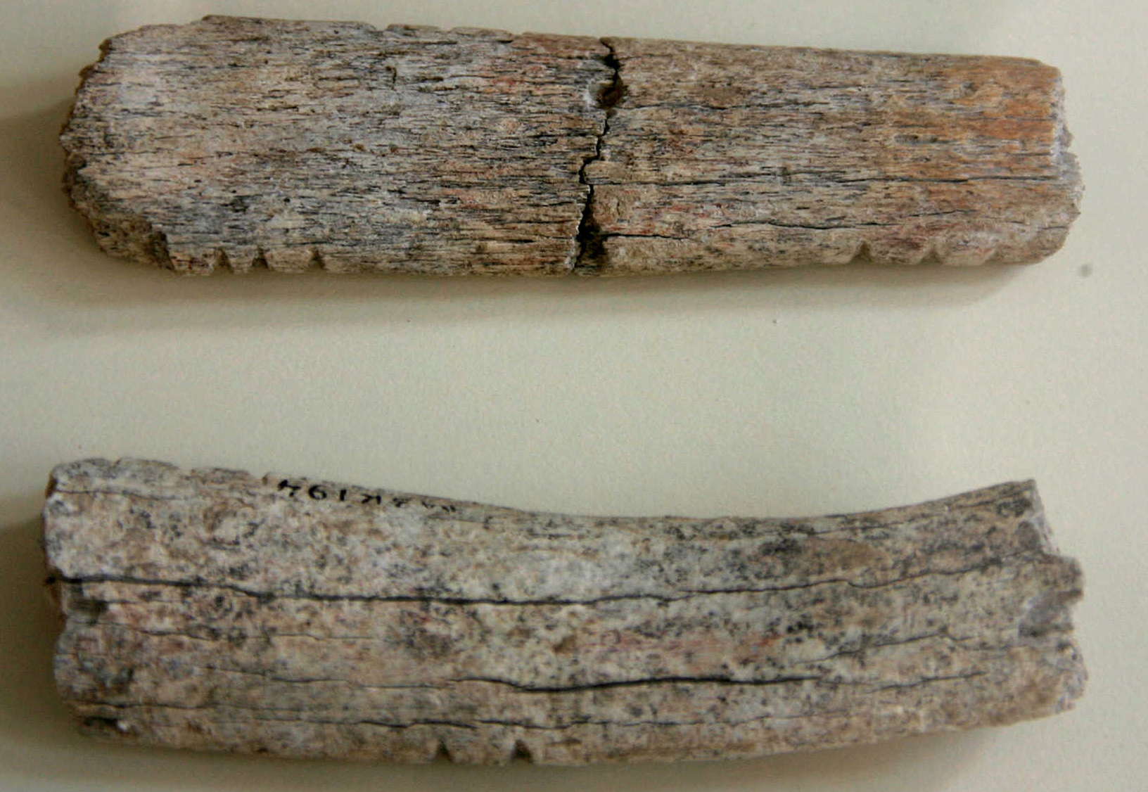
Two pieces of bone with deliberate notches cut in the edges.
Kostenki 9.
Excavations in 2006.
Photo: Vladimir Gorodnjanski 2011
Source: Originals, Kostenki Museum

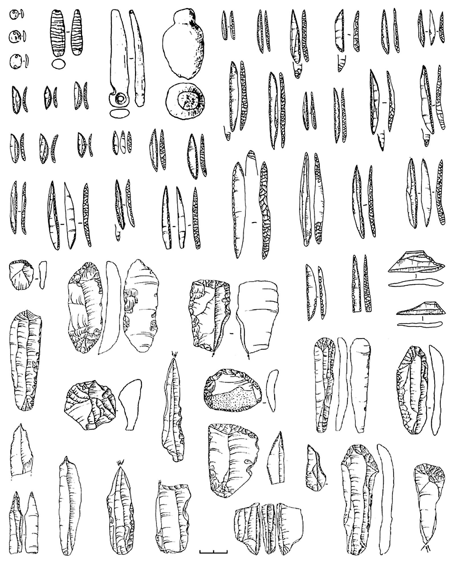
Finely made stone tools.
Kostenki 9.
Excavations in 2006.
Photo: Vladimir Gorodnjanski 2011
Source: Originals, Kostenki Museum
Kostenki 11 - Kostenki XI
Kostenki XI contained not less than five cultural layers. In the upper layer the remains of a round dwelling 9 metres in diameter made from large mammoth bones were discovered. In the lower layers there were interesting findings of triangular flint tips, analogous to those found in the lower layer of Kostenki I.
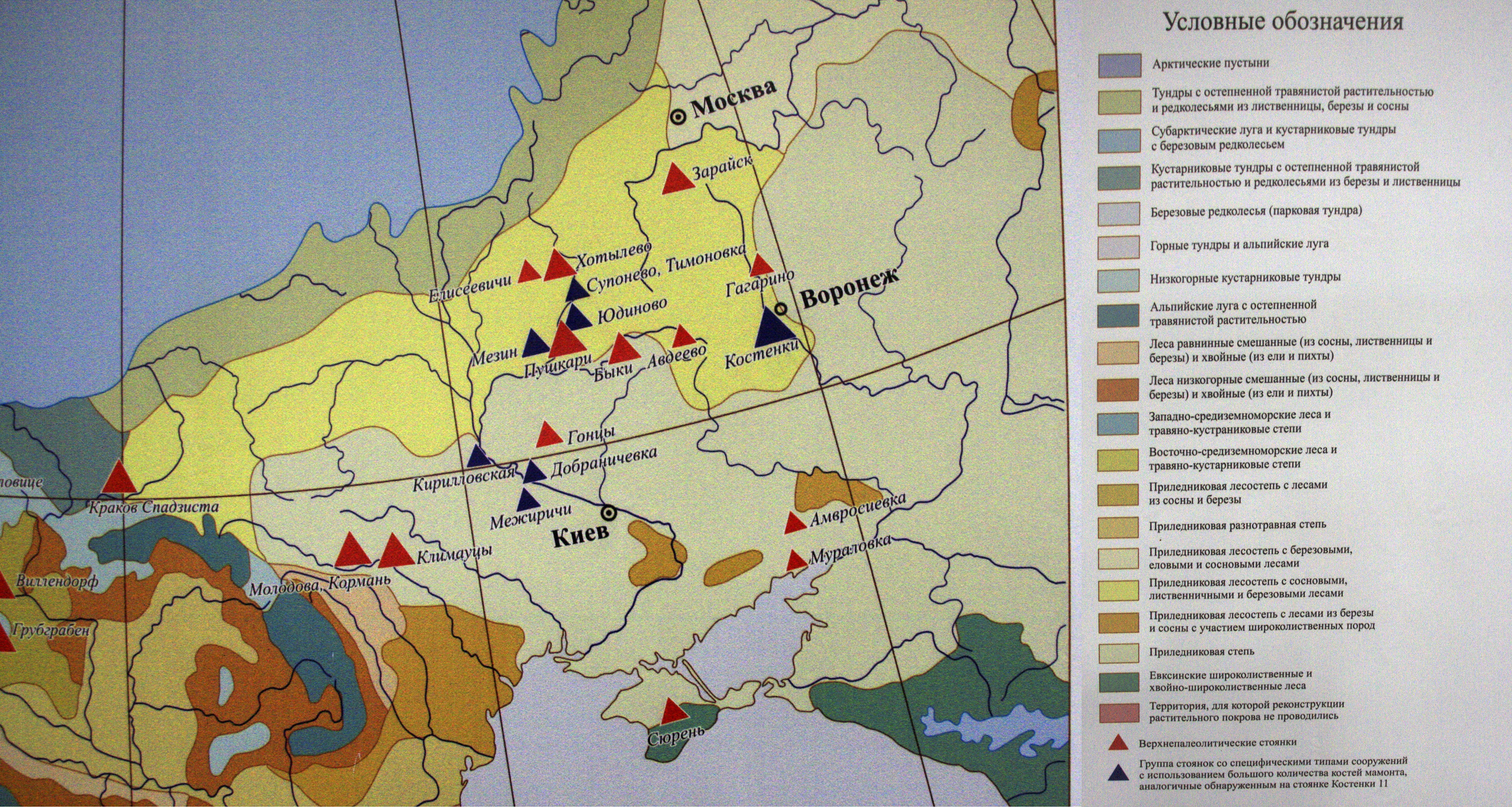
Sites marked with red triangles are Upper Paleolithic sites.
Sites marked with black triangles are sites with specific types of structures with a large number of mammoth bones similar to Kostenki 11
Photo: Vladimir Gorodnjanski 2014
Source: Kostenki Museum
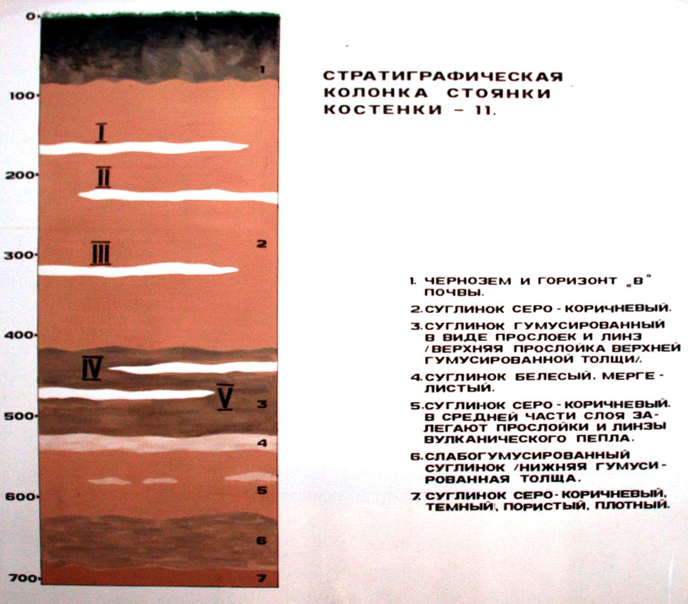
'Soil' profile for Kostenki 11
Source: Boguchar Museum
Photo: Vladimir Gorodnjanski
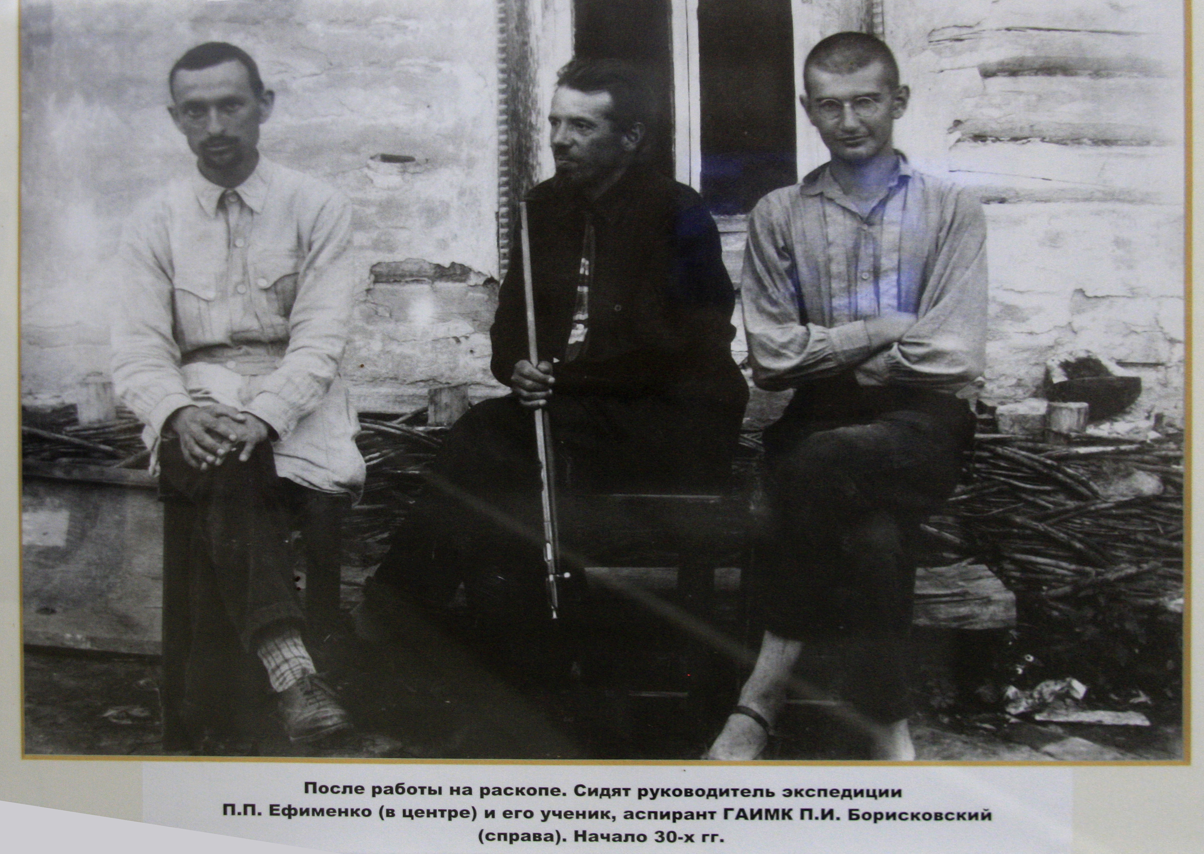
После работы на раскопе. Сидят руководитель экспедиции П.П. Ефименко (В центре) и еГо ученик аспирант ГАИМК П.И. борисковский (справа). Начало 30-х гг
After working on the excavation. Campaign leader PP Yefimenko (centre) and two of his students.
On the right is P.I. Boriskovsky, at the time a graduate student of the Academy of the History of Material Culture (GAIMK). He was a specialist in the archaeology of the Palaeolithic, had gained his Doctorate of Historical Sciences by 1952, and was appointed a professor of the University of Leningrad in 1959.
(this photograph was probably taken not long after the site was first discovered in 1949 - Don )
Photo: Vladimir Gorodnjanski 2014
Source: Kostenki Museum
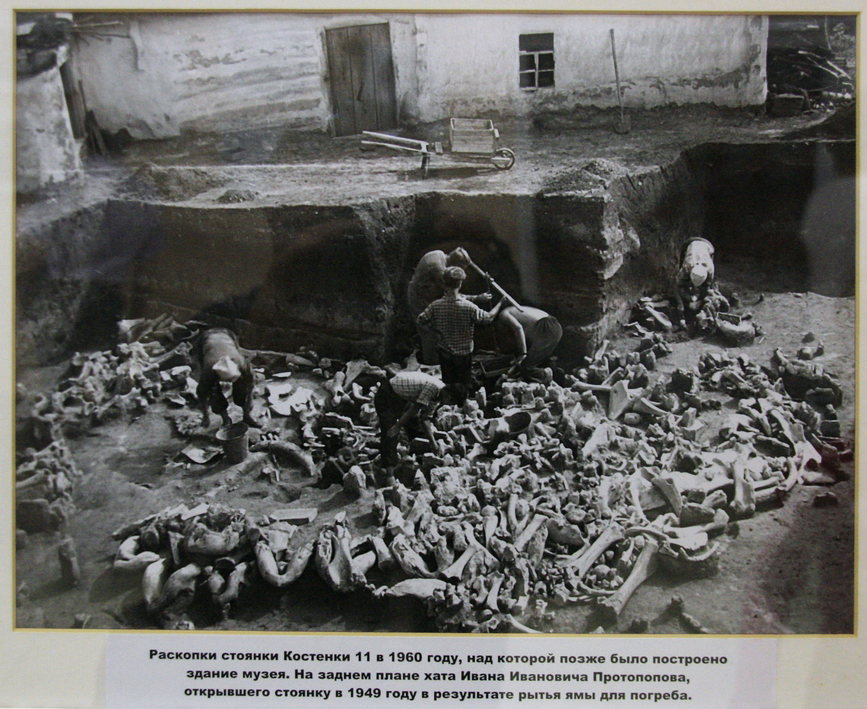
Раскопки стоянки 11 в 1960 году, над которой позже было построено здание музея. на заднем плане хата Ивана Ивановича Протопопова, открывшего стоянку в 1949 году в результате рытья ямы для погреба.
Excavations on the oldest layer at Kostenki 11 in 1960, on the site of which was later built the museum building.
The hut in the background was there when the site was first discovered in 1949 by Ivan Protopopov, as a result of digging a hole for a cellar.
Photo: Vladimir Gorodnjanski 2014
Source: Kostenki Museum

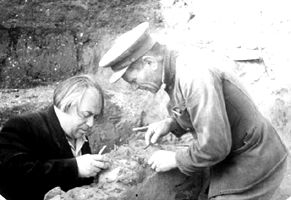
Процесс тщательной и кропотливой расчистки древнего слоя стоянки Костенки 11. На переднем плане Н.д. Праслов за работой. Неизменные орудия археолога: нож, кисть, лоток для земли, которая затем тщательно промывается водой для обнаружения мелких находок.
The process of careful and painstaking excavation of the oldest layer of the Kostenki 11 site.
In the foreground, the important archaeologist N.D. Praslov at work.
The immutable tools of the archaeologist are always at hand: a knife, a brush, and a tray for the earth which is collected, which is then carefully rinsed with water for the detection of small finds.
Photo: Vladimir Gorodnjanski 2014
Source: Kostenki Museum
Text below adapted from the John Hawks Weblog at:
http://johnhawks.net/weblog/reviews/archaeology/upper/vishnyatsky_2004_kostenki.html
Note that Kostenki is not a single "site": instead there are an array of open-air sites within the Kostenki district, all of which are stratified into the terraces of the Don River. Distinct localities are labeled with an Arabic number and the "cultural layer" is given a Roman numeral, e.g., "Kostenki 12/III." These localities comprise a majority of the initial Upper Paleolithic sites on the Russian Plain, and the archaeological and the earliest occupation stages had been dated to between 39 000 and 34 000 years ago.
This photograph shows that the 'pavilion' that was in disrepair at Kostenki 11 is now very much restored, which is wonderful news. This is the original dig at Kostenki 11, kept so that visitors can get a feel for the look of an archaeological dig when a dwelling made of mammoth bones is unearthed.
Photo: Vladimir Gorodnjanski, 2006
It is also very good to see that the pavilion is being used for educational purposes. These students will come away with a better understanding of their culture and heritage.
Photo: Vladimir Gorodnjanski, 2006
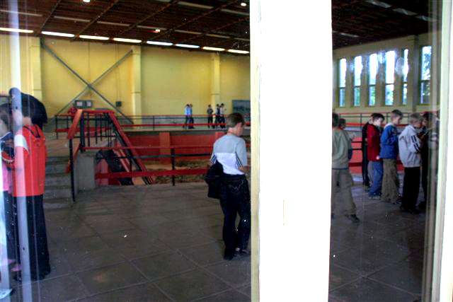
The Museum is beautifully laid out to allow a full appreciation of the Kostenki 11 site.
Photo: Vladimir Gorodnjanski, 2014
It is a huge job to clean and sort through the many thousands of artefacts found in a large and diverse site such as this.
Photo: Vladimir Gorodnjanski, 2014
All the objects have to be identified and marked with their origin for future study. These are just a few of the blades from Kostenki 11.
Photo: Vladimir Gorodnjanski, 2014

Plan of the excavated dwellings of cultural layer 1 A, Kostenki 11.
900 pieces of flint were found just on the one metre square К-40 alone.
Photo: Vladimir Gorodnjanski, 2014
At Kostenki 11, the combination of simple small and circular houses with a diameter close to 6 metres, with an original stone industry and developed art, among which there are small animal figurines, are some of the criteria which make this assembly a particular variety of Gravettian.
The stone tools of this site show:
* a large number of truncated blades, sometimes oblique and concave, forming the tip of an awl with retouched lateral edges;
* a relatively low index of chisels (15%) and rare scrapers (less than 1%);
* tools on tanged blades;
* symmetrical points with a leaf-like profile plano-convex or bi-convex formed by a partial bifacial retouch;
* backed points and blades constituting nearly 50% of the tooling. The special character of this group is the existence of a series of objects similar to Federmesser (Federmesser means 'pen-knife' in German, and the term refers to the distinctive pointy projectile points of the culture. These points are found across lowland northwestern Europe, from France to eastern Germany ) or Azilian points, associated with various points of the Gravettian. The problem of distinguishing Federmesser and Gravettian points was debated in the 1970s. It is important, since this variety of backed points is one of the landmarks of the lithic industry, for Kostienki 11 (II), but also for the lithic assemblies of Kostienki 21 (III).
Photo and text: Sinitsyn (2007), and extra text in italics from: http://archaeology.about.com/od/fterms/g/federmesser.htm
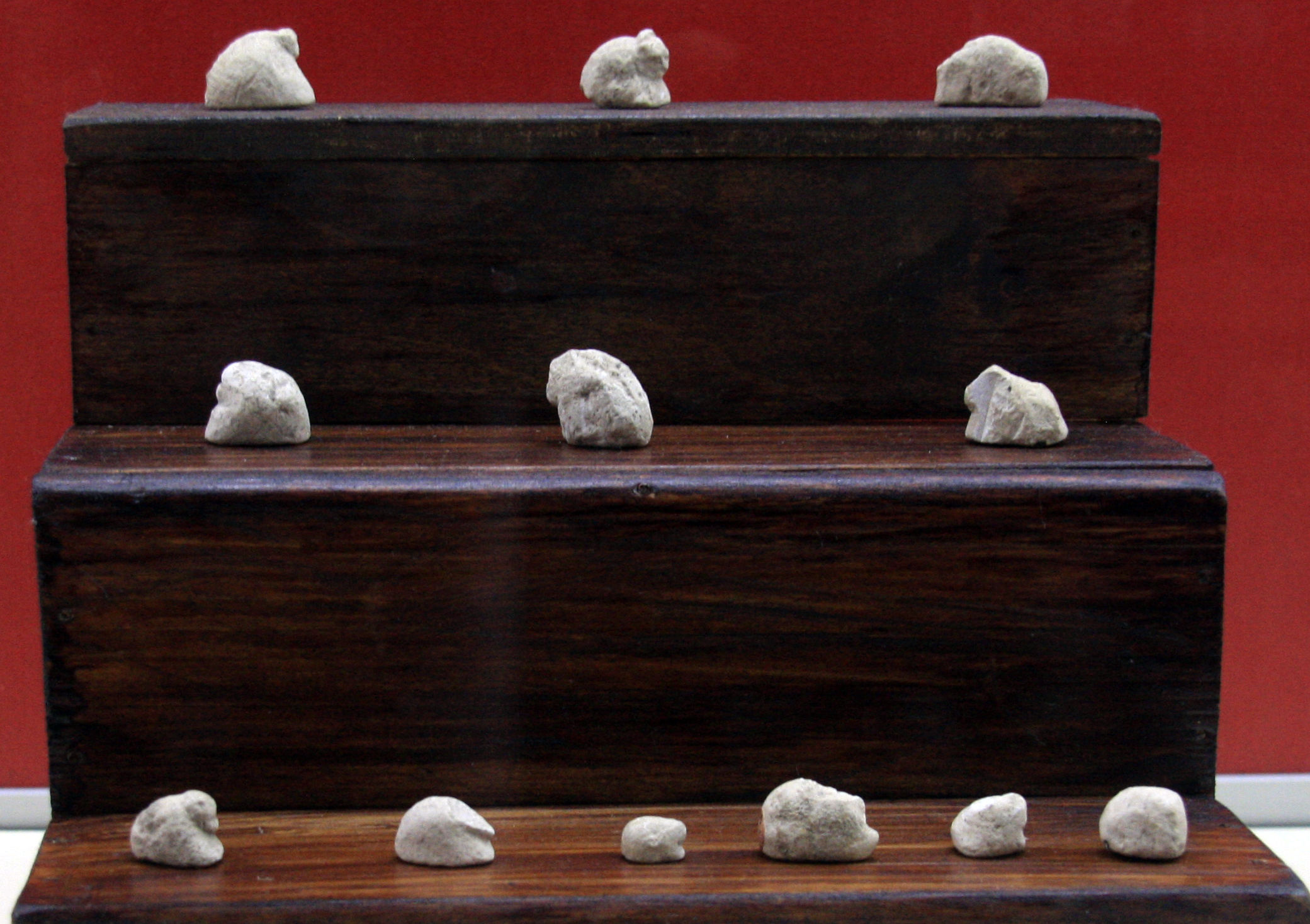
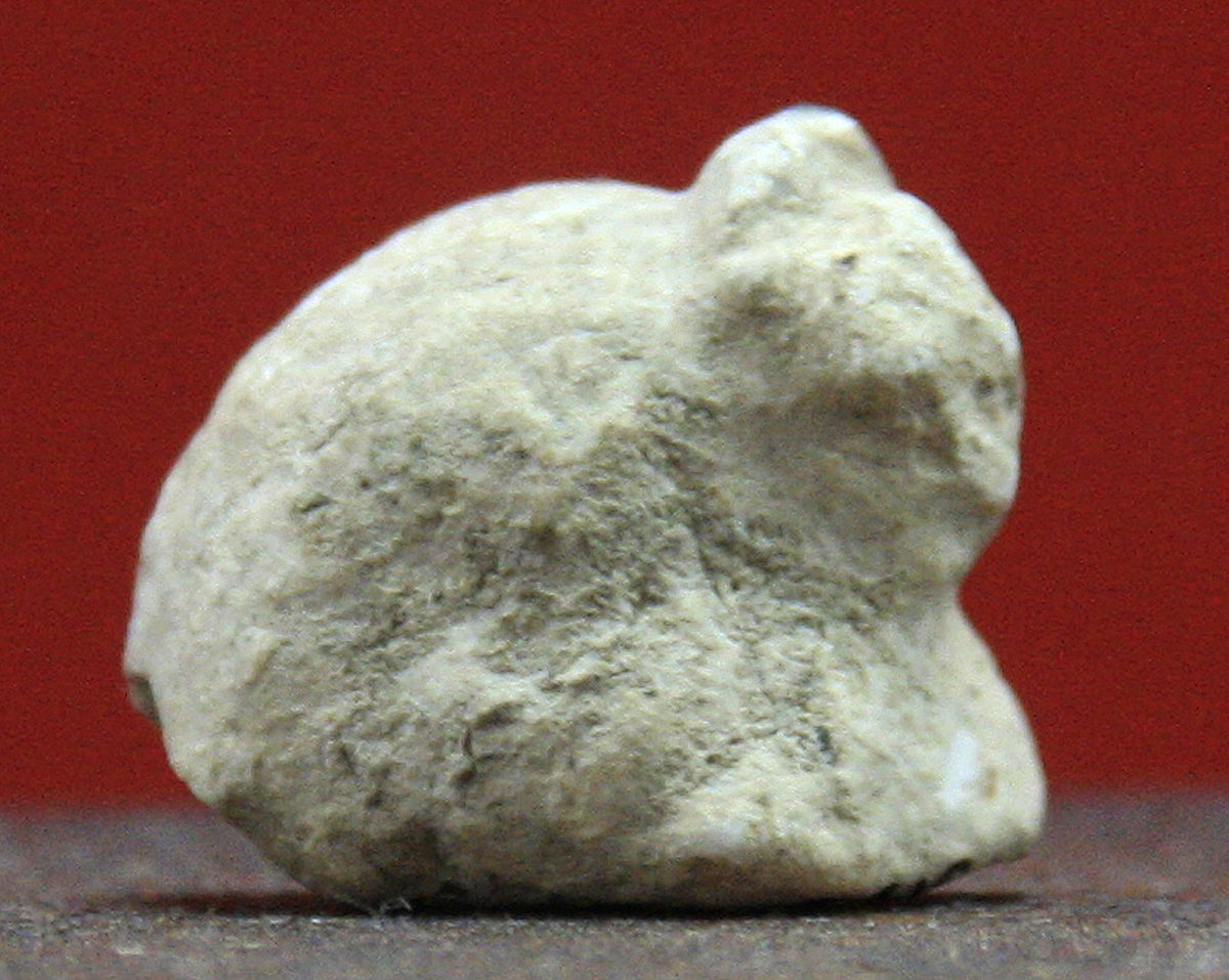
Kostenki 11, 22 000 BP
Animal figurines, cultural layer II
(some of these are the originals of the first two rows of the drawing above - Don )
Photo: Vladimir Gorodnjanski, 2014
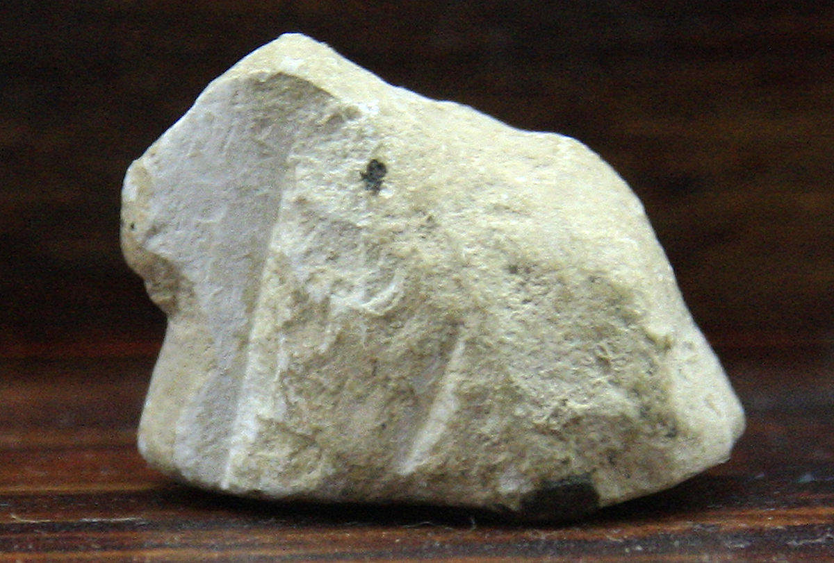
Kostenki 11, 22 000 BP
Animal figurines, cultural layer II
Photo: Vladimir Gorodnjanski, 2014
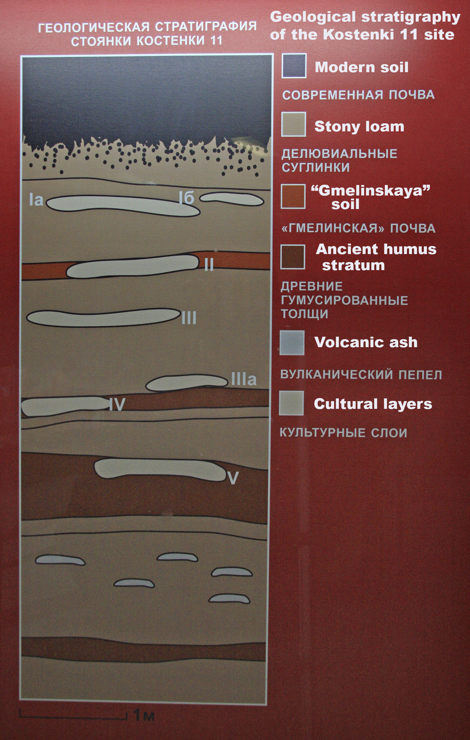
Geological stratigraphy of the Kostenki 11 site.
In order:
Modern soil
Stony loam
"Gmelinskaya" soil
Ancient humus stratum
Volcanic ash
Cultural layers
Photo: Vladimir Gorodnjanski, 2014
English text on photo: Don Hitchcock
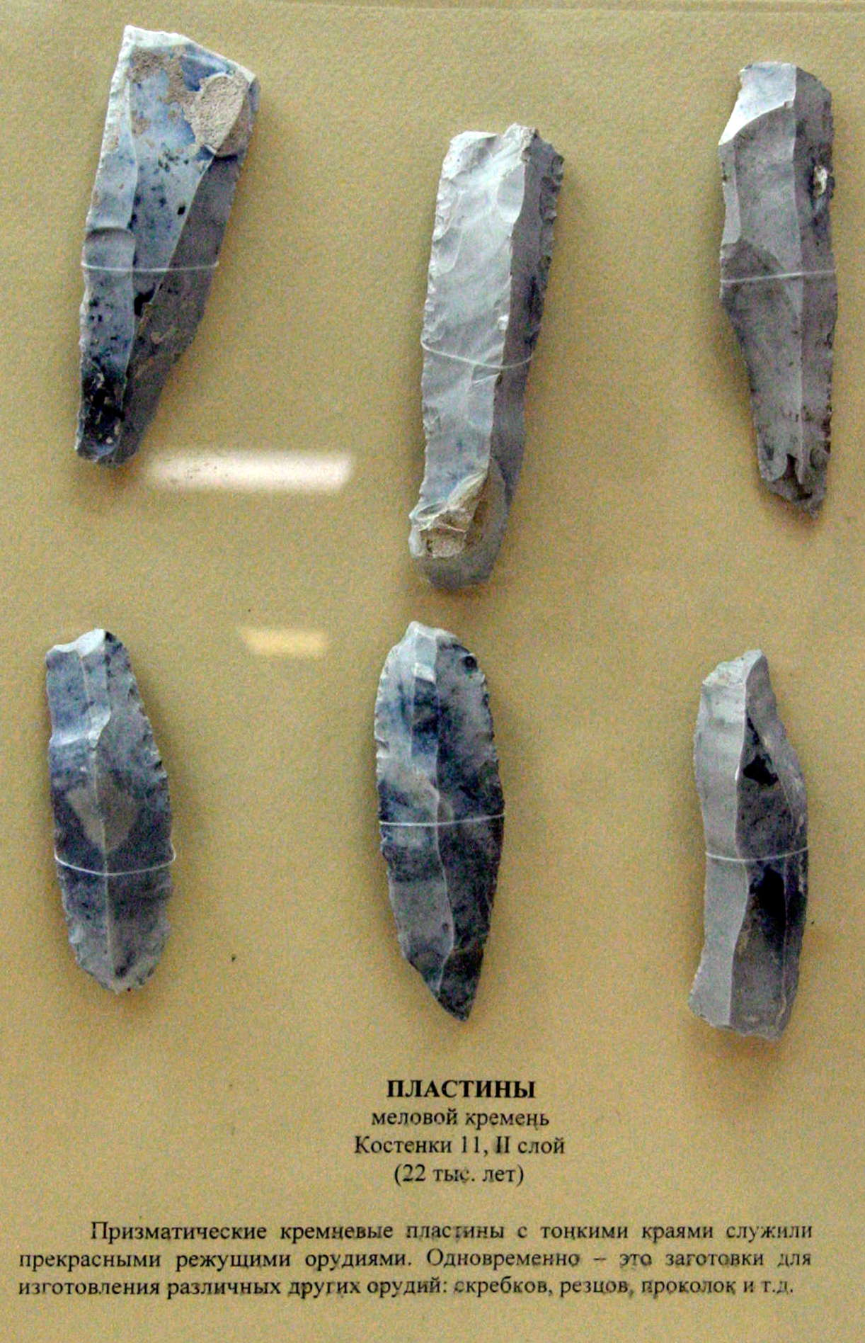
ПЛАСТИНЫ
меловой кремень
Костенки 11, II слой
(22 тыс. лет)
Призматические кремневые пластины с тонкими краями служили прекрасными режущими орудиями. Одновременно - зто заготовки для изготовления различных других орудий: скребков, резцов, проколок и т.д.
Blades
Material: Cretaceous flint
Kostenki 11, layer II
(22 thousand years old)
Prismatic flint blades with thin edges were fine cutting tools. At the same time, they were useful blanks for making various other tools: scrapers, burins, awls, etc.
Photo: Vladimir Gorodnjanski, 2011
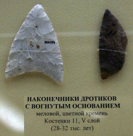
НАКОНЕЧНИКИ ДРОТИКОВ С ВОГНУТЫМ ОСНОВАНИЕМ
меловой, цветной кремень Костенки 11, V слой (28-32 тыс. лет)
Point with concave base
Cretaceous flint, Kostenki 11, layer V, (28 000 - 32 000 BP)
Photo: Vladimir Gorodnjanski, 2014
Kostenki 12

Pokrovskij Ravine
Photo: Vladimir Gorodnjanski, 2014
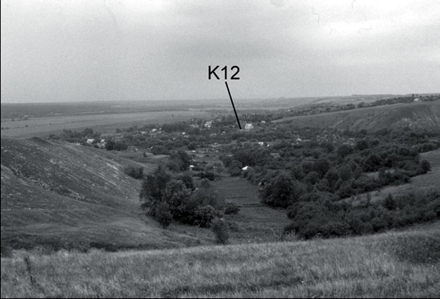
View to the southeast down a side valley of Pokrovskii Ravine, looking across the mouth of the ravine and the village of Kostenki to the second terrace with Kostenki 12. The floodplain of the Don River
is visible in the middle and left distance. Kostenki 1 is just out of view beyond the right side of the side
ravine.
Photo and Text:
Geoarchaeology of the Kostenki– Borshchevo Sites, Don River Valley, Russia.
Vance T. Holliday et al.
Geoarchaeology: An International Journal, Vol. 22, No. 2, 181–228 (2007)
My thanks to Dr Vance Holliday, Professor of Anthropology & Geosciences, University of Arizona, for access to this resource.
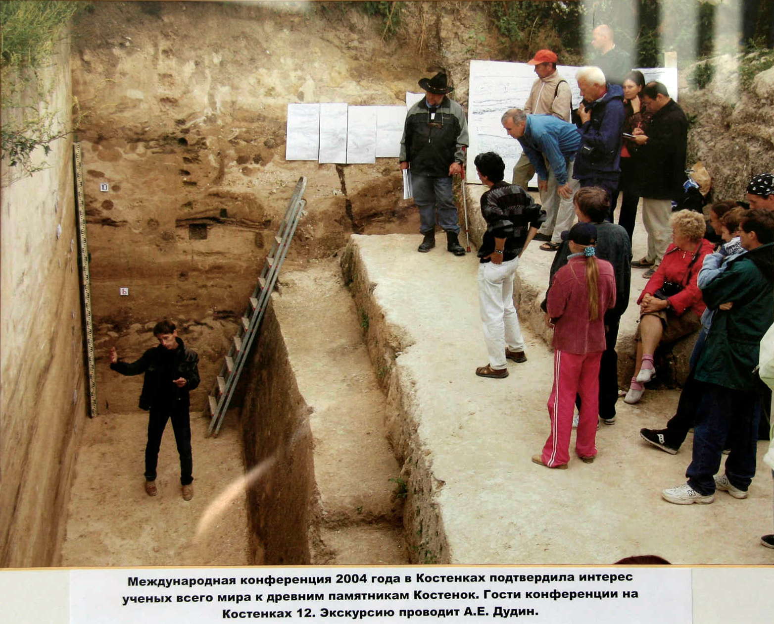
The International Conference of 2004 confirmed the interest in Kostenki.
Scientists from around the world came to these ancient monuments.
Here we see guests at the conference, with an excursion to the dig at Kostenki 12 conducted by A.E. Dudin.
Photo: Vladimir Gorodnjanski 2011
Source: Kostenki Museum
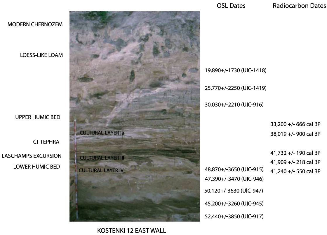
Stratigraphic profile of Kostenki 12 (east wall) showing the position of the humic beds, CI tephra horizon, Laschamps excursion, and Upper Paleolithic cultural layers, as well as OSL dates and calibrated radiocarbon dates on charcoal.
At Kostenki 12, sediment below the level of the
ash horizon yielded optically stimulated luminescence
(OSL) dates of between 52,440 ±
3850 and 45 200 ± 3260 years.
Paleomagnetic measurements show that this
sediment contains the Laschamps excursion,
which has been dated elsewhere to 45 000 to
39 000 years ago (21, 22).

View to the northeast from the uplands immediately west of (and above) Kostenki 12 looking across
the mouth of Pokrovskii Ravine and the village of Kostenki illustrating the setting of Kostenki 1 at the mouth
(and to the left) of a side ravine (see Figure 3). Kostenki 1 is not on the second terrace proper, which is
considerably higher in elevation. Note position of Kostenki 13 on the second terrace for comparison of elevations.
The floodplain and channel of the Don River is visible in the upper-right distance.
Photo and Text:
Geoarchaeology of the Kostenki– Borshchevo Sites, Don River Valley, Russia.
Vance T. Holliday et al.
Geoarchaeology: An International Journal, Vol. 22, No. 2, 181–228 (2007)
My thanks to Dr Vance Holliday, Professor of Anthropology & Geosciences, University of Arizona, for access to this resource.
From Wikipedia:
A geomagnetic excursion, like a geomagnetic reversal, is a significant change in the Earth's magnetic field. Unlike reversals however, an excursion does not change the large scale orientation of the field, but rather represents a dramatic, typically short-lived decrease in field intensity. These events, which typically last a few thousand to a few tens of thousands of years, often involve declines in field strength to between 0-20% of normal.
At least two types of assemblages are found below the CI tephra. At Kostenki 14, the lowermost occupation level (Layer IVb) contains prismatic blade cores, bladelets, end-scrapers, burins, pièces ésquillées, and small bifaces.
Nonstone artifacts include bone points, antler mattocks, worked ivory, and perforated shell ornaments. One carved piece of ivory appears to represent the head of an (unfinished) human figurine. At Kostenki 17, Layer II yielded large prismatic blades, numerous burins, end-scrapers, and some pièces ésquillées. Ornaments of stone were perforated with a hand-operated rotary drill. Nonstone items include bone points and awls and some worked ivory. These assemblages are associated with large numbers of small and medium mammal remains— especially hare (Lepus tanaiticus), arctic fox (Alopex lagopus), and wolf (Canis lupus)—and some bird remains. The bones and teeth of large mammals, including horse (Equus latipes) and reindeer (Rangifer tarandus), are present but less common.
(Note in particular the cultural layers III and IV below the volcanic ash of the CI Tephra - Don)
Photo and text:
Early Upper Paleolithic in Eastern Europe and Implications for the Dispersal of Modern Humans
M. V. Anikovich, et al.
Science 315, 223 (2007)
My thanks to Dr Vance Holliday, Professor of Anthropology & Geosciences, University of Arizona, for access to this resource.
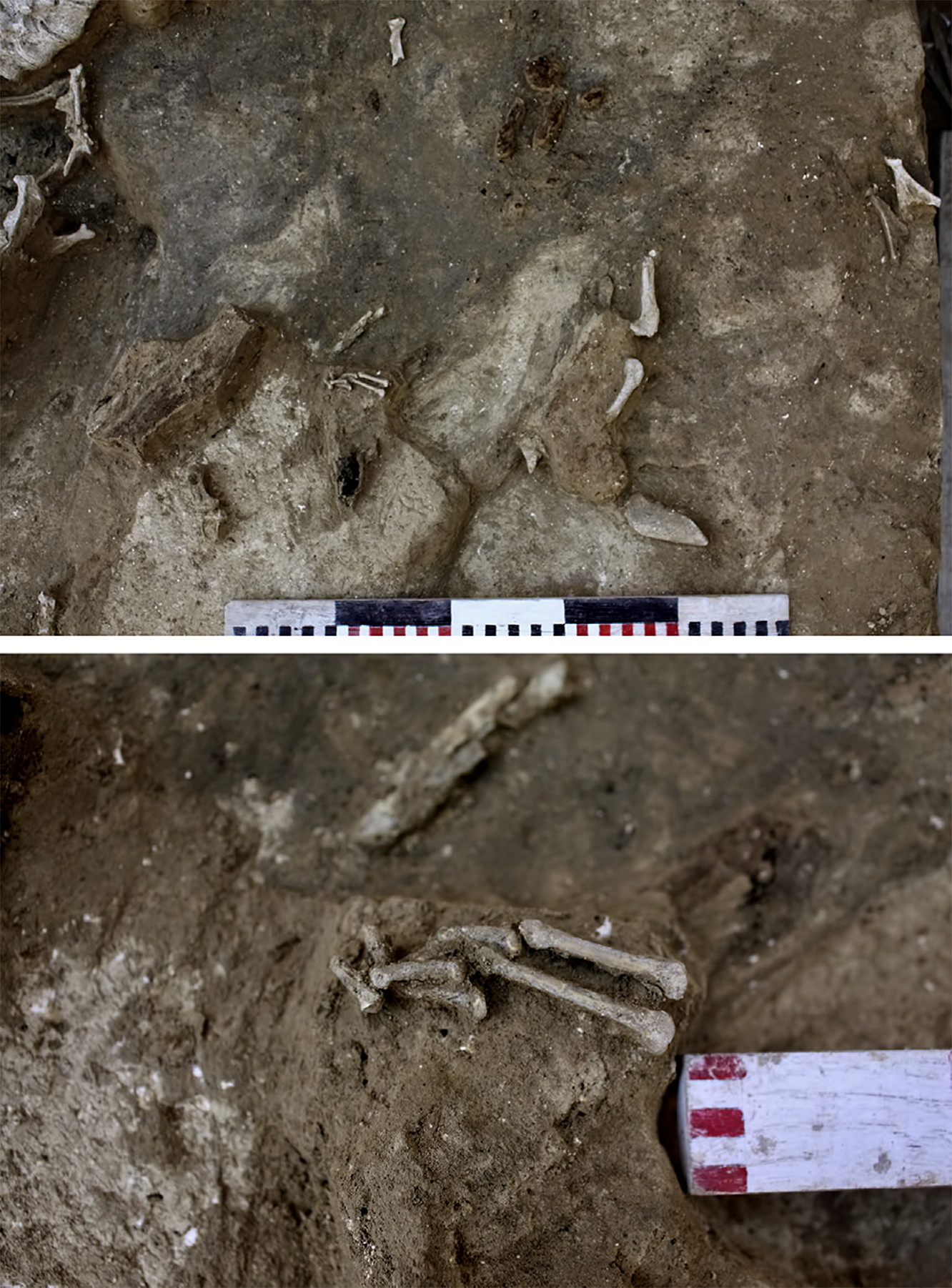
2015 excavation of Kostenki 14/IVw2 (top) and close up of articulated hare
hindlimb bones (bottom).
Photo: A. Sinitsyn
Source: Dinnis et al. (2018)
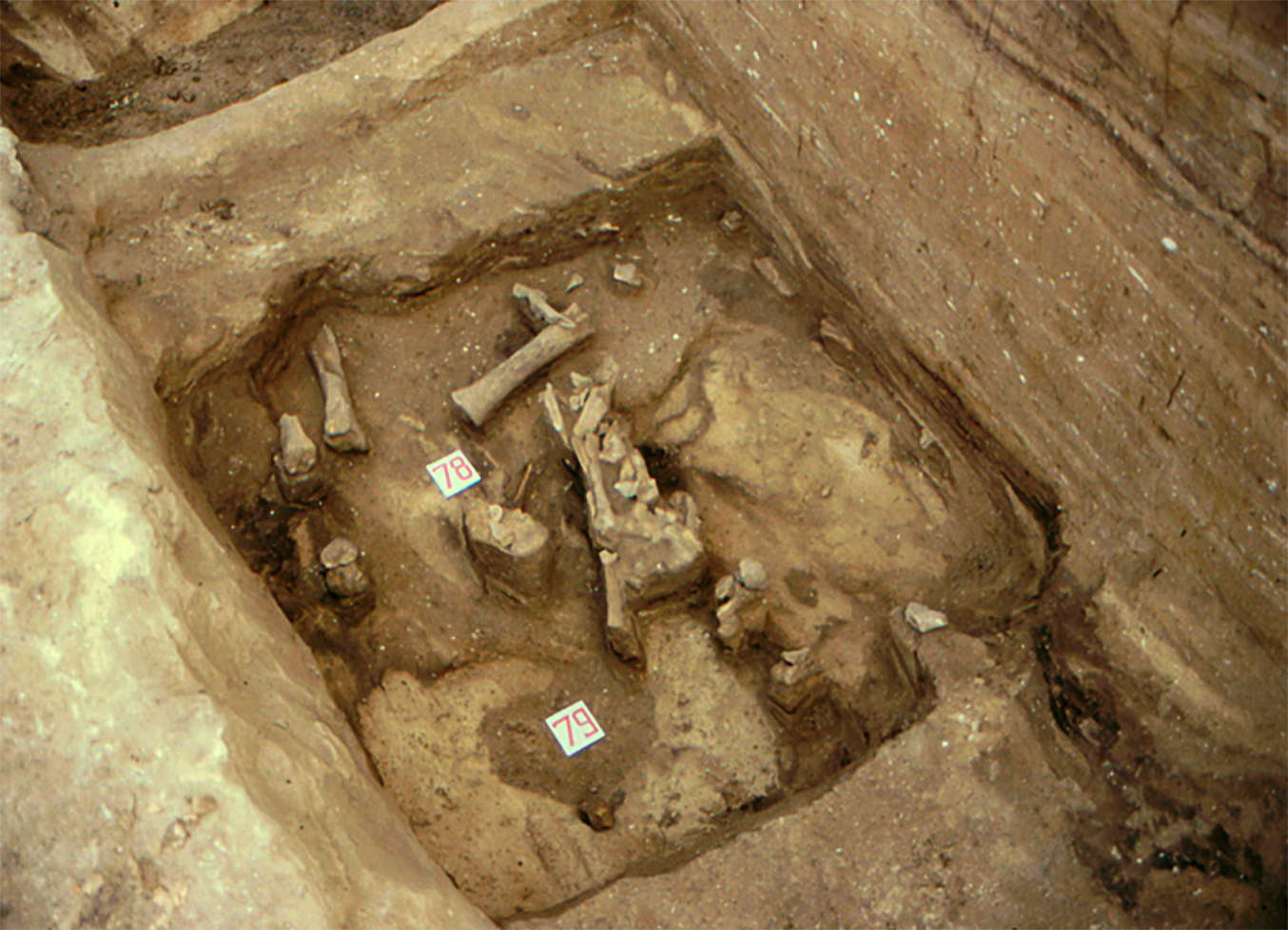
Depositional context of EUP large mammal remains: Lower Humic Bed surface
exposed in Cultural Layer III at Kostenki 12 (K 12-III), showing large mammal bone
fragments in situ.
Photo: John F. Hoffecker, August 2002
Source: Hoffeker et al. (2010)
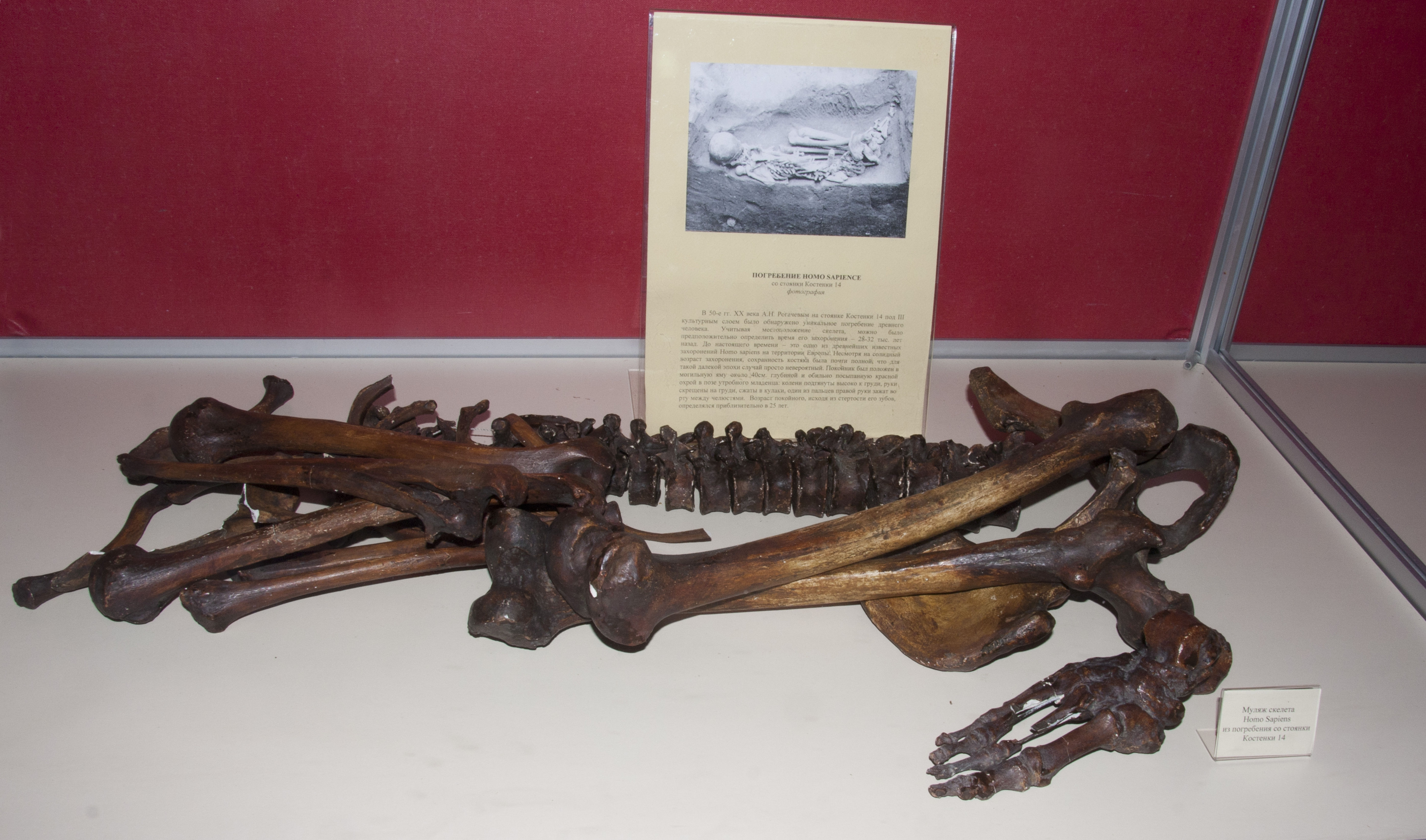
Kostenki 14 - Kostenki XIV - Markina Gora)
Kostenki XIV (Markina Mountain, Markina Gora), contained four cultural layers. In the third was found the ochred burial of a man with some negroid features.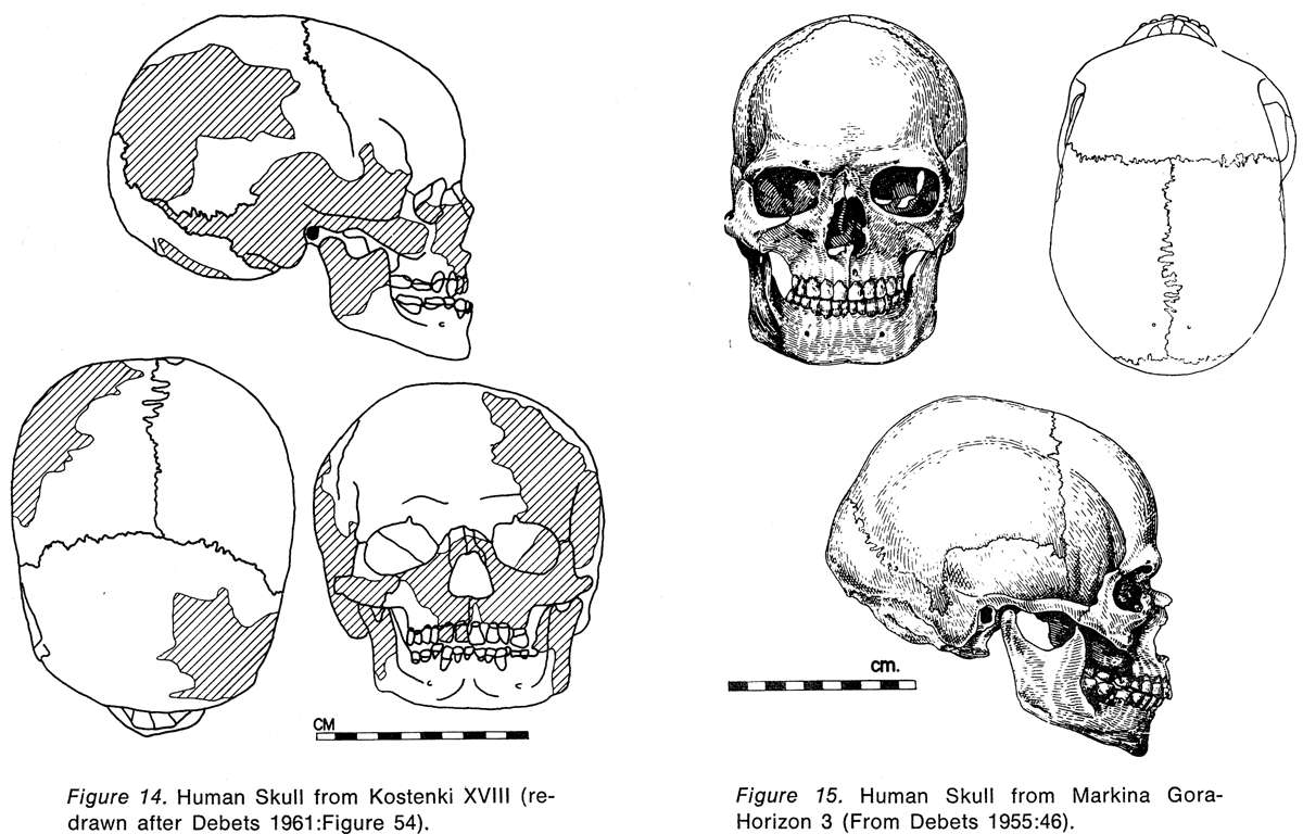
Figure 14: Human skull from Kostenki XVIII
Figure 15: Human skull from Markina Gora, Horizon 3.
Photo: Klein, "Man and Culture in the Late Pleistocene", 1969
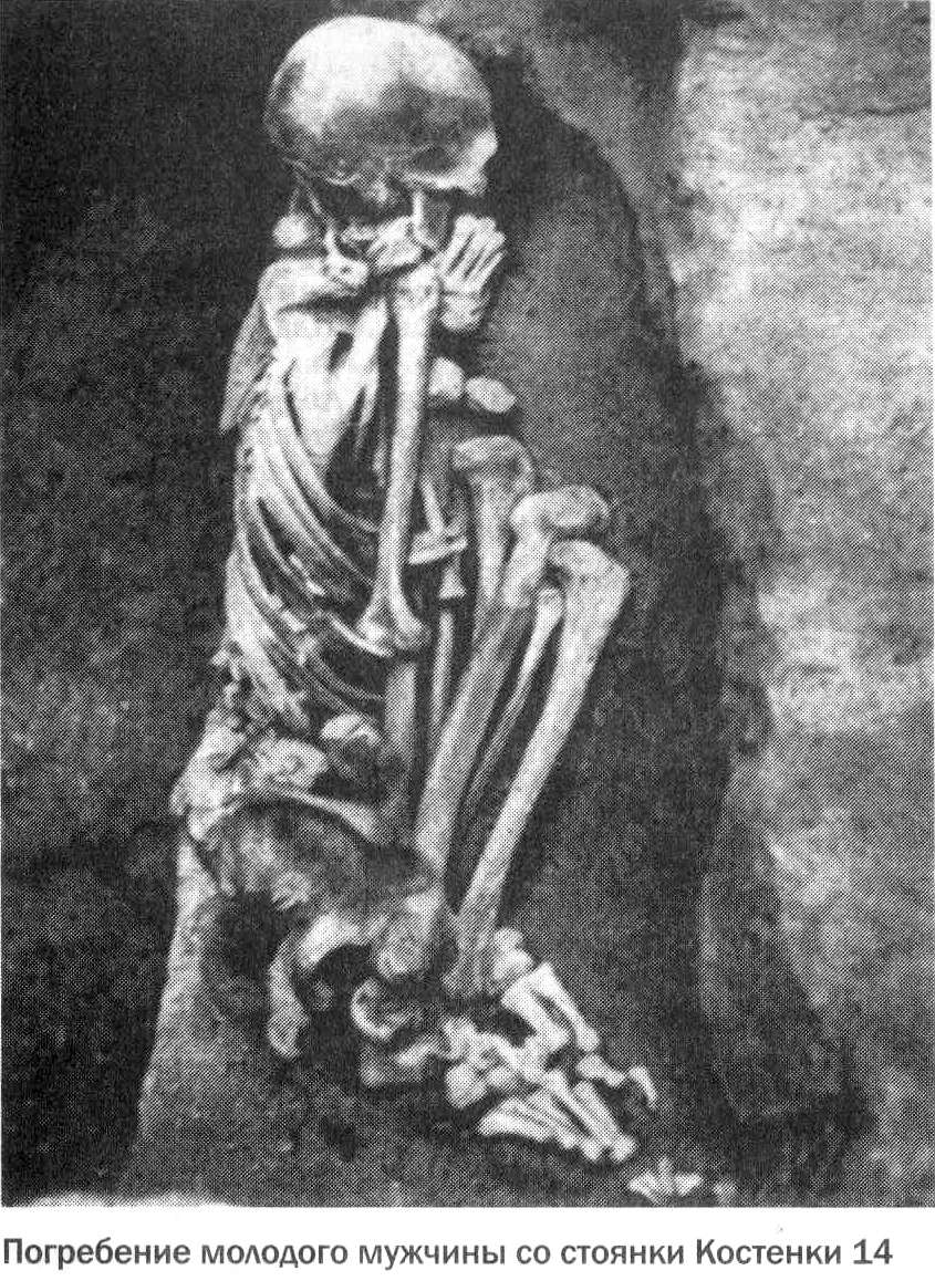
Skeleton from Kostenki 14
Photo: The Stone Age in Ostrogozhsk area.
My thanks to Vladimir Gorodnjanski for access to this resource.
Skeleton from Kostenki 14
Photo: Vladimir Gorodnjanski
Source: Facsimile, display, Kostenki Museum
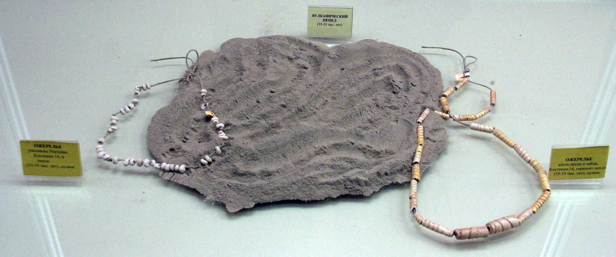
(Left) Necklace made of Neritidae, snail shells. Kostenki 14, 33 - 35 thousand years old.
(Right) Necklace made of Arctic fox bones. Kostenki 14, 33 - 35 thousand years old.
вулканический пепел
The necklaces were found in volcanic ash, 33 - 35 thousand years old.
Photo: Vladimir Gorodnjanski, 2011
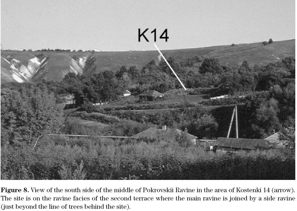
View of the south side of the middle of Pokrovskii Ravine in the area of Kostenki 14 (arrow).
Photo:
Geoarchaeology of the Kostenki– Borshchevo Sites, Don River Valley, Russia.
Vance T. Holliday et al.
Geoarchaeology: An International Journal, Vol. 22, No. 2, 181–228 (2007)
My thanks to Dr Vance Holliday, Professor of Anthropology & Geosciences, University of Arizona, for access to this resource.
Map of the Kostenki 14 site.
Fauna include bison, mammoth, horse, rabbit, deer, rhinoceros, reindeer, mammoths, wolves, steppe lemming, steppe pika, voles, cave lion.
Photo: http://vantit.ru/antiquities/876-stojanka-14.html
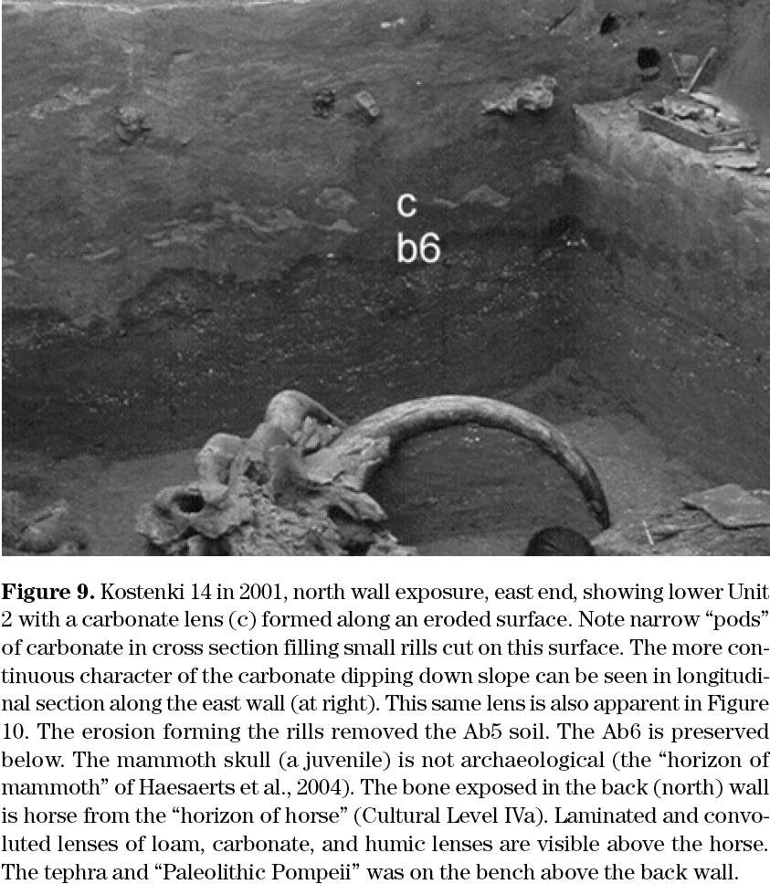
Kostenki 14 in 2001, north wall exposure, east end, showing lower Unit 2.
Photo:
Geoarchaeology of the Kostenki– Borshchevo Sites, Don River Valley, Russia.
Vance T. Holliday et al.
Geoarchaeology: An International Journal, Vol. 22, No. 2, 181–228 (2007)
My thanks to Dr Vance Holliday, Professor of Anthropology & Geosciences, University of Arizona, for access to this resource.

Human skull with alleged Negroid features from Kostenki 14 (Markina Gora).
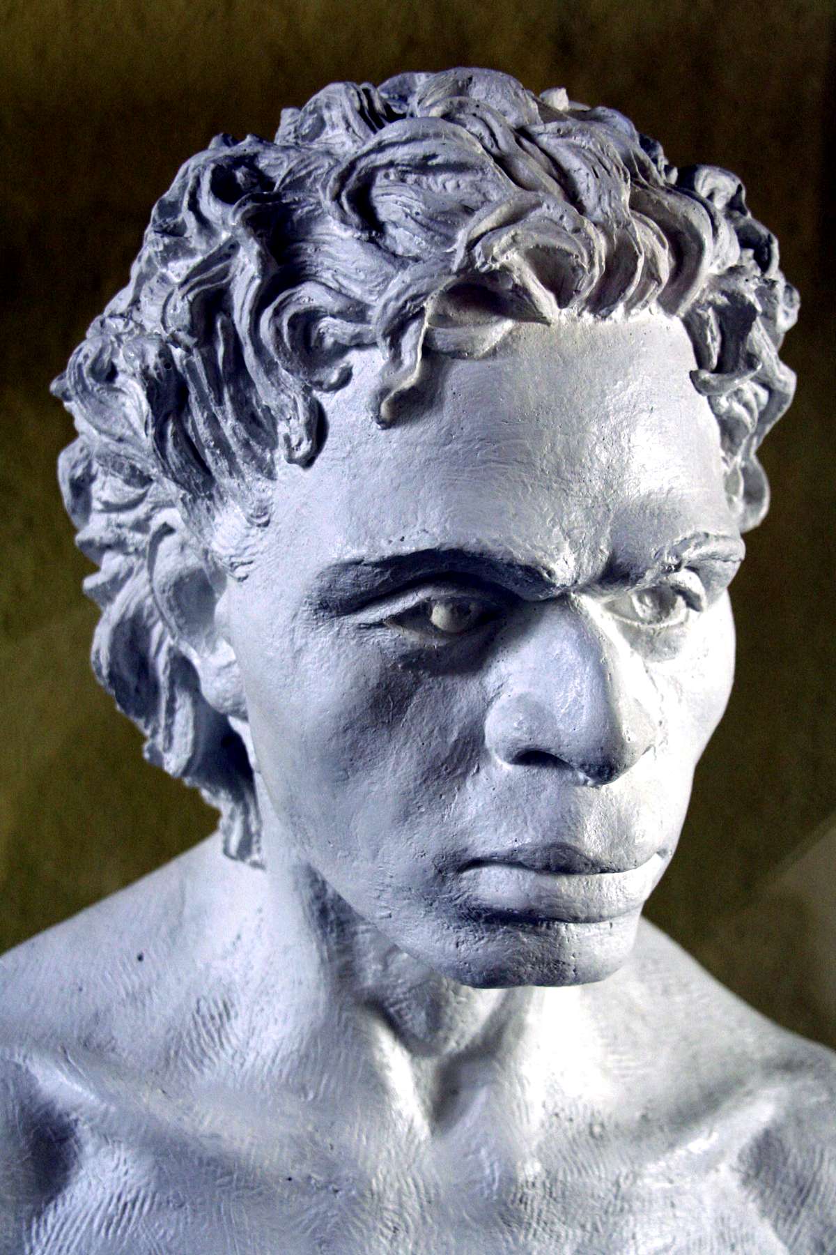
Kostenki 14 (Markina Gora) at the approximate level of the discovery of the human (at horizon III) whose bust has been created by Professor M.M.Gerasimov, shown right. This is the skull with alleged Negroid or east african features.
- There was only one find at this horizon, a male aged 20 - 25 years.
- Skull and postcranial skeleton both well preserved.
- All permanent teeth in place and slightly worn. Third molars less worn than others.
- All cranial sutures open.
- Length of right femur 427 mm.
- Height of individual estimated to have been 160 cm.
Photos: (left) http://www.trinitas.ru/rus/doc/0211/008a/02111056.htm
(right) Vladimir Gorodnjanski
Text: Richard G. Klein, Man and Culture in the Late Pleistocene.
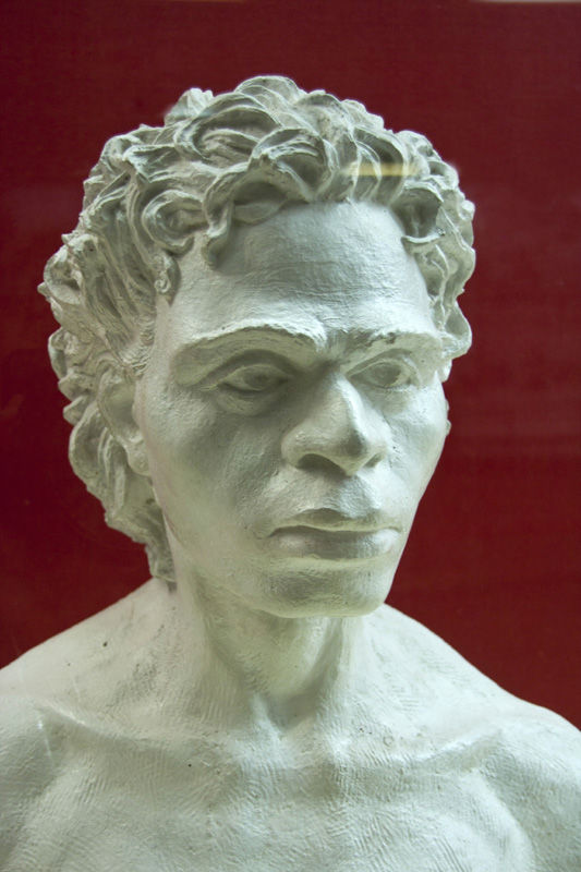

Kostenki 14 human reconstruction by Professor M.M.Gerasimov
Photo: Vladimir Gorodnjanski
Source: Facsimile, display, Kostenki Museum
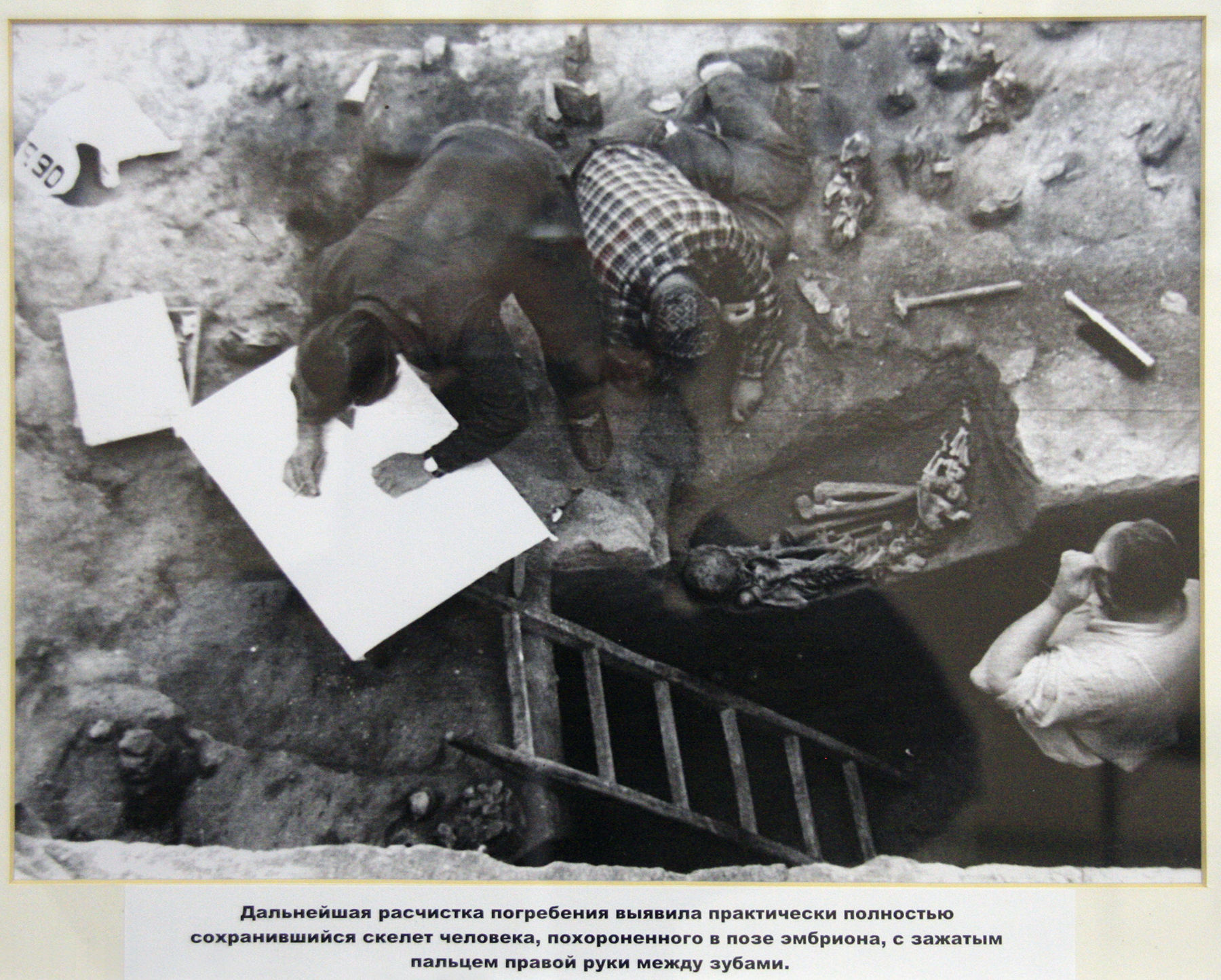
Дальнейшая расчистка погребения выявила практически полностью.
сохранившийся скелет человека похороненного в позе эмбриона с зажатым пальцем руки между зубами.
Further cleaning of the burial revealed the almost completely preserved skeleton of a man buried in the fetal position with a thumb clamped between his teeth.
Photo: Vladimir Gorodnjanski 2014
Source: Kostenki Museum
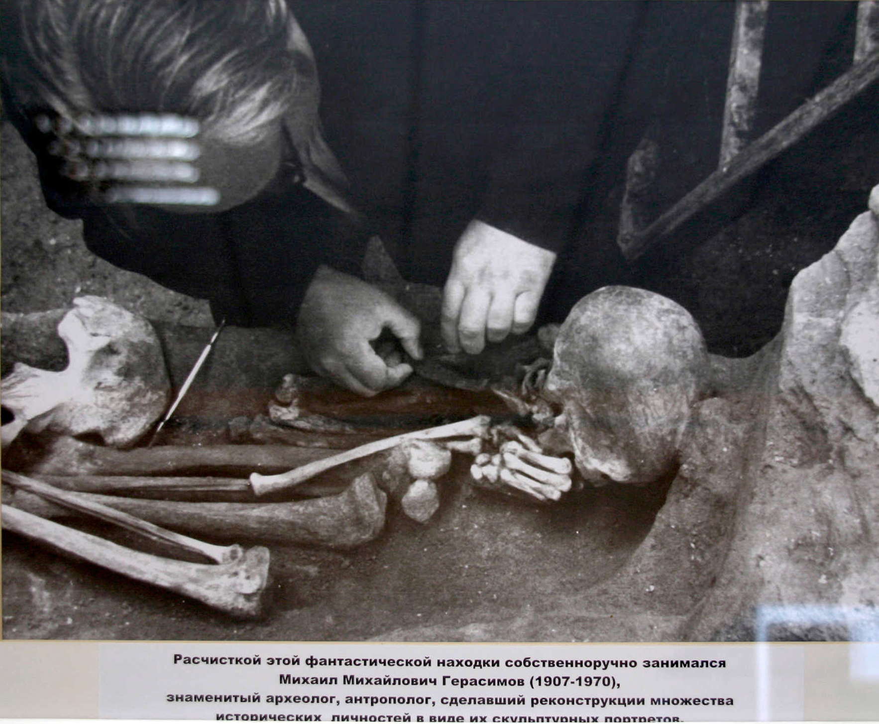
Расчисткой этой фантастической находки собственноручно занимался
Михаил Михайлович Герасимов (1907-1970),
знаменитый археолог, антрополог, сделавший реконструкции множества
исторических личностей в виде их скульптурных портрето.
Mikhail Gerasimov (1907-1970) was always personally involved in cleaning up his fantastic finds.
He was a famous archaeologist as well as an anthropologist, who reconstructed his discoveries in the form of sculptural portraits.
Photo: Vladimir Gorodnjanski 2011
Source: Kostenki Museum
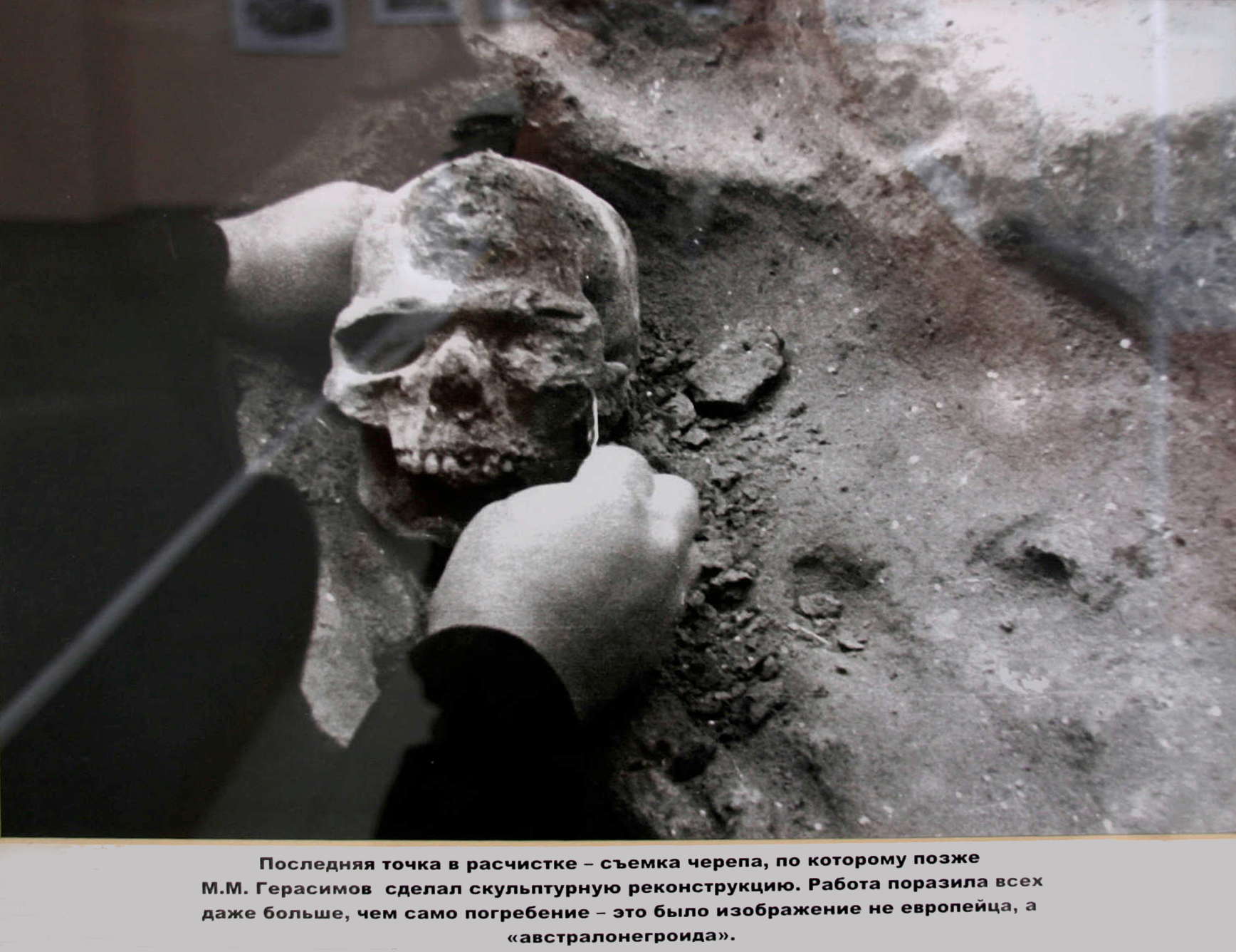
Последняя точка в расчистке - съемка черепа, по которому позже
М.М. Герасимов сделал скульптурную реконструкцию. Работа поразила всех
даже больше, чем само погребение — это было изображение не европейца, а
«австралонегроида».
The last stage of cleaning - then the skull was photographed, from which MM Gerasimov later made a sculptural reconstruction. The work surprised everyone even more than the actual burial - it was not a European, but a southern Negroid.
Photo: Vladimir Gorodnjanski 2011
Source: Kostenki Museum
 Недалеко от строящегося музея в 1970 году А.Н. Рогачевым было обнаружено
и частично вскрыто еще одно древнее жилище, очень похожее на первое,
сохраненное в музее.
Not far from the museum being constructed in 1970, AN Rogachev discovered and partially uncovered another ancient dwelling, very similar to the one preserved at the museum.
Photo: Vladimir Gorodnjanski 2011
Source: Kostenki Museum
Text and photos below from: http://www.kunstkamera.ru/en/temporary_exhibitions/virtual/gerasimov/09/
Early Upper Paleolithic Man from Markina Gora (Kostenki XIV)
M.M. Gerasimov with A.N. Rogachev (head of expedition) at Kostenki XIV (Markina Gora).
An excellently preserved skeleton of a male aged 20-25 was discovered by A.N. Rogachev in 1954 in a shallow oval grave at the Upper Paleolithic site of Markina Gora (Kostenki XIV) on the Don, Voronezh Region. The estimated age of the burial is 32 thousand years.
M.M. Gerasimov taking the human skull out of the grave at Kostenki XIV (Markina Gora).
Judging by a strongly flexed position of the skeleton and by traces of red paint on the bones, the body had been tightly wrapped or tied up and strewn with ocher. No burial goods were present, but the associated cultural layer contained Early Upper Paleolithic (Aurignacian) tools – blades, scrapers, burins, etc. – as well as animal bones (mainly those of wild horses).
M.M. Gerasimov with his colleagues in archeology during the excavations at Kostenki XIV (Markina Gora) in the 1950s.
The Markina Gora skeleton was examined by G.F. Debetz, who estimated the individual’s age at 20-25. The man was rather low-statured (about 160 cm). The morphology of his skeleton is generally quite modern. Certain cranial features, including very narrow braincase, low and narrow face, marked prognathism (anterior protrusion of the midface), and very wide nose, are typical of tropical populations. The trait combination links the cranium with those of Papuans and Melanesians.
Certain other Upper Paleolithic crania from Europe, too, display “tropical” features. Bodily proportions of Early Upper Paleolithic people reveal southern characteristics as well. This also concerns the arm proportions of the Markina Gora individual, whose forearm was relatively long compared to the shoulder.
The meaning of those facts is yet unclear. Modern geographic human groups (so called “races”) had not completely formed by the Upper Paleolithic, and some of their characteristics may have incidentally appeared in various parts of the world. On the other hand, tropical features may indicate that anatomically modern humans had migrated to Europe from the south, specifically from Africa. Genetic data favor such possibility.
The situation is further complicated by the fact that the supposedly Upper Paleolithic age of the burial has not been proven by absolute (radiocarbon) dating methods. The burial may actually be rather recent and unrelated to the enclosing cultural layer. If so, the appearance of the Markina Gora individual is even more difficult to explain.
M.M. Gerasimov, like G.F. Debetz, believed that people of such appearance or their direct ancestors had actually migrated to Europe in the early Upper Paleolithic from areas lying far south. Therefore he endowed the reconstructed individual with tropical characteristics including curly hair. The future will hopefully show whether or not this “artistic liberty” of the scientist and sculptor was warranted.
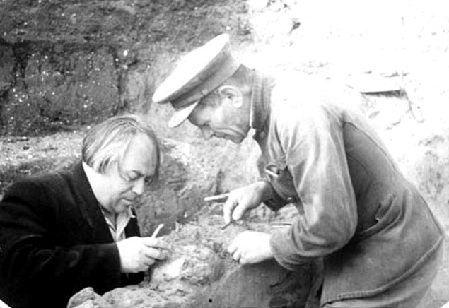


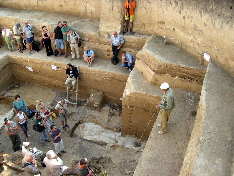

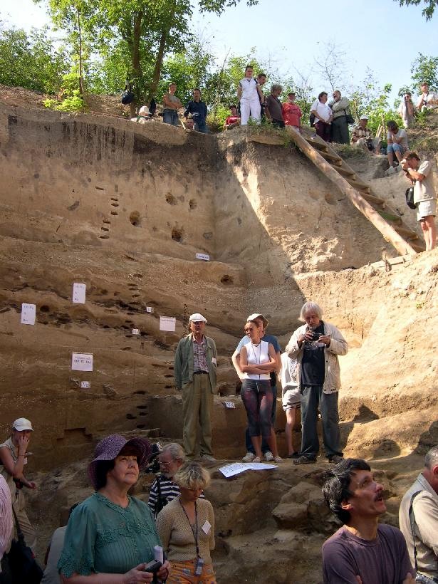
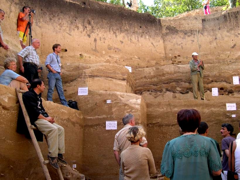
Well known archaeologist Andrey Alekseevich Velichko gives a lecture on the actual site of Kostenki 14.
The holes in the walls of the excavation have been made to take samples for analysis.
Photos: http://www.trinitas.ru/rus/doc/0211/008a/02111056.htm
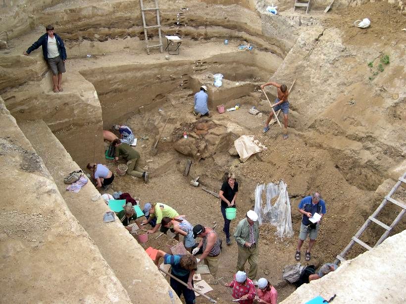
There is a lot of hard work, with little result, when working on an archaeological site. But there is a lot of good feeling generated by being with others in such a situation.
Kostenki 14
Photo: http://www.trinitas.ru/rus/doc/0211/008a/02111056.htm

Photo from the dig at Kostenki 14, 2004.
Photo: http://www.trinitas.ru/rus/doc/0211/008a/02111056.htm
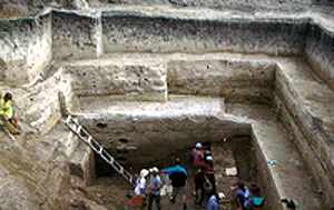
Excavations at Kostenki 14 in 2003 (looking at the north wall of the excavations and stratigraphic profile).
The archaeological site of Kostenki is a actually a stratified series of sites deeply buried within the alluvial deposits of a steep ravine that empties into the Don River in central Russia. The Kostenki site has been known for quite a while (it is best known for the recovery of Venus figurines from its Gravettian levels), and its uniqueness has not gone unnoticed.
The occupations at Kostenki include several Late Early Upper Paleolithic levels, dated ca 40 000 to 30 000 calibrated years ago. Below these levels is a layer of volcanic ash, associated with the volcanic eruptions of the Phlegrean Fields of Italy (aka Campanian Ignimbrite), which are thought to have erupted between about 38 000 and 40 000 years ago. Within and below the ash level (called the CI Tephra) is what archaeologists are calling "Aurignacian Dufour," containing numerous small bladelets and related to similar sites in western Europe.
Typically, the Aurignacian is the oldest component associated with modern humans at archaeological sites in Europe, underlain by Mousterian-like deposits representing Neanderthals. At Kostenki, a previously unidentified assemblage, exhibiting a sophisticated tool kit of prismatic blades, burins, bone antler, and ivory artifacts, and small perforated shell ornaments underlies the CI Tephra and Aurignacian Dufour assemblage. That the location includes
the use of traps to catch small mammals such as hares, reinforces the view that stone age humans used technology and innovation to expand into new areas.
Photo and text: http://archaeology.about.com/od/earlymansites/a/kostenki.htm
Science © 2007
Humans or Neanderthals?
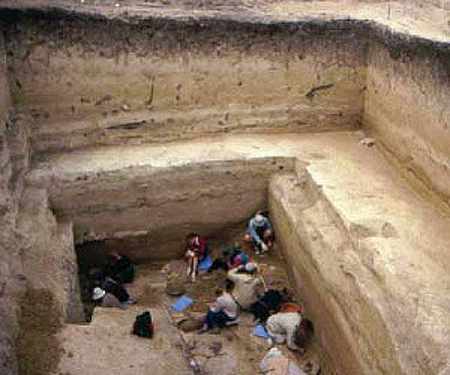
Kostenki 14 excavations in 2002.
No skeletal remains have been found to date in these levels at Kostenki, except for isolated teeth, which appear to be modern human. Modern humans are identified as the occupants of these levels primarily on the basis of the artifacts, which include forms completely unknown in neandertal sites.
At the moment, the assemblages in the lowest levels at Kostenki do not have a parallel - they are generically Upper Paleolithic but without close analogue - and researchers are convinced that Kostenki does in fact represent one of the earliest outposts by early modern humans outside of Africa.
Text above from: http://archaeology.about.com/od/earlymansites/a/kostenki.htm
Photo: http://elementy.ru/news/430435
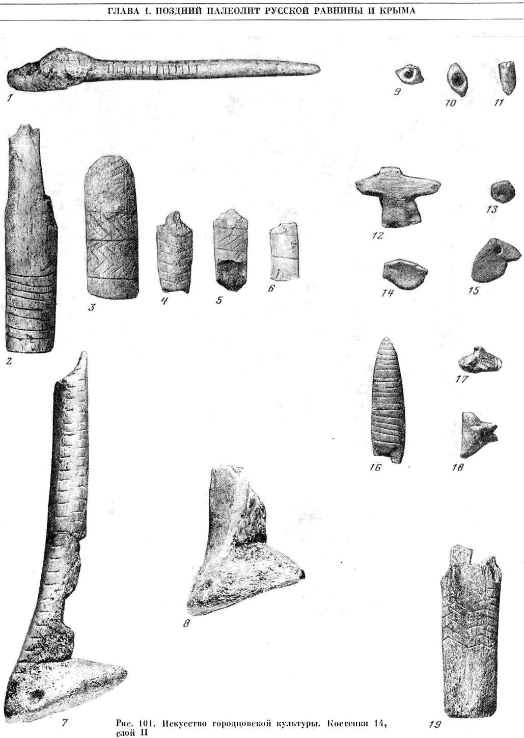
Art of the Gorocovskaya cultures
Artefacts recovered from Kostenki 14 level II. They consist of what look like bone or mammoth ivory zoomorphic forms, hoes, spades, handles and possibly a digging stick.
Photo: "The Upper Paleolithic of the Russian plain and the Crimean Peninsula"
My thanks to Vladimir Gorodnjanski for access to this resource.
Kostenki 15 - Kostenki XV- Gordocovskaja site
At Kostenki XV (Gordocovskaja site) the ochred burial of a child of about six years was found. With this burial were flint and bone tools, and over 150 drilled teeth of the Arctic Fox.
Kostenki 15: Plan of excavated units (upper) and generalised stratigraphic profile (lower), adapted fromRogachev (1957)
Kostenki 15 (also known as Gorodtsovskaya) is located on the second terrace level near the mouth of Aleksandrovka Ravine. It represents a rare example of a single-component Early Upper Palaeolithic (EUP) locality that was not discovered by excavating below a younger Upper Paleolithic horizon. The site was found in 1951 during construction of a small reservoir and excavated by Rogachev during the following year; much of the site apparently was destroyed by spring flooding prior to excavation. A total of 70 m2 was exposed in 1952 and it appears that little of the site now remains.
Two radiocarbon dates on bone yielded calibrated estimates of c. 30 000 cal BP. A large quantity of horse bones comprising the vast majority of bones was excavated from Kostenki 15. Many were concentrated in and near a shallow 'bowl-shaped' depression measuring 70 cm in diameter and up to 20 cm below the level of the occupation layer. A total of 1501 bones and teeth excavated in 1952 were assigned to the broad-toed horse (Equus latipes). Other taxa included bison, hare (Lepus tanaiticus), wolf (Canis lupus), arctic fox (Alopex lagopus), mammoth (M. primigenius), and red deer (C. elaphus).
Source: Hoffeker et al. (2010)
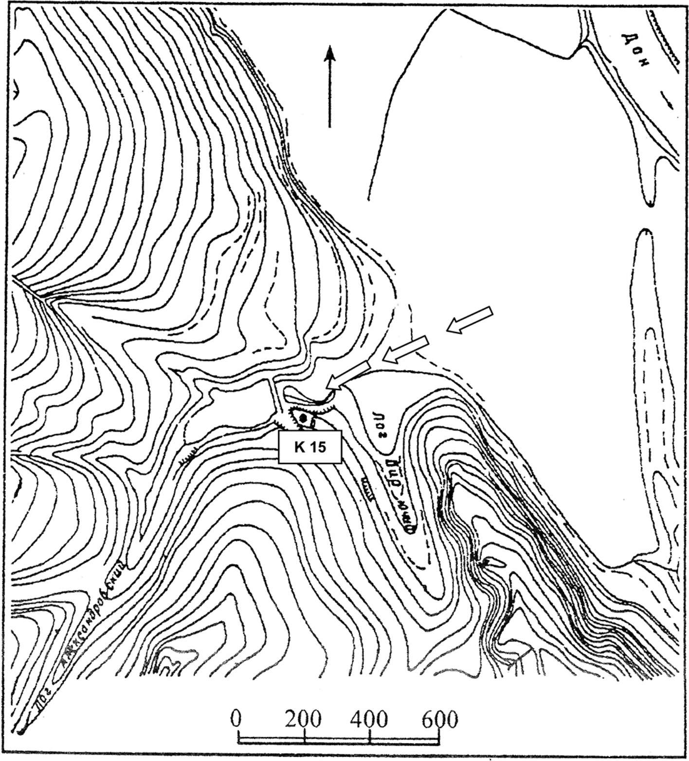
Topography of Aleksandrovka Ravine and setting of K 15. Arrows illustrate hypothesised route of horses driven up into the ravine from the main valley.
At Kostenki, groups of horses could have been driven up into the ravine systems from the main valley of the Don River (see Fig.11), or alternatively, driven down off the steep slope of the eastern margin of the Central Russian Upland. In either case, some form of corral or artificial barrier may have been necessary to channel the horses into the area where they were killed.
Source: Hoffeker et al. (2010)
Kostenki 17 - Kostenki XVII
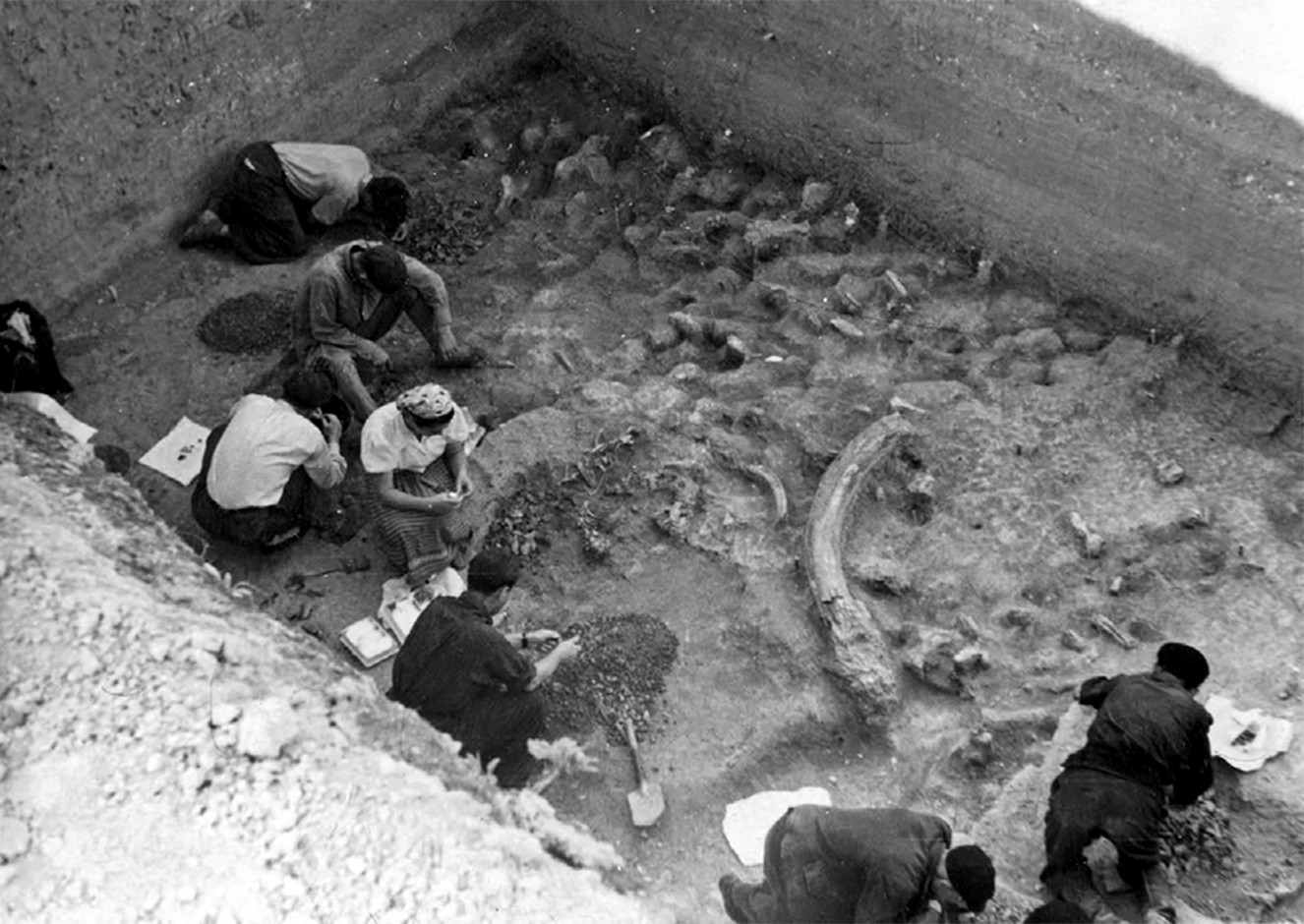
Excavation of Kostenki 17/I in 1953.
Photo: Institute for the History of Material
Culture, Russian Academy of Sciences (IIMK RAN), archive reference О.1958e67
Proximal Source: Dinnis et al. (2018)
The main excavations at Kostenki 17 were undertaken by P.I. Boriskovskii in 1953 and 1955. Boriskovskii discovered two archaeological layers: the stratigraphically higher Layer I, positioned in the UHB; and the underlying and archaeologically richer Layer II, found in the top of the LHB, ~6 m below the modern-day surface.Text above: Dinnis et al. (2018)
Layer II was stratigraphically separated from Layer I by ~3 m of archaeologically sterile deposits. Within these sterile deposits, roughly halfway between Layers I and II, was a layer containing lenses of volcanic ash. Boriskovskii excavated Layer II over an area of 60 m2. Small areas of the archaeological layer or contemporary deposits have been excavated since then, most recently in 2017e2018 by one of us. However, Boriskovskii's collection still constitutes ~90% of the archaeological material excavated from this layer.
Finds in Layer II were generally limited to a gently sloping 20-30 cm thick horizon. Boriskovskii and Velichko both considered the layer's contents to be mostly in situ, and subject to only minor downslope redeposition. The layer's lithic assemblage appeared unrolled and unweathered, and contained very small chips as well as larger pieces. In some places the layer was stained with red ochre, and concentrations of charcoal and ash in the NE and SW corners were interpreted as remnants of two hearths >1 m in diameter, around which lay concentrations of archaeological material.
In the central part of the trench were horse vertebrae and limb bones in anatomical position. Boriskovskii recovered a large lithic assemblage of ~10 000 pieces, as well as a modest osseous tool assemblage of two awls made from arctic fox (or hare) ulnae and several fragmentary bone/ivory objects. The abundance of archaeological material within a relatively small excavated area led Boriskovskii to interpret the layer as evidence for a long-term settlement.
Given the assemblage's size it may well represent a palimpsest of multiple phases of activity. Boriskovskii also found pendants made from fossil shells, carved stone and belemnites, along with a group of 37 fox canines perforated by rotary biconical drilling. The faunal assemblage comprised wolf, mammoth, horse, reindeer, bison and wolverine, with arctic fox represented by 37 pendants. A single human molar found in the layer was tentatively attributed to Homo sapiens, but it has never been the subject of complete study and for some researchers it is undiagnostic.
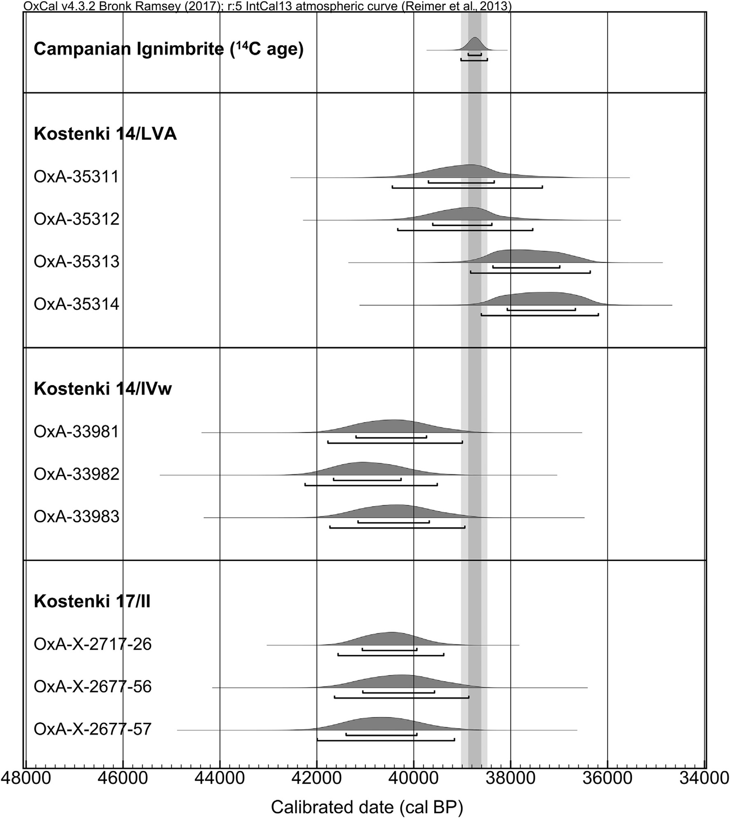
Calibrated ages for new radiocarbon dates from Kostenki 17/II (HYP dates only), Kostenki 14/IVw and Kostenki 14/LVA.
The figure includes the age of the CI tephra following Giaccio et al. (2017)
Source: Dinnis et al. (2018)
Kostenki 18 - Kostenki XVIII
Figure 14: Human skull from Kostenki XVIII
Figure 15: Human skull from Markina Gora, Horizon 3.
Photo: Klein, "Man and Culture in the Late Pleistocene", 1969
Kostenki 21
The six identified complexes at Kostenki 21/III can be divided into two groups according to several criteria: lithic techno-typology, the dimensions and planigraphy of the complexes, faunal remains and flint patination. There is a clear mutual exclusion between the types of backed points found in the northern and southern groups (Anosovka points only in the former, small shouldered points only in the latter) which has been previously noted and is confirmed by our work. The faunal assemblage from Kostënki 21/III provides some surprising insights into the behaviour of late MUP hunter–gatherer groups in Eastern Europe.Text above: Reynolds et al. (2019)
The remains from the southern complexes provide evidence for the systematic exploitation of hares and for hunting of mammoth, with a particular focus on juvenile mammoth. Canids were likely used for their skins. In the northern complexes, there seems to have been more emphasis on the hunting of adult mammoths, while the canid remains provide evidence for both skinning and consumption. Hare was absent or near-absent in the assemblage from the northern complexes.
Overall, however, a wider range of species is represented in the northern complexes than the southern. At both the northern and southern complexes, there is evidence for preferential transport of mammoth head and foot parts to the site. The canid remains at the site vary in size: one of those found in the southern complexes is “dog-like in size”. The range of ages of juvenile mammoths represented at the southern complexes suggests that activity took place at this part of the site during both spring/early summer and autumn/ early winter. In the northern complexes, a more restricted period of human presence is attested: spring/early summer only.

Despite strong similarities, the cultural layer III of Kostienki 21 shows the existence of another cultural unity of the original Kostienki Gravettian. The specific features cover all elements of material culture: the lithic assemblage and bone, art, adornment.
For the stone industry, first, the proportions of notched points are the same as those observed in the western Gravettian, as well as the importance of the Gravettian notched points east and ends at the back of the type Federmesser.
The bone industry is characterised by particular types of tools whose function is unknown. Mobile art is represented by engravings of animals on stone plaques, unique to Eastern Europe, but well known in the West.
The dates obtained for this layer are 22 270 ± 150 and 21 260 ± 340.
Photo and text: Sinitsyn (2007)
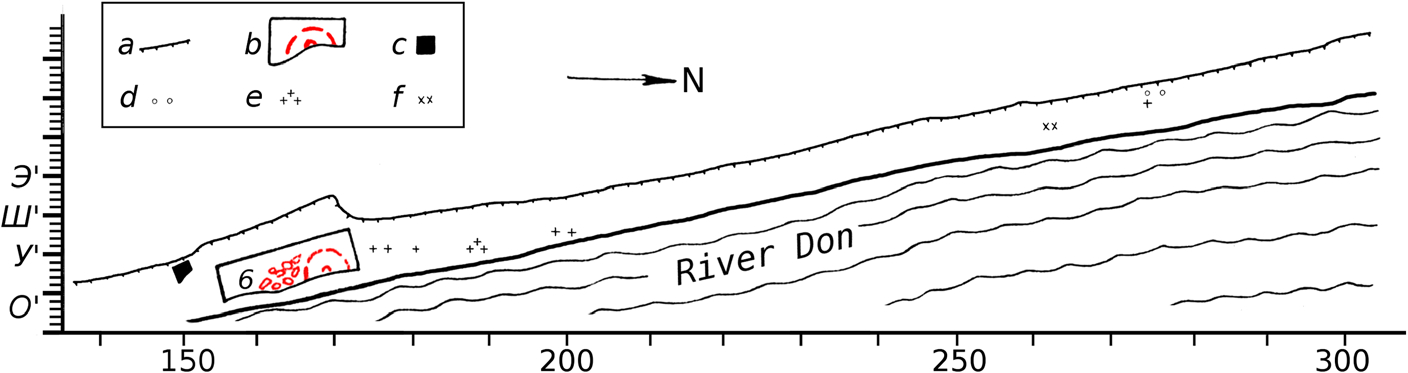
Kostenki 21 was discovered in 1956 by N. D. Praslov, who led excavations there in 1956–1961, 1964, 1967, 1969, 1971–1972 and 1976–81, as well as further excavations during the 1980s. The twentieth century
excavations extended for circa 160 m along the river bank, and more than 510 m2 was excavated in total by the early 1980s. Due to active erosion by the Don, the excavations were carried out as rescue excavations. Further limited rescue excavations were carried out in 2013–2016, led by A. A. Bessudnov. The richest and most extensive archaeological layer is the lowermost layer, now known as layer III, which was the first to be recognised. Around 35 000 – 36 000 lithic artefacts were attributed to this layer during the twentieth-century excavations of the site.
Photo and text: Reynolds et al. (2019)
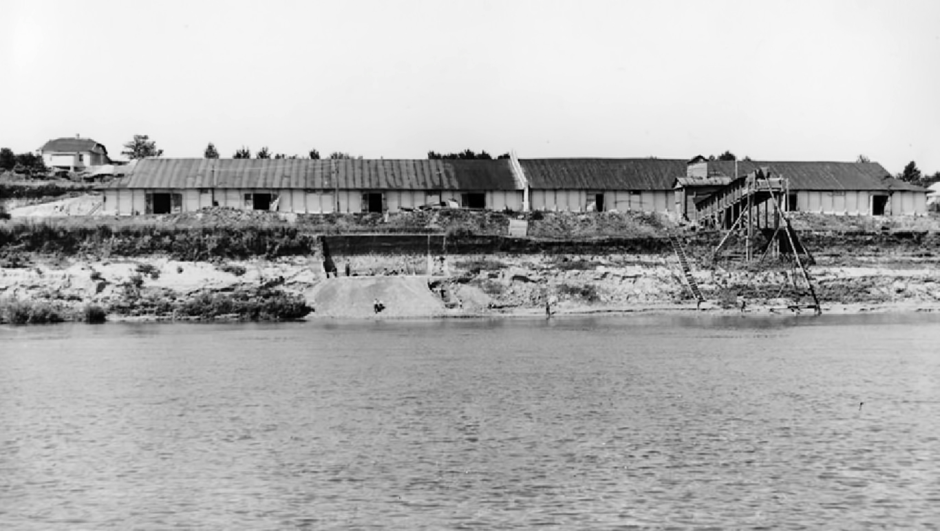
Photograph of the 1958 excavations at Kostenki 21, showing the proximity of the excavated area to the Don.
Photo courtesy of the Archive of IHMC RAS, no. O-2134-59
Photo and text: Reynolds et al. (2019)
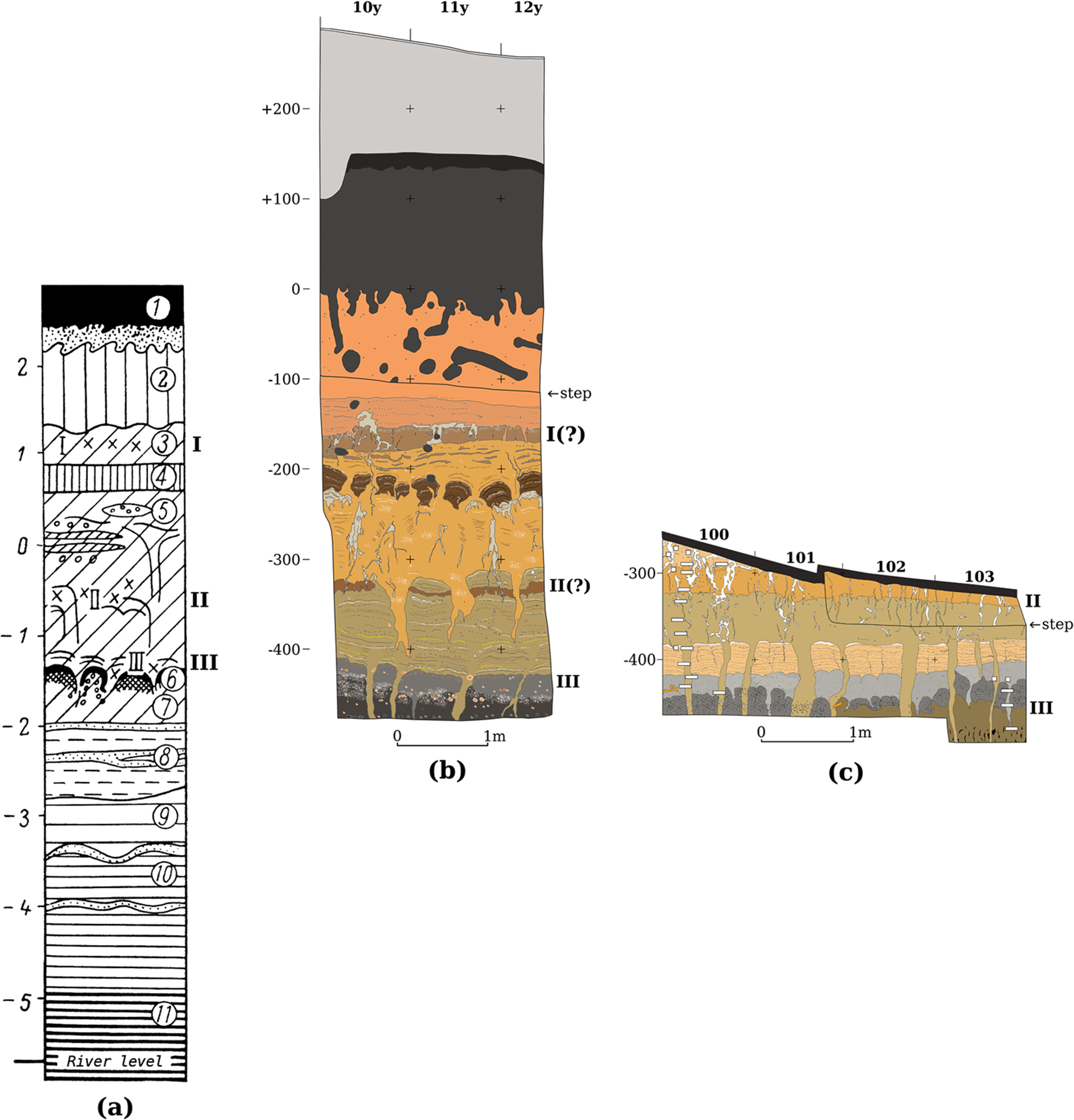
Section drawings for Kostenki 21.
a Schematic drawing of section based on pre-1982 excavations.
b Drawing of 2016 section.
c Drawing of 2014 section.
Cultural layer numbers given in Roman numerals. All to same scale. Drawings have been vertically aligned according to approximate locations of cultural layers, not
relative depths of sections.
Photo and text: Reynolds et al. (2019)
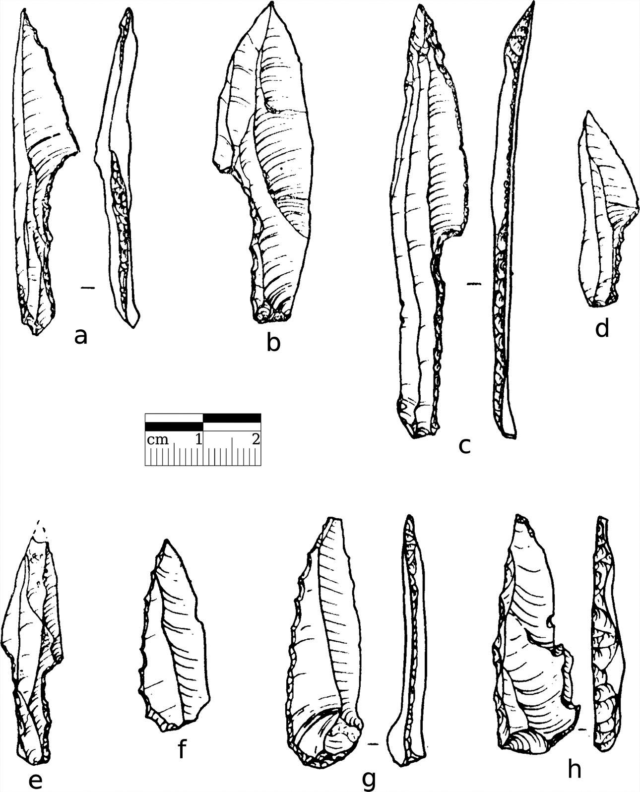
Drawings of lithic artefacts from Kostenki 21/III.
a–e Shouldered points from the southern complexes.
f–h Anosovka points from the northern complexes.
Photo and text: Reynolds et al. (2019)
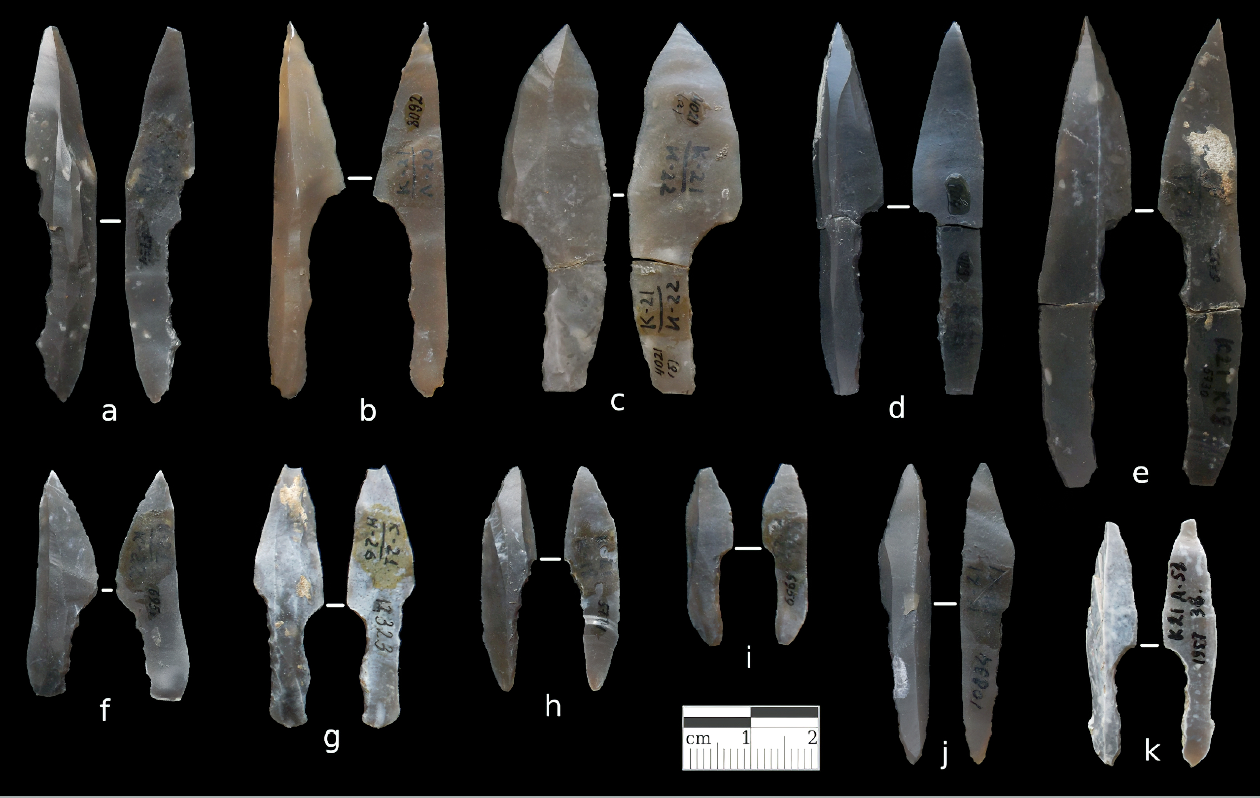
Shouldered points from the southern complexes of Kostenki 21/III.
The shouldered points from layer III are made on small blades, with backed, shouldered stems. Previous work has suggested that they constitute a unique series compared to shouldered points from other late Gravettian sites. They are clearly different, in their size, morphology, and technology of production, from the overall profile of those found at the sites of the Kostenki–Avdeevo Culture (Kostenkian/Eastern Gravettian sensu stricto), including Kostenki 1/I, Avdeevo and Zaraisk, and further west at sites of the 'shouldered-point horizon'/'Kostenki-Willendorfian', such as Kraków-Spadzista. They are also very different from the backed points found at Khotylevo 2.
Photo: N. Reynolds
Photo and text: Reynolds et al. (2019)
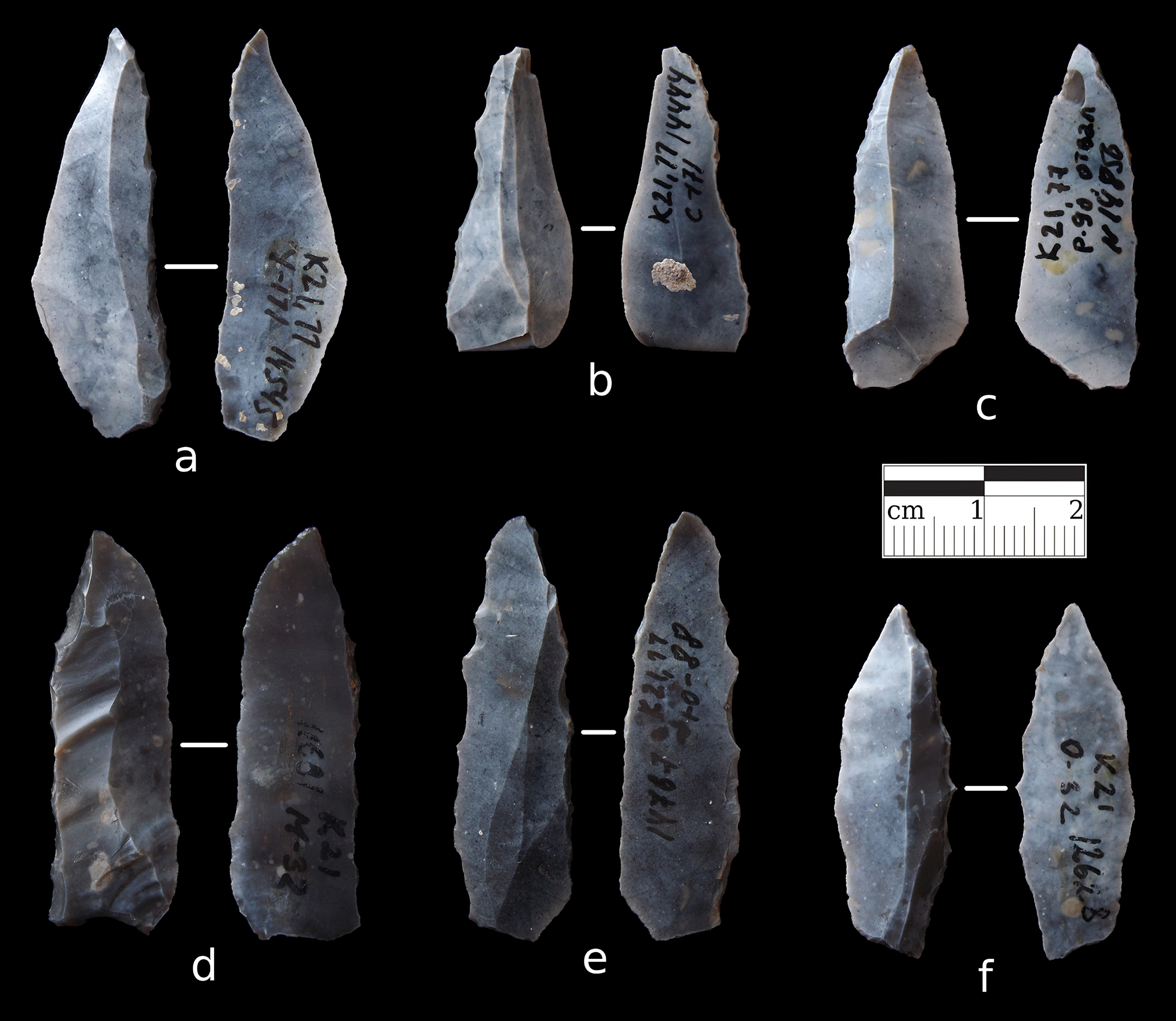
Anosovka points from northern complexes of Kostenki 21/III
The Anosovka points found at the site are small, wide-based points with one backed edge. They have been compared to Azilian and Federmesser points.
To be identified as an Anosovka point for the purposes of our study, the artefact had to be small (less than 5 cm long), have a clear point formed by the convergence of one backed straight or convex edge and the unbacked edge of the blank and have a wide base.
Photo: N. Reynolds
Photo and text: Reynolds et al. (2019)
The consensus on Kostenki 21/III has favoured an interpretation where all parts of the layer were occupied synchronously, despite the well-described differences between the two groups of complexes. In Soviet archaeology, approaches to the spatial analyses of Palaeolithic sites were sophisticated, and this aspect of archaeology was emphasised in both excavation practice and archaeological theory.
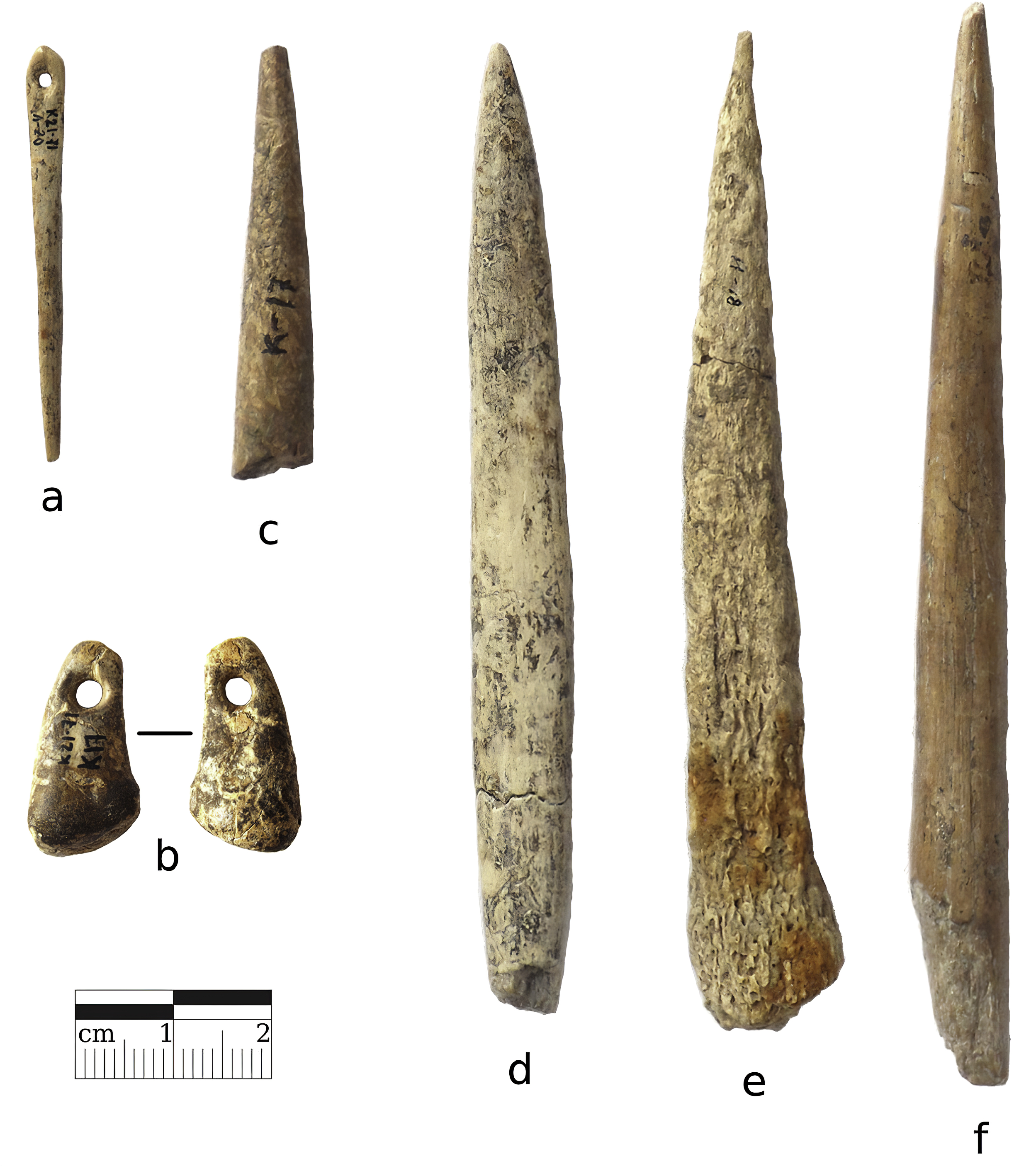
Photographs of bone and ivory artefacts from Kostenki 21/III:
a: bone needle (complex 2)
b: deer canine pendant (complex 2)
c–f: osseous points (c, e, f complex 2; d northern complexes)
Photo: N. Reynolds
Photo and text: Reynolds et al. (2019)
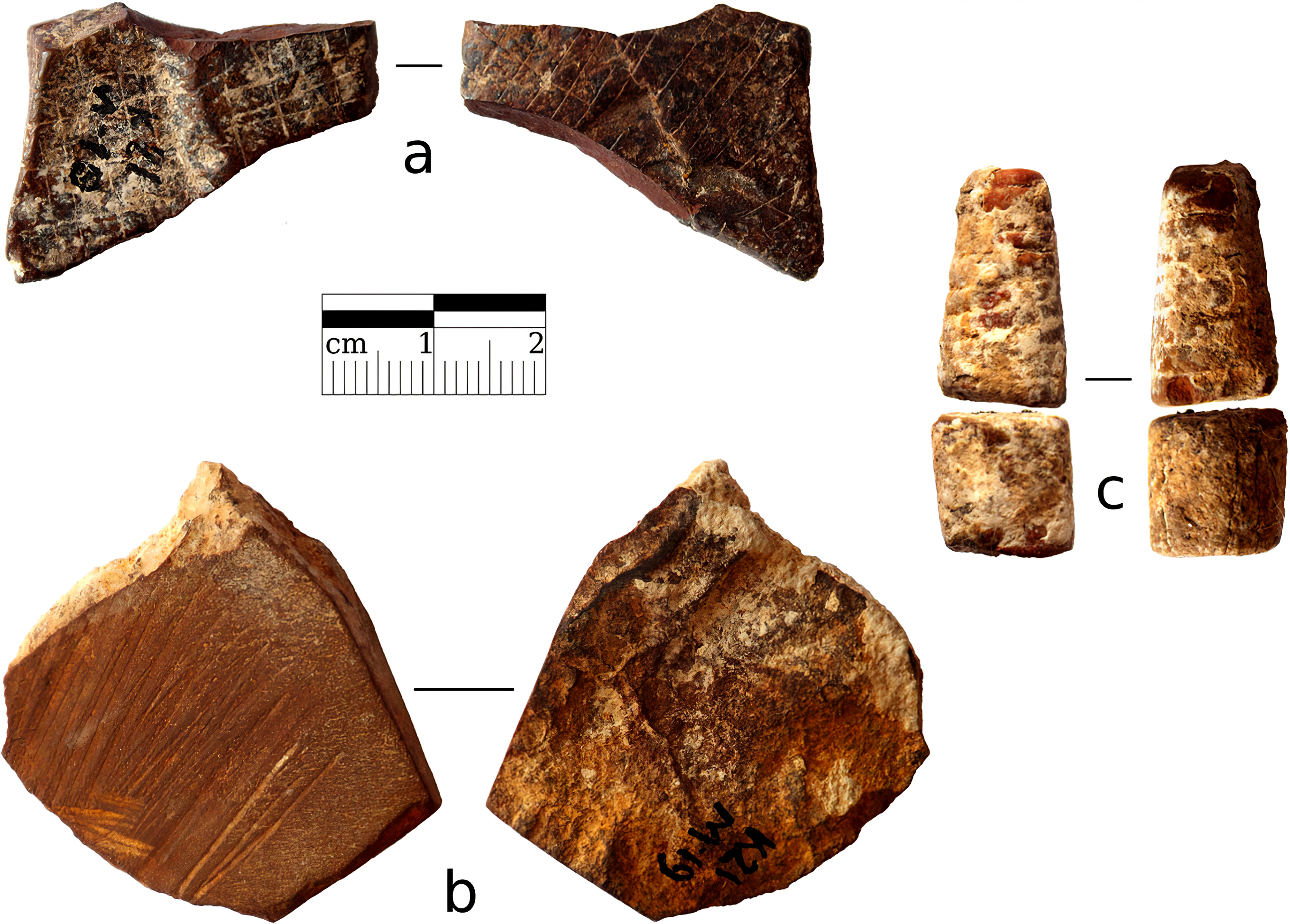
Ochre from Kostenki 21/III.
a, b: Complex 2.
c: Complex 5
Photo: N. Reynolds
Photo and text: Reynolds et al. (2019)
Borshevo II - Borshevo 2
Borshevo II contained three cultural layers, dated from the end of the late Palaeolithic through to the Mesolithic. In the top layer, the camp of a temporary settlement of horse hunters, mammoth bones were absent, but there were reindeer bones. The flint tools were of the microlith type, which could have been used for arrow heads.
Borshevo V - Borshevo 5
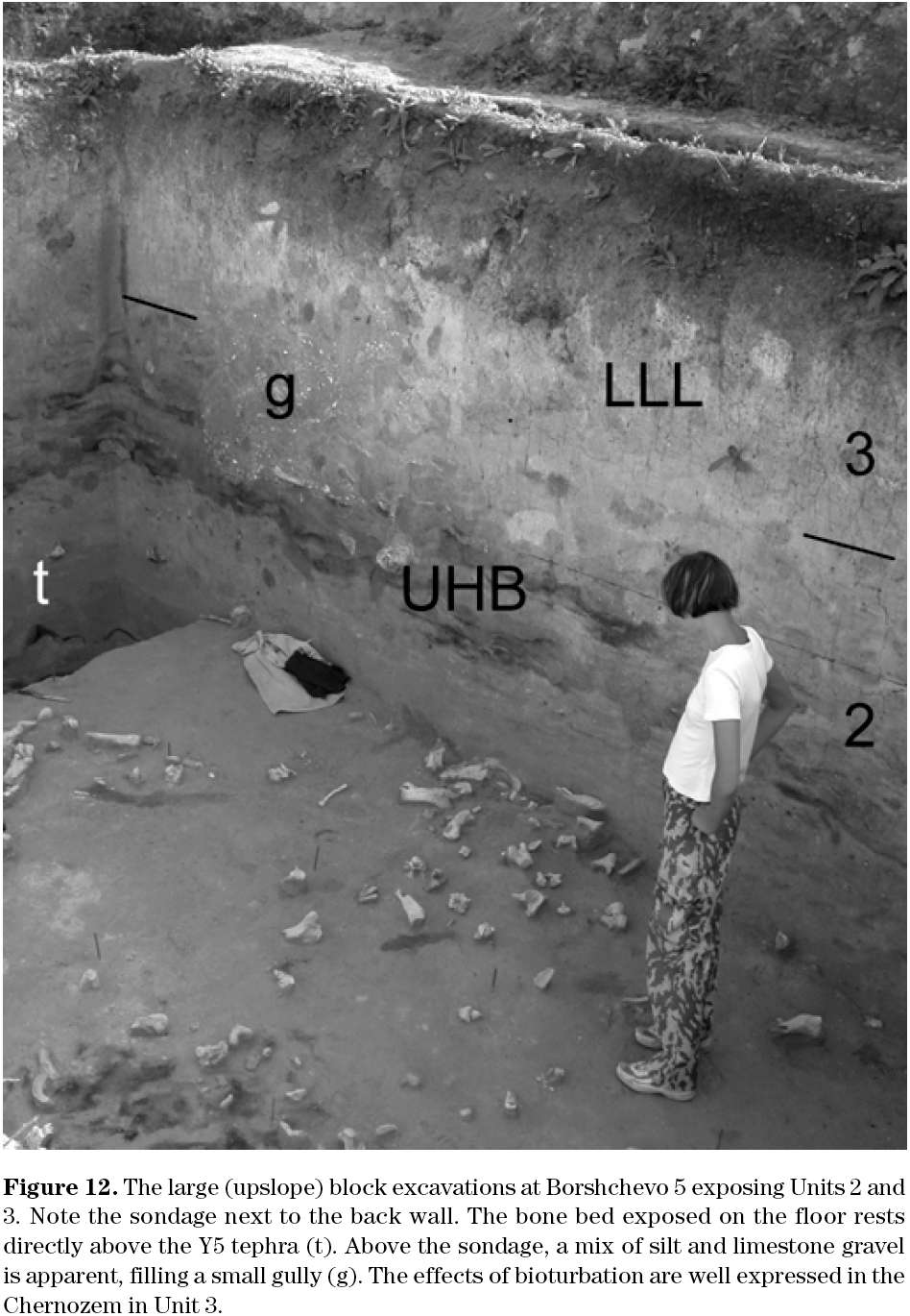
The large (upslope) block excavations at Borshchevo 5 exposing Units 2 and 3. Note the sondage next to the back wall. The bone bed exposed on the floor rests directly above the Y5 tephra (t). Above the sondage, a mix of silt and limestone gravel is apparent, filling a small gully. The effects of bioturbation are well expressed in the Chernozem in Unit 3.
Photo and Text:
Geoarchaeology of the Kostenki– Borshchevo Sites, Don River Valley, Russia.
Vance T. Holliday et al.
Geoarchaeology: An International Journal, Vol. 22, No. 2, 181–228 (2007)
My thanks to Dr Vance Holliday, Professor of Anthropology & Geosciences, University of Arizona, for access to this resource.
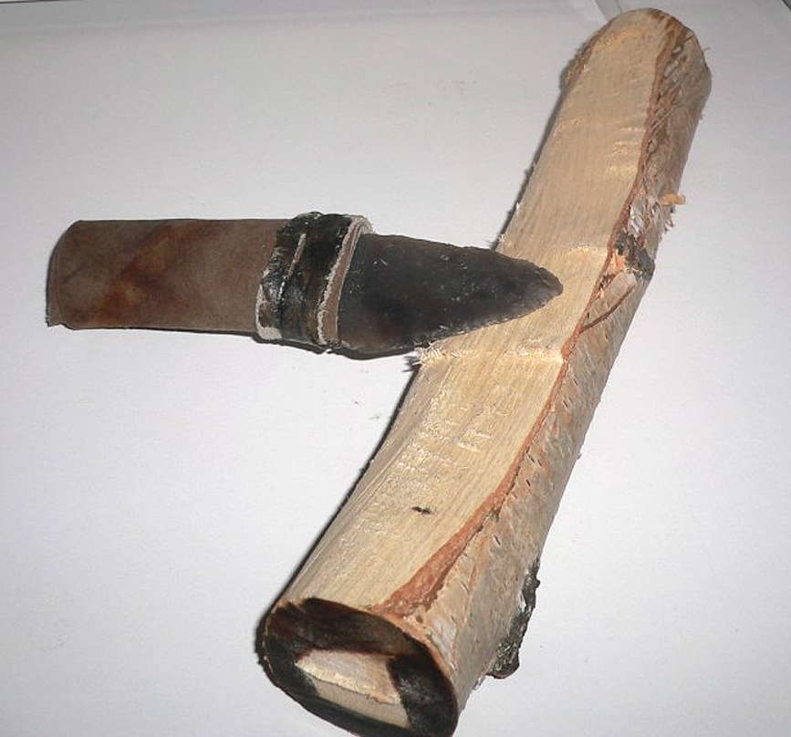
This is the classic shouldered point, or point with tang, as it would have been used, with a handle. The tools are razor sharp, and very effective.
This recreation shows the handle being made of leather wrapped around the tang. Other methods would include the use of bone or antler as a handle.
Photo: http://baida.su/2010/07/progulka-na-20-000-let-nazad/
Source: Kostenki Museum.
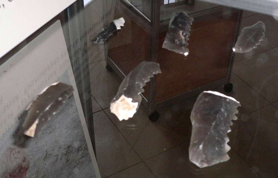
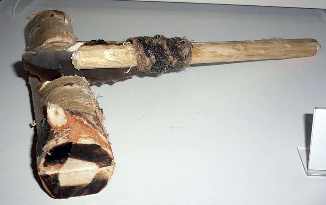
The skill of the flint knappers was such that they could create notched blades which functioned well as saws.
(left) saw blades as found.
(right) a display to show how well they worked when a handle was attached.
Photo: http://baida.su/2010/07/progulka-na-20-000-let-nazad/
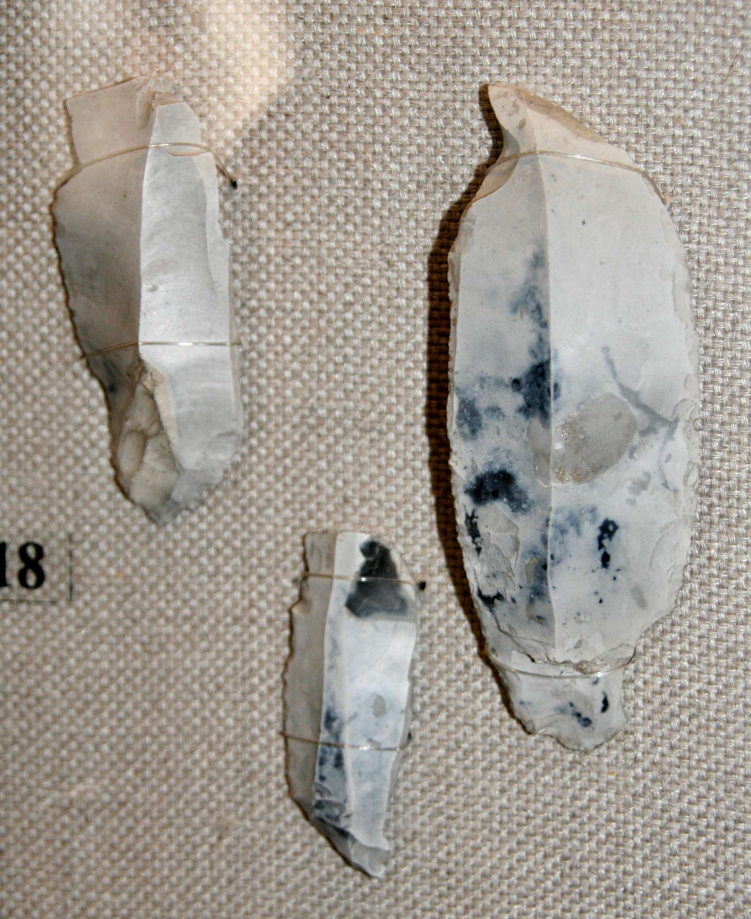
Резцы
Burins (engravers).
Photo: Vladimir Gorodnjanski, 2008
Voronezh Museum
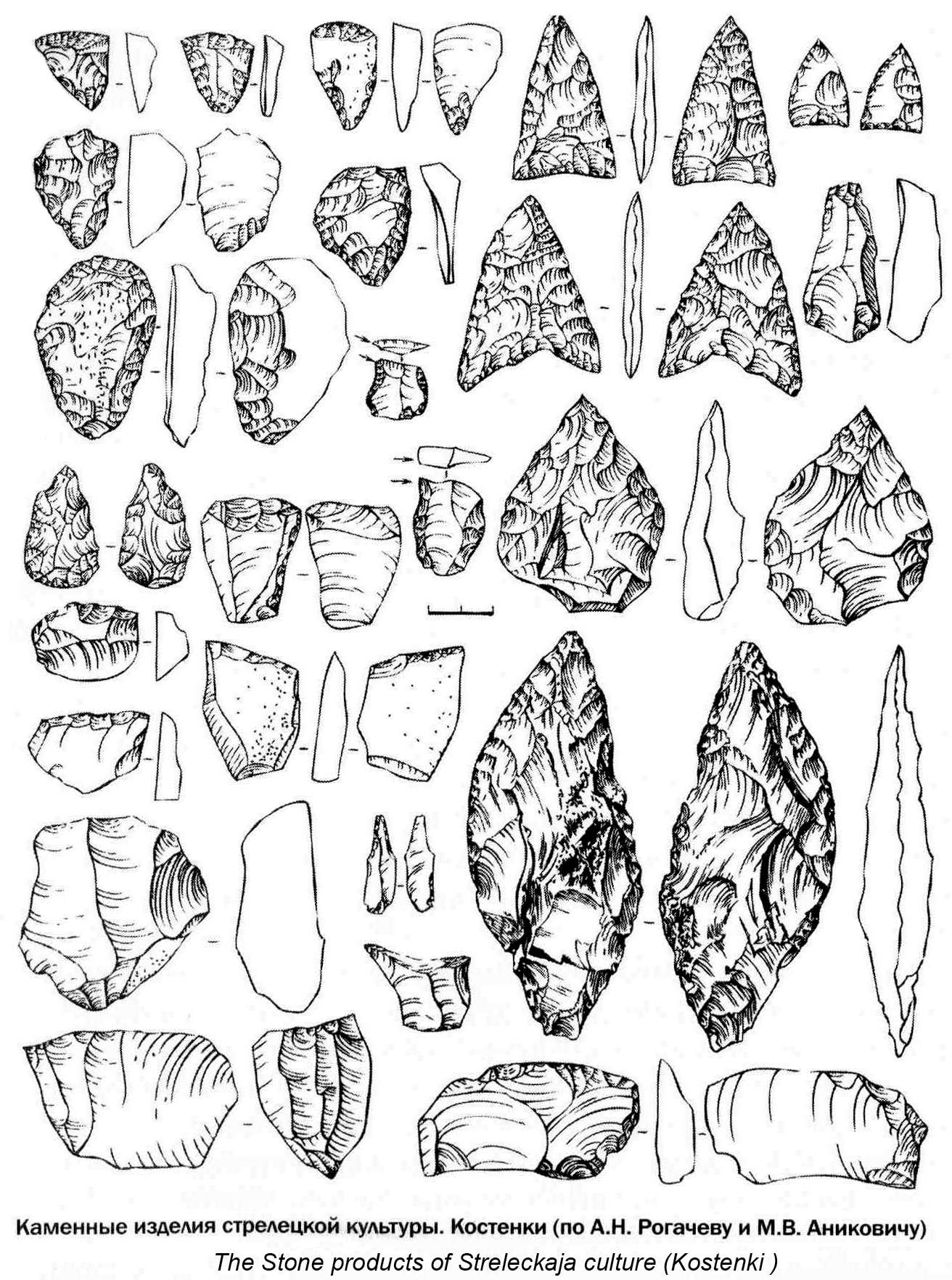
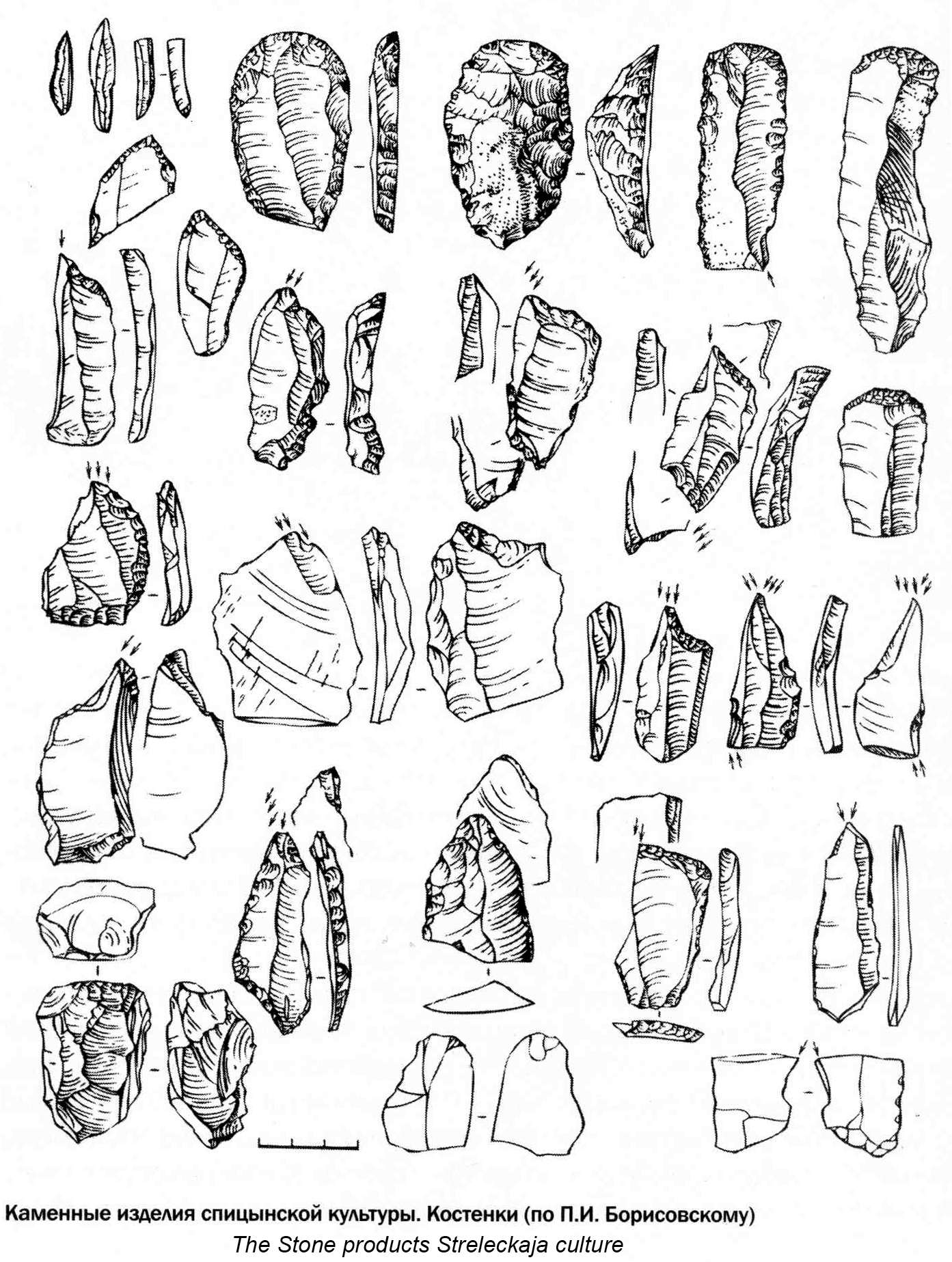
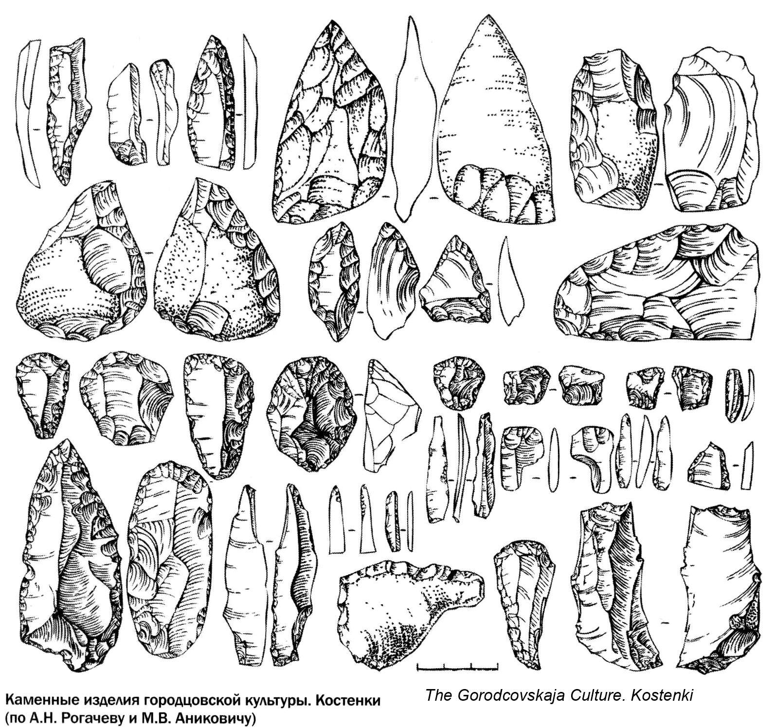
Stone tools from the Kostenki area.
Photo: The Stone Age in Ostrogozhsk area.
My thanks to Vladimir Gorodnjanski for access to this resource.
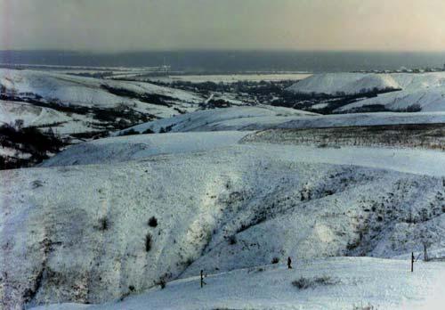
Photograph of the landscape near Kostenki in winter. The area has an enthusiastic amateur ski club. This is amazing in an area in the middle of the Russian steppes, but there are slopes up to 70 metres high and four ski lifts!
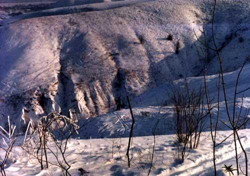
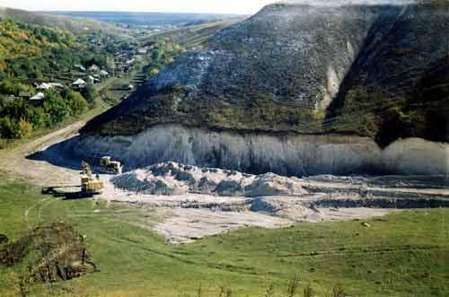
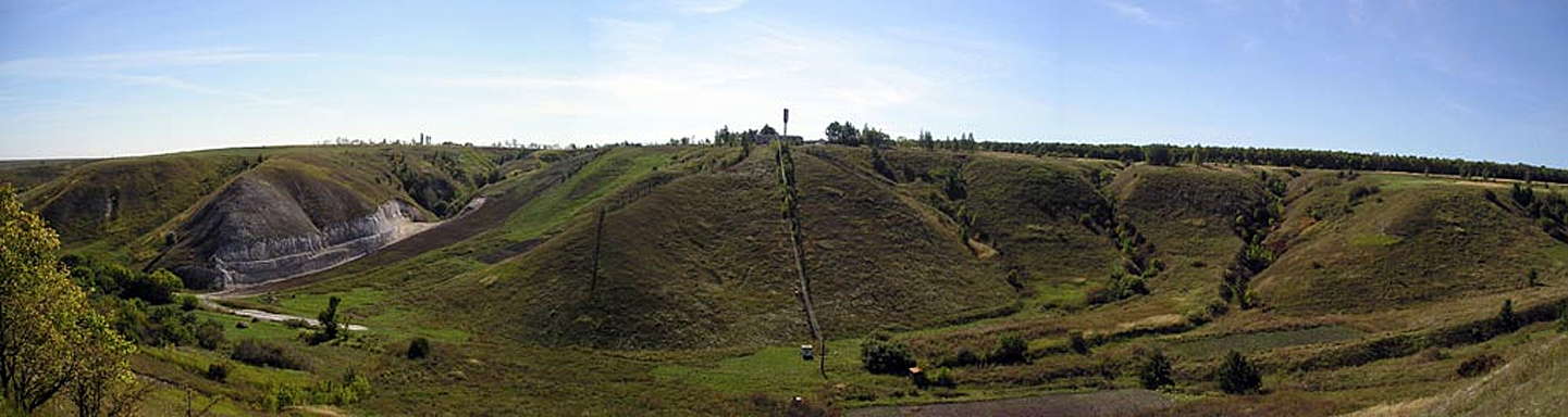
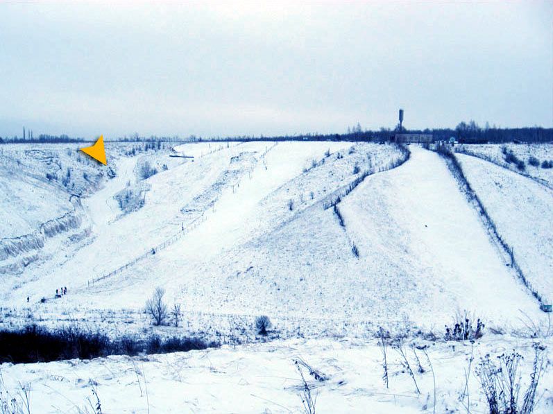
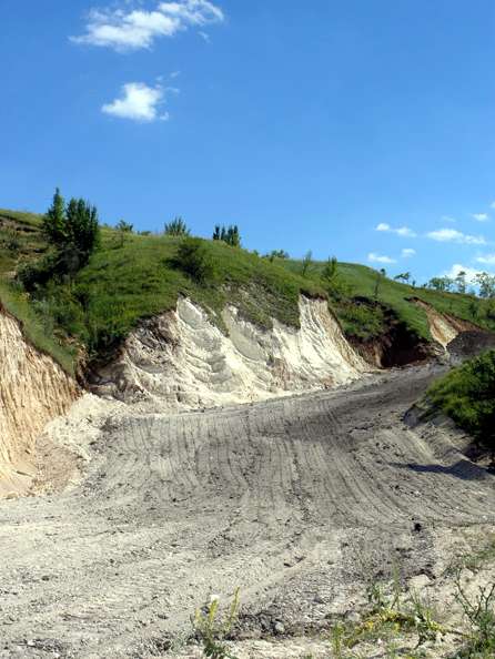

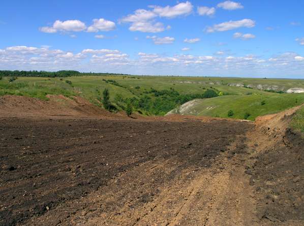
The slopes have been upgraded (2006) with a new ski run, the position being shown by the yellow arrow in the first photo (2006/2007 season), with three views of the construction process in summer 2006.
Photos: http://kostenski.ru/
A recent photo of one of the ski runs, January 2008.
Photo: http://xirax.livejournal.com/113411.html
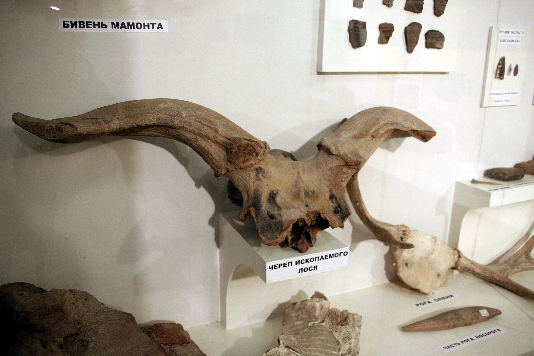
The area was rich in game. This is an Aurochs skull.
( My thanks to Tracey Fallak (pers. comm.) for this identification - Don )
Photo: Vladimir Gorodnjanski, 2006
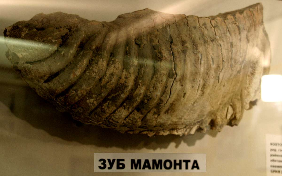
This is the very characteristic shape of a mammoth tooth, used for grinding vegetation.
Photo: Vladimir Gorodnjanski, 2006
The bones of the mammoth would have been serviceable weapons, should the need have arisen.
Photo: Vladimir Gorodnjanski, self portrait 2006
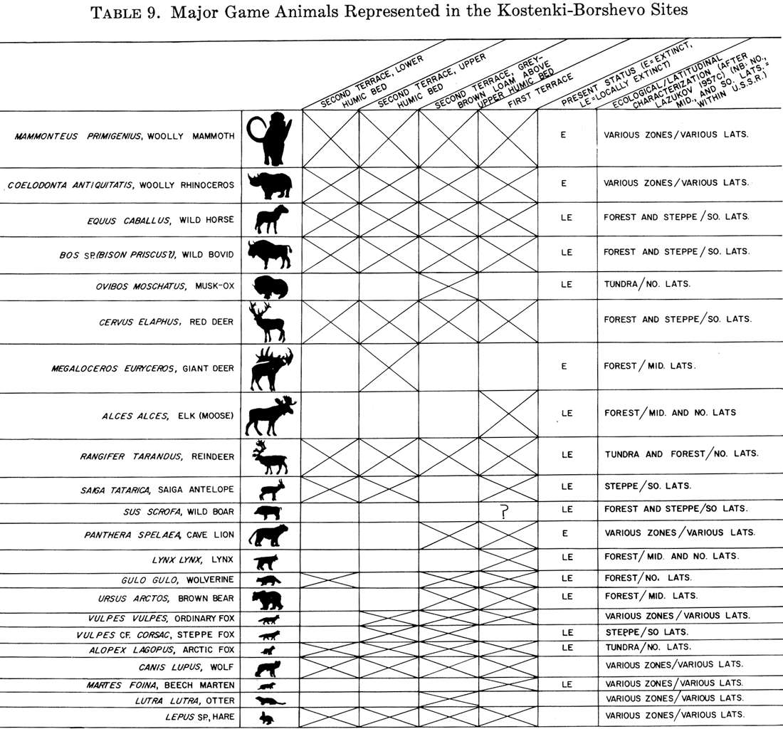
Animals at Kostenki
Photo: Klein, "Man and Culture in the Late Pleistocene", 1969

Rodents at Kostenki
Photo: Klein, "Man and Culture in the Late Pleistocene", 1969
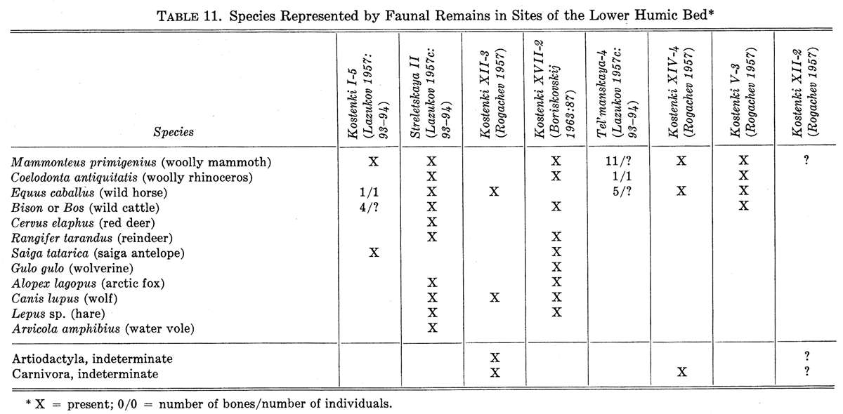
Faunal assemblage at Kostenki
Photo: Klein, "Man and Culture in the Late Pleistocene", 1969

Map of the Kostenki area.
My thanks to Vladimir Gorodnjanski for access to this resource.
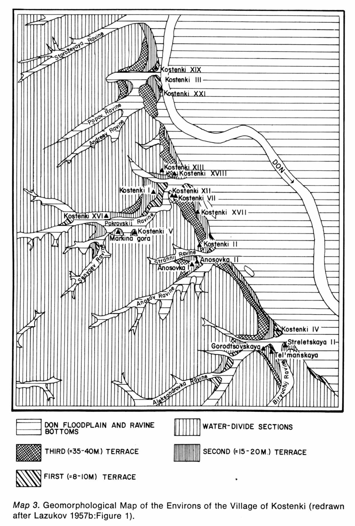
Map of the Kostenki sites. Note that this source uses Roman numerals for the distinct localities.
Photo: Man and Culture in the Late Pleistocene, by Richard G. Klein, 1969
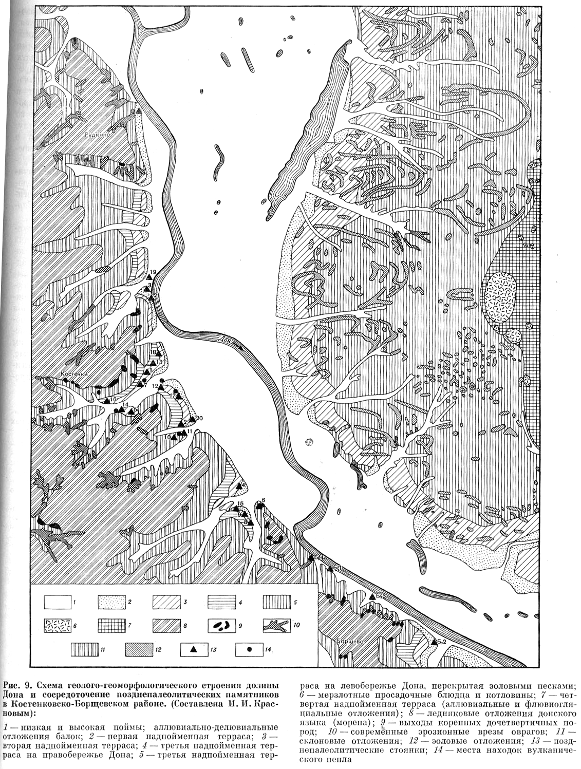
Map of the Kostenki and Borshevo sites.
Photo: Archaeology of the USSR - The Palaeolithic of the USSR.
My thanks to Vladimir Gorodnjanski for access to this resource.
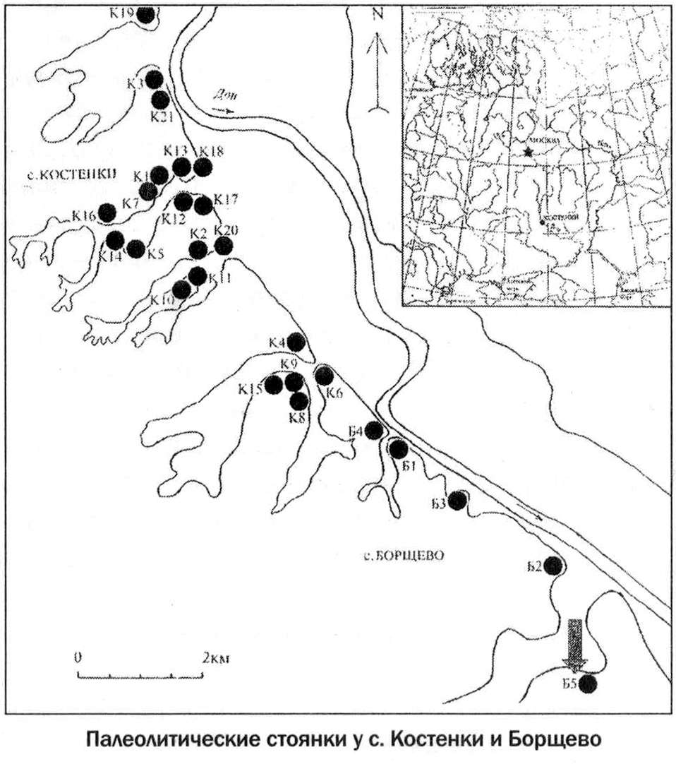
Map of the Kostenki and Borshevo sites.
Photo: The Stone Age in Ostrogozhsk area.
My thanks to Vladimir Gorodnjanski for access to this resource.
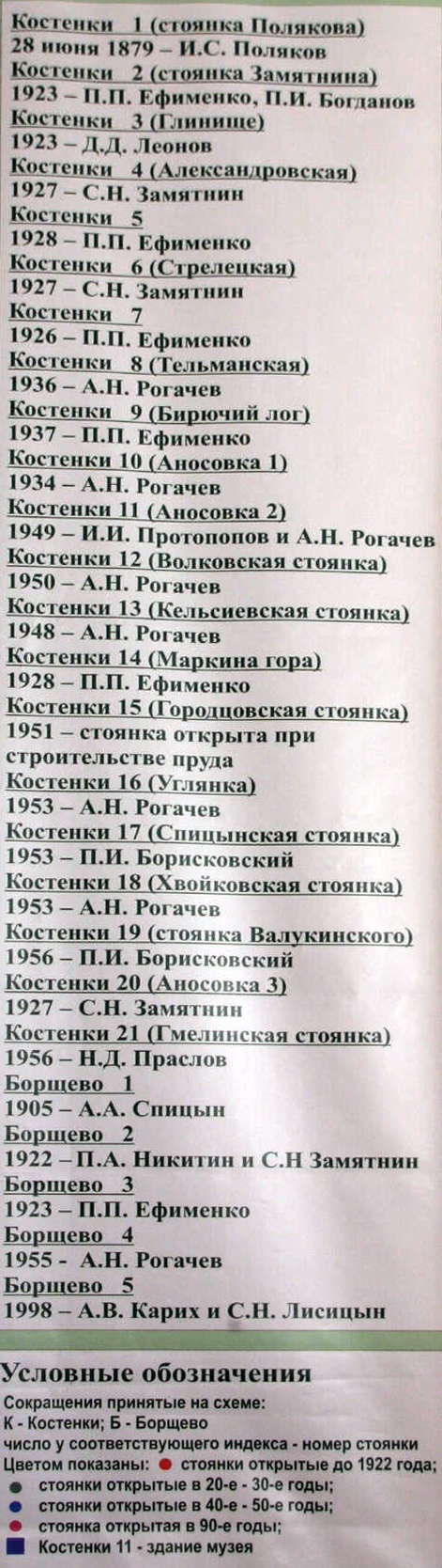
A list of the dates of discovery at Kostenki and Borshevo, and the scientists responsible for the excavations, a valuable resource.
Photo: Vladimir Gorodnjanski 2011
Source: Kostenki Museum
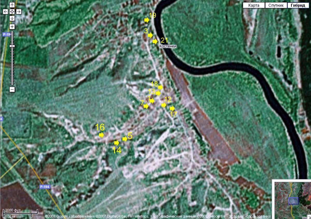
Photo/map of the Kostenki sites.
Photo: Google maps
My thanks to Vladimir Gorodnjanski for this adaptation showing specific Kostenki sites.
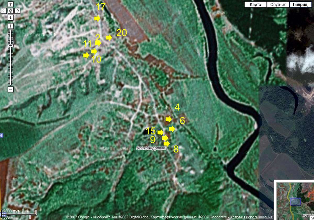
Photo/map of the Kostenki sites.
Photo: Google maps
My thanks to Vladimir Gorodnjanski for this adaptation showing specific Kostenki sites.
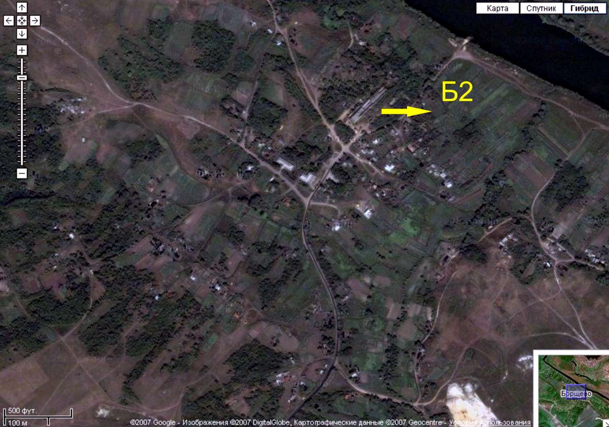
Photo/map of the Borshevo 2 site.
Photo: Google maps
My thanks to Vladimir Gorodnjanski for this adaptation showing the Borshevo 2 site.
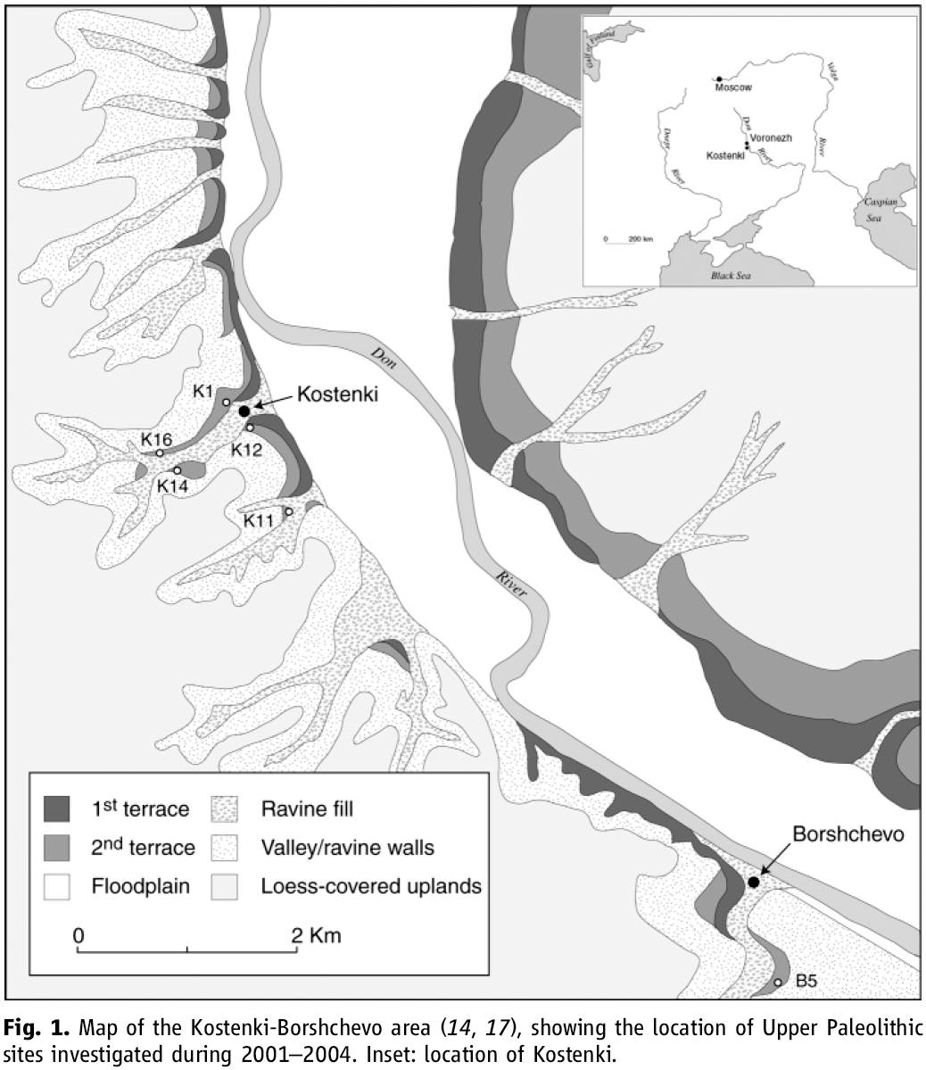
Map of the Kostenki-Borshchevo area, showing the location of Upper Paleolithic sites investigated during 2001–2004. Inset: location of Kostenki.
Although several Upper Paleolithic sites (e.g., Kostenki 18) are located on the third terrace (30 to 40 m) in late Pleistocene loams that directly overlie Cretaceous sand, most sites are found on the second (15 to 20 m) or first (10 m) terrace.
Many of the Kostenki sites are found along Pokrovskii Ravine, one of the largest of the several ravines in the area. Other sites are situated in the main valley or in the smaller side valleys. The Borshchevo localities are along the main valley and adjacent to a large ravine on the south side of the village of Borshchevo.
Photo and text:
Early Upper Paleolithic in Eastern Europe and Implications for the Dispersal of Modern Humans
M. V. Anikovich, et al.
Science 315, 223 (2007)
Also:
Geoarchaeology of the Kostenki– Borshchevo Sites, Don River Valley, Russia.
Vance T. Holliday et al.
My thanks to Dr Vance Holliday, Professor of Anthropology & Geosciences, University of Arizona, for access to this resource.
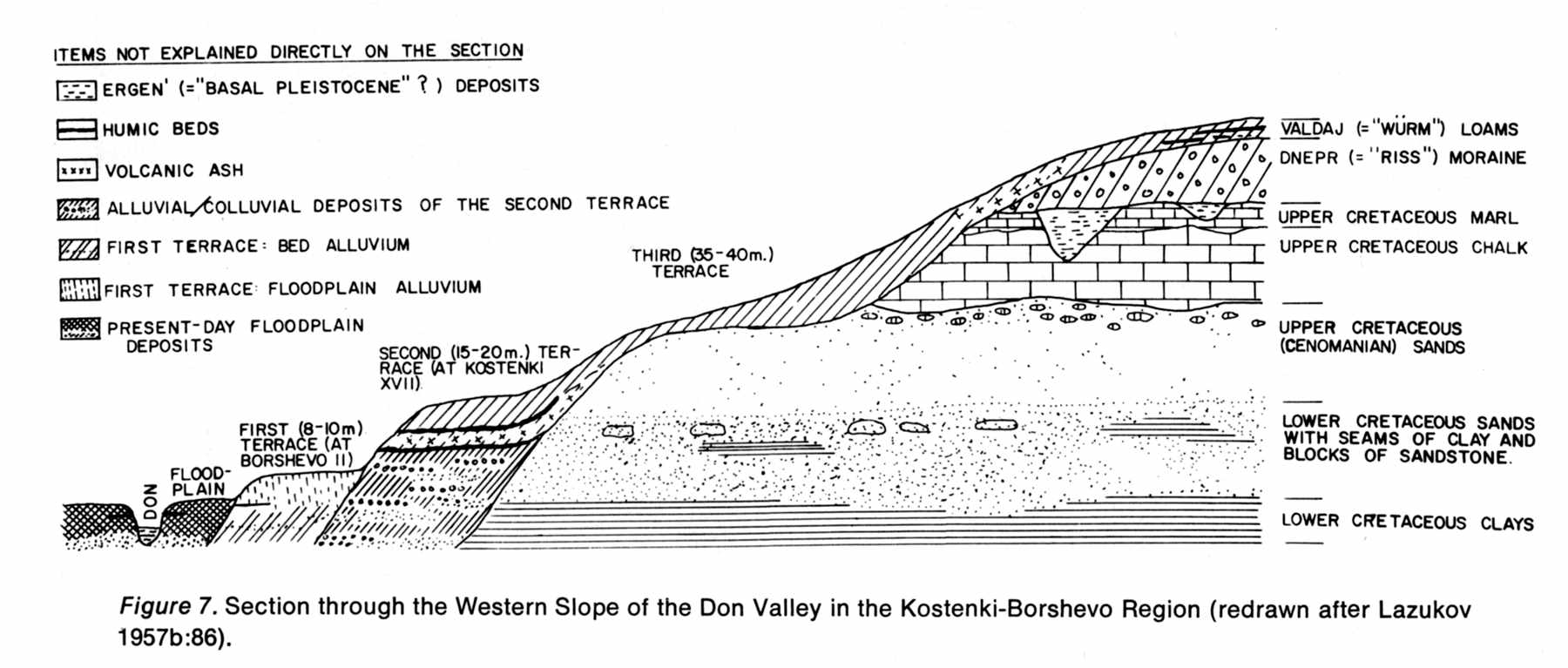
Cross section of a hypothetical transect in the area.
Photo: Man and Culture in the Late Pleistocene, by Richard G. Klein, 1969
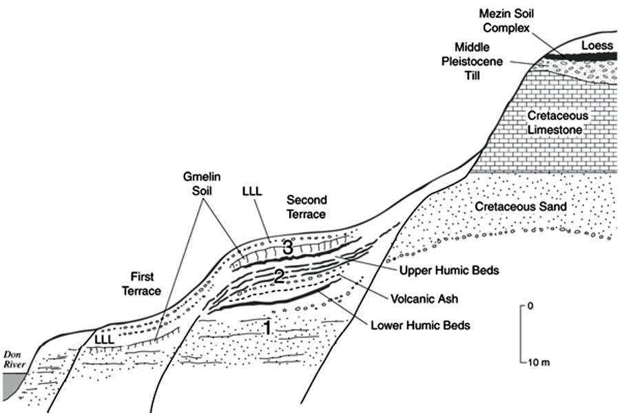
Generalized geologic cross section of the west bank of the Don Valley in the Kostenki–
Borshchevo area illustrating the bedrock, upland, and valley fill stratigraphy. Stratigraphic Units 1, 2, and
3 contain the Upper Paleolithic occupations at most sites on terrace 2. (Based on Lazukov, 1982, Fig. 4)
Photo and Text:
Geoarchaeology of the Kostenki– Borshchevo Sites, Don River Valley, Russia.
Vance T. Holliday et al.
Geoarchaeology: An International Journal, Vol. 22, No. 2, 181–228 (2007)
My thanks to Dr Vance Holliday, Professor of Anthropology & Geosciences, University of Arizona, for access to this resource.
Text below from Wikipedia:
Colluvium is the name for loose bodies of sediment that have been deposited or built up at the bottom of a low grade slope or against a barrier on that slope, transported by gravity. The deposits that collect at the foot of a steep slope or cliff are also known by the same name. Colluvium often interfingers with alluvium (deposits transported downslope by water). Coarse deposits due to rockfall at a cliff base are called talus (scree) and if lithified are talus breccias. Avalanches, mudslides and landslides are processes that deposit colluvium. This build-up process is called colluviation.
Colluvium normally forms humps at the base of mountains or fan-shaped deposits similar in shape to alluvial fans that cover former ground surfaces. This process is an important phenomenon in the fields of archaeology and soil science.
Many colluvial soils tend to have a fragipan associated with them that are a brittle subsoil layer typically high in clay. One theory of fragipan formation is the smearing of soil during the colluvial process causing the clays to seal the surface between the moving portion of soil and the stationary soil on which it slides. Ancient sites can be preserved beneath colluvium if later changes in the landscape such as deforestation encourage a downward movement of material.
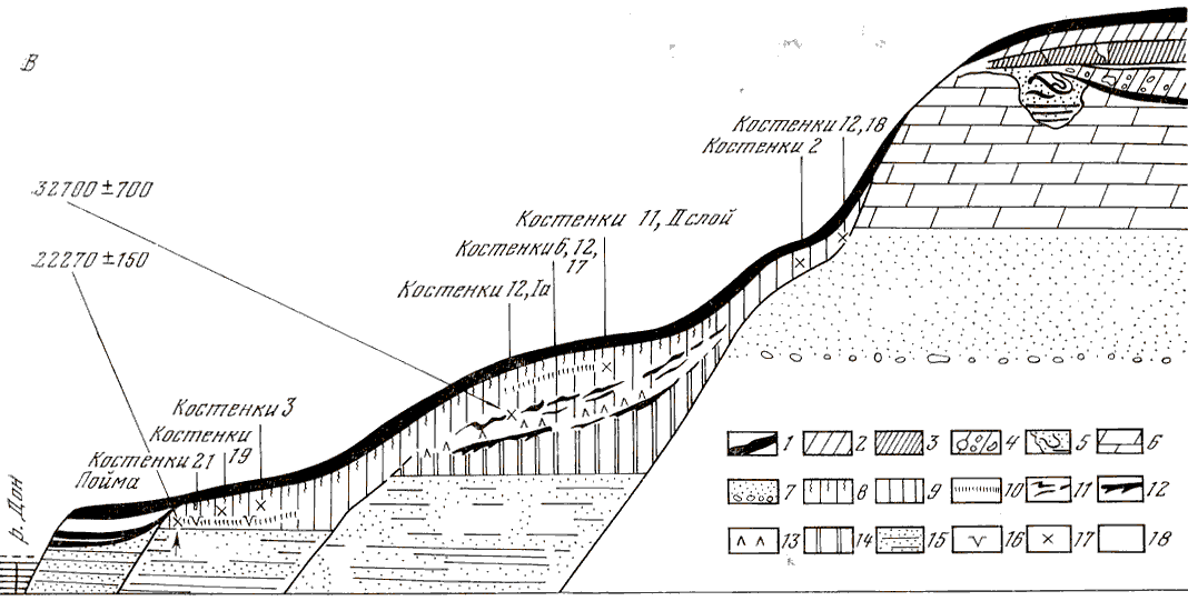
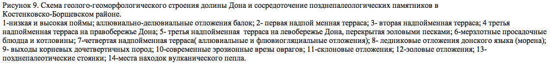
This is an imaginary cross section through the various Kostenki - Borshevo sites to illustrate the typical positions of the sites in relation to the topography and geology.
- low and high flood-lands; alluvial - dealluvial (?colluvial?) sediments on the valley wall
- the first terrace above the flood plain
- the second terrace above the flood plain
- the third terrace above the flood plain, on the right bank of the Don River
- the third terrace above the flood plain, on the left bank of the Don River, blocked (?) wind blown sand
- frozen subsidence saucers and hollows
- the fourth terrace (alluvial and fluvioglacial sediments)
- glacial edge of the Don (moraine)
- sediment base before quaternary sediments
- modern eroded gullies
- hillside adjournment (?)
- wind deposits
- late palaeolithic deposits
- volcanic ash deposits
Photo: Archaeology of the USSR - The Palaeolithic of the USSR.
My thanks to Vladimir Gorodnjanski for access to this resource.
Map of Campanian Ignimbrite.
Key sites with hominin remains around the Middle to Upper Paleolithic transition, and sites associated with the Campanian Ignimbrite (CI) marker horizon. Map based on SRTM data; sea level lowered by 75 m.
(It would appear from the plume on the map that at the time of the volcanic eruption, winds were from just north of west to south-westerly - Don)
Photo: Jöris and Street (2008)
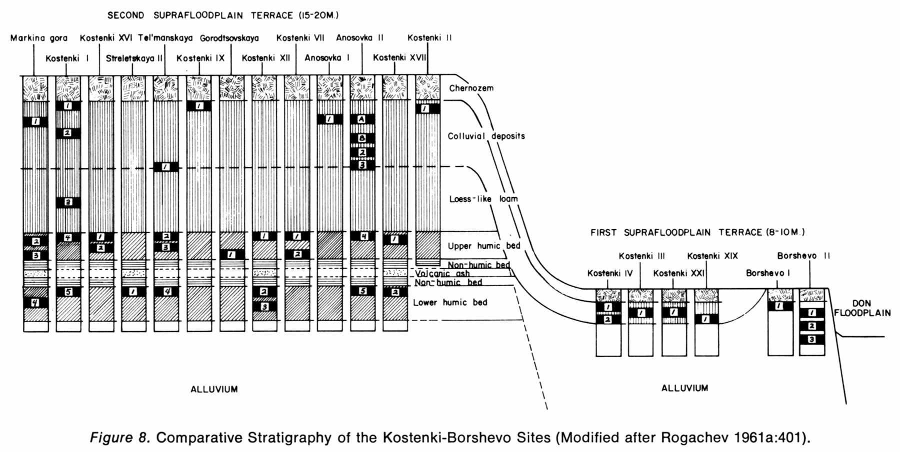
Comparative stratigraphy of the Kostenki - Borshevo area.
Photo: Man and Culture in the Late Pleistocene, by Richard G. Klein, 1969
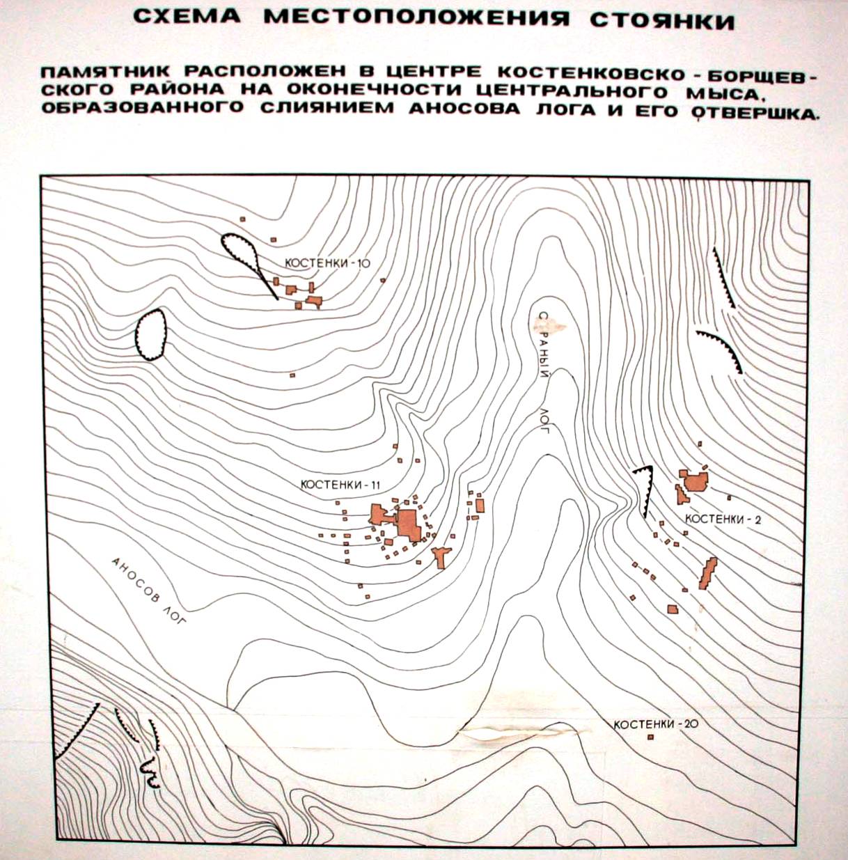
Detailed map showing locations of the Kostenki 2, 10, 11 and 20 sites.
Source: Boguchar Museum
Photo: Vladimir Gorodnjanski
Kostenki is at 51° 23'N, 39° 03' E. This puts it near the town of Novovoronezh, about 40 km (25 miles) south of Voronezh, on the western side (right bank) of the Don River.
Borshevo is at 51° 20' 48" N, 39° 07' E.
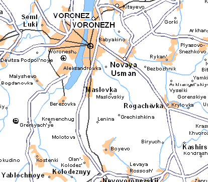
Map of location of Kostenki
Photo: http://uk8.multimap.com
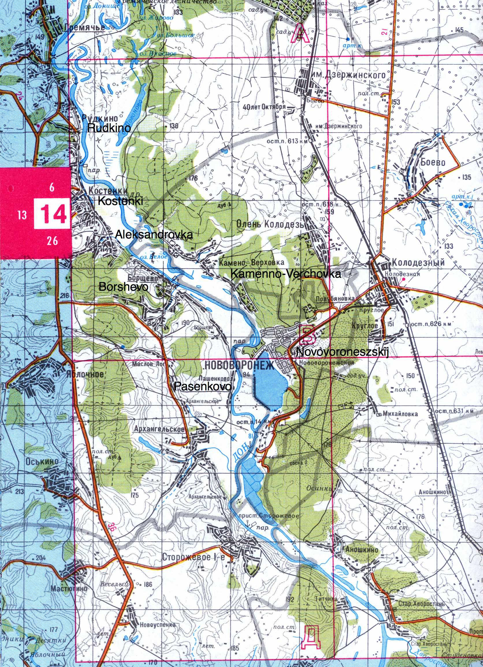
Road Map of the Kostenki - Borshevo area
Photo: adapted from an unknown source
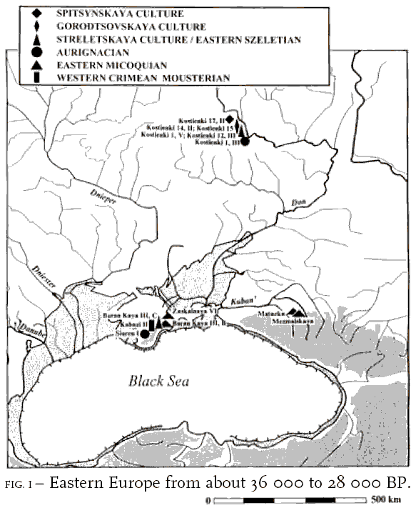
- The Streletskaya Culture/Eastern Szeletian at Kostenki 1/V and at Kostenki 12/III with dates ranging from 36 000 to 27 000 BP
- The Spitsynskaya culture at Kostenki 17/II with dates ranging from 36 000 to 32 000 BP
- The Gorodtsovskaya culture at Kostenki 14/II and Kostenki 15 with dates ranging from 32 000 to 27 000 BP
- The Aurignacian culture at Kostenki 1/III with dates centering around 25 000 BP
Table of dates below from:
The Early Upper Paleolithic beyond Western Europe (2004)
P. Jeffrey Brantingham, Steven L. Kuhn, Kristopher W. Kerry
| Age | Stage | West and Southwest | South | Central | Northeast |
| 24 000 BP | Biryuchia Balka 2/III | Khotylevo | |||
| Korpatch IV | Sungir | ||||
| Late/early | Koulichivka II | Rusanikha | |||
| 26 000 BP | Brynzeny III | ||||
| Upper | Korman 4/VII | Kostenki 17/I | |||
| Molodova 5/VIII | Kostenki 16 | ||||
| 28 000 BP | Palaeolithic | Kostenki 8/II | |||
| Ivanychi | Kostenki 1/III | Garchi 1 | |||
| Zhornov IIa | Byzovaya | ||||
| 30 000 BP | |||||
| Molodova 5/IX-X | Kostenki 15 | ||||
| Kostenki 14/II | |||||
| 32 000 BP | |||||
| Mira II | |||||
| Kulychivka III | Biryuchia Balka Iv/VII | Zaozerie | |||
| Initial | |||||
| 36 000 BP | Upper | Kostenki 1/V | |||
| Korman 4/X | Kostenki 12/II | ||||
| Palaeolithic | Molodova 5/Xa, Xb | Kostenki 17/II | |||
| 38 000 BP | Kostenki 12/III | ||||
| Kostenki 14/IVb | |||||
| 40 000 BP |
Sites with no absolute dates are shown in italics.
The dates above need to be seen in relation to recent recalibration of the Campanian volcanic ash deposits, under which the oldest of the Kostenki deposits are laid.
Note results such as the following:
From Pyle et al: http://gsa.confex.com/gsa/inqu/finalprogram/abstract_55609.htm
The ca. 39 000 to 41 000 yr BP eruption of the Campanian Ignimbrite from the Phlegrean Fields, Central Italy, left a widespread tephra marker (known as the Campanian Ignimbrite Y5 ash, or CI Y5) that has been recognised in marine sediment cores across the Eastern Mediterranean. Recent work in the north-eastern Aegean and in south-western Russia confirms that a considerable portion of the Y5 ash was dispersed towards the North and East during this eruption, with fine-grained tephra deposited more than 2500 km from the known source region. In the Don River region of south-west Russia, deposits that are correlated with Y5 on the basis of detailed chemical analysis are found both in well-characterised archaeological contexts (the Paleolithic sites of Kostenki-Borschevo), and in undisturbed geological contexts nearby. The extent of dispersal of ash during the Campanian Ignimbrite eruption confirms this event as the largest known volcanic eruption in Europe of the past 100 000 years.
And this one, a version of which may be found at: http://www.archeo.ru/rus/projects/kostenki14.htm
Unusual antiquity of the bottom cultural layers of a monument
Project head: Sinitsyn Andrey Aleksandrovich, Professor of historical sciences.
e-mail: admin@archeo.ru
Radiocarbon date 37 240 ± 430/400 for IVb, (not the lowermost) a cultural layer, for the present moment is the most ancient authentic date of the top paleolithic
The excavations undertaken by the Kostenki expedition from the Russian Academy of Science on the mountain Markinoj (Kostenki 14) during 1998-2000, have led to opening a previously unknown layer of the most ancient upper palaeolithic monuments of the East Europe, and to the unexpected discovery for this time of human archeological materialsThe age of at least three cultural layers is defined by their position under a horizon of volcanic ashes whose formation results from one of the eruptions of the volcanic system Flegrejskih of fields in Italy (the Campanian Ignimbrite from the Phlegrean Fields, Central Italy), dated 35 000 years BC. Radiocarbon and IRSL dates for these cultural layers within the limits of 34 - 44 thousand years BC and the palynological analysis does not contradict the geological age of the site.
- On mountain Markinoj (Kostenki 14, also known as Markina Gora) we deal with a unique situation of great value.
- presence of a series of cultural layers lying in precise stratigraphic conditions;
- two of them represent the remains of complexly structured settlements, in Eastern Europe.
- One of the IRSL dates for the bottom cultural layer designated as " horizon of the hearths " gives an age of 44.9 ± 3.8 thousand years, that is according to the paleological data analysis, testifying to an early Vjurmskij age for the geological horizon containing this cultural layer;
-
Unusual character of material culture of the most ancient cultural layers, first of all, the bone industry having (on modern representations) a very "developed" shape. The ornamental core from the IVб (IV b) cultural layer is an example of the most ancient art of Eastern European ornamental art in general;
-
Found in the horizon of volcanic ashes in 2000 the cultural layer represents a unique phenomenon, being the remains of a settlement whose existence has been interrupted by a catastrophic event comparable to the cataclysm which destroyed Pompeii, Herculaneum and Stabij 35 000 years later. Ornamental strung objects and shells with artificial apertures from this layer are the most ancient ornaments known from Eastern Europe; (the perforated shells (Columbellidae) in the lowermost level at Kostenki 14 apparently are derived from a source no closer than the Black Sea i.e., transported >500 km) (Science 12 January 2007: Early Upper Paleolithic in Eastern Europe and Implications for the Dispersal of Modern Humans by M. V. Anikovich, A. A. Sinitsyn et al)
-
In aggregate these data not only change traditional representations about the upper paleolithic of the East Europe, and the character of evolution and the mechanism of formation of a cultural originality, but change the problematics of the top paleolithic as a whole, raising some questions, which had not arisen earlier. In this result consists the principal value of the research.
-
Layer IVa and "the horizon of the hearths" represent extremely seldom met types of settlements: the first, contacts result single-sweep rotational hunting; the second, in general earlier the unknown person, presumably (by results of the excavation enough limited on the area 1999), has a number of the attributes, allowing to establish its communication with fishery and accompanying (down to weaving nets) kinds of activity.
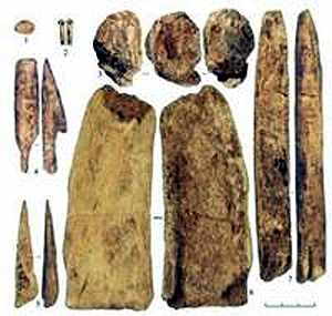
Non-stone artifacts from the lowest layer at Kostenki that includes a perforated shell, a probable small human figurine (three views, top center) and several assorted awls, mattocks and bone points dating to greater than 40 000 years ago
The CI Y5 Tephra was recently dated in the eastern Mediterranean using the potassium-argon dating method to 39 300 years ago; and optically stimulated luminescence dating of the layers below it at Kostenki indicates that they are several thousand years older than the tephra. The new non-Aurignacian assemblage is unarguably sophisticated, particularly in comparison with the local Mousterian, including large prismatic blades, numerous burins, end scrapers and pieces esquillees.
Photo and text: http://archaeology.about.com/od/earlymansites/a/kostenki.htm
Colorado University at Boulder © 2007
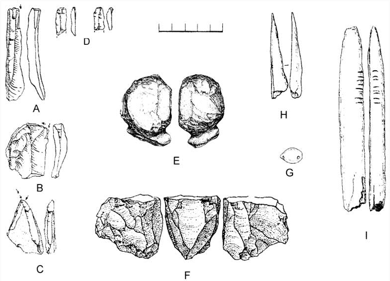
Shell, fossil, and bone ornaments were made with a hand-held rotary drill. Perforated shells originating in the Black Sea region were discovered; and a piece of carved ivory may represent an unfinished human figurine. Finally, bones of small animals (hare, arctic fox, wolf, and bird) suggests the inhabitants used fairly sophisticated hunting methods.
Text: http://archaeology.about.com/od/earlymansites/a/kostenki.htm
Photo:
Early Upper Paleolithic in Eastern Europe and Implications for the Dispersal of Modern Humans
M. V. Anikovich, et al.
Science 315, 223 (2007)
My thanks to Dr Vance Holliday, Professor of Anthropology & Geosciences, University of Arizona, for access to this resource.
From: N.D. Praslov et al, 'The Steppes in the Late Palaeolithic'
Although a location close to a source of drinking water seems to have been a desideratum in each case, the strategy for positioning the settlement site seems to have been different. Mammoth hunters arranged their permanent settlements in low areas of dissected relief on the first and second terraces within river valleys, near brooks and ravines, e.g. Kostenki, Mezin; on the other hand specialist bison-hunters and the hunters of other gregarious animals preferred to settle in elevated areas with a good view, shown by the plateau sites of Amvrosievka, Zolotovka and Anetovka.
Late Palaeolithic sites excavated over the past decades provide good examples of cultural adaptations both in terms of general traits and in detail. Mammoth-hunters often used large mammoth bones for building purposes. There were many cases when mammoth long bones were used to stabilize the bases of dwellings (see photo below) in contact with the earth, in preference to wood which rots quickly (particularly in conditions of variable humidity). Cleaved transversally and dug into the ground, sometimes fixed in place with chips of bones or stones, they served as sockets into which wooden poles were inserted, at Kostenki 4, Kostenki 19, etc.
(Note: this is a method of ensuring that wooden poles for houses or other structures have a much longer life. Normally wood rots quickly in moist ground. The builders cut across the mammoth bones, which exposed the hollow centre of the bone. The bone was then dug into the ground and locked into position with rammed stones and bone chips around it, but the pole was inserted into the hollow centre of the bone, above ground level. It was thus not exposed to the fungi and wood rotting organisms such as insects and other invertebrates which otherwise destroy organic material such as wood in a few years. A similar method is used today to preserve vertical wooden supports for such things as carports, but steel stirrups are used to raise the wooden posts above the (usually concreted) ground level. - Don)
Tusks were used in the construction of roofs above subterranean dwellings at Kostenki I. Understandably, no such examples are found in the southern zone, as there are no mammoth remains in that area and bones of bison or horses are unsuited for such purposes.
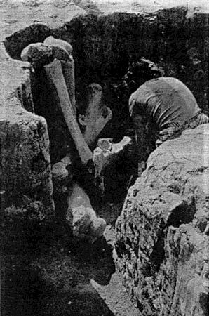
The structure of settlements and the 'regular' planning of dwellings in view of the relief shows how well adapted Late Palaeolithic hunters were. For instance, at Kostenki 4 long dwellings were arranged on a slope in such a position as to allow for water run-off along the long walls during the snow melt.
Of particular interest are the stone pavements found at sites of totally different cultures, situated in different landscape zones far from one another. Kostenki 21 is situated in the area of the Middle Don, whereas Muralovka lies on the right bank of the Mius liman (a brackish salt-water lagoon) not far from Taganrog. Both these settlements were situated near water sources, Kostenki 21 near a brook mouth, Muralovka on a bank of a liman (shallow lake - Don ).
Text above from: N.D. Praslov et al, 'The Steppes in the Late Palaeolithic'
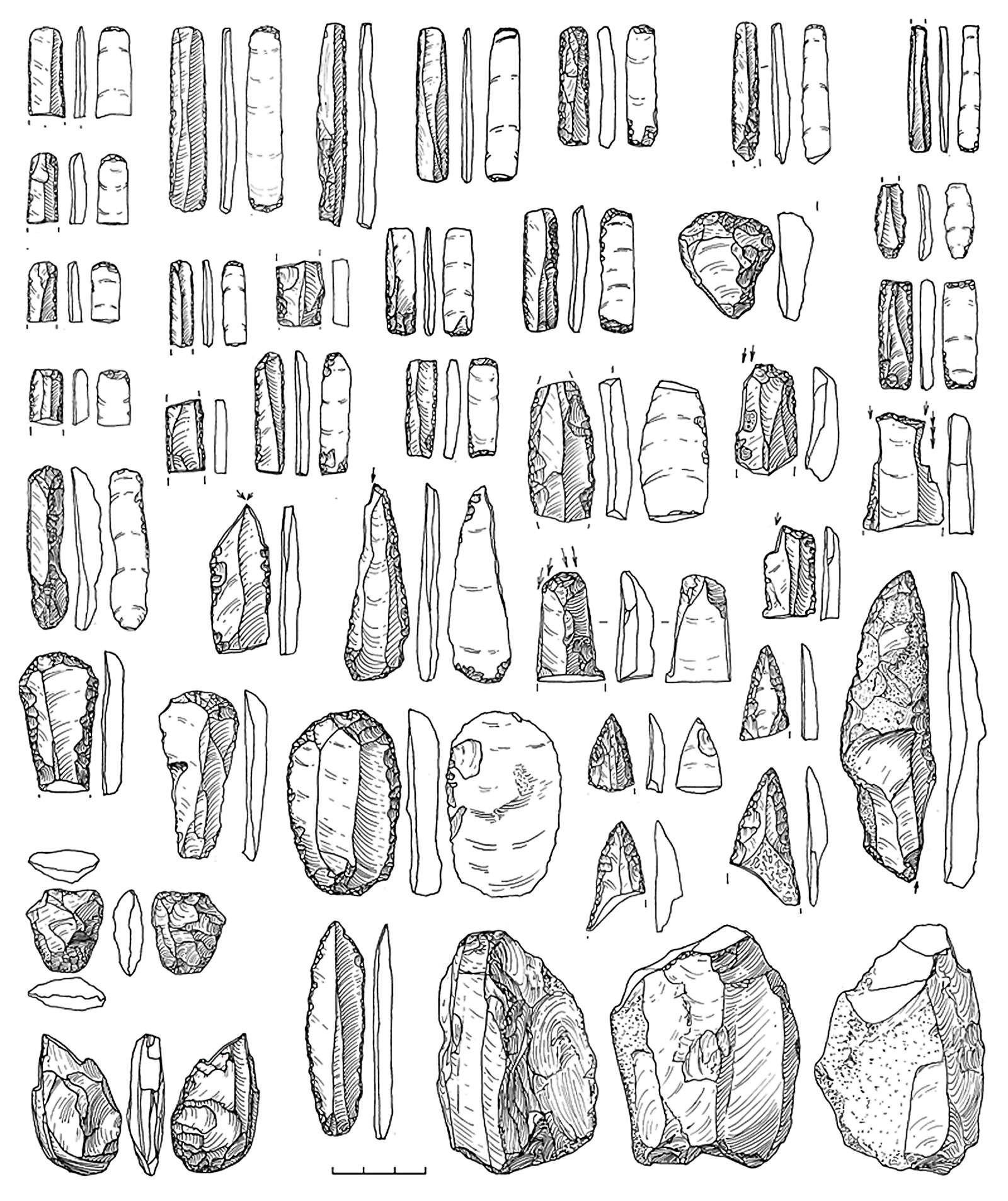
This tool industry of the Gravettian Borschevo - Kostienki region is characterised by high proportions of backed bladelets sometimes truncated at both ends (forming rectangles). The similarity between the assemblages of Kostienki 9 and Borschevo 5 (I) is also underlined by symmetrical or asymmetrical points whose edges have a semi-steep retouch.
Photo and text: Sinitsyn (2007)

The Kostenki sites are close not only to the Don River, which provided a "highway" for migrating mammoths, but to smaller streams and springs which almost always provided clear drinking water, not muddied by floods or glacier runoff clouded by ground rock.
This pontoon bridge provides valuable access from one side of the Don to the other. The gears visible on the right are used to tension the wire rope which helps to keep the pontoons lined up correctly.
Photo: Vladimir Gorodnjanski, 2006
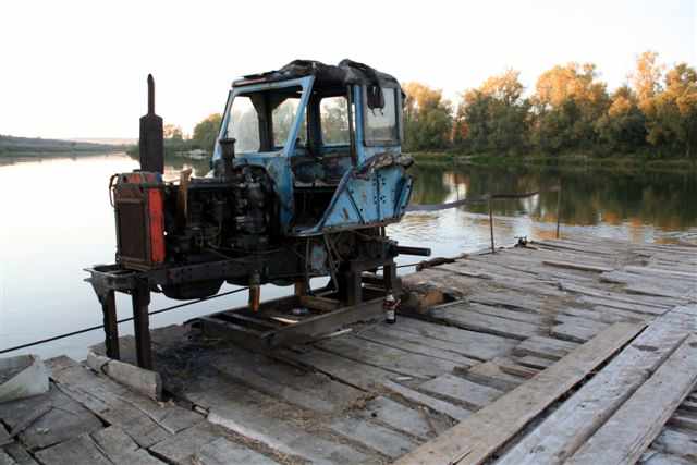
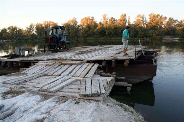
Elsewhere, car ferries are used. This one has a recycled tractor to act as the motive power, pulling on a wire rope stretched from one side of the Don River to the other.
Photo: Vladimir Gorodnjanski, 2006
 Ongoing excavations in Russia indicate anatomically modern humans were developing new technologies for survival in the cold, harsh region some 30 000 to 40 000 years ago, according to a University of Colorado at Boulder researcher...excavations at Kostenki -- a series of more than 20 sites about 250 miles south of present-day Moscow -- have yielded bone and ivory needles with eyelets that are 30 000 years old.
A similar situation was observed at Muralovka. The dwelling was situated on a small cape on a bank of a liman. Quite near its western side ground water ran from below loamy clay along the surface of Sarmatian limestone. To keep out the constant moisture, a narrow band along the north-western part of the dwelling was paved with limestone slabs.
Hunting flourished during the so-called middle part of the Upper Palaeolithic. In my opinion, this was promoted considerably by the improvement of hunting implements, particularly the ability to launch projectiles over a longer range after the bow was invented and brought into use between 30 000 and 25 000 b.p.
Photo and text: http://www.marsearthconnection.com/news.html
(Google cache, no longer there. Photo probably summer 2001)
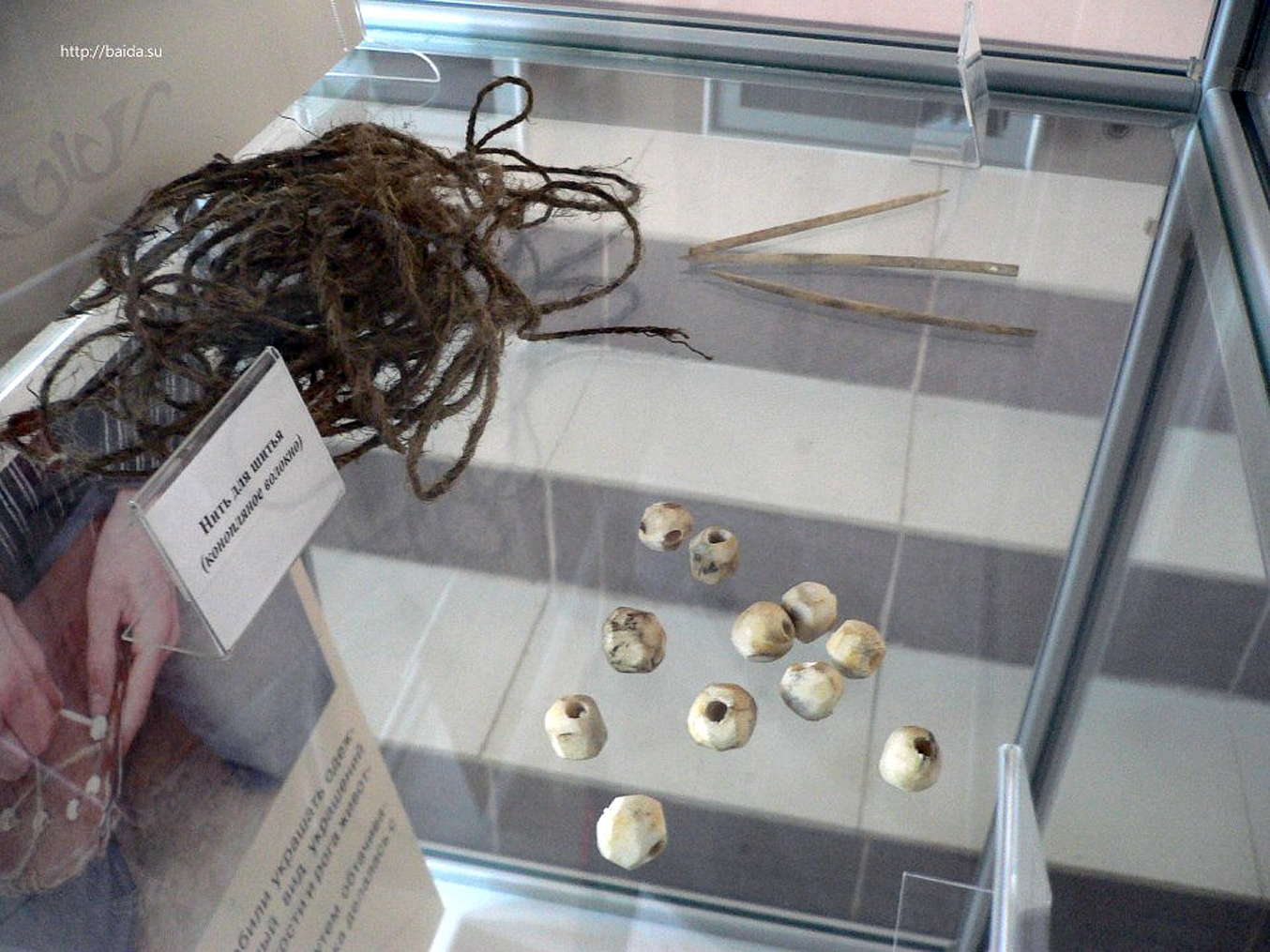
Needles and beads from Kostenki.
Hemp thread was used for sewing.
Photo: http://baida.su/2010/07/progulka-na-20-000-let-nazad/
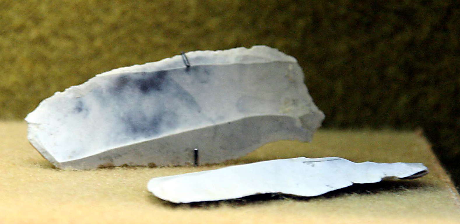
Typical Kostenki knives
Photo: Vladimir Gorodnjanski 2007
Source: The Hermitage Museum, Saint Petersburg
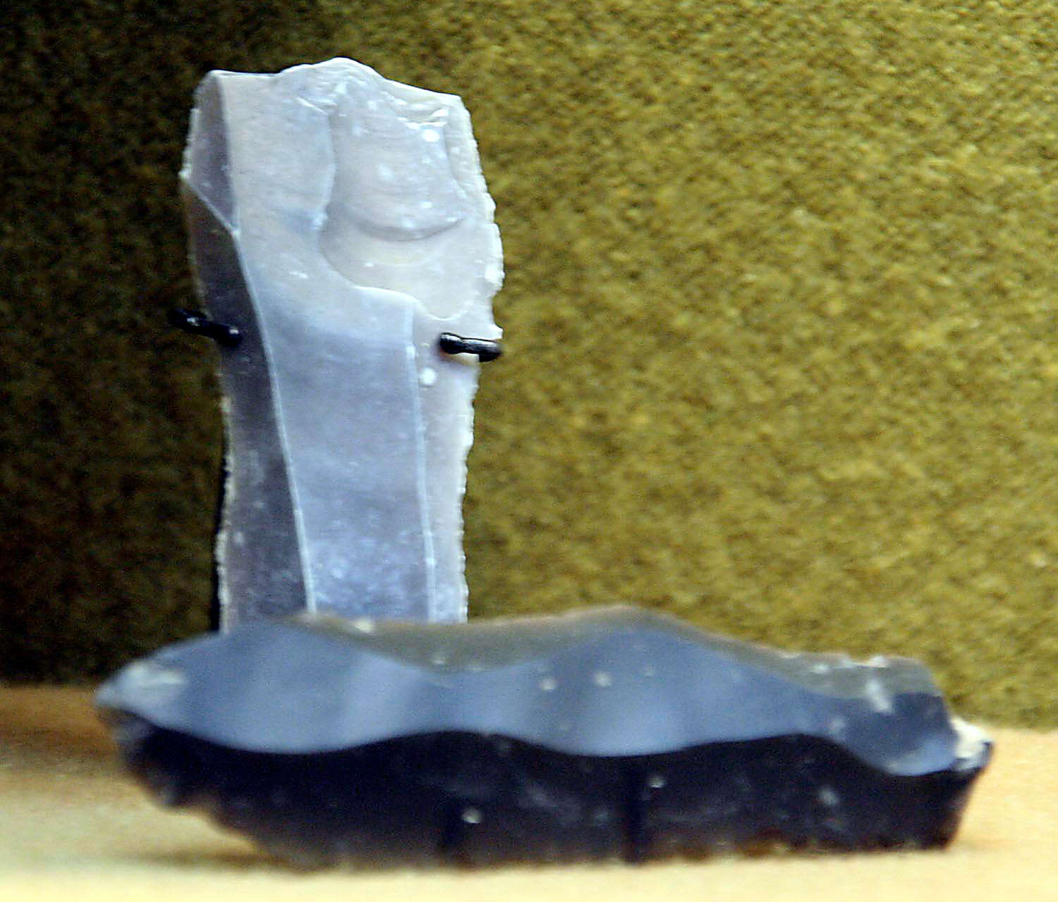
Shouldered points
Photo: Vladimir Gorodnjanski 2007
Source: The Hermitage Museum, Saint Petersburg
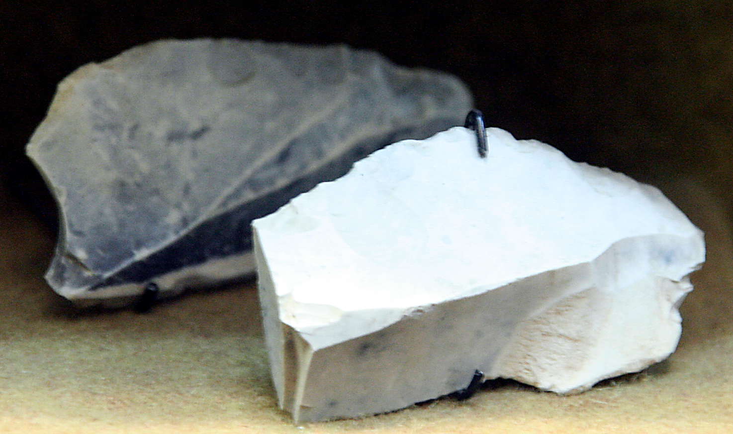
knife, burin.
Photo: Vladimir Gorodnjanski 2007
Source: The Hermitage Museum, Saint Petersburg

Point (apparently broken off - Don )
Photo: Vladimir Gorodnjanski 2007
Source: The Hermitage Museum, Saint Petersburg
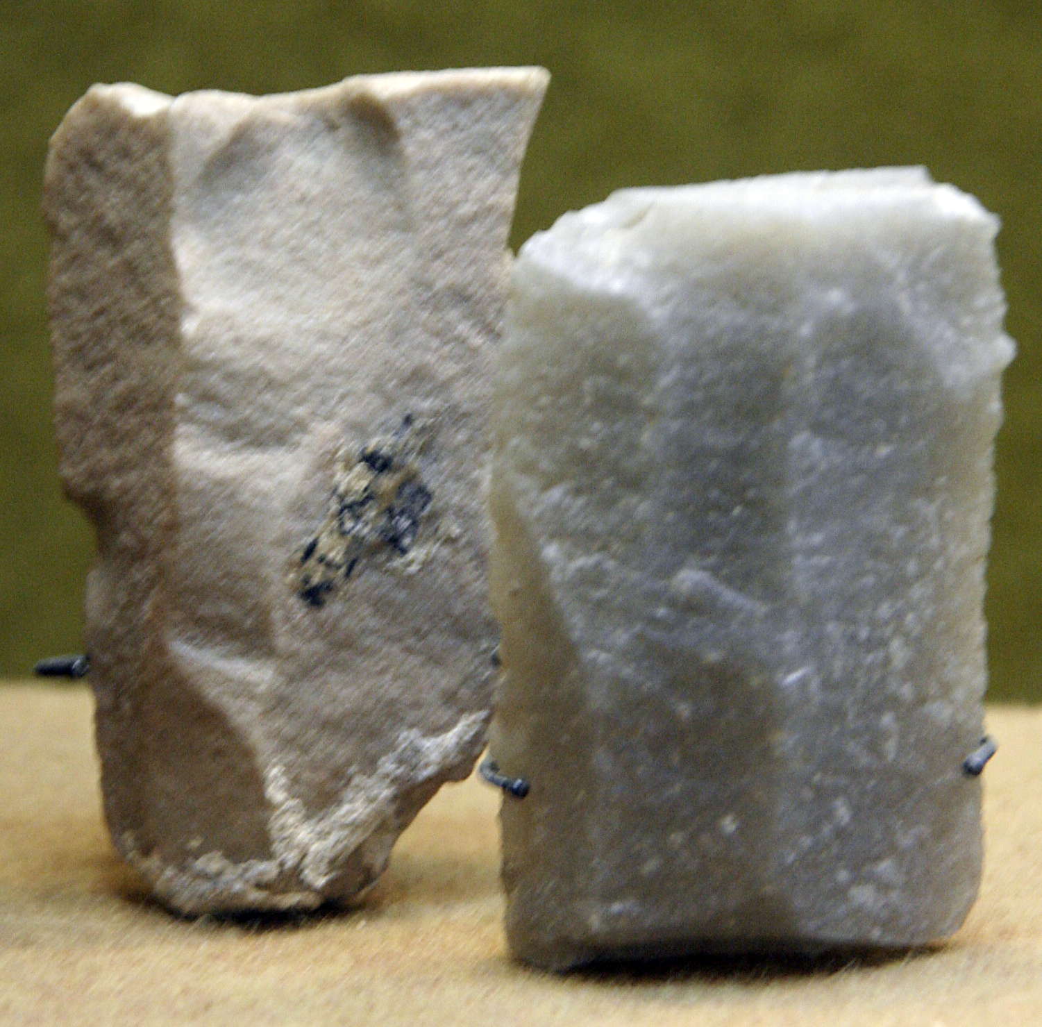
Scrapers
Photo: Vladimir Gorodnjanski 2007
Source: The Hermitage Museum, Saint Petersburg
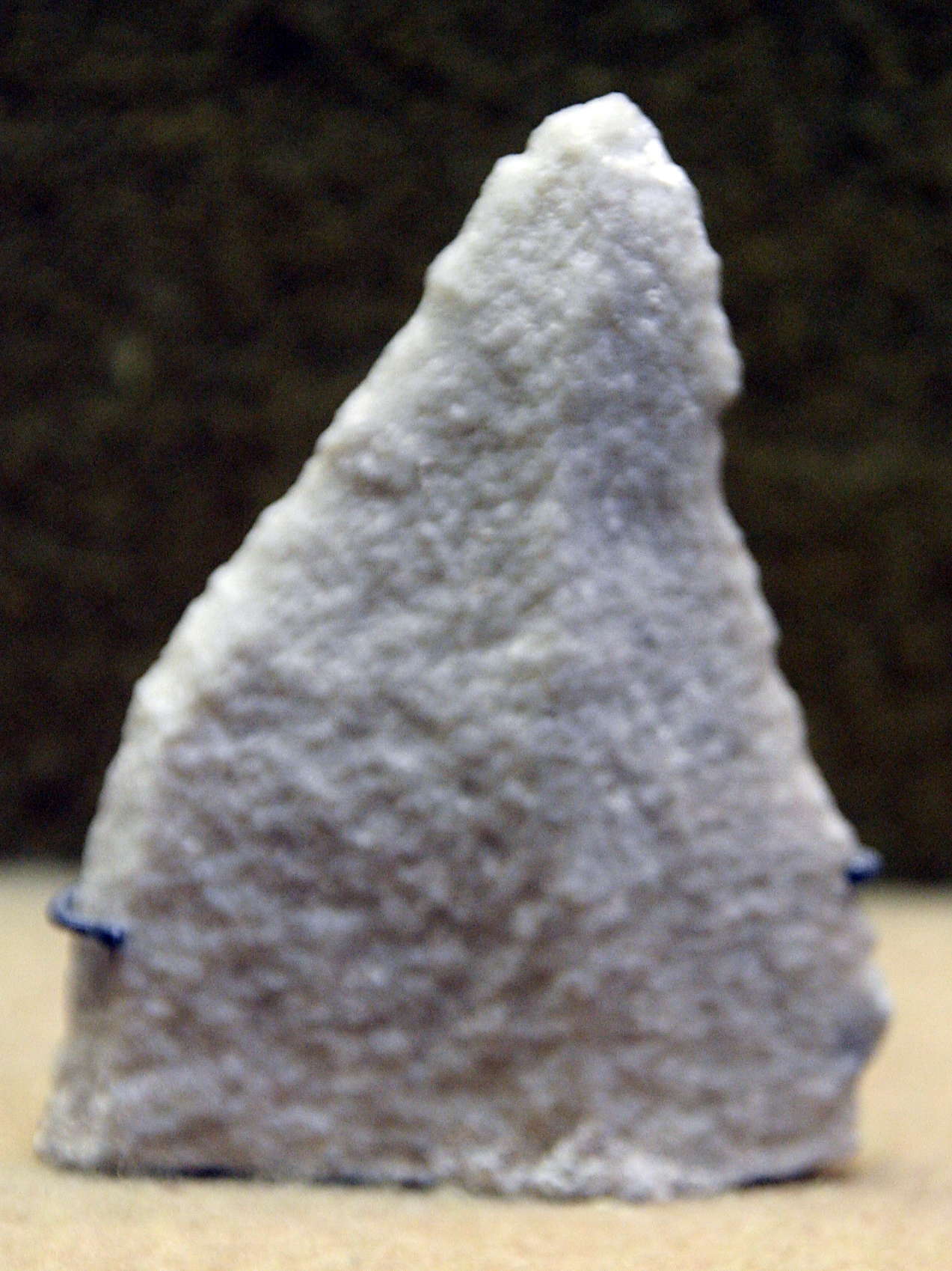
Nucleus or core.
Photo: Vladimir Gorodnjanski 2007
Source: The Hermitage Museum, Saint Petersburg

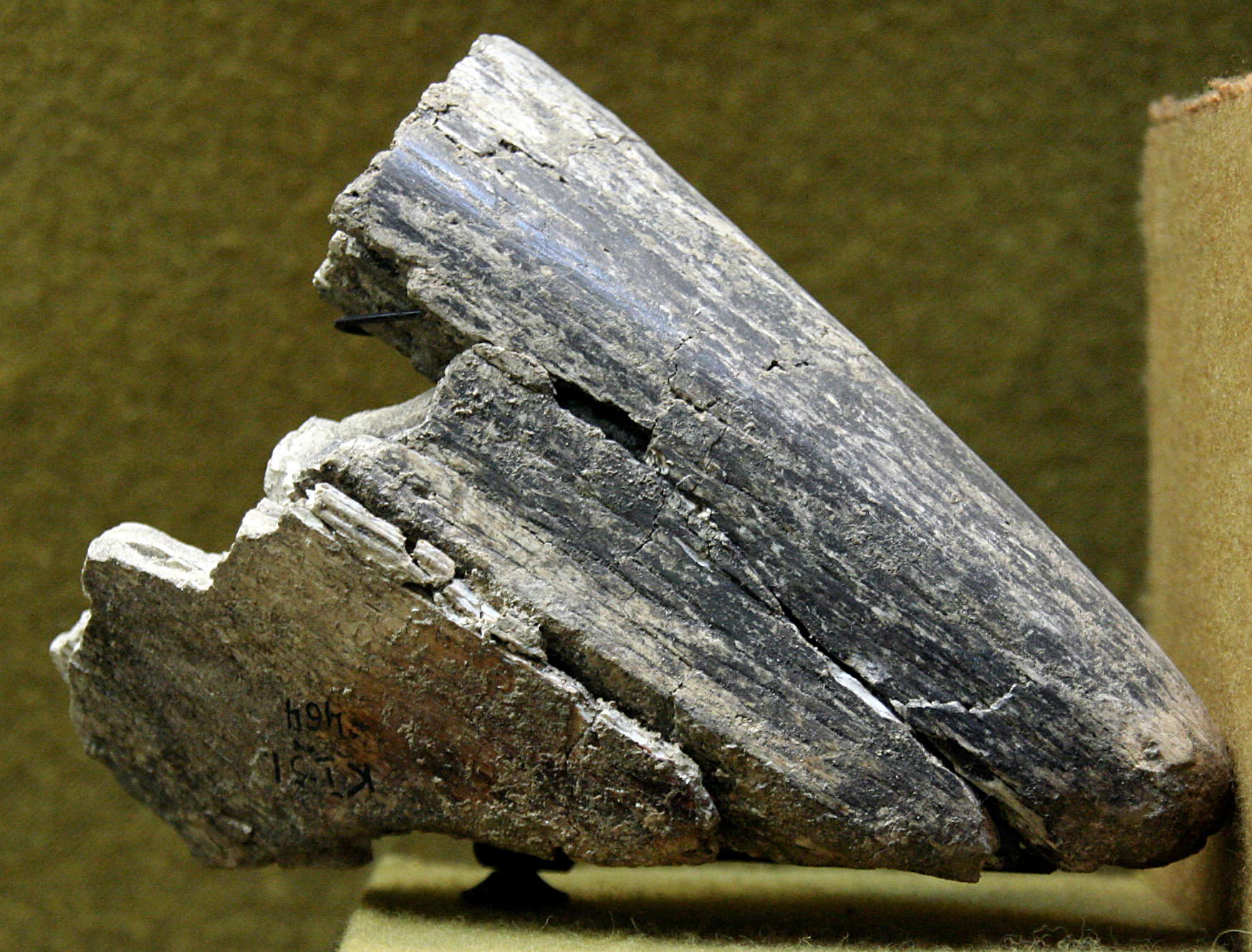
Fragments of mammoth bone.
The piece on the left appears to have been used as a striker to obtain flakes or blades.
Photo: Vladimir Gorodnjanski 2007
Source: The Hermitage Museum, Saint Petersburg
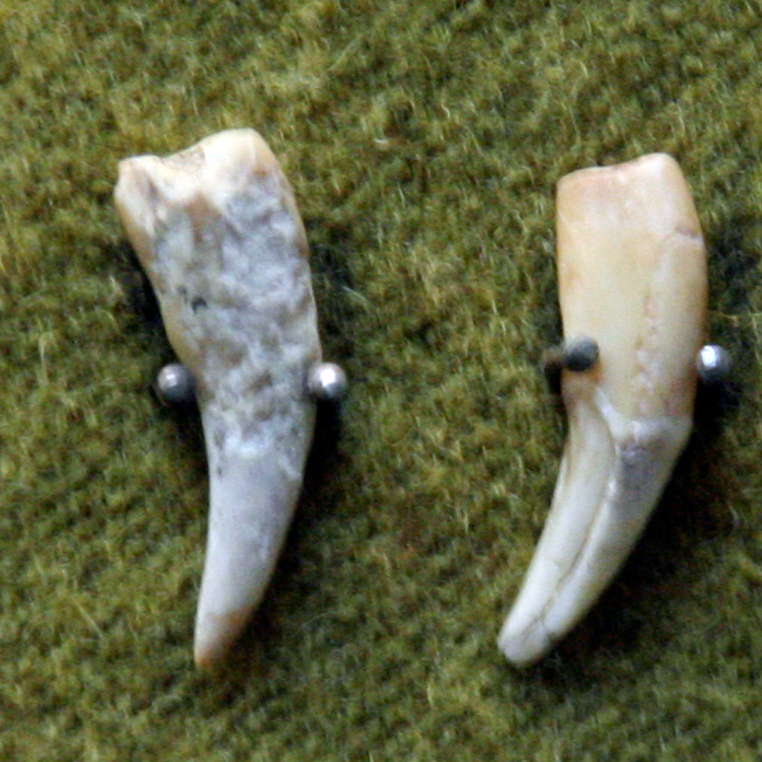
Pierced fox canines, Kostenki.
Photo: Vladimir Gorodnjanski 2007
Source: The Hermitage Museum, Saint Petersburg
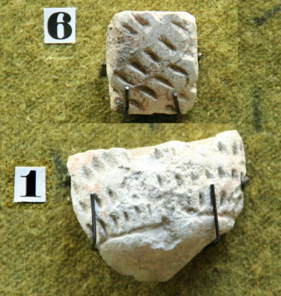
Kostenki jewellery.
6 - части статузток
1 - Украшения
Photo: Vladimir Gorodnjanski 2007
Source: The Hermitage Museum, Saint Petersburg

Mammoth tusk from Kostenki with traces of carving.
Photo: Vladimir Gorodnjanski 2007
Source: The Hermitage Museum, Saint Petersburg
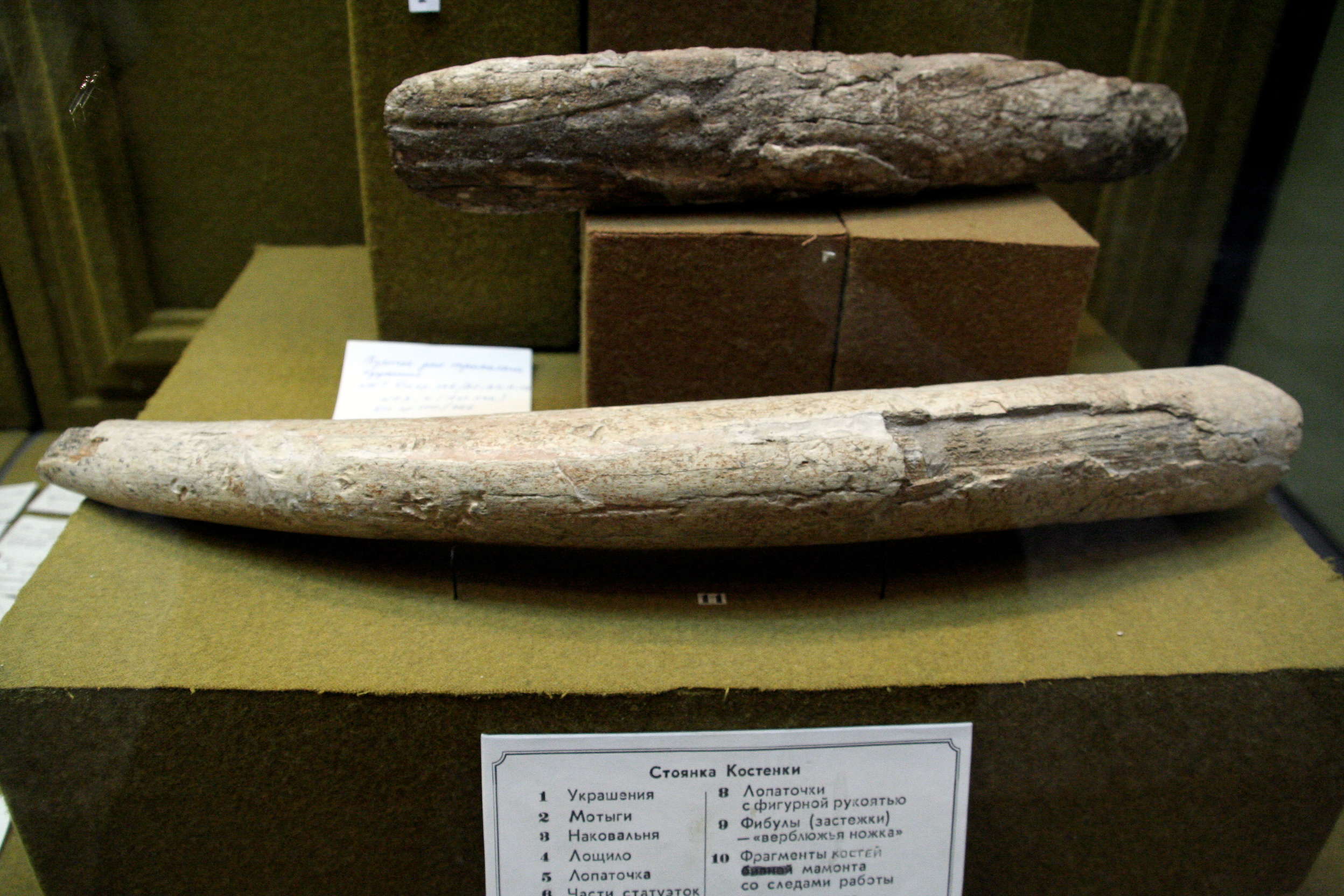
Mammoth tusk from Kostenki with traces of carving.
Photo: Vladimir Gorodnjanski 2007
Source: The Hermitage Museum, Saint Petersburg
Close up of the mammoth tusk with traces of carving shown above.
Photo: Vladimir Gorodnjanski 2007
Source: The Hermitage Museum, Saint Petersburg
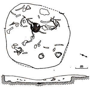
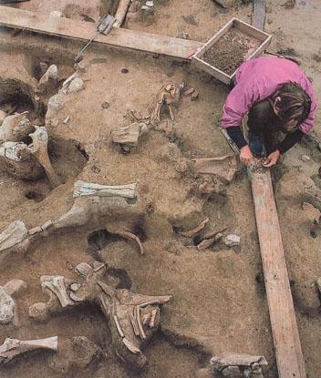
From scattered mammoth bones excavators at Kostenki along the Don River south of Voronezh in Russia reconstruct the appearance of shelters built some 23 000 years ago. A wealth of ornaments, tools, and animal remains point to a complex life style and plentiful game exploited by hunters who had adapted to the cold of windswept steppes and were not constantly on the move seeking food.
Reconstruction of a house at Kostenki which does not use mammoth bones as a primary structural material.
Photo: From the book shown, by Vinnikov.
My thanks to Vladimir Gorodnjanski for access to this resource.
The text below is from pages 51 and 52 of the above book, by Vinnikov, and kindly translated for me by Vladimir Gorodnjanski:
There are now convincing proofs that paleolithic people used gathering or collecting as an auxiliary means of livelihood. They prepared berries, grains of wild cereals, young wild plants, dug up edible roots, and even supplemented the diet with fresh-water molluscs.
Found at the sites are many stone implements used for cutting up and grinding of vegetable food. They are found especially at Kostenki 1.
At the very end of the paleolithic people increasingly began using fishing even though they did not yet use hooks or nets.
Catching of a fish was conducted by the most elementary ways during the periods spawning when fish, becoming careless, gathered in shallow water, where they could be speared or harpooned.
Fish bones have been found at Kostenki 8.
Despite the increasing importance of collecting, hunting at this time was still the basis of the economy of palaeolithic communities, it defined their development, social system and spiritual life.
Only on the Don River are so many different types of buildings represented.
At Kostenki 1, huge dwellings up to 31 metres long and 8 metres wide, with many hearths and with many dug pantries were found, and at Kostenki 4 the top layer had a long dwelling with a living area of 187 square metres.
As well as these longitudinal plan dwellings, there were a number of round dwellings (constructed of bone and earth) as well, especially at Kostenki 2 and 11.
On a number of other sites, the dwellings were of an elementary type resembling tepees or wigwams, but surprisingly for such portable dwellings, there was a great accumulation at these sites of cultural artefacts, as though they were used for long periods of time in this one place.
On the bottom cultural layer of Kostenki 4 are found round dwellings with a diameter of 6 metres, slightly dug into the ground, with one fireplace in the centre and with an extension providing a type of inner porch.
In the construction of these larger semi subterranean dwellings, mammoth bones were widely used, and preference was given to tusks, skulls and shoulders of the animals. They were driven into the ground or stacked like a woodpile to provide the basis for the walls of the dwellings. As well, skins, wood and earth were used for building.
It is difficult to imagine in such a remote northern area, but the people of Kostenki had a gregarious way of life, where severe conditions demanded adaptation to the environment, sustained by hunting for animals which themselves were gregarious.
Cooperation was needed for both hunting these large animals, and in building these large shelters. It predetermined a settled way of life for human societies. Collecting was limited by the foods available within a limited territory, and a division of labour was probably necessary, possibly based on age and sex, as well as the size of the particular group. Adult men were probably engaged in hunting, the manufacture of stone and bone implements, and the construction of dwellings as well as the processing of large animals, those occupations which demanded greater physical strength.

The text below is from the very useful book 'The Prehistory of Europe' 1980 by Patricia Phillips (Allen Lane)
Kozlowski has recently discussed flint mines in southern Poland, one near Cracow, one near Czestochowa, and one near Radom. The latter source produces magnificent chocolate-coloured flint. All these sites have deep extraction shafts and shallower pits. In the Polish Late Palaeolithic (Swiderian) the flint extracted was initially worked near by, e.g. at the site of GoJac. Then pre-cores, initial cores and blank blades were exported. There is a vast distribution of chocolate flint, presumably coming from the Radom mines, along the River Vistula. Away from the source sites there is a greater concentration of artifacts and less flintworking debris than in the workshops near the mines. Kozlowski has studied the distribution of flint types in eastern Europe (as in the accompanying diagram) In the western part of Poland, Czechoslovakia and Hungary, Upper Palaeolithic peoples used a majority of Upper Silesian flint (76-87 per cent in Moravia), with some radiolarite coming from the Carpathians or the Alps in second place. In eastern Slovakia and east Hungary, the dominant material used was the local obsidian and in the Dneister and Punt valleys local Cretaceous flint. Kozlowski has suggested intergroup ownership of source areas, or early barter, as an explanation for distribution patterns of flint and other materials. He suggests that these trade routes began in the Paudorf interstadial, i.e. from approximately 30 000 years B.P. One route led from the Danube to the Morava to the Oder, and another from the Dniester to the east Carpathian passes, and thence to the Carpathian basins.
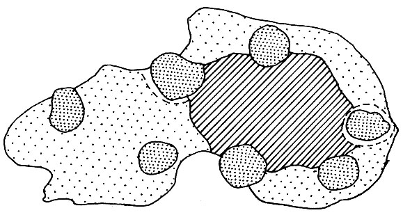
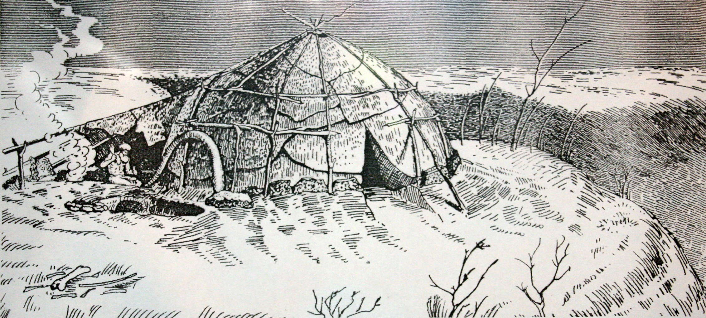
Photo: Vladimir Gorodnjanski
Source: Display, Voronezh Museum
the quote below is from:
"The Russian Dig" by: Andrea Elyse Messer (Research/Penn State, Vol. 17, no. 1 (March, 1996))
The landscape was amazing. Miles of gently rolling fields filled with wild flowers and herbs. As we walked, the smell of dill, mint, and marjoram was strong. At the terminal moraine, the furthest reach of the glaciers, the ground stretched out a series of very thin fingers above a drop of hundreds of feet. The archaeologists keep a small section of the edge of one finger clear of vegetation so that, standing across on another finger, we could see the sediment layers clearly: The 28 000-year-old layer, from which we would be excavating human artifacts and evidence of habitations (Americans can claim human occupation only back to 12,000 or perhaps 14,000 years ago). And two other layers beneath, the earliest dating to about 35,000 before present.
the quote below is from:
http://www.zin.ru/annrep/2000/14.html
As a result of archaeological excavations in Late Palaeolithic sites in Kostenki village in Voronezhskaya Oblast vast paleontological material has been accumulated comprising more than 50 000 bones of different mammal species of which more than 10 000 belong to the mammoth. Fossil bones collected were characterized by poor state of preservation, and therefore only 497 specimens were used for measurements during the period from 1977 through 1989. .............
Length of numerous tusks in Kostenki in Voronezhskaya Oblast varied from 18 cm to 3 m. Female tusks were 40-95 mm in diameter, on the average 81.3 mm (n=22). Their circumference varied from 130 to 300 mm, on the average 235.73 mm. Tusks ascribed to males were 97-195 mm in diameter on the average 140.2 mm (n=48) with circumference of 310-615 mm on the average 440.22 mm.
the quote below is from:
http://www.alekseevmanuscript.com/ChapterIV.html
Kostenki is located in the Don River Basin near the Sea of Azov. It is a small village surrounded by hills and dry valleys, ideal for hunting. At the site of Kostenki, both stone and bone tools have been found as well as stone and bone sculptures. Alexander Marshack interprets decorations found on bone pieces as astrological calculations. Bone female figurines also have been found; these are similar to those found in Willendorf, Austria and are examples of Kostenki art. Here at Kostenki there is also evidence of houses.
Both Kostenki II and Kostenki XIV produced burials of Upper Paleolithic man. Skeletal remains from Kostenki II are of an adult male, tall, and approximately fifty years of age. Reconstruction of the head reveals a broad face and narrow brow. The head from Kostenki XIV is the best preserved; no bones were destroyed except for the end of the nasal bone which had been crushed by the investigator. Reconstruction reflects a very strong adult individual with a combination of morphological features. The nose is very broad, similar to African or Australian. This strong development around the nose is not typical for Europoid but is similar to East African populations; however, Negroid nasal bones are flat while Kostenki XIV is strong. This find is a combination of features whose origin is different from other groups.
Thus, at Kostenki, we have both stone and bone tools and sculptures as well as houses, female figurines similar the "Venus of Willendorf", and the remains of Upper Paleolithic man. From Kostenki II we have a broad head and narrow brow and from Kostenki XIV we have a tall adult exhibiting a combination of strong physical features which differ from typical Europoid.
The quotes below are from: The Pictorial Encyclopedia of The Evolution of Man
J. Jelinek
PP236 - 247
Discoveries from Ukraine and south Siberia
Discoveries of Stone Age settlements in Ukraine and south Siberia have yielded much information. Both areas belong to the loess regions which bear so many Palaeolithic remains. The dwellings can be divided into two groups. There are round dwellings with a diameter of about 5 to 6 metres, and there are dwellings which are very large and are thought to have been inhabited by whole tribes. These dwellings usually have many fireplaces running down the middle. Today, ideas have changed and it is not clear whether the settlement was made up of separate dwellings with the fireplaces in the middle, or whether they represent a single construction.
The oldest Ukrainian dwelling was excavated during 1955 to 1961 and 1963 in Molodova on the banks of the river Dniester, USSR. Large mammoth bones from the Mousterian layer were found lying in a circle. The circle was 6 to 8 metres in diameter and consisted of twelve skulls, fifteen tusks, thirty-four hip and shoulder blade bones, five lower jaws, and fifty-one mammoth long-bones. The circle was broken in two diametrically opposed places, which must have been the entrances. Inside the dwelling fifteen small fireplaces were found, their size varying from 0.4 by 1.0 metres and 0.3 by 0.4 metres. They contained burned bones and charcoal and this latter proved that the inhabitants had used wood to make their fires.
There is not much evidence of what this dwelling looked like inside. It is probable that the basic structure was made of wood and was covered with animal skins which were held down at the edges by bones. The large mammoth bones were obviously part of the building material. This type of construction is also found in Upper Palaeolithic settlements in Ukraine, and seems proof that man was already able to build large dwellings in the Middle Palaeolithic and that he was no longer dependent on caves. The remains of the dwelling found at Molodova, however, could not nave been arrived at without many years of prior development because such a dwelling cannot be called primitive any more.
The site of Telmanskaya at Kostienki (Ukraine) was discovered by P P Yefimenko and A N Rogatchev in 1937. In the upper cultural layer a round hut-pit with a diameter of 5.2 to 5.6 metres and 500 to 700 millimetres deep was found. The walls were upright and the bottom flat. A 2 metre wide passage led out of the hut in a westerly direction. The only bowl-shaped fireplace lay right in the centre of' the hut. It measured 750 to 800 millimetres in diameter, was 150 to 200 millimetres deep, and contained ash and burned bones. Opposite the entrance three depressions in the ground were noticed. These were probably used as storage places. Rogatchev continued the research here in 1949 and 1950 and found further pits. If they had all been built simultaneously the dwelling could not have been habitable. It can be assumed that several layers representing continuous periods must have contributed to the positions of the various pits and holes. This settlement is similar in size and in the shape of the small pits to the settlement of Alexandrovka which lies only a little further away.
Rogatchev discovered second, third, and fourth occupation layers. The second layer revealed a complete settlement and part of a round dwelling six to seven metres in diameter which stood out as being different from the surroundings by kind and number of tools. Several quartz flakes were found here, but hardly, any mammoth tusks, bones, and bone flakes, although these were found in abundance outside the hut, while no quartz flakes were found outside at all. A fireplace was in the centre of the round hut, and it contained charcoal and burned bones. It is not a rare occurrence at Kostienki to find more than one occupation level, which must mean that this was a very favourable place, situated as it is along the banks of the river Don on clay ground.
The site of Alexandrovka is known as Kostienki IV and was excavated in 1937 and 1938 by A N Rogatchev. He discovered two kinds of settlement which he later attributed to two different cultures. He uncovered two round huts in the upper layer which were overlapping on one side with huts of the lower layer, and which presented a number of fireplaces. A loess deposit, completely sterile, separated the two layers: this loess deposit was found opposite the two round huts of the upper layer. The lower deposits also showed outlines of round huts and contained large dwellings. Rogatchev felt that the two occupation layers must have intermingled at a later date, as there were different types of dwellings as well as differences in other objects. The upper layer contained several quartz, slate, and mammoth ivory flakes, and typical burins and bifacial stone tools which were all totally absent in the lower layer.
The outlines of the two round huts of the upper layer were only 100 to 400 millimetres deep, and each had a bowl-shaped fireplace in the centre of the floor. Many more implements were discovered inside the hut than outside. On the northern edge of the dwelling situated to the west the thinner cultural layer did not reach far beyond the hollowed-out space of each hut. This did not happen on the southern edge where the two round huts were connected by an ochre-coloured substance. The area was sloping slightly at this particular point, and it can be assumed that the upper deposit had slipped down at a later date.
The hut on the western side was more interesting. It was 400 millimetres deep towards its northern edge but only 100 millimetres on its eastern side. There the floor of the hut was on a level with the ground outside. Six enormous tusks were found inside, the larger part of a humerus bone, a lower jaw, part of a shoulder blade, and parts of the spines and ribs of mammoths At the edge of this deposit twenty large sandstone stabs and pieces of sandstone were found. They lay at the very top of this deposit. and may be considered to be building material.
Particularly interesting was the discovery of a lion's skull, found in the upper levels of the layer. Rogatchev thought that the skull might have been kept on top of the roof as a kind of decoration or that it might have had some ritual significance. Yefimenko made an interesting discovery of the skull of an aurochs in dwelling 'A' at the site of Kostienki 1, which might be a parallel.
The fireplace which was in the centre of the settlement was surrounded by about twenty holes, about 200 millimetres deep. They were probably used to store or prepare food, because pots or similar containers were unknown at this period. The tusks and bones of mammoths in the eastern dwelling were found at the bottom of the layer, not at the top. It can be assumed that they were not part of the construction (with the exception of the two tusks which were found in a somewhat higher level). The fireplace which was almost round, measured I metre in diameter, was approximately 100 millimetres deep, and slightly tilted in a westerly direction. It had a flat base and was bordered by a very small rim, only slightly protruding above the normal surface of the hut, Five medium-sized holes were found nearby, and from their position it would appear that they were of different periods. On the southern edge of the settlement a clay wall in good condition was found, it was 50 to 90 millimetres high and 400 to 500 millimetres wide. The clay was obviously deposited there when the living area was dug out and was then used either to stabilise the huts or to form a retaining border. The flat stones found at the western side must also have been used in the same way.
The lower layer of this site revealed two large, long dwellings. The one on the southern side was 33.5 metres by 5.5 metres and was distinguishable by the reddish colouring of its cultural layer. The other one was situated between 17 and 20 metres further north and measured 5.5 by 2.3 metres. (this length and width appear to be typographical errors) The first dwelling had more than ten (11 fireplaces are shown) centrally placed fireplaces in it and the plan shows that there must have been three different parts which are separated from one another by steps about 100 millimetres high. The first part, to the west, was 14 metres long, the centre part was 9 metres long, and the eastern section was 10.5 metres long, and also contained the richest finds. (28.6 metres by 6 metres according to the plan. This could easily be the description for 371 instead of 370) The dwelling was constructed along the slope obviously to protect its shortest side against the rain and water from melting snow. All fireplaces were built along the longitudinal axis of the dwelling, and it can be assumed that the structure must have had a roof which was highest in the middle.( no mention is made here of the add-on semicircular section) The roof was obviously anchored to the ground and cross-beams were connected to the ridge.
This is also substantiated by the way in which it was found. The middle of the dwelling produced more material probably because all activities were carried out there. On the north end of the western section was a kind of passage which was obviously the only entrance and faced the valley of the Don. Most of the stone and bone flakes were found around the fireplaces which means that meals were prepared here, and tools made. All activities were obviously carried out inside the dwelling. Most of the bones found here belonged to hares; other animals are rarely found. On the north, and south-east side of the dwelling two smaller areas were found; they were not dug out, but were covered with flaked stones and bones. In the warm season people obviously used to sit outside and work.
The outlines of the second dwelling were clearly marked by the tool-finds. This dwelling, too, was divided into three parts and had altogether nine bowl-shaped fireplaces. There were two fireplaces in the western part, four in the central section, and three in the south-eastern part. ( 33.3 metres by 6 metres according to the plan. The division of the fireplaces identifies this as plan 371) Three cooking pits and twenty five smaller holes were found around the fireplaces - they were 200 to 400 millimetres across and of the same depth. There were no holes outside the dwelling. Three upright mammoth flakes of long-bones were found on the western part 600 millimetres away from the edge of the dwelling, and they obviously were used to strengthen the clay wall around it.
Kostienki I is sometimes also called Polyakovo. P P Yefimenko did some research there during 1931 to 1936, and A N Rogatchev researched during 1938. Yefimenko uncovered an oval-shaped settlement measuring 14 to 15 metres by 36 metres, where numerous tools were found in the deposits inside the dwelling, although only a few implements occurred outside. It is possible that the living room was surrounded by some kind of walls. At the edge of this settlement Yefimenko found four large pits filled with deposits, and he called them the winter hut-pits. He also found twelve smaller ones which were used to keep bones in. If the building covered the whole area, as Yefimenko assumes, the pits at the edge could then be remains of the construction. It is more likely, however, that only part of the area was covered, a fact indicated by the finds. Semi-subterranean hut-pit 'A' could be described as one of the larger dwellings. It is about 2 metres by 3.5 metres and has a small terraced passage leading to the outside. A mammoth tusk and two shoulder-blades were found here with which the entrance could be covered up. Mammoth shoulder-blades were also used in the Upper Palaeolithic to cover graves, so that it is not surprising that they were also used to build huts. A similar entrance at the back of the hut was also found; it was shorter and steeper. But this could have been some kind of light shaft.
The floor of the hut-pit was more or less flat and showed outlines of two circles. One of them was larger and had a fireplace in the centre. The smaller circle had two layers of bones. The upper layer consisted mainly of shoulder-blades, hip-bones, and tusks of the mammoth. The lower layer, which was level with the floor of the hut, consisted mainly of tusks which were laid with the points turned inwards towards the centre of the room. They were fairly regularly spaced. This was presumably the supporting framework of the dome shaped roof which collapsed once the hut-pit was empty. The floor of the hut was approximately I metre below the ground and the top of the hut rose 0.8 to 1.0 metres.
These facts led Polykarpovitch to believe that these pit-huts must have been used for sleeping and somehow were kept warm: otherwise they would not have been sufficient protection against the cold. They showed no traces of typical fireplaces; one layer of coal and ash could be found and there was only a little space left around the remains of embers. It could be that the main fire was kept somewhere else and that the inhabitants collected the hot ash and bone 'coal' in rolled up animal skins and took them back to their huts and slept on them. This hypothesis is strengthened by the fact that no traces of stone nor large bones could be found inside the huts. Rogatchev also assumed that sick people could have been cured there. But an answer to this suggestion can only be given after further research has been carried out.
Along the middle of the large settlement eleven fireplaces were found. two of them a little further away, towards the edge of it. Several irregular, bowl-shaped depressions and small holes were found inside the dwelling which might have been used as storage places. Beside some of the depressions large mammoth bones had been stuck vertically into the ground. According to Yefimenko they were used as working tables or anvils, and the pits which contained numerous implements could be thought of as the working places. Rogatchev also discovered well-preserved remains of hut constructions in Kostienki-Anosovskaya with several deep store pits, where large bones were used in their construction.
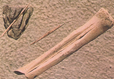
How to make a bone needle: A small bone splinter is removed by making two grooves (or sometimes three if a short one is made at the blunt end of the needle) using a flint burin. The splinter is then perforated, shaped and polished on a piece of sandstone.
It should be noted that the flint for the tools found at Kostienki came from at least 90 miles away. This would be a powerful incentive for getting the most blades possible from each nodule of flint.
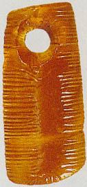
Drilled bead of fossilised sea-urchin spine, 36 000 years BP.
Photo: Time Magazine 13th Feb 1995
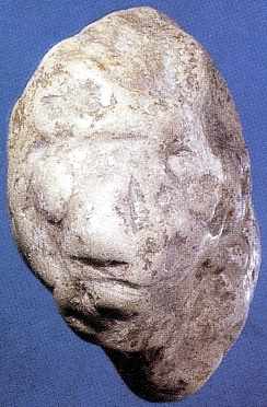 Tête zoomorphe sculptée de S(K?)ostienski 1 - Collection MAE - Photo L. Iakovleva.
Carved head from S(K?)ostienski 1 - Collection MAE - Photograph L Iakovleva.
Photo and French text: "les mammouths - Dossiers
Archéologie - n° 291 - Mars 2004"
Photograph L Iakovleva.
My thanks to Anya for access to this resource.
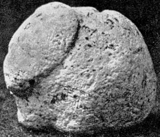
2 cm long stylised stone mammoth from Kostienki.
Photo: J. Jelinek, 'The Evolution of Man'
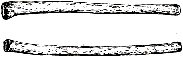
Pipes made from long, hollow bird bones from Kostienki 1. They may have been musical instruments or animal lures.
Photo: K. Sklenar, 'Hunters of the Stone Age'
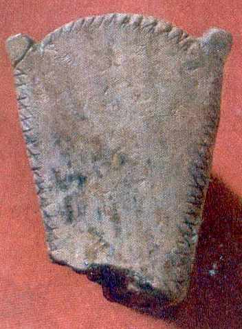
The decorated head of a spade from Kostenki 1.
Photo: Archaeology of the USSR - The Palaeolithic of the USSR.
My thanks to Vladimir Gorodnjanski for access to this resource.
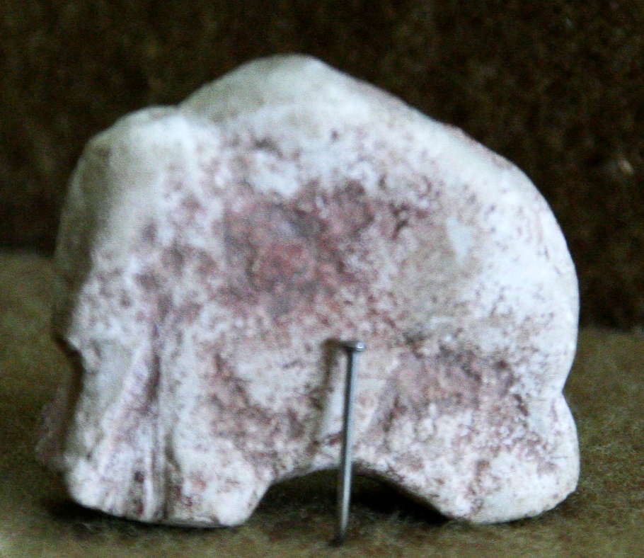
Sculpture of a mammoth.
Photo: Vladimir Gorodnjanski 2007
Source: The Hermitage Museum, Saint Petersburg
From:
http://carbon14.univ-lyon1.fr/synits.htm
Kostenki-Borshchevo area is the principal for the chronology of Upper Palaeolithic of the Eastern Europe. More than 25 sites are located on the territory of about 20 sq. km, along the right bank of the Don. Taking into account that more than 10 sites are multi-layer, remains of more than 50 settlements of palaeolithic times are represented here.
The stratigraphy of the second terrace above the floodplain of the Don and of the large ravines was the basis for relative chronology which was established by A.N.Rogachev in the middle sixties in cooperation with the geologists M.N. Grishchenko, G.I. Lazukov, A.A. Velichko. The sequence of deposits from the top up to bottom is represented by the following succession: chernozem, followed by loess-like loams, and two humic beds, separated by non-humic loams with lenses of volcanic ash.
At the first stage the chronological scheme consists of four, later - of three chronological groups. The first (ancient) group included sites with cultural layers in the lower humic bed; the second consisted of sites in the upper humic bed; and the third included sites in the overlaying loess loams which constitute a colluvial deposit on the first and second terraces above the floodplain.
The background for the division of lower and upper humic beds is the horizon of the sterile loam containing lenses of volcanic ash. According to analytical investigations, the age of the volcanic ash can be regarded as 35-32 kyr, (i.e. 35 000 to 32 000 years ago) and can be attributed to one of the eruptions of Campi Flegrei in Italy. These dates appear to be an upper limit of the first chronological group, which framework is define at 33-36 kyr with the very probable more ancient lower limit back to 40 kyr. Among the series of 17 14C dates for 6 site of this group the most important are dates of 34-37 kyr for Kostenki 1 (V), 36 kyr for Kostenki 12 (III) and Kostenki 17 (II), and 33 kyr for Kostenki 14 (IVa). Pollen records indicate an evolution of the vegetation from pine forest conditions to forest with the dominant of spruce (Picea) of tiaga type and to the meadow-steppe associations. The climate change from cold to temperate, relatively warm and humid correspond to the interglacial environment in the lower part and to the beginning of glaciation in the upper part of the deposits of the lower humic bed. Paleomagnetic digression correlated with Lashamp excursus (41-43 kyr) was identified inside this deposits. Times and conditions of the accumulation of lower humic bed are comparable with the Hengelo interglaciation of Western Europe.
Remains of 14 settlements, 10 of which have a radiocarbon dates, compose the second chronological group which cultural layers lie in the deposits of the upper humic bed above the horizon of volcanic ash. According to series of 14C dates for Kostenki 1 (III), Kostenki 12 (Ia), Kostenki 14 (II) the age of the sites and the times of the accumulation of upper humic bed are defined in the frameworks of 32-27 kyr. Pollen records are the evidence for the very complicated processes of climate fluctuation during this period. From 7 up to 4 vegetation cycles are identified on Kostenki 1, 14, 17. In general the climate and environment indicate the replacement of the warm humid interglacial conditions by cold and dry environment of the glaciation. The most probable equivalent seems to be Arcy-Denecamp - Kesselt period of Western scheme.

40.827 N, 14.139 E; summit elev. 458 m
The volcano of Campi Flegrei (Phlegrean Fields, Greek for "burning fields") lies immediately to the west of Napoli, and its deposits form much of the hills on which the higher areas of that city have been constructed. Less conspicuous as a volcano than neighboring Vesuvio, the Campi Flegrei must be considered one of the most dangerous volcanoes in Italy, mostly because of continuing unrest and dense population within the caldera and in its immediate vicinity.
Volcanism has occurred in the Campi Flegrei area during the past 50 thousand years, including two extremely violent explosive eruptions, the one that erupted the Campanian ignombrite (35 thousand years ago) and another one only 12 thousand years ago which produced the Neapolitan Yellow Tuff. The erupted volumes show a general decrease with time, and the most recent eruptions were characterized by moderate to small volumes.
Photo: http://www.geo.mtu.edu/~boris/CAMPIFLEGREI.html
From Wikipedia:
Campi Flegrei, also known as the Phlegrean Fields (Greek for "burning fields"), is a large Caldera area situated in the west area of Napoli, Italy. Today most of the crater lies underwater, but includes the town of Pozzuoli and the Solfatara crater, home of the Roman god of fire, Vulcan. It is thought that the caldera was created in 2 major events, the first (Campanian Ignimbrite) occurred in the area about 40,000 years ago. At approximately 12,000 years ago another major eruption occurred forming a smaller caldera inside the main one (centered on the town of Pozzuoli), this event is known as the Neopolitan Yellow Tuff (referring to the characteristic yellow rocks there).
In 1538, an 8-day eruption in the area deposited enough material to create a new hill, Monte Nuovo ("new mountain").
Map of Campanian Ignimbrite.
Key sites with hominin remains around the Middle to Upper Paleolithic transition, and sites associated with the Campanian Ignimbrite (CI) marker horizon. Map based on SRTM data; sea level lowered by 75 m.
(It would appear from the plume on the map that at the time of the volcanic eruption, winds were from just north of west to south-westerly - Don)
Photo: Jöris and Street (2008)
From:
http://www.primtech.net/strelets.html
We spent most of our time studying artifact collections and attempting replication at the magnificent site of Kostenki. It is in a small village of the same name (which means site of bones in Russian) situated on the bank of the famous Don River about 500 kilometres southeast of Moscow. Kostenki is not actually a single site but really an area of a lot of site locations (21 known to date) all dating to the Upper Paleolithic. We mostly studied the large blade (struck blades not bifaces) technology that was present in many of the younger localities (25 000 - 15 000 years old). This was of course interesting and it was fun to get back into some Old World knapping. Zhenya supplied the flint that he collected from the lower Don area (the closest known source) almost 500 kilometres south of Kostenki. Those ancient folks sure did haul flint!
From:
http://www.kostenski.narod.ru/kostenski_eng.htm
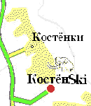
In 1986 a group of hobby-skiers started a search for suitable places for skiing near their native town. The places had to be interesting and near. But it was not easy to find descents in the middle of the Russian lowland. That is why they have chosen the ravines near the village Kostyonki, district Khokholsky. Limestones here come up to the surface and form relatively large altitude differences - up to 70 m. Since then this area has become attractive not only for archaeologists but also for skiers.
However it was not pleasant to stay in this naked place without any comfort, especially in the winter. So the skiers started to fit out the descents themselves. Skilifts and caravans appeared, later a solid house for 30 persons was built, in which you can stay quite comfortably for a couple of days. The ski club is growing and developing thanks to the efforts of enthusiasts.
At the moment we have 5 runs up to 400 m long and 4 ski lifts, which serve all descents, beginning with the learning run and ending with the sports run, where sports events are organised regularly. We have instructors for beginners who will teach you not only to 'stand' on skis but also to use a ski lift. Already after two-three months you will be able to cut a good figure in the Caucasus, in the Alps or wherever else. The club has a ski lending if you do not have your own skis. Apres-ski you will get as everywhere mulledwine, supper and billiard.
Archaeological Museum and Nature Reserve Kostyonki.
The museum includes the areas of palaeontological settlements from the late (high) Palaeolithic. There are 21 historical sites near the village Kostyonki, other 5 similar sites are situated approximately 15 km to the south, near the village Borshtshyovo. Besides there are archaeological monuments from the early Middle Ages (8-9 c. AD) there. According to its ethnic belonging it is Slavic culture, may be it is the furthest Eastern point of the Slavic spread in Europe.
The museum itself is a pavilion above a settlement from the high Palaeolithic which was excavated in 1957-1963. The site is called Kostyonki 11 and is 21 000 years old.
At the moment the museum is closed for visitors because of the bad condition of the pavilion. Owing to lack of financing the restoration of the building is constantly postponed.
Yearly archaeological excavations are carried out here by the Institute of the History of Material Culture of the Russian Academy of Sciences in St Petersburg in July - August.
References
- Abramova Z., 1995: L'Art paléolithique d'Europe orientale et de Sibérie, Grenoble: Jérôme Millon.
- Boriskovskij P., 1953: Palaeolithic of the Ukraine, Academy of Sciences, USSR, Moscow-Leningrad (1953).
- Cohen C., 2003: La femme des origines. Images de la femme dans la préhistoire occidentale, Paris, Belin-Herscher, 2003, 191 pages.
- Cook, J., 2013: Ice Age art: arrival of the modern mind, The British Museum, 18 Feb 2013, ISBN-10: 0714123331, ISBN-13: 978-0714123332
- Dinnis, R. et al., 2018: New data for the Early Upper Paleolithic of Kostenki (Russia), Journal of Human Evolution, www.elsevier.com/locate/jhevol
- Giaccio, B. et al., 2017: NHigh-precision 14C and 40Ar/39Ar dating of the Campanian Ignimbrite (Y-5) reconciles the time-scales of climatic-cultural processes at 40 ka), Scientific Reports 7, 45940.
- Grigor'ev G., 1967: A New Reconstruction of the Above-Ground Dwelling of Kostenki, Current Anthropology, Vol. 8, No. 4, Oct., 1967 (pp. 344-349)
- Hoffeker J., Kuz'mina I., Syromyatnikova E., Anikovich M., Sinitsyn A., Popov V., Holliday V., 2010: Evidence for kill-butchery events of early Upper Paleolithic age at Kostenki, RussiaJournal of Archaeological Science, 37 (2010) 1073–1089.
- Jöris O., Street M., 2008: At the end of the 14C time scale - the Middle to Upper Paleolithic record of western Eurasia, Journal of Human Evolution, 55 (2008) 782–802
- Pryor A. et al., 2020: The chronology and function of a new circular mammoth-bone structure at Kostenki 11, Antiquity, Volume 94, Issue 374 April 2020, pp. 323-341n
- Reynolds N., Germonpré M., Bessudnov A., Sablin M., 2019: The Late Gravettian Site of Kostënki 21 Layer III, Russia: a Chronocultural Reassessment Based on a New Interpretation of the Significance of Intra-site Spatial Patterning, Journal of Paleolithic Archaeology, (2019) 2:160–210 https://doi.org/10.1007/s41982-018-0018-6
- Rogachev A., 1957: The multilevel sites of the Kostenki-Borshevo region on the Don and the problem of the development of culture in the epoch of the Upper Palaeolithic on the Russian Plain (in Russian), Mnogosloinye stoyanki Kostenkovsko-Borshevskogo raiona na Donu i problema razvitiya kul’tury v epokhy verkhnego paleolita na Russkoi Ravnine. , Materialy i Issledovaniya po Arkheologii SSSR, 59:9–134.
- Sinitsyn A., 2007: Variability of the Gravettian of Kostienki (Bassin moyen du Don)Paleo, No. 19, December 2007, pp 181-202, http://paleo.revues.org/599